Gourd Sea
Introducing Gourd Sea
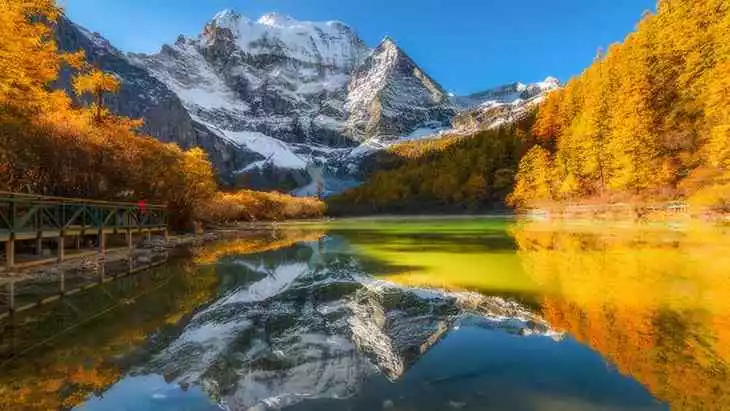
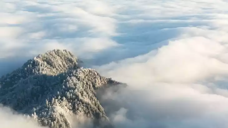
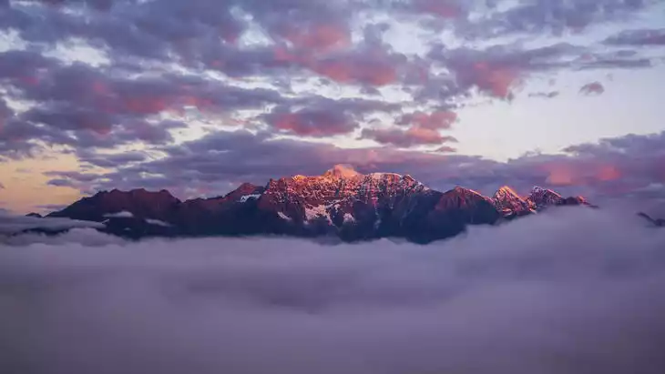
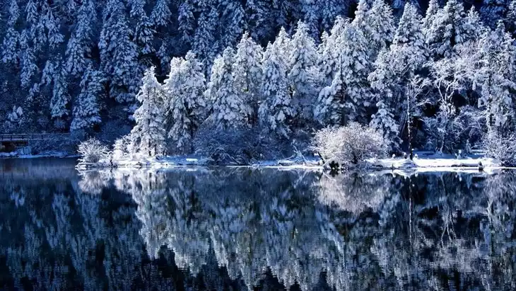
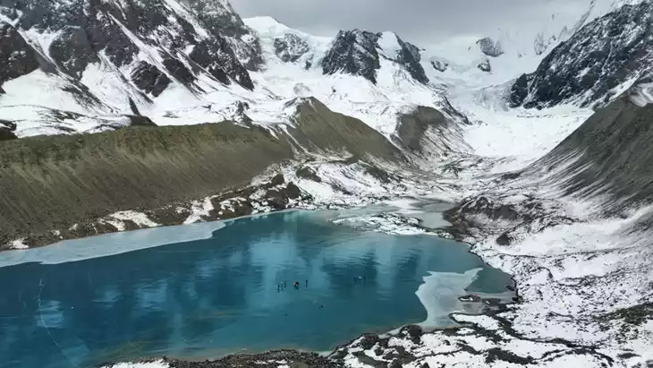
Huluhai, nestled among dozens of snow-capped peaks over 5,000 meters high, sits at an altitude of approximately 4,200 meters and is uninhabited. Starting from Dangling Village, the route is half horseback and half on foot. The terrain is rocky and swampy, and even a slow ride can lead to stumbles. The second half of the hike is even more arduous, requiring sheer determination and perseverance to overcome altitude sickness and fatigue and continue onward.
Climate and best time to travel
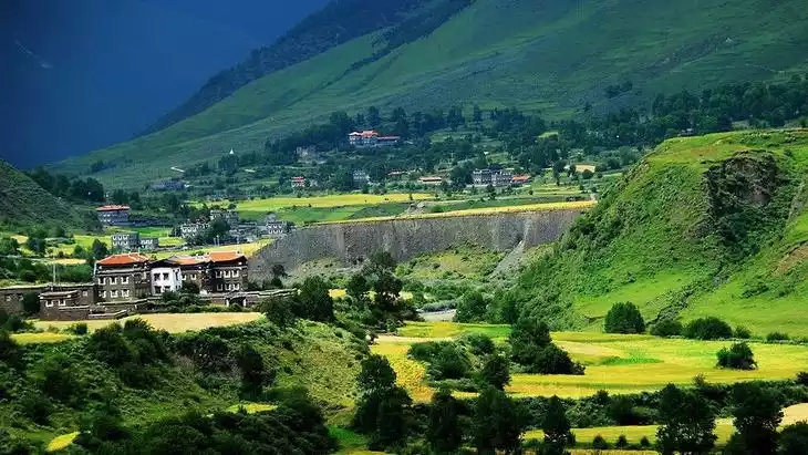
Danba County has a Qinghai-Tibet Plateau-type monsoon climate, characterized by vertical zonation. The temperature difference between the mountaintop and the valley is over 24°C. The average annual temperature is 14.2°C, with an average temperature of 4.4°C in January and the hottest month, August, at 22.4°C. From December to March of each year, the mountain roads at 4,500 meters are icy. The frost-free period lasts 316 days, and the annual precipitation is 600 mm. The area enjoys ample sunshine, with neither severe winters nor scorching summers.
Tickets
free
Attraction opening hours
All day
Most Popular FAQs for Gourd Sea
What is the history and significance of this attraction/city?
This lake/valley likely holds local ecological, cultural, and spiritual significance for Tibetan communities of Ganzi. Such alpine lakes often feature in local folklore, religious traditions, and serve as water sources for surrounding communities. Over time they become scenic draws linking highland landscapes, water, and pastoral life.
Where is it located and how do I get there (metro, bus, taxi, walking)?
It would be located somewhere within Ganzi Tibetan Autonomous Prefecture, in high altitude terrain. To reach it, you’d typically travel by road (bus, private car, or van charter) from a town such as Kangding or a county seat, then hike or take local transport to the lake/valley. Walking/hiking is needed inside the scenic zone.
What are the opening hours and best times to visit?
- Scenic areas in Tibet/Sichuan highlands typically open from early morning (~8:00 AM) to late afternoon (~5:00–6:00 PM).
- Best visiting seasons: late spring (May–June), summer (July–August), and early autumn (September–October), when access is easier and the weather is more stable.
What is the entrance fee/ticket price, and how to buy tickets (online/offline)?
There is likely an entrance fee (common range: ¥50–¥100 or local equivalent). Tickets may be bought on site or via local scenic area offices. If part of a larger ticket network, combo tickets might apply.
Do I need to book tickets in advance, and how far in advance?
For normal visits, advance booking may not be strictly necessary, but in peak season or for large groups, booking 1–2 days ahead is safer. For any special services (boat ride, guided trek) advance reservation is recommended.
How much time is needed to fully explore it?
A full loop of the lake or valley and side trails could take 2–4 hours, depending on elevation changes and the extent of side paths.
What are the must-see highlights or main areas inside?
- Main lake or pond area with reflections.
- Water inlets/outlets, wetlands, or marsh zones.
- Nearby slopes, meadows or forest edges offering different vantage points.
- Overlooks or ridges above the lake with panoramic views.
Are guided tours or audio guides available (and in which languages)?
Smaller scenic lakes often lack formal audio guides. Local guides (in Mandarin or Tibetan) may be arranged through tour operators or local guesthouses.
What are the best viewpoints or photography spots?
- From a ridge looking down on the lake, especially at sunrise or sunset.
- Lake edge with reflections of surrounding mountains.
- Marshy fringes or inlet streams during golden hour.
- Elevated vantage points for panorama shots.
What is the recommended route or itinerary inside?
- Start from the entrance → follow lakeside trail → detour to wetland marsh or inlet streams → ascend to overlooks → return via alternate path if available.
Are night visits, light shows, or special tours available?
Unlikely; remote alpine lakes are usually closed at dusk and lack lighting or show infrastructure.
Is it crowded, and when are the least crowded times/days to visit?
- Remote lakes are rarely crowded except during local holiday periods.
- Weekdays and early morning visits tend to offer solitude.
What facilities are available (toilets, food, water, rest areas, shops)?
- Basic restrooms and shelters near entrance or main scenic nodes.
- Snack huts or small kiosks may be available, but bring your own supplies just in case.
- Benches or resting spots along trails.
Is the attraction accessible for elderly, children, or disabled visitors?
Lower sections and flat trail segments may be accessible, but steep slopes, uneven paths, and altitude may challenge elderly, children, or those with mobility issues.
Is cash needed or are cards/mobile payments accepted?
In highland or remote areas, cash is more reliable. Scenic offices may accept mobile payments (WeChat, Alipay) where connectivity permits.
What restaurants or cafes are available inside or nearby?
Simple local eateries in the nearest village or base camp may exist, offering Tibetan/Chinese staples (tsampa, noodles, yak meat). Otherwise, more full-service dining in towns further away.
Are there vegetarian/vegan/halal food options?
Vegetarian options (vegetables, potatoes, Tibetan barley products) are more common; halal offerings may depend on the local population and whether Tibetan Muslims reside nearby.
What hotels or accommodations are close to the site?
Guesthouses or basic inns in the nearest village or valley base. For more comfortable lodging, stay in the main town or county seat and transit in.
What other attractions or landmarks are nearby and easy to combine in a day trip?
Other alpine lakes, highland pastures, Tibetan monasteries, mountain passes, or other scenic valleys in Ganzi/Tibetan region.
Are there souvenir shops and what are the typical souvenirs?
Small gift shops may sell local handicrafts, yak wool items, prayer flags, postcards, and regional specialties (dried herbs, tea).
What are the best transportation options to continue the trip after visiting?
- Return via the same road to the nearest town or transport hub.
- Chartered vehicle or shared van connecting to county seats or other scenic zones.
- Use a broader route network (e.g. county buses or local transport) to access adjacent scenic destinations.