What to see at Gongga Snow Mountain? A comprehensive photography guide around Gongga Snow Mountain
Preface
The world is so big, only Gongga Mountain can be seen
...Suddenly, the majestic and magnificent Muya Gongga appeared before us, like a cape surrounded by flowing clouds, imperturbably looming... A vast expanse of snow stretched endlessly from north to south, while the incomparable Muya Gongga towered over the turquoise sky, surpassing all its sister peaks! Its form is a pyramidal platform, with massive glaciers stretching for miles around it, providing immense support. Meanwhile, glaciers continuously cascade down from Muya Gongga, merging with each other, filling and reinforcing the massive glacier, maintaining its powerful support for this majestic peak...
——Joseph Locke, The Glorious and Magnificent Muya Gongga
In 1930, National Geographic
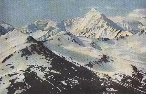
Dr. Joseph Rock photographed the southwest slope of Gongga Mountain - picture from the Internet
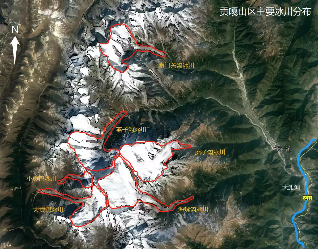
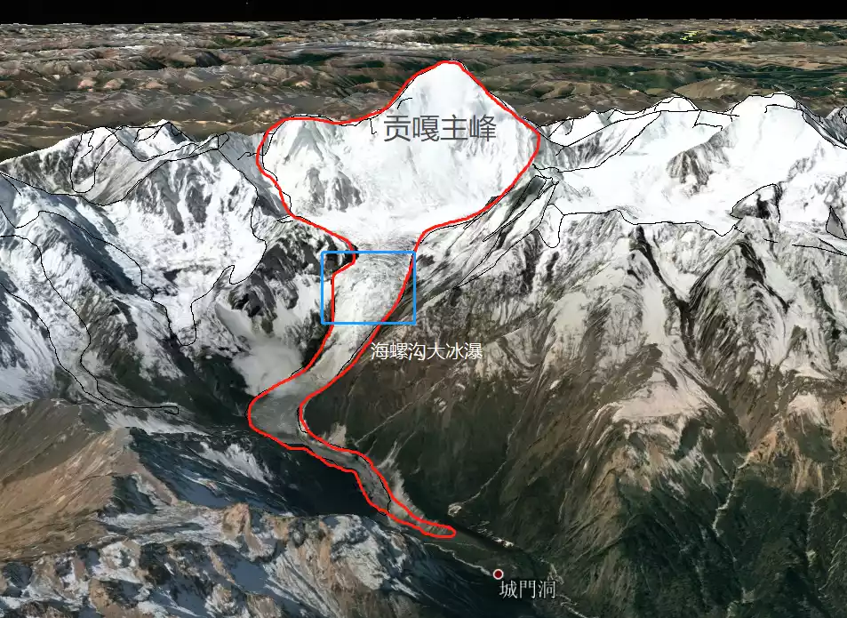
Schematic diagram of the distribution and location of the main glaciers on Gongga Snow Mountain
There are many snow-capped mountains in the world, but there is only one, Mount Gongga. It is the easternmost 7,000-meter-high snow-capped mountain in the world, reaching an altitude of 7,556 meters. It is also the most difficult snow-capped mountain to climb, with a climbing mortality rate of an astonishing 1.7:1, second only to Kawabo, the main peak of Meili Snow Mountain. It is also the closest snow-capped mountain to major cities. On clear days, it can be seen directly from downtown Chengdu.
Even among towering snow-capped mountains, Mount Gongga stands out. So much so that upon first sighting it, Joseph Rock declared, "This mountain is even taller than Mount Everest and is the highest in the world." In a telegram to the National Geographic Society, he added, "The main peak of Muya Gongga is the highest on Earth, at 30,250 feet (9,210.52 meters). Discoverer and surveyor—Rock." Although the National Geographic Society ultimately refused to acknowledge this measurement, the record left behind indirectly demonstrates the unparalleled height and breadth of Mount Gongga.
The huge relative height difference is the main reason why Mount Gongga looks so majestic.
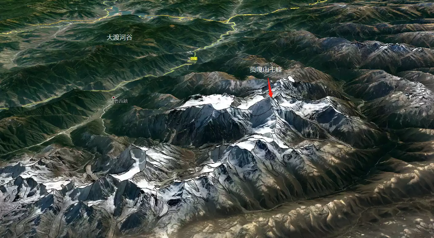
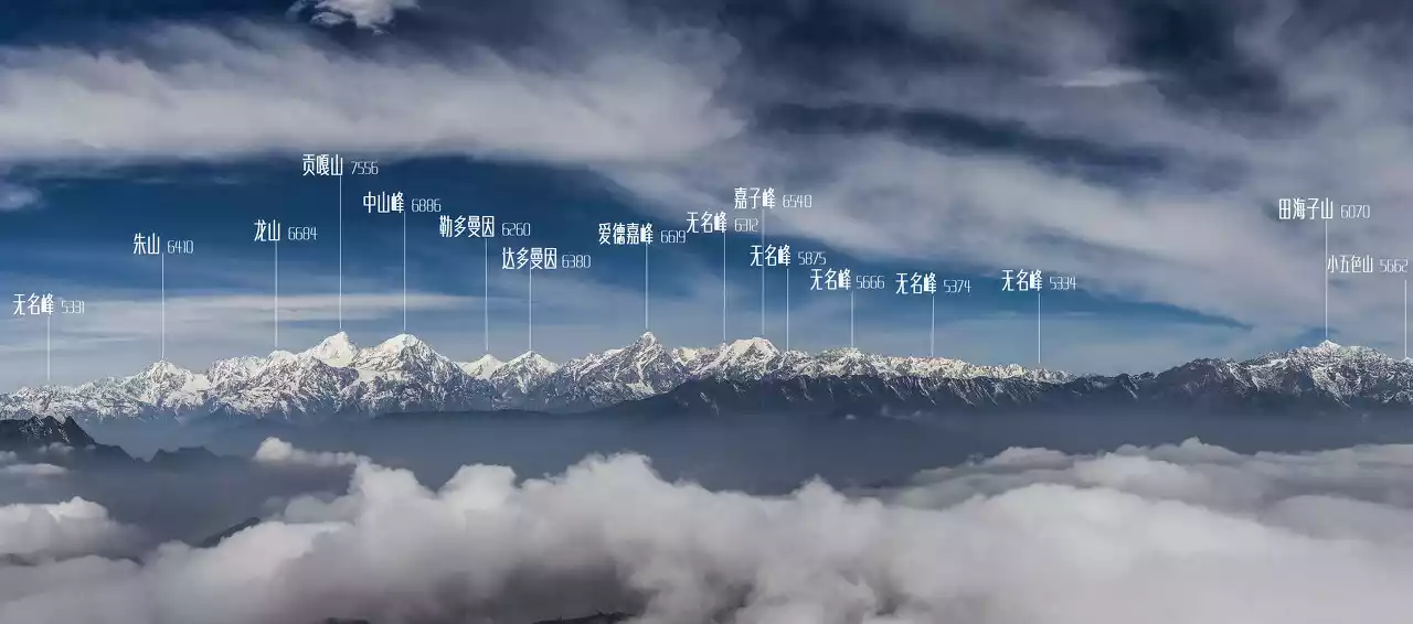
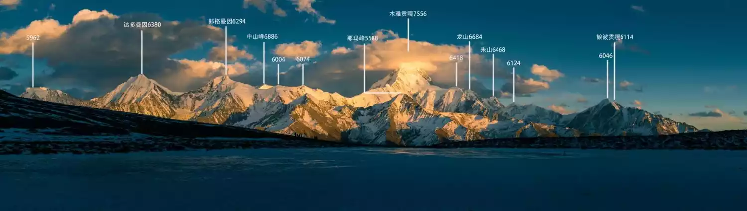
Surrounding Mount Gongga's main peak are 145 peaks rising to 5,000 to 6,000 meters, creating a majestic spectacle of a galaxy of stars surrounding the moon. Peak Gongga reaches a remarkable 6,000 meters in altitude, ranking second in the world after Mount Namjagbarwa. Its triangular, pyramidal granite massif creates a towering, isolated presence from every angle. Due to its three-dimensional shape, Mount Gongga's main peak is defined by four main ridges: the northwest, northeast, southwest, and southeast. Circling these four ridges are numerous stunning viewing platforms, offering breathtaking views of the majestic mountain range in its various forms. These numerous viewing platforms, large and small, collectively form the scenic belt surrounding Mount Gongga. Despite the diverse scenery, the central attraction is the Muya Gongga Snow Mountain, towering above the clouds at an altitude of 7,556 meters.
Among the ten most beautiful mountains in China selected by China National Geographic, Gongga is ranked second with only a slight gap.

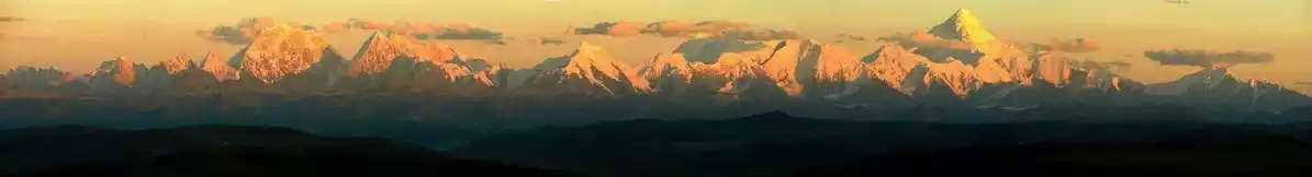
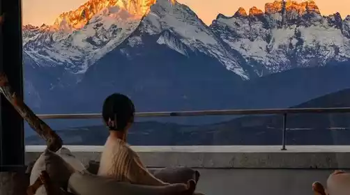
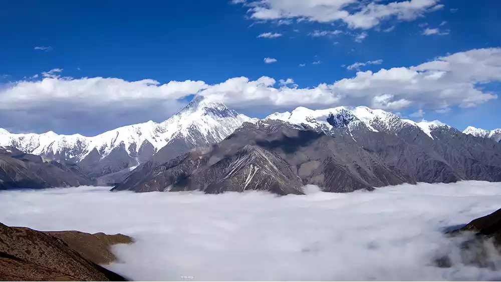
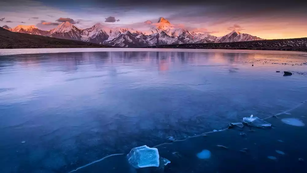
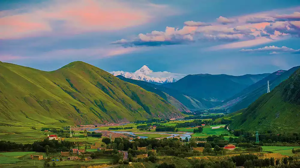
In winter, see Mount Gongga from Lenggacuo
Schematic diagram of the location of Gongga Snow Mountain and its surroundings (picture from the Internet)
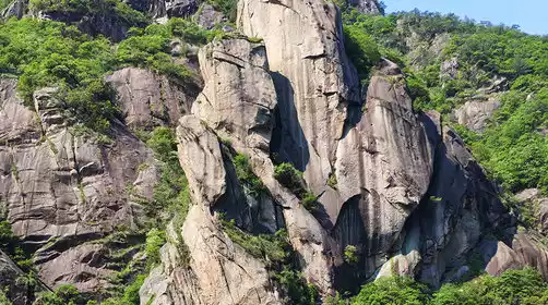
 Overview of the Gongga West Slope Snow Mountain
Overview of the Gongga East Slope Snow Mountain
Gongga Snow Mountain Observation Deck
Niubei Mountain
Viewing direction: Northeast ridge and east slope of the main peak
Niubei Mountain is located in Yingjing County, Ya'an City, Sichuan Province, on the border with Luding County. A branch of Erlang Mountain, it forms the watershed between the Qingyi and Dadu Rivers. Its summit, at 3,600 meters, is named for a cliff with a protruding rock resembling an ox's head and a slender ridge resembling an ox's back. The name first came to public attention in an article titled "Luding: The King of Shu Mountains Constructs a Secluded Beauty" in the 9th issue of National Geographic China in 2009.
Author Lü Linglong first mentions Niubei Mountain in her article: "The sea of clouds on Niubei Mountain is dense and even, magnificent and gentle. The waterfall clouds that can be seen everywhere are like the Hallelujah Mountain in Avatar, making you feel like you are walking on air. Looking around, the endless mountains are arranged in an orderly manner with clear layers. Gongga Snow Mountain, the king of Shu Mountains, stands at the highest point. Niba Mountain, Niangniang Mountain, Wawu Mountain, Emei Mountain, Jiajin Mountain, Siguniang Mountain and Erlang Mountain are in front, and the Dadu River Grand Canyon is behind. Almost all the famous mountains and ridges in the Land of Abundance have become exquisite bonsai at this moment. Beneath the rolling clouds, the mountains and hills gradually decrease in level, slowly merging into the rolling rice paddies of the Tianfu Plain."
Many years later, Lv Linglong wrote the following on her Weibo: "I was filming around the Gongga Mountains, passing through Luding. I climbed to the top of an unnamed mountain and looked out at the Gongga peaks. I saw the mountains rushing, the clouds flying like weaves, and the scenery was fantastic. I asked a fellow villager what the mountain was called, and he said it was called Dakuangshan. Because the mountain scenery is magnificent and it is shaped like an ox's back, it was renamed Niubei Mountain and was also named the largest viewing platform in China. After that, Niubei Mountain replaced Dakuangshan and became famous, and photographers from all directions flocked to it. The mountain and river have no name, so I gave it this name..." Thus, the two names "Niubei Mountain" and "China's Most Beautiful Viewing Platform" spread across China with the publication of "National Geographic China".
Tips: Niubei Mountain is currently closed and temporarily closed. Unauthorized entry is strictly prohibited.
Hongyanding, located on the east slope of Gongga Mountain, is one of the most accessible viewing platforms.
Hailuogou National Geopark
Viewing direction: southeast ridge and east slope of the main peak
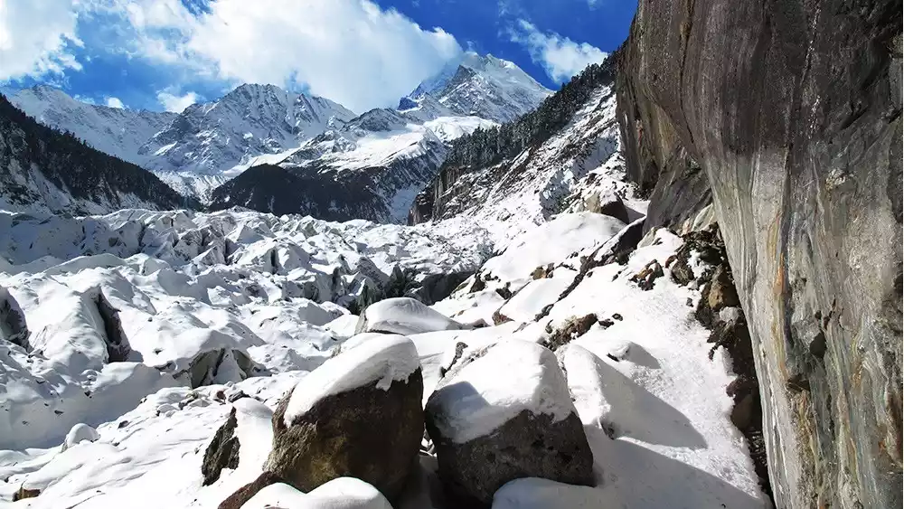
Hailuogou National Geopark, located at the foot of Mount Gongga, is renowned for its low-altitude modern maritime glaciers. Crystal clear modern glaciers cascade down the steep valley. The Gongga Icefall, over 1,000 meters high and approximately 1,100 meters wide, is one of the largest known low-altitude modern maritime glaciers in the world.
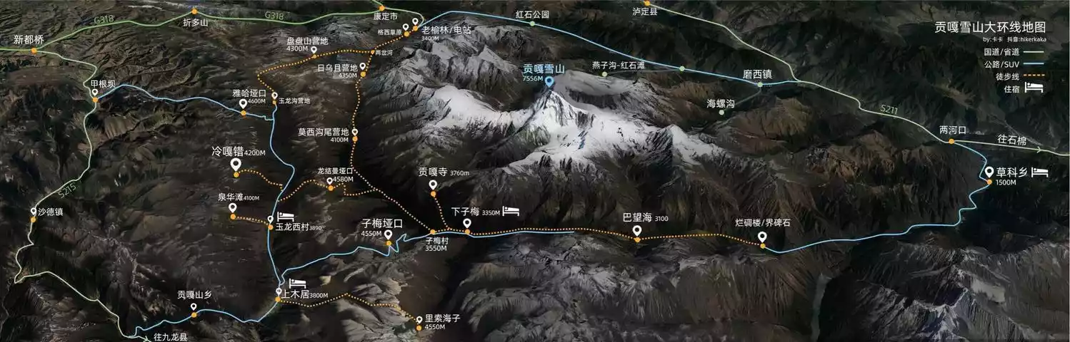
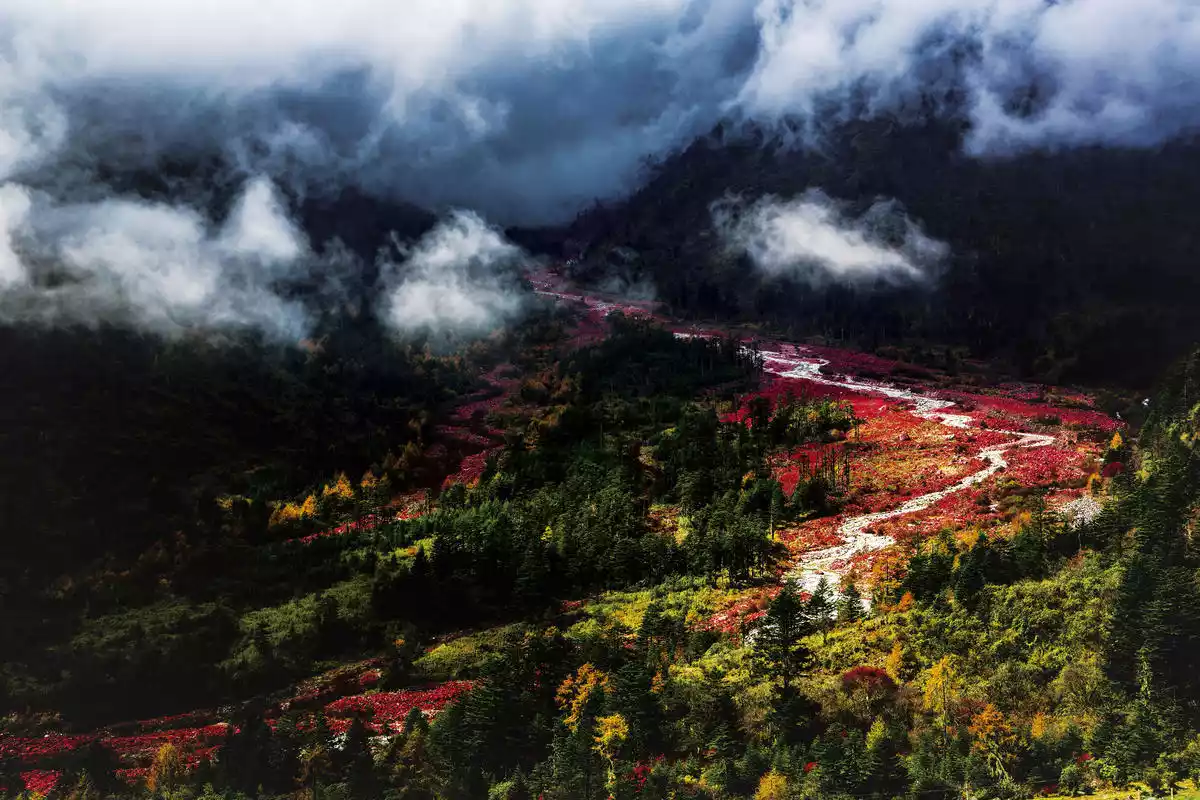
The entire national geological park, centered around the ancient town of Moxi, comprises six scenic areas: Hailuogou, Yanzigou, Mozigou, Nanmenguangou, Yajiageng, and the Moxi Terrace. It boasts diverse landscapes, including mountain glaciers, large icefalls, ecological vegetation landscapes, a red stone park, and snowy hot springs. It is the only easily accessible viewing platform within the scenic belt surrounding Mount Gongga, where one can touch the mountain's 10,000-year-old glaciers.
During the National Day of 2018, the Yumo Highway, which starts from Moshi Ancient Town in the south and ends at Yulin Village in Kangding in the north, will be opened to traffic. This highway, which is only more than 70 kilometers long, effectively connects the many scenic spots on the east slope of Gongga, forming the tourist route with the most complete infrastructure in the Gongga Scenic Belt.
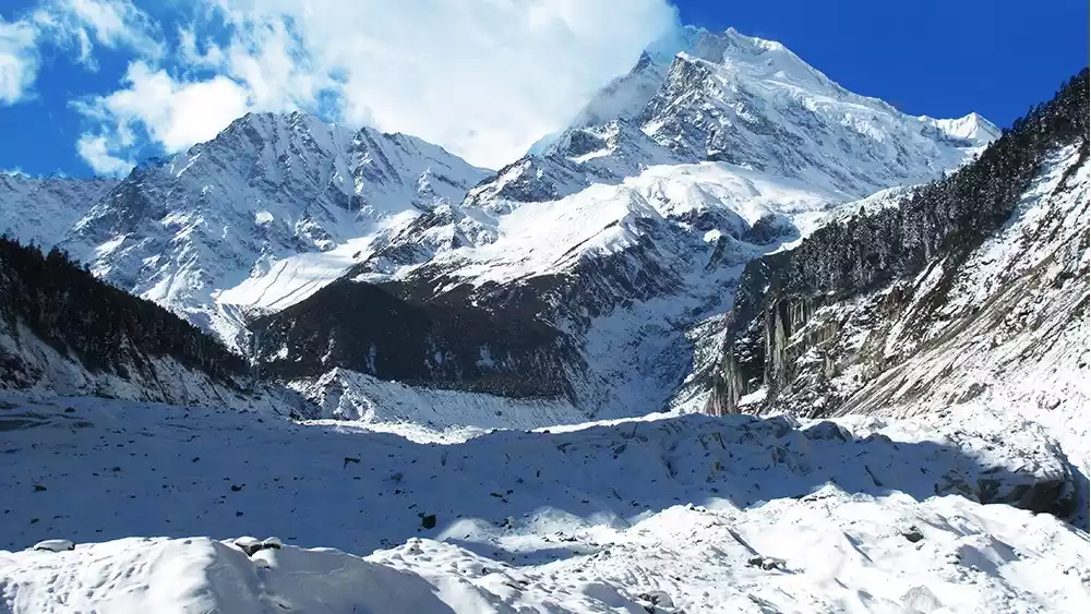
Viewing the eastern slope of Gongga and Hailuogou Glacier from Hailuogou, picture from Photo Network
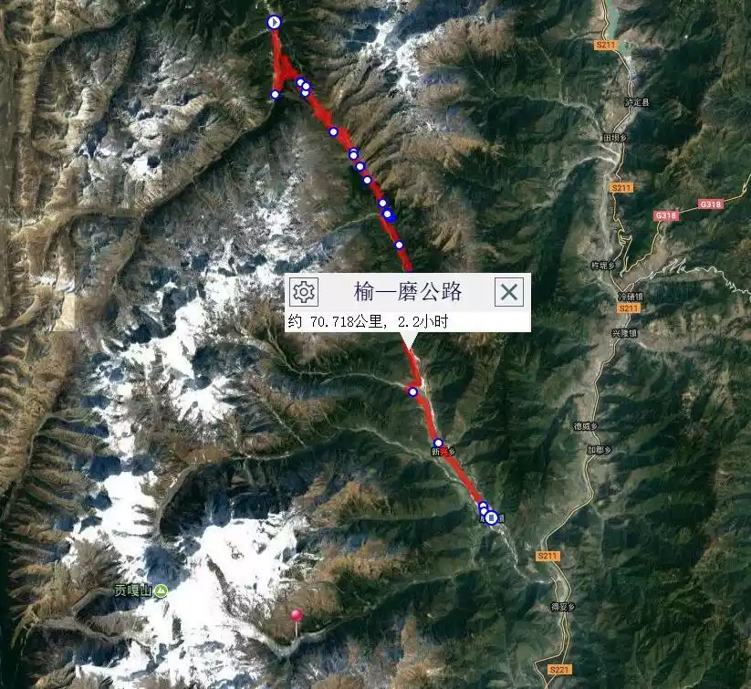
Yumo Highway starts from Moxi Ancient Town, connects many scenic spots on the east slope of Gongga, such as Hailuogou, Yanzigou, Nanmenguangou, Yajiageng Red Stone Beach, and ends in Kangding Yulin.
Schematic diagram of Hailuogou Glacier
Tips: From Chengdu, take the Chengya-Yakang Expressway westward, exit at Luding, and head to Moxi Ancient Town. The Hailuogou Scenic Area ticket office is in Moxi Town.
Tips:
Tips for riding the Hailuogou Cable Car
1. Take the cable car to Camp No. 4, round-trip ticket price: 150 yuan per person (round-trip tickets are only available; one-way tickets are not available). The journey is relaxing and the scenery is stunning.
2. Walk 3.5 kilometers (about 1 hour) along the scenic path through the primeval forest to the viewing platform. The scenery along the way is beautiful, but it takes a long time and is physically demanding.
From the viewing platform, you can go down to the bottom of the glacier and touch the body of Gongga with your hands.
After visiting the glacier, you can go to Camp No. 2 to enjoy the hot spring world in the embrace of the snow-capped mountains; or return to the entrance of the scenic area and go to Gongga Shentang Hot Spring Hotel to enjoy the hot springs.
Zimei Pass
Viewing direction: southwest ridge and southwest slope of the main peak
Zimei Pass, located in Gongga Township, Kangding City, Ganzi Prefecture, offers the best viewing platform on the southwest slope of Gongga Mountain. At an altitude of just under 4,500 meters, the pass is less than 20 kilometers from Gongga Snow Mountain. It's the closest viewing platform to the main peak of Gongga Mountain. The sea of clouds and the towering southwest slopes of Gongga Peak are the highlight of Zimei Pass photography.
With Zimei Pass as its center, there are many unique landscapes such as Quanhua Beach, Lisuohai, and Gonggar Temple.
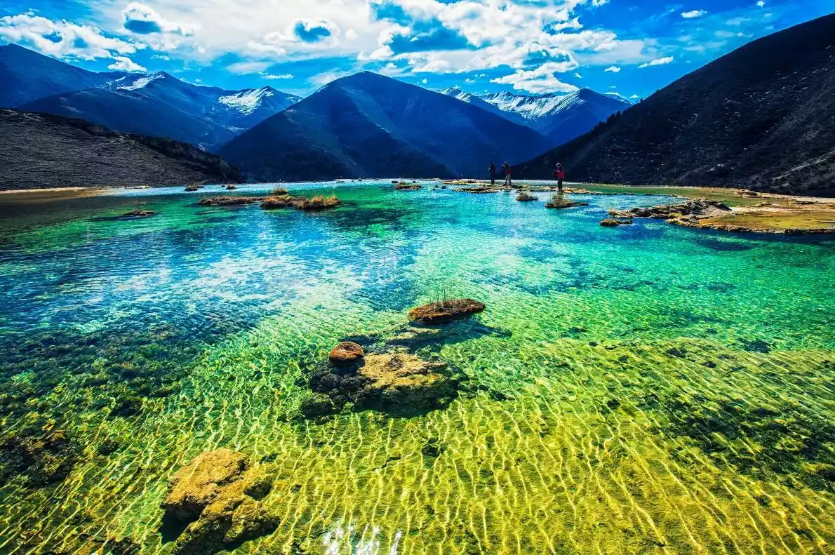
Quanhuatan is a plateau composed of calcified landforms at the foot of Mount Gongga, similar to the famous Huanglong Scenic Area. In the distance, snow-capped mountains tower over the blue-purple sky of the plateau; in front of you are mottled calcifications, and Quanhuatan presents a colorful appearance, like a palette in the hands of the Gongga Mountain God.
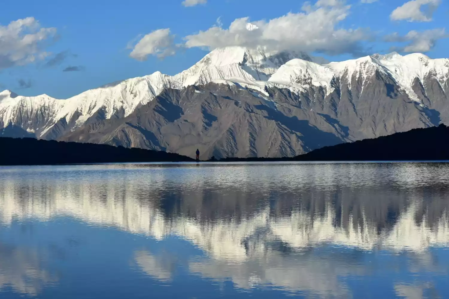
Lisuohai is located at the foot of Zimei Pass. It is one of two small lakes left over from the retreat of glaciers in ancient times. Although the lakes are not big, they are an excellent place to photograph the reflections of Mount Gongga and the starry sky when there is no wind.
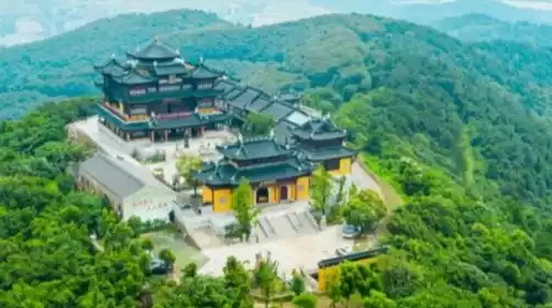
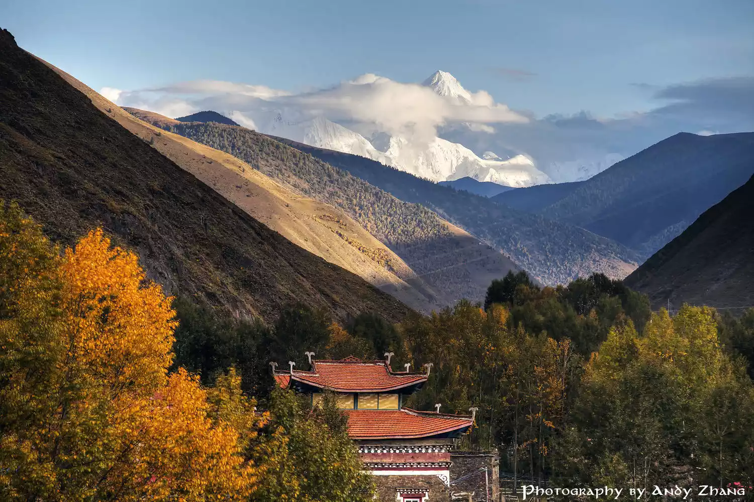
Gongga Temple, a 600-year-old monastery at the foot of Mount Gongga, overlooks the sacred mountain and is nestled against the backdrop of a glacier. It's a must-see for hikes up the southwest slopes of Gongga and for climbing Mount Gongga. In June 1957, six members of the Chinese National Mountaineering Team reached the summit of Mount Gongga from the base camp near Gongga Temple, marking the first successful ascent of Mount Gongga by Chinese climbers. However, this climb also resulted in the deaths of four members.
View of the southwest slope of Mount Gongga from Zimei Pass. Image from Photo Network
 Viewing the southwest slope of Gongga and its reflection from Lisuohai. Image from Photo Network
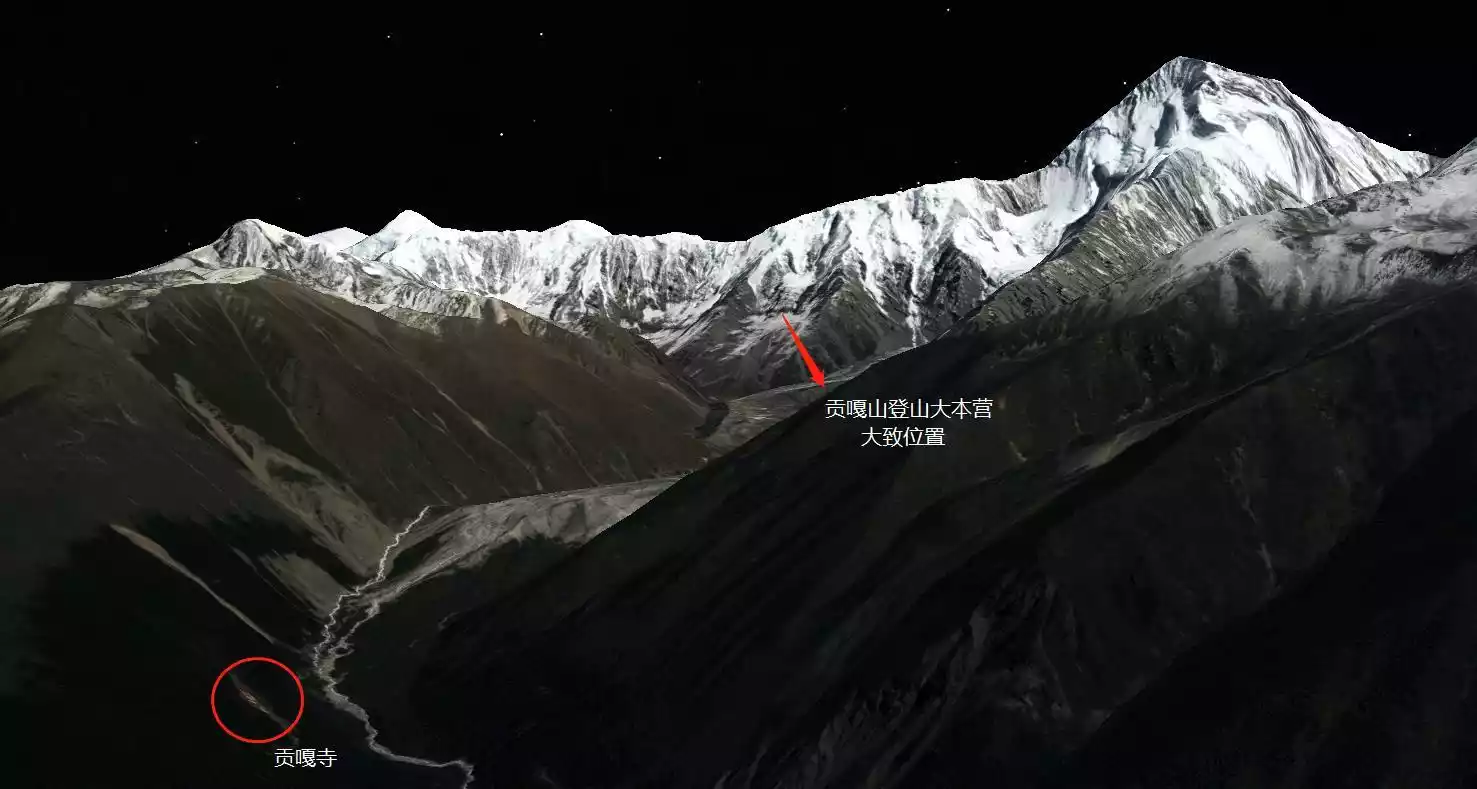
A summary of the locations of Gongga Temple, Gongga Southwest Slope, and the Mountaineering Base Camp. (Image from Google Maps screenshot)
Tips: Zimei Pass is difficult to reach and requires an off-road vehicle for the entire journey.
Starting from Xinduqiao, head towards Jiulong. After passing Jiagenba and Shade Township, there will be signs leading to Shangmuju Village.
Shangmuju provides accommodation and is a transit station for traveling to Zimei Pass, Quanhua Beach, Lisuohai and other places.
Zimei Pass and Lisuohai are not accessible by car, so you need to take a local car.
Lenggacuo
Viewing direction: southwest ridge and southwest slope of the main peak
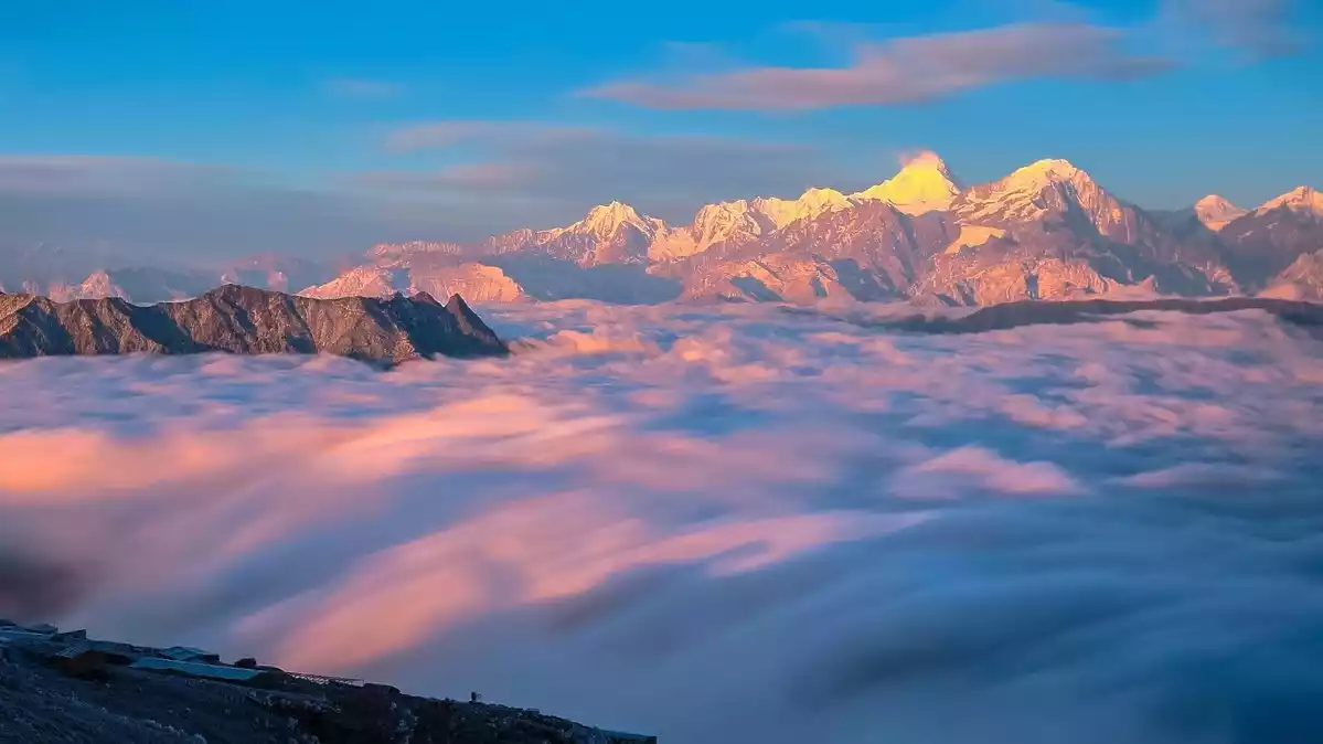
As one of the most important viewing platforms on the southwest slope of Gongga Mountain, the starry sky and the reflection of Gongga Snow Mountain are the most eye-catching photography subjects in Lenggacuo.
Lengga Co is one of the closest alpine lakes to Mount Gongga, located 23 kilometers away and 4,550 meters above sea level. Its most striking feature is its mirror-like reflection of Mount Gongga in the early mornings. Located southwest of Mount Gongga, Lengga Co offers an excellent vantage point for photographing the sunset and the starry sky above Mount Gongga.
Every April, the Milky Way arch rises from behind Mount Gongga, forming a perfect arch in the second half of the night. At this moment, a 12mm lens can capture both the reflection of the snow-capped mountains and the Milky Way arch.
After that, the Milky Way gradually became vertical, and it is still one of the best photography spots among the many viewing platforms of Gongga Snow Mountain.
[Extreme Snow Mountain. Gongga Photography] is a new route developed by China-TravelNote in 2019. A camping trip at Lenggacuo is specially arranged to show the most beautiful side of the King of Shu Mountains to the world.
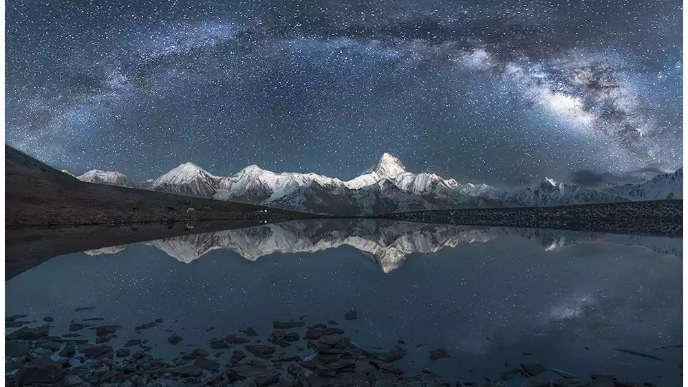
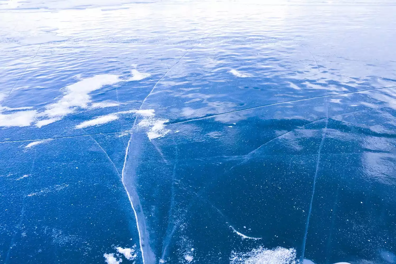
Reflection of the starry sky in Lenggacuo, picture from photo network
Reflection of Lenggacuo Gongga, picture from China-TravelNote Photography Network
Tips:
There is no road to Lenggasuo. It takes about three hours to walk to reach Lenggasuo. The lake surface is 4,600 meters above sea level.
Stinzo
Viewing direction: northwest ridge of the main peak, north slope
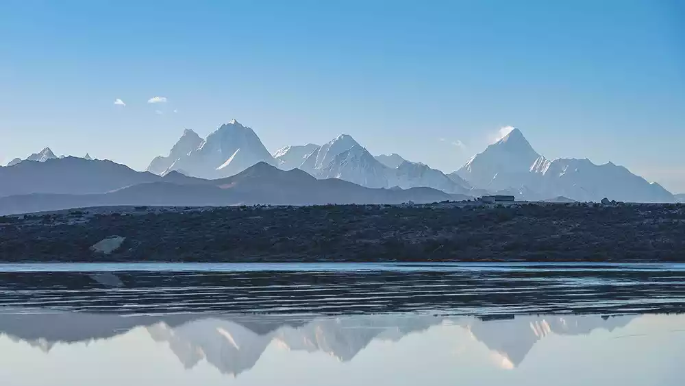
Sidingcuo is located on Zheduo Mountain in Kangding, close to Kangding Airport, at an altitude of 4,260 meters. It is currently the only easily accessible viewing platform on the north slope of Gongga Mountain, with its unique reflections of the snow-capped mountains and the passing of airplanes.
Mount Gongga, as seen from Stincuo, presents a perfect pyramidal shape, with flag-shaped clouds often seen rising from its summit. Information about Stincuo is nearly impossible to find, as it is so small and rarely visited. However, as a viewing platform, it rivals Niubei Mountain and Black Stone City, boasting a higher elevation and equally expansive views. Stincuo gleams beautifully like a flawless jade, a mirror that clearly reflects the blue sky, white clouds, red flowers, and green grass... Here, reflected in the lake is more than just scenery; it evokes a vibrant highland dream, a dream of galloping white clouds, soaring iron birds, and roaming horses and sheep. Standing at Stincuo, the world seems half in the sky, half in the lake.
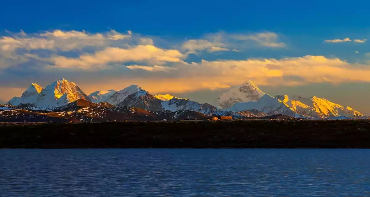
Stincuo, picture from photo network
Tips: Sidingcuo is located west of Kangding Airport, but vehicles with more than seven seats are inaccessible. The most convenient way to get there is to charter a car from Xinduqiao. If you want to take pictures of planes taking off and landing facing Gongga, you need to arrive at Sidingcuo before 11:00 am. There are no planes taking off or landing at Kangding Airport in the afternoon.
Xinduqiao
Viewing direction: northwest ridge and northwest slope of the main peak
Xinduqiao, nestled at the foot of Zheduo Mountain, is both a well-known "photographer's paradise" and one of the many Gongga Mountain viewing platforms. Compared to other viewing platforms, Xinduqiao offers a more diverse landscape: villages interwoven with fields and towering snow-capped mountains. Standing on the hillside, one can quietly watch the pristine peaks, like ice cream, stained golden by the setting sun. At the foot of the mountain, vast groves of poplar trees shimmer in the sunset's glow. The shadows of the trees and villages draw the eye toward the distant Mount Gongga.
Tips: There are two good locations for the Gongga Observation Deck in Xinduqiao. One is located next to the Muya White Pagoda at the fork in the road at the entrance to the town. It can be reached by horseback, but a one-way fee of 50 yuan plus a 20 yuan entrance fee is required. The second is located on the hill behind the Gongga Zong Hotel. It is free but requires hiking.
Black Rock City
Viewing direction: northwest ridge of the main peak, west slope
Black Stone City is located near the Gaolusi Mountain Pass on the old National Highway 318 and is named after the ancient black stone buildings.
China National Geographic magazine has featured images of Mount Gongga taken in Heishicheng on its cover several times. Along with Zimei Pass and Niubei Mountain, this spot is considered one of the three major photography locations for Mount Gongga in National Geographic.
Besides Mount Gongga, Black Stone City is the only one of the many Gongga viewing platforms offering panoramic views of the Great Snow Mountain Range. Standing at the pass and gazing southeast, the pristine peak of Gongga, surrounded by dozens of snow-capped peaks, stands tall at the edge of the sky. The Yala Snow Mountain to the northeast and the Gongga Snow Mountain to the southeast jut out from the Great Snow Mountain Range, forming the two ends of the sky.
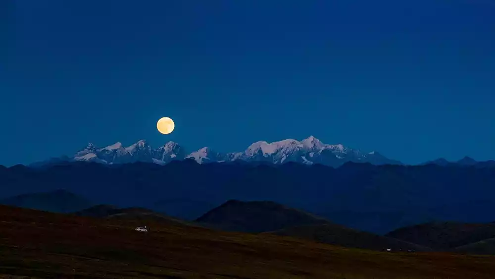
Sunset is the best time to photograph Black Stone City. The setting sun passes over the mountains, spreading its final rays across the peaks of Gongga, creating a brilliant and splendid scene. If it happens to be the 15th day of the lunar calendar, you can see a full moon rising from Gongga Snow Mountain, complementing the golden snow-capped peaks.
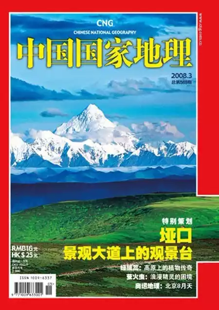
Screenshot of the cover of National Geographic China magazine
Tips: Black Stone City is located near the Gaolusi Mountain Pass on the old National Highway 318. This road has long been abandoned and has difficult traffic. You can hire a local off-road vehicle from Xinduqiao to reach it.
Conclusion
At the point closest to the horizon, the mountaintop supports the heavens and the earth, radiating the radiance of Buddhahood, solemn and steady. Like a log in the sea of my heart, I dare not touch it, like a heartbeat buried in my chest, unable to calm down. Gongga, in this life, I only want to see you.
——CCTV10 documentary "Gongga" copy, I would like to use this as a conclusion