Qilian Mountains Travel Guide: From Menyuan Rapeseed Flowers to Qilian Mountain Grasslands, Recommended Qilian Mountains Tours
Preface
I'm sure everyone is familiar with the Qilian Mountains. After all, this place name appeared constantly in our geography textbooks from junior high school to high school. While the Qilian Mountains are well-known, for many people, myself included, their initial impression of them might be a short line on a topographical map of China. Therefore, in the eyes of many, the Qilian Mountains seem to be just a long mountain range, and crossing this mountain range also means crossing the Qilian Mountains. This perception remained unchanged until I first visited the Northwest.
Starting from Xining, we headed north over the Dabashan Mountains and arrived at Menyuan, then continued on our journey. When I stood at the Jingyangling Pass and the Eboling Pass, I was shocked by the scene in front of me. The Qilian Mountains were not just an isolated mountain range as I had imagined before, but a series of mountains and ridges. What was presented before me was an ocean composed of thousands of mountains and rivers.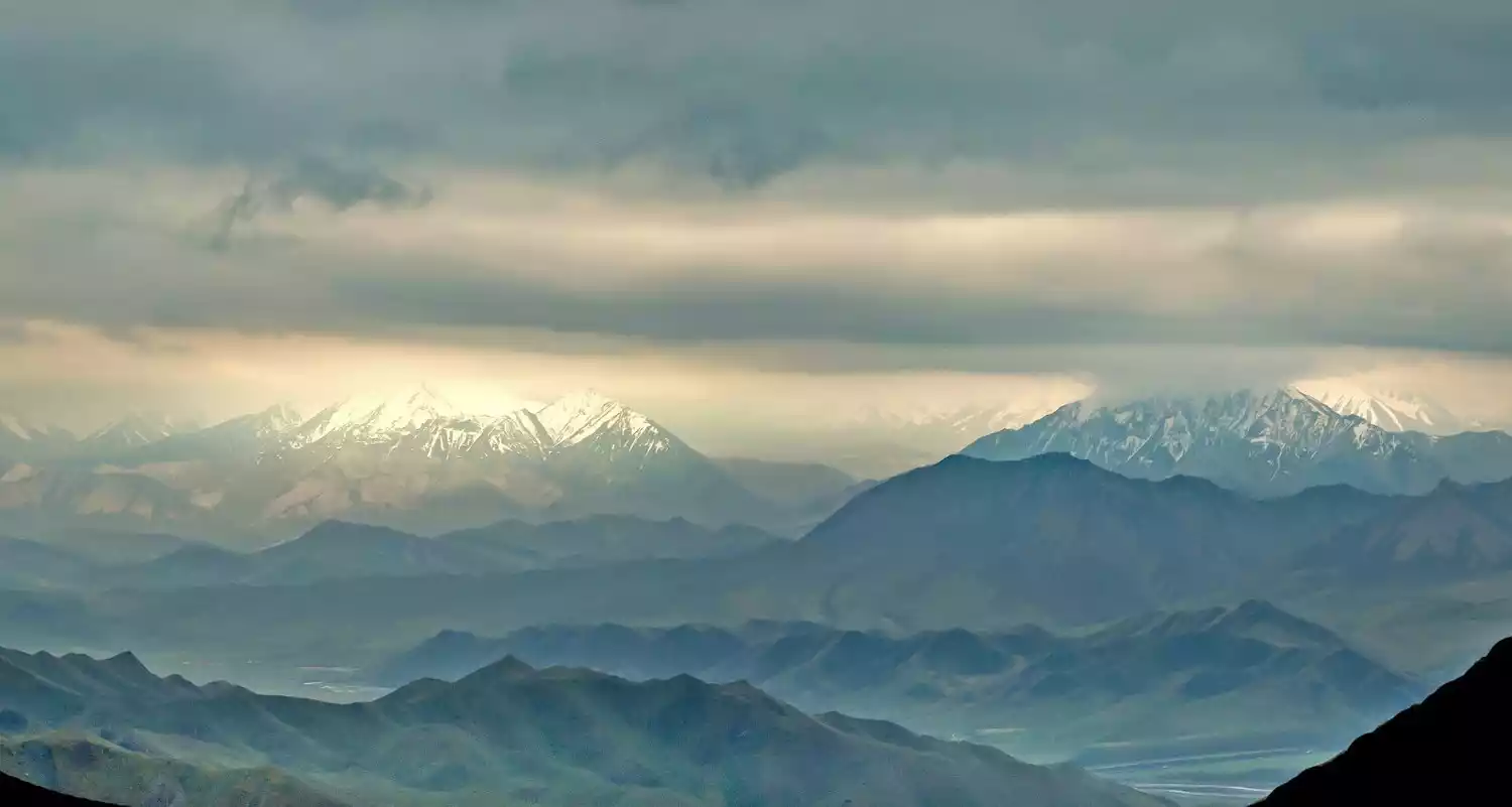
A brief introduction to Qilian Mountains
Geographical location and significance
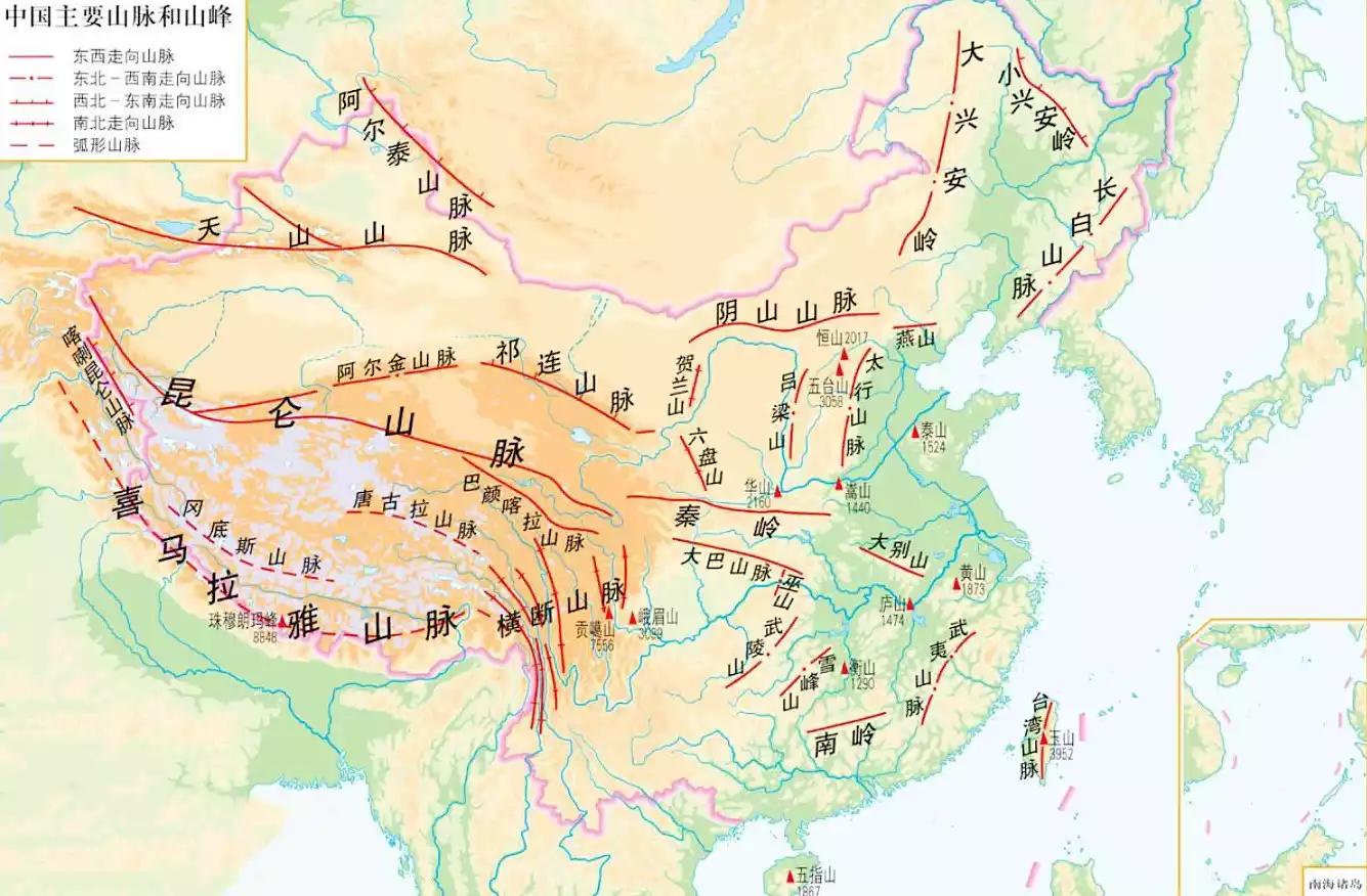
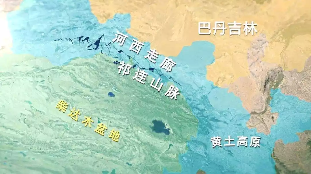
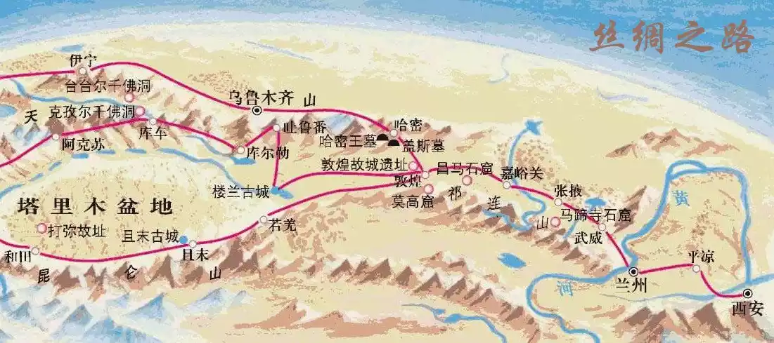
The Qilian Mountains are located in Gansu and Qinghai, and are the boundary mountains between the two provinces. It starts from Wushaoling in the east and ends at Dangjin Pass in the west, where it connects with the Altun Mountains. It is about 1,000 kilometers long from east to west and about 300 kilometers wide from north to south.
The Qilian Mountains hold immense historical significance. Without them, there would be no Hexi Corridor, and perhaps no great Silk Road. The Qilian Mountains' towering presence separates the deserts of Inner Mongolia from those of the Qaidam Basin, allowing the southeast monsoon from the Pacific to settle, forming glaciers, rivers, and oases, nurturing the Hexi Corridor and connecting the Silk Road.
Climate characteristics and impacts
The Qilian Mountains lie in a transition zone between a temperate continental climate and a plateau mountain climate. The numerous, intersecting mountain ranges create a diverse climate, resulting in a never-distinct season. The so-called "Qilian June snow" perfectly captures this unique climate and natural landscape. Consequently, the Qilian Mountains boast a diverse array of natural landscapes. Glaciers, forests, grasslands, rivers, snow-capped mountains, lakes, and more can all be experienced in the Qilian Mountains. This guide focuses on tourism, so the following sections will also highlight these naturally scenic destinations.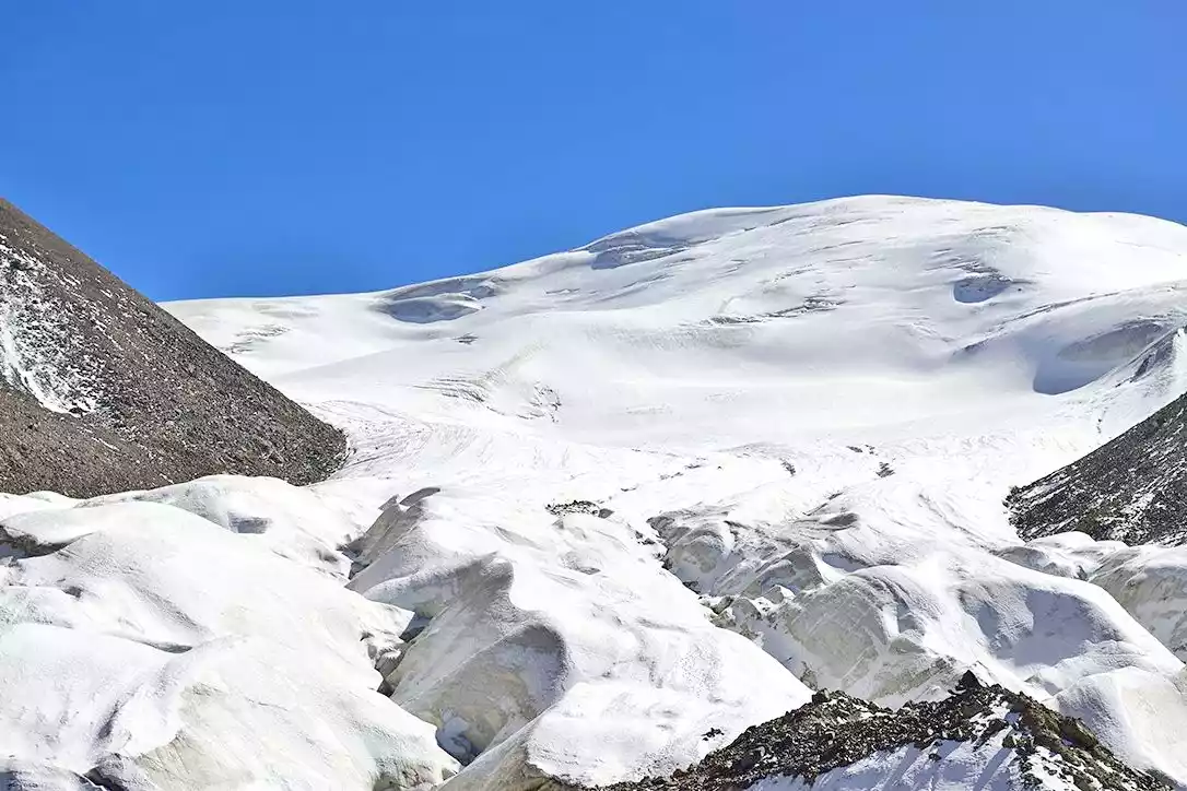
(Qiyi Glacier)
(Beishan Cailin)
(Heihe Grand Canyon)
(Hala Lake)
Qilian Mountain Tourism
The unique geographical significance and diverse climate changes have created a diverse range of tourist destinations in the Qilian Mountains. These are mainly divided into two categories: natural landscapes and historical and cultural sites. Natural landscapes are mainly concentrated in the middle and eastern sections of the Qilian Mountains, while historical and cultural sites are mainly represented by the Hexi Corridor.
Eastern Qilian Mountains
There's no clear dividing line between the eastern and central sections of the Qilian Mountains. For the sake of convenience in describing tourist destinations, I'll use the area around Eboling and Jingyangling as the dividing line. The eastern section of the Qilian Mountains is more strongly influenced by the Southeast Pacific monsoon, resulting in higher rainfall and a humid climate, which has led to extensive forests. At higher altitudes, snow-capped mountains have formed year-round, resulting in denser rivers and extensive economic pastures. This guide features several representative scenic spots.
Beishan National Forest Park
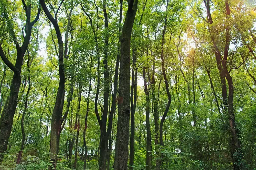
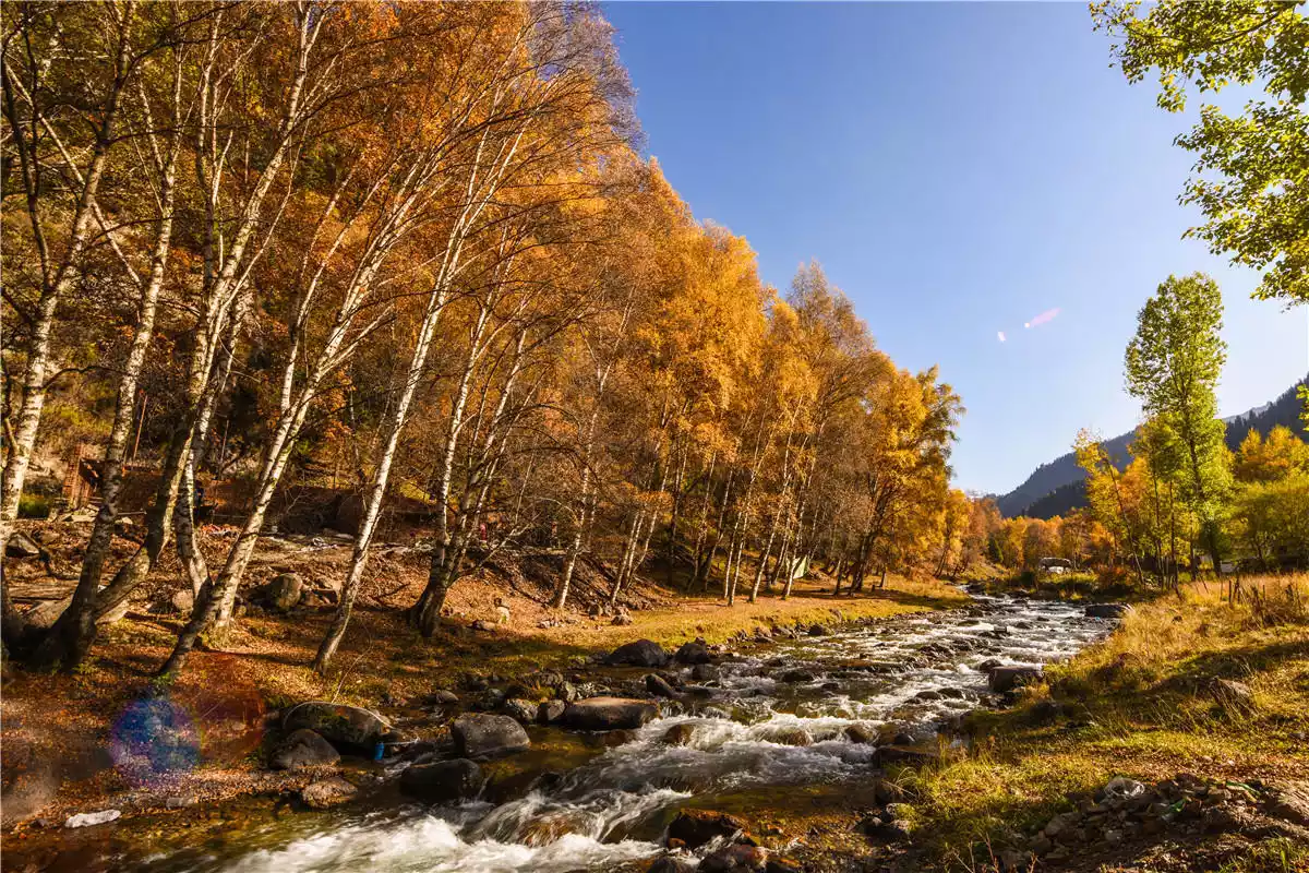
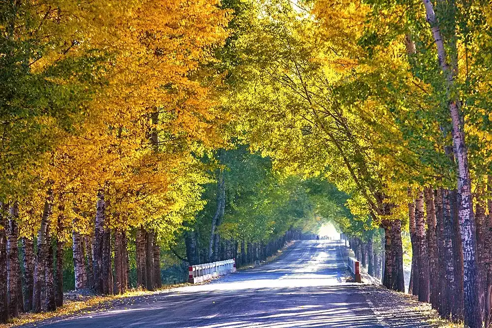
Strongly influenced by the Southeast Pacific monsoon, the eastern section of the Qilian Mountains has developed vast expanses of dense forest, with Huzhu Beishan National Forest Park being a prime example. The park boasts gurgling streams, shrouded in mist, verdant pines and cypresses, shady green fields, towering ancient trees, fragrant pines and cypresses, and a profusion of wildflowers and plants. It's a great place to escape the summer heat and enjoy the autumn scenery in winter.
Tips:
[Ticket Price] Tickets are 50 yuan, and the battery car is 30 yuan, a total of 80 yuan. The scenic area is very large, so it is recommended to take an electric car to play.
How to Visit: The Langshidang Scenic Area is the heart of the forest park. You can drive in (though you still need to purchase a shuttle ticket) and explore at your leisure. The area boasts the spectacular Shenlongtan Waterfall, the sacred and pristine Shengmu Tianchi Lake, and a vast, tranquil birch forest. The scenery is stunning, offering great photo opportunities everywhere.
Transportation: 1. Most people visiting Beishan National Forest Park in Xining travel by car or charter. In the summer, chartering a car in downtown Xining costs approximately 500-600 yuan per day. 2. A direct bus to Beishan departs from Xining Jianguo Road Bus Station at approximately 9:00 AM daily. Alternatively, you can travel to Huzhu County first and then charter a car or take the regular bus service (approximately one bus per day, one in the morning and one in the afternoon).
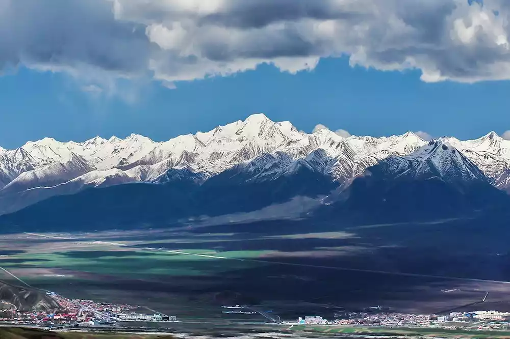
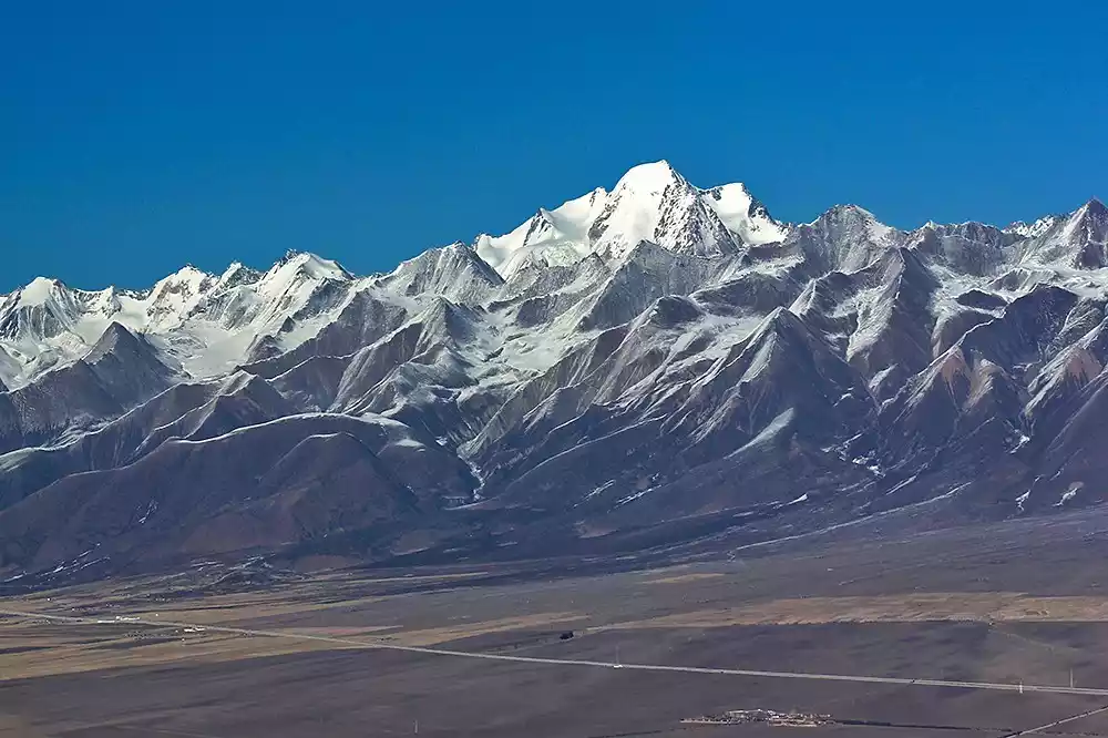
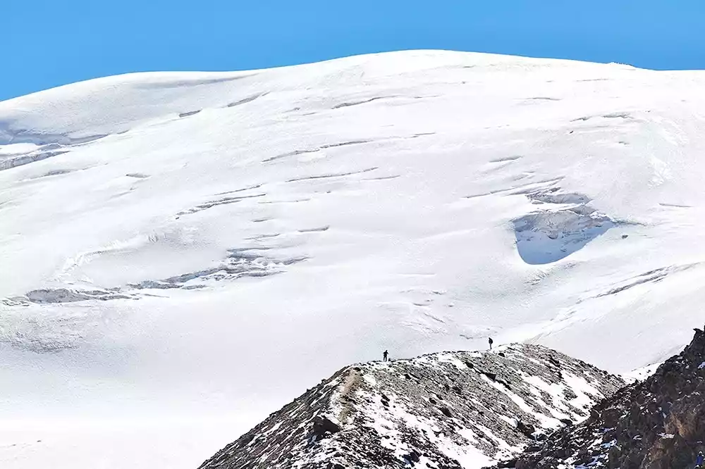
Gangshika Snow Peak
Before discussing the Gangshika Snow Mountain, it's worth mentioning Lenglongling. Many people have heard of Lenglongling, but only vaguely in connection with the Qilian Mountains. Their location is unknown, even to locals living at the foot of the Qilian Mountains, who can only give a general idea of it. Lenglongling, a crucial component of the Qilian Mountains, is located north of the Babao and Datong Rivers within Qinghai Province. It extends from the Heihe River in the west to the east of Menyuan County. Within Qinghai Province, it stretches 280 kilometers long and 30-50 kilometers wide. Most of the peaks are between 4,000 and 5,000 meters above sea level. Its highest peak, Gangshika Snow Mountain, is located north of Qingshizui, at 5,254.5 meters, also known as the main peak of Lenglongling. Its low altitude makes it an ideal spot for mountaineering and adventure, attracting numerous domestic and international mountaineering and adventure enthusiasts.
Tips:
【Ticket Price】Free.
[How to visit] Gangshika Snow Peak can be seen after crossing Daban Mountain. Most tourists mainly view it from a distance along the way, and generally more professional mountaineering enthusiasts will choose to enter the scenic area.
[Transportation] Generally, you can choose to charter a car to Qingshizui Town, Menyuan, which is about 20-30 km away.
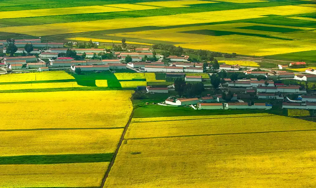
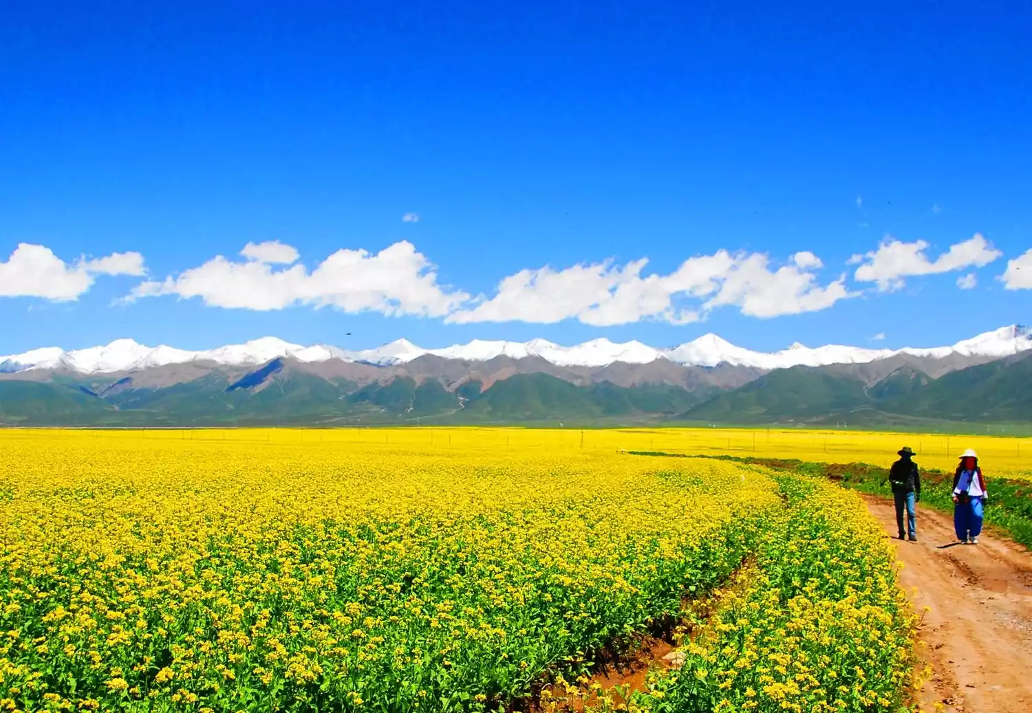
Menyuan rapeseed flower sea
Menyuan, nestled at the northern foot of the Qilian Mountains, boasts a climate, soil, and geographical environment ideal for growing rapeseed. Rapeseed cultivation has a history of over 1,800 years in Menyuan, making it the birthplace of rapeseed in northern China. Through sustained efforts in recent years, Menyuan Hui Autonomous County in Qinghai Province, once a major boost to farmers' incomes through rapeseed cultivation, has now transformed its vibrant fields of rapeseed into a tourist attraction and a major draw for Qinghai tourism. The rapeseed blossoms enter their peak blooming season in early July each year, blooming from July 5th to 25th, with peak bloom from July 10th to 20th.
Tips:
[Ticket Price] It is free to see the Menyuan rapeseed flowers, but you need to buy tickets to go to some viewing platforms (Yuanshan Flower Viewing Platform Ticket is 60 yuan/person, Flower Sea Fragrance Bath Ticket is 40 yuan/person)
How to Complete the Tour: The best viewing spots are Yuanshan Flower Viewing Platform in Qingshizui Town, about 20 kilometers west of Haomen Town, and Dabanshan Viewing Platform on the road between Xining and Menyuan County, about 30 kilometers from Haomen Town. The rapeseed flowers are most densely packed in Qingshizui Town.
Getting There: Menyuan Rapeseed Flower Park is located in Menyuan County, Haibei Tibetan Autonomous Prefecture, Qinghai Province, 150 kilometers from Xining and 150 kilometers from Qilian. You can choose to charter a car, drive yourself, or join a tour group. From Xining Xinning Bus Station, there are more than a dozen buses departing daily for Menyuan County. The journey takes about three hours and costs about 40 yuan per person.
[Special reminder] The best time to visit is from July 10th to 20th.
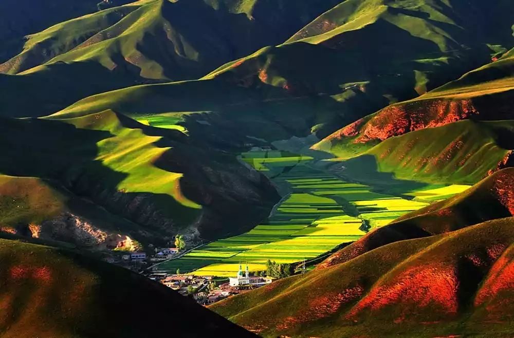
Middle Qilian Mountains
Despite the vastness of the Qilian Mountains, a unique county bears its name. Qilian County is named for its location in the heart of the central Qilian Mountains. As you can imagine, this area boasts abundant tourism resources. Qilian County is a key highland ecotourism destination in Qinghai Province, arguably a microcosm of the vast beauty of Qinghai. It has earned the reputations of "Qilian, the Heavenly Land" and "Switzerland of the East."
Zhuoer Mountain
If you're in Qilian, a must-see is Zhuoer Mountain, nestled against the Babao River and facing the sacred Tibetan mountain Amidongso (Niuxin Mountain) across the river. Standing atop Zhuoer Mountain, you'll enjoy an unobstructed view. Across from it lies Niuxin Mountain, offering breathtaking views of all seasons. To the left and right are the Ladong Gorge and Baiyanggou Scenic Areas. Behind you, the rolling Qilian Mountains rise. At the foot of the mountain, the surging Babao River curls around the county seat like a white hada.
Tips:
[Ticket Price] Ticket price: 60 yuan/person, including shuttle bus
How to Visit: Zhuoer Mountain is also a fantastic viewing platform. Standing atop Zhuoer Mountain, you'll enjoy a breathtaking view, unobstructed by anything. Across from it lies Niuxin Mountain, offering breathtaking views of all four seasons. The highest point is a fantastic spot for photos. It's best to plan a half-day visit to Zhuoer Mountain, visiting in the morning (for sunrise views) and continuing until noon, when you return to the county town for lunch.
[Transportation] Take the Xining-Qilian bus from Xining Road Bus Station. The journey takes 5-6 hours and costs about 55 yuan per person. There are five departures per day. You can also join a tour group or drive yourself.
[Special reminder] Open all year round, with rapeseed blossoms in summer and rich autumn colors in autumn
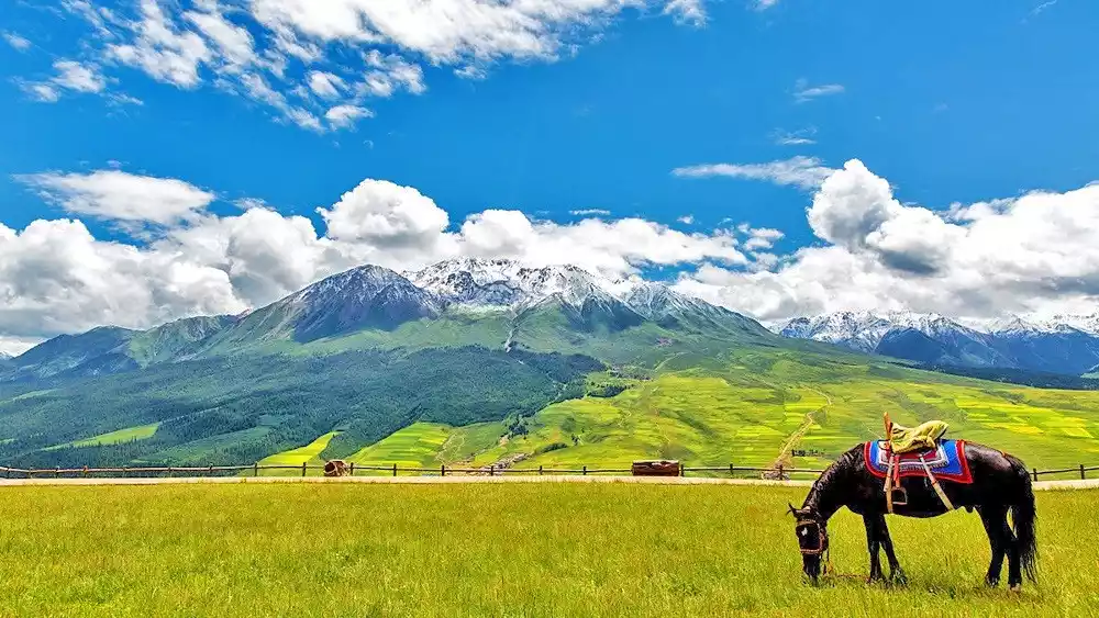
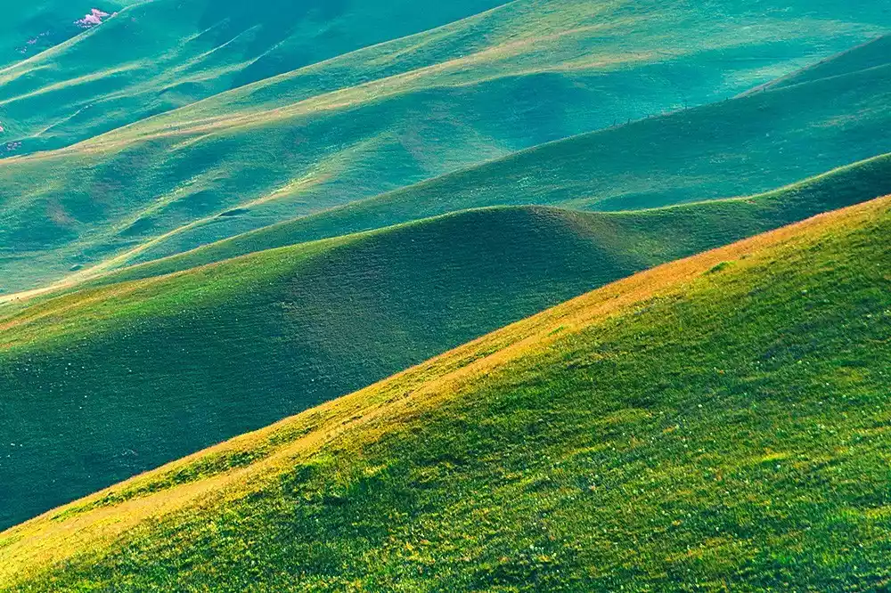
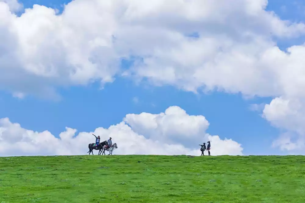
Qilian Mountain Grassland
Traveling west from Menyuan County towards Qilian County, you'll gradually encounter vast expanses of grassland. This is the renowned Qilian Mountain Grassland, recognized by National Geographic as one of China's six most beautiful grasslands. While it may not be as vast and flat as the Hulunbuir Grassland, its undulating landscape, dotted with the Qilian Snow Mountains, makes it unique.
Tips:
[Ticket Price] Free, but some attractions require a certain amount of admission fee (20 yuan/person for the Sea of Flowers and Mandarin Ducks).
How to Visit: The Sea of Flowers and Mandarin Ducks Scenic Area is particularly representative of the vast Qilian Grassland. Also known as Luanhaizi and Eye Lake, the Sea of Flowers and Mandarin Ducks is one of the Eight Ancient Scenic Spots of Menyuan. It is a key component of the Qilian Mountain Grasslands, one of China's six most beautiful grasslands.
[How to get there] The sea of flowers is located in the Huangcheng grassland on the northern slope of Lenglongling in the eastern section of the Qilian Mountains, 36 kilometers away from Haomen Town, Menyuan County.
Western Qilian Mountains
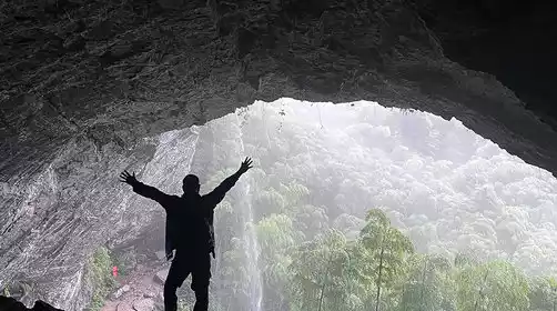
Due to its inconvenient transportation, the western section of the Qilian Mountains lacks the level of tourism development and maturity of its eastern and eastern sections, leading to its stunning natural scenery often overlooked. Starting from Qilian County, travel west along S204, passing through Yeniugou Township. Continue for over 150 kilometers to the Bayi Glacier, the source of the Heihe River, my country's second largest inland river. Continuing west along S204, you'll truly enter the western section of the Qilian Mountains. To the north lie the Silk Road strongholds of Jiuquan and Jiayuguan, and to the south, the renowned Qiyi Glacier and Qinghai's second-largest lake, Hala Lake.
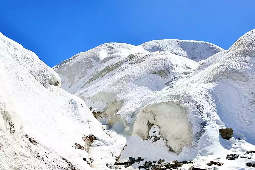
July 1st Glacier
Formed approximately 200 million years ago, the Qiyi Glacier is perpetually covered with snow, vividly embodying the saying, "Green mountains never grow old, whitened by snow." The Qiyi Glacier offers a unique landscape. From a distance, it resembles an inverted Milky Way, with a white ribbon dangling. Up close, the glacier reveals a diagonal glacier tongue, towering ice walls, draping ice curtains, and deep, sunken cirques, creating a mysterious and enigmatic scene. A 5-kilometer pedestrian trail and a monument dedicated to the theme, "Green mountains never grow old, whitened by snow," have been erected at the glacier site. The tourist area encompasses approximately 4 square kilometers. During summer and autumn, visitors can witness the melting snow on the glacier tongue, cascading water and cascading waterfalls, their roaring echoes echoing through the valley. Snowcocks sometimes roost on the hillsides, while snow lotuses compete with ice crystals for beauty. Below, cattle and sheep roam the grassy slopes, and smoke curls from the shepherds' tents, creating a vibrant atmosphere.
Tips:
[Ticket Price] Ticket price is 161 yuan/person (excluding oxygen cylinders, which can be purchased or rented separately).
How to Tour: The glacier is not well developed, and the facilities are relatively underdeveloped. Due to the high altitude, it is recommended to walk slowly, especially on the hundreds of steps at the entrance. Once you have acclimatized, you can slowly move forward.
[Transportation] The Qiyi Glacier is located in the heart of the Qilian Mountains, 116 kilometers southwest of Jiayuguan City. You can choose to charter a car or drive yourself, or take the train and then transfer to the scenic area sightseeing bus to reach the scenic area directly.
[Special Reminder] According to the sign posted by Qiyi Glacier Tourism Co., Ltd. at the Glacier Visitor Center: Qiyi Glacier has been closed to the public since April 5, 2017. (Specific opening time is to be determined)
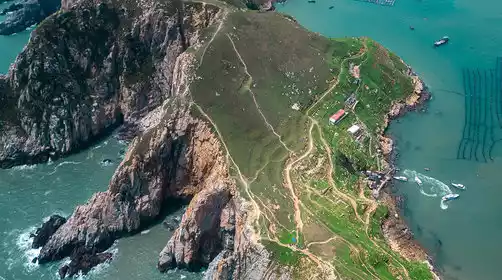
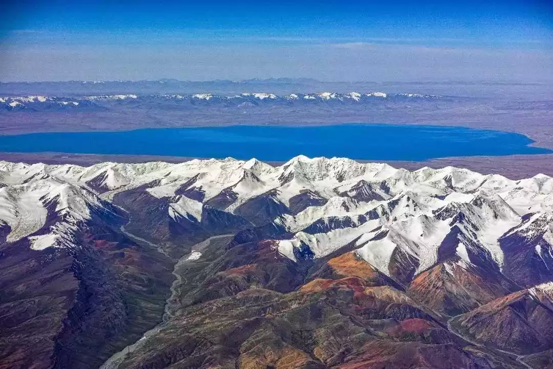
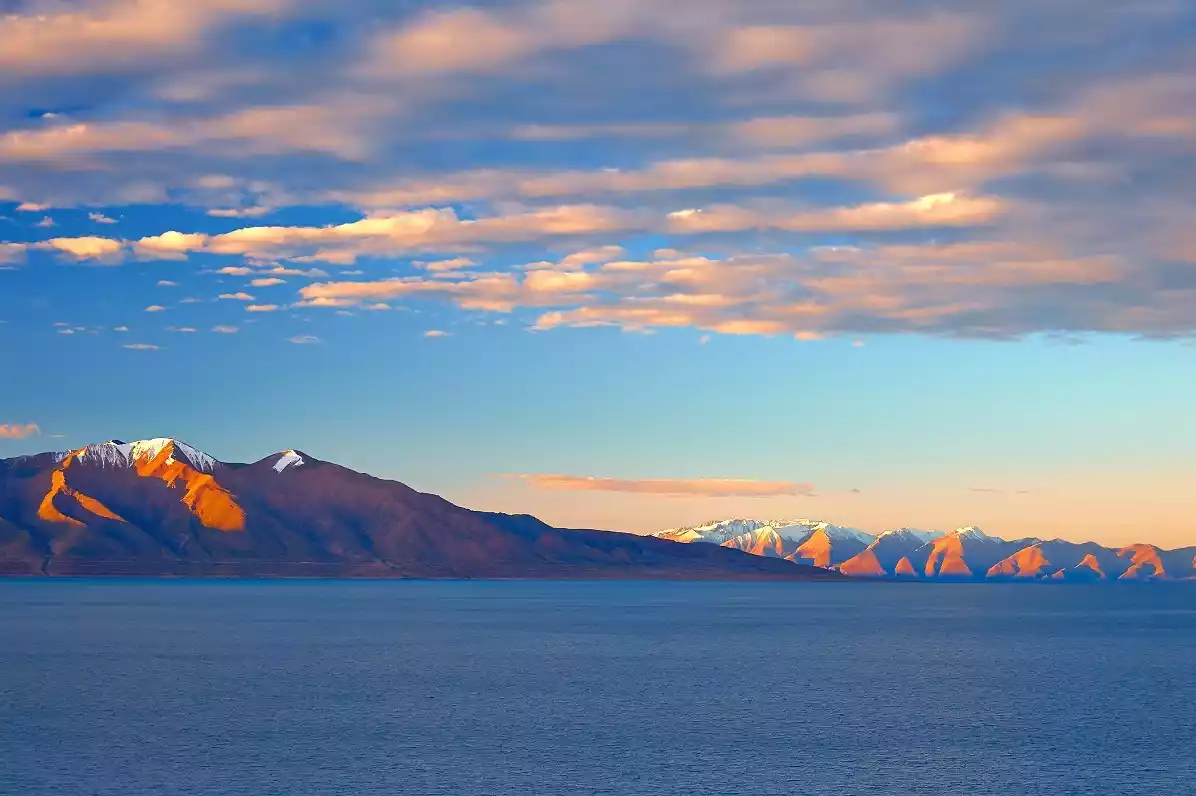
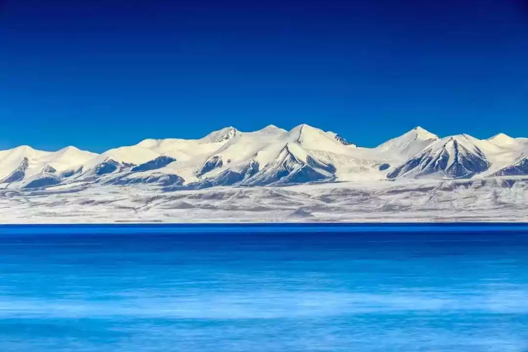
Hara Lake
Hara Lake, a virgin land hidden deep in the Qilian Mountains, has gradually come to the fore with the development of tourism and adventure activities on the Qinghai-Tibet Plateau. The road from Delingha City to Hara Lake is approximately 140 kilometers long. The first section is a 25-kilometer cement road through the Delingha Cypress Mountain Park. After crossing the first pass and entering the mountains, the road becomes mostly newly built gravel, winding through the high hills of the Qilian Mountains, passing through numerous grasslands and wetlands, offering breathtaking scenery along the way. Tuanjie Peak, at 5,826 meters above sea level on the north side of Hara Lake, is the highest peak in the Qilian Mountains and the highest peak on the border between Gansu and Qinghai provinces.
Tips:
【Ticket Price】Free
[How to complete the tour] Due to the long distance and the lack of any tourist facilities in the area, you must bring camping equipment when traveling to Hara Lake. Even in summer, you should bring a down sleeping bag with a high cold protection index.
[Transportation] Hala Lake is located in the north of Delingha City, about 730 kilometers from Delingha City and about 536 kilometers from Xining City. It is recommended to drive there by yourself and choose a four-wheel drive off-road vehicle with better performance.
[Special Note] Brown bears may roam near Hara Lake, so caution is advised when exploring. It's best to travel in a convoy of several vehicles. The lake is located deep in the mountains, where the climate is unpredictable and snowy. The access roads are all gravel and sandy, rugged, muddy, and slippery. Furthermore, the route crosses two mountain ridges, making it extremely difficult to navigate. For those without experience, it's extremely difficult to identify the path. I personally recommend seeking a local guide or an experienced driver to explore this uninhabited area.
Conclusion
In fact, the beauty of the Qilian Mountains goes far beyond this. Its beauty isn't limited to scenic beauty; it also possesses a unique cultural beauty. As mentioned earlier, the presence of the towering Qilian Mountains gave rise to the Hexi Corridor. During the heyday of the Han and Tang dynasties, the bustling Silk Road produced countless historical relics and monuments. Among them are the well-known Jiayuguan Gate Tower, which still stands on the north side of the Qilian Mountains; the peerless "Horse Stepping on Flying Swallow" unearthed in Wuwei; the invaluable Mogao Grottoes in Dunhuang; the Yangguan and Yumenguan passes, renowned for their ancient poetry; and Zhangye's Dafo Temple and Mati Temple. We'll share more about the cultural heritage of the Hexi Corridor later.

(Jiayuguan Tower)
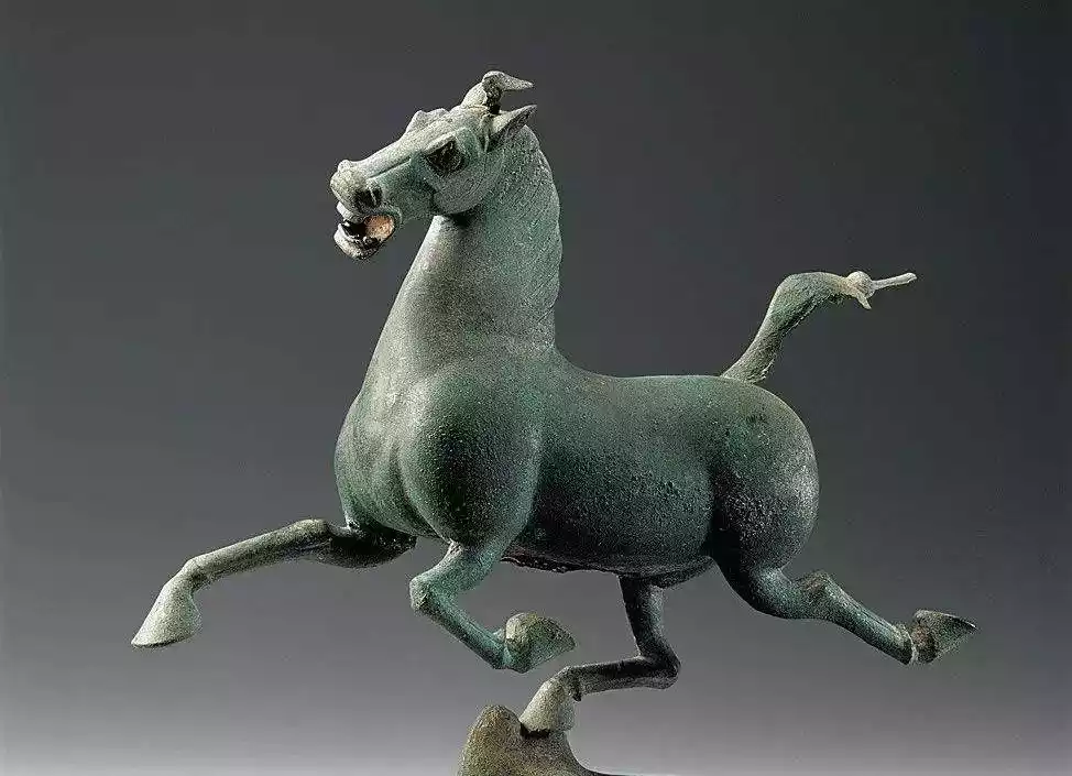
(Horse Stepping on Flying Swallow)
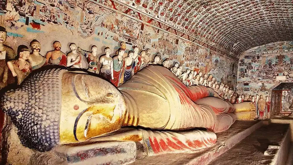
(Dunhuang Mogao Grottoes)
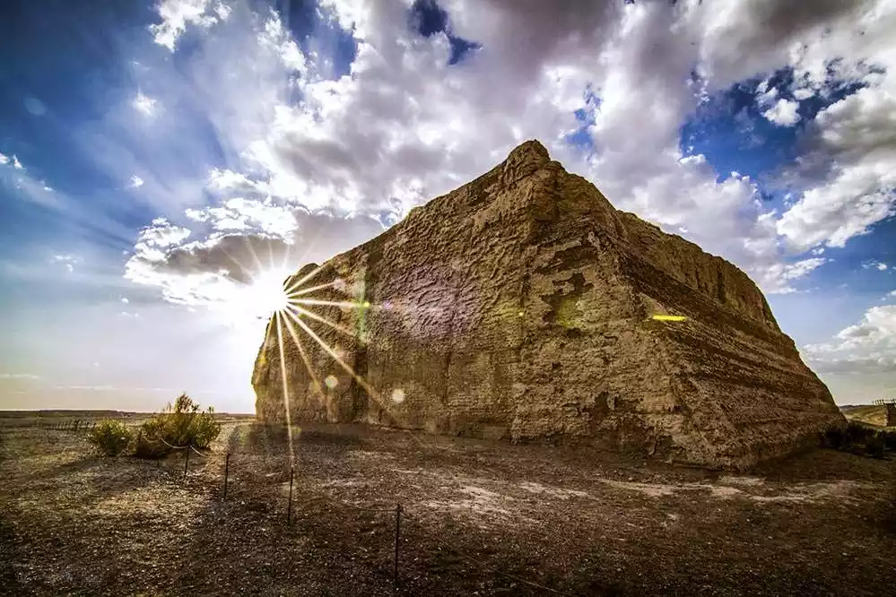
(Yumen Pass)
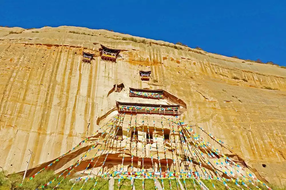
(Mati Temple)