In-depth interpretation of the North-South Line and the Grand Loop Line of Ali in Tibet. All the Ali strategies you need are here
Preface
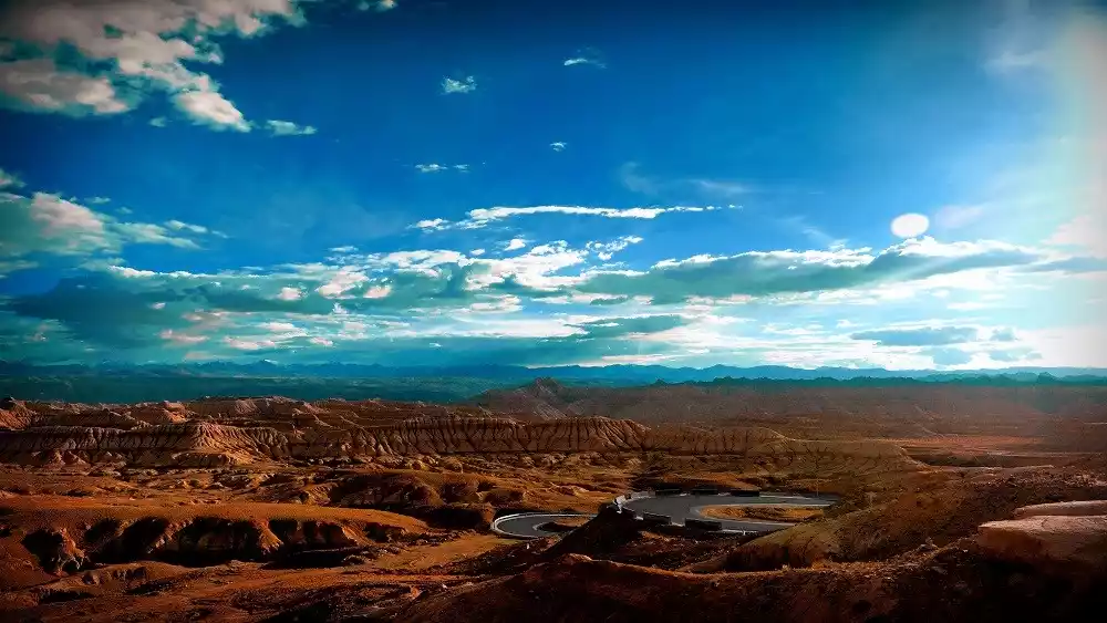
This vast, snow-capped plateau is where the Himalayas, Gangdise Mountains, Kunlun Mountains, and Karakoram Mountains converge. With an average altitude of 4,500 meters, it is truly a plateau within a plateau, the roof of the roof of the world. This region exudes a unique charm—a serene sound, akin to the sounds of nature, tucked away from the hustle and bustle of society. This is Ali.
Alibaba Overview
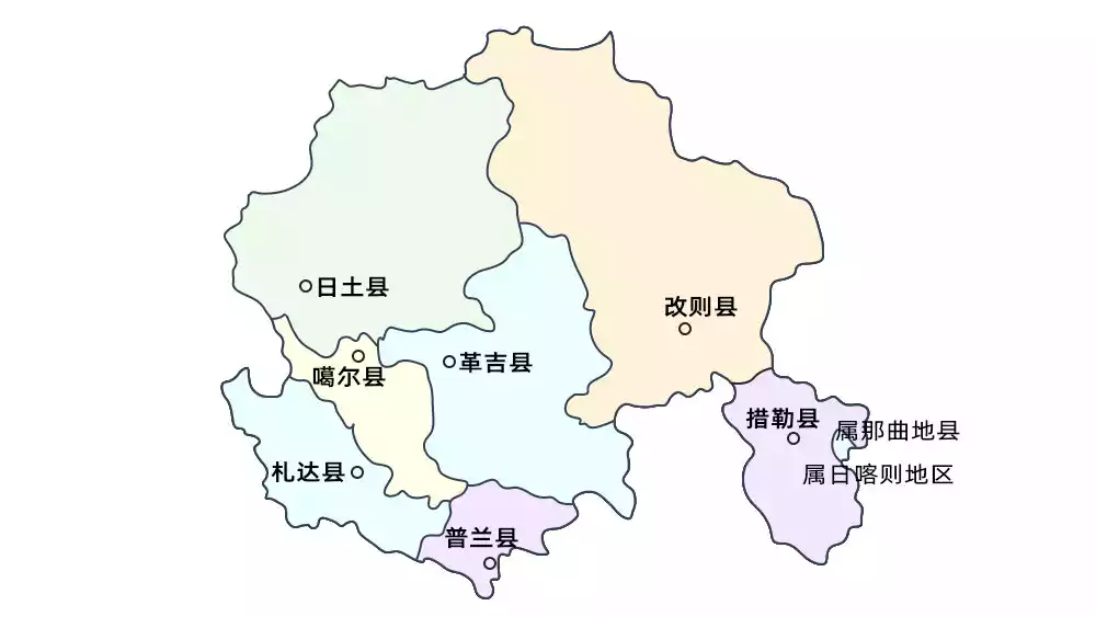
Ali is located in the southwestern border of China, in the western part of the Tibet Autonomous Region and the southwestern part of the Qinghai-Tibet Plateau. It is a regional administrative division of the Tibet Autonomous Region of China.

Ali is one of the least densely populated areas in the world. This high-altitude and cold land, which seems extremely unsuitable for human habitation, has had human activities for 10,000 to 20,000 years.
Ali, Tibet, known as the "ancestor of all mountains and the source of all rivers," has always been a journey only the brave dare to challenge. Therefore, not everyone has the opportunity to see the most magnificent scenery along the way. Going to Ali is the ultimate dream of countless people.
However, most tourists are still confused about the choice of tourist routes in Ali region. There are many different travel guides on the Internet, but they often still can't find their way after reading them.
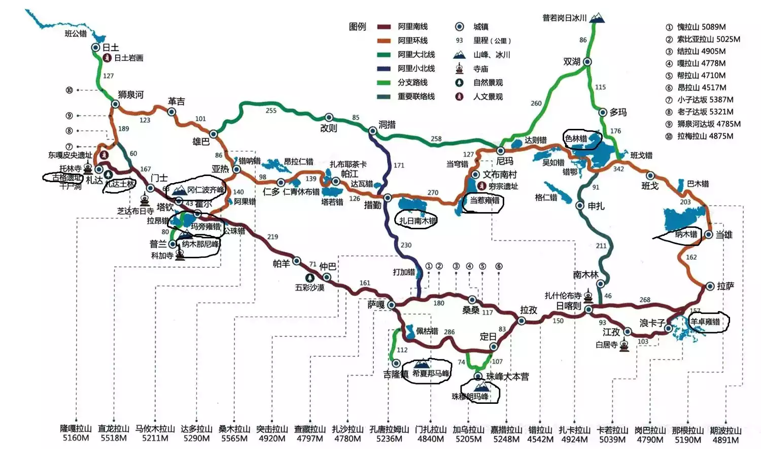
As a professional travel organizer for Ngari, China-TravelNote is here to introduce several routes to Ngari, Tibet, including the Ngari South Line, the Ngari North Line, and various Ngari loop lines.
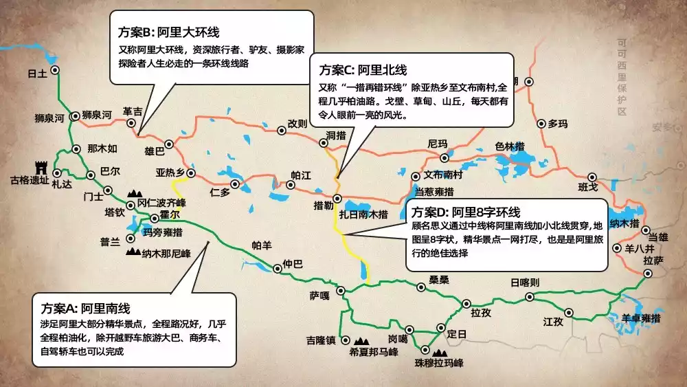
Ali South Line
The Ali South Line includes a section of the Xinjiang-Tibet Highway from Shiquanhe to Purang, so it is sometimes called the Xinjiang-Tibet Highway South Line.
Photographer: @枯草
Route Introduction
The southern route of Ngari begins in Lhasa, passing Yamdrok Lake, Langkazi Lake, and Gyantse before reaching Shigatse. After reaching Lhasa, the road forks and continues up the Yarlung Zangbo River, passing Saga, Zhongba, and Payang Lake to reach the sacred lake of Mapang Yongcuo. The route then continues south to the border town of Purang, from where it heads northwest to Zanda County and finally to Shiquanhe Town. Returning, the route continues south through Saga, where the road forks, along G318 to Gonggar Temple. According to incomplete statistics, the total distance is approximately 4,000 kilometers.
This route traverses the vast wilderness between the Himalayas and the Gangdise Mountains, offering a wealth of cultural and natural attractions, including the Zada Earth Forest, sacred mountains and lakes, and the Guge ruins. Therefore, many travelers choose the southern route to enter and exit Ngari. However, compared to other routes, the southern route passes through fewer towns and the road conditions are poor, so most trucks avoid it.
Travel suggestions
The best time to travel throughout Ali is from May to July and mid-September to mid-October.
The simplest and most direct route, the shortest way to play: start returning after arriving in Zhada. Generally, it takes about 11 days to complete the round trip from Lhasa. The road condition is good and almost all of it is asphalt. In addition to off-road vehicles, tourist buses, commercial vehicles, and self-driving cars can also complete the trip.
Ali North Line
The Ali Great North Line mentioned on the Internet generally refers to the Ali Great Ring Line. The Ali North Line is often referred to as the "One-Step-Two-Wrong Ring Line"
Route Introduction
The journey to Tso Lake begins from Namtso Lake in Lhasa, and then goes along Dangxiong, Bange, Nima, Gaizi, Geji to Shiquanhe, then returns to Xiongba, enters Yare Township, Renduo, Qincuo, Nima and then returns to Lhasa.
There are so many big and small lakes on the small loop line in the north. Not only are there lakes at every step, but there are also various "cos" on both sides of the road. There are N "cos" of lakes of different sizes, which is really dazzling. It is hard to tell whether the names are right or wrong!
Travel suggestions
Lhasa - Dangxiong - Bange - Nima - Gegye - Gegye - Shiquanhe, a one-way 1,500-kilometer journey with fully paved asphalt roads, Gobi, meadows, and hills, with eye-catching scenery every day.
Namtso, Bange Co, Selin Co, Daze Co, Dangqiong Co, and more than a dozen Co Lakes... unfold one after another on the roadside like a picture scroll. The "Coo Lake after Coo Lake" on the northern line of Ali is not in vain.
However, the entire route from Yare Township to Wenbu South Village is still covered with gravel and washboard dirt roads. Therefore, for safety reasons, there are basically no travel products online that can help you, except for off-road enthusiasts.
Ali Grand Loop
It is also commonly called the Ali Great North Line
Route Introduction
The Ngari Grand Loop combines the southern and northern Ngari routes. The journey beyond Shiquanhe is particularly adventurous, offering stunningly desolate scenery. Entering the Qiangtang No Man's Land, this wildlife paradise boasts Tibetan antelopes, wild donkeys, wild horses, and wild yaks. This truly captivating journey offers breathtaking views, a truly in-depth look at Ngari.
The usual circular route is Lhasa - Yamdrok Lake - Shigatse - Mount Everest - Pegu Co - Saga - Zhongba - Gongzhu Co - Manasarovar - Tarchin - Kailash - Zanda Tuling - Guge Kingdom - Shiquanhe - Xiongba Township - Renduo Township - Coqen - Nima - Seling Co - Bange - Namtso - Yangbajing - Lhasa.
Travel suggestions
This is a must-take route for experienced Tibetan travelers, hikers, photographers, and explorers in Ali. After crossing the Shiquan River, you start to go deep into the hinterland of Ali and keep driving at an altitude of more than 4,500 meters. Much of the journey is dirt roads, washboard roads, and gravel roads.
Ordinary cars and low-displacement vehicles cannot travel the Ali Grand Loop, as they have to cross mountains and rivers. Therefore, from the perspective of safety and stability, the best vehicle configuration is a large-displacement, powerful, hard-core off-road vehicle in Tibet, preferably one with dual fuel tanks, dual spare tires, and four-wheel drive.
Ali Small Loop/Ali Figure 8 Loop
It is also commonly called Ali Xiaobei Line
Route Introduction
If the Ali Grand Loop is the South Line + North Line, then the Small Loop is the South Line + Small North Line. The locations are: Lhasa → Shigatse → Saga → Shiquanhe → Gaize → Coqen → Saga → Lhasa. The Small North Line will not go north through Dongcuo, but go south through Coqen to the 22nd Road Station and then return along the original route of Lazi-Everest Base Camp (voluntary, not a must) and Shigatse-Lhasa.
Travel suggestions
This route runs through the north and south lines of Ali from the middle. If tourists do not have enough time to take the large loop line, they can go directly through the middle and cut the large loop line into the most essential area of Ali scenery.
Ali's Communications
In terms of communication, since the entire journey is on the plateau, there may be no signal for a whole day. It is recommended that you tell your family in advance to report your safety. The best mobile phone signal is from China Telecom, followed by China Mobile, and China Unicom is relatively poor. It is recommended that you make corresponding preparations in advance before entering Tibet.
Alibaba's Medical
Everyone should prepare common medications such as gastrointestinal and cold medicines. You can also take some anti-altitude sickness medications such as Rhodiola rosea and Gaoyuan An in advance. Bags of oxygen or bottles of oxygen are available in Ali Town, so there is no need to prepare them specifically.

Ali's altitude
The northern route is higher than the southern route. Starting from Shiquan River, the average altitude of the northern route is over 4,500 meters. Nima County is 4,500 meters, and the highest altitude reaches nearly 5,000 meters towards Bange, generally remaining around 4,400 to 4,600 meters. Furthermore, from Shiquan River eastward, the terrain is generally high.
The southern line is low in the west and high in the east, that is to say, except for briefly crossing several mountains over 5,000 meters from Shigatse to Saga, the altitude is basically between 4,000 and 4,200 meters. Only from Saga to Payang is relatively high, close to 4,500 meters, and it becomes about 4,200 meters when it reaches Shiquanhe. If you enter from the south line, the altitude of the north line is easy to accept and will not be a problem.
The picture comes from the Internet
Ali's road conditions
The southern route is several times better than the northern route. From Lazi to Shiquanhe, there is basically an asphalt road, and the speed can reach over 100 kilometers per hour.
The northern route is much worse, consisting primarily of gravel, washboard, and deep potholes. The worst section, from Cuoqin to Yare Township, feels like a roller coaster ride. The most treacherous section is from Nima to Wenbu, where single-vehicle-only curves have slopes exceeding 30 degrees, many of them sharp, with five or six such turns in a row. The road is also a gravel road with large stones, making it feel like walking into a rocky hill.
Accommodation in Ali
The conditions on the South Line are better than those on the North Line, and the prices are also higher. Because it is the peak tourist season, the slightly better hotels on the South Line are all above 200 yuan. They provide 24-hour hot water, breakfast included, and internet access in some places. There are independent parking lots on both the North and South Lines, which are very safe.
There is no hot water along the entire North Line. The power supply is only available from 9pm to 12am (the situation may improve), so you cannot take a shower.
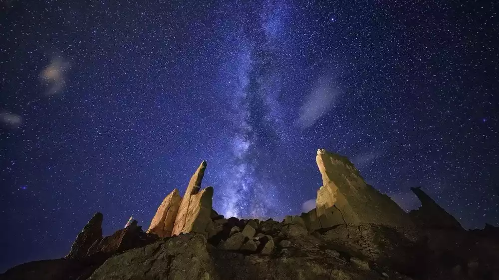
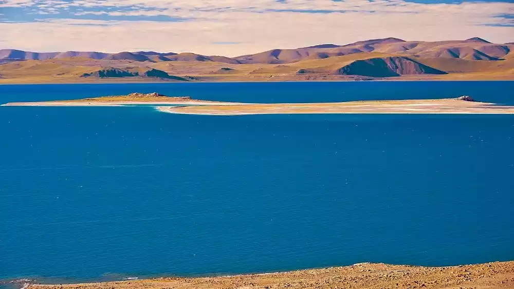
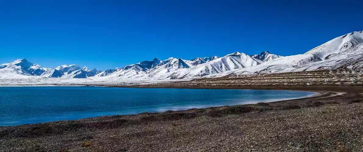
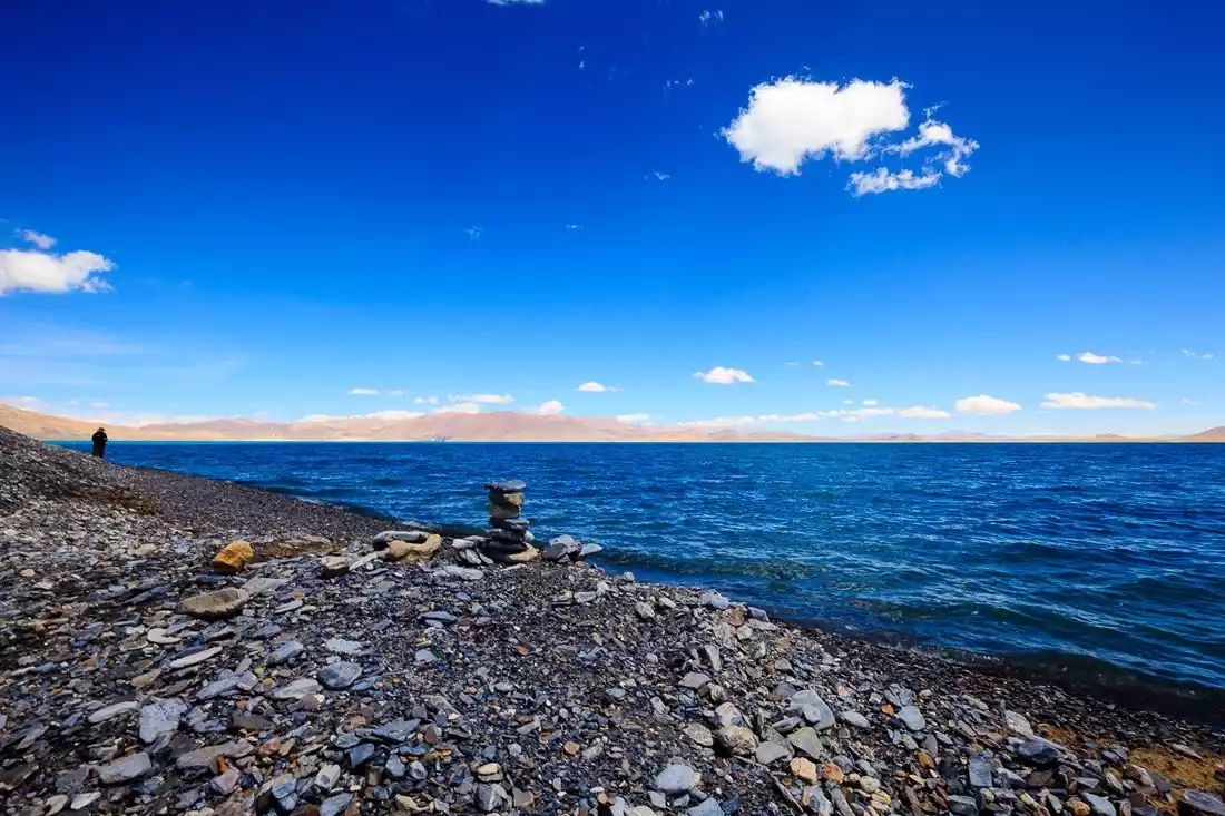
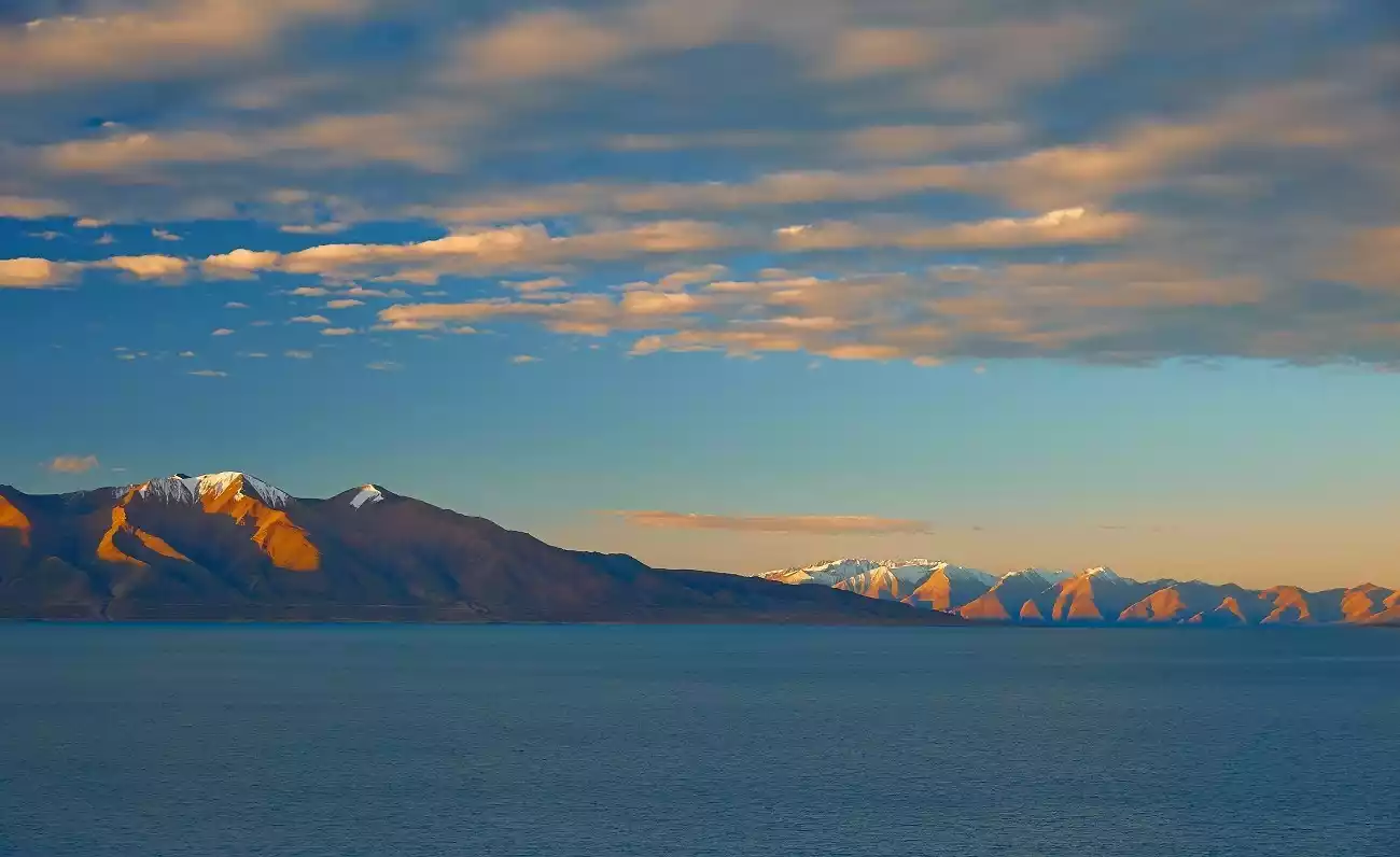
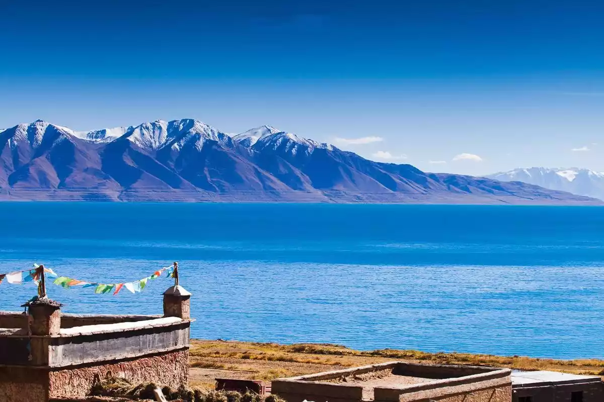
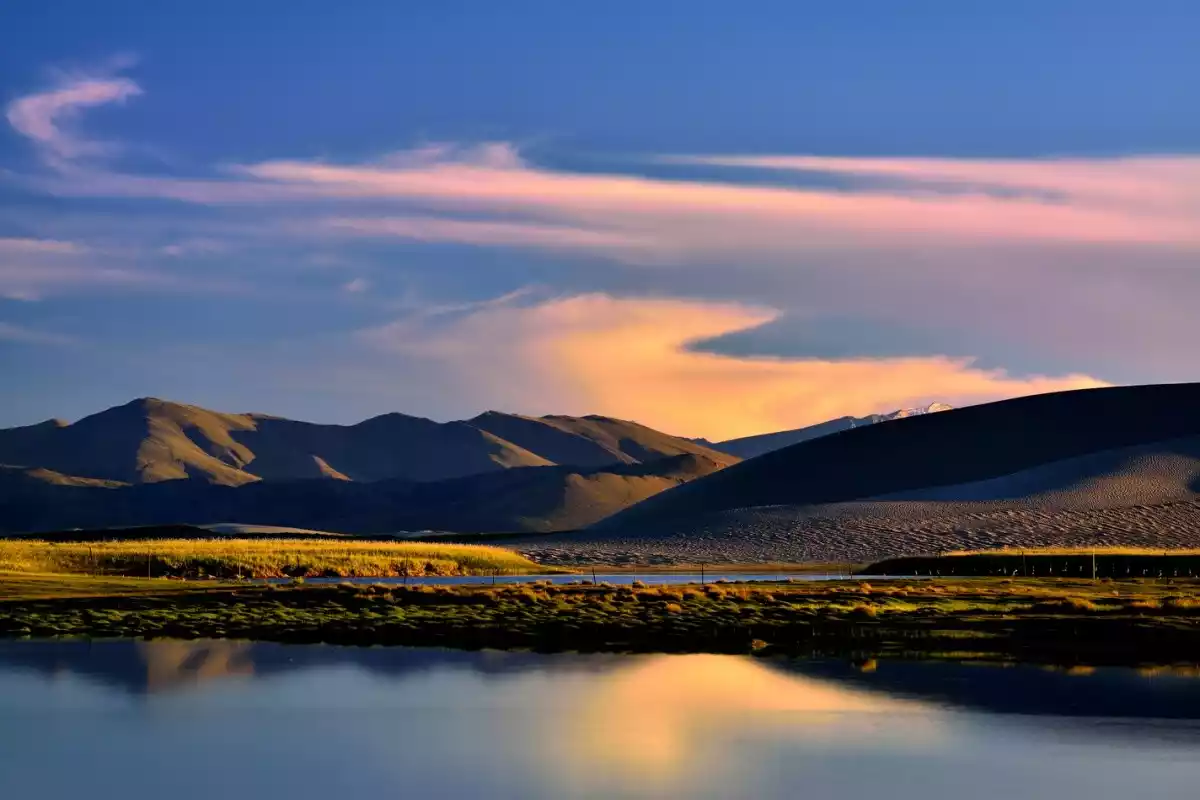
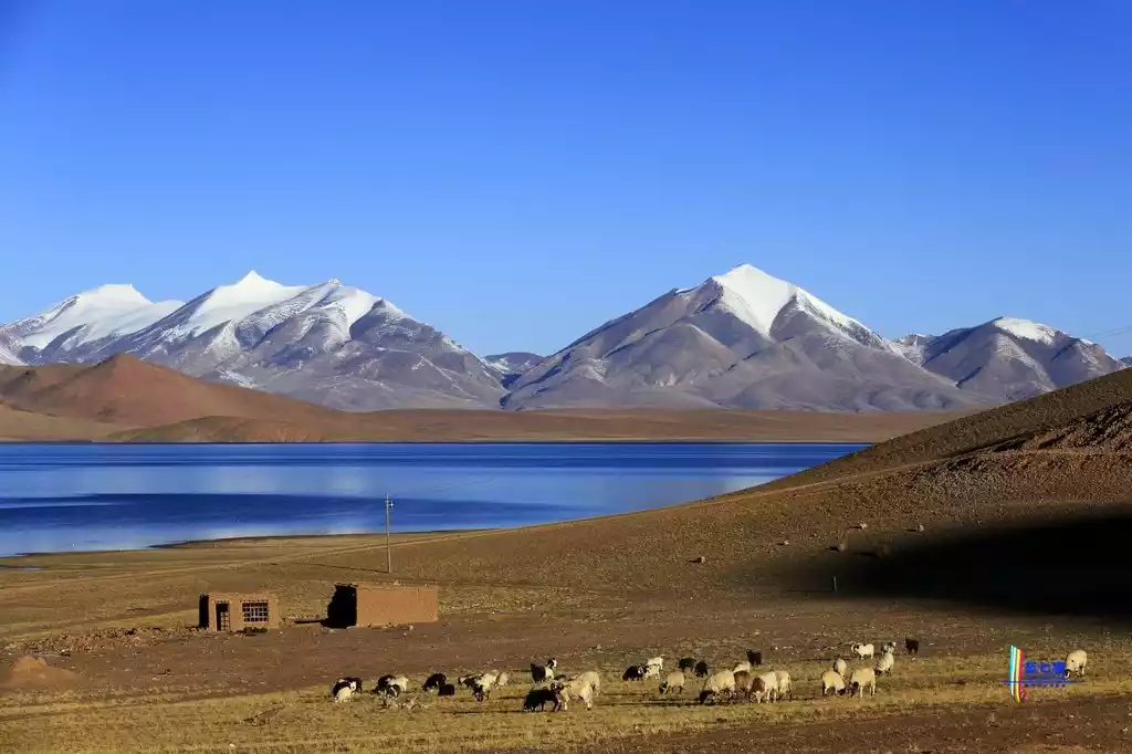
The beautiful scenery of Ali
The sky is very close here, the altitude is very high, and the clouds are very low. The land here is vast, the snow-capped mountains stretch, and the lakes are ethereal!
"The Source of All Waters"
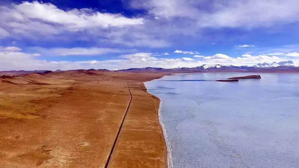
There are more than 80 lakes of various sizes in the area, the larger ones include Zha Ri Nam Co, Pangong Co, Manasarovar Co, Laang Co, etc. Here, you can "swim in one lake after another".
There are more than 100 rivers of various sizes in the territory, including the Maquan River, Kongque River, Xiangquan River and Shiquan River. The four major rivers originating from the Gangdise Mountains are the main sources of the world-famous Yarlung Zangbo River, Sutlej River, Ganges River and Indus River.
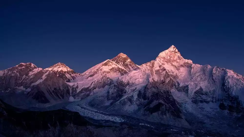
"The Roof of the Roof of the World"
A feast of snow-capped mountains: Mount Everest, Mount Kailash, Shishapangma, the Himalayas, and the Nyainqentanglha Mountains. In the north, there are the Kunlun Mountains and the Karakoram Mountains, stretching from west to east; in the central part, the Gangdise Mountains run diagonally across the country from northwest to southeast; and in the south, there are the Himalayas.
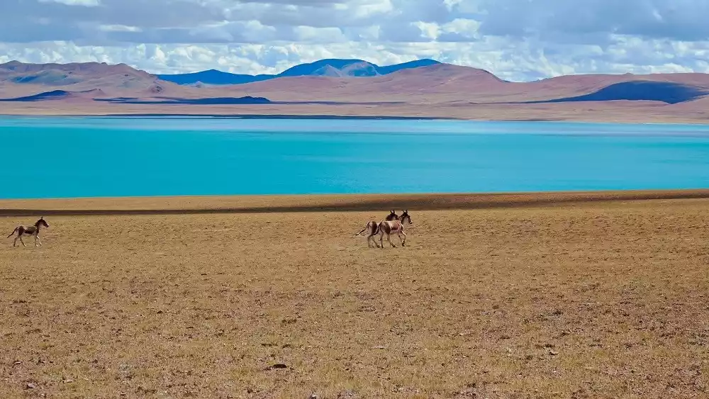
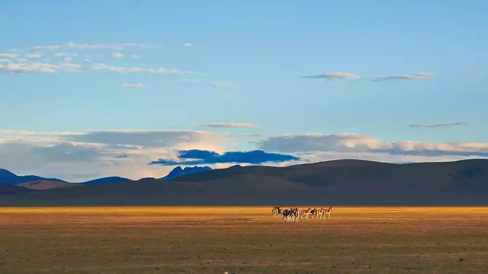
Animal Paradise
Walking in Ali, wildlife is your closest companion. On the grasslands, Tibetan antelopes and wild donkeys forage for food everywhere. Elegant black-necked cranes dance gracefully beside ponds. In the lakes, flocks of red-billed and brown-headed gulls frolic, while bar-headed geese stroll leisurely along the shore.
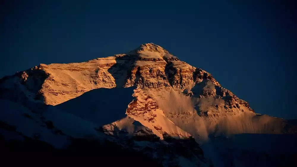
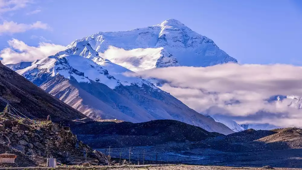
Rongbuk Monastery, the best viewing platform on Mount Everest
Tickets/Opening Hours:
35 yuan
Traffic Overview:
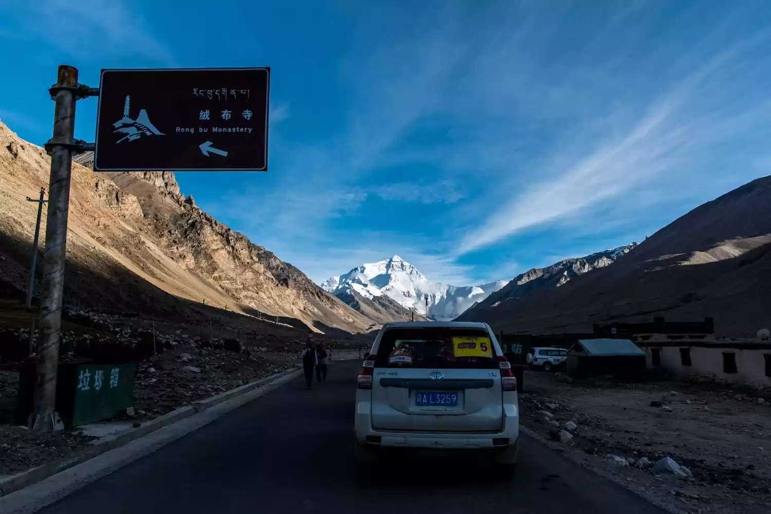
To go to Rongbuk Monastery, it is best to charter a car from Xintingri, as there are rarely hitchhikers on this route.
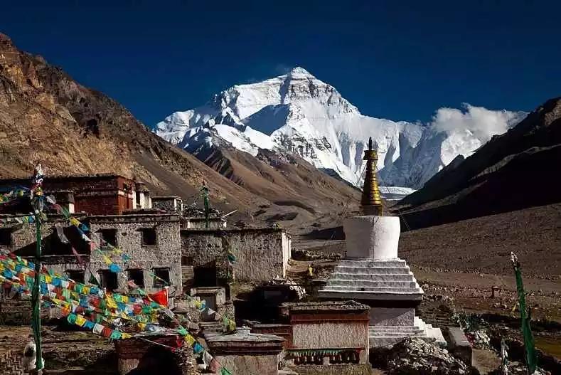
Rongbuk Monastery, whose full name is "Laducha Rongbuk Dong'aqulin Monastery", is located at the end of Rongbuk Glacier at the foot of Mount Everest, at an altitude of 5,150 meters. It belongs to the Nyingma sect of Tibetan Buddhism and is a rare temple where monks and nuns live together.
The entire temple is built into the mountainside and has five floors, of which only two are still in use. The temple is divided into two parts, the old and new. The old temple is closer to Mount Everest and contains the cave where Guru Padmasambhava meditated, as well as stones and pagodas with the hand and foot prints of Guru Padmasambhava.
The new temple, which includes a nunnery, was built in 1902. The best vantage point for viewing Mount Everest is from the south of the temple, especially the Mani pile and white pagoda at the temple entrance, which are often used by tourists as a foreground for photographing Mount Everest.
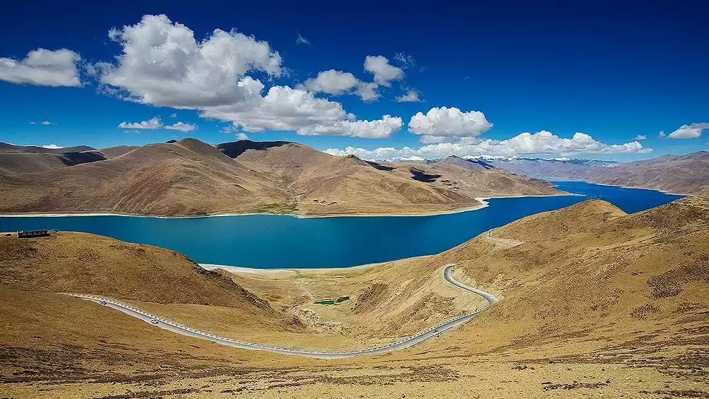
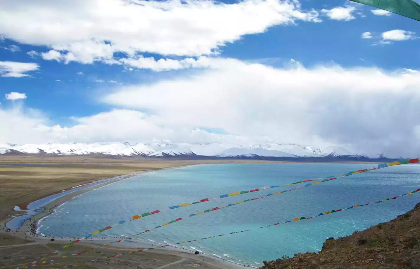
Blue Rhapsody of Yamdrok Lake
Tickets and opening hours:
40 yuan/person (collected at the top of Gangbala Mountain)
Traffic Overview:
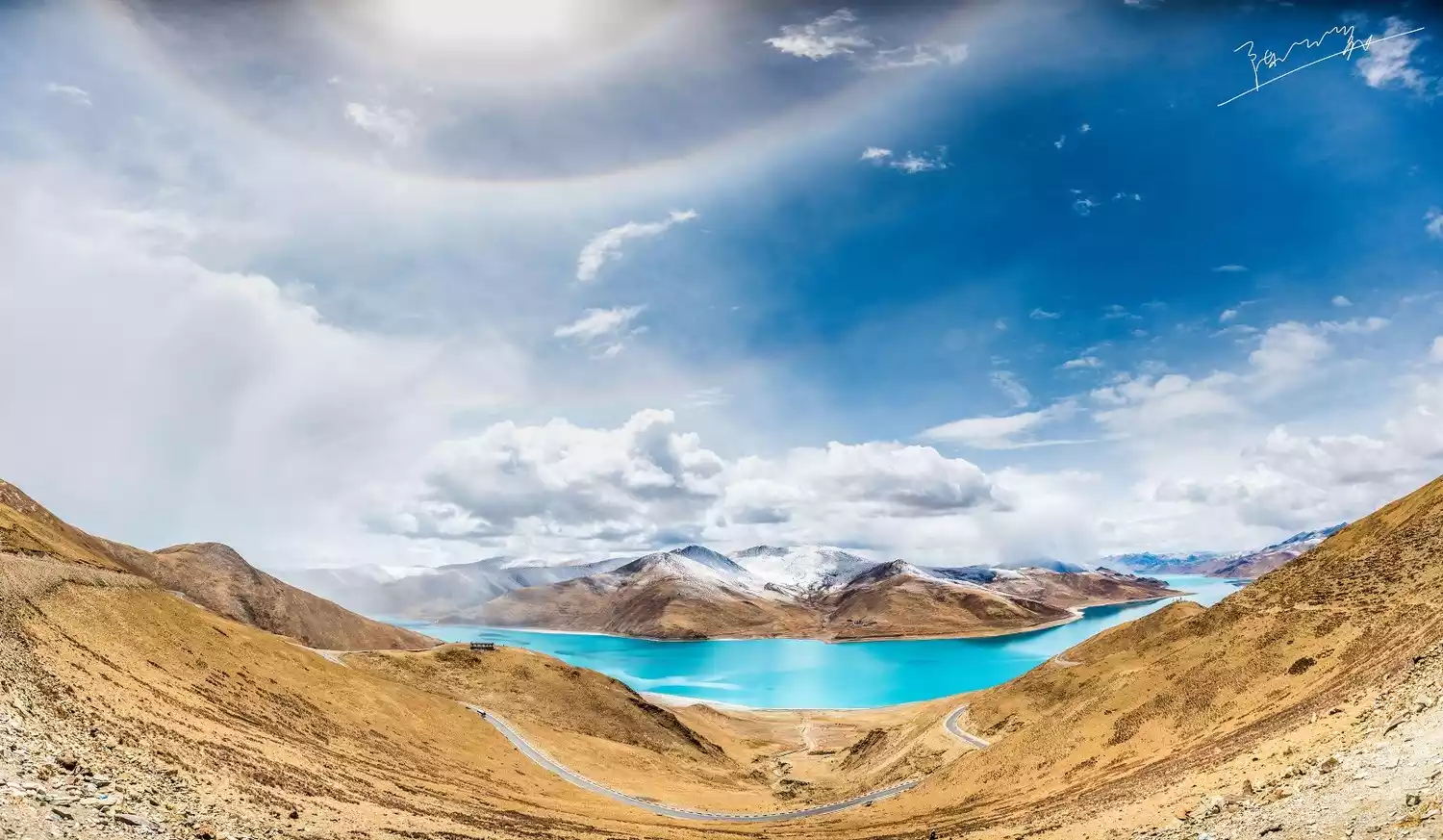
Leaving Lhasa to the west, passing the Yarlung Zangbo River Bridge in Qushui County, heading south along the Laya Highway for 170 kilometers, and crossing the 5,030-meter Gambala Pass, the beautiful, jade-like Yamdrok Lake will appear before us.
Photographed by: @钱小朵
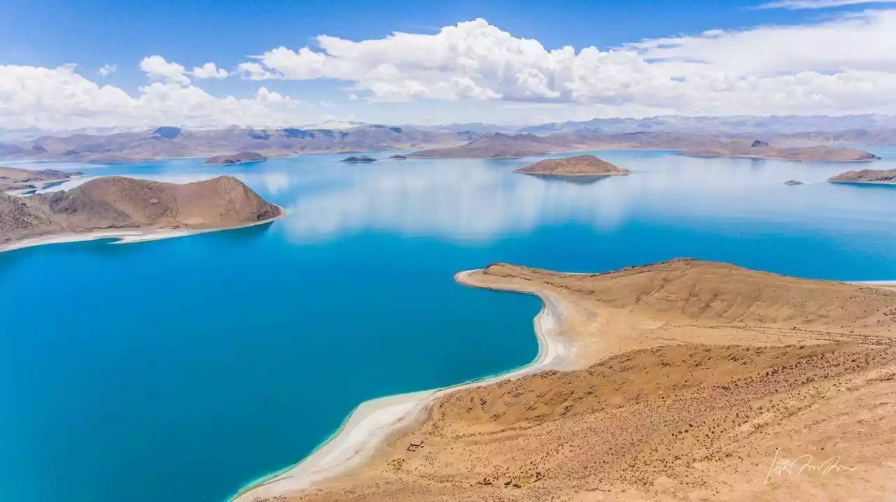
Yamdrok Lake, with a lake surface of more than 4,000 meters above sea level and an area of 638 square kilometers, is a unique natural scenic spot that integrates a variety of landscapes such as plateau lakes, snow-capped mountains, islands, pastures, hot springs, wild animals and plants, and temples.
The lake is rich in plateau naked carp, earning it the nickname "Tibet's Fish Reservoir." It's also Tibet's largest water bird habitat, surrounded by perennially unmelted snow-capped peaks, the highest reaching over 7,000 meters. The lake, snow-capped peaks, and blue sky blend seamlessly into a scene that captivates visitors.
Photographed by: @Mr. Orange
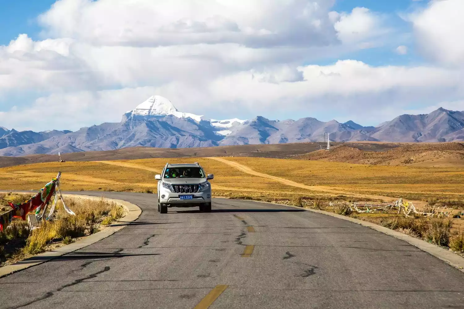
Mount Kailash, the center of the world
Tickets and opening hours:
The combined ticket price for Mount Kailash and Lake Manasarovar is 200 yuan, and there is a separate fee for entering the temple.
Traffic Overview:
Mount Kailash stands tall in Tachin, Baga Township, Purang County, over 400 kilometers from Shiquanhe Town and about 100 kilometers from Purang County. There are two routes to the sacred mountain: southbound and westbound.
To reach the mountain from the south, take a bus or charter a car from Shiquanhe to Baga Township. The cost of a charter car is around 800 yuan per day. Shiquanhe is 480 kilometers from Baga Township, and can be reached in a day if all goes well. From Baga, drive about 20 kilometers to Tachin.
Westbound: Traveling west from Lhasa to Baga Township is the standard Ali South Line route, which takes about 4 days (excluding going to Mount Everest). There are no shuttle buses along the way (shuttle buses take the Ali North Line).
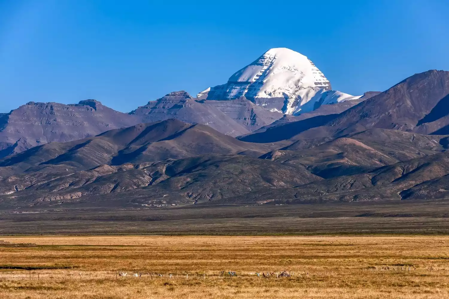
Image source: @photo.net
Mount Kailash, commonly known as the Snow Spirit Mountain, is located north of the holy lake Mapang Yongcuo in Purang County. It is the main peak of the Gangdise Mountains, with an altitude of 6,656 meters. Its Tibetan name means "mountain of gods" and it is one of the famous Buddhist holy sites.
Lake Manasarovar, the Mother of Holy Lakes
Tickets and opening hours:
Lake Manasarovar now charges a fee in conjunction with Mount Kailash, with an entrance fee of 200 yuan.
Traffic Overview:
Most tourists will stay in a small village next to Jiwu Temple, which is located 30 kilometers southeast of Dajin. If you do not hire a jeep to go to Mount Kailash, you can only wait for a ride in Dajin or at the Baga checkpoint, and the price ranges from 30 to 70 yuan.
Photographer: @Xiaolei
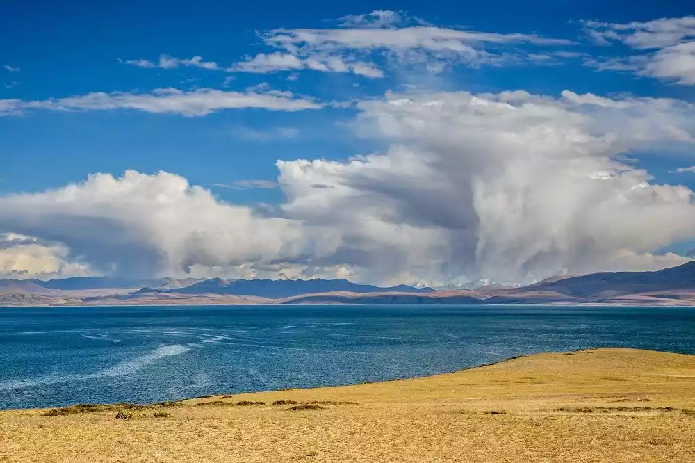
Lake Manasarovar, located 20 kilometers southeast of Mount Kailash, stands at an altitude of 4,588 meters and covers an area of over 400 square kilometers. Since ancient times, Buddhists and Bon believers have regarded it as a sacred place, the "center of the world."
It is the freshwater lake with the highest water transparency in China, one of the three sacred lakes in Tibet, and the source of four major rivers in Asia - the source of the famous Ganges, Indus, Sutlej and Yarlung Zangbo rivers in South Asia. It is known as the "Mother of the World's Rivers".
Namtso Lake, a jade-like lake
Tickets and opening hours:
Peak season (May 1st - October 31st): 120 yuan;
Off-season (November 1st - April 31st of the following year): 100 yuan.
9:00-18:00.
Transportation Overview: There is no shuttle bus to Namtso. In addition to joining a tour group, you can rent a car with your companions and find a minibus for two days of round trip.
Namtso, which means "Heavenly Lake" in Tibetan, is one of the three sacred lakes in Tibet. The lake surface is 4,718 meters above sea level, 70 kilometers long from east to west, 30 kilometers wide from north to south, and covers an area of 1,920 square kilometers. It is the largest lake in Tibet, the second largest saltwater lake in China, and the highest lake in the world.
Like a glittering gem inlaid on the vast Qiangtang grasslands, it is tranquil and vast, with water and sky blending seamlessly into one. Strolling along the lakeside feels like being in a fairyland.
Photographer: @善友
Photographer: @Tunan
The magnificent Zada Earth Forest
Tickets and opening hours:
It’s free, but you need to bring your border pass.
Traffic Overview:
The typical round-trip journey to Zanda is from Shiquanhe, with a chartered car taking about 12 hours. If traveling north from Mount Kailash, or continuing south from Zanda, consider getting off at Namjia (also known as Naburu), 136 kilometers from Shiquanhe, before continuing on to Zanda.
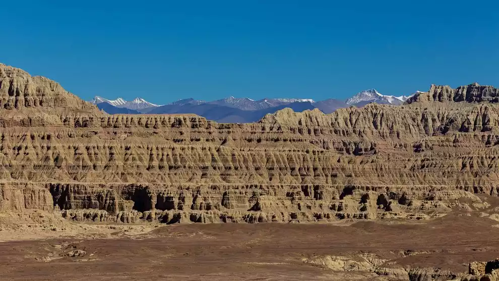
Photographer: @风水印
The Earth Forest is a unique landform formed by the ancient orogeny. The sedimentary layers of the lake bottom were cut by flowing water and gradually weathered and eroded. The "trees" within the Earth Forest range from dozens of meters high to low, creating a unique and fascinating landscape. Driving through it feels like circling the feet of giants.
Dynasty ruins Guge Dynasty
Tickets and opening hours:
120 yuan/person, natural landscape open all day
Traffic Overview:
Travel route: Alikunsha Airport is 160 kilometers away from the scenic area, and you can take a tourist bus to the scenic area.
Self-driving route: ① Menshi Township on National Highway 219 - Qulong Yincheng - Dongpo Temple - Daba Ruins - Guge Kingdom Ruins - County Seat ② Baer Military Station on National Highway 219 - Piyang Dongga Ruins - Zanda County Seat (Tolin Monastery) - Guge Kingdom Ruins ③ Kunsha Airport - Namru on National Highway 219 - Piyang Dongga Ruins - Zanda County Seat (Tolin Monastery) - Guge Kingdom Ruins
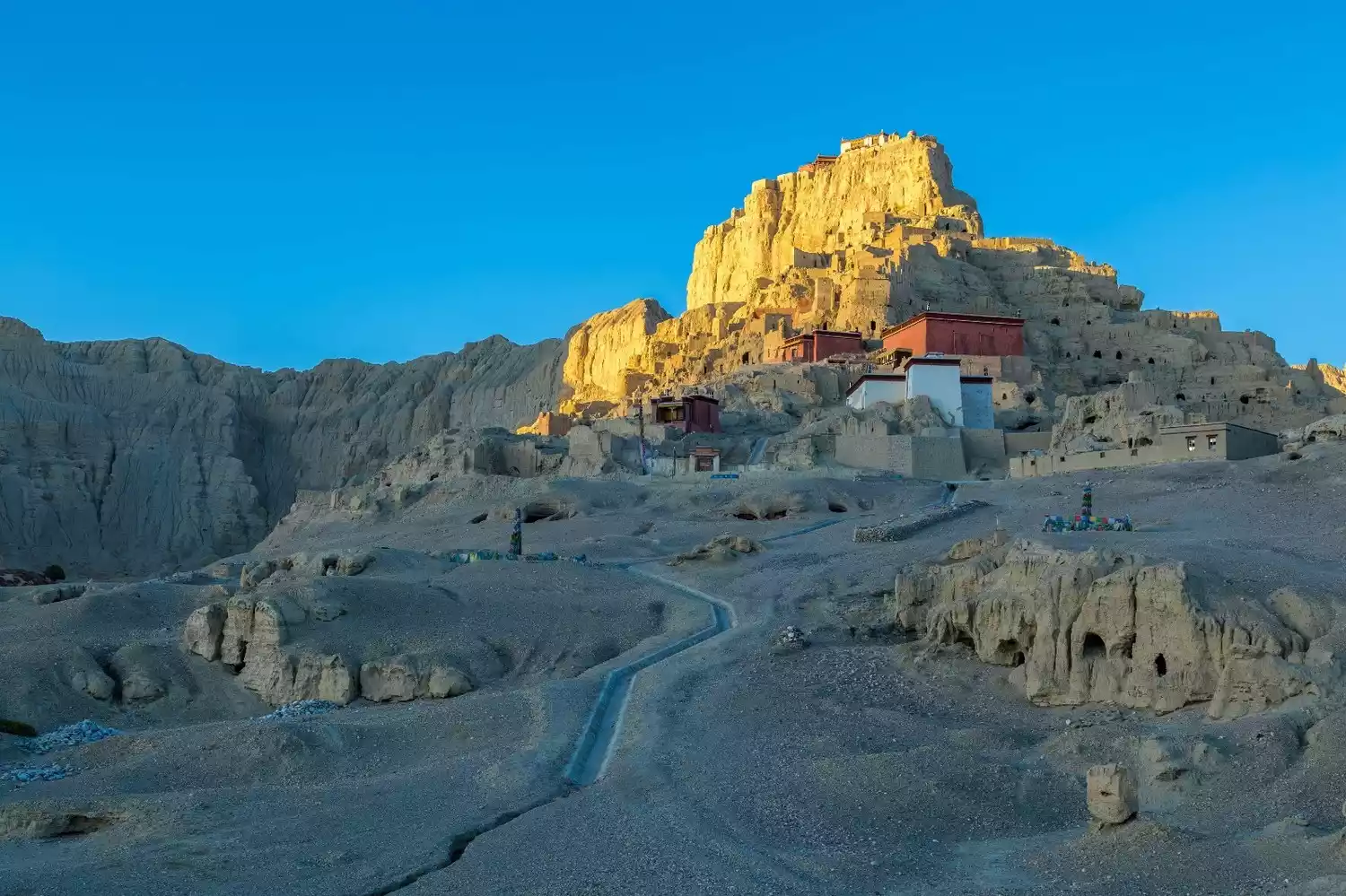
Photographer: @Xiaolei
The Guge Dynasty is located in Zabjang District, Alizada County, on the south bank of Xiangquan River, 19 kilometers away from the county seat, on a loess mountain more than 300 meters high, covering an area of about 1.83 million square meters.
It was once the palace of the Guge Dynasty. From the 10th to the 16th century, it was continuously expanded by 16 generations of Guge kings. It is huge in scale and consists of royal palaces, temples, watchtowers, pagodas and caves.
Pekutso, a paradise for wild animals
Tickets and opening hours:
No entrance fee required, included in the Shishapangma Scenic Area package. 09:00-18:00 (Monday-Sunday, January 1st - December 31st)
Traffic Overview:
You need to charter a car to go to Jilong County.
Peiku Co, also known as Peigu Co, Bogu Co, and Laco Xin Co, is located in Gyirong County in southern Tibet Autonomous Region, China. It lies 60 kilometers north of Mount Shishapangma and 40 kilometers south of the Yarlung Zangbo River. At an altitude of 4,580 meters and covering an area of 284.4 square kilometers, it is the largest lake in the Shigatse region.
Influenced by warm, humid air currents from the Indian Ocean, the lake area enjoys abundant precipitation. The average annual temperature is 2°C, and annual precipitation is 300-400 mm. The lake is primarily fed by precipitation and snowmelt runoff. The main inflow is the Bajixiongqu River, which flows into the lake from its southeastern shore.
Photographer: @疯言疯语
Dangre Yumtso, the cradle of Zhangzhung civilization
Tickets and opening hours:
Free and open all day
Traffic Overview:
If you want to go there, you must first take a car along the Ali Great North Line to Nima County, then turn southwest from Nima County, turn left after about 8 kilometers, and then go south for about 80 kilometers, cross a mountain pass of more than 5,000 meters, and reach Wenbu, where you can enter the Dangre Yumco Lake Basin.
Dangre Yongcuo is the most important sacred lake of Bon religion. It was once the site of the royal palace of the Zhangzhung Dynasty and is one of the areas with the most concentrated Zhangzhung relics in northern Tibet. It is a key to deciphering the mystery of Zhangzhung culture and an important place for studying Bon culture.
The glorious light shines upon Selingtso
Tickets and opening hours:
free
Traffic Overview:
To get there, you must first take a car along the Ali Great North Line to Yuezhu County. You can see Selincuo on the road from Yuezhu to Shenzha or Nima. The road is more than ten kilometers away from the lake, but it is difficult to get close because there are many swamps around the lake, so you need to pay attention to safety when going there.
Selin Co Lake, with a lake surface at an altitude of 4,530 meters, is 72 kilometers long from east to west and has an average width of 22.8 kilometers. The widest part in the east is 40 kilometers. The lake area is 1,640 square kilometers, making it the largest inland lake system in Tibet.
Numerous rivers and lakes connect within the basin, forming a closed inland lake complex. In addition to Selin Co, there are 23 smaller satellite lakes, including Geren Co, Wuru Co, and Rencuo Gongma. In summer, the lakeside scenery is unique, and the small islands within the lake are home to a variety of migratory birds.
The most beautiful border Jilong Port
Tickets and opening hours:
free
Traffic Overview:
There are regular buses from Shigatse to Gyirong, and to Gyirong Town.
Photographer: @京华岳云
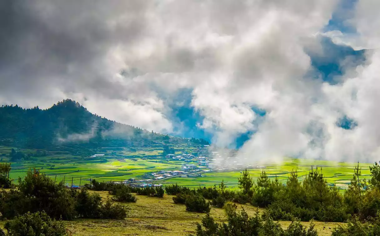
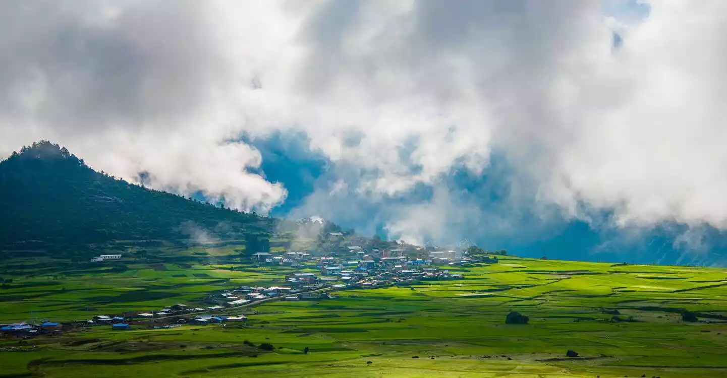
Jilong Valley, Tibet's last untold secrets. Tibet is steeped in mystery. This snowy plateau, the world's highest, is filled with countless mysteries and wonders. The majestic mountains speak of Tibet's sanctity and inviolability, while the gentle and beautiful holy lakes demonstrate Tibet's purity and inviolability. Even more remarkable is the vast difference in altitude, which creates distinct ecological environments.
Photographer: @京华岳云
The high altitudes offer a year-round alpine climate covered in snow, while the lower altitudes offer a subtropical climate with dense forests and a rich biodiversity. The magic is breathtaking!
Conclusion
After visiting Ali, I realized that all the Tibet we had visited before were fake!
China-TravelNote: Ali South Line, Ali Grand Loop, Ali In-Depth Photography, Meet the Sacred Mountains and Lakes, Explore the Guge Kingdom, and Cross the Uninhabited Qiangtang!
Let us gallop through the wilderness of western Tibet and start our in-depth journey through Ali!