Hiking in the Taihang Mountains: A New Hiking and Trekking Landmark: Eighteen Cylinders. A Detailed 3-Day Guide to the Taihang Mountains' Highlights.
Preface
I go to Taihang Mountains every year and have new experiences every time. From the moment I set foot on this road of no return to the outdoors, I have been chasing after beautiful mountains and rivers and exploring little-known places deep in the mountains.
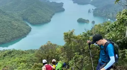
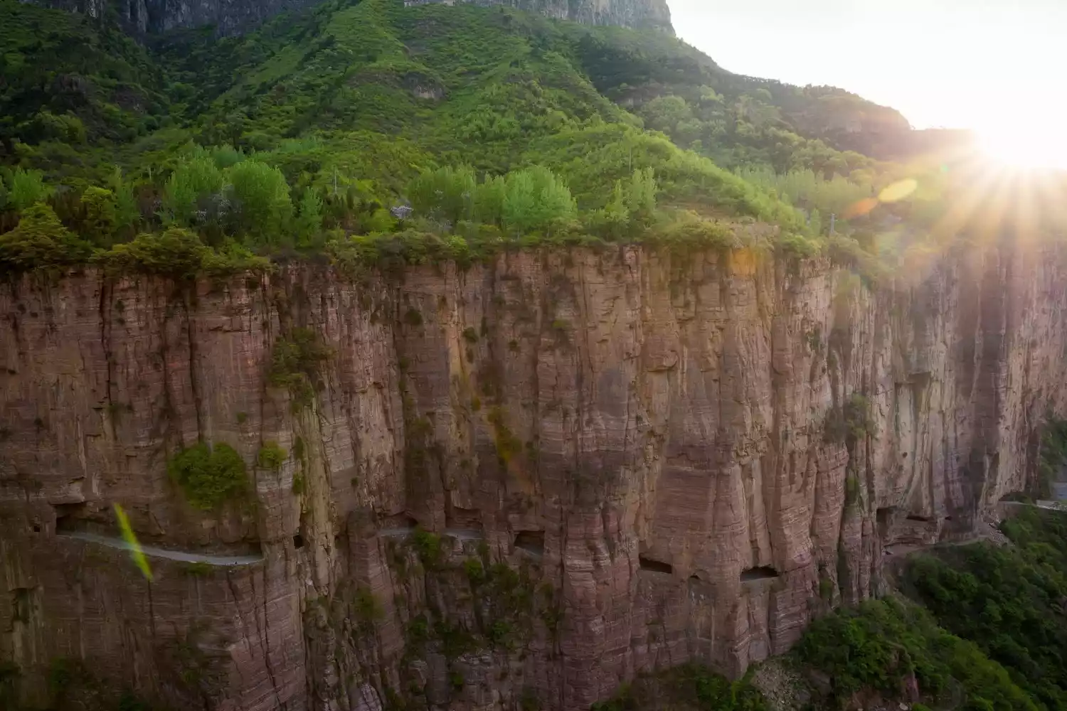
When talking about Taihang Mountains, the first thing that comes to mind is its location. In fact, the main part of Taihang Mountains is at the junction of Shanxi and Henan. Hikers can easily "cross provinces" if they are not careful. It is known as "one of the top ten classic hiking destinations in China."
(Source: China-TravelNote Photography Network, Photographer: Kehang)
(Source: China-TravelNote Photography Network Photographer: Beautiful Elements)
When counting the famous scenic spots in Taihang, the first places that come to mind are Guoliang Village, the filming location of "Raise Your Hands", the Cliff Road, Baligou, Xiyagou, Jingdi Village, Mawu Village, Qixiantan, Baodui Village, a paradise for outdoor enthusiasts, Beibajue, Xilian Temple, Jiguanati, Shiziling, Fengmen Village, etc.
(Source: China-TravelNote Photography Network, Photographer: Kehang)
Here I would like to share with you a niche route in Taihang Mountains, which sometimes has flying eaves and cliffs, sometimes is a leisurely ancient road, sometimes has waterfalls and clear springs, and sometimes is steep cliffs.
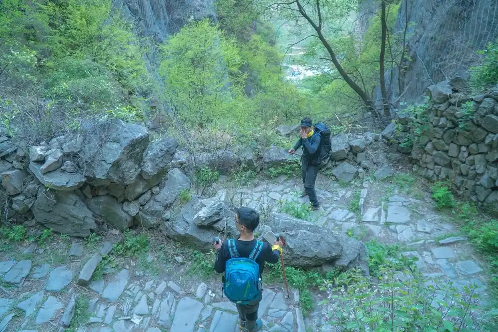
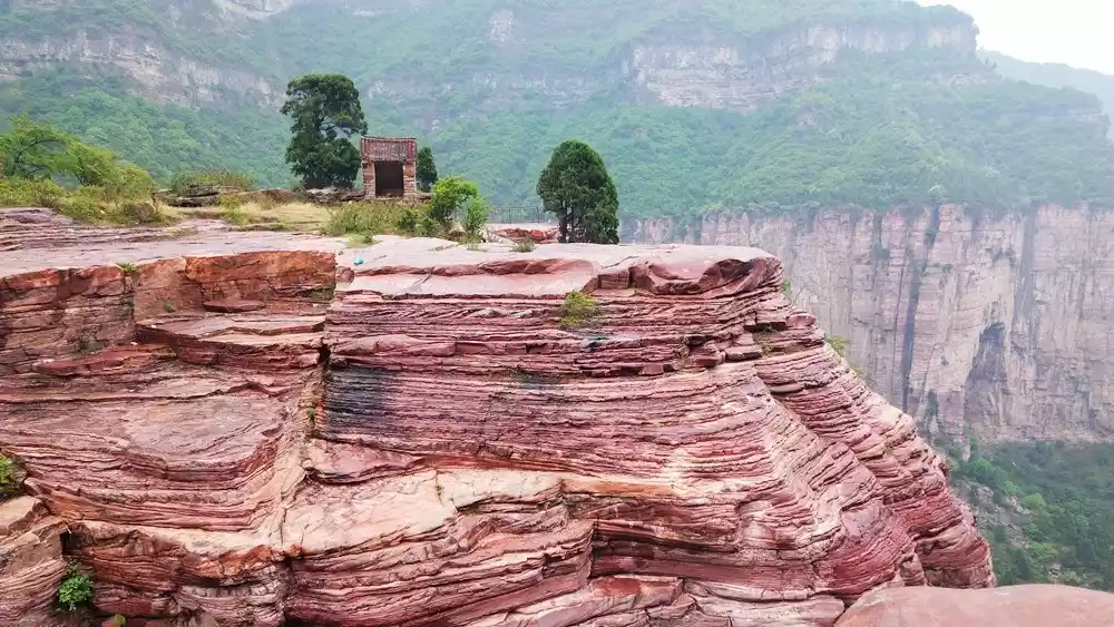
Butterfly Valley Eighteen Cylinders
Eighteen Jars is located near Shuangdi Village, Magedang Township, Lingchuan County, Shanxi Province. It is located deep in the canyon and is surrounded by dense trees and lush greenery, which is where the name came from. According to local people, the name Butterfly Valley was given when the Wujiawan Tourist Area developed this ravine.
The valley was once a gathering place for a large number of butterflies of various species. What's even more unique is that each gathering point had a different species, with patches of black and white, creating a spectacular and unique scene. Locals still call it the "Eighteen Jars."
(Source: China-TravelNote Photography Network, Photographer: Wang Keke)
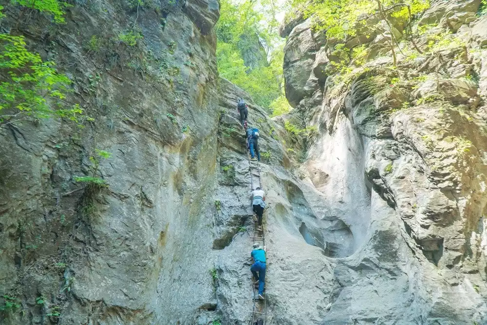
In fact, there are estimated to be about 28 large and small tanks along the way. The Eighteen Tanks is also the name given by the villagers for convenience. Occasionally, springs can be heard in the valley and colorful butterflies are flying. After 20 meters, there is a turn and suddenly a pit appears. It is more than 2 meters deep and can accommodate more than ten people. There are many small stones of different shapes in it.
(Source: China-TravelNote Photography Network, Photographer: Wang Keke)
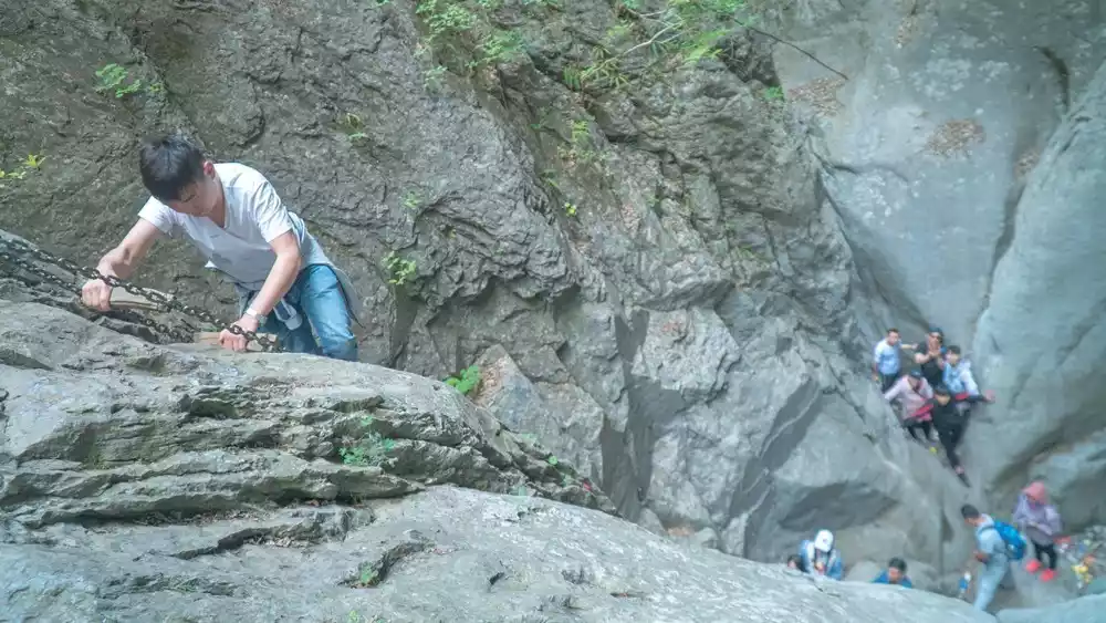
The description of it as a vat is most descriptive. Its walls are smooth and nearly circular. Inside, there's an iron ladder, provided by the owner for hikers. We lined up to descend the ladder, and the interior felt slightly warm. Because there were so many people, the vat seemed incredibly cramped.
(Source: China-TravelNote Photography Network, Photographer: Wang Keke)
It is easy to get down from the tank but difficult to get up. The people in the tank have to climb up along the rope one by one, and the speed is much slower.
The lower vat is over two meters high, while the upper vat from the opposite side is over four meters high. The terrain gradually rises. The natural vat in the valley also has a ravine, with the southeast edge lower and the northwest edge higher. Once you reach the top of the vat, you'll find a narrow, long, narrow bottom. Continuing to climb along the wall, there's an iron ladder below, but it's not high enough, so there's a rope above for you to climb up.
(Source: China-TravelNote Photography Network, Photographer: Wang Keke)
Tips:
As soon as we entered the mountain pass, we met local villagers collecting entrance fees. The iron ladders and wooden pillars of the tank were built by nearby villagers. The price per person ranged from 5 to 10 yuan.
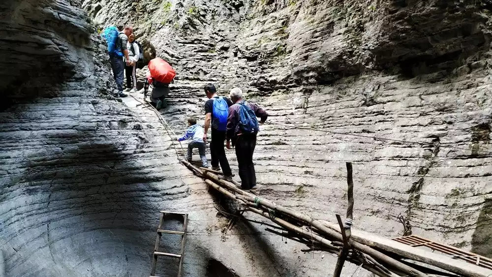
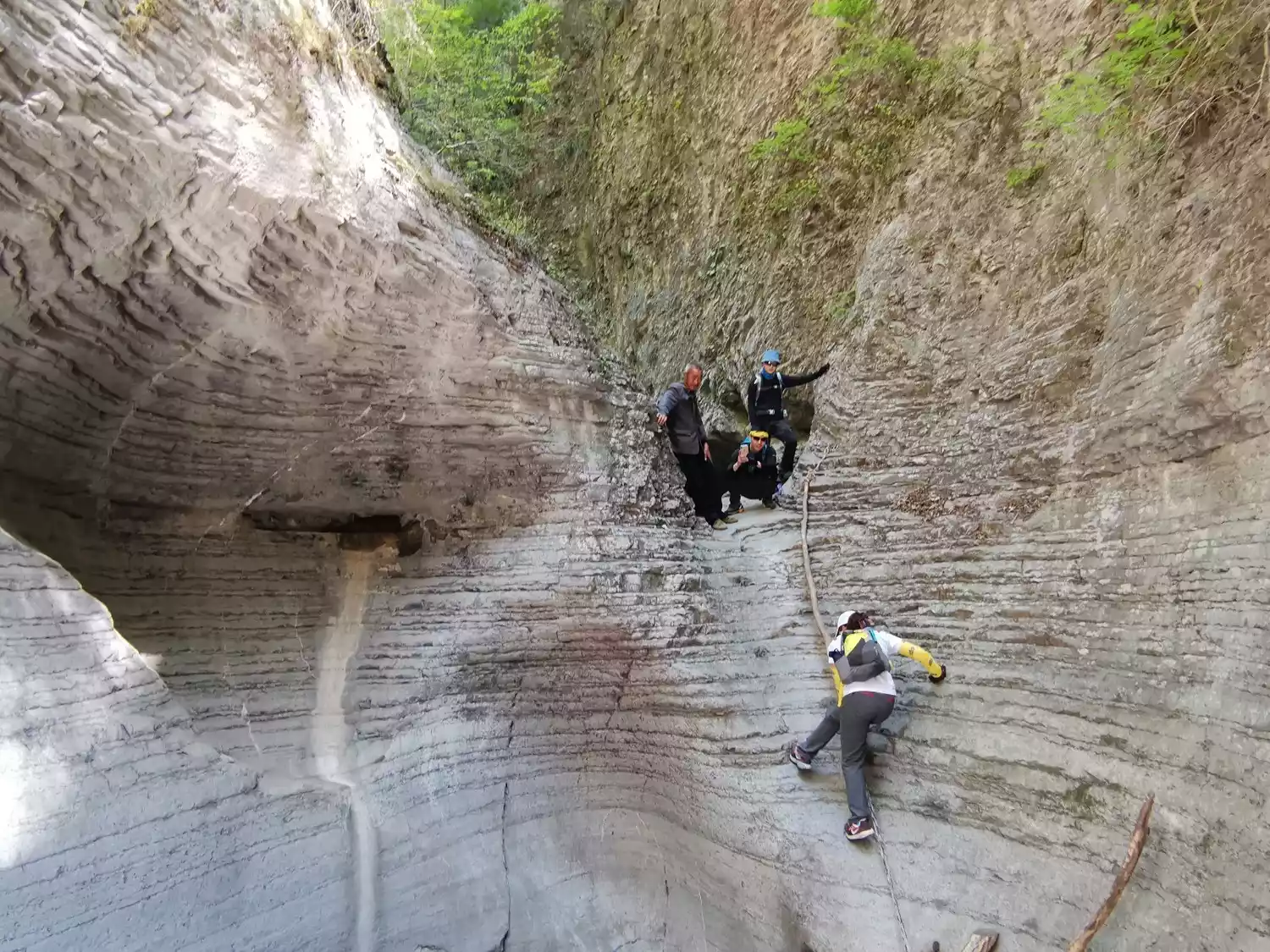
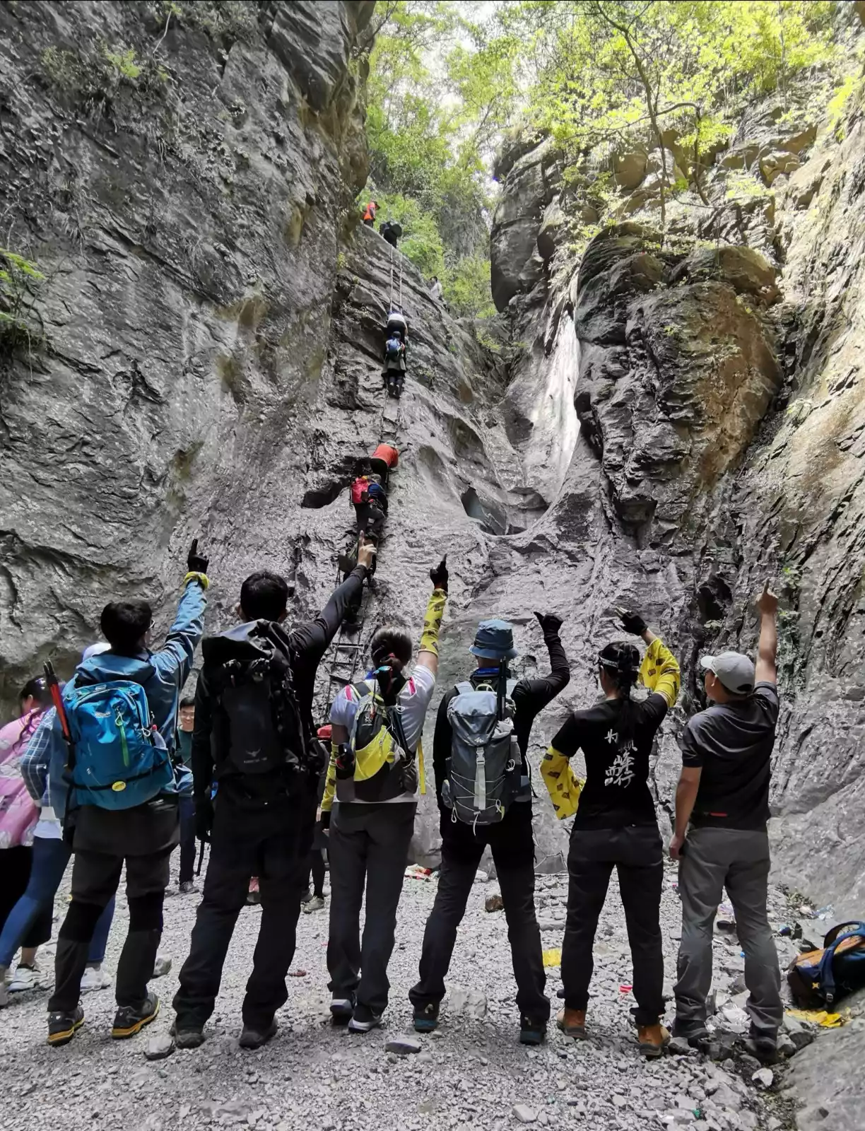
Next, we crossed the rocky ditch, crossed the horizontal wooden slope, entered the tank, climbed up the tank, entered the tank again and climbed up the tank again, using all the strength and flexibility we could use. It was exciting, powerful and interesting. It can be said that there were tanks connected to each other, tanks stacked on top of each other, and tanks within tanks.
The height of the rims also increased dramatically from the initial 3 or 4 meters to more than 10 meters, with the highest rim reaching more than 30 meters. Each rim is higher, steeper, and more dangerous than the last.
(Source: China-TravelNote Photography Network, Photographer: Wang Keke)
The shapes of the tanks also have their own characteristics, including round, flat, long, square, and strip-shaped. The walls of each tank are smooth and the slopes are steep, so they cannot be climbed directly. The only way is to use various other tools.
Since the nearby villagers are not professionals, the simple rope ladder they built is not very safe. When people go up, they will sway and tremble with fear. People who are afraid of heights will feel weak in the legs and feet. It is very dangerous. It is really thrilling and exciting to walk on it.
I've lost count of how many tanks I've climbed. One tank is slightly different in that it has a lid, but it's actually a large rock pressing down on it, leaving only a small hole. A fat person would have a hard time getting out, and even a skinny person like me struggled. I had to remove my backpack and push it out, then struggle to get out. Later hikers nicknamed it the "slimming hole."
(Source: China-TravelNote Photography Network, Photographer: Wang Keke)
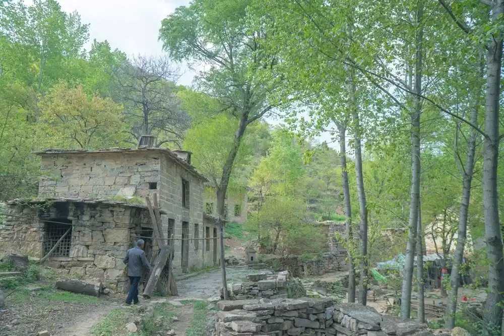
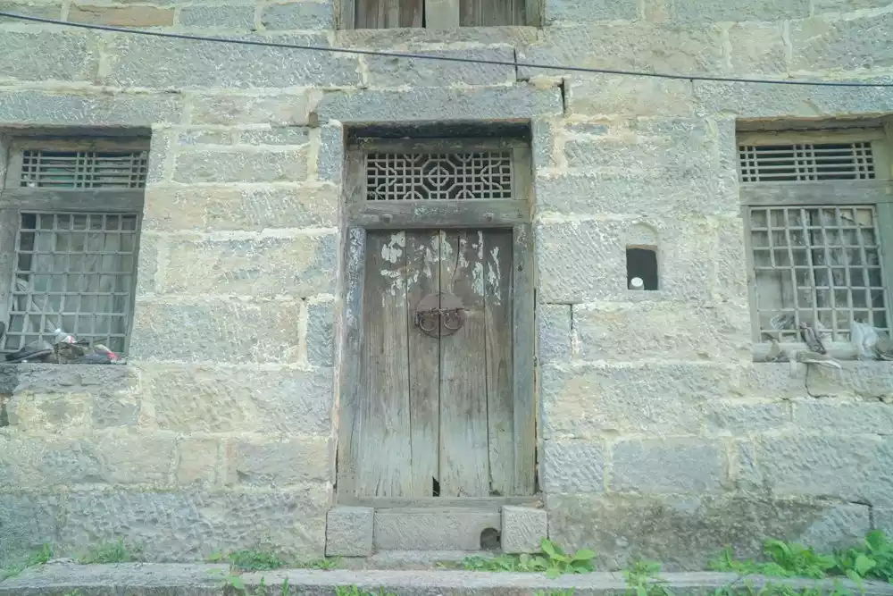
After escaping from the desperate situation of Shibagang, we walked for more than half an hour to reach Laopi Village. In 19 years, there was only one family left in Laopi Village, an old man and three dogs. According to the old man, this place was once a revolutionary base. Later, due to the Anti-Japanese War and poor transportation, the whole village moved out of the mountains.
(Source: China-TravelNote Photography Network, Photographer: Wang Keke)
(Source: China-TravelNote Photography Network, Photographer: Wang Keke)
About 800 meters away, you'll see a towering white pine, its massive trunk, shading branches, and a girth exceeding three meters. Nestled deep in the Taihang Mountains at an altitude of over 1,000 meters, this white pine is over 600 years old. It's a key landmark on the Eighteen Cylinders Route. It's said that Laopi Village was built around this tree, hence its name.
(Source: China-TravelNote Photography Network, Photographer: Guo Huaping)
Tips:
At Laopi Village, lunch is served with hand-rolled or dried noodles for 15 yuan per person, and cucumbers are 2 yuan each. You can also get some water here for 5-10 yuan per bottle. All the food is carried in from outside the mountain by the elderly, so don't waste it.
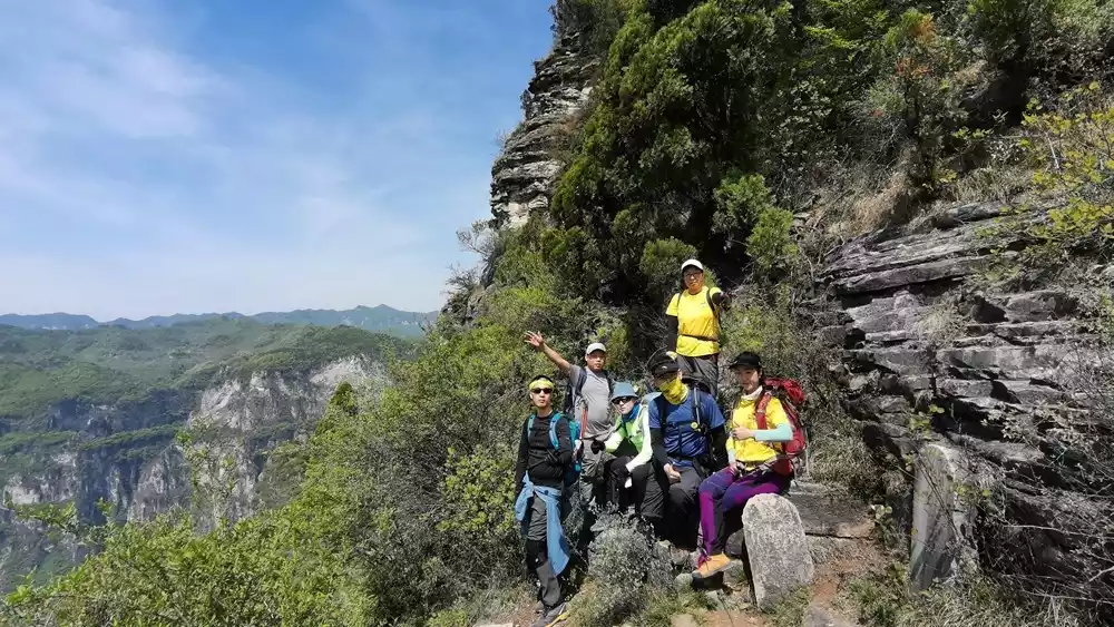
Baixing Ancient Trail
Walk out of Laopi Village and hike about 2-3 kilometers to reach the Baixing Ancient Road. Walking on the ancient road, the stone road has been smoothed out by time, and you can even see the bumpy horse hoof prints. There are about 5 or 6 viewing platforms along the way, and you can also see the original post station ruins.
(Source: China-TravelNote Photography Network, Photographer: Wang Keke)
Baixing, also known as Mengmenxing, is the third of the eight paths in Taihang Mountains.
"Xing" refers to the most extreme point in the mountain, that is, the place where the mountain range is interrupted. There are many east-west horizontal valleys (Xing) in Taihang Mountains. The famous ones include Jundu Xing, Puyin Xing, Feihu Xing, Jingxing, Fukou Xing, Baixing, Taihang Xing, Chenguan Xing, etc. They were called the Eight Xings of Taihang in ancient times. They were the eight throat passages through which the three provinces of Shanxi, Hebei and Henan communicated with each other across Taihang Mountains in ancient times. They were important military passes on the borders of the three provinces.
(Source: China-TravelNote Photography Network, Photographer: Wang Keke)
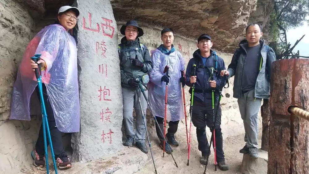
Baixing has existed since the Spring and Autumn Period and the Warring States Period, boasting a history of over 2,000 years. The Baixing Ancient Road connects Lingchuan County, Jincheng City in the north and Huixian County, Henan Province in the south. This section of the road, stretching over 100 kilometers, is the best-preserved stretch of the original ancient road, running from Shuangdi Village in Lingchuan County, Jincheng City, Shanxi Province, to Shilihe in Huixian County, Henan Province.
(Source: China-TravelNote Photography Network, Photographer: Wang Keke)
(Source: China-TravelNote Photography Network, Photographer: Wang Keke)
Tips:
Baixing Ancient Road ticket price: 20 yuan per person
Seventy-two bends
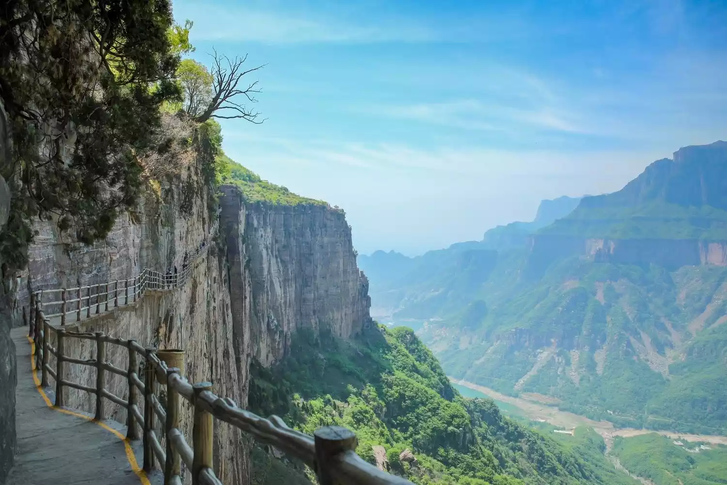
The 72 bends are a must-see on the Baixing Ancient Trail, and they are the essence of the trail's scenery. It's the oldest, best-preserved, most interesting, and boasts the best cultural landscape of the eight ancient roads in Shanxi. Before the construction of the Shilihe Highway in 1972, the 72 bends on the Baixing Ancient Trail were the only way in and out of Shanxi. With the highway's arrival, the trail was gradually abandoned, becoming a haven for outdoor enthusiasts.
The Seventy-Two Bends is actually a zigzag-shaped ancient trail carved into the steep mountaintop, leading to Shuangdi Village at the foot of the mountain. From the bottom of the cliff to the top, there are 72 bends, a total distance of 2.5 kilometers, with a relative height of over 400 meters. The zigzag turns every ten meters or so, and the slope is very gentle, so whether carrying people or horses to the top of the mountain, they will not feel very tired.
(Source: China-TravelNote Photography Network, Photographer: Wang Keke)
Beibajue
The longest "ladder to heaven" in the southern Taihang Mountains is undoubtedly Beibajue and Jiguanati. According to locals, nearly a hundred years ago, local wealthy businessmen donated and built a double-bottomed mountain road leading to Xicang.
During the Anti-Japanese War, it also played an important role in protecting revolutionaries. The most dangerous fortress in Taihang Mountains is "Beibajue". You must get on all fours and crawl forward along the mountain with your body close to the steps. You will pass by several small viewing platforms, which are less than one square meter in area. You can overlook the distant mountains and the winding roads. It is beautiful.
(Source: China-TravelNote Photography Network, Photographer: Wang Keke)
(Source: China-TravelNote Photography Network, Photographer: Wang Keke)
Tips:
Due to the weak signal in the mountains, some of the tracks of Beibajue's outdoor assistant and Liuzhijiao may be lost. It is recommended that first-time hikers must have a guide to lead the way.
You can have lunch near Xicang Village, which is also 20 yuan per person and includes a full meal. I passed by on May Day in 2019 and happened to catch the Chinese toon egg and tomato egg stew, which tasted delicious!
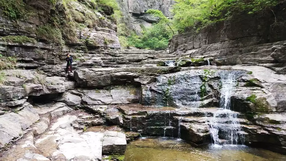
Qixiantan
Qixiantan, also known as Qixingtan, has many pools of water of different sizes, just like the Eighteen Jars. The water flows from the upstream to the downstream in a winding manner. The water is crystal clear, and it is like the Eighteen Jars are filled up. An iron ladder is built here for easy passage.
It was once said that seven fairies from the sky played and bathed here, hence the name Qixiantan; this is a fork in the pond, one side leads to Mawu Village and the other leads to Baodui Village.
(Source: China-TravelNote Photography Network, Photographer: Wang Keke)
At the turn of spring and summer, there are many tadpoles in the shallow water, the largest of which is the size of a dime, and transparent little fish occasionally pass through the water.
Baodu Village
All the supplies for the village were fished up from the cliffs near Laolongkou by crane, and every grain of food was hard-earned.
Baodu Village is the only village in Jincheng that has no access to roads. One needs to hike through the canyon to enter. Currently, there are only seven or eight households, and people still keep their original schedules. It is said that the first calf/cow here was brought in from outside the mountain, so it was named Baodu Village.
(Source: China-TravelNote Photography Network, Photographer: Wang Keke)
Another famous place in Baodui Village is the Laolongkou Waterfall. The brown rocks in the cliff mountain and the steep cliff walls like a knife have softened the curves of the cliffs after thousands of years of rain erosion. After being soaked by rain, the red color is even more beautiful and is a great place for taking photos and checking in.
(Source: China-TravelNote Photography Network, Photographer: Wang Keke)
Tips:
Accommodation prices range from 40 to 80 yuan per person; accommodation is available in bunk beds or dormitories, ranging from triple to dozen-person rooms. Travelers who book in advance for holidays will have to sleep in tents (the price is the same as for rooms).
The toilet is a dry toilet
Average dining cost per person: 40 yuan
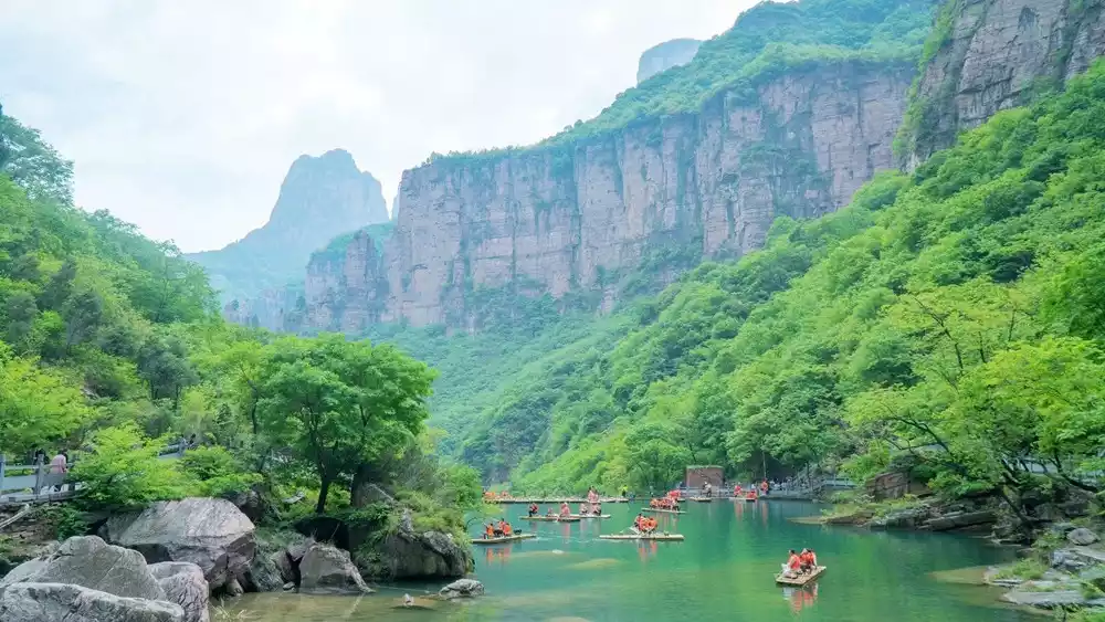
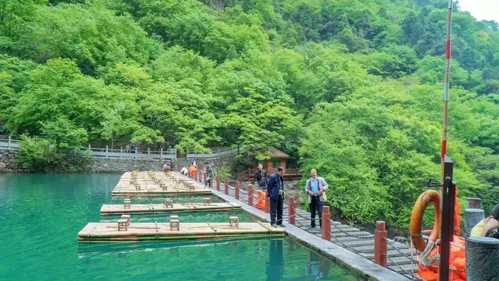
Baligou
Entering the Baligou Scenic Area from Baodui Village means crossing provinces from Shanxi to Henan. All the way to the Baligou Scenic Area is walking along the shade of the trees halfway up the mountain.
Baligou Scenic Area is a national 4A-level scenic area, a national geological park, a natural macaque protection area, a famous scenic spot in Henan Province, and one of the top ten scenic spots in Henan Province.
(Source: China-TravelNote Photography Network, Photographer: Wang Keke)
(Source: China-TravelNote Photography Network, Photographer: Wang Keke)
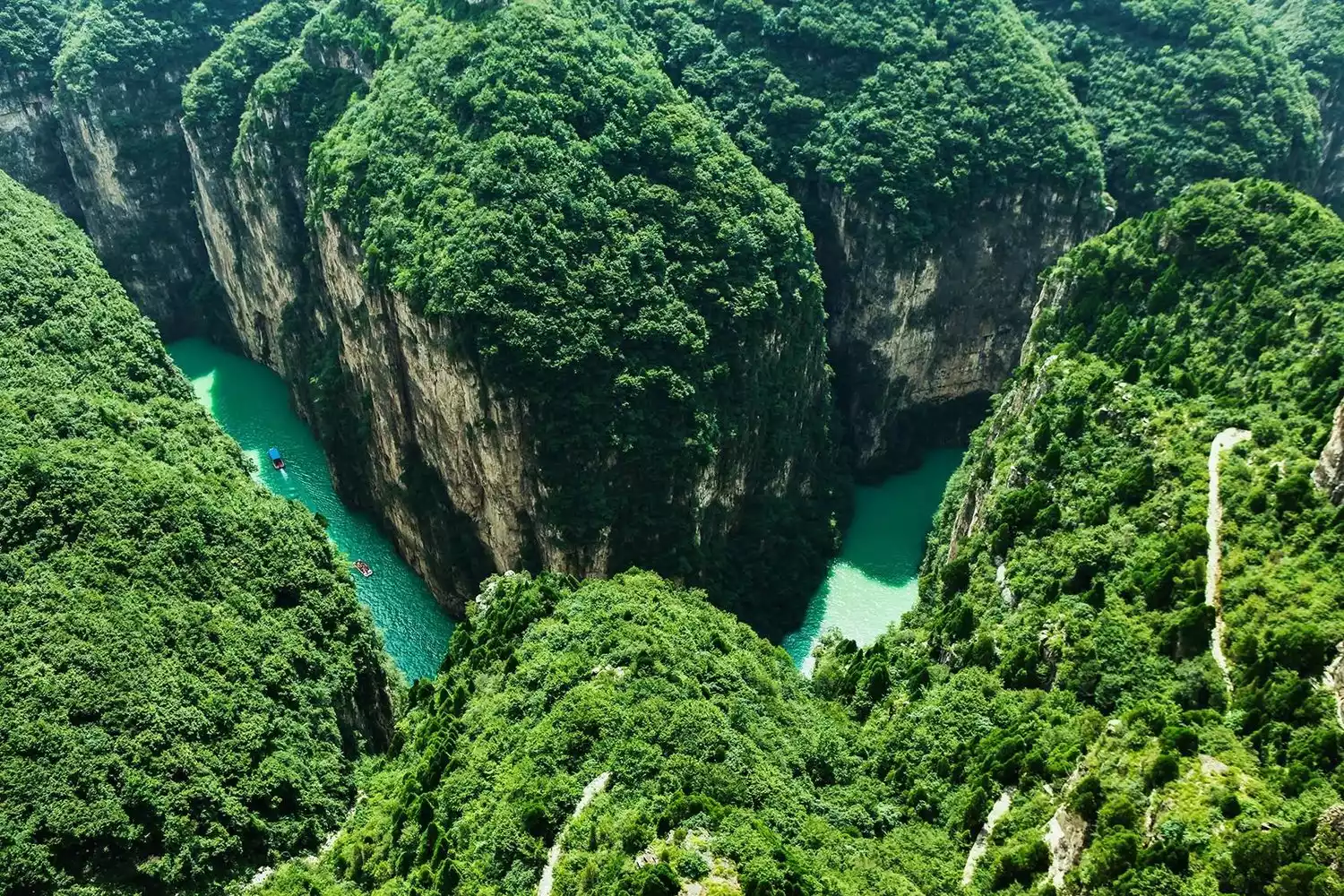
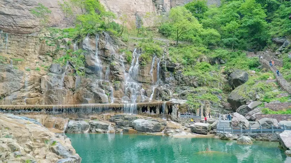
The most famous attraction in Baligou is the Baligou Waterfall. The Hongshi River, which flows into the area from Shanxi, has a drop of up to 170 meters. The widest part is more than 20 meters, and the smallest part is 5 meters. The river flows through the deep ditch in this area and rushes down, forming an overwhelming momentum, dropping thousands of feet, and stirring up several meters high water columns and waves.
(Source: China-TravelNote Photography Network, Photographer: Wang Keke)
(Source: China-TravelNote Photography Network, Photographer: Wang Keke)
Tips:
The name of Baligou Scenic Area comes from the fact that it is nearly eight miles away. It is more than eight miles away from my actual hike. Counting from the beginning, it is nearly 8 kilometers, and it is about 8 kilometers away. There are shuttle buses in sections for the return trip, 10 yuan per person (highly recommended)
There are also many farmhouse restaurants at the entrance of Baligou Scenic Area. The average price per person is 60 yuan. It is recommended to taste the local wild vegetables.
Recommended walking sketch
Six-legged tracks:
2626251 / 2626252 / 2626256
D1 Get out of Xinxiang Railway Station or Bus Station and charter a car to Shuangdi Village for 350 yuan. It is recommended to share a car with several people.
Morning: Double bottom - 18 cylinders
Noon: Lunch at Laopi Village or roadside meal (with supplies)
Afternoon: Baixing Ancient Road - Seventy-two Bends
Accommodation: Shuangdi Village, 100 yuan per person (private bathroom, air conditioning, breakfast included, and supplies)
Full day: about 17km
D2: Charter a car for about 50 yuan from Shuangdi Village to Beibajue Village and start climbing
Morning: Northbound Ladder to Xicang
Noon: Lunch at Xicang (with simple meals and supplies)
Afternoon: Qixiantan-Baodui Village
Accommodation: Beds in Baodu Village cost 64-80 yuan per person
Full day: 26km
D3 Baodu Village Laolongkou Sunrise - Baligou - Railway Station
Morning: Baodu Village - Entrance of Baligou Scenic Area
Noon: Lunch at the entrance of Baligou Scenic Area
Afternoon: Return to the train station or bus station
Full day: 16km
Transportation
Various places - Shuangdi Village
Xinxiang Railway Station: Distance: 85km Time: 2.5h Reference Fee: Charter 350-450 yuan
Zhengzhou East Station: Distance: 137km Time: 3h Reference Fee: Charter 400-600 yuan
Baligou - Various places
Line up at the entrance of Baligou Scenic Area and take a bus to Xinxiang Bus Station for 25 yuan per person (subject to slight adjustments). There will be one more bus on holidays and 3-5 buses per day on weekdays.
The bus from the entrance of Baligou Scenic Area to Huixian is 25 yuan per person (subject to slight adjustment);
Distance from Baligou Scenic Area to Xinxiang Railway Station: 55km Reference fee: 300-450 yuan for a chartered car;
Conclusion
Every year, I come here with friends. The towering Taihang Mountains stretch for 800 miles, and the scenery is unique in spring, summer, autumn, and winter. Autumn is definitely a favorite for foodies, as we pass by the spicy aroma of Sichuan pepper trees, the fruit-laden fragrant pears, the sour and sweet hawthorns, the precious medicinal herbs on the cliffs, and the various wild vegetables in the mountains—all gifts from nature.
Walking through the winding Seventy-two Bends, following the footsteps of our ancestors, climbing the extremely steep Beibajue, feeling the tenacious side deep in the mountains, I want to share the beautiful scenery deep in Taihang with more people.