Recommended Guangdong hiking routes: 4 beautiful and sparsely populated hidden peaks perfect for weekend decompression
Preface
Nowadays, we spend a lot of energy and patience in the trivial daily life and work, and are looking for a new way to relieve stress or vent. Outdoor hiking and mountain climbing, which can vent excess energy and temporarily forget the troubles in life, has gradually come into everyone's attention.
When you are feeling depressed, under great pressure in life or encounter a bottleneck at work, an exhausting and focused mountain climbing session may be a good way to release stress.
Especially when you live in a city where winter has failed many times (like Guangdong), where the seasons don't change very much, hiking can be a very pleasant experience. So today, I'd like to recommend a few routes that are more strenuous but offer beautiful scenery for your reference.
Dananshan
If you search for "Da Nanshan" on Gaode, Shenzhen's Da Nanshan will appear, but the route we are talking about this time is Huidong's Da Nanshan. The name is the same, but the difficulty and scenery along the way are different.
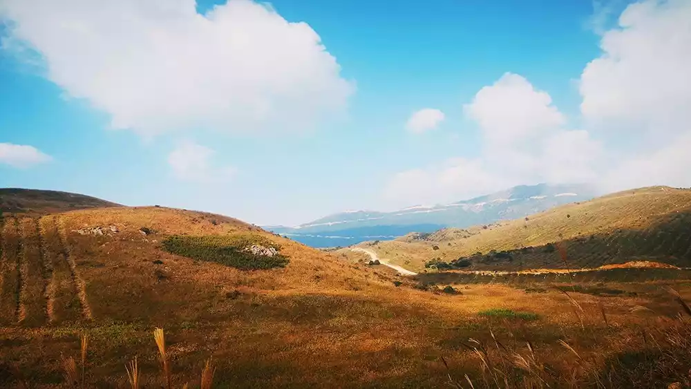
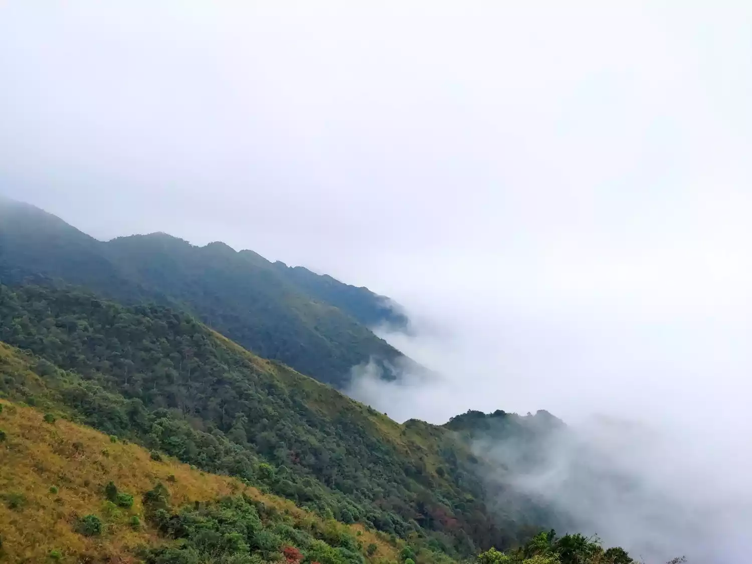
Da Nan Mountain is located near the border of Zengguang Village and Haifeng, on the coast. From the mountaintop, you can enjoy the ocean views, while the summit offers a breathtaking view of the world. Here, towering peaks rise, with white clouds drifting along the mountainside and streams flowing at the foot. Within a three-kilometer radius, there are three or four peaks exceeding a thousand meters: Axe Stone Peak (1,105 meters), Shuidi Mountain (1,282 meters), and Niupi Peak (1,118 meters). These three peaks are connected by a rugged line. The name "Da Nan Mountain" originates from the famous Nanshan Temple and Nanshan River located on the mountain.

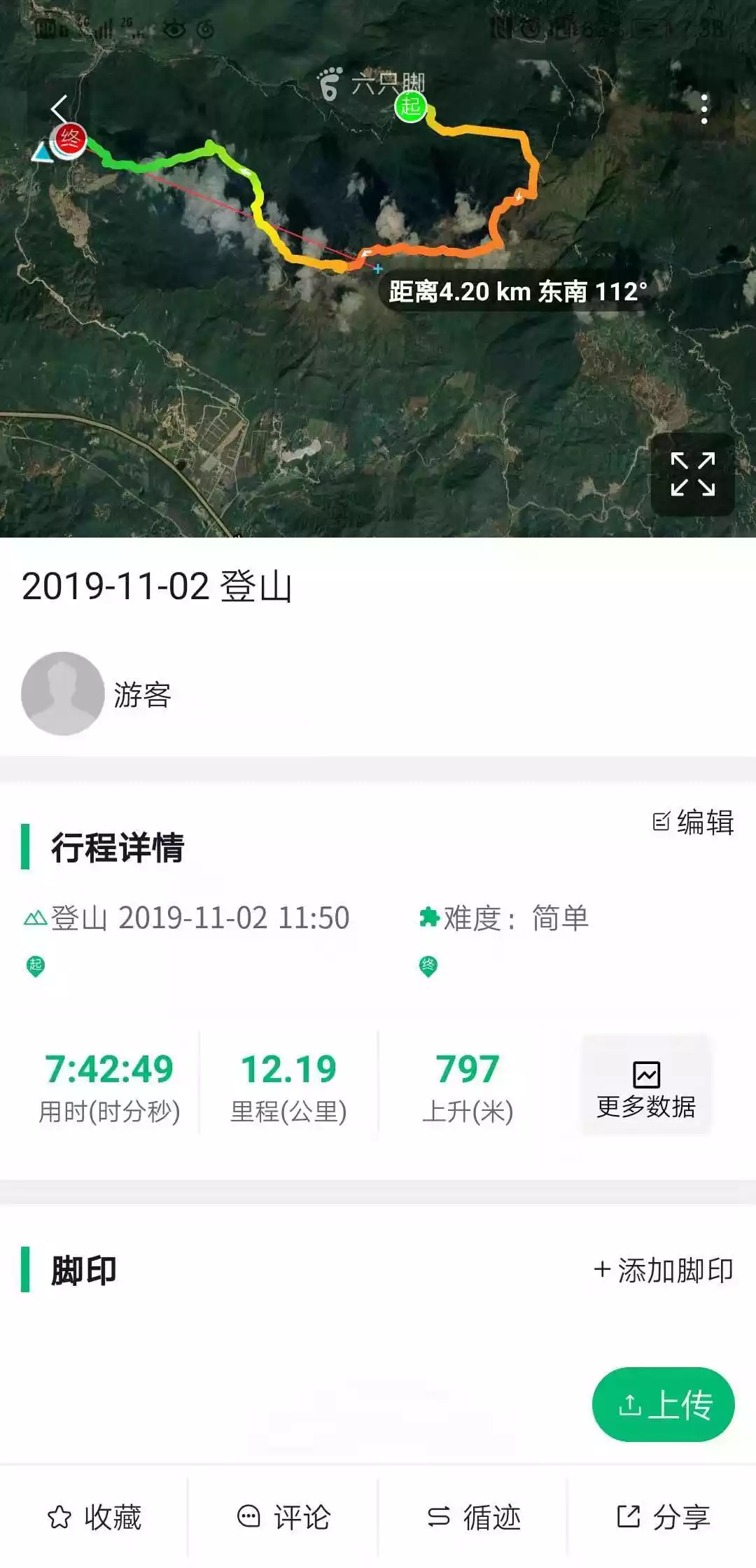
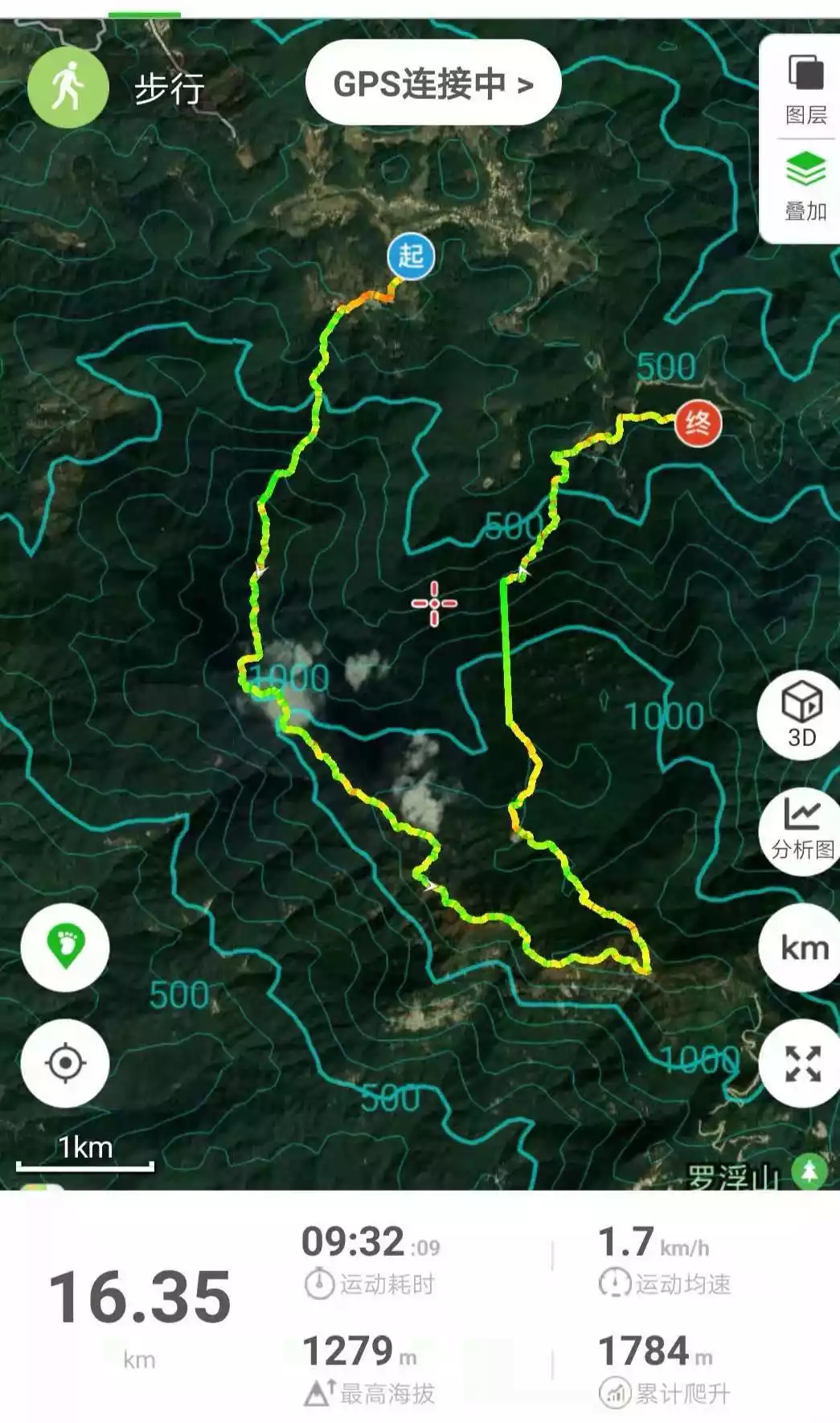
【Route Length】Total length: about 13 kilometers
Hiking time: 6-8 hours
【Climbing height】Cumulative climb 797 meters
[Activity Intensity] ★★★★ (five stars is the highest, three stars is medium difficulty, not recommended for beginners without hiking experience)
[Activity Difficulty] ★★★ (five stars is the highest, three stars is medium difficulty)
@Leader Saohao
It has alpine meadows like Wugong Mountain and plateau scenery like Chuandiding. It is one of the places where hikers from Huizhou and Shenzhen often train and enjoy the fun of the mountains.
If you want to fully enjoy the scenery of Da Nanshan, you can travel through it in two days with heavy luggage, or you can travel through it in one day with light luggage. Here I suggest traveling through it in one day with light luggage, which is just enough for a round trip in one day without having to camp overnight.
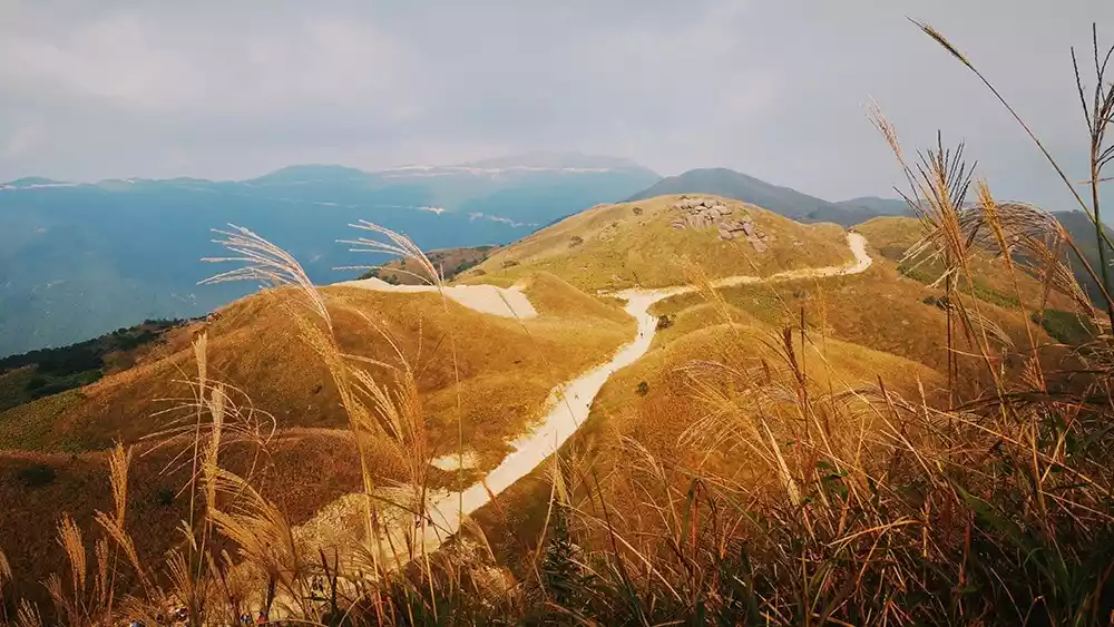
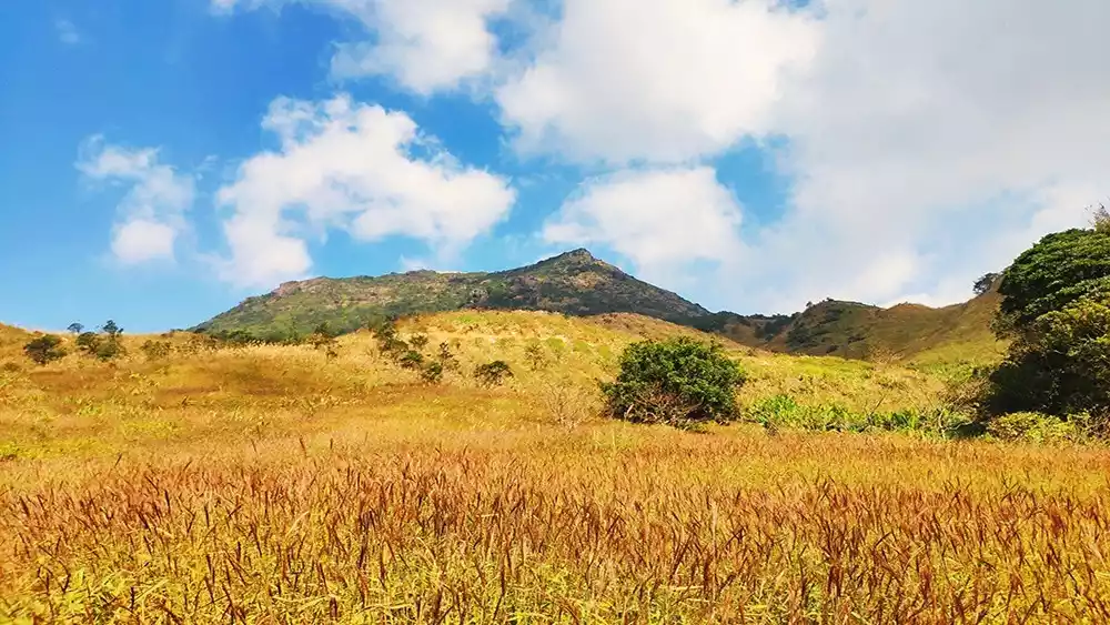
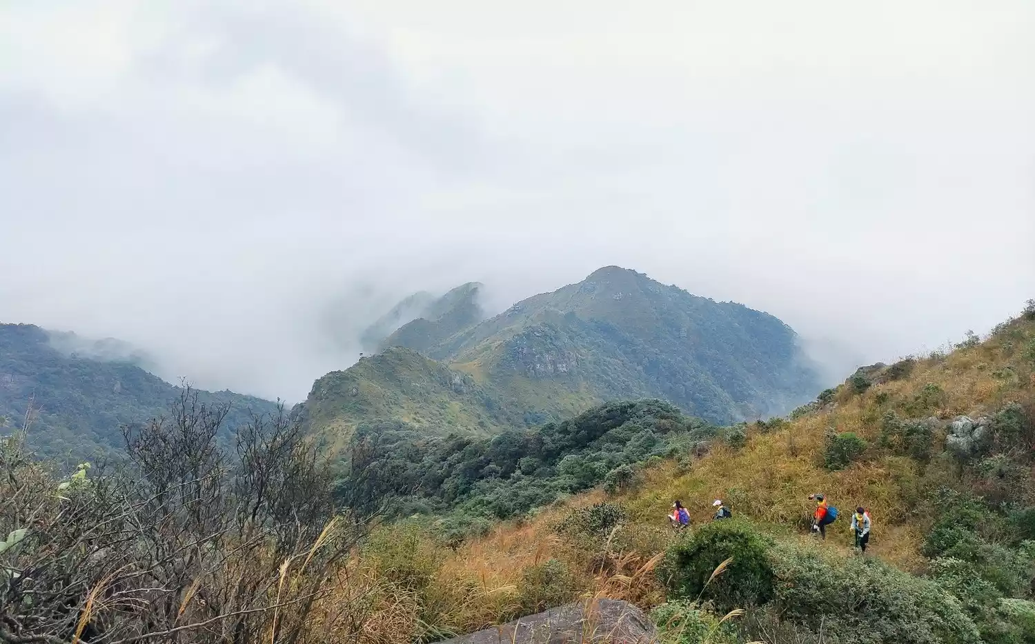
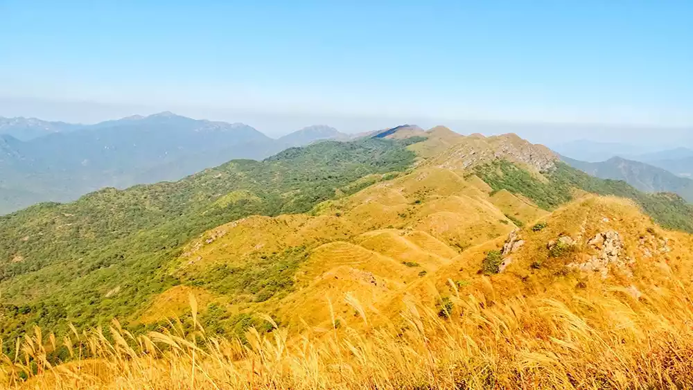
For a day trip, the Dawang Temple to Longyan Temple route is the highlight of the entire hike, offering stunning alpine meadow scenery. I find Da Nan Mountain at its most beautiful in autumn, when the golden reed grass sways in the breeze. The fatigue of the climb is instantly forgotten, and the view is truly worth it.
@tourists爆小花
@tourists Explosion Flower
@Leader Saohao
Here is a photo of Da Nanshan in spring and summer. It is a green ocean at a glance, with a few clouds dotted in it. It is so beautiful.
Tips:
There are many ups and downs along the entire route of Da Nan Mountain, so you can bring knee pads to protect your knees. Don't just wear knee pads because you are young and have enough money, or you won't be able to withstand it.
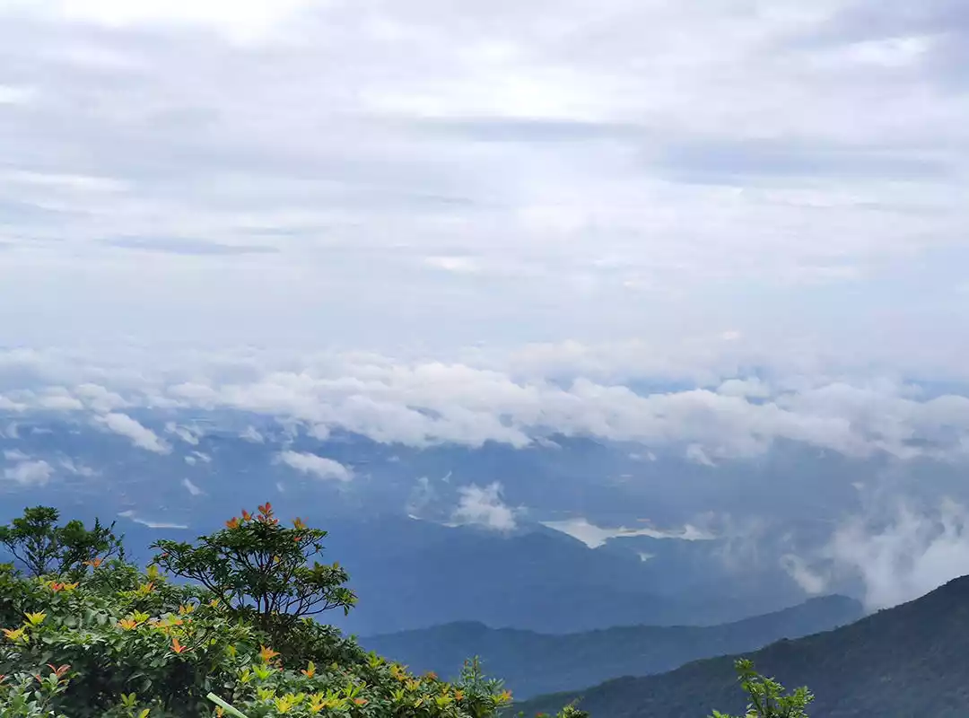
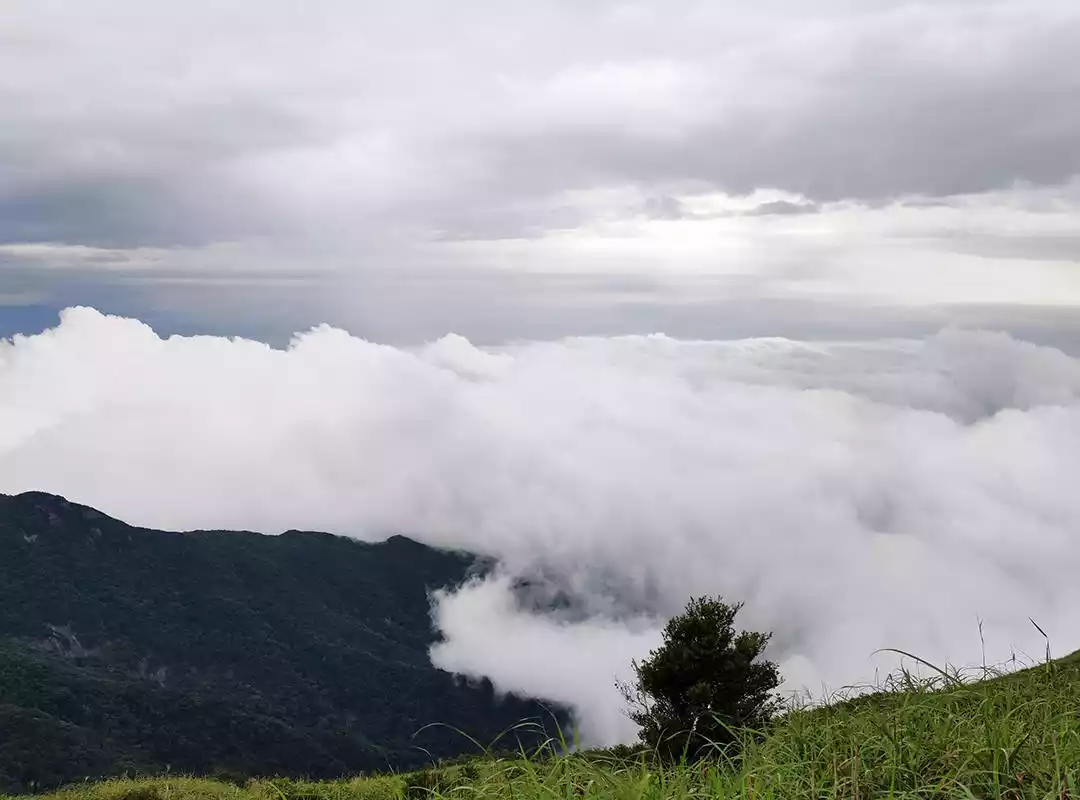
If you are lucky enough, you can see the sea of clouds in Da Nan Mountain. Although it is not as large as the sea of clouds in Wugong Mountain, it is also very beautiful. After all, there are not many places in Guangdong where you can see the sea of clouds, haha.
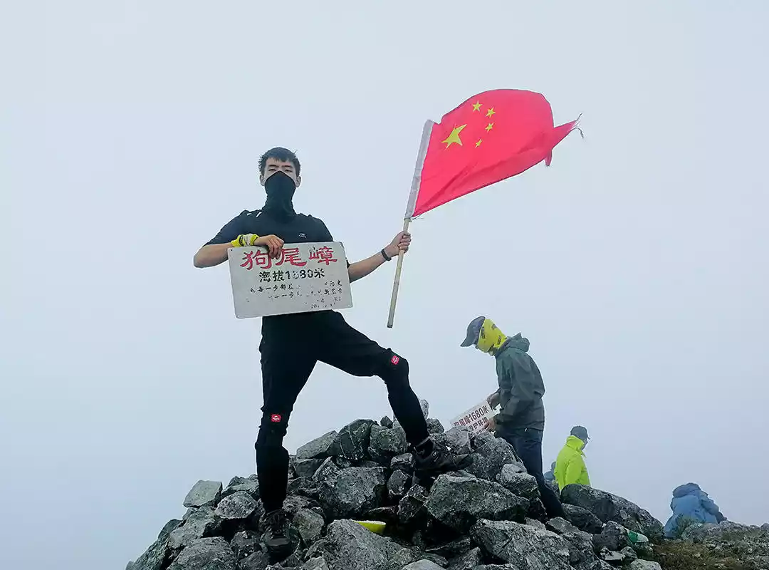
Gouweizhang
The fourth highest peak in Guangdong and one of the three most dangerous peaks in Guangdong, it is 1,686 meters above sea level. It is located in Daqiao Town, Ruyuan, and is the junction of Bibei, Dongping and Daqiao towns.
Gouweizhang is a mountain with handsome terrain, magnificent scenery and unique landform. It is a completely undeveloped mountain with primitive landform. As the name suggests, "Gouweizhang" means that the mountain is covered with large areas of foxtail grass.
@Team Leader
【Route Length】Total length: about 14 kilometers
Hiking time: 8-10 hours
【Climbing height】Cumulative climb 1179 meters
[Activity Intensity] ★★★★ (five stars is the highest, three stars is medium difficulty, not recommended for beginners without hiking experience)
[Activity Difficulty] ★★★ (five stars is the highest, three stars is medium difficulty, requires rock climbing, those afraid of heights should proceed with caution)
@Team Leader
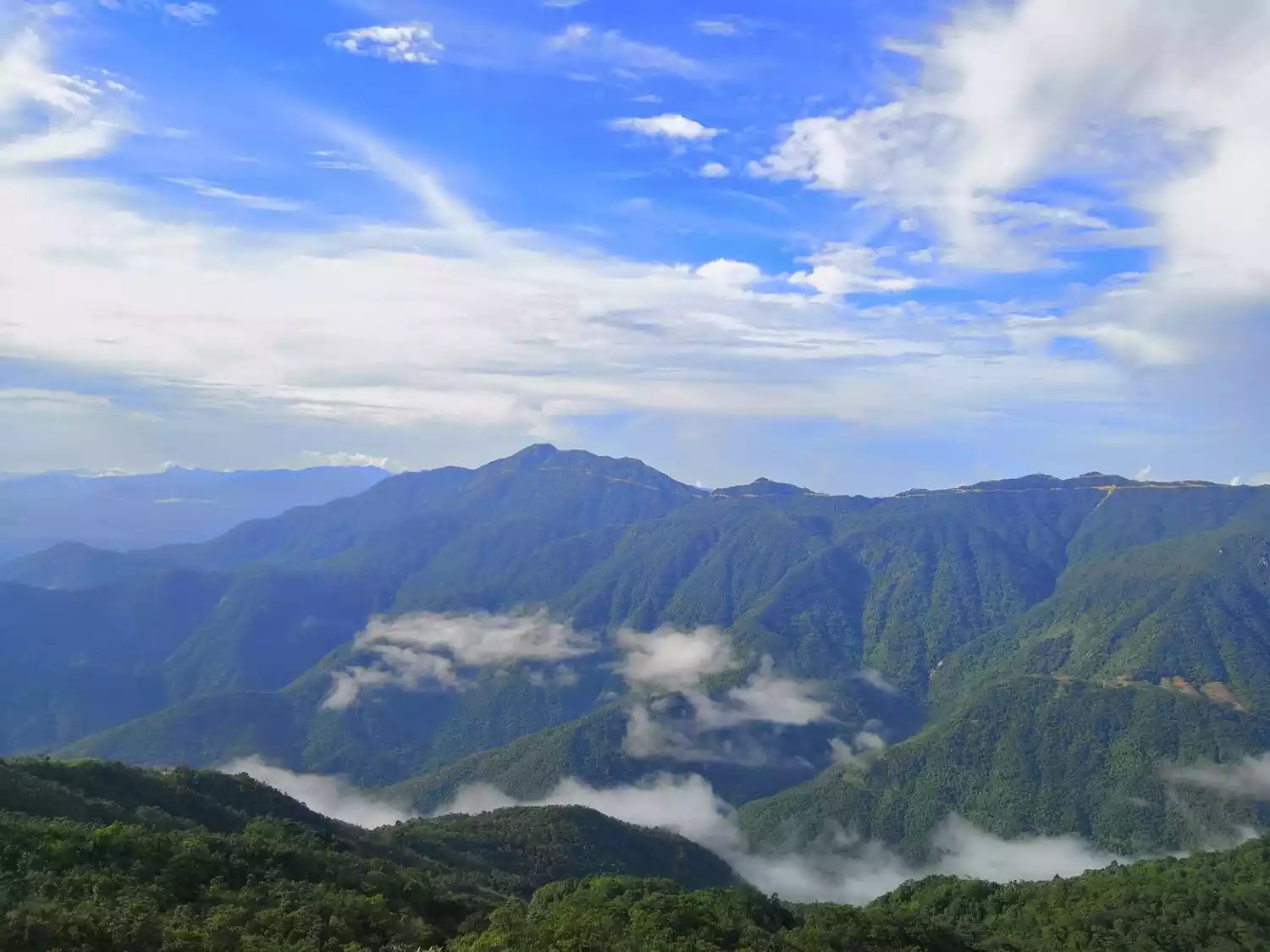
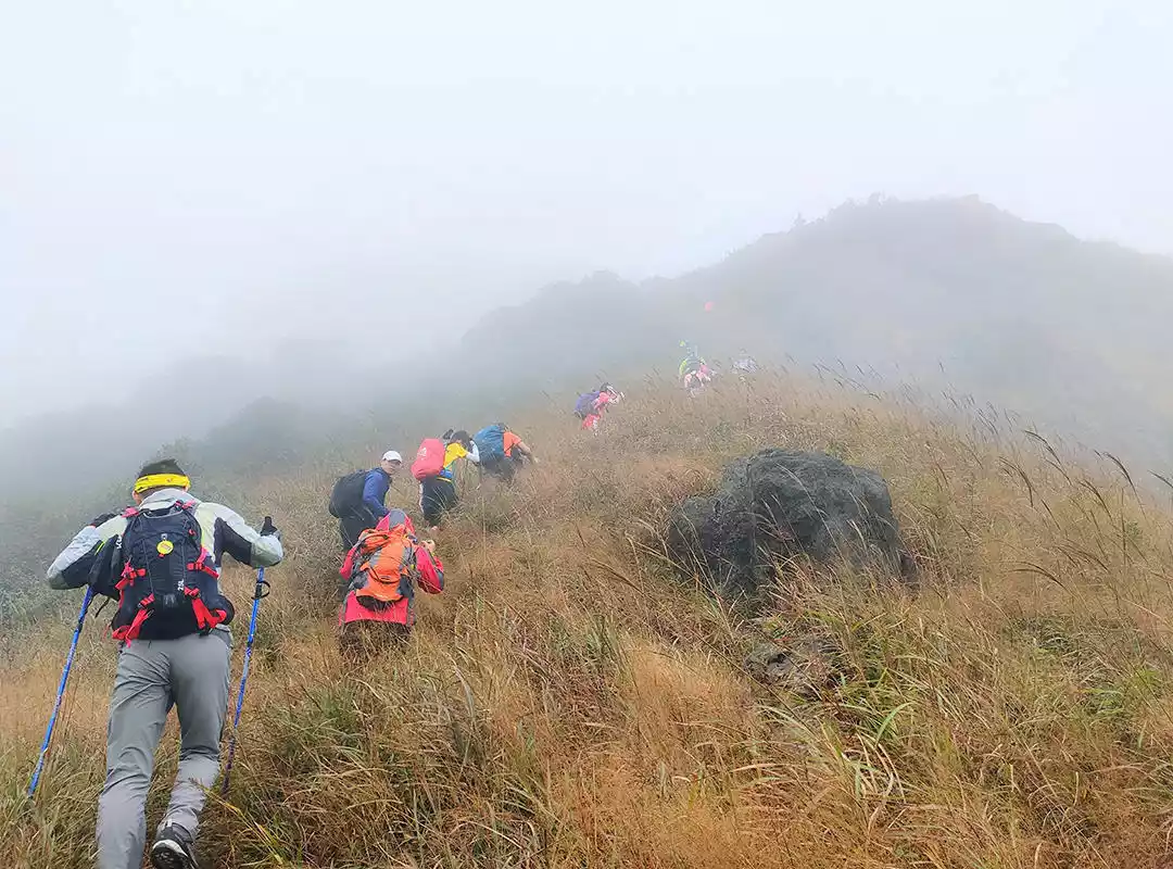
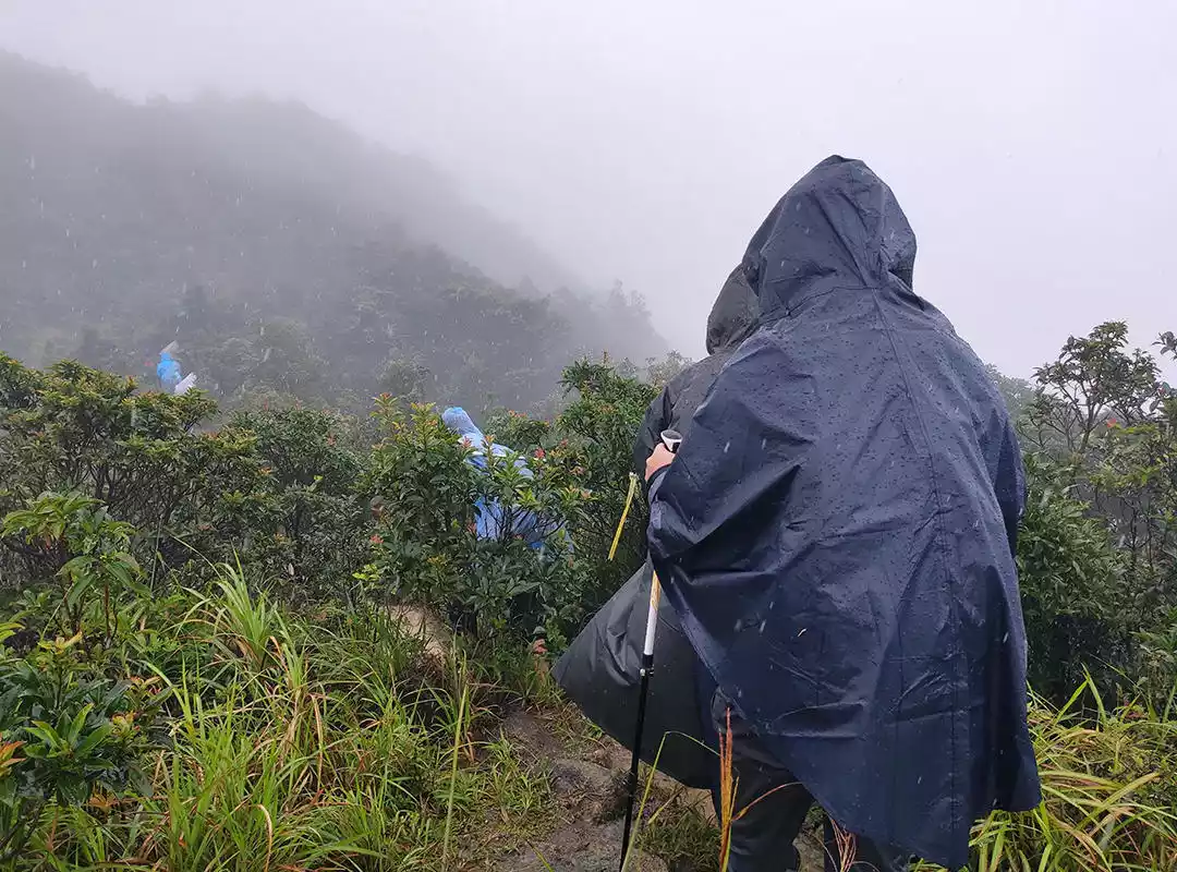
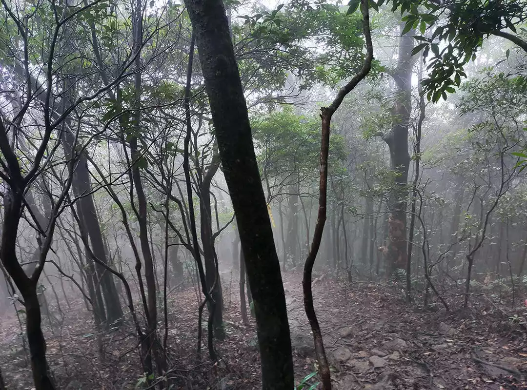
The terrain is complex and varied, with numerous Qingyun Mountain-like rock climbs, boat-bottom-like river tracing, and Yulong River-style hikes. While not the most challenging or treacherous route, nor the most scenic, it offers a unique blend of difficulty, danger, and seas of clouds. More importantly, the route traverses a variety of terrain (grasslands, cliffs, forests, streams, etc.) and weather conditions (strong winds, showers, heavy rain, fog, cloudy skies, sunny days, etc.), allowing for a diverse array of challenging road conditions and changing weather. It truly is an outdoor paradise.
@Team Leader
 @Team Leader
@Team Leader
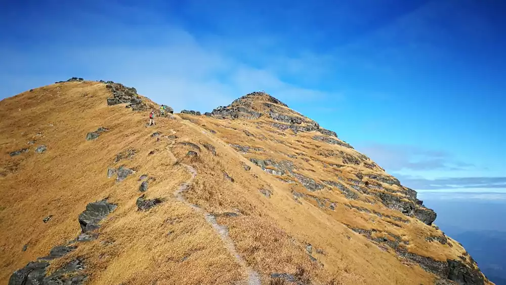
Here is a photo of Gouweizhang on a sunny day. It is very important to have good weather!
Tips:
It is recommended to stay in a village at the foot of the mountain the night before so that you can go hiking early the next morning and not waste time on the next day.
Because the weather in the mountains is changeable and unstable, and there are many mosquitoes, rats and ants, it is recommended to prepare for sun protection, rain protection, cold protection, snake protection, and insect protection.
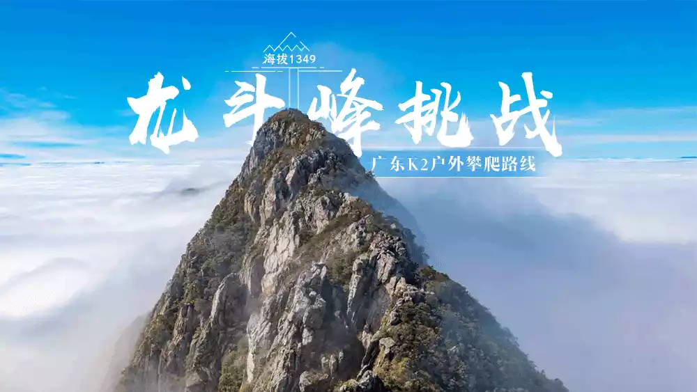
Longdou Peak
One of the three most dangerous peaks in Guangdong, it is composed of a mountain range consisting of three parts: Dragon Tail, Dragon Middle and Dragon Head. It looks like a soaring dragon. This mountain is not very high, but it is famous for its strangeness, danger and steepness.
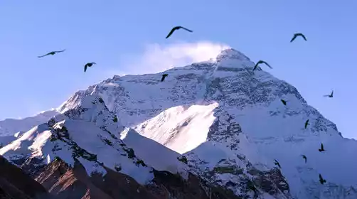
The highest point of Longdou Peak is 1,368 meters above sea level. It is located at the junction of Aizi Town, Shixing, Shaoguan City and Xiaokeng Town, Qujiang. It is said to have the largest meteorite crater in the world, but because it has not been developed yet, it is rarely visited by people.
In the winter of 1982, when processing a color satellite photo, Chinese scientific and technological workers discovered an obvious "green bean dot" at the intersection of 113°55′ east longitude and 24°43′ north latitude. Subsequently, personnel from the Institute of Geology, Mineral Resources and Mineral Deposits of the Ministry of Geology of China and the 706 Geological Brigade of Guangdong Province rushed to the location of the "green bean" - Longdou Peak in Aizi Town, Shixing County for a field investigation, thus unveiling the mystery of the Longdou Peak meteorite crater.
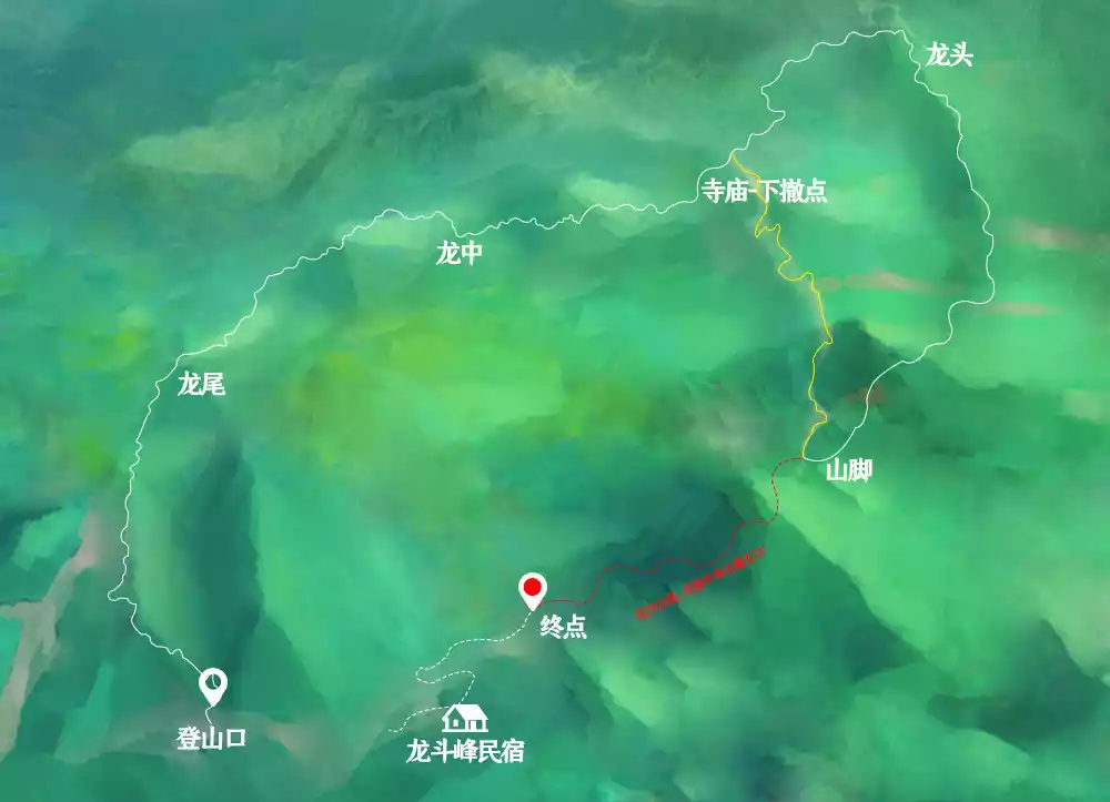
【Route Length】Total length: about 18 kilometers
Hiking time: 12-14 hours
[Climbing height] The highest peak is 1,349 meters. The terrain is steep and some sections require ropes to cross
[Activity Intensity] ★★★★ (five stars is the highest, three stars is medium difficulty) The intensity is high, and experience of single-day hiking of more than 15 kilometers is preferred. It is not recommended for those without outdoor experience.
Difficulty: ★★★★ (five stars is the highest, three stars is medium difficulty, comparable to the first day's ascent of the new Chuandingluo line)
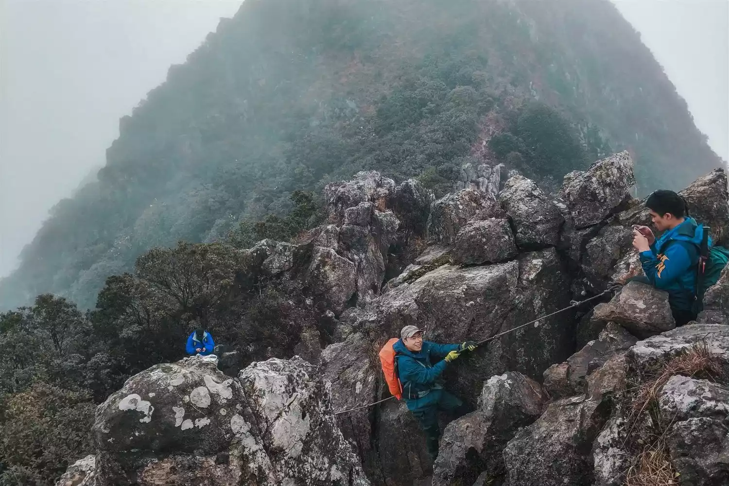
This isn't just a typical hiking route, but a rock climbing route that requires both hands and feet. Starting early in the morning, climbing 80-90° rocks, rappelling, and traversing ridges, valleys, and woods, you'll experience a variety of outdoor experiences all in one place.
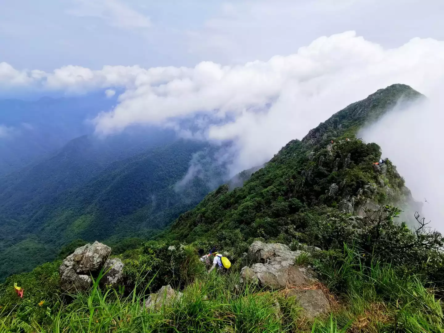
If you like the outdoors, this mountain is not to be missed. If you like the sea of clouds and sunrise, you will definitely be fascinated by the scenery at the top of the mountain.
@Team Leader Cao Ye
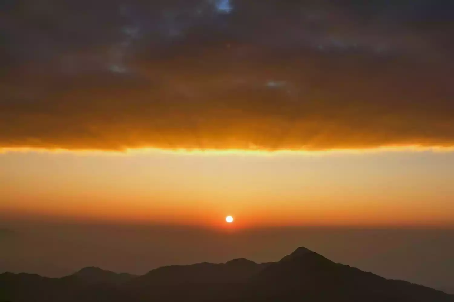
Sunrise in the East
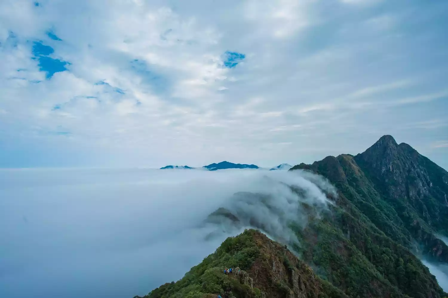
Alpine sea of clouds
Here is a photo of the golden dragon head in autumn. Only challengers who successfully reach the summit have the honor of seeing this beautiful scenery.
Tips:
Climbing this route requires an early morning departure. The mountain air can be very cold late at night, so be sure to have breakfast and warm up before heading to the trailhead.
The entire route from Dragon Tail to Dragon Middle is a rock climbing route, requiring gloves and the use of both hands and feet. The route also involves climbing an approximately 80° rock face and descending with a rope.
The difficulty and intensity of Longdou Peak are relatively high, and the road conditions are complicated and steep. If you go down the mountain too late, you will have to walk at night, which is too dangerous. Therefore, if you do not reach the descent point by 2 pm, you will not be allowed to climb Longtou and will be forced to descend.
Sifang Mountain
Luofu Mountain, located in Changning Town, Boluo County, Huizhou City, Guangdong Province, is one of the ten most famous Taoist mountains in China. Historian Sima Qian once compared Luofu Mountain to Yueyue, leading to its nickname, "The First Mountain of Lingnan."
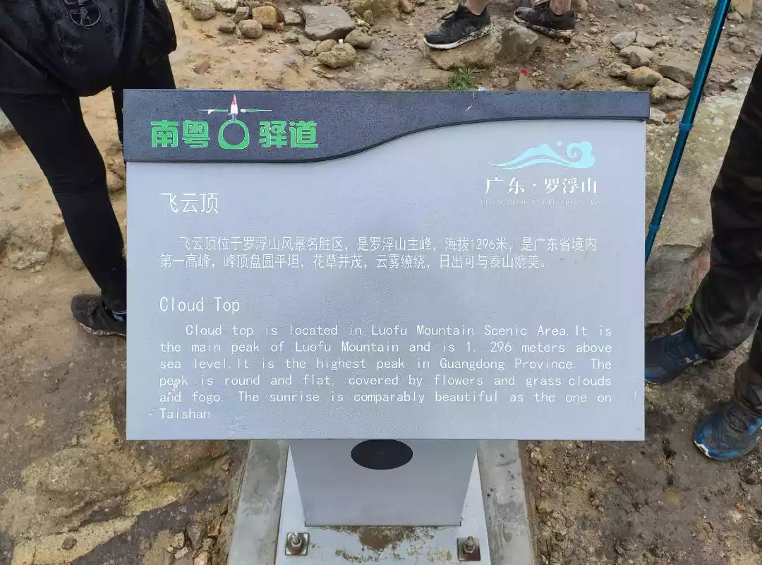
Sifang Mountain is a remnant of Luofu Mountain. It is located in the planned but undeveloped core scenic area in the northwest of Luofu Mountain in Huizhou. The main peak, Feiyunding, is 1,296 meters above sea level. The peak is flat, with lush flowers and plants, and shrouded in clouds and mist. The sunset is comparable to that of Mount Tai. The hiking route requires climbing 32 mountaintops in a row, so it is also called "the strongest one-day crossing route in Guangdong" by hikers. It is the "Legend of the Night" in their hearts. It is a relatively unpopular and difficult route.
@Team Leader
【Route Length】Total length: about 16 kilometers
Hiking time: 12-14 hours (longer hikes, requiring nighttime travel)
[Climbing height] The highest peak is Feiyunding, 1,296 meters
[Activity Intensity] ★★★★ (five stars is the highest, three stars is medium difficulty) The intensity is high, and experience of single-day hiking of more than 15 kilometers is preferred. It is not recommended for those without outdoor experience.
[Activity Difficulty] ★★★★ (five stars is the highest, three stars is medium difficulty)
@Team Leader
From a small platform more than 900 meters above sea level, 400 meters above sea level, a long steep climb will take your life, and you will be hit in the face by bamboo forests along the way, making a loud clacking sound.
@Team Leader
@Team Leader
After the wind and rain, a sea of clouds appeared, dotted with mountains and waters, like a beautiful Chinese landscape painting, so beautiful!
Hiking outdoors is a tortured process. You work hard to climb a slope, go through wind and rain, and muddy roads. You endure countless hardships and torture your body, all for the moment of standing on the top of the mountain! That moment of magnificent view of the mountains!
@Team Leader
@Team Leader
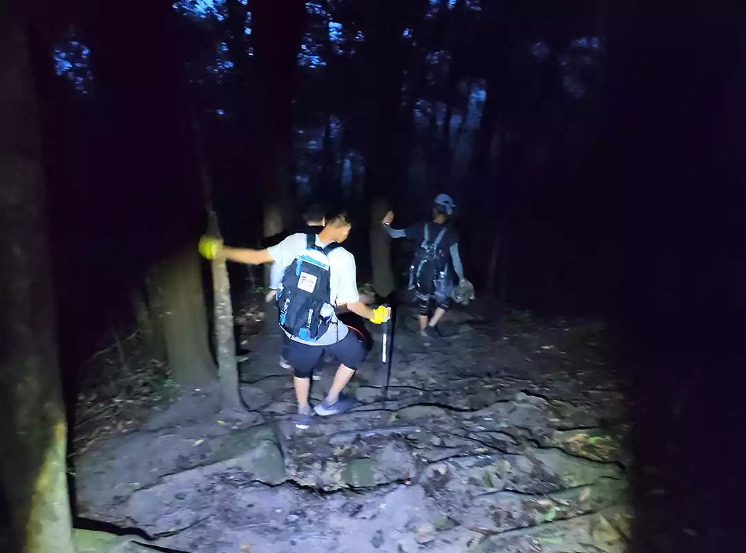
The main meaning of Underworld is: walk down the mountain at night with a headlamp, go, go, go!
@Team Leader
Tips:
To challenge the legend of the night, you must bring headlights, flashlights and other lighting equipment. Except for some strong donkeys, most of them need to walk at night.
If you cannot reach the summit due to weather or time reasons, you can go directly to Boyun Temple.
If you walk down a little from the top of Feiyunding, you will see a fork in the road. Going left leads to Boyun Temple, and going right leads to the scenic area.
Conclusion
Life is always like this, with all kinds of troubles coming one after another and never stopping. Even if you are a superman, sometimes you need to adjust your state.
Occasionally, a short, exhilarating climb up a mountain may allow you to temporarily escape from these affairs, forget all your worries, and restore yourself.
Come on! Let’s go hiking!