Taking stock of Asia's top ten niche hiking routes, Asian hiking shouldn't be so low-key
Preface
There's more than one way to travel; many popular destinations offer a variety of unique ways to explore. Hiking is one such way to explore. Let's explore the world on foot and discover exotic cultures.
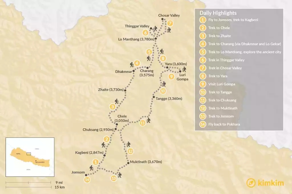
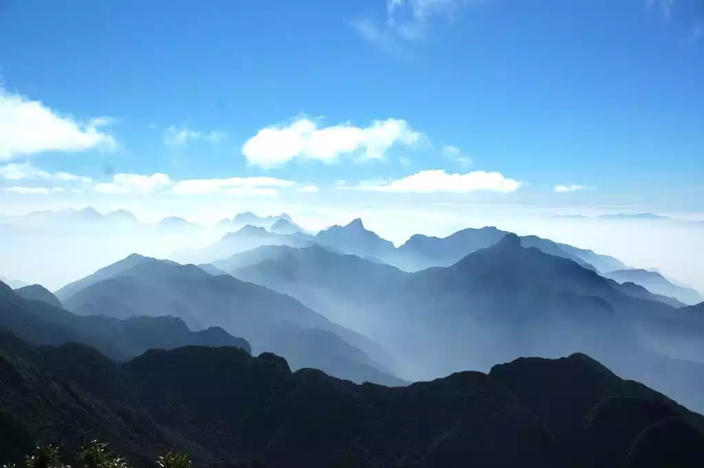
NO.1 Nepal Upper Mustang Trek
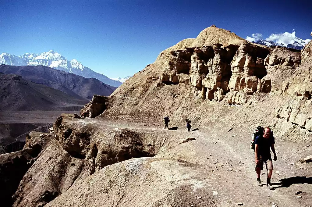
Mustang is an almost mythical land, very remote, occupying a remote area high in the Himalayas in Nepal. As a powerful and independent kingdom, it has a very fascinating history. It was not until 1992 that Mustang was allowed to be visited by foreigners.
All of this makes Mustang irresistible to hikers looking for the real Shangri-La, but hiking in Mustang requires a permit (limited), and the lucky few will enter a pure world undisturbed by modernization and catch a glimpse of the wonderful landscape.
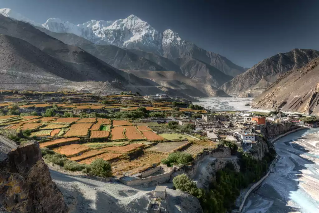
An otherworldly fold of red, yellow, brown and blue fossil sedimentary rock, carved into a canyon by the mighty Kali Gandaki River, Mustang is pristine, desolate and utterly awe-inspiring.
Tips:
English name: UPPER MUSTANG TREK
Location: Himalayas, Nepal
Duration: 10 days
Difficulty: Moderate (remote, high altitude)
Best months: March to May, September to November
Important: A permit is required for trekking in Mustang
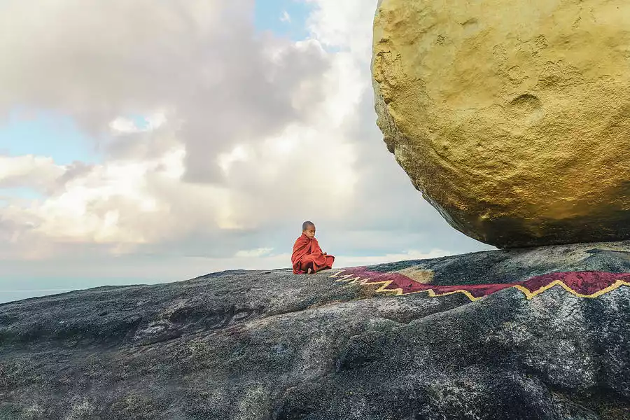
NO.2 Myanmar Golden Rock Pilgrimage Trail
The Buddha possessed such immense power that he could stop a falling rock with a single strand of his hair. At 1,100 meters above sea level, a gilded boulder teeters on the edge of a cliff at the summit, perfectly balanced (legend has it) by a single strand of his sacred hair, preserved in a pagoda at the summit.
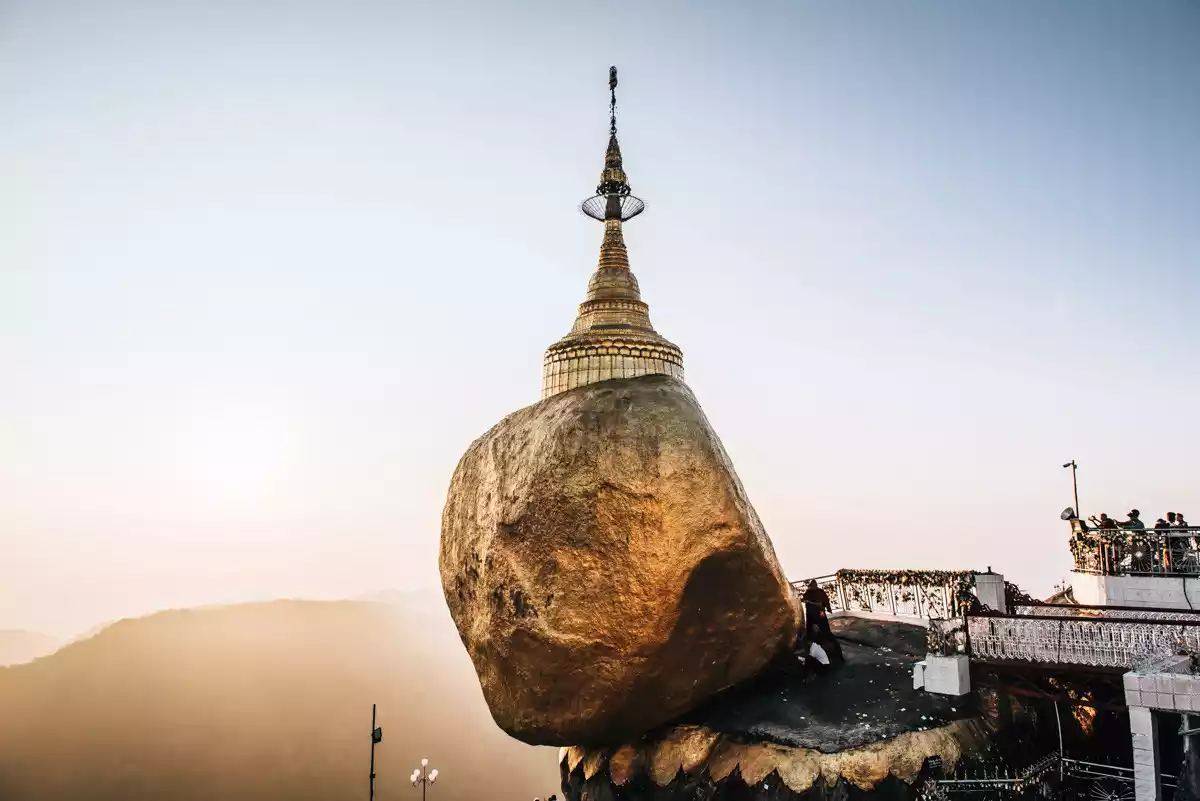
From Chinbang, walk the 11-kilometer pilgrim path. You can cheat your way to the summit—a bus service runs to Yataon, 1.6 kilometers from the summit.

Tips:
English name: GOLDEN ROCK PILGRIM PATH
Location: Southeastern Myanmar
Length: 11 km
Duration: 4-5 hours
Difficulty: Moderate (short, steep)
Best months: October to April
Important Note:
1. Clothing must be modest and cover the legs and shoulders.
2. Women are not allowed to approach the Big Golden Stone.
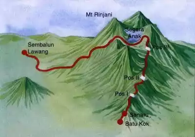
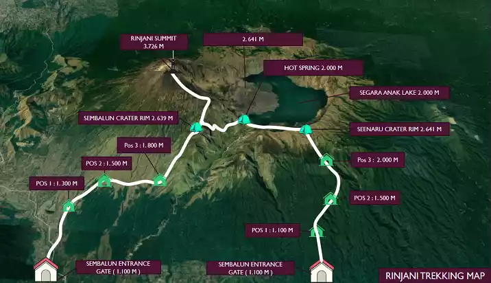
NO.3 Mount Rinjani Hike
Lombok is an island in Indonesia, close to Bali. However, unlike the lively and literary Bali, Lombok is still a holy place for adventure lovers around the world, especially the active volcano Mount Rinjani in the north of the island, which makes it a paradise for many hiking adventure enthusiasts.
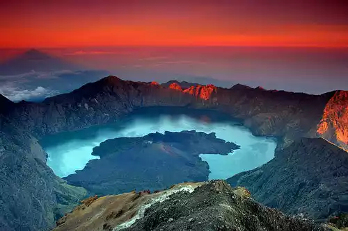
As the second highest volcano in Indonesia, Mount Rinjani attracts people from all over the world with its unique scenery. A volcanic lake is formed in the circular crater under the action of the earth's crust, and a small mountain is formed in the middle of the volcanic lake. The volcano is surrounded by volcanoes, and the mountain and lake are connected.
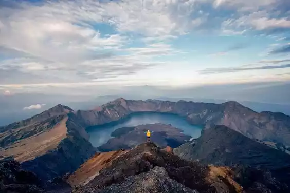
Standing on the top of the mountain and looking into the distance, the crater that occasionally emits steam is like a channel at the bottom of the volcanic lake, releasing excess energy. The looming peaks of the island in the distance and the vast ocean seem to constitute another world, allowing people to see the unknown side of the earth.
Tips:
English name: GUNUNG RINJANI TREK
Location: Lombok, West Nusa Tenggara, Indonesia
Length: 23 km
Best time to hike: April to November
Important note: Mount Rinjani is a very active volcano, with its last eruption in 2016, so be sure to pay attention to the assessment report of the current volcanic eruption activity before visiting.
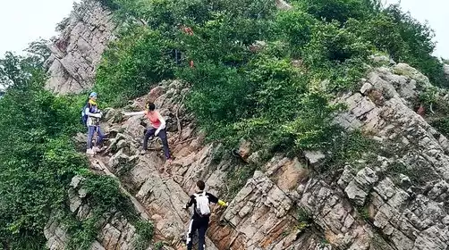
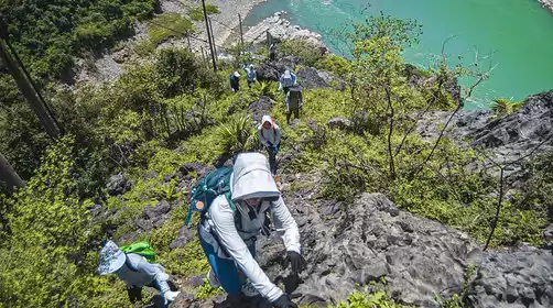
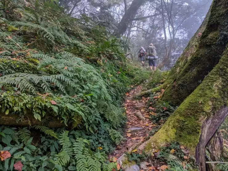
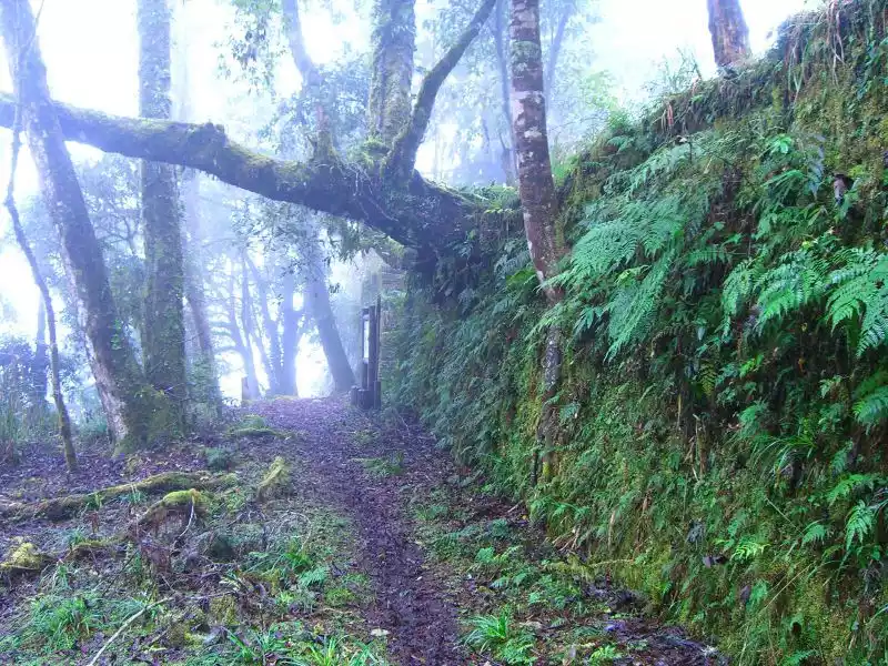
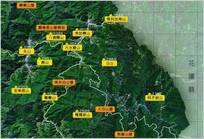
NO.4 Taiwan Batongguan Trail
In 1683, the Qing Dynasty unified Taiwan. In 1875, the Qing government built the Batongguan Trail, a cross-island path, to strengthen control over the Bunun, Tsou, and other ethnic minorities. Following the First Sino-Japanese War, the Qing government ceded Taiwan to Japan in 1895. In 1921, to facilitate communications and control the indigenous population, the Japanese constructed a second Batongguan Trail, overlapping with the ancient Batongguan Trail in Dongpu Hot Spring Village. The hiking route winds around narrow cliffside paths, with steep drops plunging down to a turbulent river.
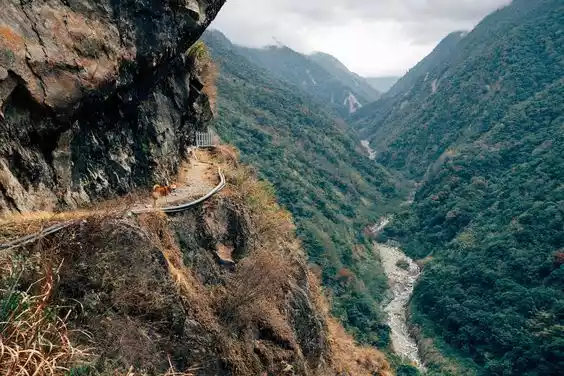
Hikers must cling to ropes to navigate the landslide zone. The forest is covered in usnea and azaleas are in bloom. Above the route looms the mist-shrouded Jade Mountain, the eternal ruler of this wild land.
Tips:
English name: BATONGGUAN TRAIL
Location: Yushan National Park, Taiwan, China
Length: 90 km
Duration: 7 days
Difficulty: Moderate (with steep climbs and cliff drops)
Best months: May-June, October-December
Important Note: Hiking in Yushan Park requires a permit
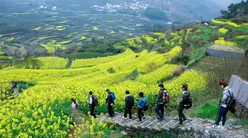
NO.5 Vietnam Hill Tribe Hiking
Sapa, perched high on the edge of a plateau often shrouded in mist, nestles in the 1,600-meter-high Donkini Alps. Hikers can access the lush rice terraces surrounding Sapa. The best route is from Sapa to the outlying villages.

Hiking time ranges from 2 hours to 6 hours per day. If you crave higher altitudes after mountain hiking, you can consider climbing Fansipan Peak at an altitude of 3,143 meters, the roof of the Indochina Peninsula.
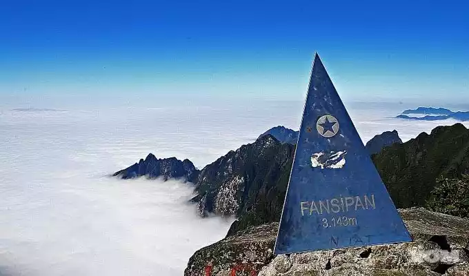
Sapa is directly opposite Vietnam’s highest peak, and summit expeditions from the town take three to five days. These hikes pass colorful villages and into a lush wilderness populated only by monkeys and goats.
Tips:
English name: HILL TRIBE TREKS
Location: Sapa, Vietnam
Duration: 1-5 days
Difficulty: Moderate
Best months: March to May, September to November
Important note: Sapa can be very cold, especially at night, so bring warm underwear.
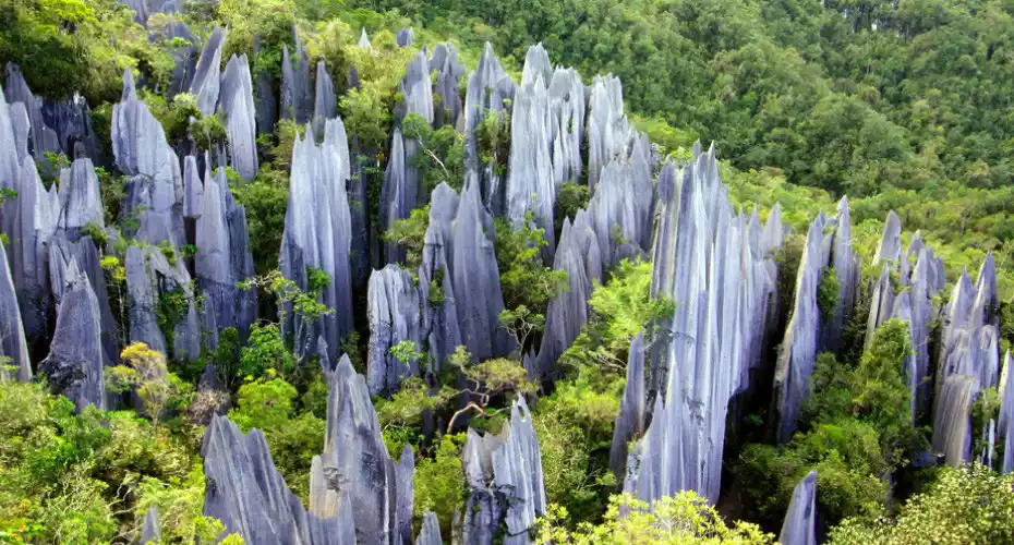
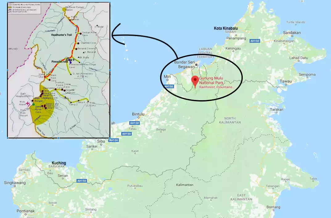
NO.6Malasiya Headhunter Trail
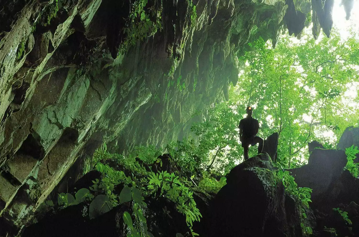
The Headhunter Trail connects Gunung Buru National Park to the Limbang River Port, following the route once used by Kayan headhunters to launch raids on neighboring tribes. Warriors would travel along the Merinao Gorge, then drag their canoes from land into the Telikan River to reach their enemies, where they would decapitate their heads and keep them as grisly souvenirs. Gunung Buru National Park is an adventurer's paradise.

This is a nest of mountains, limestone peaks, and pristine rainforest. To begin this hike, you'll need a large canoe from the visitor center at Gunung Buru National Park to the mouth of the Berar River. Then, you'll hike 8 kilometers through dipterocarp and riparian forest to Camp 5 at the end of the canyon. From Camp 5, it's an 11-kilometer hike to the settlement at the mouth of the Telikan River, where you'll learn about the legends of the headhunters of the past.
Tips:
English name: HEADHUNTERS' TRAIL
Location: Sarawak, Kalimantan, Malaysia
Length: 19 km
Duration: 2-3 days
Difficulty: Easy (wet, gentle slope)
Best months: March to October
Important: A park guide is required and boat access is required
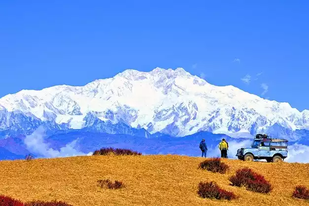
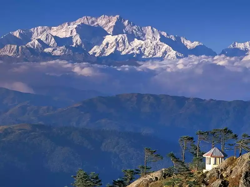
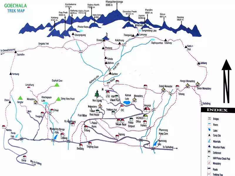
No. 7 Singalila Range, India
Singalila, the natural border between India and Nepal, offers one of the most spectacular viewpoints in the entire Himalayas. Perched high above the dusty plains, it basks in fresh air and lush greenery, gazing across at the gleaming snow-capped summits of the world's highest peaks.
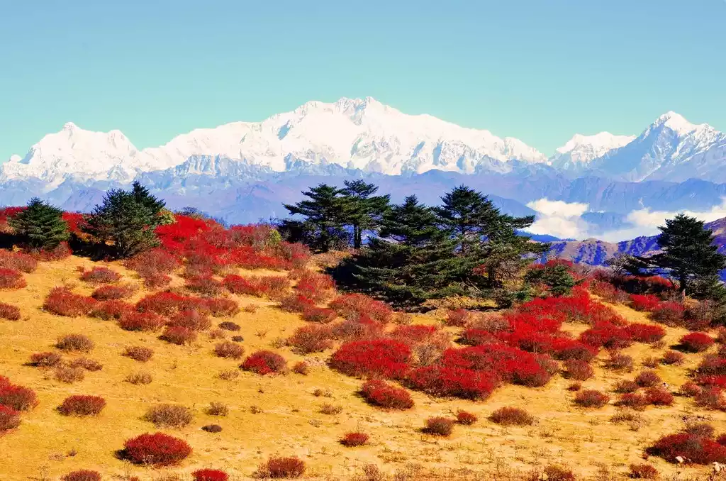
The Singalila Range lies west of the Darjeeling curve, and the classic five-day trek begins from the town of Menibandan, 26 kilometers from the mountain resort.
The trail follows the ridge northwest, running along the India-Nepal border to Polud Peak (3,600 meters). It then turns southeast, following the border between West Bengal and Ceylon, ending at the village of Limbi. The 83-kilometer Wonder of the Himalayas route offers views of four of the world's top five peaks: Mount Everest, Kangchenjunga, Lhotse, and Makalu.
Tips:
English name: SINGALILA RIDGE
Location: West Bengal, India
Length: 83 km
Duration: 5 days
Difficulty: Moderate
Best months: May-June, October-November
Important: Permit and Guide Mandatory
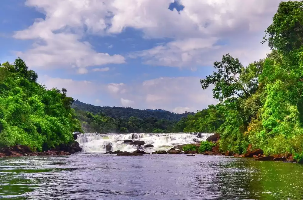
NO.8 Cambodia Cardamom Mountains Loop
Explore Cambodia's last remaining refuge from the Khmer Rouge in a beautiful biodiversity hotspot. The Cardamom Mountains, ravaged by war for years, have been cleared of mines, trails and thatched huts have been built, former Khmer Rouge conflict fighters now serve as guides, and the forest has been reclaimed.
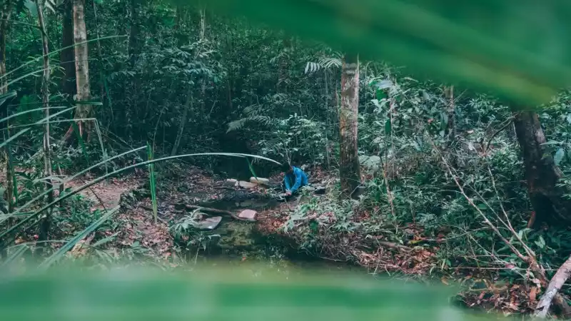
There are various hiking trails here, including a 145-kilometer-long trail cleared around Chi Phat Village. Another 36-kilometer loop requires a downstream boat trip and a two-day return trip to Chi Phat Village, with a night in a jungle lodge along the way.
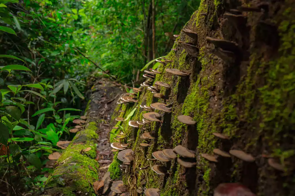
The trail passes through a forest of evergreens, redwoods, giant ferns and giant mushrooms. The wildlife is rich and there are many species living in the mountains, such as gibbons, sun bears and clouded leopards.
Tips:
English name: CARDAMOM MOUTAINS CIRCUIT
Location: Southwestern Cambodia
Length: 36 km
Duration: 2 days
Difficulty: Moderate
Best months: November to March
Important note: It takes 3 hours to drive from Phnom Penh to Cipha and then a 2-hour boat ride.
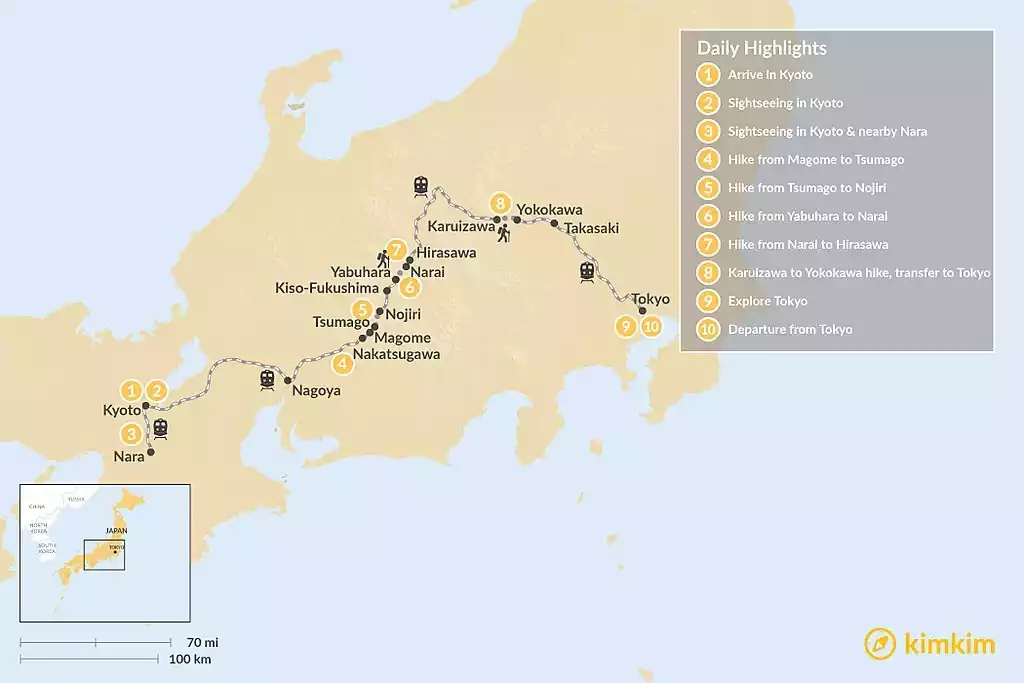
NO.9 Nakasendo, Japan
Walk along a historic thoroughfare from Kyoto to Tokyo, traversing pristine, ancient stones. Nakasendo, meaning "road through the mountains," was one of the main thoroughfares during the Tokugawa shogunate. It connected major destinations on Honshu, Japan, and today, much of the Nakasendo remains intact.
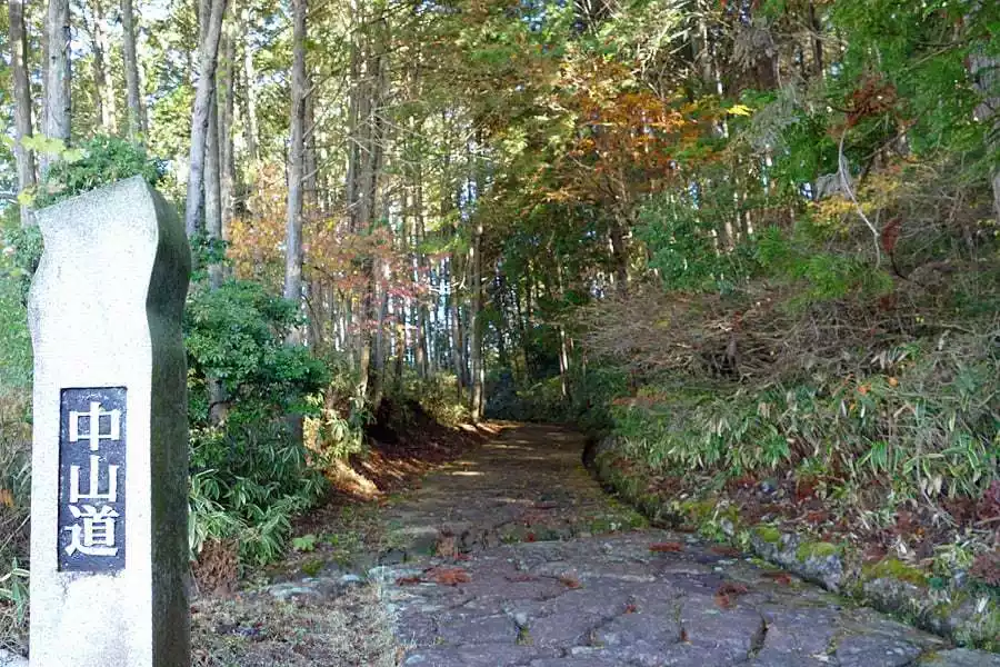
The Nakasendo was once as long as 533 kilometers, bypassing Lake Biwa from Kyoto, rising into the mountains at Sekigahara Town, traversing the plains near the southern Japan Alps, extending to the Kiso Valley, turning south across the Kanto Plain to reach Edo.

The route is dotted with 67 post towns, which are evenly spaced rest stops. Walking the entire Nakasendo is not feasible, as many sections have been destroyed, but enough sections have been preserved to provide a sense of living in Edo-period Japan.
Tips:
English name: NAKASENDO WAY
Location: Honshu, Japan
Length: 533 km
Duration: 18-20 days
Difficulty: Easy
Best months: April to October
Important: Shinkansen trains connect Kyoto and Tokyo in 2.5 hours.
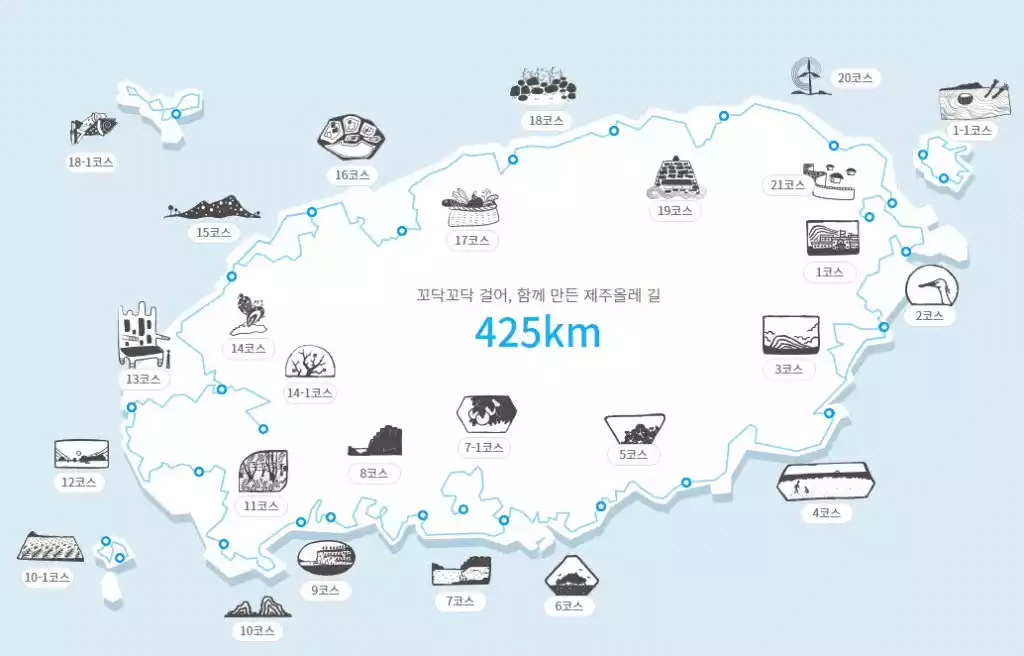
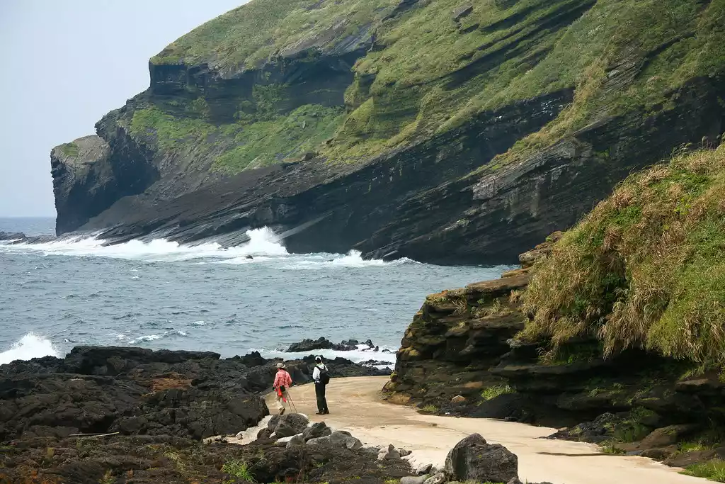
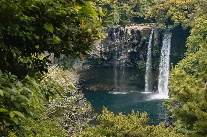
NO.10 Olle Trail, South Korea
"Olle" is a Korean slang term for the narrow path connecting the main street and the front door. The "Olle Trail" connects broken paths, rediscovers forgotten paths, and reawakens lost paths. It circumnavigates Jeju Island, connecting the island's natural scenery and cultural villages, showcasing its unique local customs and culture.
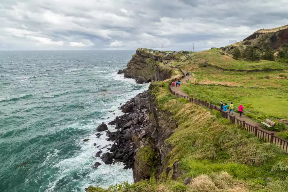
You can think of the Olai Trail as a single hiking route or as a collection of multiple routes. Technically, there are 26 Olai Trails, including 21 main routes and five secondary routes. Each one is numbered, so no matter which one you choose, you'll feel like you're walking through the scenery.
Tips:
English name: Olie Trail
Location: South Korea, surrounding the entire island of Jeju
Length: more than 400 kilometers
Best hiking time: March to May, September to November
Important note: There are actually not many toilets and restaurants along the Olai Trail, so you must be fully prepared before hiking.