Jiangxi Lingshan Travel Guide, where huge rocks form a forest and the scenery is very beautiful, violent and fiery, and only strong donkeys can climb it!
Preface
China's geographical terrain is divided into three levels, gradually changing from high to low from west to east, creating a variety of landscapes in China.
On the relatively flat third step, in East China, nestled in the heart of the Yangtze River Delta Economic Zone, the Pearl River Delta Economic Zone, and the West Coast Economic Zone, lies a province.
Rich in resources and boasting a beautiful ecology, it boasts China's largest freshwater lake, Poyang Lake. Since ancient times, it has been known as "the head of Wu and the tail of Chu, the home of Guangdong and the courtyard of Fujian," and is known as the "land of fish and rice in the south of the Yangtze River."
This province is Jiangxi, a province that often claims to be the least visible in China.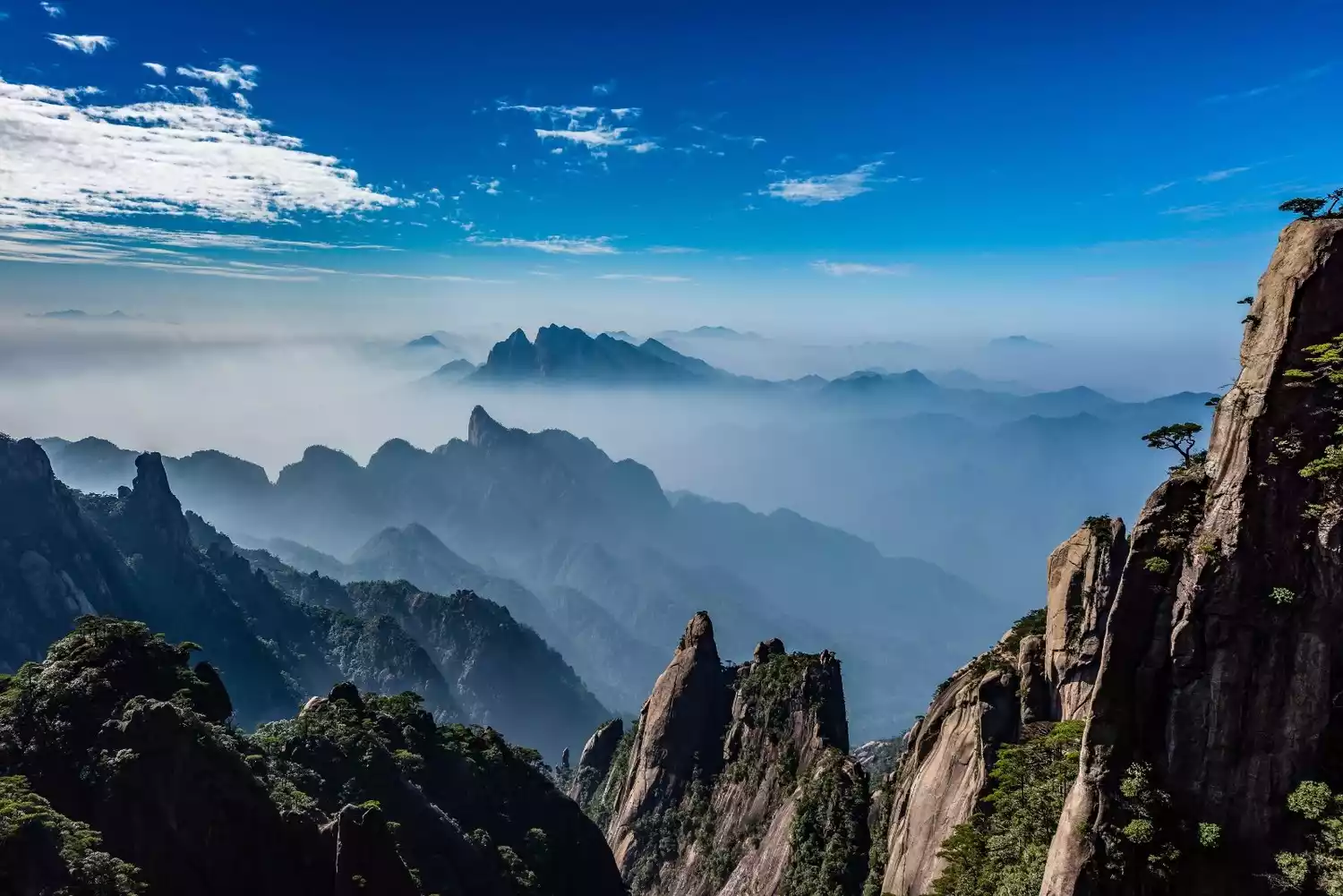
But, in the tourism and outdoor world, it's a very popular spot!
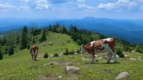
Five World Heritage Sites are located here: Lushan, Sanqingshan, Longhushan, Guifeng, and Wuyishan. The first three are also designated World Geoparks. Wugong Mountain, a sacred place for Chinese outdoor activities, is also located here.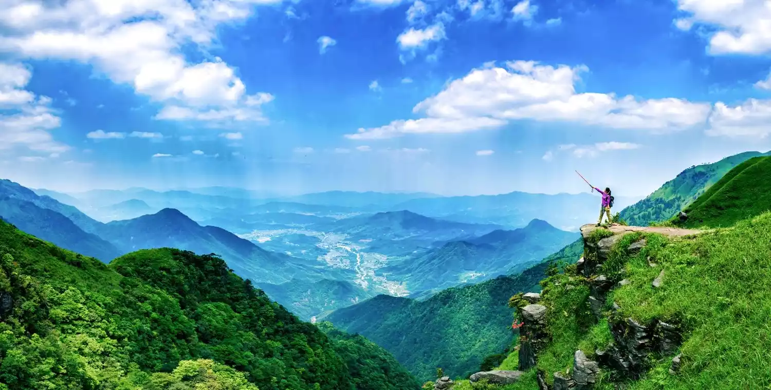
▲Wugong Mountain
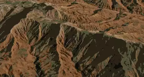
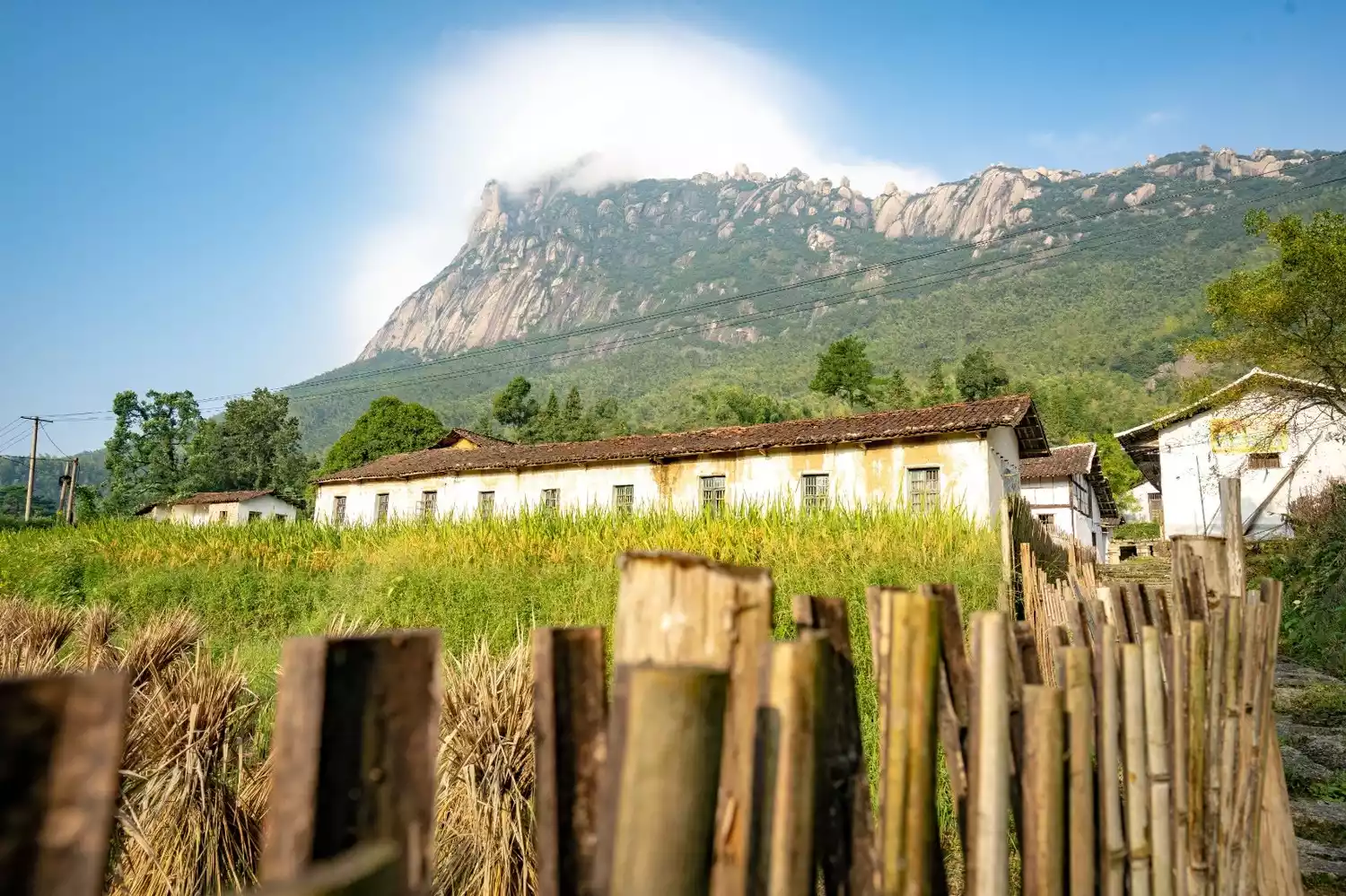
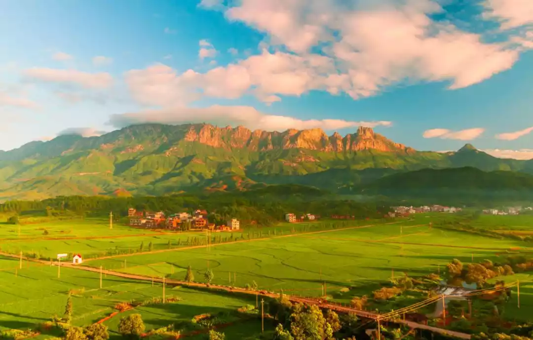
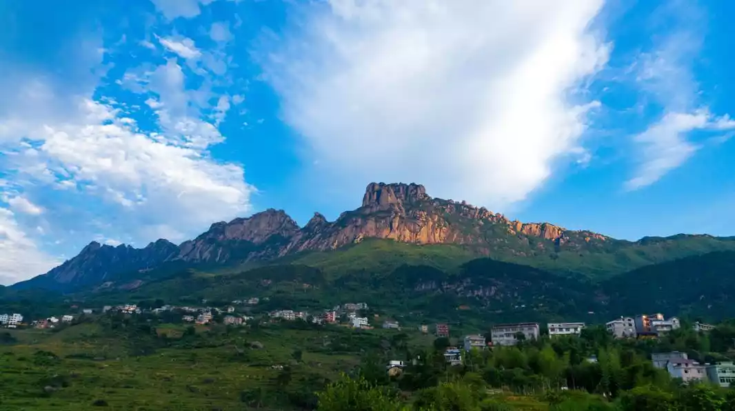
In Guangxin District, less than 30 kilometers away from the main urban area of Shangrao City, between Sanqing Mountain and Guifeng Mountain, in the rolling hilly area of Jiangnan, a group of steep peaks suddenly rise up, running in a northeast-southwest direction, drawing a graceful arc, like the upper Xuan moon.
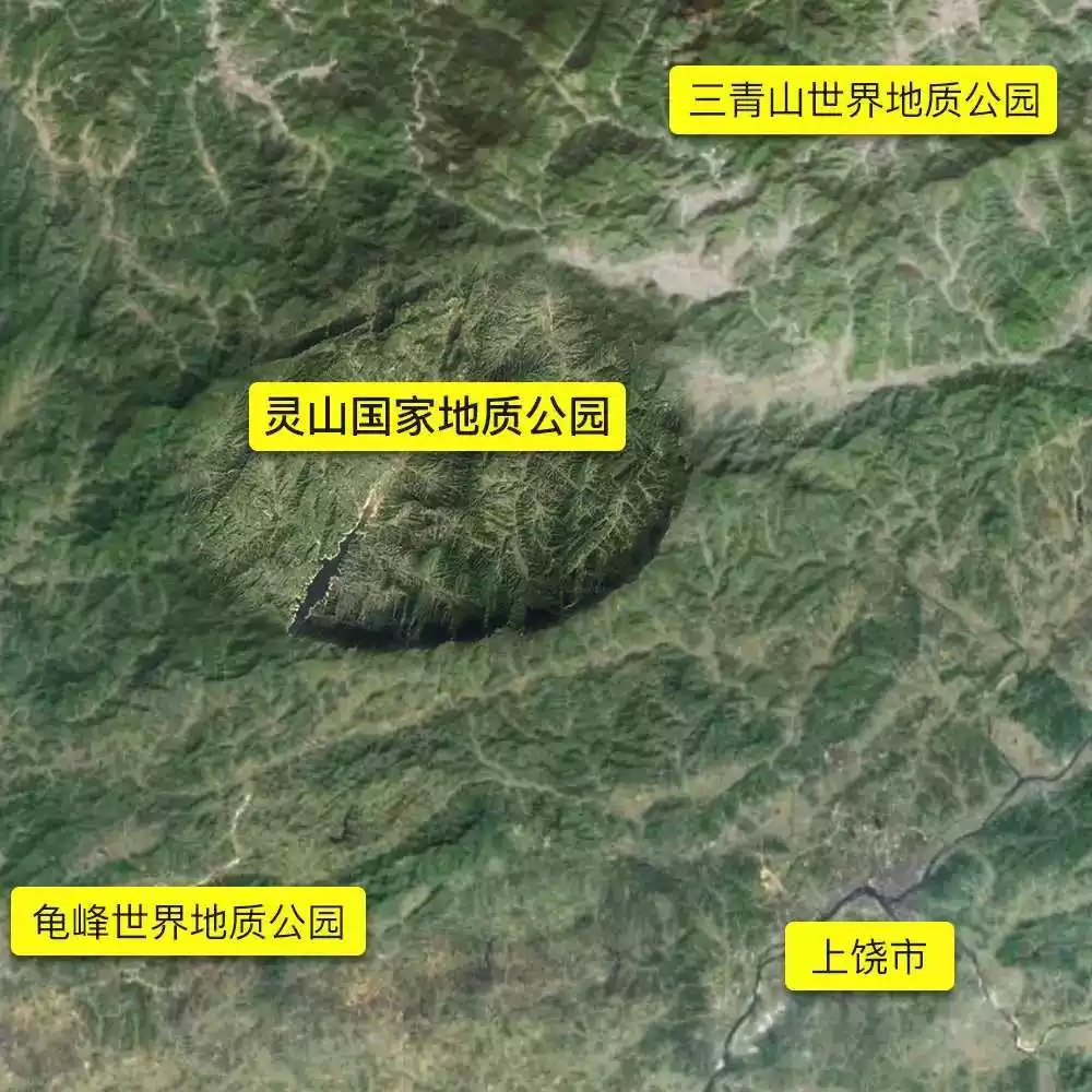
This is the National Geopark listed as the "33rd Blessed Place in the World" in Taoist books, and the Lingshan Mountain that looks like Sleeping Beauty.
The magnificent terrain formed by millions of years of geological creation stretches across this red land, waiting for more people who pursue scenery to come and see it.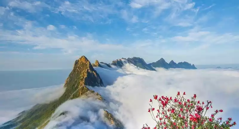
@Zhang Shuangying
Legend of Stonehenge in the Clouds
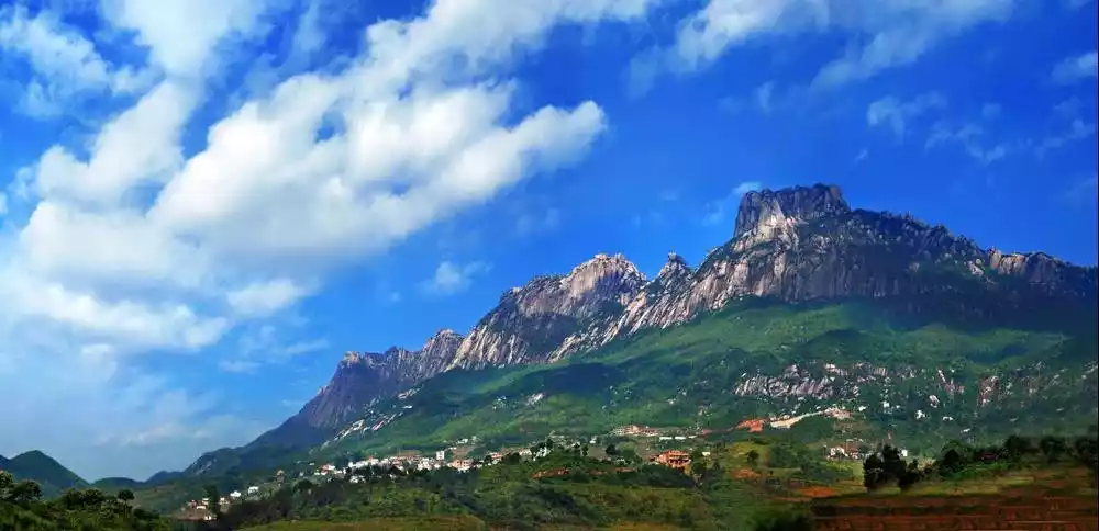
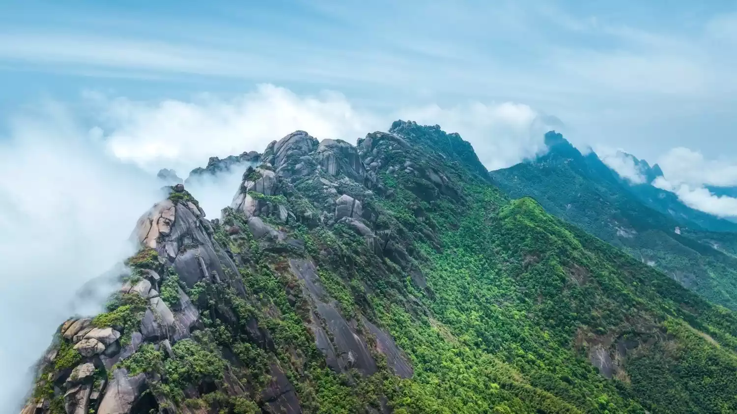
The vast and overlapping Lingshan Mountains are full of granite and huge rocks, which are the legend of the stone formations in the clouds.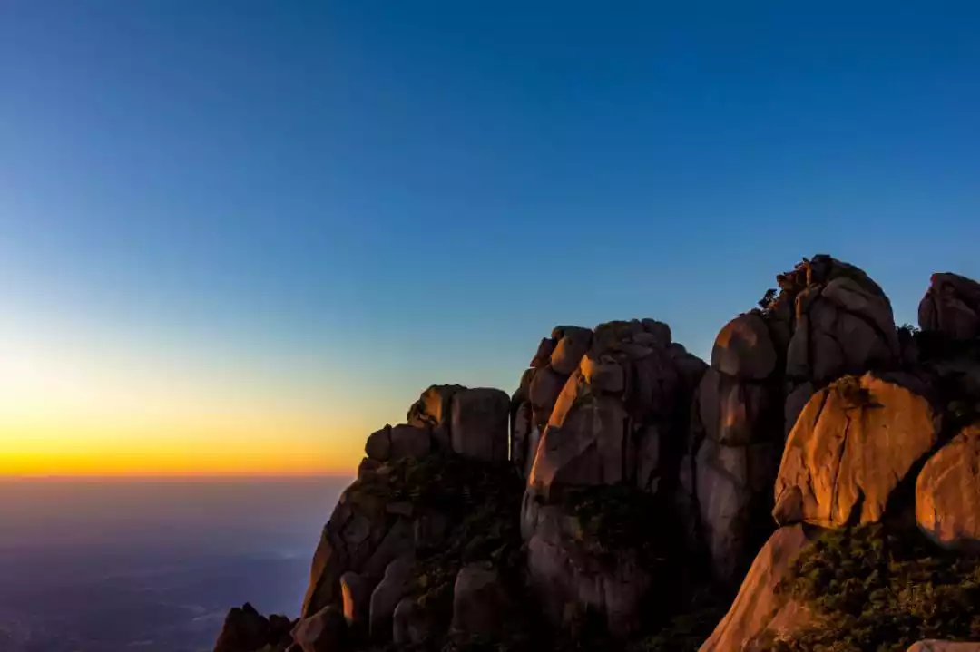
@Chen Guangxing
Seen from the side, Lingshan looks like a sleeping beauty lying on the ground, with a complete head, eyes, nose, mouth, chest, abdomen, long legs, etc., with concave parts and convex parts, and a beautiful and graceful shape.
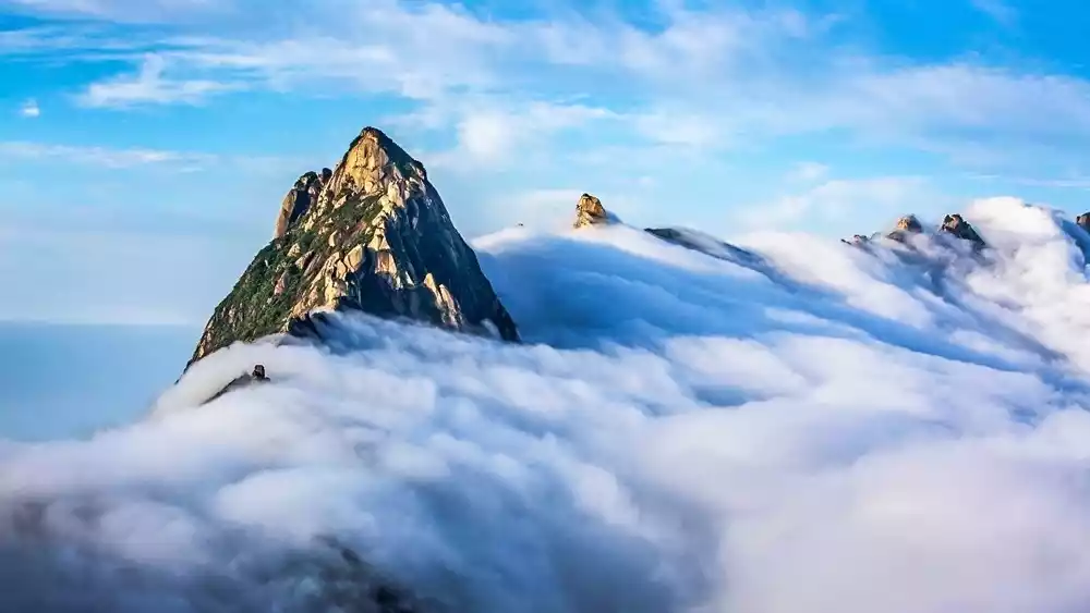
This protrusion is the 72 peaks of Lingshan Mountain, which locals have long named. A closer look includes Dragon Head Peak, Cat Peak, White Cloud Peak, and Stone Man Peak. Ranging from 1,200 to 1,500 meters above sea level, they stretch endlessly and meander away.
Steep yet beautiful, interspersed with lush evergreen vegetation, the summits offer a truly breathtaking view.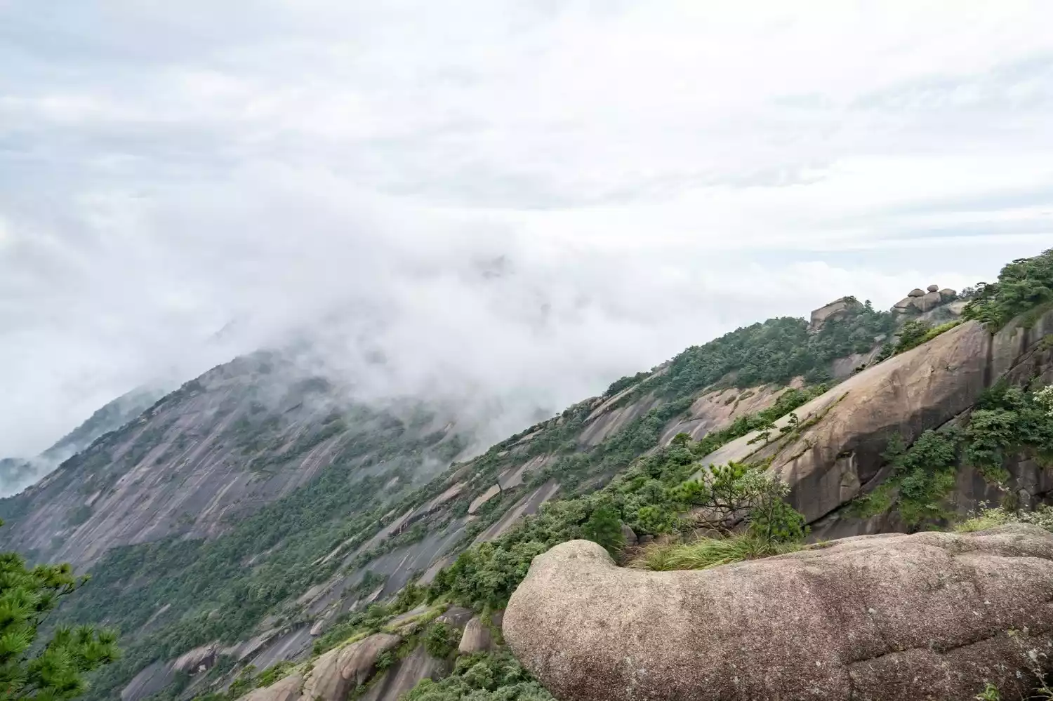
Five Wonders of Lingshan
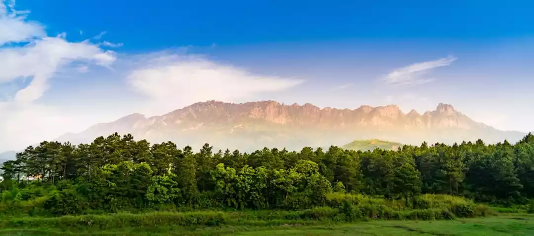
🏃♂️The world's rare ring-shaped granite peaks
Lingshan, a rare ring of granite peaks, is renowned for its towering peaks. Its 72 peaks, each one strikingly beautiful and graceful, offer a myriad of forms. From afar, Lingshan resembles a reclining beauty; from above, it soars through the sky like an eagle; and from below, it resembles a gigantic dragon, entwined across the northeastern Jiangxi landscape.

@Bao Lin
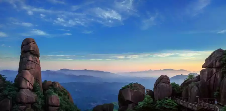
🏃♂️Rare stone landforms in China
Lingshan is a kingdom of stone, a world of stone. The sheer number and high quality of its shaped rocks are rare in China, and indeed the world. During orogeny, the intermittent upheavals of the mountain created countless granite blocks, sculpted by wind and rain over millions of years to create a myriad of shapes and forms.
@王源清
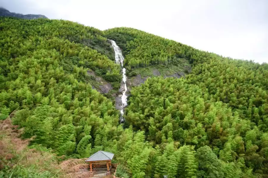
🏃♂️The granite waterfall with the largest drop in Jiangnan
The largest granite waterfall in Jiangnan. The picturesque scenery of Lingshan and the abundant rainfall provide ample water, with trickling streams, springs, and cascading waterfalls everywhere. Among the larger waterfalls, there are 36, including the Crystal Waterfall in the Crystal Mountain Scenic Area, which cascades down the mountain like a flying silk hanging from the sky and roars like thunder. Its drop is over 230 meters.
@Wang Ting
🏃♂️China's most distinctive alpine Lingshi terraces
The Lingshi Rice Terraces are China's most distinctive high-altitude terraced fields. Constructed on the mountainside, the terraces are dotted with massive boulders. Year-round, the rice paddies are either verdant green or the rapeseed oil is golden, blending subsistence and aesthetics into a pastoral, poetic landscape. This has also created China's most distinctive high-altitude Lingshi Rice Terraces landscape.

@Zhan Dingping
🏃♂️A famous mountain with great influence on folk religion in Jiangnan
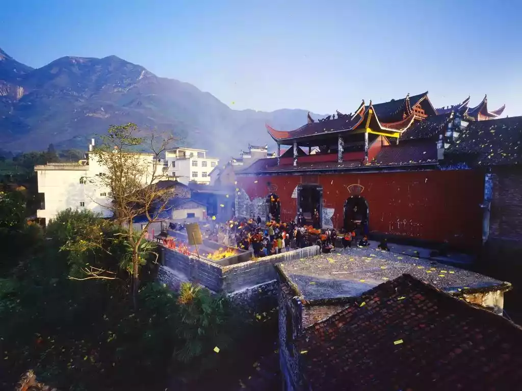
Lingshan, a renowned mountain in Jiangnan, is a renowned and influential folk religion destination. Since ancient times, it has been a sacred site for both Taoism and Buddhism. It is one of the nation's most renowned Taoist grottoes and blessed sites, and is ranked as the 33rd most blessed site in the world. According to the Tang Dynasty's Yundian, at its peak, Lingshan boasted 99 temples and shrines. Due to its "spiritual and divine responses," Lingshan has become a sacred site for pilgrimage and prayer, and a place where the dreams of believers come true.
@Jiang Fang
Line gameplay
Lingshan and Wugongshan are similar in that they gained fame among outdoor enthusiasts before becoming scenic spots. 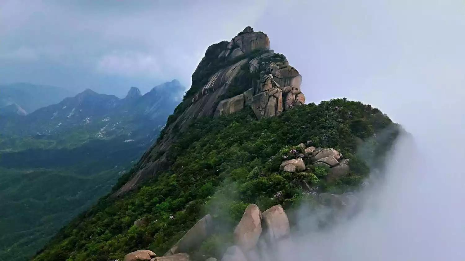 Before Lingshan Scenic Area was developed, it was already well-known in East China.
Many outdoor enthusiasts come here to climb mountains of varying difficulty under the guidance of local mountaineers, and deeply experience the infinite scenery here.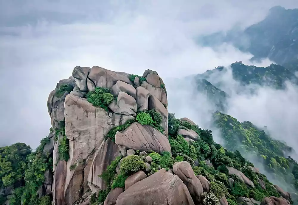
Because the rocks here are primarily natural granite, with a rough, grainy surface and strong friction, even with a steep incline, most people can easily stand on them and climb. 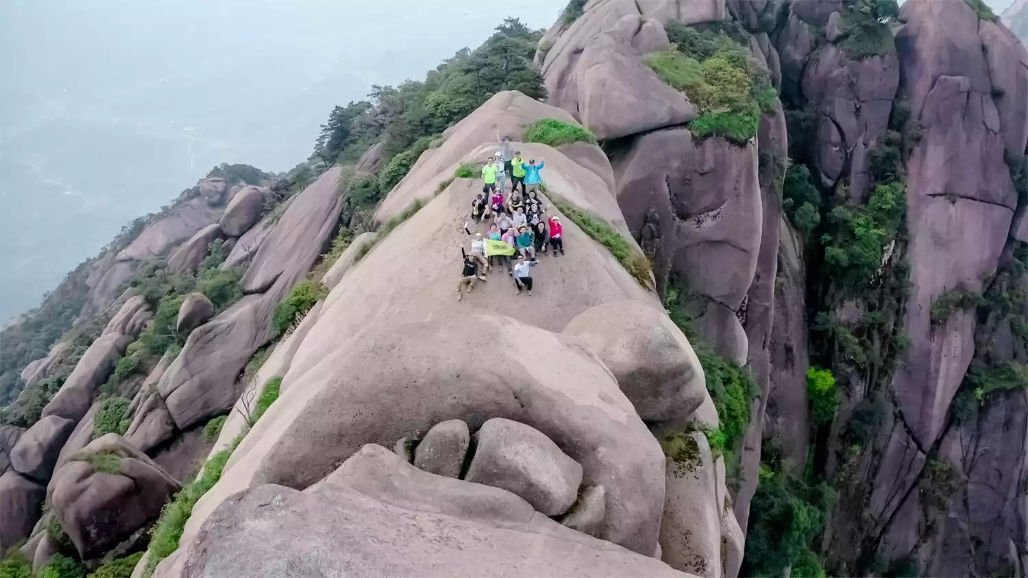
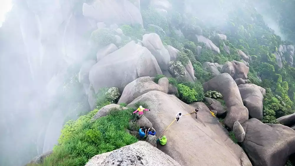
Near the summit, the incline is steeper, often requiring the use of ropes, requiring participants to have strong outdoor experience.
Climbing Lingshan is like dancing on the rocks, the fun and scenery are truly captivating! 
Two classic and popular routes are the Zhongtai Peak Loop and the Tianti Peak-Scenic Area Plank Road Loop.
Both routes are moderate to high-intensity outdoor hikes that combine off-road hiking with rock climbing.
🚩Lingshan Zhongtai Peak Outdoor Loop
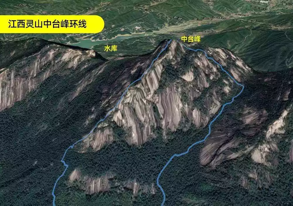
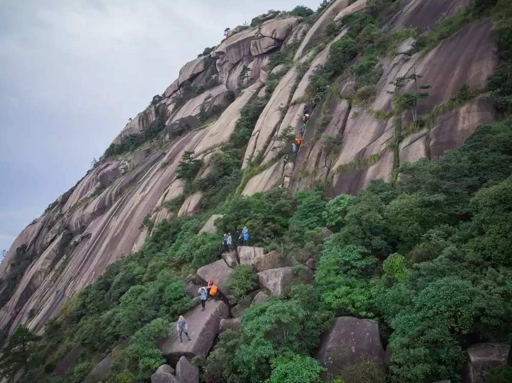
The Lingshan Zhongtai Peak outdoor loop begins at Zuoxi Longjing Village and covers approximately 6 kilometers, with an elevation gain of over 1,000 meters. The average climb takes 8-9 hours, and there are five or six sections requiring rope climbing.
The terrain is diverse and complex. At around 900 meters above sea level, you'll enter a rocky area and a chaotic stone forest. Later, it's all about climbing steep granite boulders.
Because the rock surface is heavily ridged and rough, climbing with ropes is quite safe. However, looking down from above, it feels like you're climbing from the air, a truly heart-pounding experience.
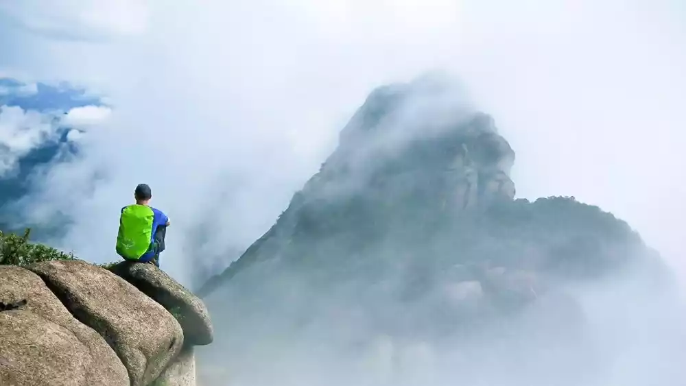
The summit of Dongtai Peak is composed of several massive granite blocks. From the summit, you can overlook other mountains, and in both directions, you'll see a winding, undulating formation of giant rocks stretching into the sky.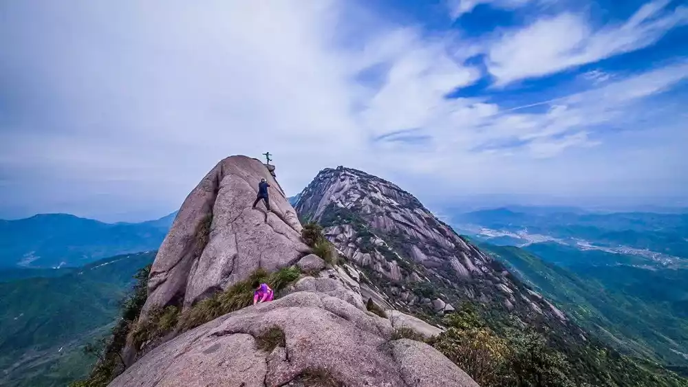
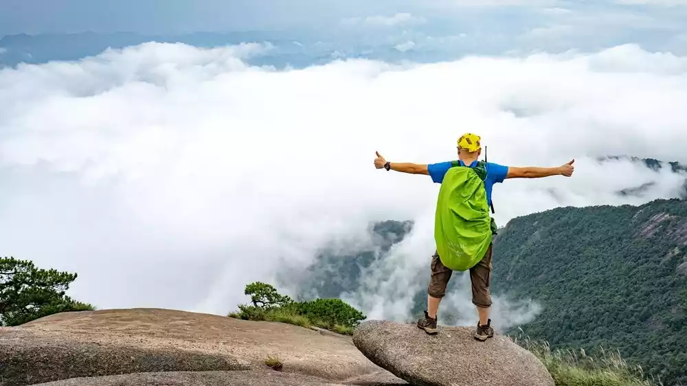
Looking out at the land of Shangrao from afar, the fields are crisscrossed, and the Mingyangguan Reservoir is like a string of emerald jade inlaid in it. The mountain breeze blows, and I can't help but feel refreshed. I just want to shout out how wonderful it is!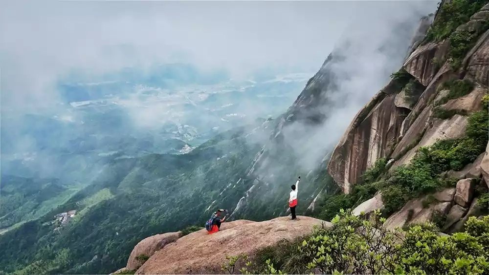
There are also some sections where you need to use ropes when you go down, especially a rock crevice, which looks like it is vertically descending from a distance. People squeeze into this rock crevice, stepping carefully down on the rock pits and branches growing in the cracks. This exciting climbing experience is also very desirable.
🚩Tianti Peak-Scenic Area Plank Road Loop
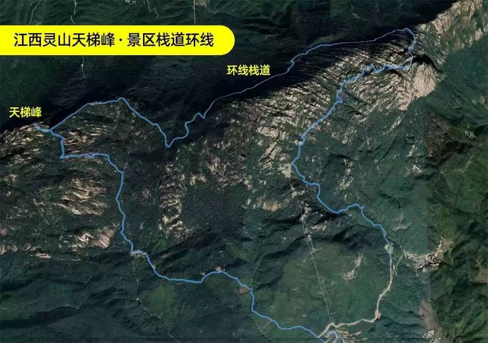
The Tianti Peak scenic loop begins on the winding mountain road east of the scenic area, ascending from the original trail entrance. After approximately 3-4 kilometers, the climb rises from an altitude of over 400 meters to approximately 1,300 meters, reaching the base of Tianti Peak's main peak.
The towering boulders tower before you, reaching the sky and seeming impossible to reach. However, a closer look reveals several crevices winding upward, which are quite safe to climb along. 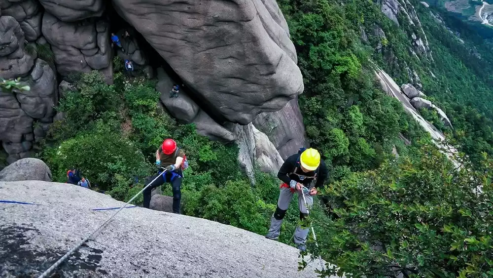
Finally, a free-standing rock face with a drop of over 30 meters is the real test of your ability. You must hold on to the ropes and cling to the rock face, the wind whistling fiercely on all sides, making you feel as if you were in the sky.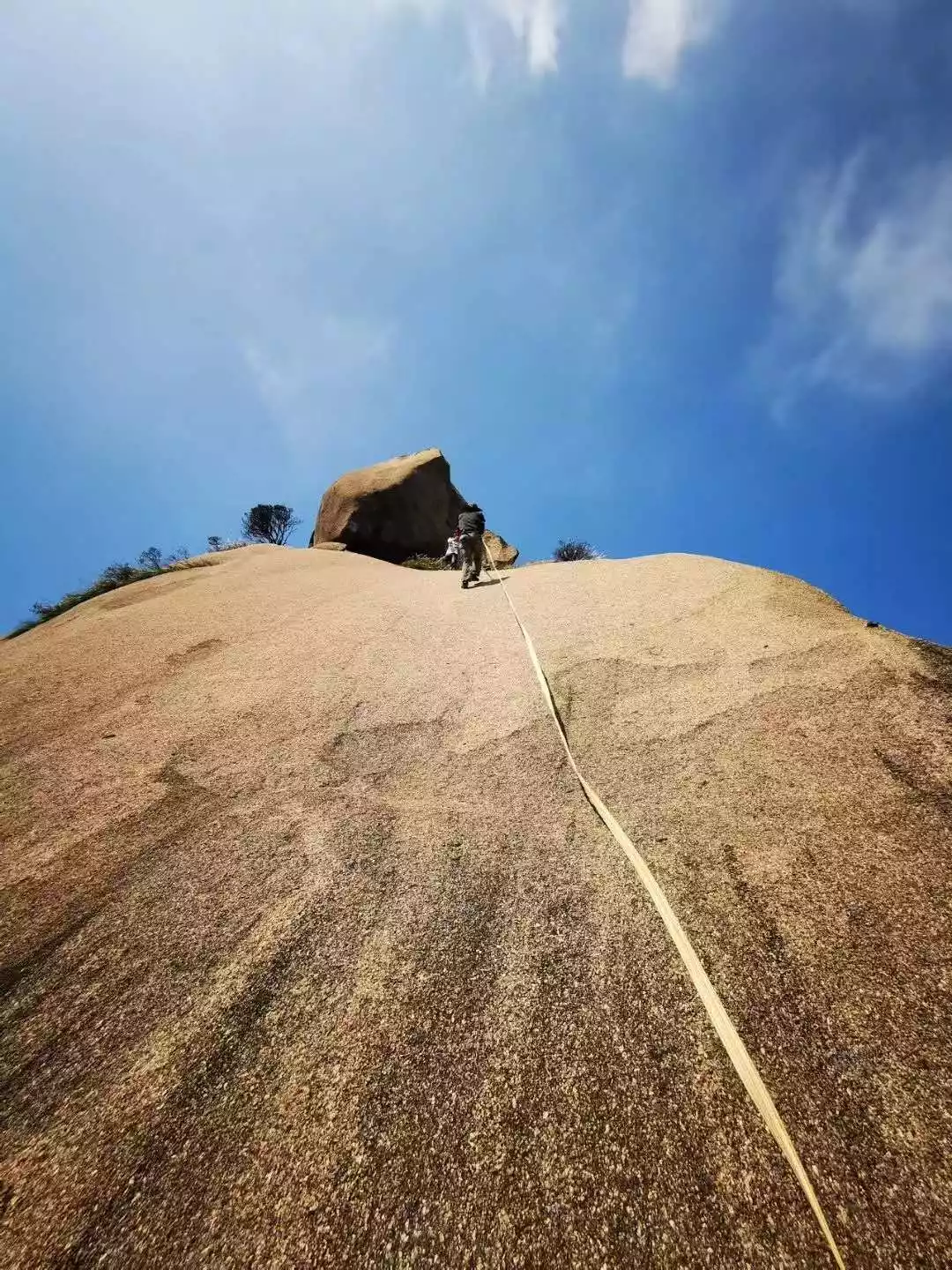
Once you reach the summit, you'll discover a massive, impassable rock that has stood there for countless years, offering breathtaking views of the surrounding landscape.
Descending the same way you came, you'll experience another thrilling climb, taking a wild path back to the scenic plank road. A circuit of the path reveals a variety of lifelike natural rock formations that will leave you breathtaking.
🚩Leisure trip
Lingshan's regular scenic area, located midway between the 72 peaks, offers hiking trails or a cable car ride to the main scenic area. Here, at an altitude of approximately 1,000-1,200 meters, a plank road is built into the cliff face.
From an aerial perspective, the entire path forms an elongated elliptical loop. Walking along it, visitors can admire the captivating jagged rocks up close, while gazing into the distance, they can see the overlapping peaks, a distant, misty landscape.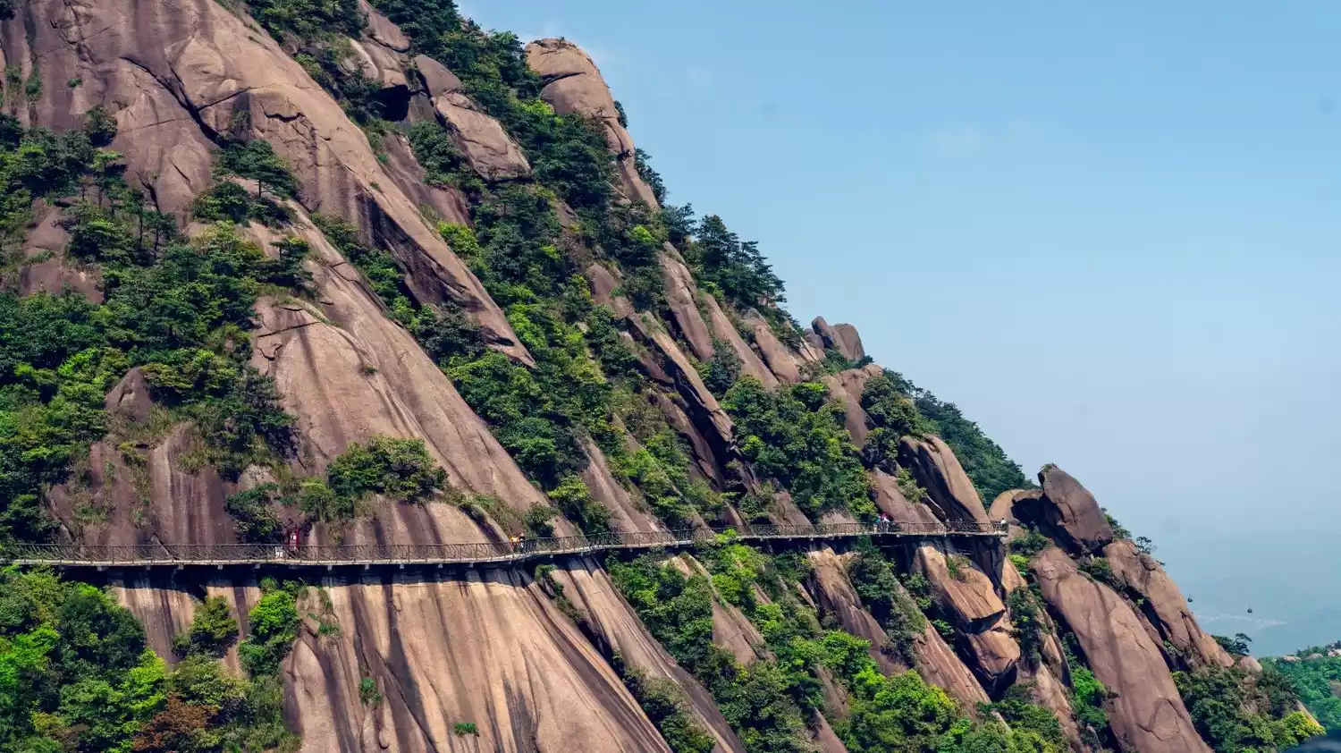
"The beauty of Mount Lingshan is as great as the five peaks of Jiuhua Mountain." The wonders of nature far surpass human imagination. Walking among the strange rocks, you can fully appreciate its wonders.
Especially the Xiong Ba Tian Xia and the Turtle and Snake Looking Up at the Sky, which are very vivid and are must-see spots when walking on the Lingshan Plank Road. There will be subtle changes when viewed from different angles. This is what is meant by "changing scenery with every step".
The plank road around the scenic area is about 8.5 kilometers long and can be easily completed by the general public.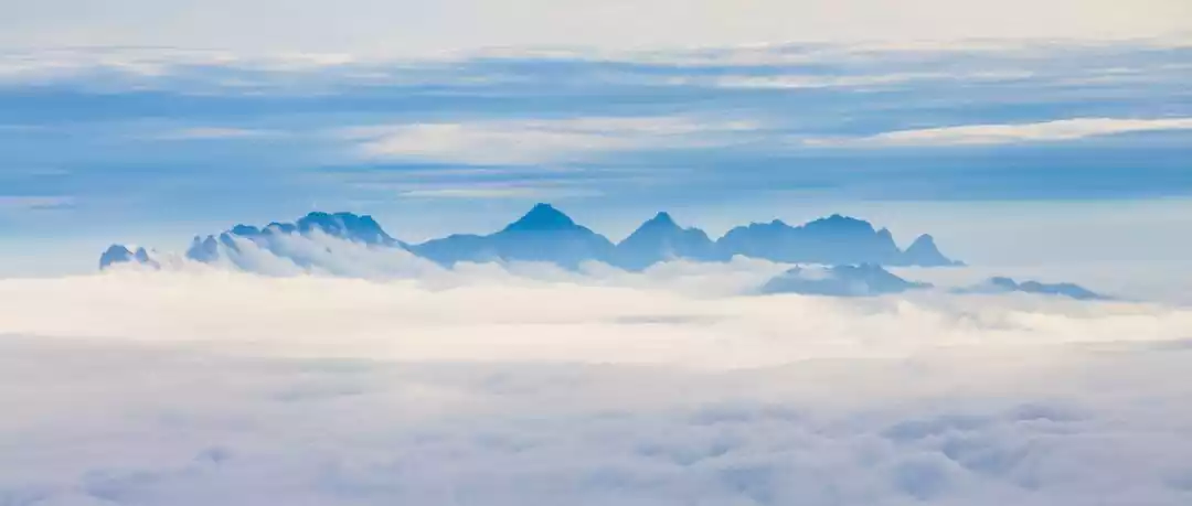
Tips:
Scenic area opening hours
Summer (May to October)
Ticket sales hours: 8:00-15:00
Cable car operating hours: 8:00-17:00
Winter (November to April)
Ticket sales time: 8:00-15:00
Cable car operating hours: 8:00-16:30
Ticket sales will be advanced half an hour on holidays, and the ticket sales will be closed at 3 pm as normal; the cable car will start operating half an hour earlier and close half an hour later.
Hiking equipment
Dress appropriately for outdoor activities, including a 30-liter backpack and seasonal outdoor clothing. Also bring a hat, a change of clothes, several pairs of thick socks, and toiletries. Also, bring non-slip hiking boots and sneakers, as the mountains can get quite chilly at night.
A roadside snack (chocolate, beef jerky, or other high-energy foods of your choice), and other snacks! Bring a water bottle. If you're traveling in autumn or winter, it's recommended to bring a thermos and hot water.
Advanced hikers can bring a wireless walkie-talkie (handheld radio) to communicate with the tour leader.
Bring your own medicines: cold and fever reducing medicines, gastrointestinal medicines, motion sickness medicines, and allergy medicines.
Documents: ID card, mobile phone, camera, power bank, data cable are all must-bring, and most importantly, you must be in a good mood!
Conclusion
The world's most magnificent, bizarre and extraordinary sights are often found in dangerous and remote places!
Do you dare to challenge such a cruel plot?