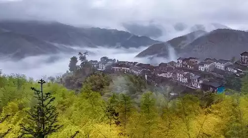
Mengkede Ancient Trail, a small and entry-level ancient trail in Xinjiang that you can't miss
Preface
The Mengkede Ancient Road, where the Wusun people migrated westward
Historically, the Wusun people, who originally lived in the Hexi Corridor, migrated westward due to the persecution of the Xiongnu. They entered the Ili River Valley in the heart of the Tianshan Mountains along a little-known passage, drove out the Dayue Di people who also migrated here because of the expulsion of the Xiongnu, and occupied the fertile land here. From then on, they lived and multiplied on this fertile river valley grassland, and the people and livestock prospered, becoming the largest country among the 36 countries in the Western Regions at that time - the Wusun Kingdom.
According to relevant documents, the route the Wusun people took during their westward migration was the Mengkede Ancient Road. For thousands of years, this road lay hidden in the beautiful Tianshan Mountains, and little was known about it to the outside world.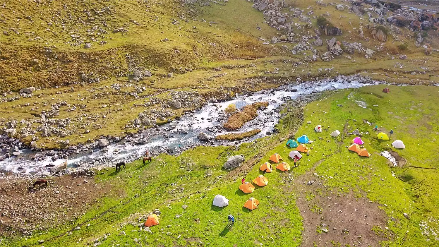
Hero's Ancient Road
This ancient road is not only picturesque, but also a heroic one. As early as the mid-1970s, my country built a national defense war preparedness highway along this ancient road, which is the predecessor of the now famous Duku Highway Ili section. Although the highway was eventually abandoned for various reasons, visitors can still feel the relatively obvious traces of the highway here. The current Duku Highway took 10 years to build and is a milestone that crosses the Tianshan Mountains and connects southern and northern Xinjiang.
Basic Information
1. Location
The Mengkede Ancient Trail is located in the easternmost section of the Borokonu Mountains in the Central Tianshan Mountains. Its highest peak stands at 4,590 meters. Its northern slopes give rise to the Gurtu and Kuitun Rivers. Its southern slopes are home to the Tangbula Baili Tourist Area, known as the "Thousand-Mile Gallery," and serve as the boundary between Kuitun and Nileke counties. Its Menketing Pass, at 3,495 meters, is one of the highest passes in the Yilianhabilga Mountains. It is perennially covered with snow, subject to unpredictable weather, and presents a treacherous and dangerous path.
2. Difficulty
Xinjiang's Mengkede Ancient Trail is relatively unknown, and it's even difficult to find much information online. However, its scenery is breathtakingly beautiful, and unlike the "hellish" hikes of the Wolf Tower and Shate Ancient Trails, it's a moderately long and demanding hike. It's not only the perfect start for first-time hikers in Xinjiang, but also a great place to relax after visiting these infernal places.
The best views along the way
The Tianshan Mountains in Xinjiang have excellent natural wonders, which wonderfully bring together the huge contrasts of heat and cold, drought and humidity, desolation and beauty, grandeur and exquisiteness, showing a unique natural beauty.
1. Snow Mountain/Tianshan Mountains, Menketing Pass
The Tianshan Mountains are one of the world's seven major mountain ranges, and the Xinjiang Tianshan Mountains are a World Heritage Site. "The bright moon rises from the Tianshan Mountains, amidst a vast sea of clouds," this majestic mountain range stretching 2,500 kilometers is one of the world's few super-mountains. The Mengkede Ancient Trail is just a tiny corner of the Tianshan Mountains, but it offers a glimpse of the world-class natural scenery of the Tianshan Mountains.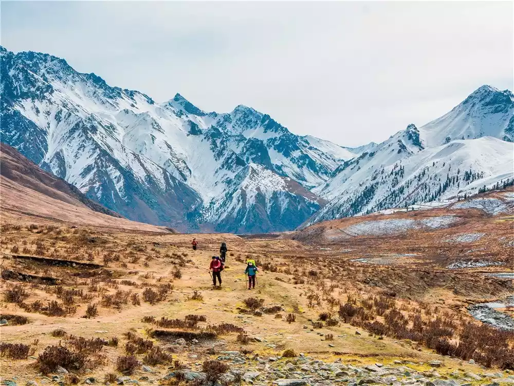
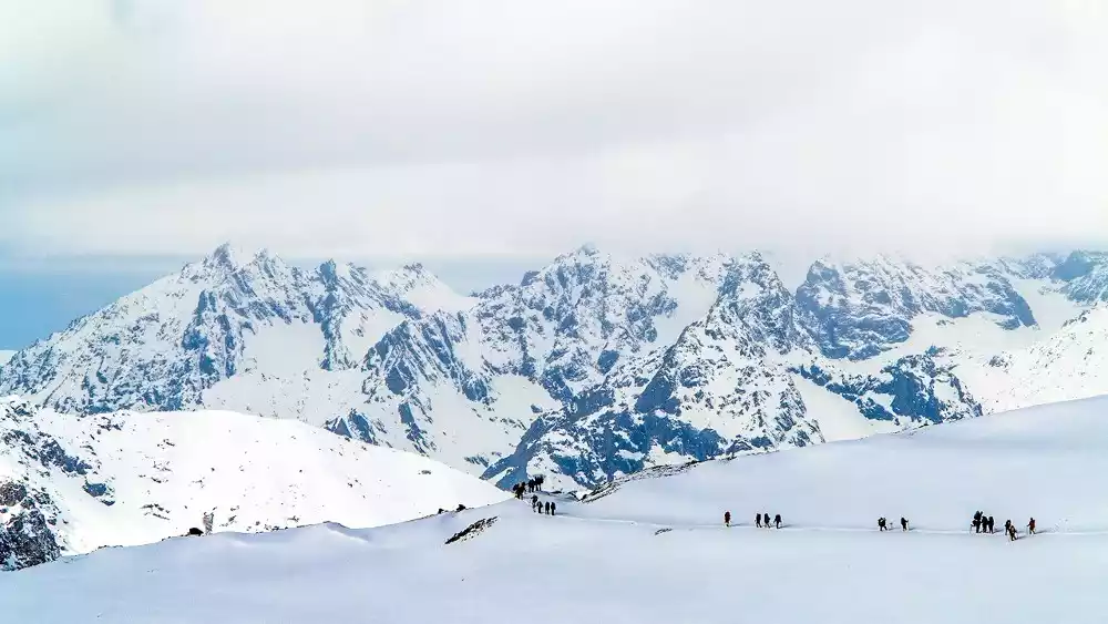
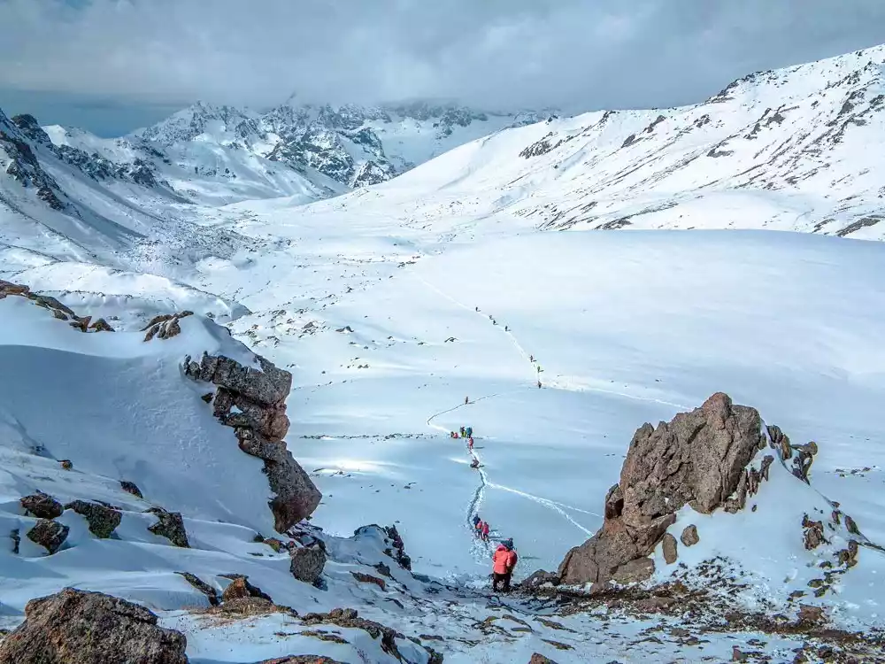
Menketing Pass, at 3,495 meters above sea level, is one of the highest passes in the Yilianhabilga Mountains of the Tianshan Mountains. It boasts a treacherous path, perennial snow, and unpredictable weather. Here, clouds and snow linger, glaciers stretch across the landscape, icefalls roar, and hot springs surge. Rare wildlife such as snow leopards often roam near the pass, and the surrounding mountains, shimmering with snow, create a breathtaking spectacle.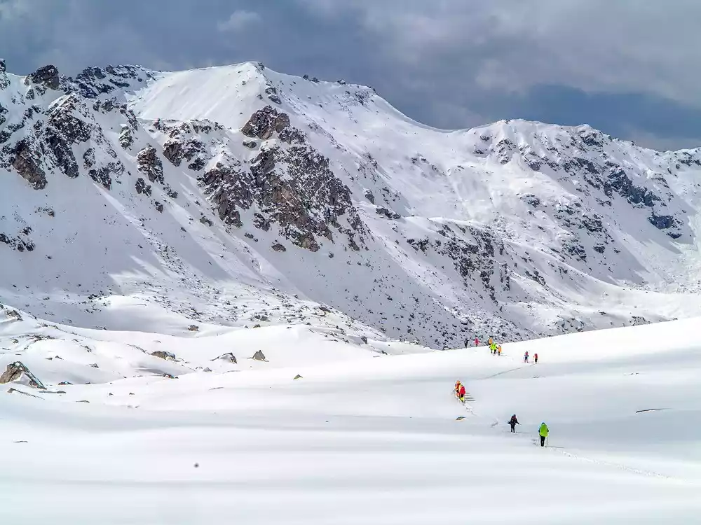
2. Highway/Duku Highway
The Duku Highway stretches 561 kilometers, stretching from Dushanzi in the north to Kuqa, the seat of the ancient Kingdom of Kucha, in the south. One-third of the highway is covered by cliffs, and one-fifth lies in permafrost. It crosses nearly ten major rivers in the Tianshan Mountains and traverses four glacial passes covered with perpetual snow. It traverses towering mountains and traverses deep valleys.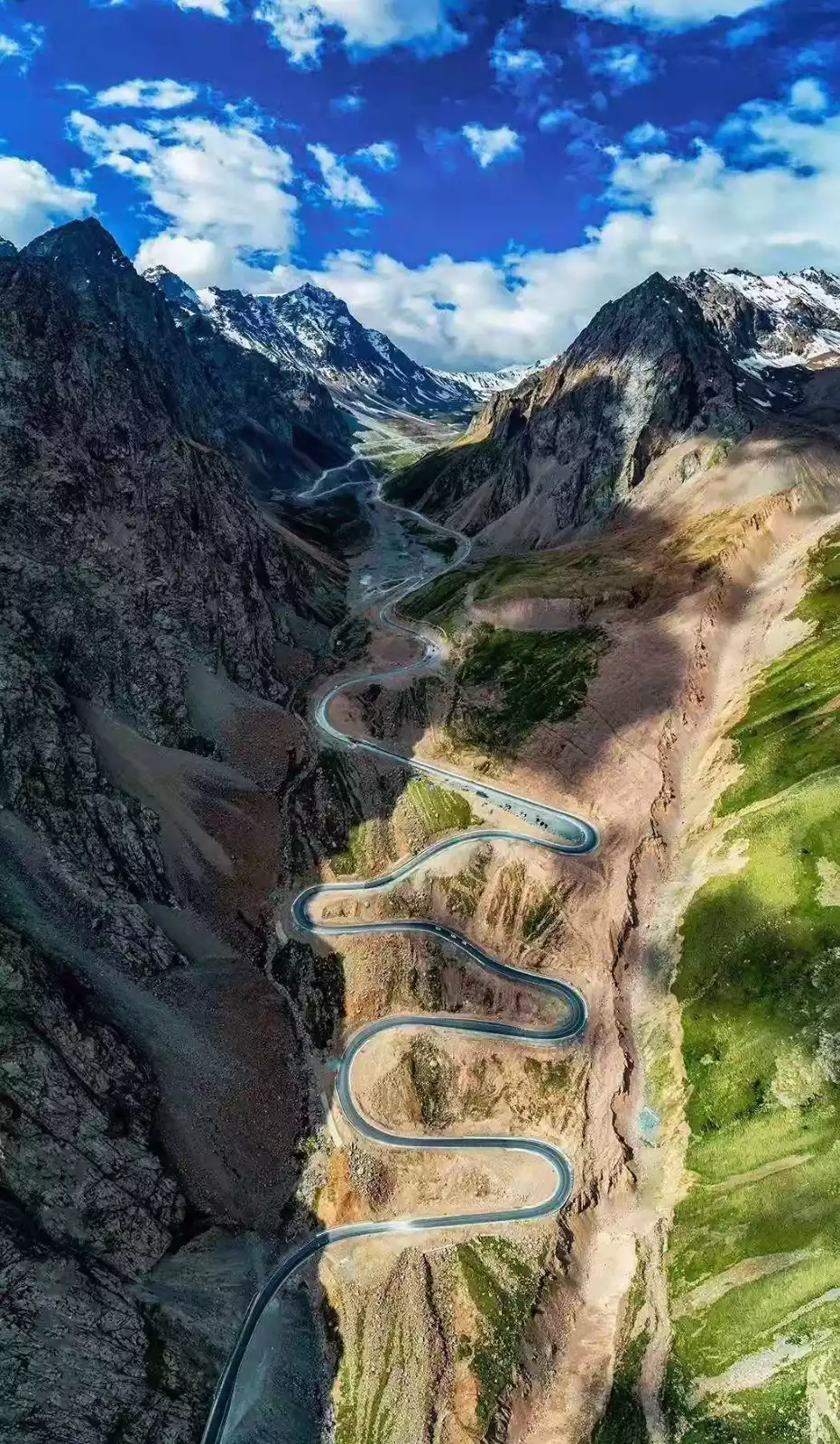
From Dushanzi City, take the Duku Highway to the starting point of the Mengkede Ancient Road, which connects southern Xinjiang and northern Xinjiang and crosses the Tianshan Mountains. Driving on the road, you will see blue sky and white clouds, quiet forests, and snow-covered and steep cliffs, which appear alternately. You can travel through four seasons in one day, and the weather is different every ten miles.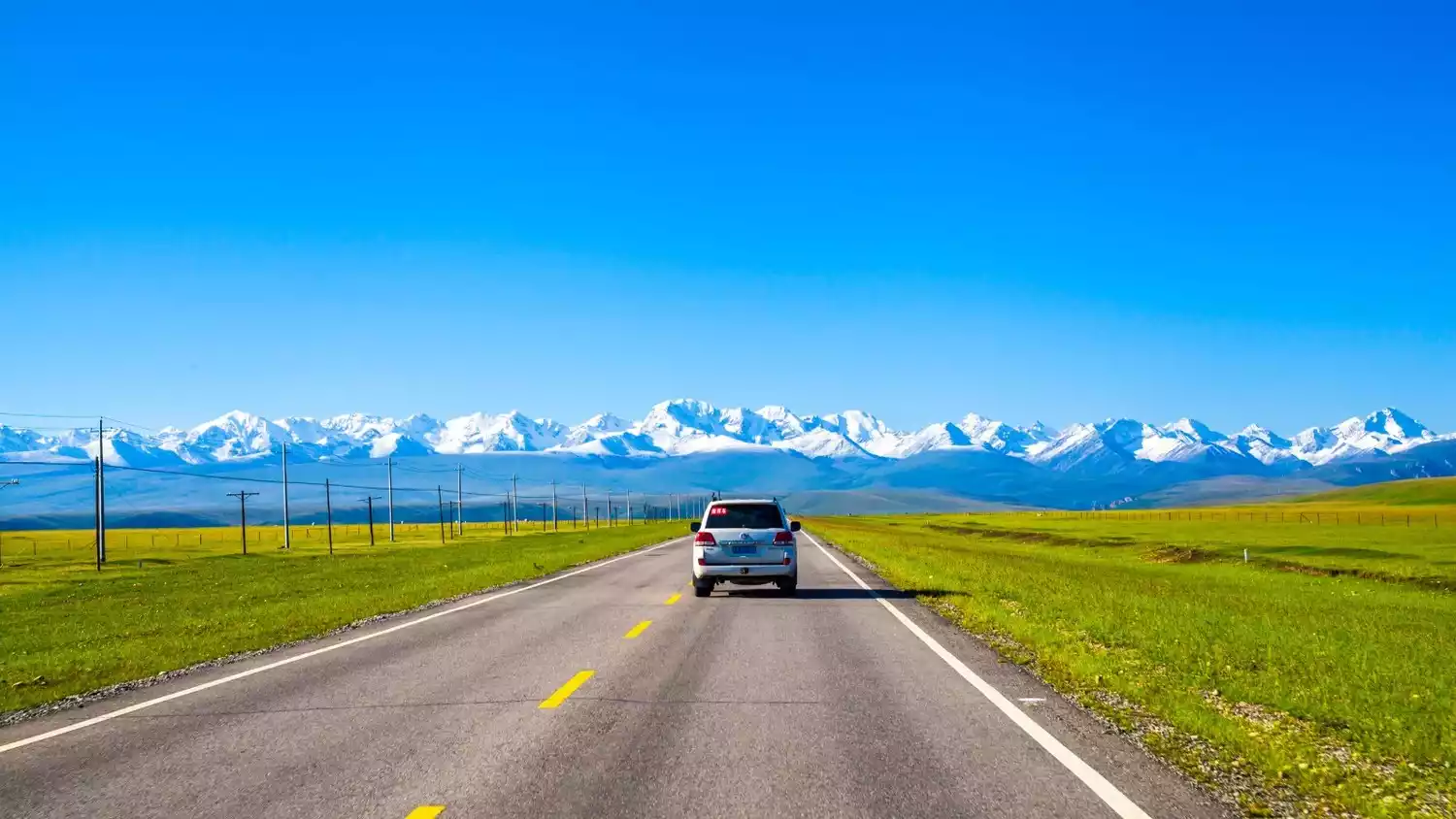
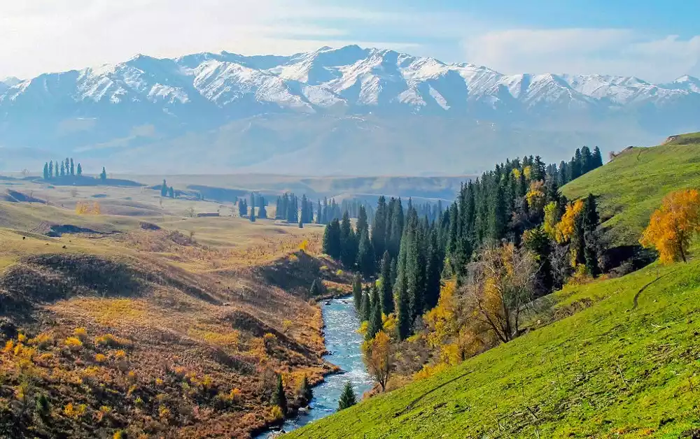
3. Lakes and rivers/Tianhu Lake and Kuitun River
The Kuitun River was formed by the melting of snow on the north side of the middle section of the Yilianhabierga Mountain. It has a large amount of water and turbulent waves. There are many huge rocks in the riverbed and a large number of poplars grow in the valley. In autumn, it is golden and contrasts with the lake and river water, creating an extremely magnificent scenery.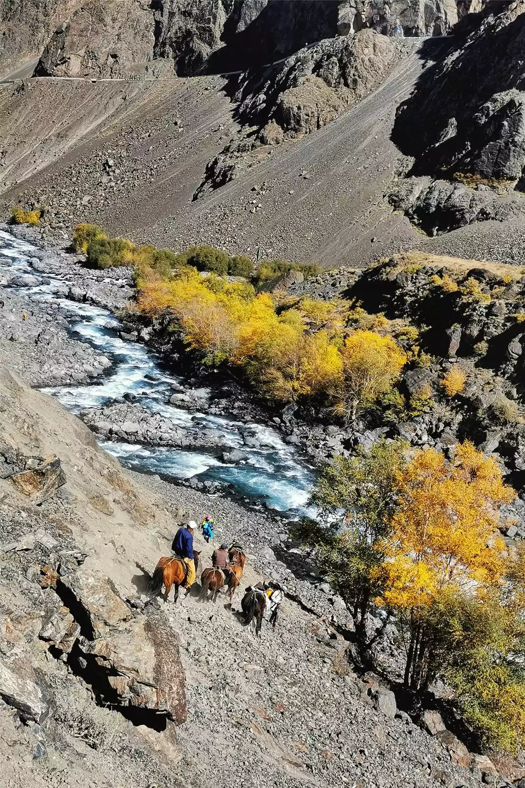
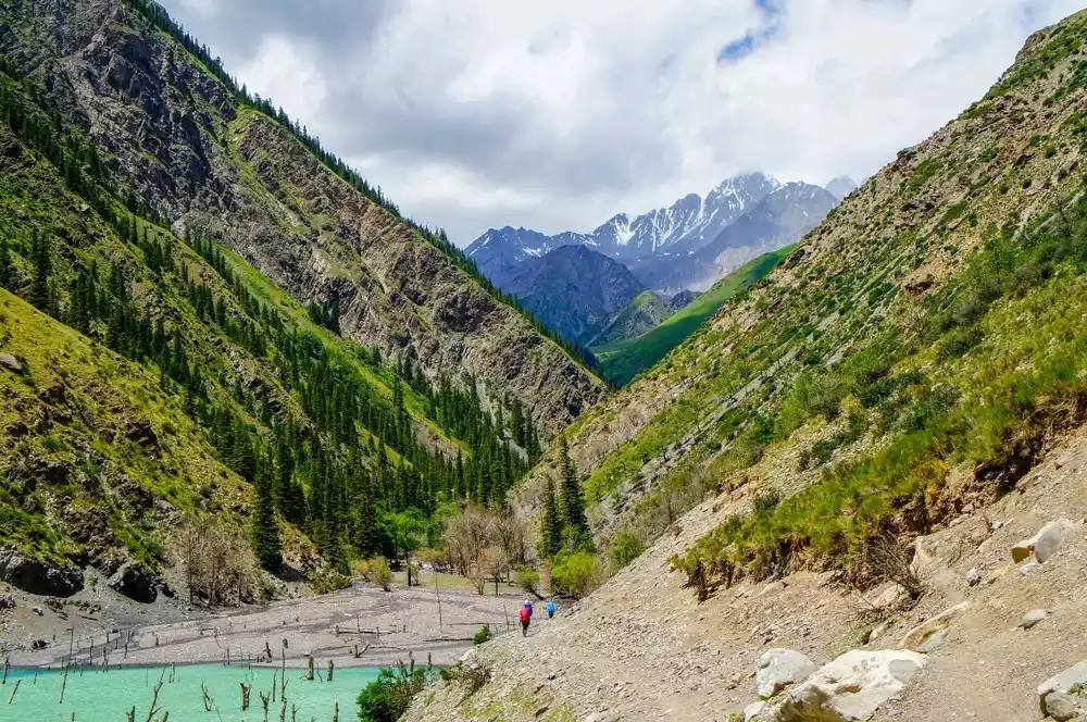
The entire Mengket Ancient Road passes through a narrow "V"-shaped river valley on the right side of the Kuitun River. There are clusters of wild willows on both sides of the river valley, interspersed with towering ancient trees such as poplars, red willows and saxaul. The dilapidated road is covered with large and small gravel and rotten wood.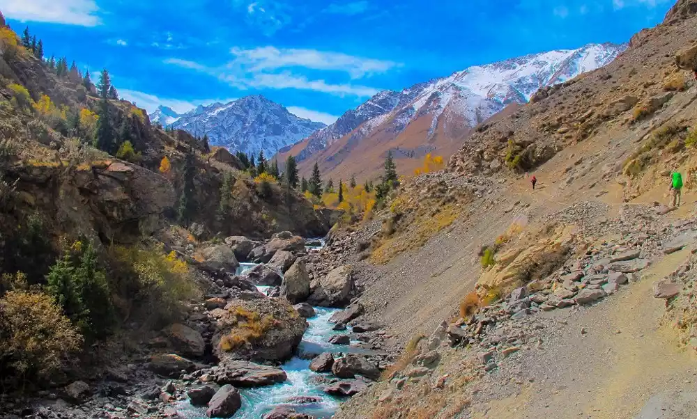
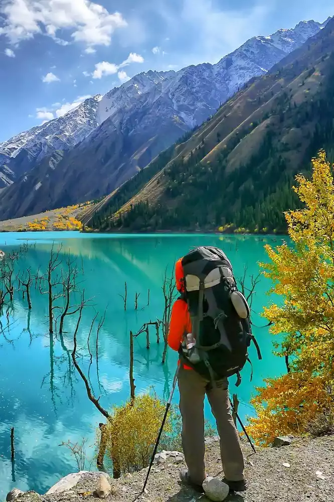
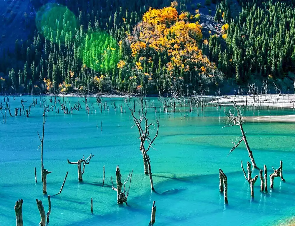
The most attractive part of this ancient road is Ulan Sadek Lake, also known as the "Heavenly Lake". It is a high mountain freshwater lake with an altitude of 600 meters higher than the world-famous Tianchi. It was formed more than 100 years ago by the accumulation of meltwater from snow-capped mountains flowing from the north to the south due to landslides and debris dams.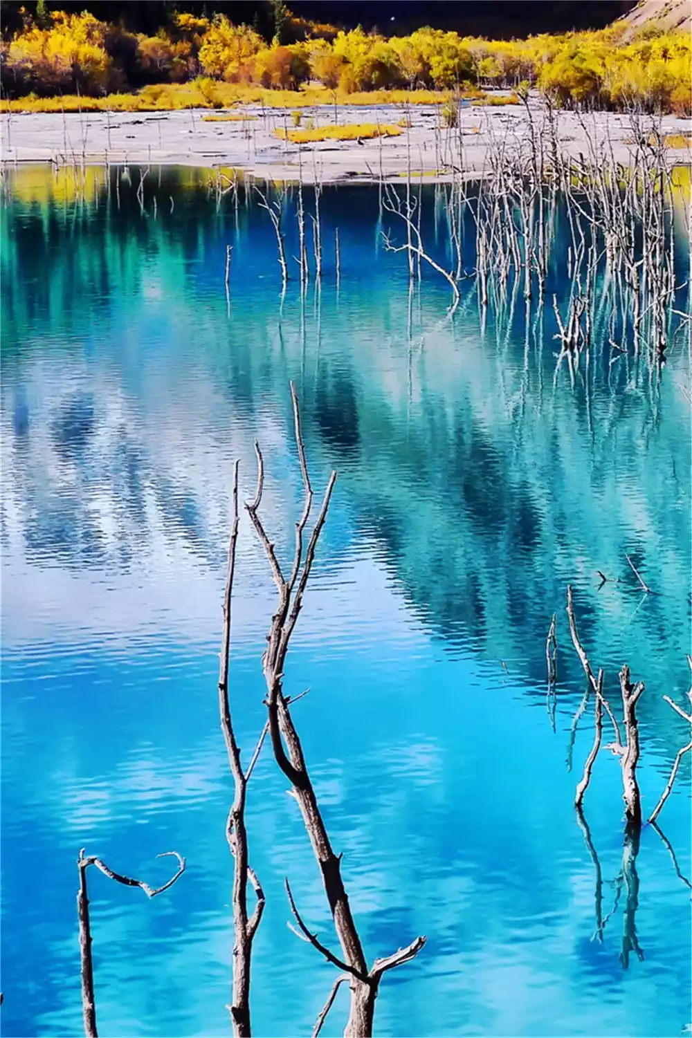
Tianhu Lake is a dreamy blue, like a giant emerald stone embedded in the valley. If you are patient, you can feel the slight changes in the color of the lake water. It changes color according to the intensity of sunlight. At one moment it looks milky green, and at another moment it seems to be deepened to emerald green by nature's "heavy strokes".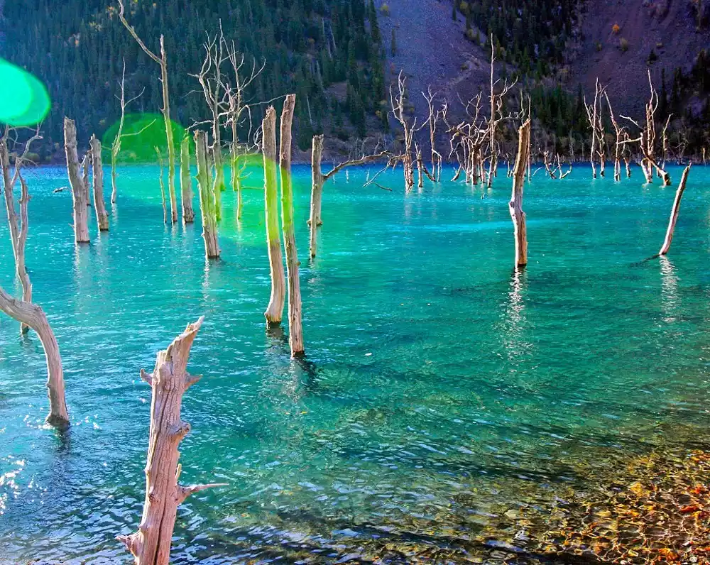
4. Grassland/Tangbula Grassland
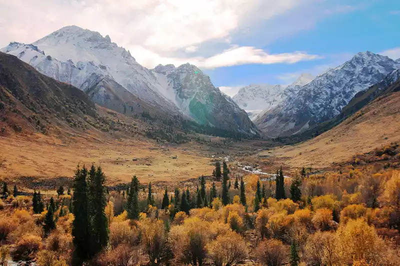
Tangbula, located in the eastern part of Nileke County, Ili Prefecture, Xinjiang, is a natural scenic area composed of forests and grasslands. Its main features are grasslands, hot springs, snow-capped peaks, and rivers. It comprises the Tangbula Grassland, Mengket Grassland, alpine lakes, and Gouxiong Valley.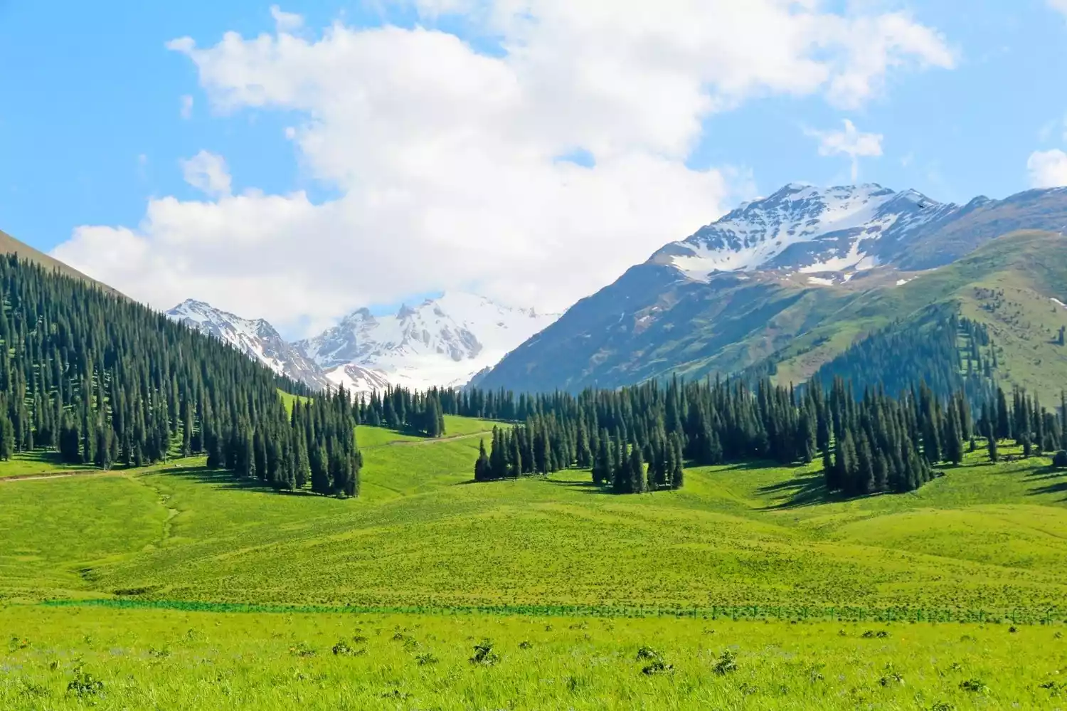
The vast mountain grasslands of the upper reaches of the Kashgar River are commonly referred to as the Tangbula Grassland, one of Yili's five most renowned grasslands. The Tangbula Grassland boasts 113 gullies, forming 113 scenic spots. The Kashgar River runs east-west, with towering mountains to the north and south, its diagonal streams frequently forming a wing-like shape. The scenery shifts with the water, creating numerous hidden valleys.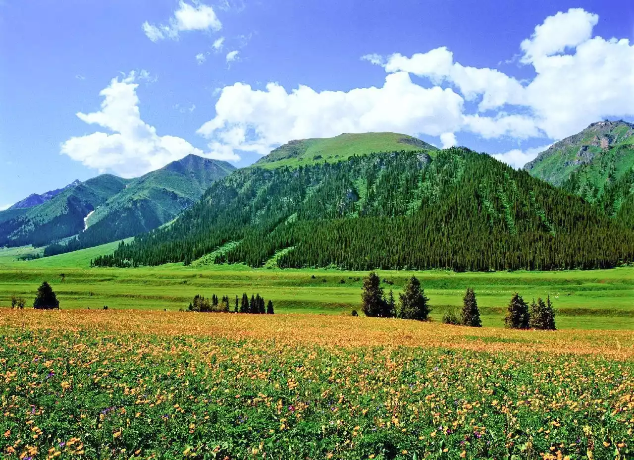
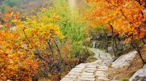
5. Trees/Poplar Forest
Wulan Sadek Valley is dotted with Populus tataricus forests, a unique plant found in the area and belonging to the Salicaceae family. While similar in appearance to the Populus euphratica, it's difficult to tell them apart. However, a closer look reveals Populus tataricus has slightly smaller leaves and prefers to grow close to waterways.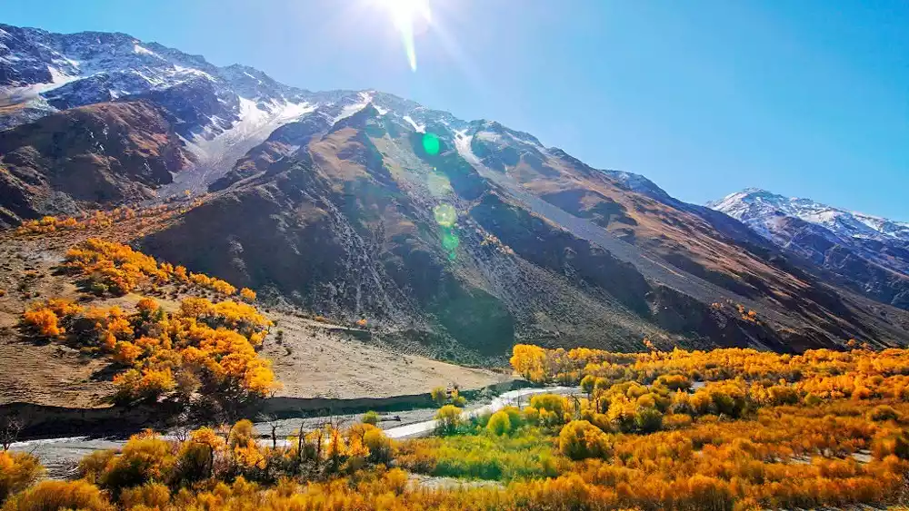
At the beginning of the hiking trip, you will pass through a poplar forest. The camp on the first day is also on a large piece of soft flat ground deep in the poplar forest. You sleep on the golden fallen leaves on the river bank. The starry sky at night is like broken diamonds inlaid in the sky.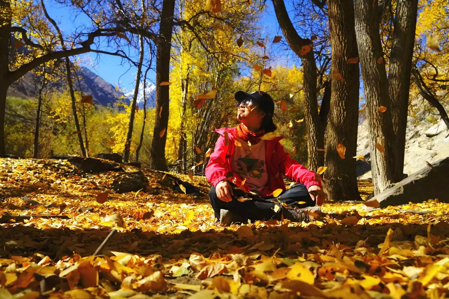
In Tianhu Lake, there are poplar stumps that have been washed away by time but still stand. Looking at their trunks, you can clearly feel the traces of time. These stumps are either alive or dead, but they are all firmly rooted in the lake, giving people a sense of desolate beauty. Against the backdrop of the surrounding environment, the viewers feel like they are in a fairyland.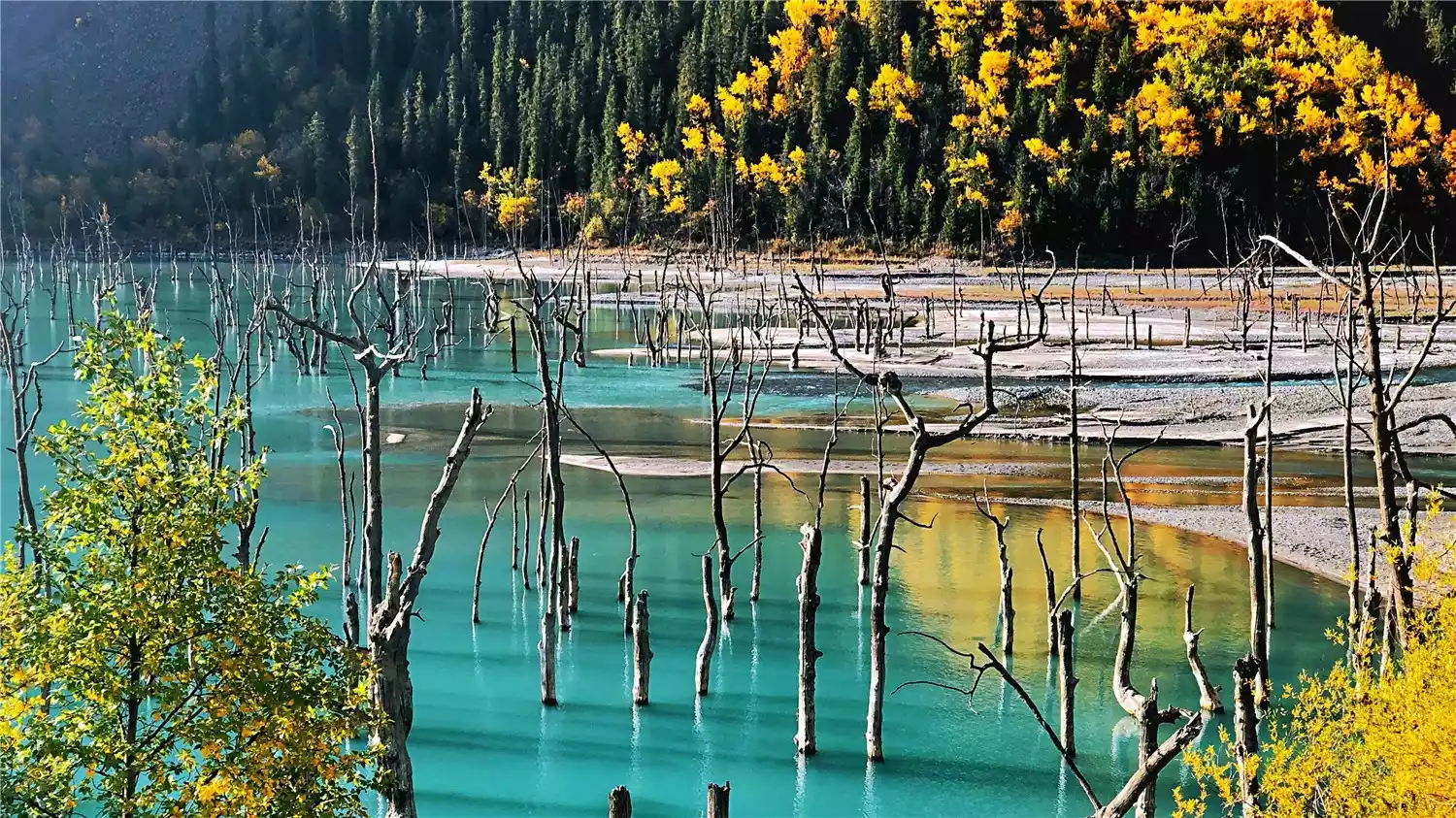
Route Details
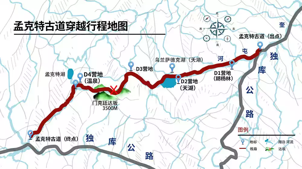
The itinerary is 7 days and 6 nights, with a 5-day hike of approximately 70 km
⭐Day 1
Around the World—Urumqi (★Assembly and Registration Day)
Located in the heart of Asia, Urumqi is world-renowned for its song and dance, fruits, gold, and jade. For a glimpse into Xinjiang's culture and history, the Xinjiang Museum is a top choice (free, entry only after 4:30 PM; closed on Mondays). For an exotic experience, the Erdaoqiao International Grand Bazaar showcases unique Western culture and a dazzling array of goods—you might find some great finds.
When in Urumqi, don't miss the delicious Xinjiang cuisine: the nationally renowned Dapanji (Big Plate Chicken), crispy grilled lamb chops, grilled lamb skewers, Yili horse intestines, and various specialty noodles. Sunset usually occurs at 10:00 PM in the summer, and Urumqi remains bustling at night. Explore the Grand Bazaar Night Market for a bite to eat.
⭐Day 2
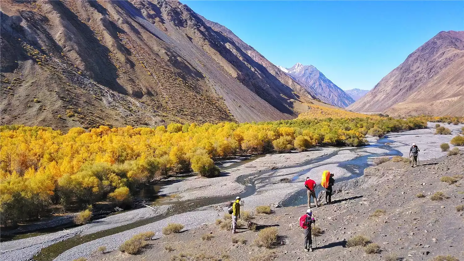
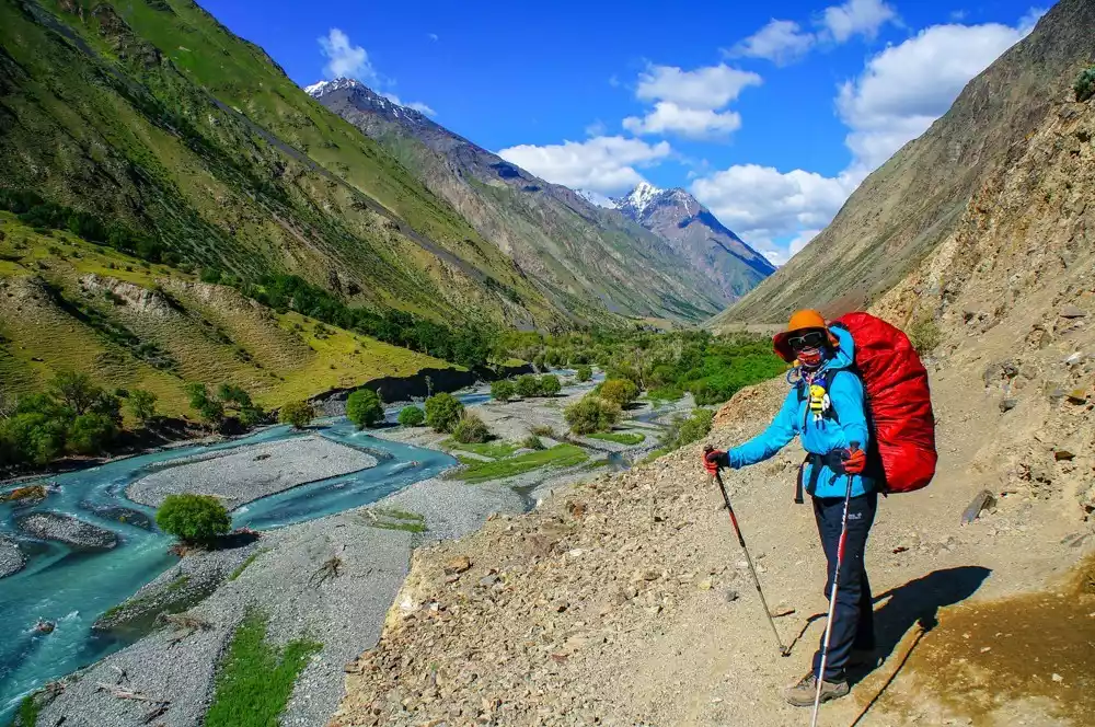
Urumqi Kuitun - Duku Highway - Ulan Sadek River Valley - Poplar Forest Camp (8km hike)
After breakfast, depart Urumqi by train or bus to Dushanzi City, then take the Duku Highway. Get off at K625 on the Duku Highway and begin your hike. The starting point is a platform about 50 meters above the Kuitun River valley. About 10 kilometers from Tianhu Lake, you'll find an open poplar forest, serving as your first campsite (2,150 meters above sea level).
⭐Day 3
Poplar Forest Campsite – Tianhu Lake (12km hike)
After breaking camp, continue upstream along the north bank of the Ulan Sadek Valley. It will take 4-5 hours to reach the east bank of Tianhu Lake. Continue along the north bank of Tianhu Lake for 500 meters to reach a larger tributary, which is also the west bank of Tianhu Lake. Today's camp is set up at Tianhu Lakeside Campground (2285 meters above sea level).
⭐Day 4
Tianhu Lake - Dongdesalaxia Ranch - Riverside Cabin (15km hike)
After getting up in the morning and resting, we set off at 12:00 PM. We walked about 4 kilometers out of the Ulan Sadek Valley and entered the Dongdesalaxia Pasture. Continuing along the north bank of the old National Highway 217 for another 8 kilometers, we came to a large triangular river valley. We crossed a small tributary to the west and set up camp (2768 meters above sea level).
⭐Day 5
Riverside cabin - Menketin Pass - River valley bend (18 km hike)
We set off early and climbed along the old National Highway 217 for about 5 kilometers to the beautiful Menketing Glacier. From there, we crossed the Menketing Pass (3,495 meters above sea level) and continued for about 10 kilometers to the confluence of two rivers. At the confluence, a large rock about 5-6 meters high marked our campsite for the day. There was also a hot spring under the bridge where the two rivers met, perfect for bathing. If you have enough time, head 2.5 kilometers northwest to see Mengkede Lake (2,800 meters above sea level). The lake is incredibly beautiful against the backdrop of the sunset. That night, we camped at the hot spring campsite (2,516 meters above sea level).
⭐Day 6
River valley bend - Mengkede River Valley - Provincial Highway 315 at the exit of the mountain - Nileke - Urumqi (17 km hike)
Continue along the old 217 and you will arrive at Provincial Highway 315 after 5 hours. There are herds of cattle, sheep and horses on the Tangbula grassland, with abundant water and grass. It is a natural pasture and the famous Tianshan Hundred Miles Gallery.
After arriving at the destination and meeting the pick-up vehicle, we took a bus to Nileke County to have a drink and chat. After dinner, we continued to drive to Nileke Railway Station to transfer to the train back to Urumqi.
⭐Day 7
Nileke - Urumqi - Various locations (★Event end date)
The train arrived at Urumqi Railway Station early in the morning, and our wonderful hiking trip to Mengked ended here.
Equipment List
Clothing: 1 set of windbreaker, 1 set of fleece, 1 down jacket (1 thin rib-type down jacket, 1 thick camp down jacket), 1 set of quick-drying underwear (no cotton underwear allowed), 2 sets of sweat-wicking underwear (change of clothes), high-top waterproof hiking boots, river trekking shoes (hard-toed rubber soles), at least 5 pairs of outdoor moisture-wicking socks (preferably high waterproof socks), sun hat, warm hat, sunglasses or snow goggles, gloves (1 pair of windproof and warm soft shell gloves, 1 pair of professional waterproof hiking gloves), flying scarf, 1 pair of simple crampons, snow glove
🍗Food: This itinerary includes all meals during the hike (the team members' meals are prepared by the team leader). You need to bring your own 1L thermos and personal tableware. Lunch is simple, so it is recommended to bring some snacks.
Accommodation: You must bring your own four-season tent, sleeping bag, moisture-proof mat (no inflatable mats), and headlamp (with a spare battery). (Tent rental is 140 yuan per tent, and moisture-proof mats are 70 yuan each. Quantities are limited, so please note this when registering. Fees are payable in advance.)
🏃♀️Travel: A waterproof backpack or pannier bag (approximately 60L) (for checked luggage for horses; no trolley cases allowed. Each person is limited to one pannier bag, with a maximum weight of 20kg), a small backpack (for warm clothing, raincoat, headlamp, water, and meals for the day), and a pair of trekking poles;
📃Important documents: ID card, a small amount of cash;
🛁Toiletries: sunscreen, garbage bags, toilet paper;
👉Digital products: cameras, mobile phones, batteries, power banks;
💊Common medicines: personal commonly used cold medicines, anti-inflammatory drugs, analgesics, gastrointestinal drugs, and anti-allergic drugs;
Sleeping bag temperature: July and August (0 degrees, 800g down sleeping bag)
Early June, September-October (-15 degrees, down sleeping bag over 1000g)
Conclusion
The Mengkede Ancient Road is just like a mayfly in the universe, a drop in the ocean to Xinjiang.
But this ancient trail is not difficult and is suitable for beginners to experience
Friends who want to see the beautiful scenery of Xinjiang but are worried about the intensity of the hike can rest assured to choose the Mengkede Ancient Trail
This entry-level Xinjiang hiking route will definitely not disappoint you