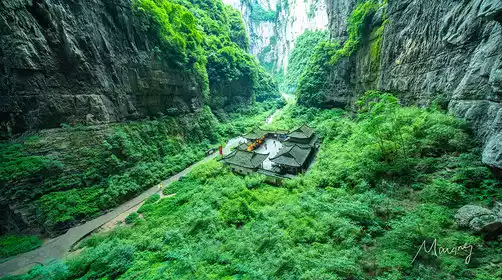
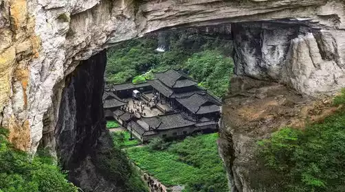
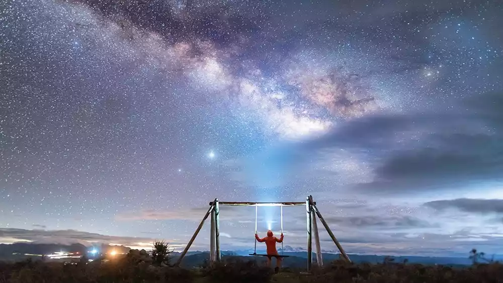
Avoid the crowds and share your camera's unique location in the snowy mountains to capture the most breathtaking beauty of the snowy region
Preface
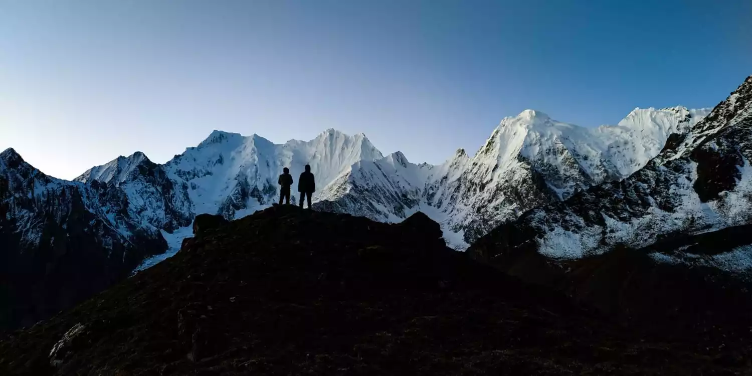
In recent years, people have carried out countless explorations around various snow-capped mountains. This is not only a thrilling journey, but also a way to record the magnificent faces of the snow-capped mountains from all angles. However, as many camera positions gradually come into people's field of vision, the colorful tents at the foot of the mountain, the crowds of people in front of the camera, and the labels of Internet celebrities have made the public camera positions increasingly crowded, which also makes the landscape photographers who come here feel helpless.
Today, avoid those popular flight locations and walk into the truly niche and unique snow mountain viewing platform to see the charm of the snow mountain!
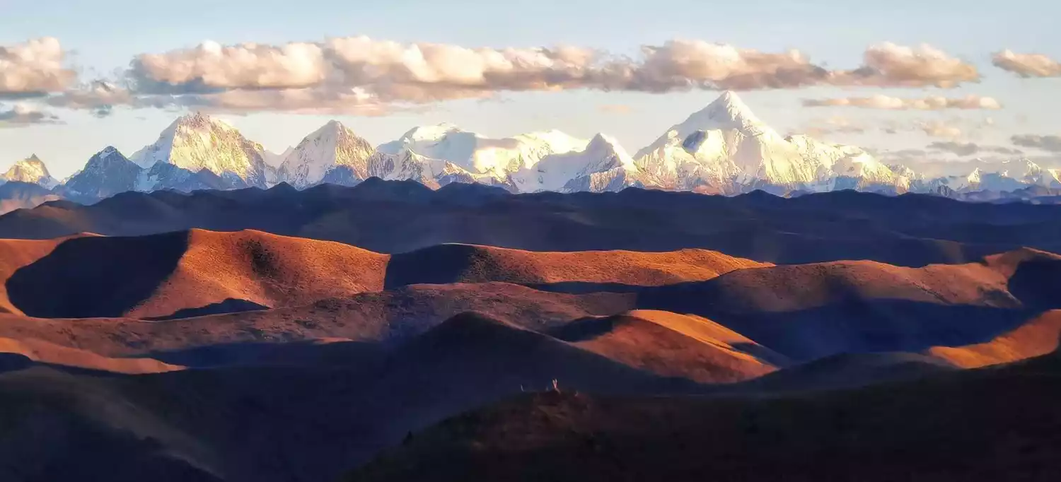
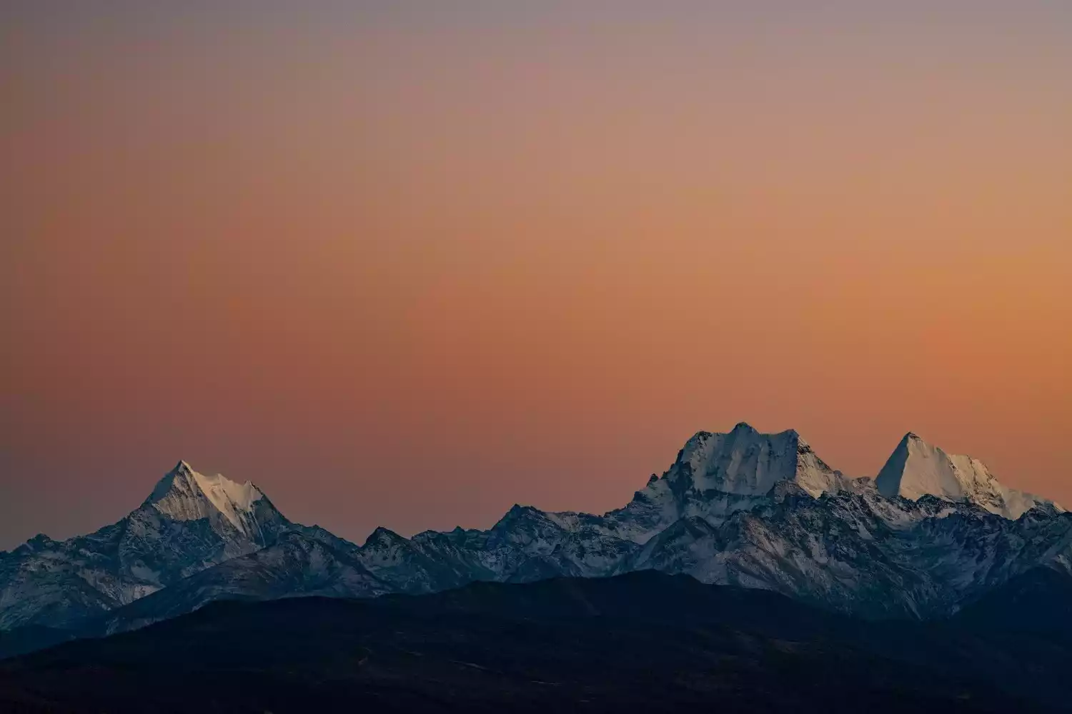
Gongga Snow Mountain
📍Location: Kangding City, Ganzi Tibetan Autonomous Prefecture, Sichuan Province
Mount Gongga, known as the "King of Sichuan Mountains," is the highest peak in the Hengduan Mountains and the highest in Sichuan Province. Surrounding the main peak, 145 peaks rising from 5,000 to 6,000 meters above sea level, form a majestic spectacle of a galaxy of stars surrounding the moon.
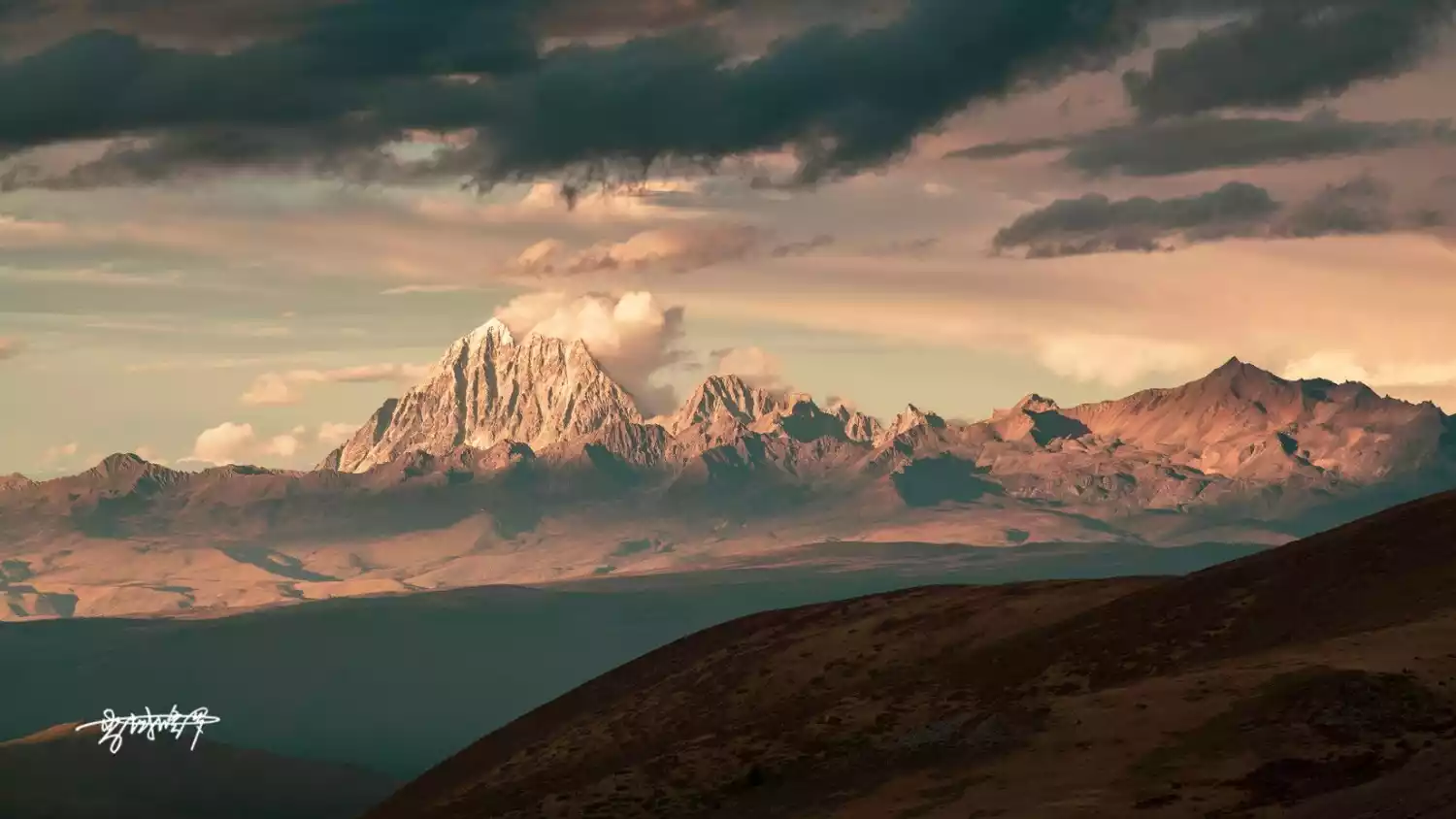
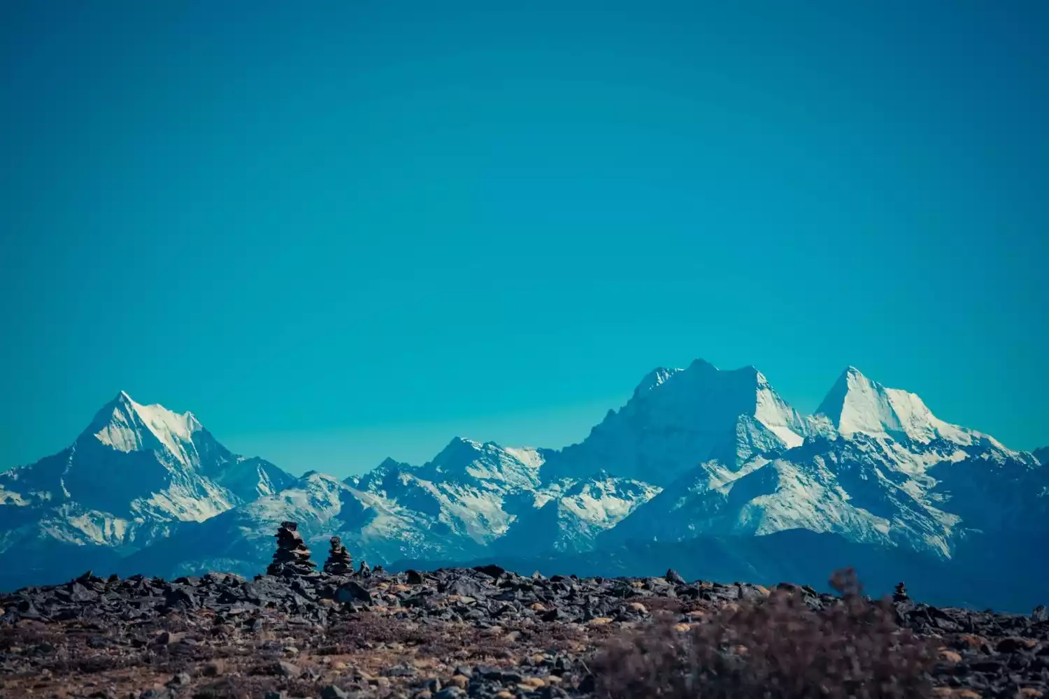
Qumogong
If you want to talk about the most comfortable camera position among the many camera positions around Gongga, Qumogong must be mentioned!
 No need to hike, just drive directly to the mountaintop viewing platform. With an unobstructed 360-degree view, you can lie on the lawn and see the Gongga Snow Mountain Range in front of you, and the holy Yala Snow Mountain in the distance.
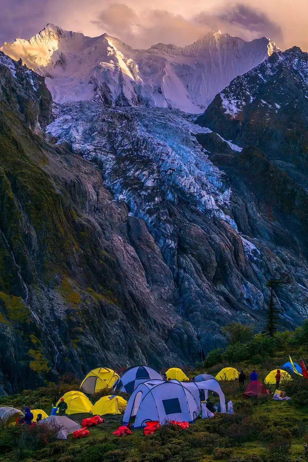
You might as well stay in the tent camp here. It has all the necessary facilities such as a convenience store, toilets, and even a slightly incongruous plateau KTV.
It turns out that landscape photography can be so relaxing.
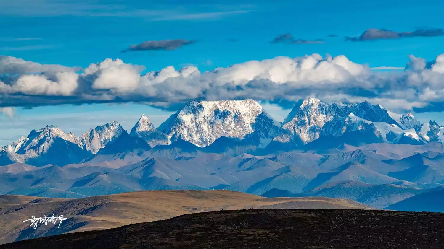
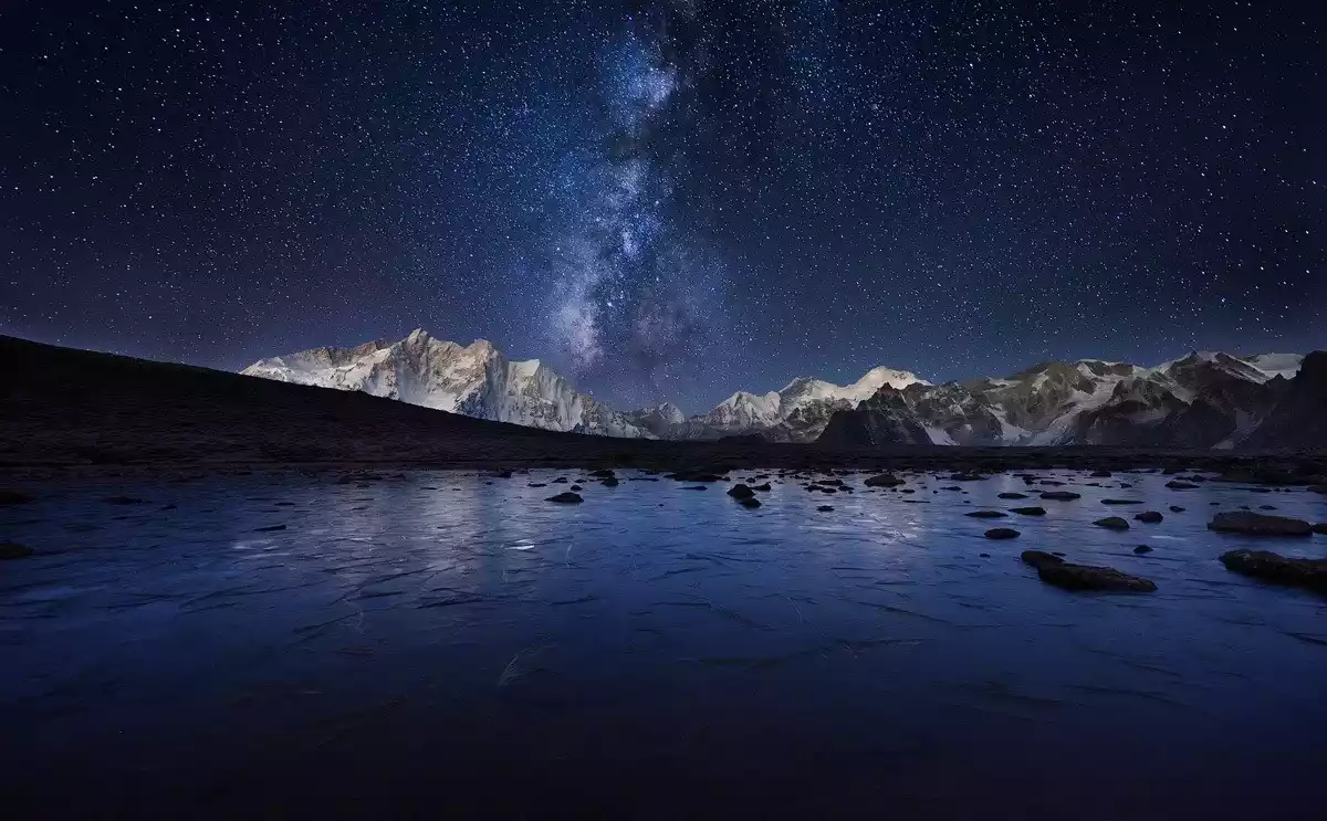
Guandejie Lake
The colorful tents by the lake, the crowds of people in front of the camera, and the label of internet celebrity have made Lengkacuo increasingly crowded, which has also made the landscape photographers who come here feel a little helpless.
Another undisturbed mirror of the sacred mountain began to come into the sight of photographers - Guandejie Lake, hidden deep in the heart of Hengduan.
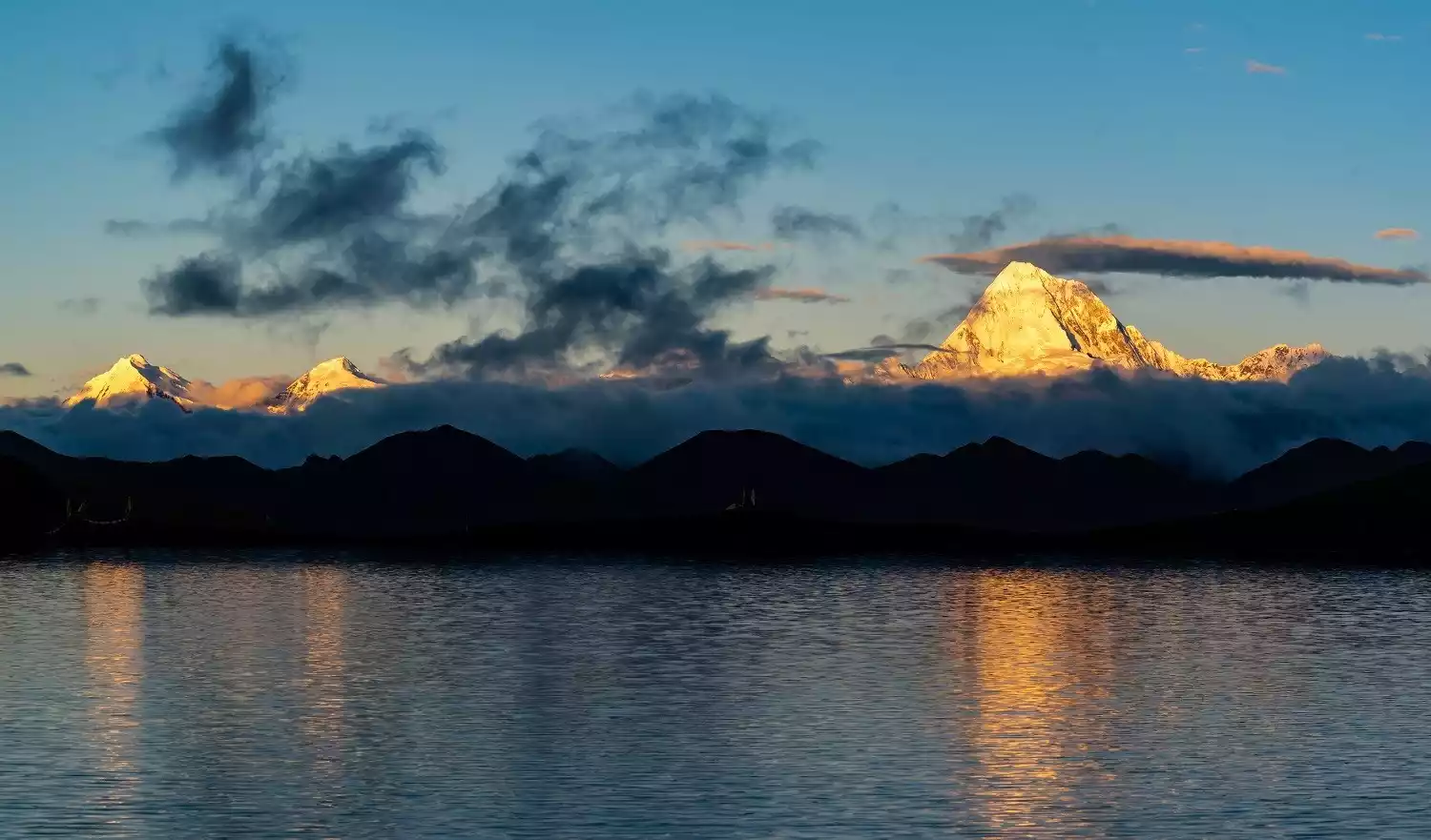
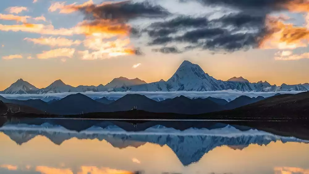
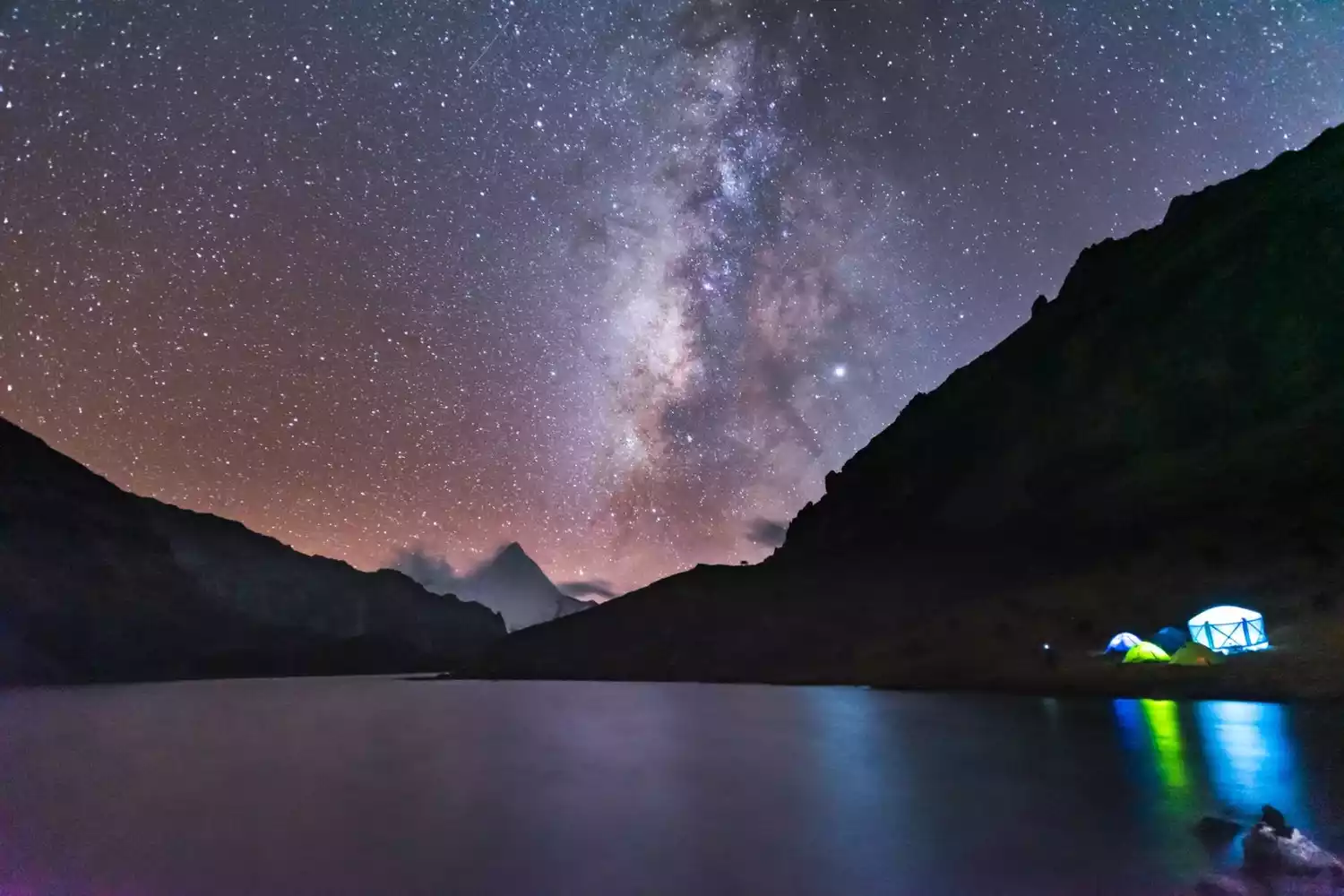
Gongga is reflected in the azure lake, and you can also camp here and wait for a magnificent starry sky.
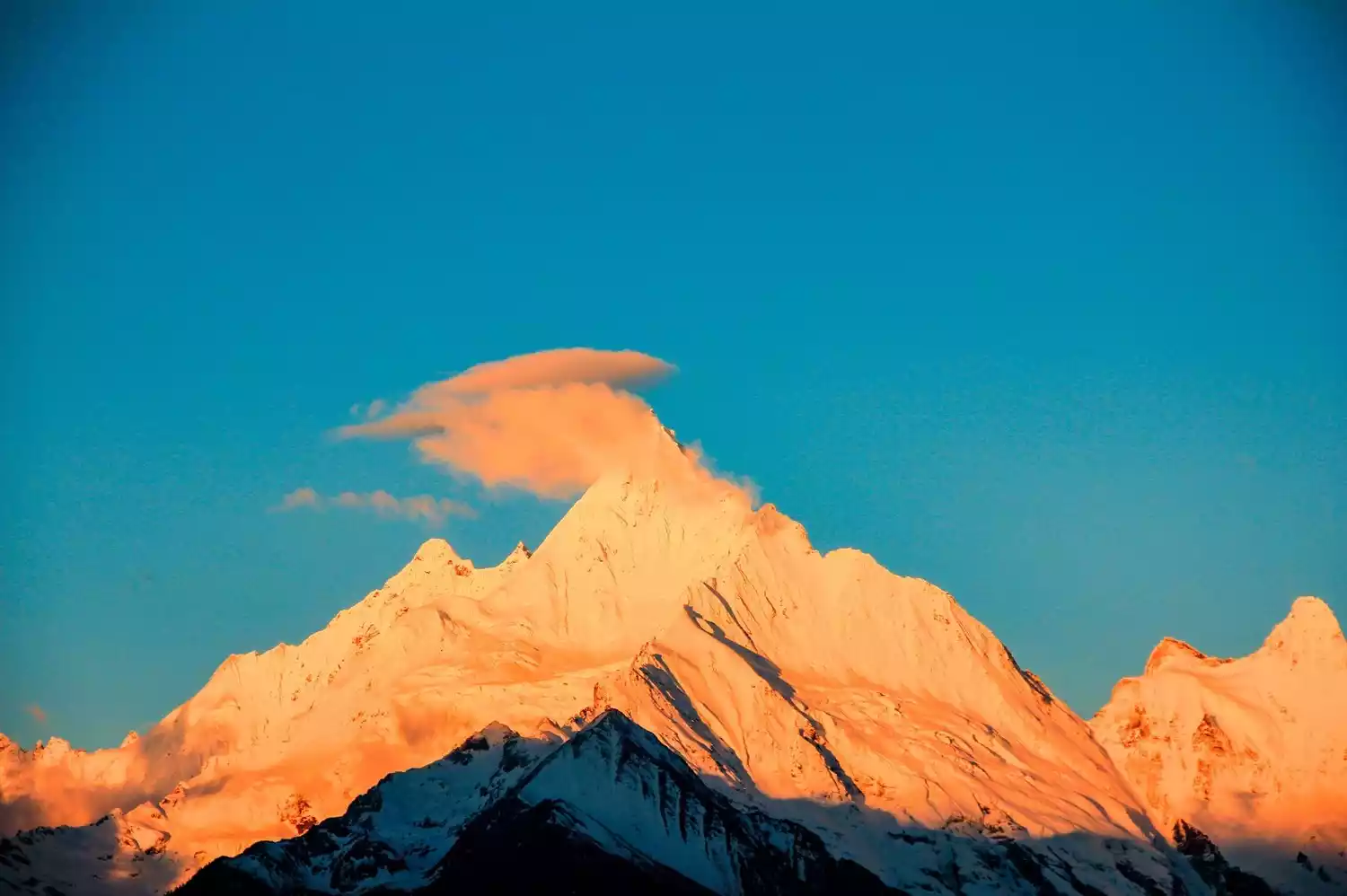
Kangding Airport
Instead of rushing past Zheduo Mountain, you might as well turn a corner and take a look at this plateau airport built on the basis of Mount Gongga.
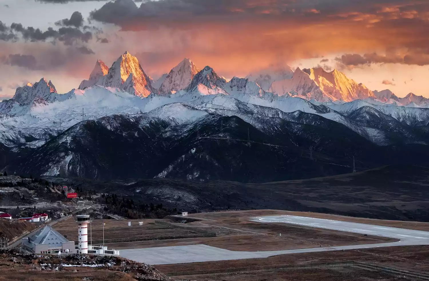
The majestic Gongga Snow Mountain, with the blue sky as its back, stands like a giant pyramid above this plateau airport, overlooking the land. You can also check the flight time, set up the telephoto lens, and wait for the moment when the plane flies over Gongga.
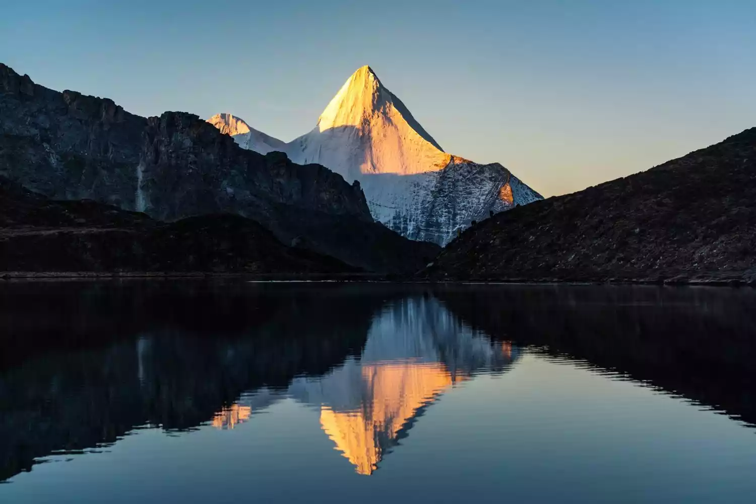
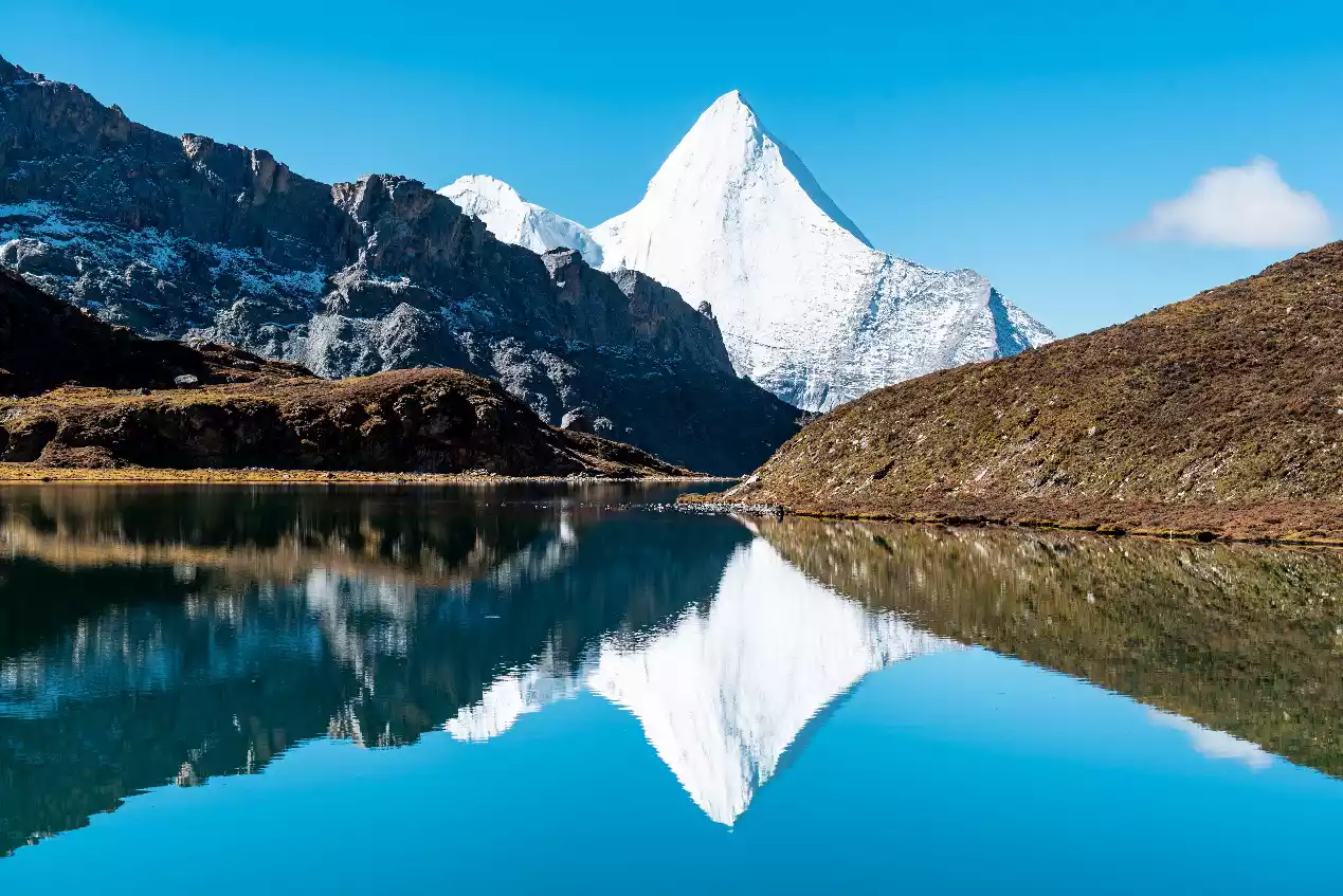
Three Sacred Mountains of Aden
📍Location: Daocheng County, Ganzi Prefecture, Sichuan Province
Xiannairi (6032m), Yangmaiyong (5958m) and Xianuoduoji (5958m) are three snow-capped peaks that are not far from each other and are spread out in the shape of a Chinese character "品", forming the Three Sacred Mountains of Aden. The snow above the mountainside does not melt all year round, which makes people yearn for it when looking at it from a distance.
The three snow-capped peaks reach the sky, and it seems like a different world when viewed from different angles. Shooting from a very niche camera position can better reflect the primitive mystery of this otherworldly place.
Black Mani
The three sacred mountains of Aden each have their own characteristics. If you want to take in the three snow-capped mountains at the same time, Heimani Pass must be the best choice.
This place is rarely visited and originally had no name. After our final search yielded no results, we named this secret place Black Mani Pass because we piled up four Mani piles of different sizes and shapes at the pass using the black stones scattered all over the mountain, leaving behind a secret footprint that belongs exclusively to China-TravelNote.
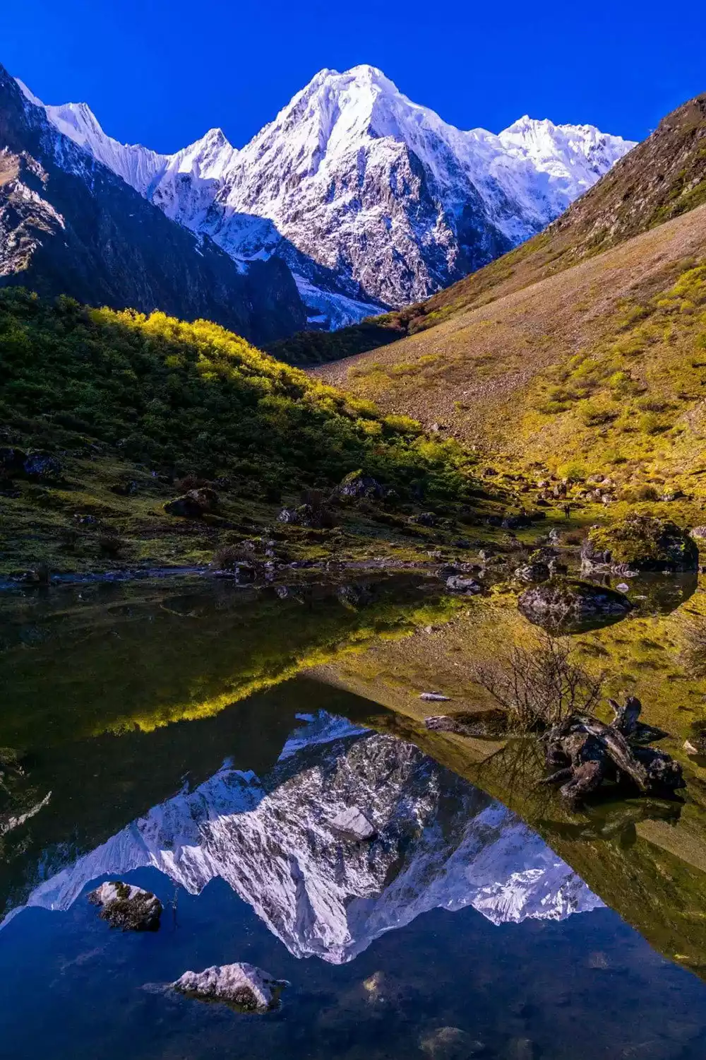
Boyongcuo
The surface of Boyongcuo Lake is in the shape of an 8. The water is crystal clear and faces the Yangmaiyong Snow Mountain. The light blue lake sparkles under the sunlight. If the weather is good, you can also take pictures of the clear reflection of the snow mountain.
Mount Kailash
📍Location: Northern Purang County, Ali Prefecture, Tibet Autonomous Region
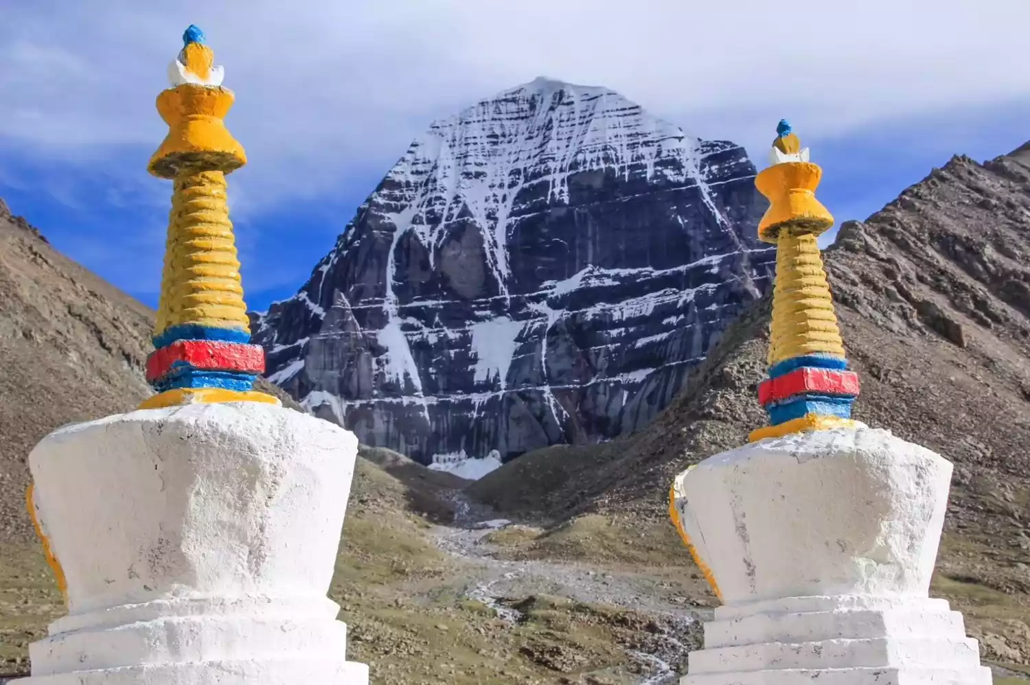
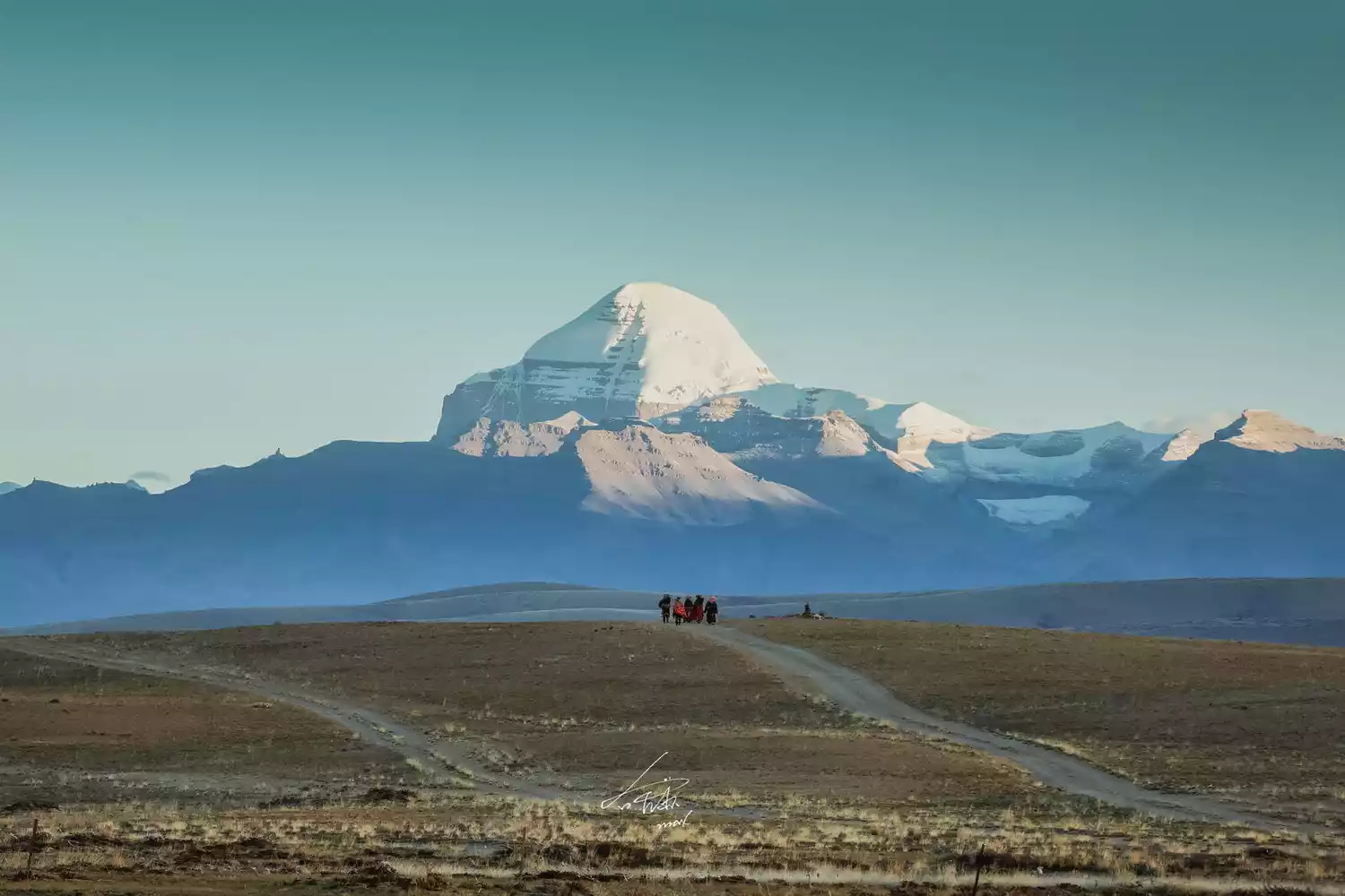 The beauty of Mount Kailash needs to be appreciated from different perspectives. Mount Kailash, meaning "mountain of the gods" in Tibetan, boasts a perpetually snow-covered landscape on its sunny side, while its shady side remains completely free of ice and snow, a truly remarkable aspect. Locals regularly circumambulate the mountain, and even hear the clatter of arhats on wooden boards in the sacred music palace at the summit. The circumambulations by tourists and believers, both domestic and international, are also a constant stream.
Northern Mount Kailash (Zheripu Monastery Camp)
When you pass by the Zheripu Monastery camp on the way to circumambulate the mountain, you will get the most stunning camera position to photograph the golden mountain in the sun. During the circumambulation season, as long as the weather is good, you can see the spectacular golden mountain in the north of the sacred mountain at sunrise.
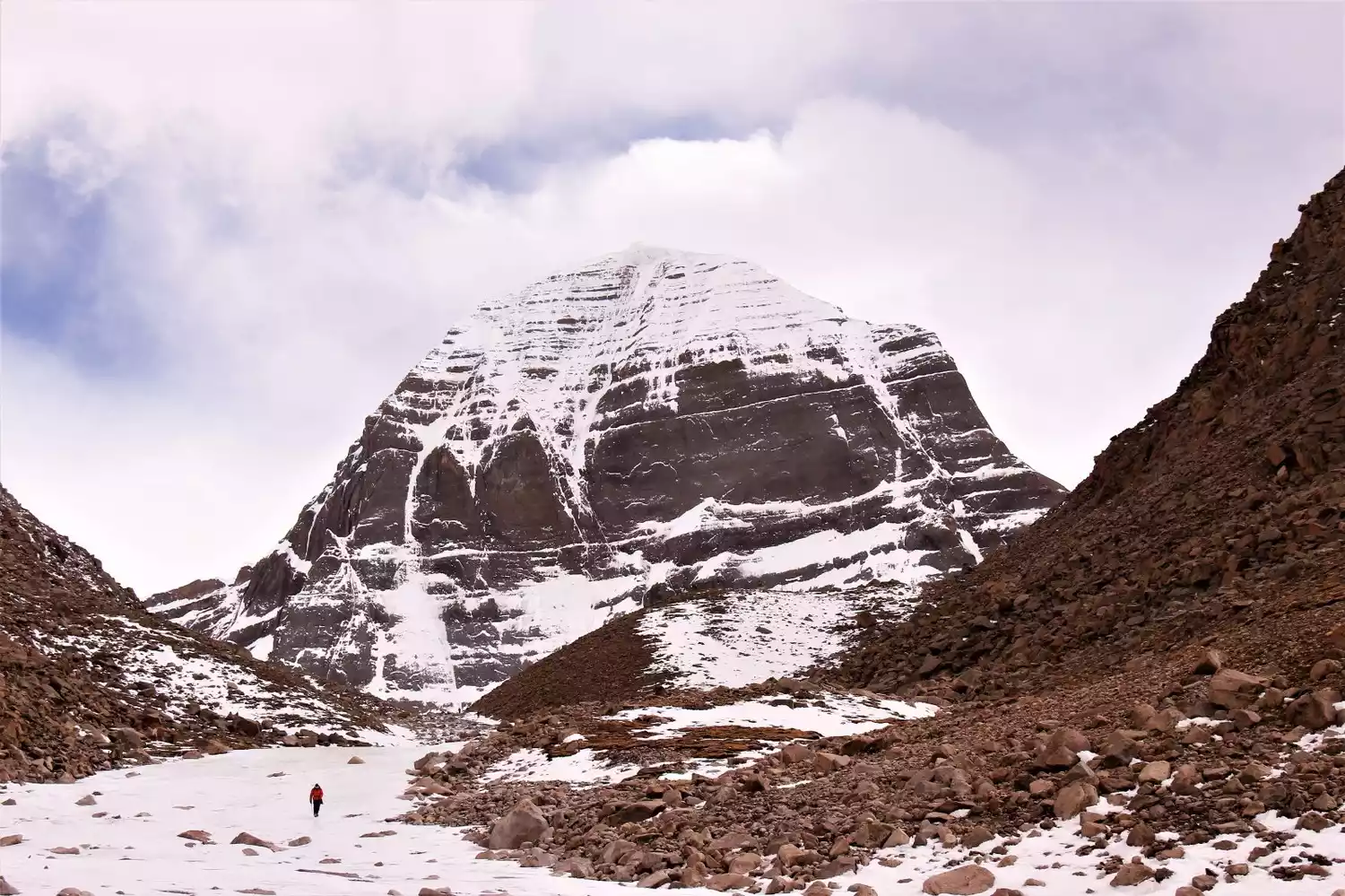
Since the north wall of Mount Kailash is slightly northeast, June and July are the best times to photograph the sunset. In other seasons, the area on the mountain wall where golden light can appear is not large and is far less magnificent than the sunrise.
Depart from Lhasa | 6~11 days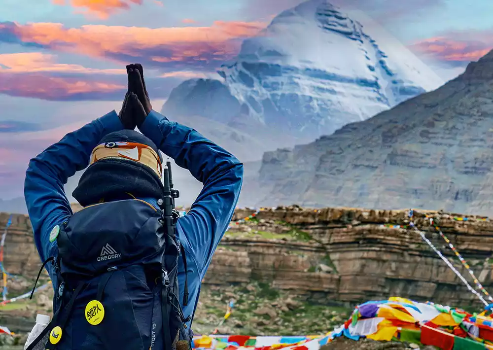
Mount Kailash: The Center of the World, 11-Day Circumambulation | A Himalayan Feast
¥7580 from 546 people have registered Register nowMount Everest
📍Geographical location: The northern part is located in Dingri County, Tibet Autonomous Region, the western slope is in Zhaxi Zong Township, Dingri County, the eastern slope is in Qudang Township, Dingri County, where the Everest Base Camp is located, and the southern part is in Nepal, where the Everest Base Camp is located.
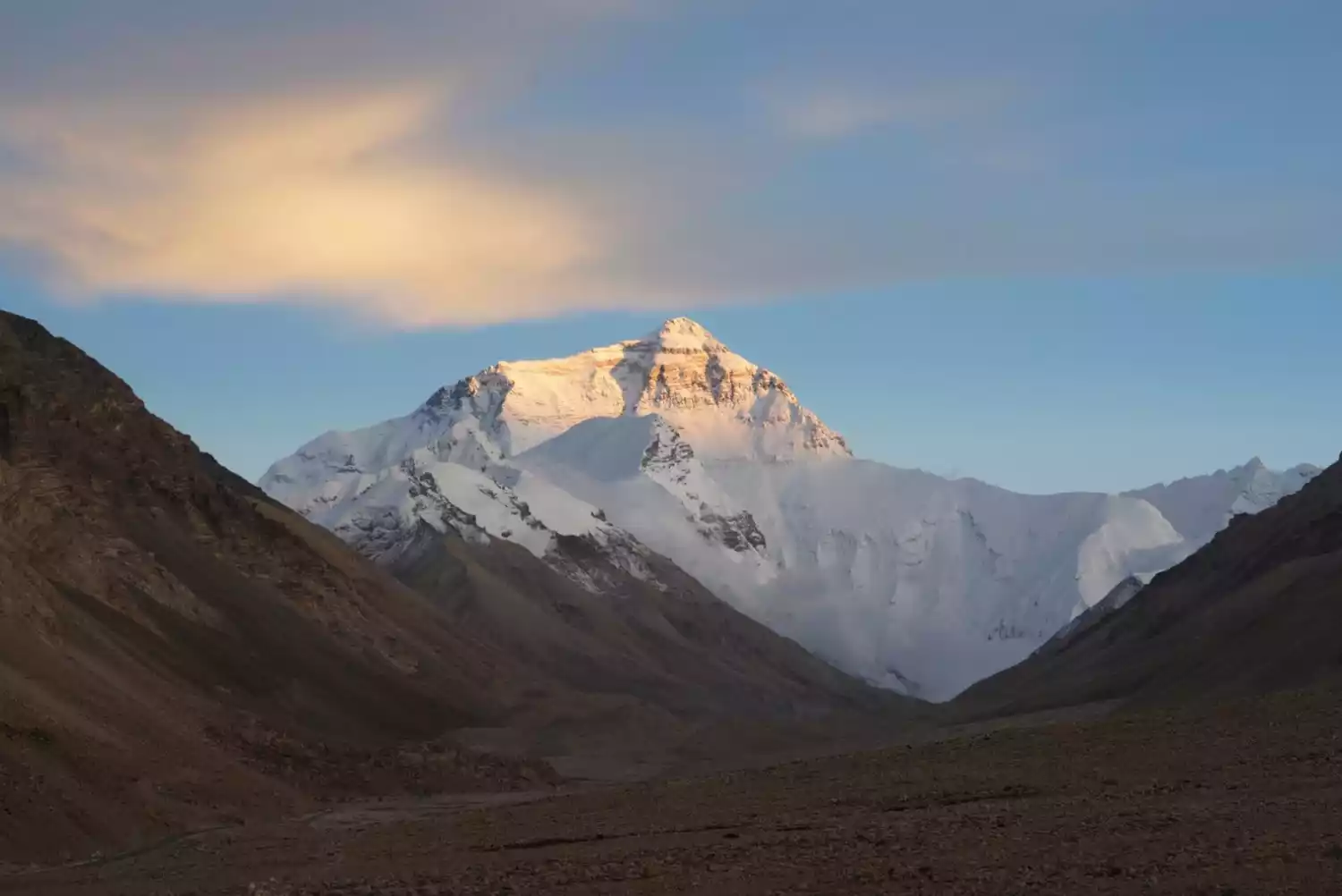
The world's highest peak is familiar to everyone. Too many people come to climb or take photos, trying to leave their own footprints on Mount Everest or leave the most beautiful images.
East slope of Mount Everest
The scenery along the eastern slopes of Mount Everest is like a dazzling display of stunning scenery. Passing through the Orchid Valley, Gama Valley, and Qiongzhuo Valley, the hike offers close-up views of the magnificent Himalayan peaks. The dazzling beauty of the three 8,000-meter peaks—Mt. Everest (8,844 meters), Lhotse (8,516 meters, fourth highest in the world), Makalu (8,463 meters, fifth highest), and Qomolangma (7,804 meters)—will unfold before your eyes, satisfying the endless thirst of photography enthusiasts.
Tangxiang Camp offers panoramic views of Mount Everest, Lhotse, and Mount Everest. The journey from Tangxiang Camp to Rega Camp is captivating. From Rega Camp, you can gaze upon the snow-capped mountains and the entire Himalayas, with clouds and mist swirling around the peaks creating an ethereal scene.
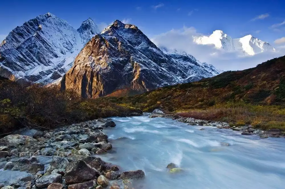
Meili Snow Mountain
📍Geographical location: Eastern part of Zayu County, Tibet Autonomous Region and western part of Deqin County, Yunnan Province
As the most sacred of the Eight Sacred Mountains in Tibet, Meili Snow Mountain inevitably evokes a sense of unfamiliarity and mystery. The renowned Golden Mountain in the Sunlight is a dream for countless enthusiasts. From the initial Meili Outer Circle and Yubeng Hiking Tour to the increasingly well-known Jiaying Village camera angle, countless explorations have taken place around Meili Snow Mountain, gradually bringing the sacred mountain's diverse face into view.
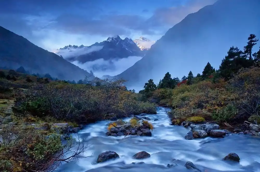
Meili North Slope
The northern slope of Meili refers to the northern peaks of the Meili Snow Mountain Group, rather than a single snow mountain. From east to west, it includes Lairigongka (6,300 meters), Naridingka (6,379 meters), Mangganglaka (6,040 meters), and Kawagebo II (6,509 meters).
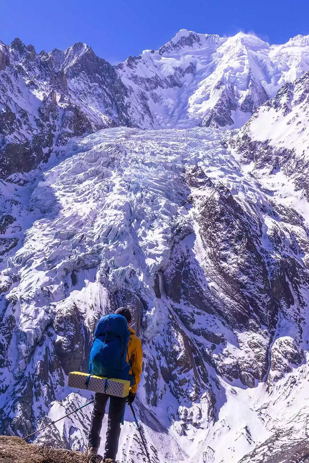
Walking in Meili, you can experience the truly uninhabited northern foothills of the Meili Snow Mountain. The northern slope of Meili, hidden deep in the foothills of the Himalayas, is even more secluded and secluded than the "hiker's paradise" Yubeng Village. Hiking in it, the huge light blue glacier belt stretches before your eyes, which is far more shocking and stunning than the Golden Mountain in the Sunlight.
Conclusion
Facing the snow-capped mountains, it feels like returning to the purest embrace of nature. The ice and snow here melt into water droplets hanging on the crystal glaciers penetrated by the sun, and the clear lakes reflect the silhouettes of the mountains, waiting for the snow to melt into small water droplets hanging on the branches.
And our journey to the snow-capped mountains will go to even more unknown distances.