Recommended hiking routes in Guangzhou city, with low difficulty and short distance, easy to complete even for beginners
Preface
If you don’t want to stay home on weekends, you can check out these classic hiking routes in downtown Guangzhou. You can relax outdoors without leaving the city, and the subway/bus are very convenient to get there!
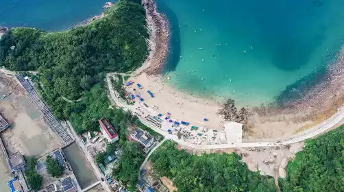
Liupianshan
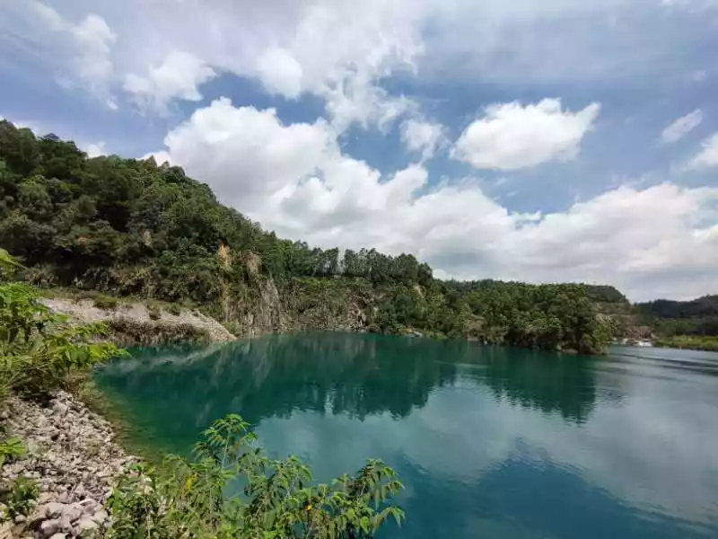
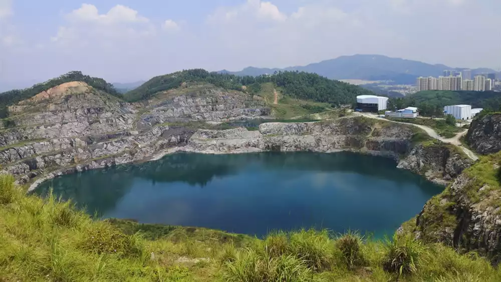
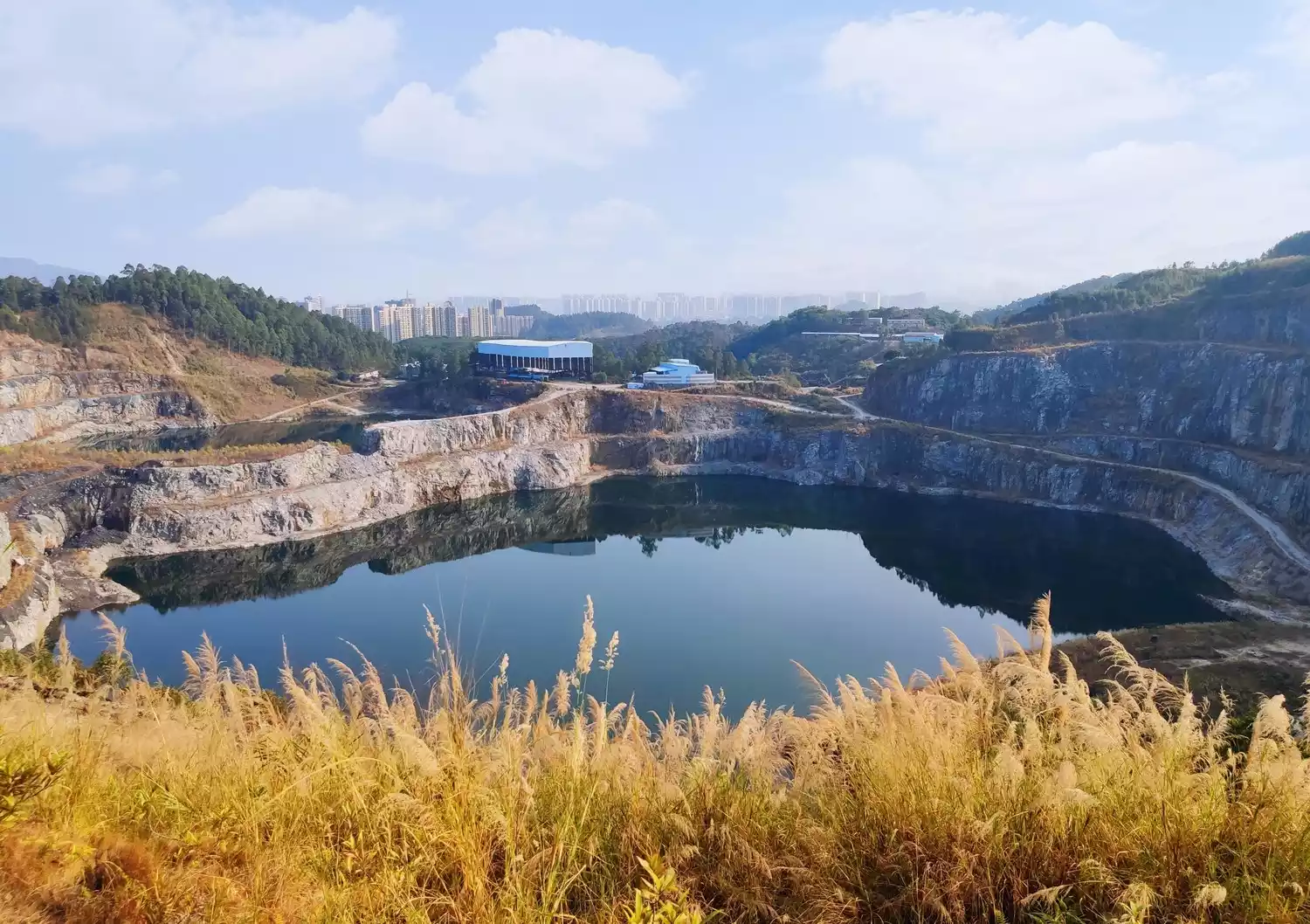
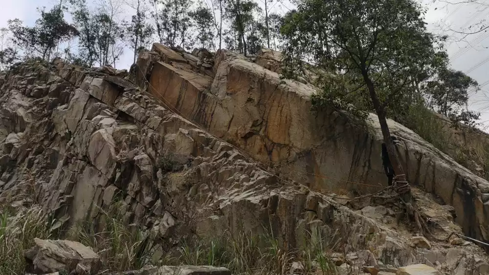
Liupian Mountain, located in Yongxing Village, Longgui Town, Baiyun District, is part of the Maofeng Mountain Range, bordered by Maofeng Mountain on the back and Baiyun Mountain on the south. The air here is incredibly fresh, creating a sense of being in a green paradise, devoid of any air pollution.
It was originally a quarry, so there are many beautiful pools of water left in the mountain. The unique Tianchi shooting spot on the top of the mountain has now become a new internet celebrity spot. The pool water is dozens of meters deep and as green as a gem.
Tips:
Starting point: Yongtai Metro Station Line 3
End point: Dongping Subway Station Line 14
Distance: 12 kilometers
Difficulty: ⭐⭐
No supplies along the way
Fire Phoenix Line
The "Huofeng Line", whose full name is "Huolu Mountain-Fenghuang Mountain Crossing Line", starts from the Huolu Mountain South Gate Bus Station and ends at the Yushatan Water Purification Station at the foot of Fenghuang Mountain. The entire journey is more than 10 kilometers, of which more than 90% is mountain roads and 10% is the highway connecting section between Huolu Mountain and Fenghuang Mountain.
The mountain roads in Huolu Mountain and Fenghuang Mountain are mostly composed of steps, yellow mud roads, and steep slopes. There are no winding mountain roads and no excessive tourism development. They are very original and suitable for first-time hikers.
 Tips:
Tips:
Starting point: Huaguan Road (Huolushan Forest Park) bus stop
End point: Yushatan Bus Station (Yudong Road)
Distance: 11 kilometers
Difficulty: ⭐⭐
Supplies along the way
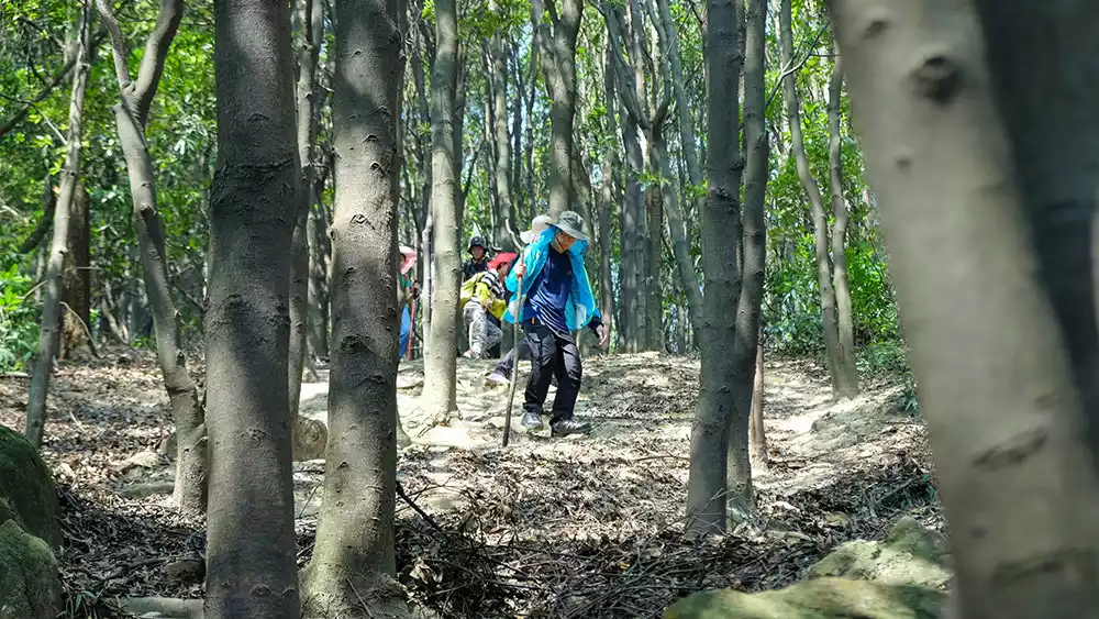
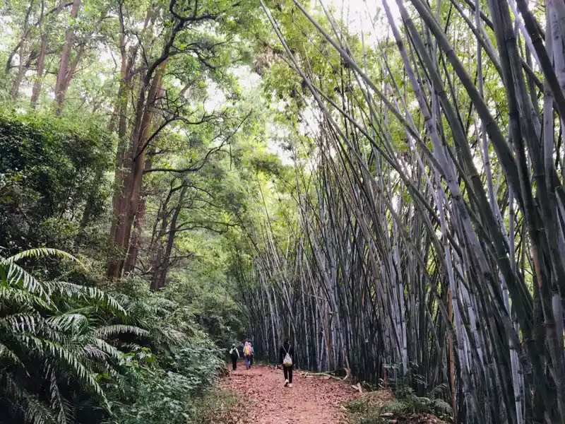
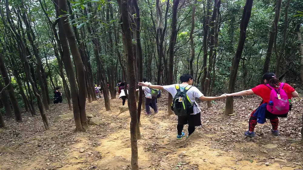
Oxwood Line
The Niumunei Line refers specifically to a training route from Niutou Mountain to the Muqiang Reservoir Dam, which has many changes in scenery and moderate intensity.
The entire route is approximately 15 kilometers, and the hike takes 5-7 hours. It passes through streams, bamboo forests, rocky slopes, secluded valleys, etc. It is an excellent weekend training ground for beginner hikers. Come and awaken the beast in your heart!
Tips:
Starting point: Tianlu Community Bus Stop (nearby subway station: Huangpi Station, Line 6; for directions, navigate to "Tianlu Community - Bus Stop")
End point: Changping Station
Distance: 15 kilometers
Difficulty: ⭐⭐⭐
Supplies along the way
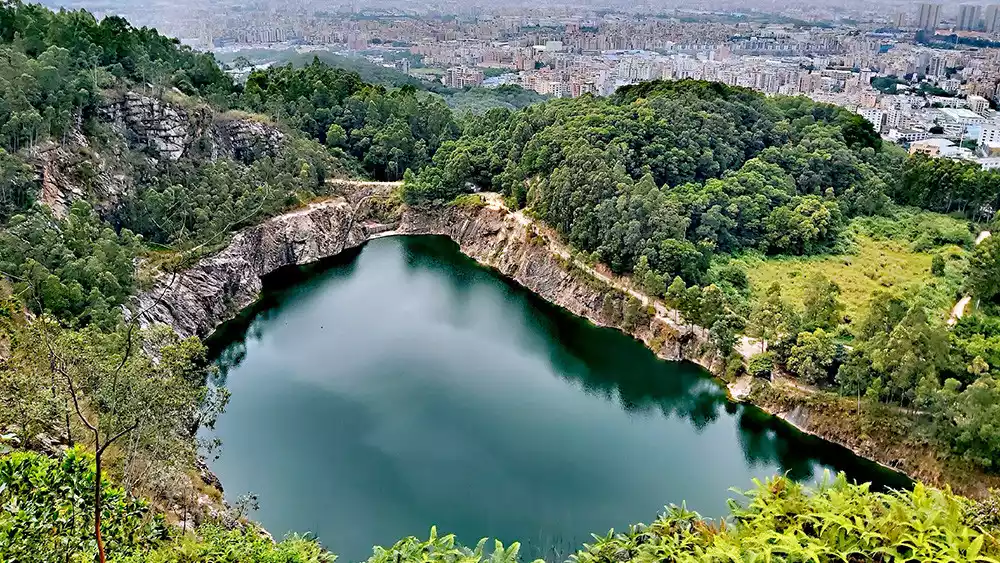
Youma Tiankeng
Youmashan Tianchi is Guangzhou's second teardrop after Liupianshan. Hiking trails are rarely seen, hidden in the pristine forests of Huangpu District. It's a rare find, yet incredibly beautiful. While this place remains undeveloped, why not check it out and take some time to capture the moment?
Tips:
Starting point: Jinkeng Subway Station Exit B
End point: Huafeng Temple Bus Station
Distance: 12 kilometers
Difficulty: ⭐⭐Half
No supplies midway
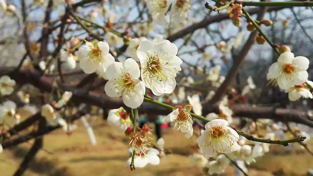
Luofeng Line
"The plum blossoms in Lingnan look like snow, and the fragrant snow on Luogang reflects the morning sun." This famous line from Mr. Guo Moruo is about one of the "Eight Scenic Spots of Guangzhou" - the fragrant snow on Luogang.
Guangzhou's Luogang Xiangxue Park, thanks to its unique natural conditions, often sees plum blossoms bloom twice, their blossoms resembling snow. The park boasts rippling lakes, plank paths winding through the mountains, towering ancient trees, stunning mountains, and magnificent cultural relics. Each scene is a delight to linger in, and a hike around the park is a great weekend getaway.
Tips:
Starting point: Yangcheng 1st Road Bus Station (Take Metro Line 6 to Xiangxue Station, transfer to Bus No. 391, and get off at Yangcheng 1st Road Bus Station)
End point: Luogang Xiangxue Park
Distance: 10 kilometers
Difficulty: ⭐⭐
No supplies midway
Dragon Fishing Line
The Longyu Line is a hiking route in Guangzhou that is very suitable for beginners. It is leisurely and does not require much physical effort.
The starting point is Longdong Main Station (Longhua Villa), along the ridge forest trail past the radar station and Shaoma Mountain, walk along the ridge line through Shaojiwo Reservoir to Yudong Road. The scenery along the way is nice, and most of the time you walk on the forest path.
Tips:
Starting point: Longyan Cave Forest Park Station
End point: Yudong Road Bus Station
Distance: 11 kilometers
Difficulty: ⭐⭐
No supplies midway
Night climbing white
Baiyun Mountain, one of the most famous mountains in southern Guangdong, has long been known as "Yangcheng's most beautiful sight." For a nighttime hike, bring your flashlight and explore the scenic area's mature concrete steps and dirt roads.
Not only can you experience a completely different feeling from daytime hiking, but you can also reach the top to see the unique and dazzling night view. Let's do a night hike together!!!

Tips:
Starting point: Tonghe Subway Station Exit C
End point: Meihuayuan Subway Station
Distance: 5 kilometers
Difficulty: ⭐
Supplies along the way