Hong Kong MacLehose Trail Hiking Guide | Nature is my own private haven, where I can be a kid again!
Preface
All the departures are natural, writing the final footnote for the shining moments you want to have - coastline hiking, green trees and beaches, sunshine and waves.
The joy of pre-departure permeates every step of the preparation process: packing, compiling travel guides, and every lively discussion. Who could have imagined it? My first trip to Hong Kong was a 50km climb. Traveling is like solving a puzzle, understanding different slices of the city from different perspectives.
If you want it, go get it! That's the coolest thing, even if it's slow, it doesn't matter
About MacLehose Trail
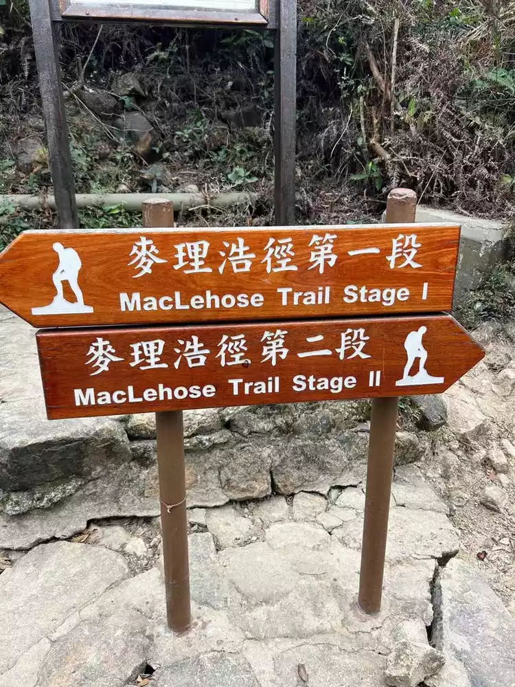
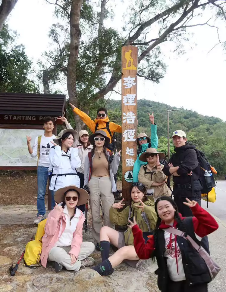
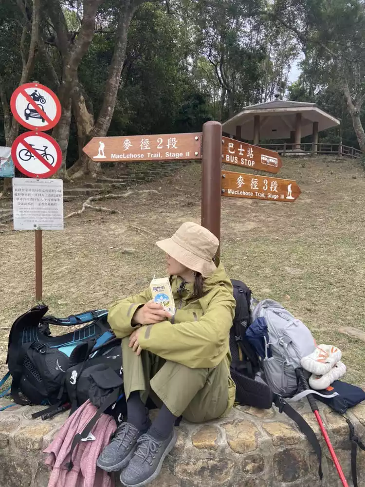
The MacLehose Trail, opened on October 26, 1979, stretches 100 kilometers. Starting in Pak Tam Chung, Sai Kung, it skirts the High Island Reservoir, traversing the New Territories from east to west, ending in Tuen Mun. The trail is divided into ten sections. Signage is plentiful, with signs every 500 meters, so getting lost is a breeze.
MacLehose Trailcheck the details
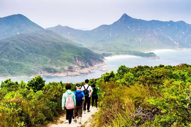
Hong Kong's first and longest hiking trail, it was recently named one of the world's best hiking trails by the National Geographic Society. Opened on October 26, 1979, the 100-kilometer route begins at Pak Tam Chung in Sai Kung, bypasses the High Island Reservoir, and traverses the New Territories from east to west, ending in Tuen Mun. It is divided into ten sections. Signposts are located along the route, with check-in points and rest areas at each section. This section reverses the route and crosses two sections of the MacLehose Trail, offering the most scenic views of the ten sections. Signposts are located along the route, with check-in points and rest areas at each section. The MacLehose Trail crosses eight of Hong Kong's 24 country parks, traversing over twenty peaks along the way, including the 420-meter Niu Er Shi Shan, the 702-meter Ma On Shan, the 649-meter Grass Hill, and the 957-meter Tai Mo Shan. The scenery along the way is different. Whether it is mountains, shores, jungles, or streams, they are all breathtakingly beautiful, especially the second section, which is half mountain view and half sea view, which is very playable.
Recommended months: October to April
4289 recommendations, 3905 visits
The MacLehose Trail spans eight of Hong Kong's 24 country parks, climbing over twenty mountain peaks along the way. This time, I only hiked the 50km highlight (sections 1-4, three of which I skipped) and Po Pin Chau. The coastal hike was truly enjoyable. Po Pin Chau is well worth a special trip to see the scenery featured on the HK$500 bill.
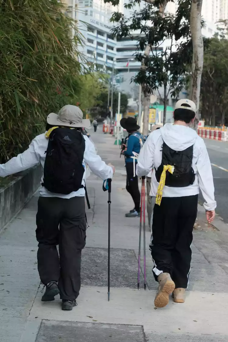
Hong Kong has a strong outdoor atmosphere, with hikers of all ages enjoying the route. Some people, young and old, especially enjoy taking their dogs for walks, off-roading, and camping on the beach. With the clearly marked and densely signposted trails, this route is also suitable for independent travel, provided you know how to read the trails and are in good physical condition.
Let’s go! GO!
This trip consisted of two main activities: a 50km hike through the highlights of the MacLehose Trail, some outdoor gear shopping, and some time for a stroll and dining along Hong Kong's City Walk. The pace was very comfortable, so our accommodations followed the same principle of camping and overnight stays.
Day 1: Can hiking really help you lose weight?
Of course not! It is true that my appetite is getting better and better. The outdoor tour group of E people chattered and ate more deliciously.
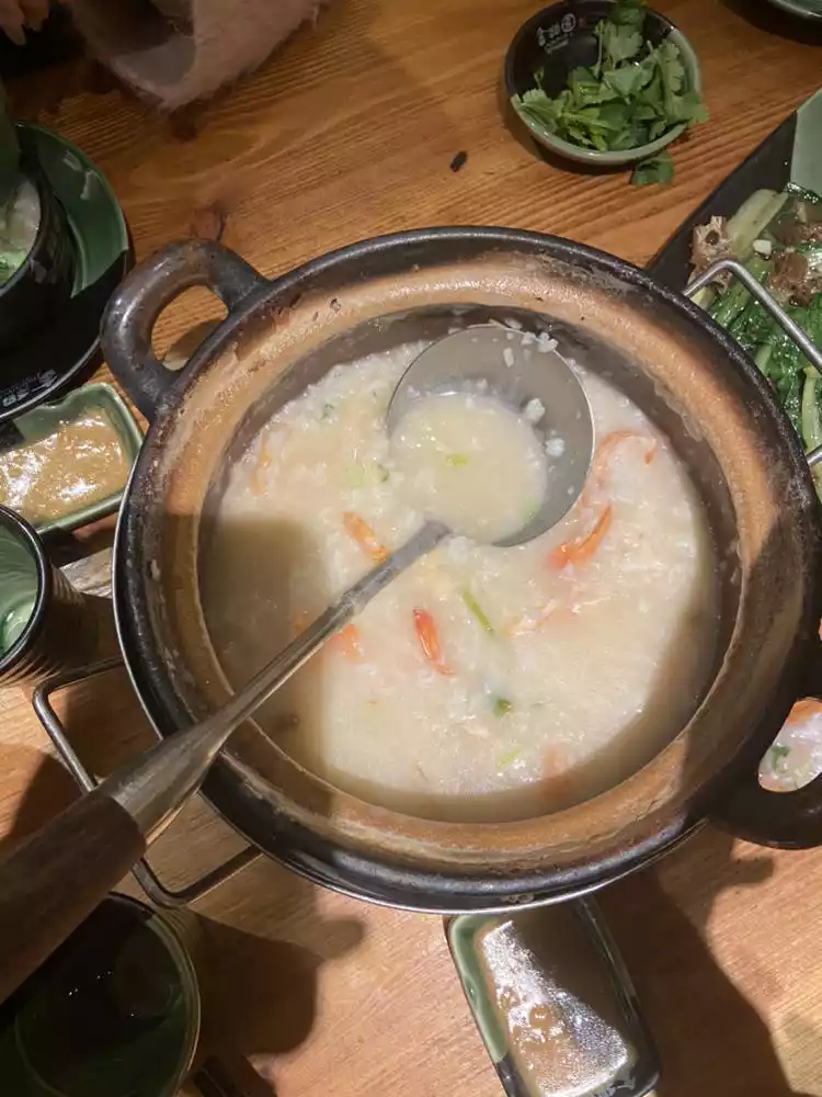
Arriving in Shenzhen on a late flight, the first thing I thought about was a late-night snack. I recommended Jindaoyuan, a nearby late-night restaurant. Their specialty is seafood casserole congee, and their barbecue is also quite good. A little tip for ordering is to start on the way from the airport. The drive from the airport takes about 40 minutes, which is just enough time for the congee to arrive and be ready to eat.
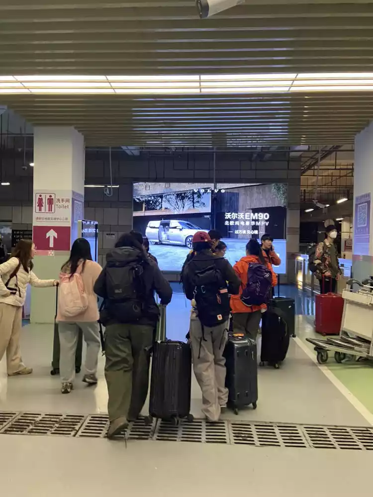
The next day we went through the Liantang Port, which was relatively less crowded. The process was very smooth, as long as we brought our ID and followed the on-site instructions.
The prices in Hong Kong are very high, but if you don’t mind the weight, this method is really good - prepare food and water for the trip in Shenzhen the night before and carry them back to be divided into packages for each day.
Day 2 Section ①② + Po Bian Chau
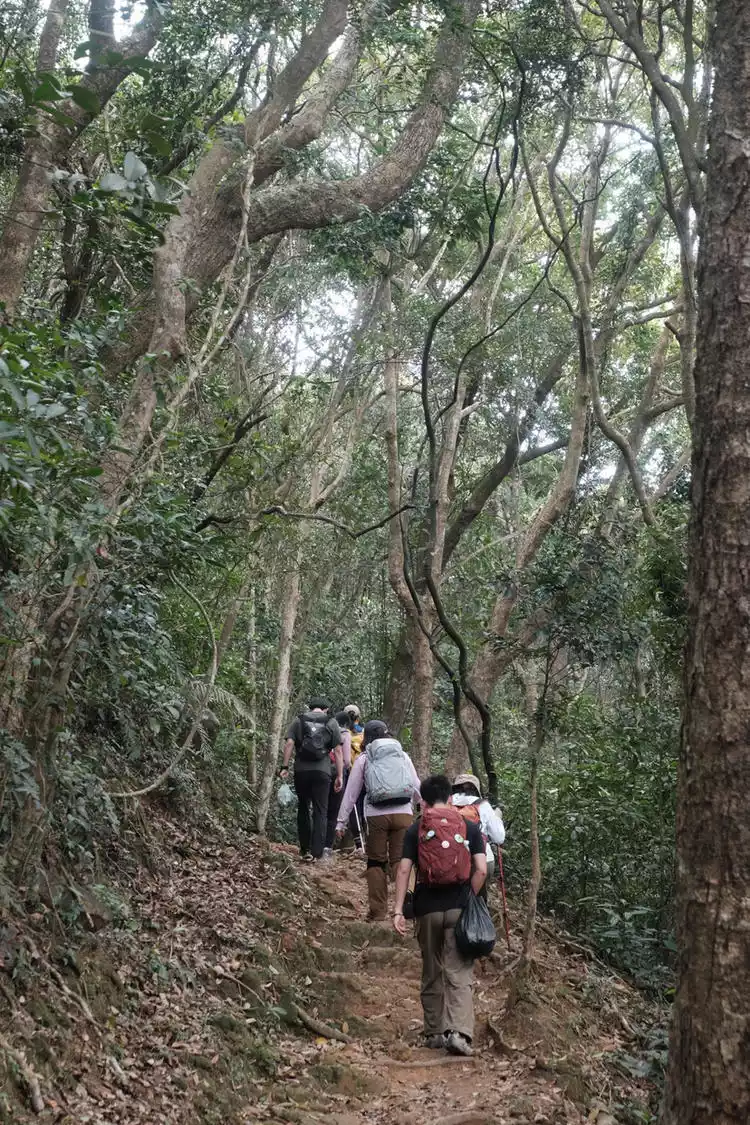
Signpost M1-36 Today's hike is about 20km, with a cumulative climb of nearly 800m. The overall road conditions include highway + paved trails + dirt and stone roads + long ups and downs.
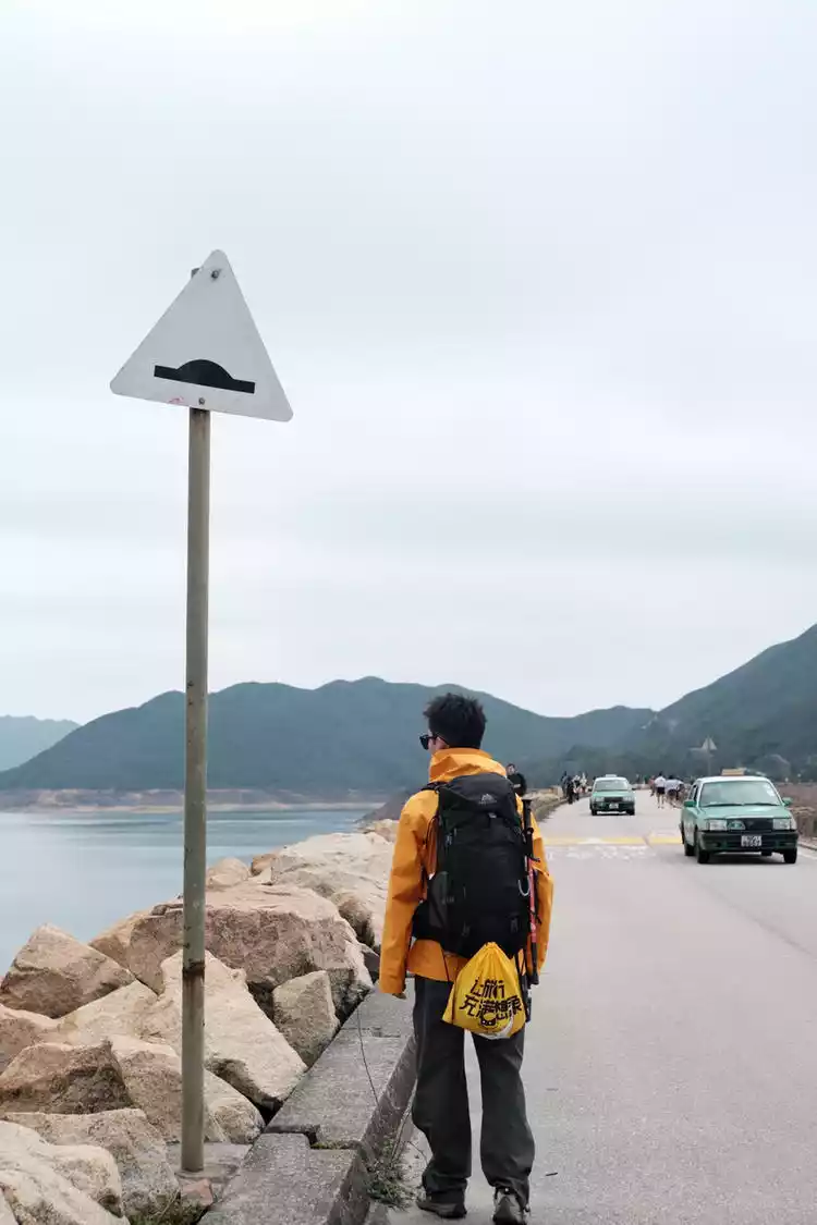
Today’s hike begins at the most classic starting point, passing through High Island Reservoir - Po Pin Chau - Long Ke Wan - Sai Wan - Ham Tin Bay.
The first 9km of the road is flat, with occasional cattle encounters. There are three basic restrooms along the way, all the way to the East Dam of High Island Reservoir. The pavilion at Baila offers a panoramic view of the vast coastline. The impromptu decision to visit Po Pin Chau was a wise one. However, it also increased the distance and time, so it's a bit of a test of your stamina, as otherwise, you'd easily run into the night.
High Island Reservoir
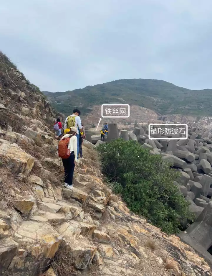
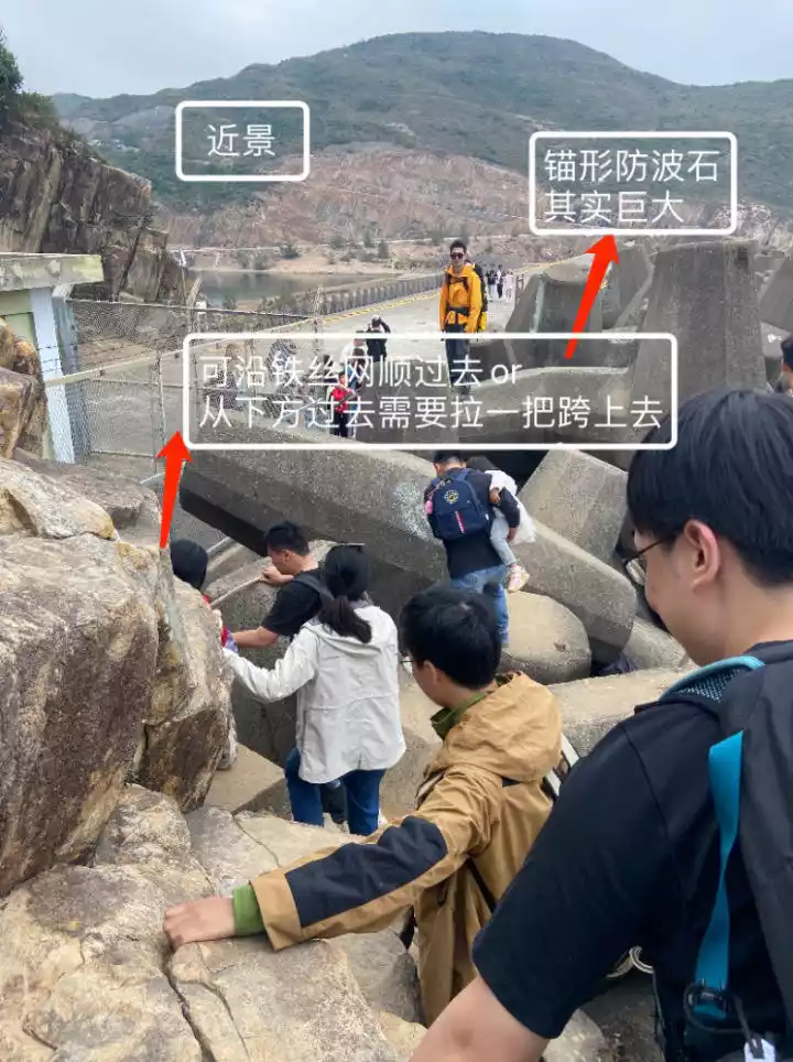
The reservoir is large, with two dams, east and west, and features a similar reservoir landscape to Qiandao Lake. One side offers a vast, calm expanse of water, while the other overlooks the city. The view from the East Dam opens up to a vast expanse of blue water, and the dam features a large, unusual anchor-shaped breakwater.
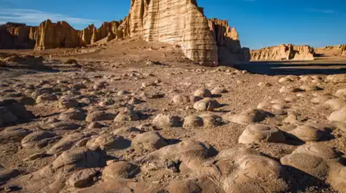
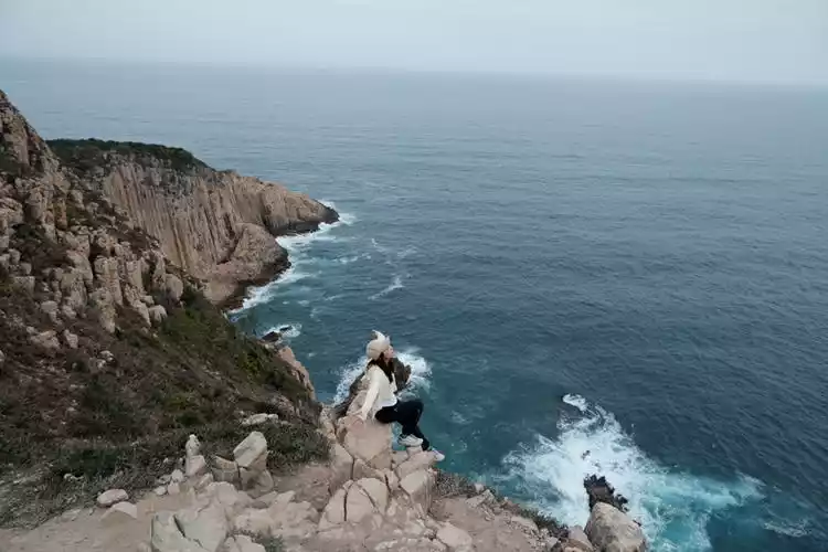
Pobianzhou
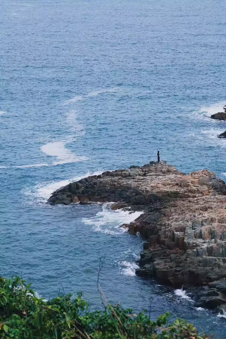
I did some research before heading to the MacLehose Trail and stumbled upon Po Pin Chau. I was so captivated that I decided to go that very day! It turned out to be truly worthwhile. The Wanzhu Coastal Cliffs at Po Pin Chau are truly stunning.
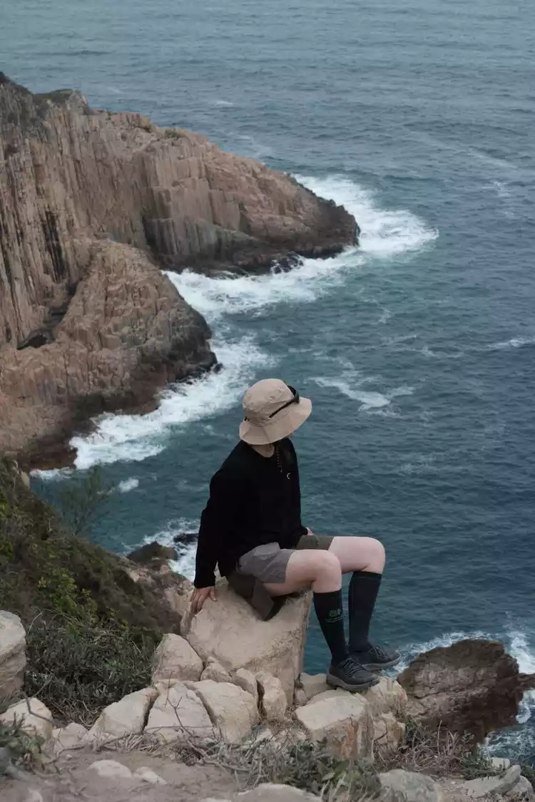
The combined effects of volcanic eruptions and ocean erosion shaped the hexagonal stone pillars we see today, the same scenery featured on the 500 Hong Kong dollar bill. Nature is truly a master of its craftsmanship. I love the feeling of hiking along the coastline; the broadened views and brightened my mood.
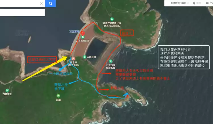
Overview of Pobinzhou
Distance: 2km round trip Time: about 2 hours (including taking photos)
Route: 2 routes to choose from (blue is the long way over the mountain and red is the short way along the barbed wire fence)
Road conditions: Dirt road + anchor-shaped breakwater + cement road on the embankment, unobstructed throughout, with long ups and downs
* It is recommended to go from Blue to Red and back without having to go back, and you can see the scenery from multiple angles. The descent from the high point has the atmosphere of Wugong Mountain on the sea
*Specific details are shown in the figure below
⚠️5 tips to share
①Although the route is short, it is still a bit difficult and is not recommended for children or the elderly.
② Be sure to avoid slipping! The mountain road is rugged and the gravel road is indeed easy to slip, so it is best to wear non-slip shoes
③There is a seaside cliff near Pobianzhou with a steep slope. Please pay attention to your feet when taking photos.
④There is no shade throughout the whole process, please pay attention to sun protection
⑤ Bring enough water and snacks, as there are no shops nearby
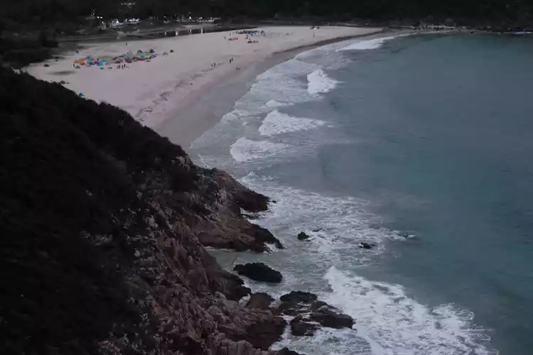
Langke Bay
It is not the Hong Kong version of Maldives, but the blue of MacLehose Trail in Sai Kung. Long Ke Wan is one of the most beautiful beaches along the MacLehose Trail.
Looking down from the top of the trail, the beige sand and clear blue water are very soothing. It would be even more beautiful on a sunny day.
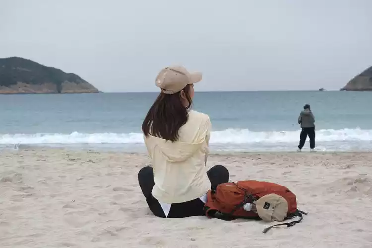
The sand is very fine, and some people have camped here. There's a forest near the shore that provides shade and protection from the sun on hot days. A few tall tree trunks create a classic camera position, perfect for posing for photos.
Sitting on the beach, facing the ocean and listening to the crashing waves is a relaxing moment, and then we continue on our way. From here, the track indicates the route is in the sea, but it's actually behind the trees. At the intersection, there's a blue ribbon tied by past organizers. From here, it's a long, grueling uphill climb (this continuous climb rivals the Longwangshan ridgeline firebreak), so it's a sprint that requires considerable stamina.
So the MacLehose Trail isn’t just about having legs, nor is it just about the coastline.
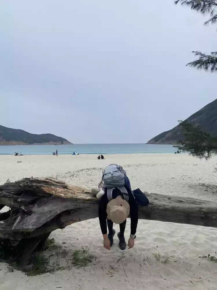
Sai Wan
There is a descent point here. Follow the sign for Sai Wan Mountain and you can choose to take a bus or a taxi as indicated in the guide. Continue along the cement road to Sai Wan Village, which extends all the way to the beach.
There are several convenience stores here where you can stock up on supplies, including water, drinks, chips, and other snacks. The first one you approach accepts WeChat Pay. This area has a distinct fishing village feel, and you can camp near the reef, though the campsites aren't as large as those in Xiantian Bay.
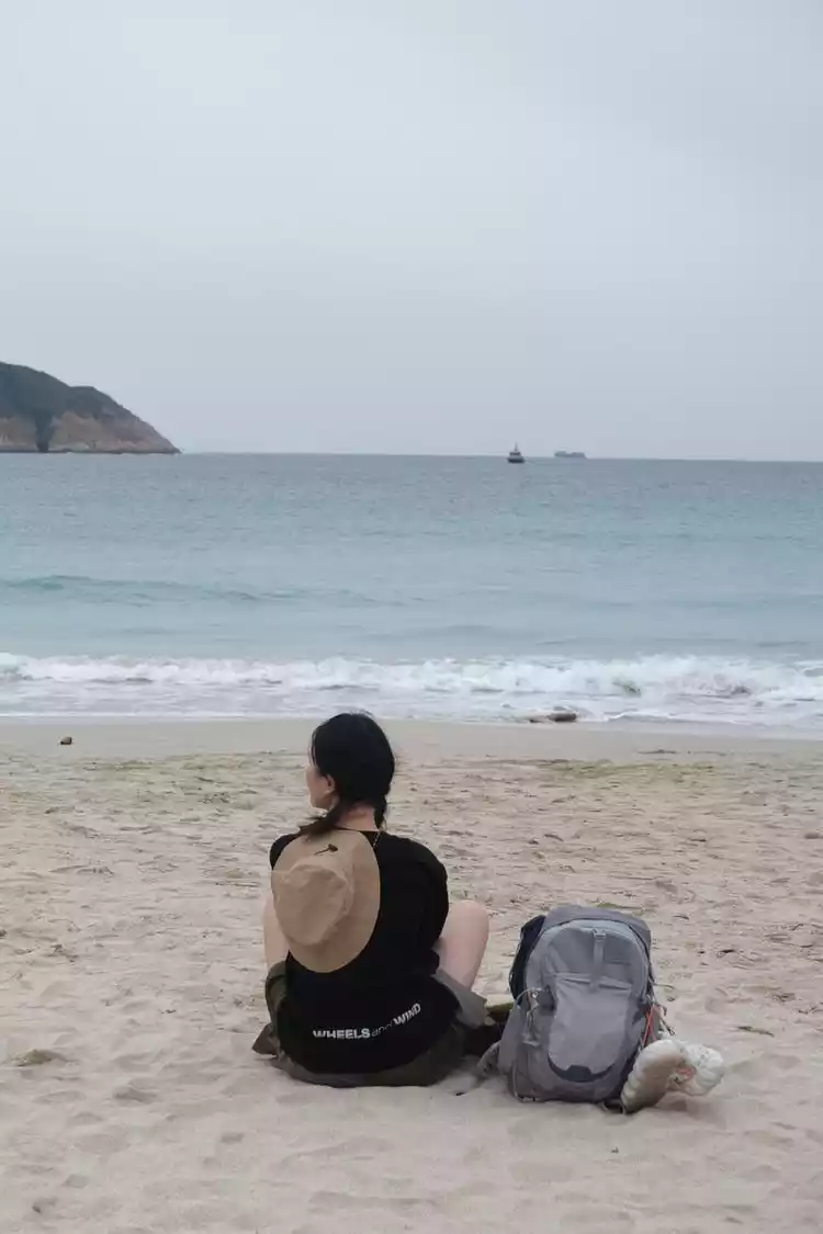
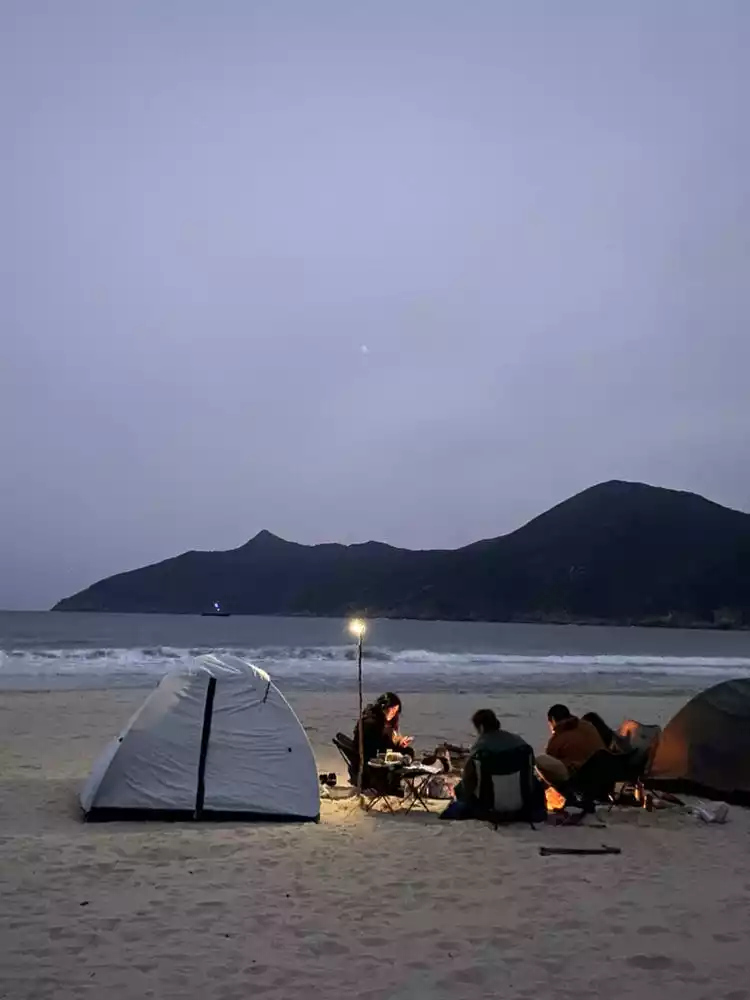
Ham Tin Bay
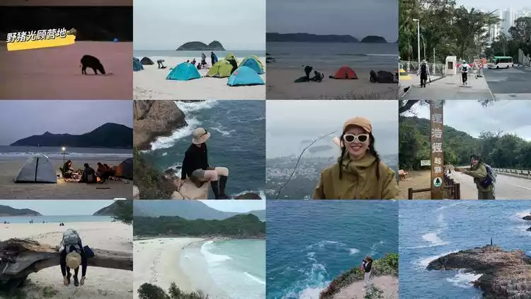
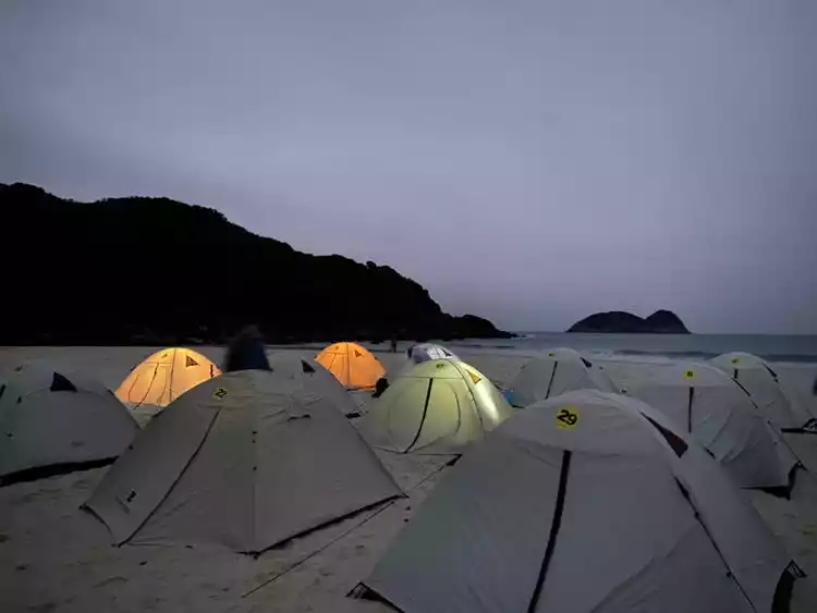
Finally, we arrived at our campsite for the night! As the sky darkened, the lights on the tents on the beach gradually came on. Some people even brought their dogs to camp, chatting and picnicking around the campfire, accompanied by the sound of waves, which was very atmospheric.
If the winds weren't strong, everything would be fine. However, strong winds at the beach were so intense that it was chilling. Hiking in shorts during the day was uncomfortable, and I needed a down jacket at night. Even from inside the tent, I could hear the wind gusting so hard that the flysheet was about to flip over. If the tent was pitched and no one was inside, or if a heavy object was pressing on it, the entire tent would flip over.
The fine sand on the beach will be brought into the tent from all corners. When you wake up in the morning, your face will be covered with sand, and then you will dig out your shoes that have been buried in the sand all night at the entrance of the tent.
Be sure to protect the springs of electronic products or trekking poles. If sand gets stuck in them, they may not be able to be folded up.
Sharing the actual situation of the camp
① If there are really wild boars, it is recommended not to put things at the entrance of the tent. It is likely that they will be dragged away and damaged by wild boars. Wild boars usually come out at night. There were many people on that day, so they were driven away when they came out.
② You don't have to pack heavily, you can also pack light. This campsite has tents, moisture-proof mats, sleeping bags, etc. for rent, but they are not very clean and have a strong smell. The moisture-proof mats and sleeping bags are thin. If you don't mind, it's OK to use them for one night; if you mind, it is recommended that you carry your own.
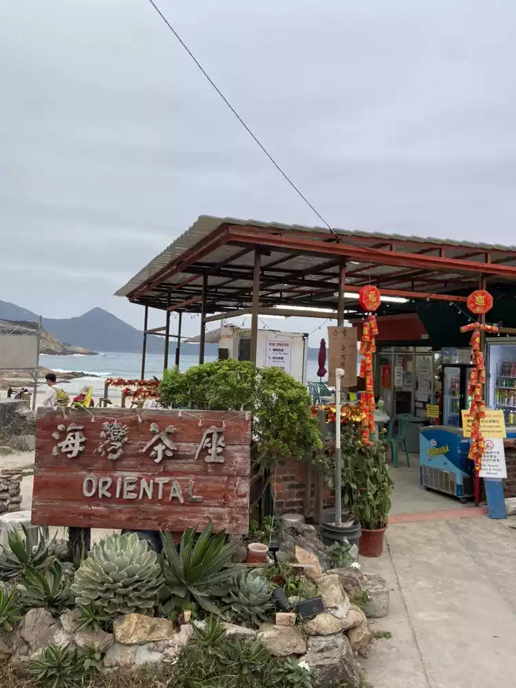
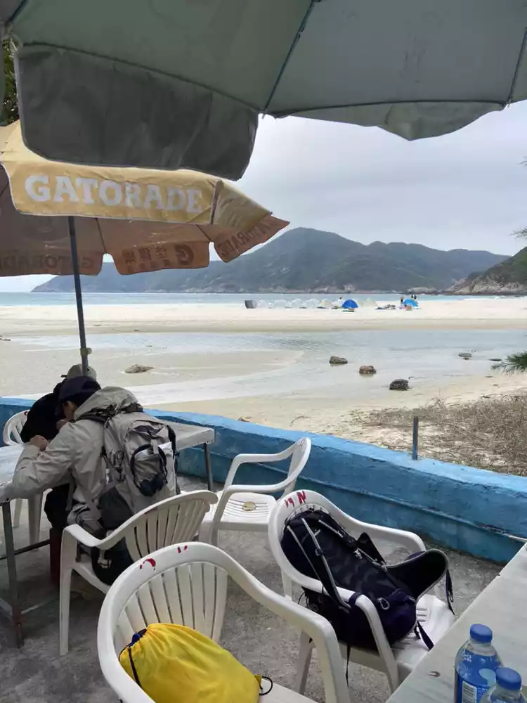
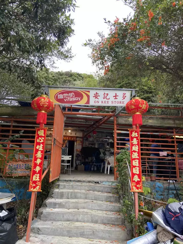
③ There are two convenience stores in this campsite. Anji Store is more popular. You can take a hot shower for 40 Hong Kong dollars for 15 minutes (please bring your own toiletries; you need to take a number and queue up); the prices here are 88 Hong Kong dollars per portion of fried rice and 20 Hong Kong dollars per bottle of water.
④ Pay attention to the weather. The temperature difference between morning and evening is large at the seaside. The weather in February is around 20℃ during the day and the wind is so strong and cold at night that you need to wear a thin down jacket.
⑤ A headlamp is essential! The campsite and the store are connected by a narrow wooden bridge, so you need to light up at night.
⑥ Regarding restrooms, there are few public restrooms and you may need to queue or use them at off-peak hours.
⑦ Prepare a power bank. A full charge at the store costs around HK$10.
⑧Xiantianwan Campground accepts cash + WeChat payment, cash ≤ 500 denominations are acceptable, 1000 denominations are not accepted. Many other supplies along the way only accept cash
Day 3: Sometimes it’s nice to descend
Signpost M37-68. Get up early, have breakfast and continue walking the remaining 6km of the second section. If you continue, you will enter the third section, which requires crossing several high mountains in Sai Kung West. You can see Chek Keng Hau, Sai Kung Hoi, Chan Chuk Wan, Kei Leng Ha Hai, and Snake Peak and Ma On Shan towering in the distance.
If you want to descend early, go directly to Pak Tam Au and take public transportation to the city center to the final destination, Sai Kung Pier.
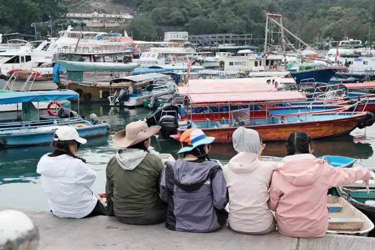
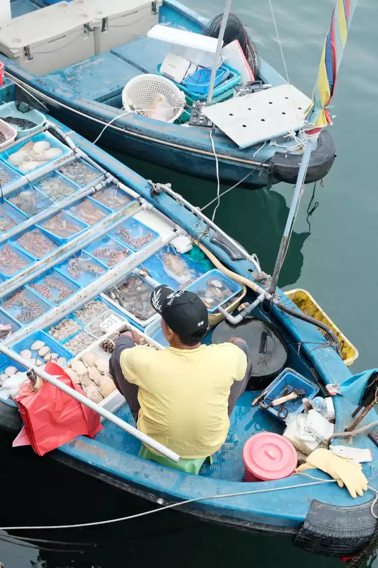
The seafood market on the shore of Sai Kung Pier is very interesting. The shopkeepers put the seasonal seafood of the day on the boat and serve it to you after it is processed. It looks very fresh.
Day 4 ends with a 50km flower scattering
Signpost M69-100 The climbs and downhills along the way were comparable to the first day's hike. When walking through the woods trail, I suddenly felt dazed. Who could still distinguish between the West Lake Mountains and the MacLehose Trail?
When we passed the first long slope, the road was shrouded in mist, and the urban area and coastline were hidden in the mist.
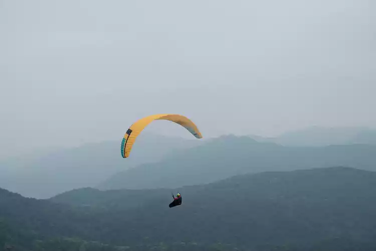
As we reached the ridgeline, the view opened up and the fog gradually dissipated. We soon arrived at Ngong Ping, a popular weekend campsite for Hong Kong residents. Nestled against the mountains, facing the cityscape, the highlands offer a backdrop of rolling, overlapping mountain shadows, and the occasional paraglider glider might be seen descending from the sky. This is indeed a popular training ground for paragliders.
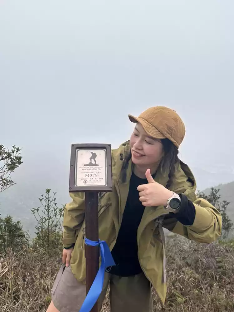
When we reached M100, we finished 50km and celebrated!
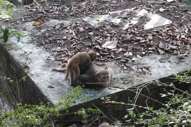
Encountering a little monkey on the road
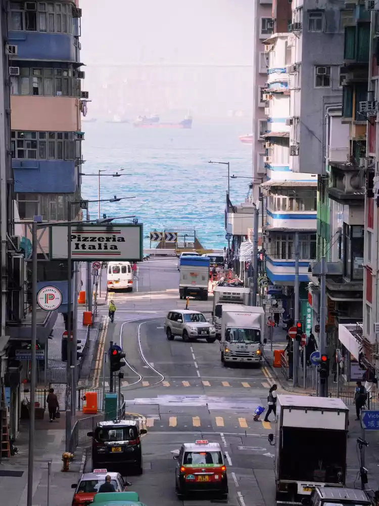
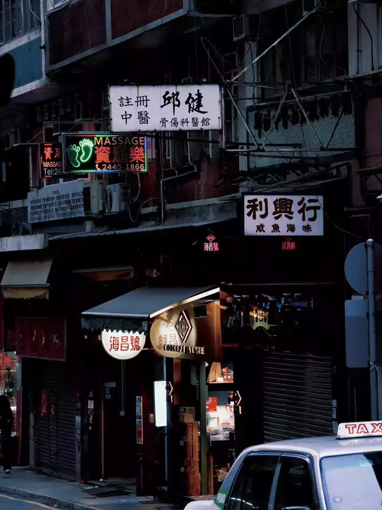
Day 5 City Walk: Walking around the city like seeing people
Walking around the city is like meeting people. A city with a unique temperament is never boring. Except for the day of camping, I would take time out every night to go shopping, eat and buy. I would hike during the day and do a city walk at night.
The blues before nightfall, the sudden lighting of thousands of houses, the day has turned a new page. (The following pictures are by Gutou & Sangzi)
The Hong Kong I have seen in Hong Kong dramas and the Hong Kong-style filters I have been obsessed with on social media, after coming here, I found that it was so authentic or it seemed that there had not been much change over the years.
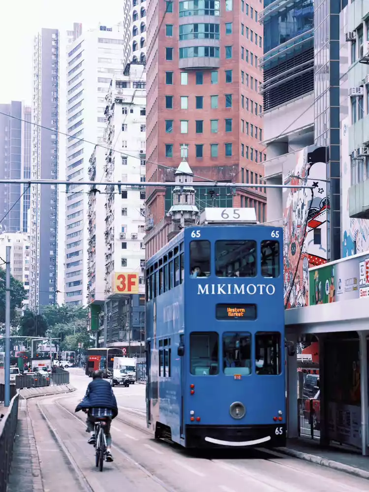
A sense of constriction, like a steel forest, permeates every street in Hong Kong. The clatter of traffic lights makes the city's rhythm seem accelerated. Looking up, I often feel the sky is divided into grids by the skyscrapers. The trams on the road are truly adorable, double-decker boxes adorned with various advertising graphics. The streets between the skyscrapers light up as the sky turns blue, and the colorful storefront billboards are a sight to behold.
Here, a metropolitan atmosphere and the hustle and bustle of everyday life, a tight squeeze and a busy schedule intertwine. For a tourist like me, this is a fascinating aura. Every city with its own unique character is always worth exploring.
Cute trams on the street
Practical Guide
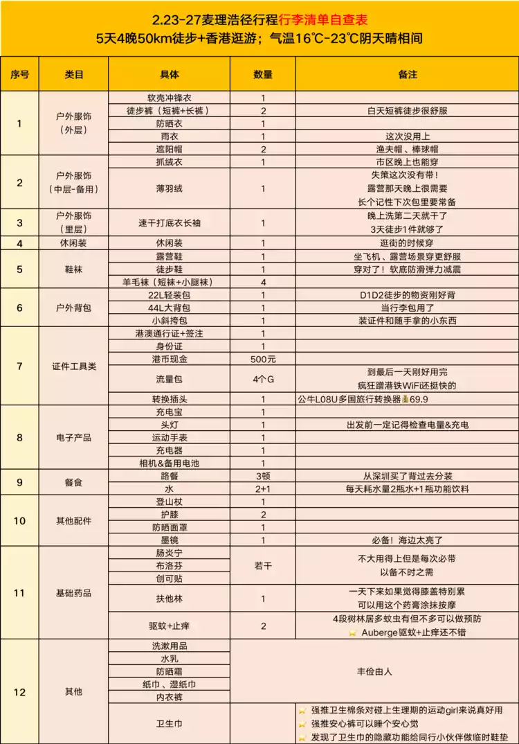
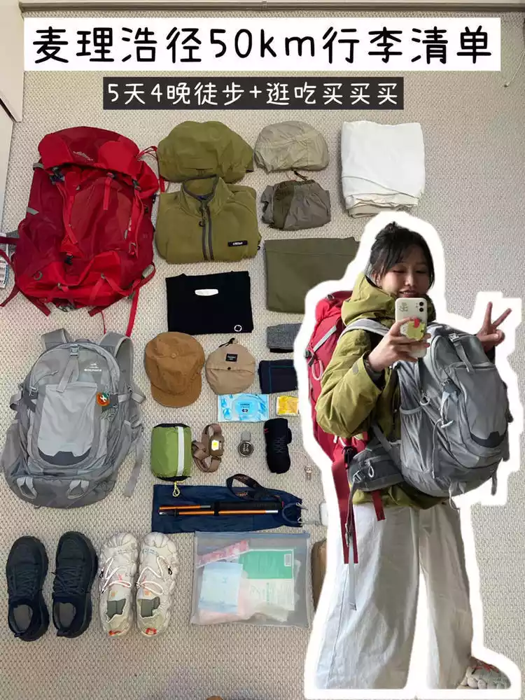
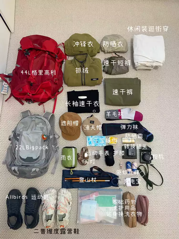
Equipment packing list
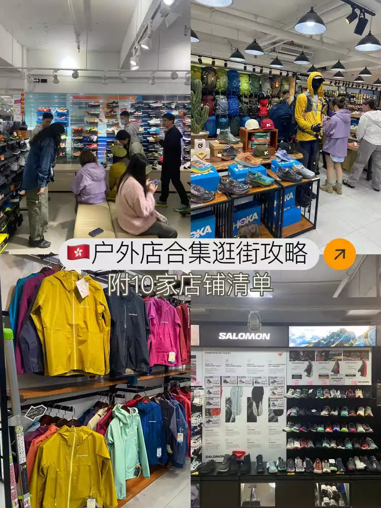
Hong Kong Outdoor Store Shopping Guide
1. Sharing shopping experience at outdoor stores
My biggest impression is the huge price difference when it comes to outdoor gear in Hong Kong, especially jackets and backpacks. You can find all the major brands you're familiar with here, and if you find a sale and a little extra currency exchange, it's a great deal!
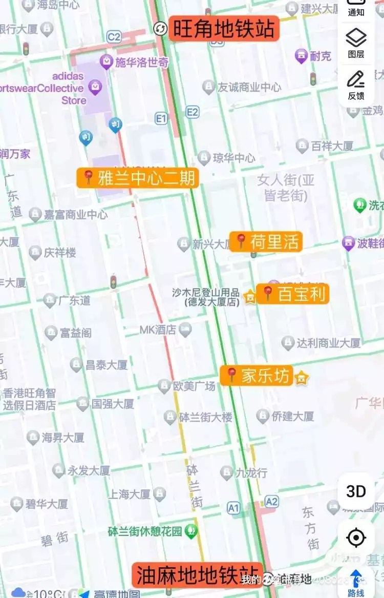
For example, the official flagship of the Kitty Hawk Tempest 24L is priced at 1700+, but you can get it here for 990+. Hong Kong's outdoor stores are concentrated in office buildings near Mong Kok and Yau Ma Tei MTR stations. We visited several stores repeatedly and always found what we liked. Be sure to reserve enough time to browse and savor the items carefully.
- Sharing a list of outdoor stores I compiled, marked with address/opening hours/main selling points and brands, etc. Many stores are open around 12 pm, so don't miss out. It's very useful information and I recommend saving it -
⭐️ Jialefang is the building we repurchased the most this time. There are 3 outdoor comprehensive stores here
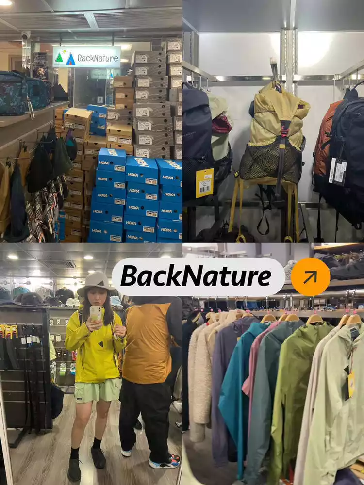
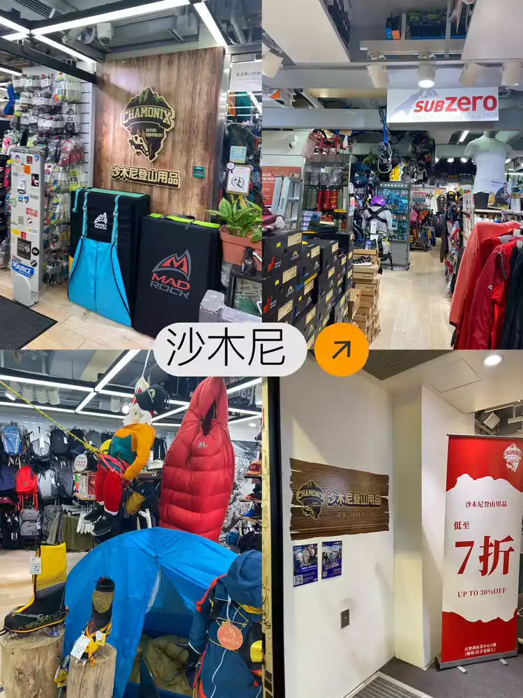
①Backnature Address: 16/F, Gala Place, Mong Kok. It's a bit like a boutique, with great styles and colors. They sell clothing, hats, backpacks, and Hoka shoes from Bird, Bata, Mountain Rat, Montbell, and The North Face. Our prize is a Mountain Rat jacket*
2. HOKA shoes*
1. North Face hat*2, Bata shorts*1
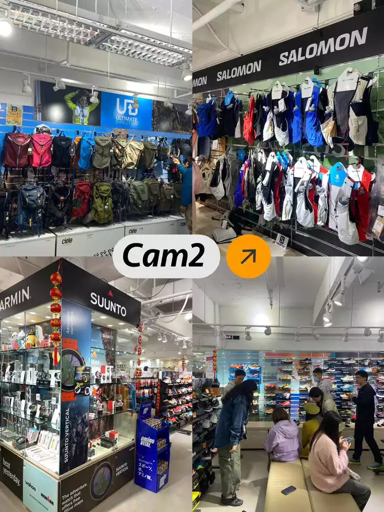
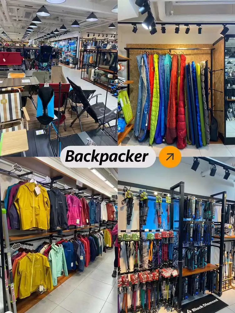
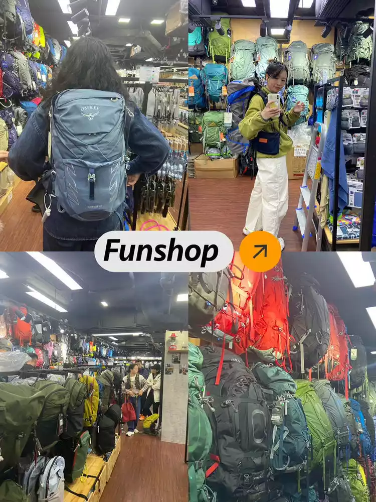
②Funshop Address: 14/F, Gala Place, Mong Kok. Mainly selling hiking, trekking, and camping gear. I was completely captivated by the sheer number of Kitty Hawk backpacks in all their models! The staff were friendly and patient with their recommendations and explanations. My favorites: two Tempest 24L backpacks and one EXPED waterproof bag.
③Cam2 Address: 10/F, Gala Place, Mong Kok. This trail running shop has a comprehensive selection of gear, including backpacks, hydration packs, walking poles, trail running shoes, sports watches, sunglasses, and more. Even beginners can get their gear right here, and there are discounts of 20-30%. They also have a wide selection of brands, including UD, Altra, Solomon, LEKI, and HOKA. They also have Ciele hats in a wide variety of colors. Our loot includes one Solomon trail shoe, four UD trail bags, and four Altra trail shoes.
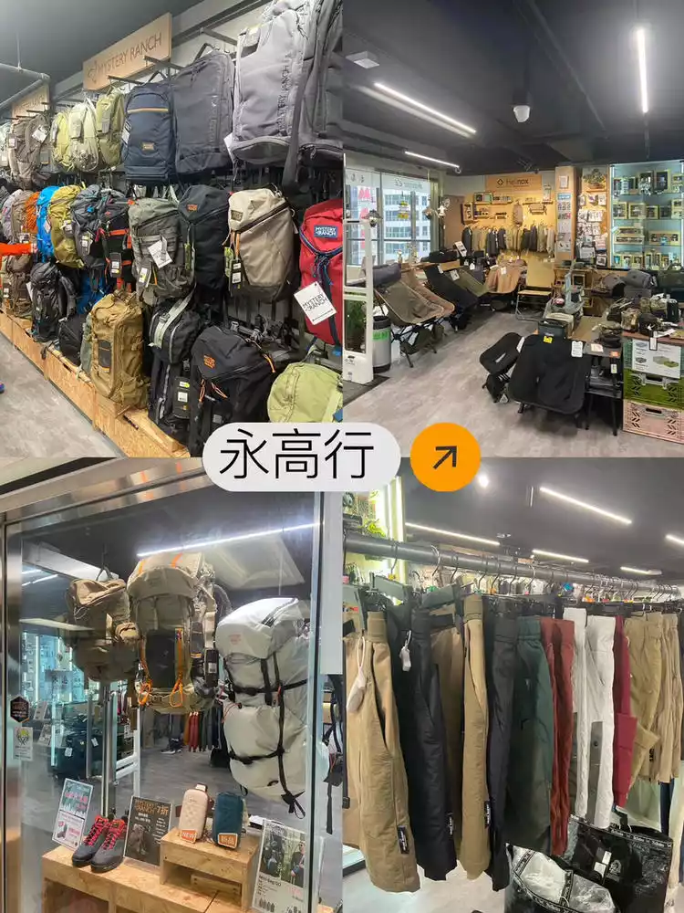
④ Yonggaohang Address: 18th Floor, Jialefang, Mongkok. It was closed when I went there on the first day. This Mystery Farm store, which is more geared towards military, has a very complete range of bags. They also have brands like Danner and Lowa. I didn't see anything I particularly liked here, so I didn't find any spoils.
⑤ Chamonix Address: On the second floor of Baibaoli, the store has a wide range of products, including rock climbing, ice climbing, camping, mountaineering, and water activities. There's a whole section dedicated to LASPORTIVA, rock climbing shoes, and KEEN (though the styles are a bit limited). This store has a strong rock climbing atmosphere, and rock climbing enthusiasts will definitely enjoy visiting here.
⑥the Overland Address: 12th Floor, Hollywood Plaza. It has a relatively comprehensive range of brands including Mammoth, Montbell, Solomon (this store has many shoe styles), Gregory, Kitty Hawk, CHUMS, etc.
There are 4 other stores whose information is listed in the table. If you have limited time, you can visit the above stores first.
2. Outdoor Store Collection List (Attached List)
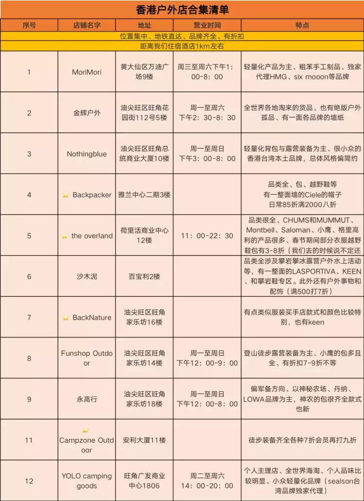
Map of each store area for reference
Summary of common Q&A and precautions
1. What are the road conditions like along Sections 1-4 of the MacLehose Trail? What shoes are suitable?
The route is mostly paved and hard. The first 9km from the starting point of Pak Tam Chung is a road, followed by paved roads and a few off-road roads. It's generally hard and bumpy. It's recommended to wear soft-soled, non-slip, elastic shoes and wool socks, otherwise it's easy to rub your feet and cause blisters and sore soles.
2. How to avoid the first 9km of road?
You can take the 9A New Territories minibus from Pak Tam Chung to the East Dam of High Island Reservoir (fare: HK$11.3) or take a taxi directly to Pak Tam Chung (the actual starting point). The starting point landmark is very classic, and there is only this one and no other worth checking out.
3. What is the scenery index?
Sections 1-2 are considered the most scenic stretches, passing through High Island Reservoir, Long Ke Bay, Sai Wan, and Ham Tin Bay. Along the High Island Reservoir, there are many cattle, so if you're in a good mood, you can walk for a bit. Once you reach Dongba, the scenery is stunning, with the coastline, trees, and sandy beaches immediately visible. Po Bin Chau is definitely worth a try! The round trip is expected to add 2km (HKD 500 for the same scenery).
4. How to take the Pobianzhou route?
See the above Pobianzhou strategy
5. How are the supplies along the way?
Regarding restrooms: There are restrooms and pavilions at the West Dam and East Dam of High Island Reservoir (there is a water source at the West Dam); there is one restroom at Baila Village; and there is a restroom at Xiantian Bay.
Regarding store refills: There are two convenience stores in Sai Wan Village where you can refill water and drinks at a reference price of HK$20 per bottle for water and Coke (WeChat payment is accepted at the first store you pass). There are two convenience stores in Ham Tin Bay where you can refill fried rice at HK$88 per portion and water at HK$20 per bottle (WeChat payment is accepted but the signal is unstable). There is one convenience store in Chek Keng where you can refill water, milk tea, etc. (I'm not sure, so it's safest to prepare small amounts of cash).
6. What is the actual situation at Xiantianwan Camp?
① If there are really wild boars, it is recommended not to put things at the entrance of the tent. It is likely that they will be dragged away and damaged by wild boars. Wild boars usually come out at night. There were many people on that day, so they were driven away when they came out.
② You don't have to pack heavily, you can also pack light. This campsite has tents, moisture-proof mats, sleeping bags, etc. for rent, but they are not very clean and have a strong smell. The moisture-proof mats and sleeping bags are thin. If you don't mind, it's OK to use them for one night; if you mind, it is recommended that you carry your own.
③ There are two convenience stores in this campsite. Anji Store is more popular. You can take a hot shower for 40 Hong Kong dollars for 15 minutes (please bring your own toiletries; you need to take a number and queue up); the prices here are 88 Hong Kong dollars per portion of fried rice and 20 Hong Kong dollars per bottle of water.
④ Pay attention to the weather. The temperature at the beach varies greatly from morning to night. In February, the weather was around 20°C during the day, and at night it was so windy and cold that you needed to wear a thin down jacket. ⑤ A headlamp is essential! The campsite and the store are connected by a narrow wooden bridge, and there are no lights at night, so you need to find your way through.
⑥ Regarding restrooms, there are few public restrooms and you may need to queue or use them at off-peak hours.
⑦ Prepare a power bank. A full charge at the store costs around HK$10.
⑧Xiantianwan Campground accepts cash + WeChat payment, cash ≤ 500 denominations are acceptable, 1000 denominations are not accepted. Many other supplies along the way only accept cash
7. Can sections 1-2 and Pobianzhou be completed in one day?
The first and second sections + Pobianzhou are 20km in total, with a total climb of about 800m. Route suggestions
① Good physical fitness and fast walking speed can complete the walk
② For those with average physical fitness, it is recommended to walk D1 Section 1 + Pobin Island + Section 2 to Ham Tin Bay in 2 days and camp overnight. D2 Section 2 (the remaining 6km) will be completed and then you can leave.
8. What are the temperature conditions like? Which month is recommended for travel?
This trip happened at the end of February, just as a cold wave was moving south. It was mostly cloudy, with daytime temperatures around 20°C. However, the wind was strong at the beach and on the mountaintops, so you should dress warmly. During the day, you should wear shorts for hiking, but at night, camping at the beach was windy and the temperature dropped significantly, so you needed a hat and down jacket. It's recommended to travel in spring or autumn when the temperature is comfortable and sunny, for a better experience. It's not recommended in the summer, as the roads are less shaded and have 360° of direct sunlight.
Conclusion
The end of every journey is to be continued.