Wusun Ancient Road | Life shouldn't be wasted in places like this! Check out the hiking guide!
Preface
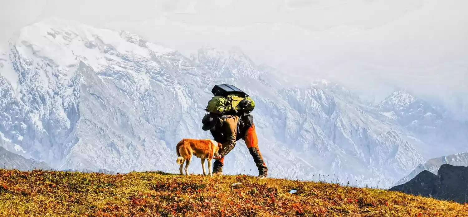
Wusun Kingdom, a thousand-year-old road, full of thrills and excitement, unforgettable for a lifetime!
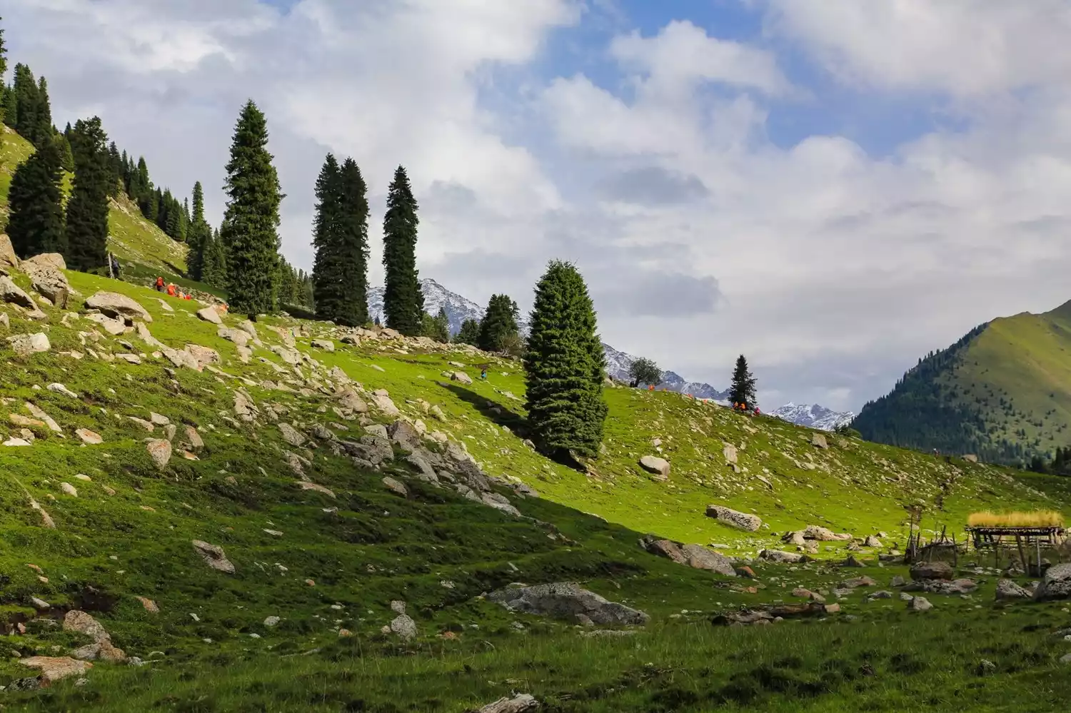
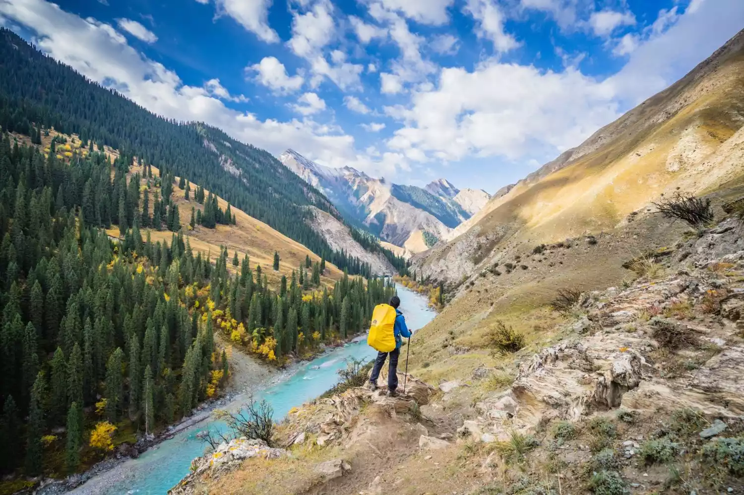
There are spring-filled meadows, clear blue lakes, majestic snow-capped mountains, and lush and tall spruces.
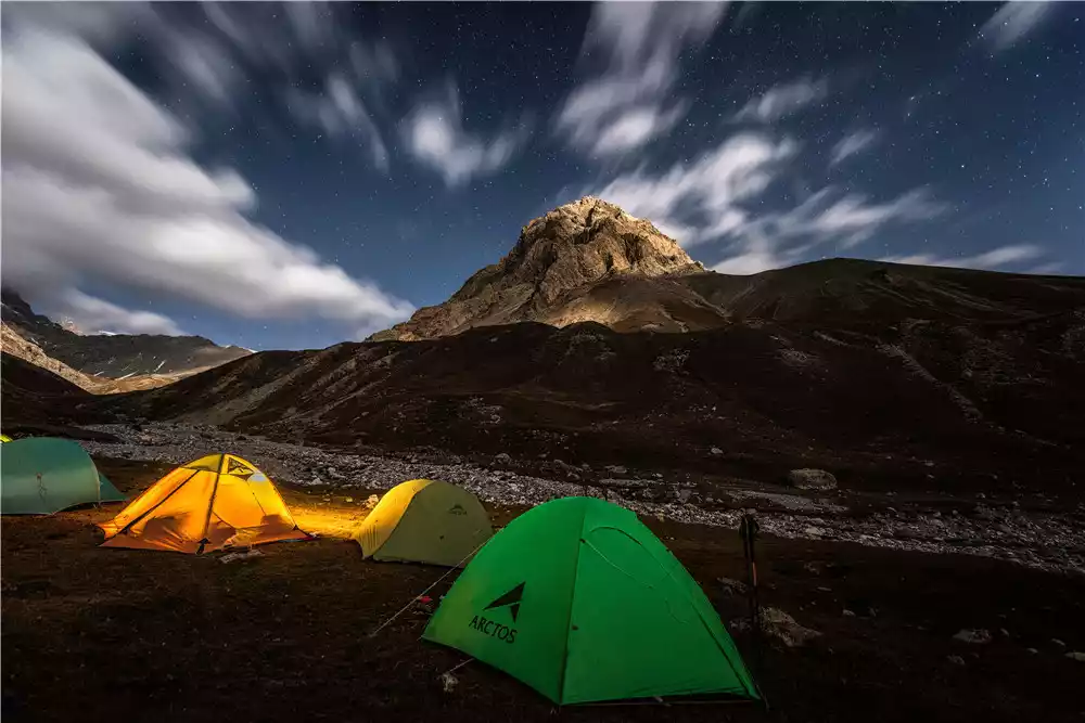
There are vast and brilliant galaxies, teammates who work together, thrilling avalanches, and holy and flawless snow lotus.
120 kilometers condenses the essence of the entire Xinjiang. The beautiful scenery along the way heals anxiety, beauty and brutality are intertwined, and you will gain surprises and satisfaction along the way!
📌What changes have occurred in Wusun now?
1️⃣Now the Wusun Ancient Road has a bridge built, there is no zip line, and it is free;
2️⃣The previous zipline camping site has been moved 7km forward;
3️⃣The road for hiking on the last day has improved and is easier to walk on.
📌Recommended season
June to October every year is the most beautiful and suitable time for Wusun. In summer, flowers are in full bloom, and forests, grasslands, snow-capped mountains and glaciers can be seen.
📌What is so difficult about hiking in Wusun?
high altitude
Above 2000m above sea level, with the highest altitude at 3830m
High strength
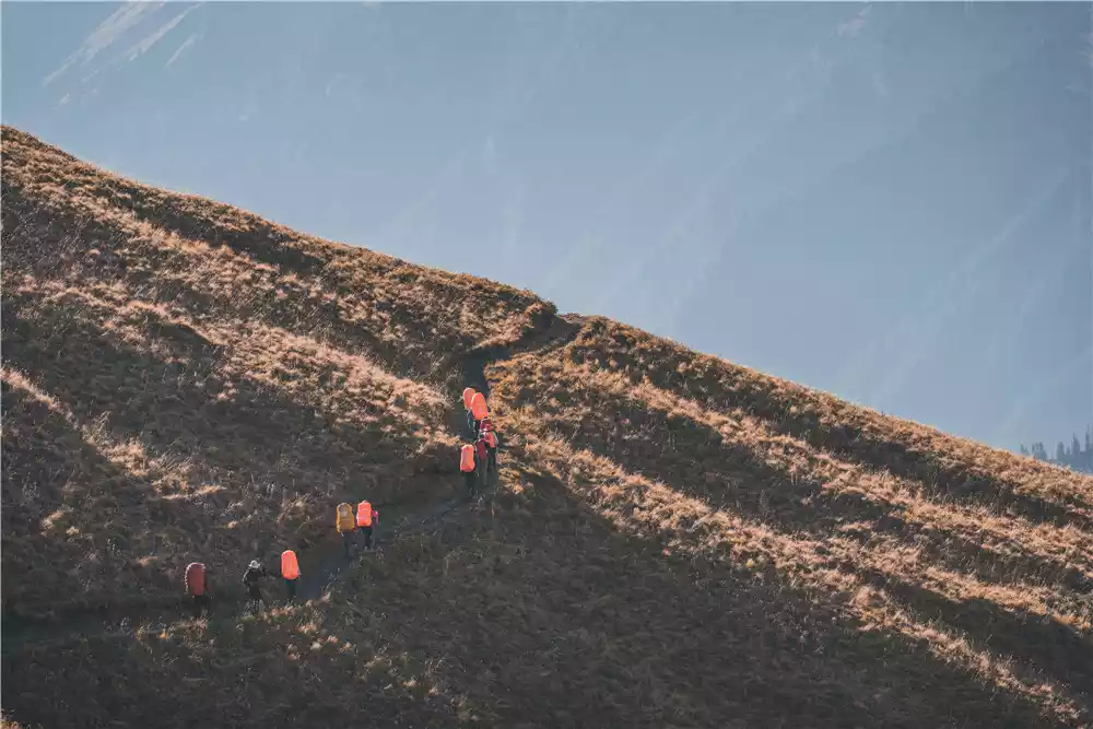
The total distance is 120km, with the longest distance in a single day being 22km and the maximum daily ascent being close to 1400m.
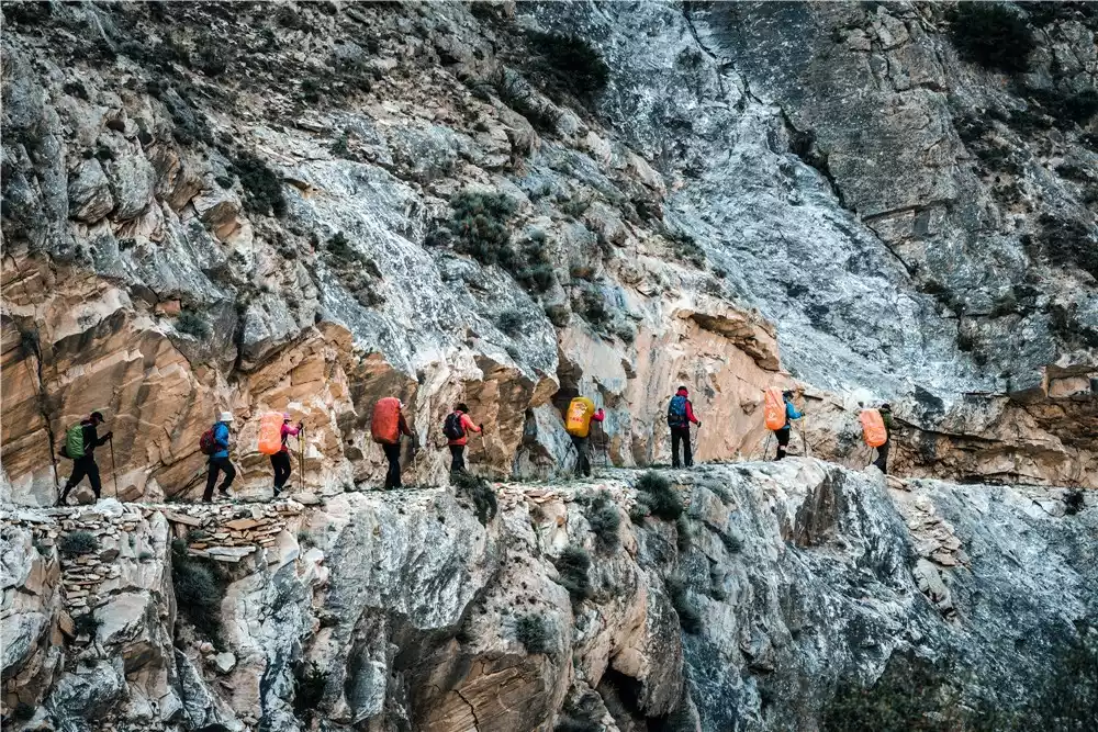
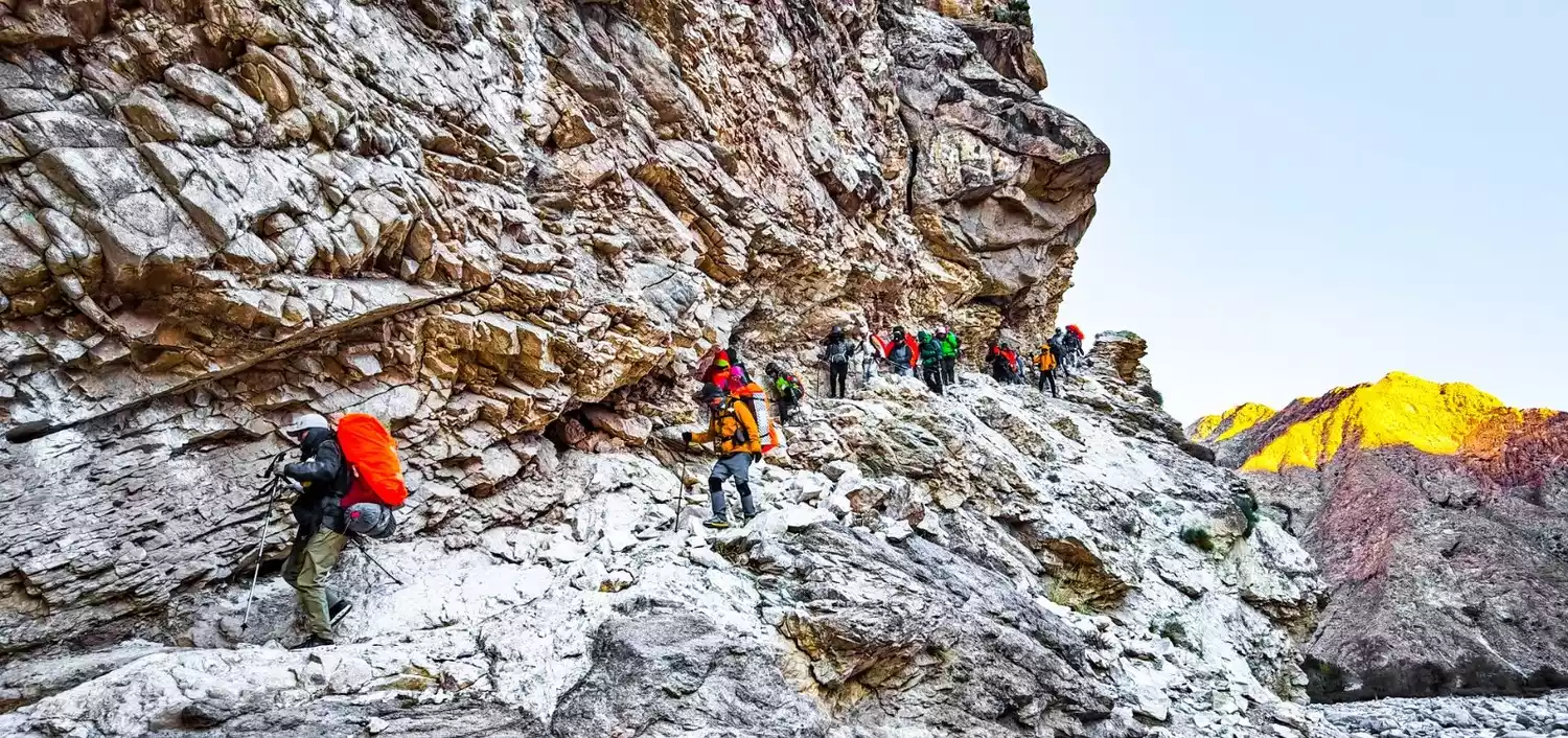
Complex road conditions
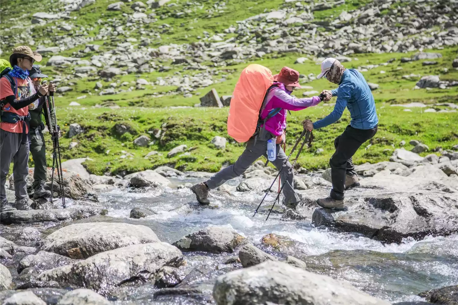
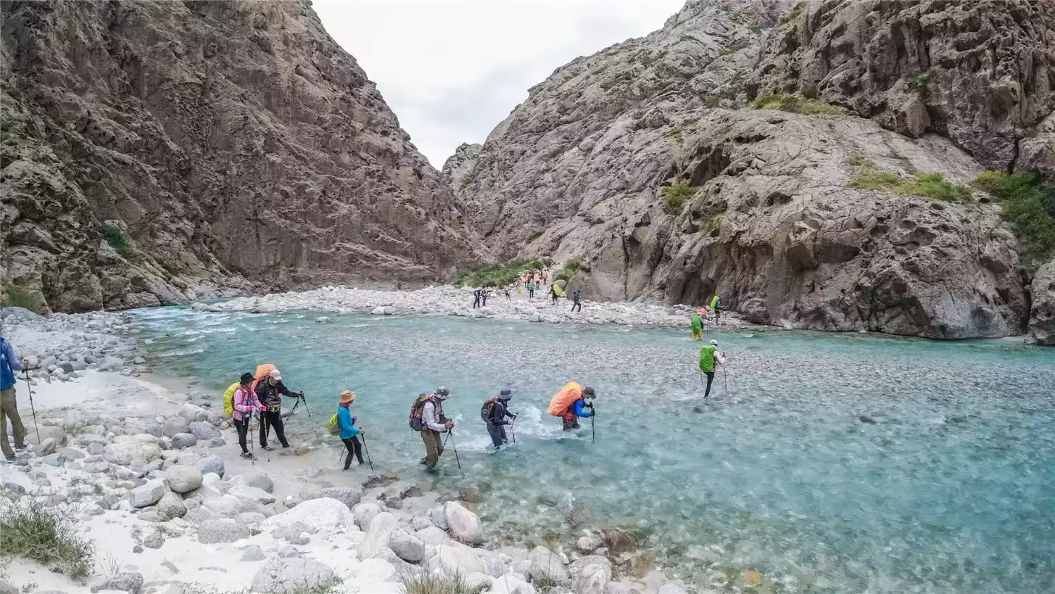
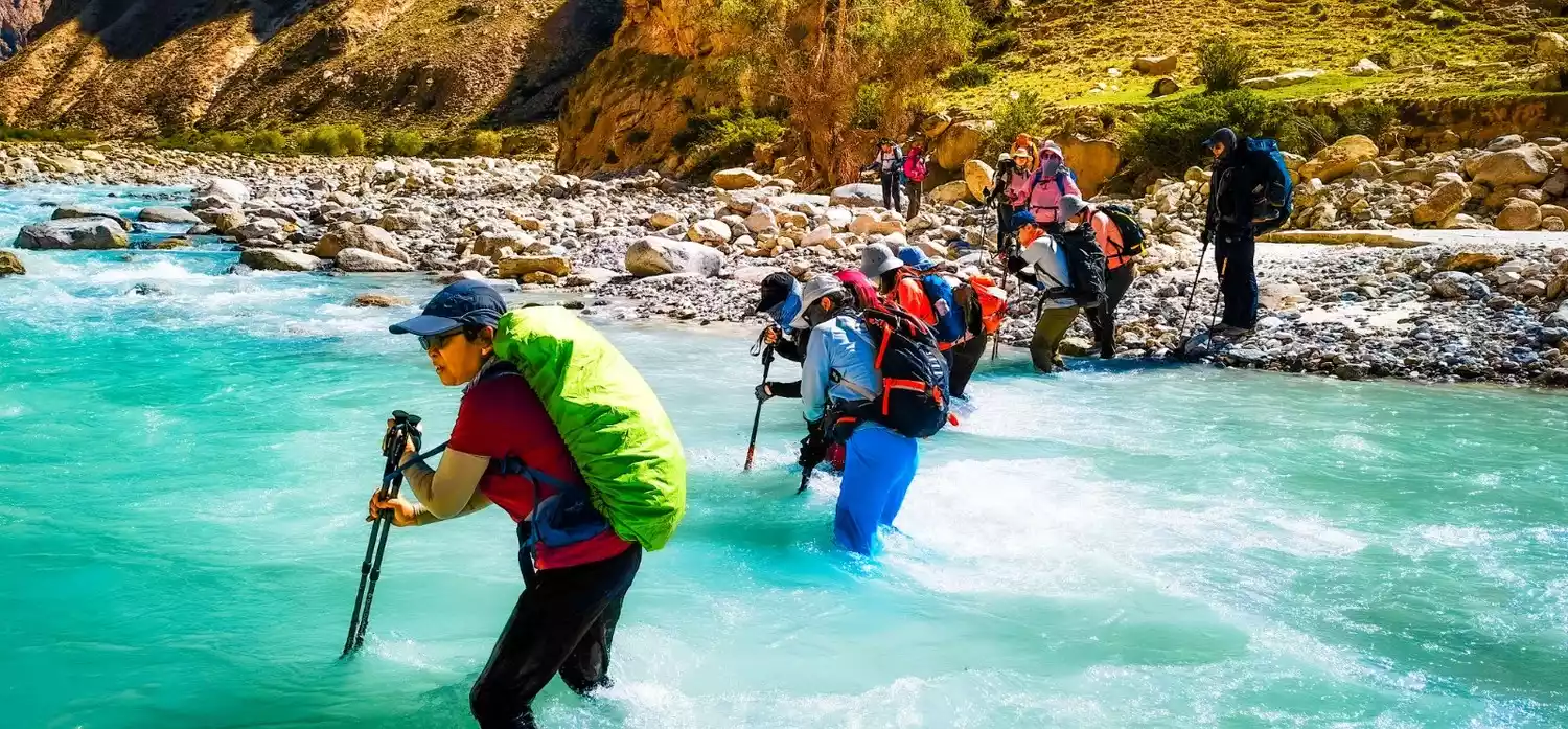
✔️Wade through the water
You will cross the river valley dozens of times during the whole journey, so you need to prepare river trekking shoes and waterproof socks. Sleeping bags, clothes and electronic products must also be waterproof.
✔️Cross two passes
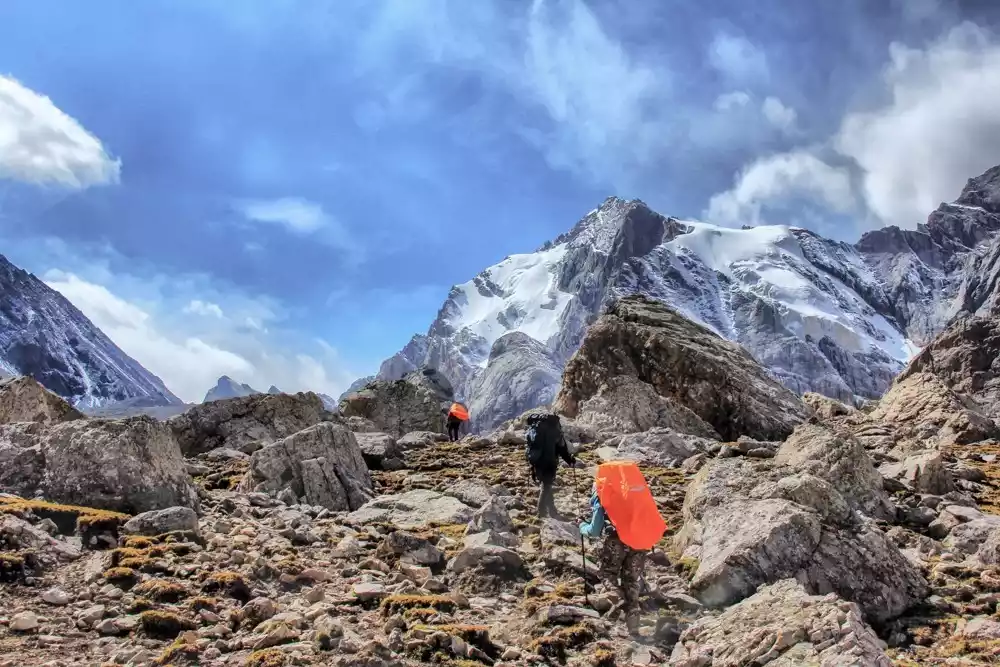
This is the most difficult and the most highlight of the trip. The highest pass is the Akbulak Pass at 3,800 meters above sea level. Standing on the top of the pass, you can have a panoramic view of the overlapping peaks and mountains!
✔️Changeable weather
You may experience all four seasons in one day. It may still be summer in the morning, but you may encounter hail and avalanches in the afternoon. It is very necessary to be well prepared with sufficient equipment!
📌Wusun Ancient Road Hiking Information Card
Wusun Ancient Road - Light Edition
Duration: 9 days and 8 nights (7 days of hiking)
Hiking distance: 120km
Activity Difficulty: ★★★★★★☆
Scenery index: ★★★★★★★
Maximum altitude: 3830m
Suitable for people: 16-60 years old, healthy hikers (with more than 3 days of hiking and camping experience)
Physical fitness reference: Ability to hike more than 18 km for 5 consecutive days
📌Why hike the Wusun Ancient Trail?
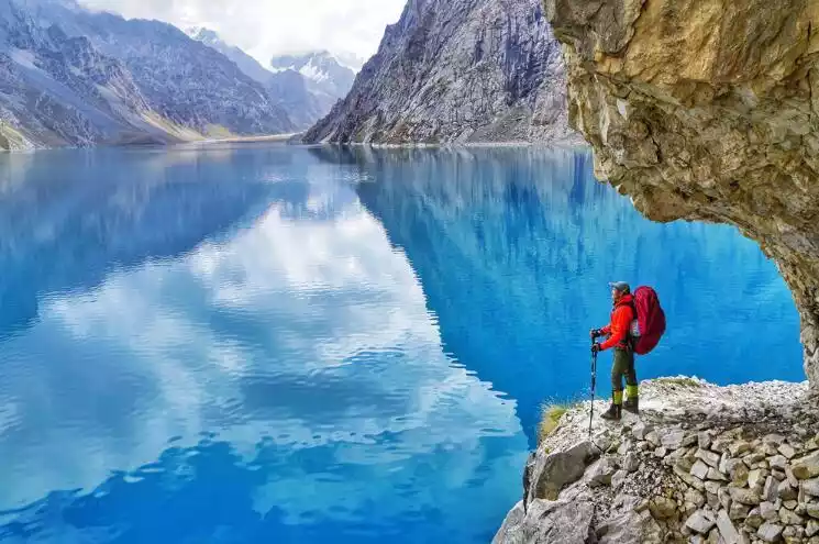
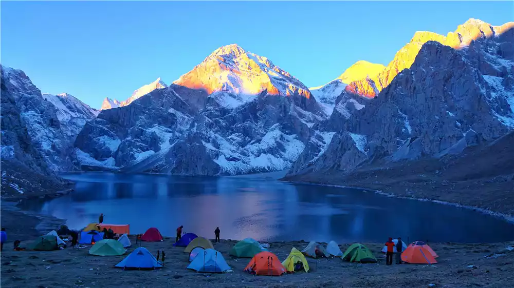
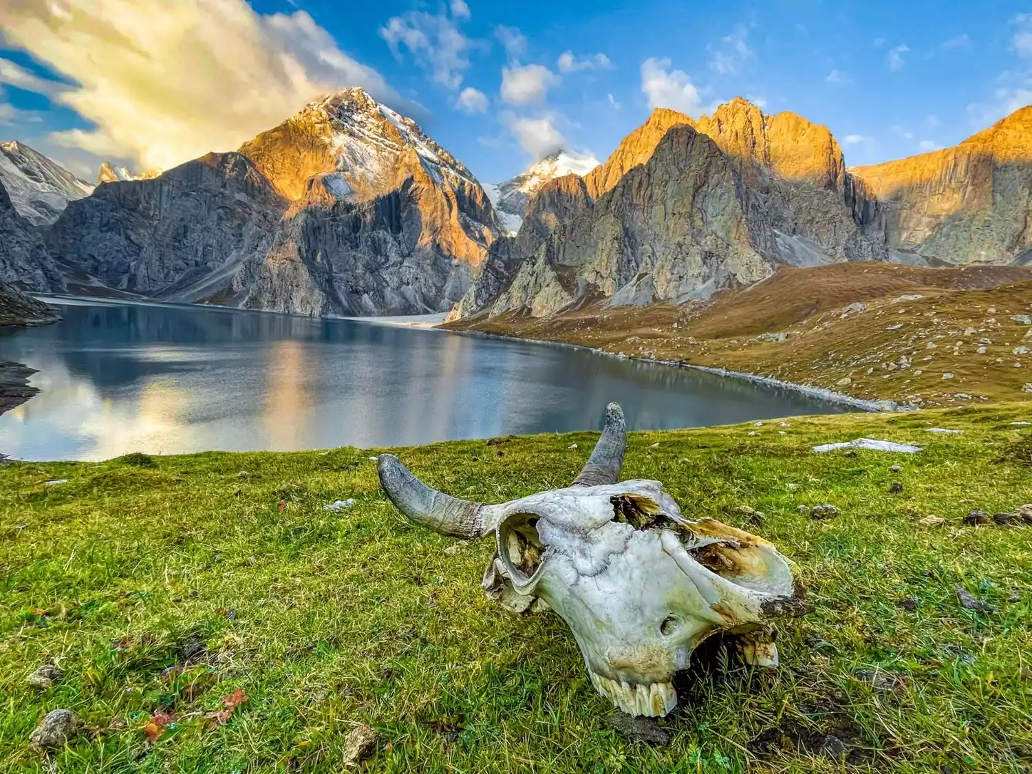
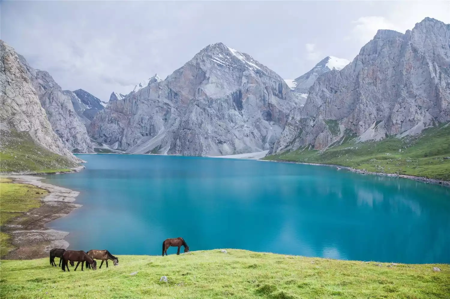
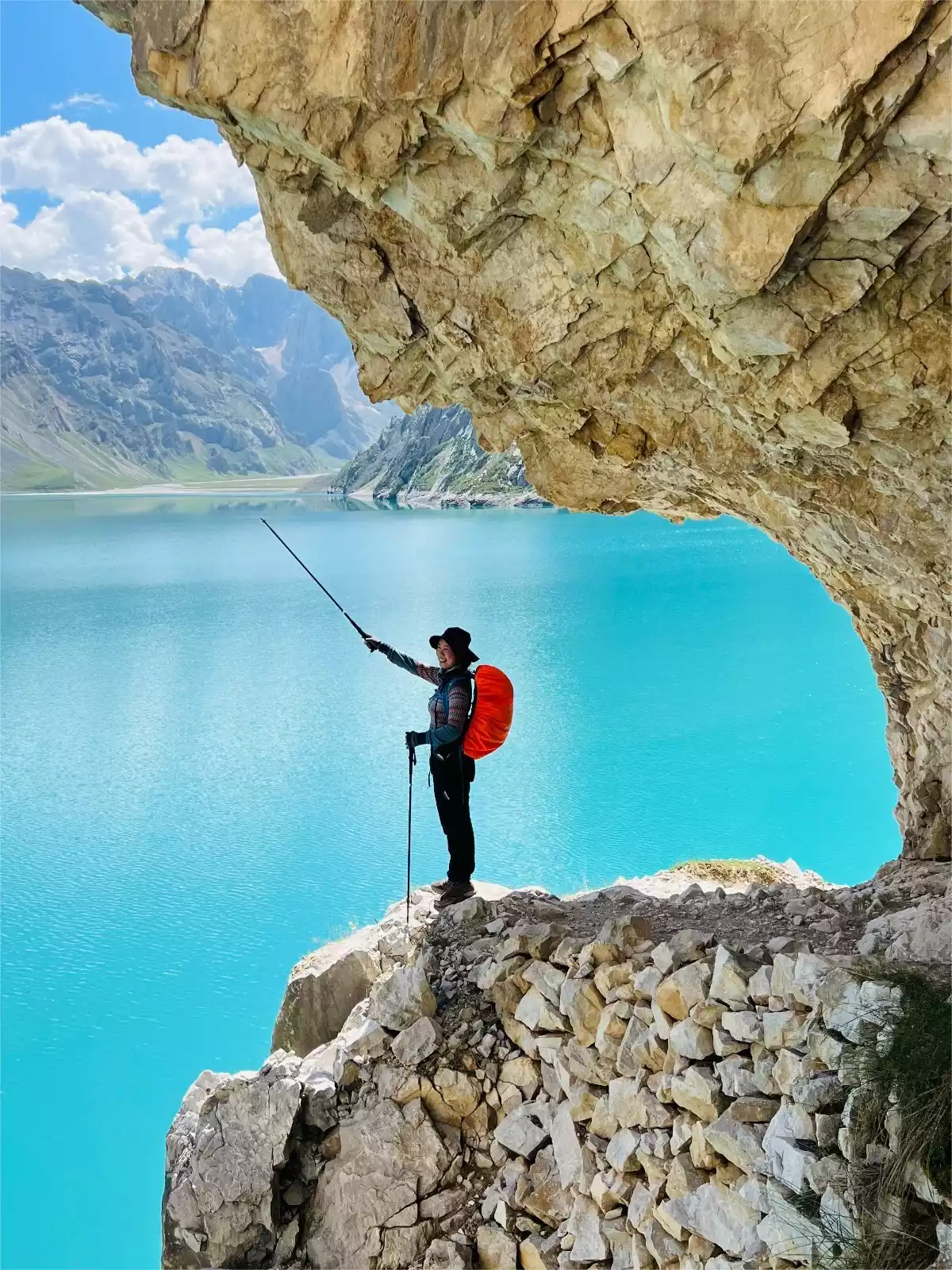
Paradise Lake
Perhaps only when you have seen the Dream Paradise Lake with your own eyes will you sigh that you have no regrets in your life. Surrounded by mountains, the lake water is as clear as jade, as if it is no longer in this world, and all the hardships along the way become worth it.
Four seasons at a glance
In the near distance is a spring meadow, with golden poplar trees scattered by the river; in the far distance is a lush green forest, and at the end are quiet snow-capped mountains.
Millennium Silk Road
Zhang Qian, Princess Jieyou and others passed by here. There are still garrisons and beacon towers along the way. Setting foot on them, it feels like you have strayed into time a thousand years ago.
📌Itinerary reference
Day 1: Urumqi
Day 2: Kuqa - Heiyingshan Township (1920m) - Bozirige River Valley (2180m)
Go up the river valley from the entrance of Heiying Mountain at 1940 meters to the camping site at Bozizhige River Valley at 2180 meters.
🔹Hiking distance: about 17 kilometers
Hiking time: 8 hours
Campsite altitude: 2180 meters
Day 3: Bozirig River Valley Camp (2180m) - Bozikrig River Valley Camp (3280m)
The river valley is winding and basically all gravel slopes, and the glacial meltwater flows into the valley along the cracks in the gravel. The river water sometimes overflows the rocks, and sometimes surges and hits the rocks.
We will cross the river frequently on this day, about 30-40 times, with varying currents.
🔹Hiking distance: about 22 kilometers
Hiking time: 11 hours
🔹Altitude gain: 1,100 meters
Campsite altitude: 3280 meters
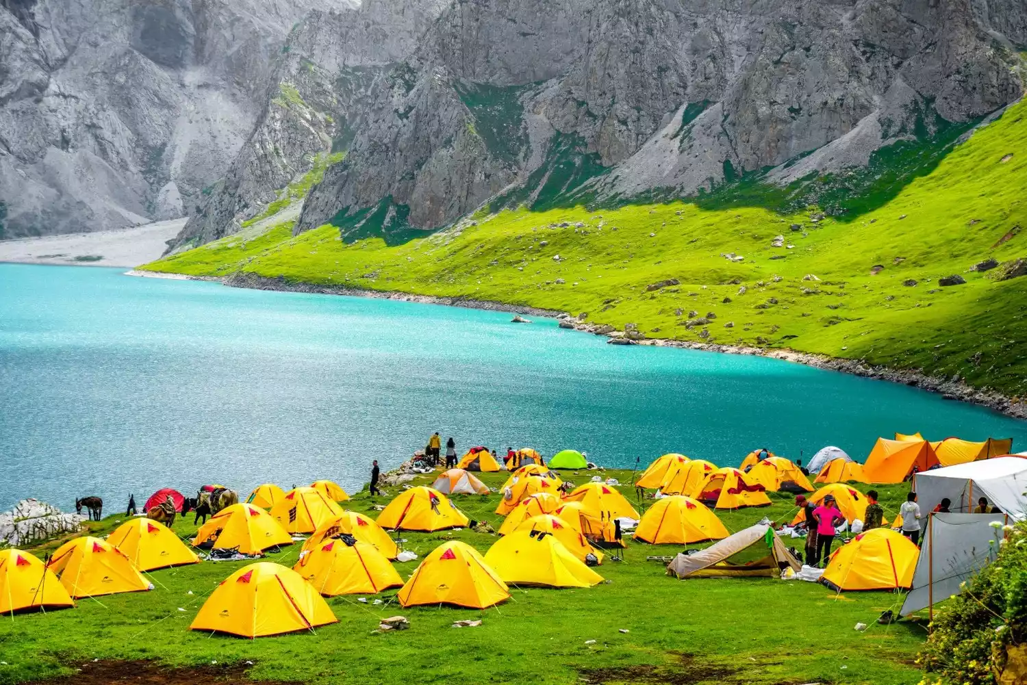
Day 4: Bozikrig River Valley Camp (3280m) - Akbulak Pass (3820m) - Akkule Alpine Lake (Heaven Lake, 3020m)
The journey continues uphill, crossing the Daban Pass to the famous Tiger Pass, a popular check-in spot for internet celebrities. The lake is like a sapphire, reflecting the mountains and green lands around it.
🔹Hiking distance: about 15 kilometers
Hiking time: 7 hours
🔹Altitude gain: 540 meters
🔹Altitude descent: 800 meters
Campsite altitude: 3020 meters
Day 5: Akekule Alpine Lake (Heaven Lake, 3020 meters) - Kuokesu River Camp (1980 meters)
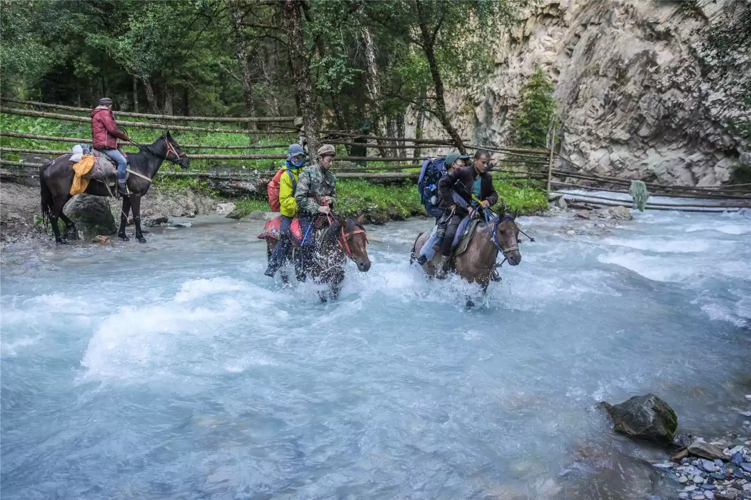
Going down the river valley is a deep mountain pasture dotted with cattle and sheep. Arriving at the Kuokesu River, we crossed the zip line and set up camp.
🔹Hiking distance: about 18 kilometers
Hiking time: 8 hours
🔹Altitude descent: 1040 meters
Campsite altitude: 1980 meters
Day 6: Kuokesu River Camp (1980m) - Kunosayi Camp (3350m)
We crossed streams and entered the jungle, and the Koksu River behind us meandered through the valley like a blue-green silk.
🔹Hiking distance: about 18 kilometers
Hiking time: 10 hours
🔹Altitude gain: 1,370 meters
Campsite altitude: 3350 meters
Day 7: Kunosayi Camp (3350m) - Qiongdaban (3760m) - Qiongkushitai Valley Camp (2800m)
Walking along the Kunosay River Valley, you can see the peaks from the top of the pass.
🔹Hiking distance: about 14 kilometers
Hiking time: 8 hours
🔹Altitude gain: 410 meters
🔹Altitude descent: 960 meters
Campsite altitude: 2800 meters
Day 8: Qiongkushitai Valley Camp (2800m) - Qiongkushitai Village (2000m) - Yining
All the way down the river valley, you will see excellent alpine pastures, herds of cattle and sheep, and dotted wooden houses.
🔹Hiking distance: about 14 kilometers
Hiking time: 6 hours
🔹Altitude descent: 800 meters
Day 9: Yining
📌Equipment Sharing
bear
Large backpack or pannier bag (luggage limit 15kg), 30L small carry-on bag
sleeping bag
In June/September, please prepare a down sleeping bag with a filling capacity of more than 1000 grams. In July/August, please prepare a down sleeping bag with a filling capacity of more than 700 grams. Cotton sleeping bags are not allowed.
clothing
Sweat-wicking clothes (2-3 pieces), quick-drying pants, fleece clothes, windbreakers, down jackets
shoe
Mid-high waterproof hiking shoes, multiple pairs of hiking socks, one pair of waterproof socks, river trekking shoes (covered toes, hard sole)
sun protection
Sunglasses, sun hat, headscarf, ice sleeves, sunscreen and moisturizing products
other
Waterproof bags (multiple), trekking poles (double poles), thermos, bowls and chopsticks, headlamp, gloves, knee pads, toiletry bag, personal medication, ID card, snow gear
📌Why choose the tourists style?
Food Tour
Three meals are included during the hike, with a standard four-course meal and one soup
Senior team leader
1 tourist outdoor leader + local China Mountaineering Association/WAFA certified leader (1:8 ratio)
Travel light throughout the trip
High-quality horse caravan team carries luggage
Equipment rental
Provide tent, moisture-proof mat rental and waterproof socks procurement services
Equipment inspection
Strictly check the equipment of team members before the trip to avoid unqualified equipment entering the mountains and effectively avoid risks
Professional logistics
Professional communication guarantee, star-rated camp accommodation and meals