20 outdoor landscapes around the world: It turns out you can have fun like this!
Preface
When I opened up the outdoor travel from the perspective of landscape, I found that——
If we regard the earth as a three-dimensional geography book, then every trip we take is like flipping through an atlas that records the magnificent mountains and rivers.
In China, 95% of the landforms can be found here!
The only thing missing is the fjord!
Why do fjords love Northern Europe so much?
Simply put, fjords are formed by the interaction between high-latitude glaciers and the ocean. Tens of thousands of years ago, glaciers carved out U-shaped valleys. As the ice slid into the sea, rising sea levels flooded the valleys, creating the epic, sheer cliffs of the Norwegian fjords.
China's eastern coastline is flat, and the glaciers of the last ice age did not reach the seashore. This "missing" has made the gentleness of the Jiangnan water towns and the grandeur of the Norwegian fjords the A and B sides of the earth's aesthetics.
Tips for Trivia
China's only "fjord-like" canyon: the sea-eroded canyon of the Yushan Islands in Xiangshan, Zhejiang. Although there is no glacier involved, the rugged cliffs carved by waves also have a unique charm.
From snow-capped mountains to deserts, from volcanoes to rainforests, from glaciers to cliffs...open up a new way of looking at the world from the perspective of landforms and landscapes!
The world's 20 most stunning landforms, each with recommended outdoor itineraries, so you can start planning your vacation!
01 Snow Mountain
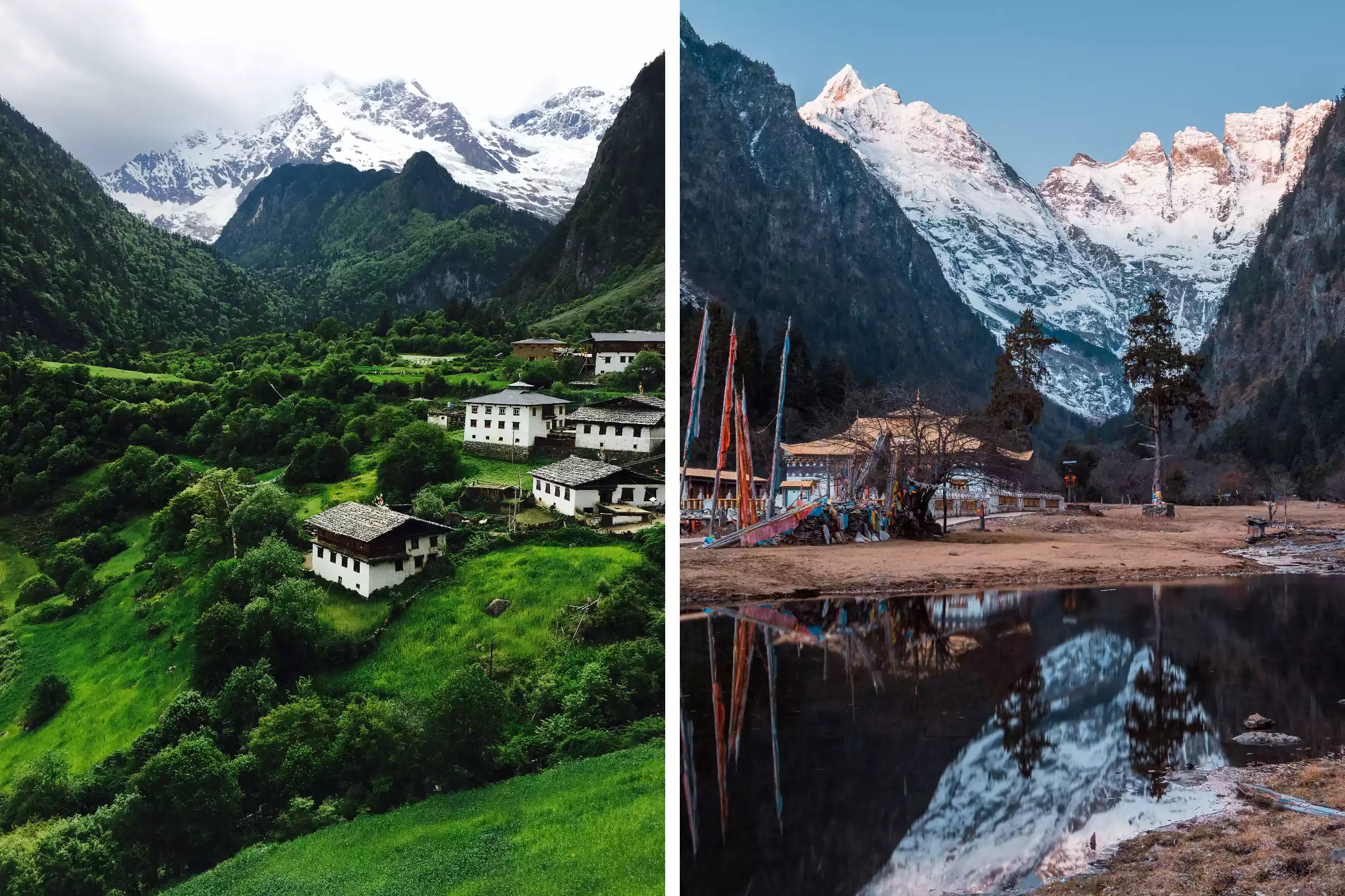
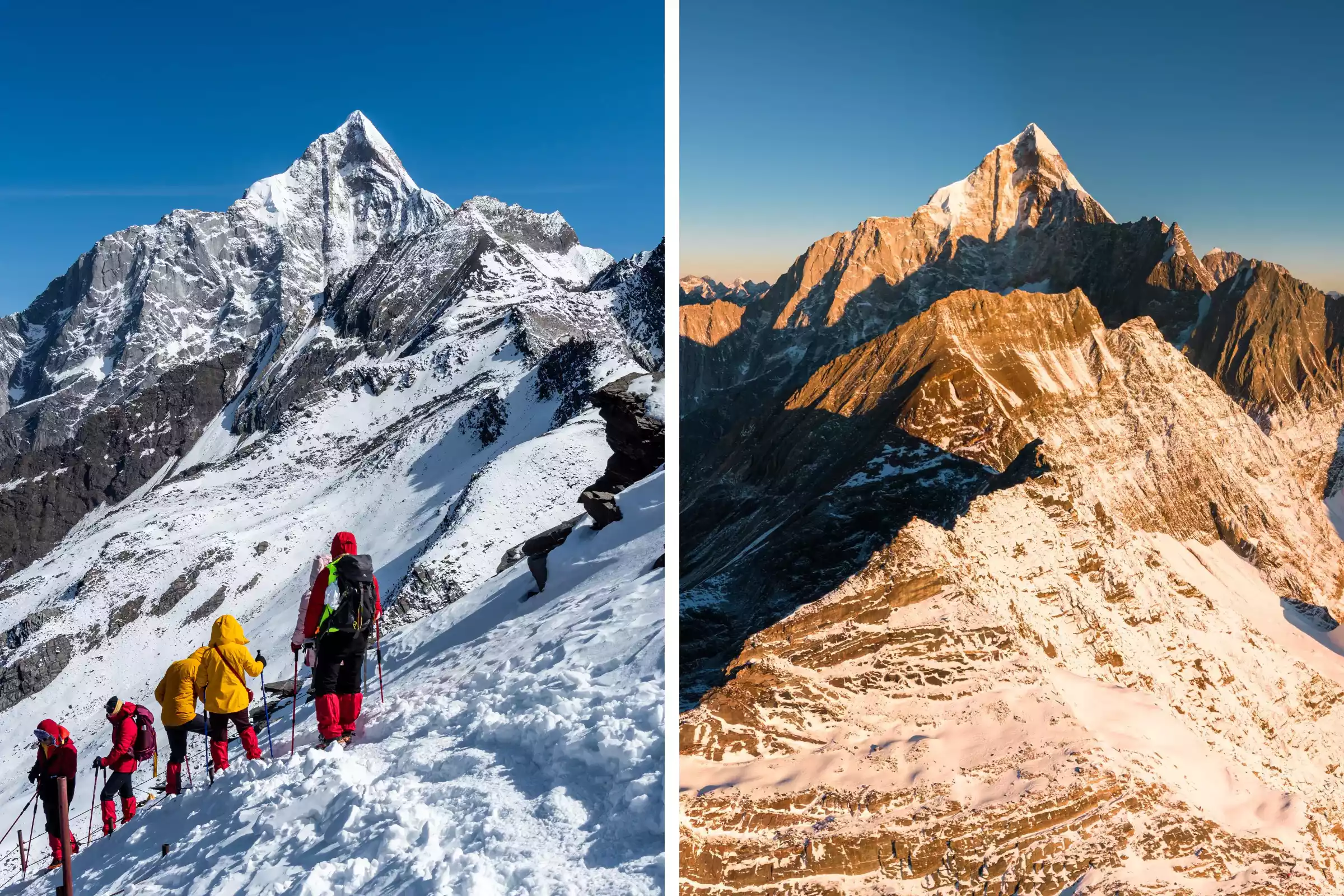
If you want to see snow-capped mountains, China is the place to be! "You don't know the grandeur of snow-capped mountains until you've visited the Qinghai-Tibet Plateau!" The Qinghai-Tibet Plateau is not only China's most renowned snow-capped mountain region, but also a world-class geographical and cultural landmark. It encompasses the Himalayas, Kunlun Mountains, Gangdise Mountains, and Hengduan Mountains, collectively forming the highest, most spectacular, and most culturally unique snow-capped mountain cluster on Earth. The Yubeng and Siguniang Mountains regions of the Hengduan Mountains are prime destinations for hikers and mountaineers!
Summer Rainfall and Autumn Rainfall
Meili Snow Mountain: One of the four sacred mountains of Tibetan Buddhism, the wonder of "Sunlight Shining on the Golden Mountain" is world-famous, and the Yubeng Hiking Route was rated as the first of the "Top Ten Hiking Routes in China" by National Geographic.
Viewpoints from the Big Peak and the Second Peak
Mount Siguniang: "Eastern Alps", the Big Peak (5025 meters) and the Second Peak (5276 meters) are the first choice for entry-level snow mountain climbing, with an annual climbing volume of over 20,000 people!
🔻Route Recommendation
02Volcano
Mount Rinjani on Lombok Island in Indonesia is an active volcano at an altitude of 3,726 meters. It has the world's largest volcanic lake [Segara Anak Lake], and there is also a small volcano Baru formed by a secondary eruption in the lake.
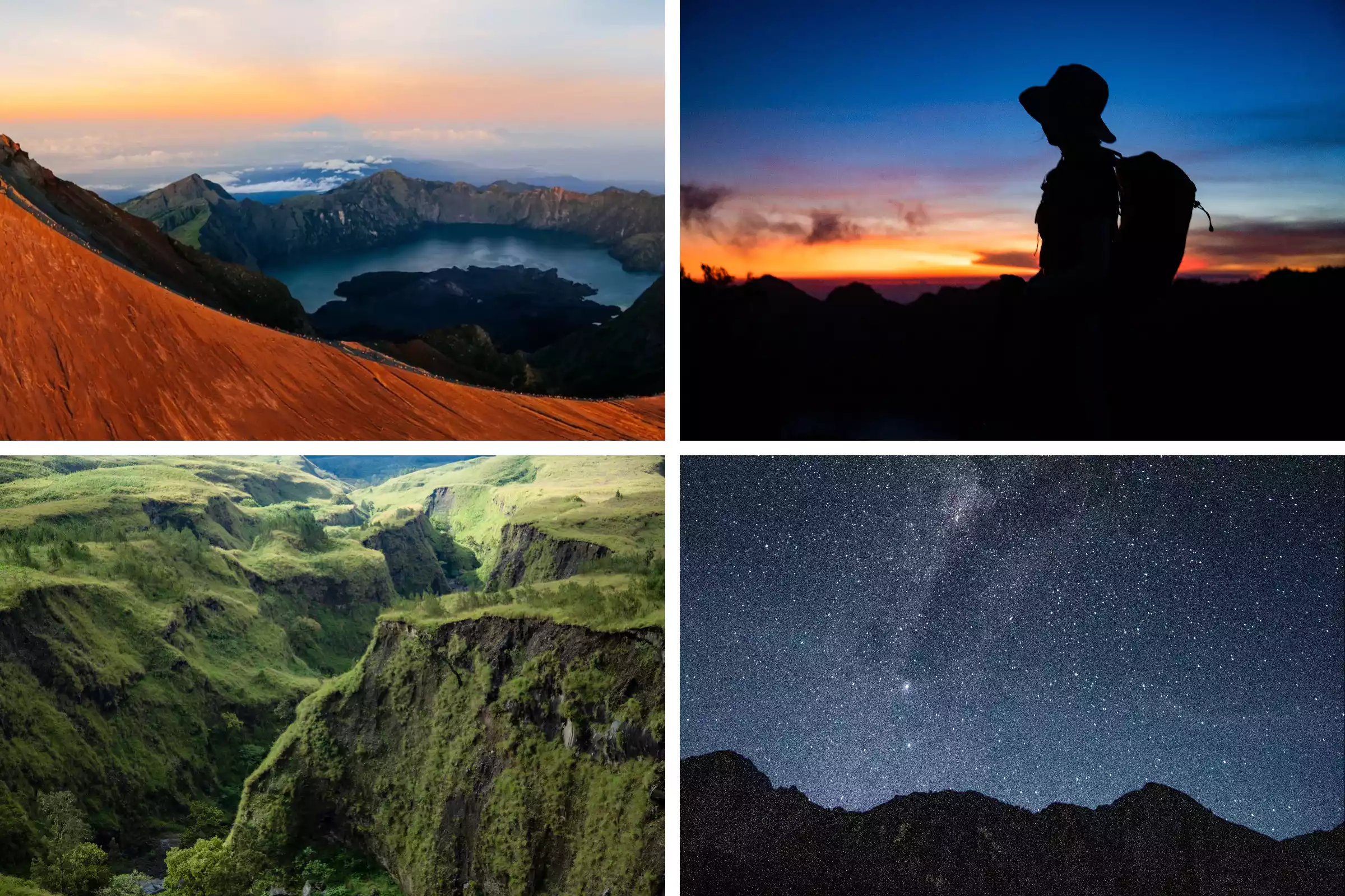
The hike starts from Sembalun Village, crossing the dense tropical rainforest, stepping on the soft alpine meadow, climbing the crater where rocks and volcanic ash are mixed, and sulfur smoke rises from the cracks in the ground. The most shocking thing is watching the morning sun rise from the sea of clouds. At night, the hot springs wash away fatigue, and when you look up, you can see the Milky Way pouring down from the southern hemisphere.
04Lake
When you have seen too many gentle lakes on the plains, you will definitely be surprised by the five "Pearls of the Plateau" surrounded by the Gongga Mountains!
Lengga Tso is widely considered the "best mirror image of Gongga Peak," offering stunning reflections of the main peak. The twin lakes of Lisuohai are ideal for camping, and at night, the Milky Way seems within reach!
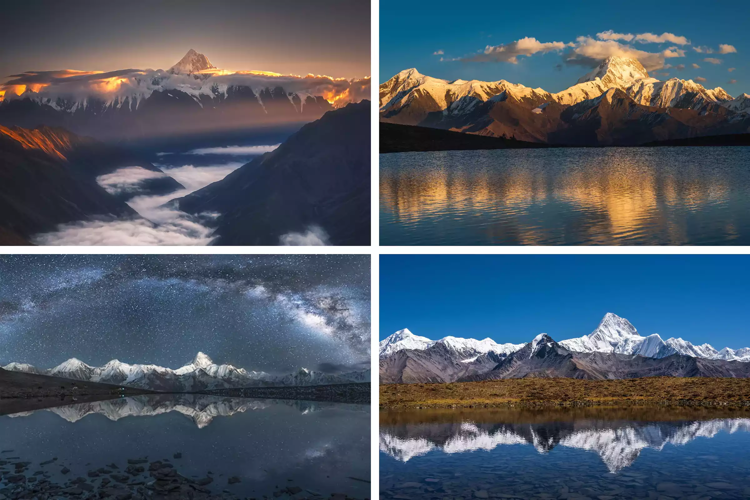
San'en Co is smaller than Lenggacuo, with lush flowers and plants around it, creating a more layered feel. Zuoruo Lake is a seasonal lake, with water from July to November, perfect for capturing close-ups of Mount Gongga and silhouettes of people.
05 Yadan
Compared with the yardang landforms around the world, why is Jordan's National Trail more worth visiting?
Its uniqueness lies in the fact that it is not only a geology textbook, but also a living history of civilization. It is the link that connects the ancient city of Petra, Little Petra and other world heritage sites!
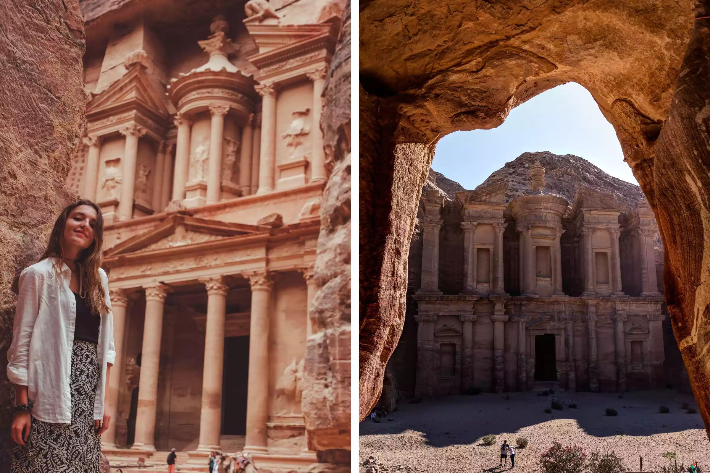
Unlike the Yardangs in Dunhuang, China, the sandstone in Wadi Rum, Jordan, is rich in iron and has a unique brick red color. It changes into dreamy tones from orange to deep purple at sunrise and sunset.
As a dual natural and cultural heritage, it preserves rock paintings, inscriptions and archaeological sites dating back 12,000 years. When the rose-colored rock buildings form a sharp contrast with the rugged Yardang landforms, this collision of nature and humanity can be called a highlight moment in the history of hiking.
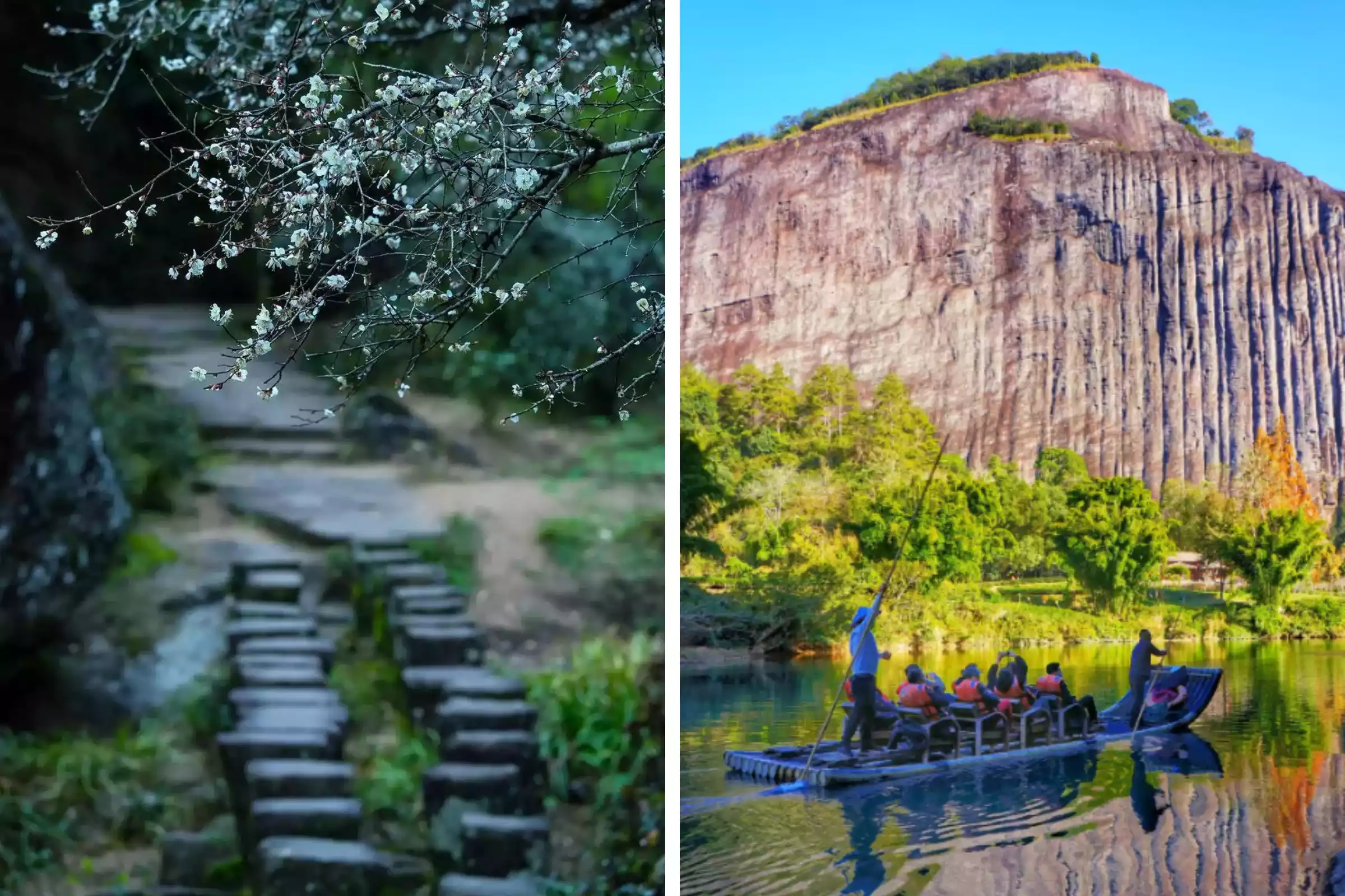
06 Karst
The Li River Basin boasts one of the most typical karst landforms in the world. The Yangdi-Xingping section was named one of China's Top Ten Hiking Routes by National Geographic China. The Nine Horses Mountain, a cluster of over 20 independent karst peaks, creates a natural mural-like formation, and the "Nine Horses" formations are clearly visible from a hiker's perspective.
As you pass by the reflection of the yellow cloth, the classic scene from the 20-yuan banknote unfolds before your eyes in three dimensions. The meandering topography of the Li River is extremely rare in the karst region, and you can observe the "Eye of the Li River" formed by a 180-degree bend. Here, you can go from being "outside the painting" to "being inside the painting."
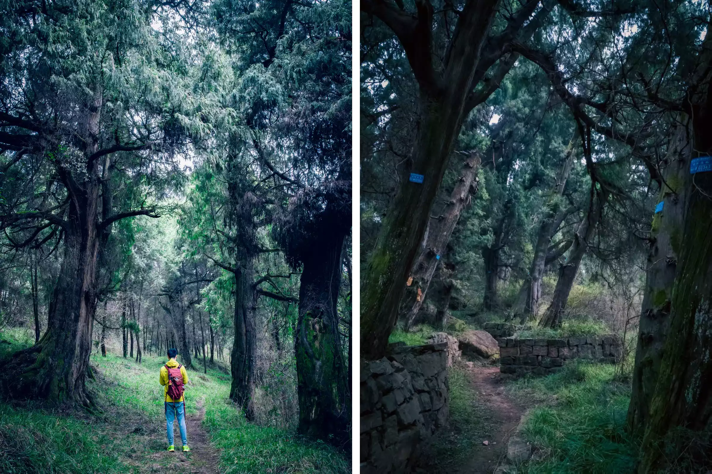
08 Forest
Shennongjia, the rooftop of central China, is the most intact virgin forest ecosystem at the same latitude in the world. It is also a model for global natural heritage protection. The legends of "Laojun refining elixir" and "wild men appearing" have added a lot of mystery to Shennongjia.
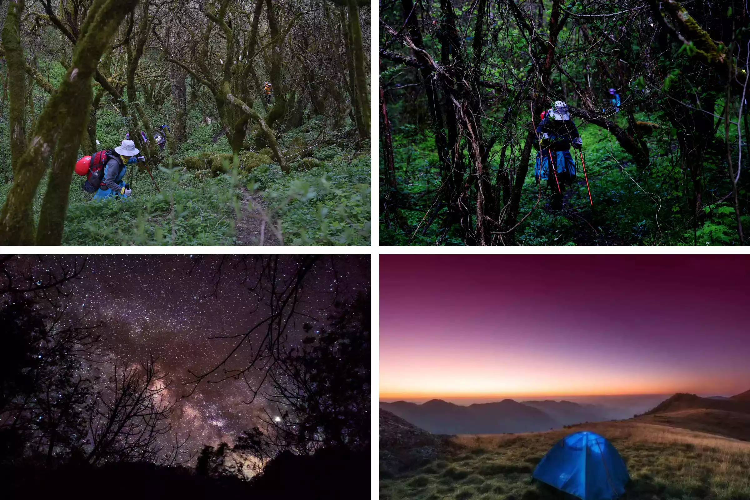
A three-day hike takes you through four major vegetation zones. The "Central China Meadow" at Laojunzhai, at an altitude of 2,900 meters, is full of golden lotuses and purple irises in summer, and you can observe the Milky Way at night.
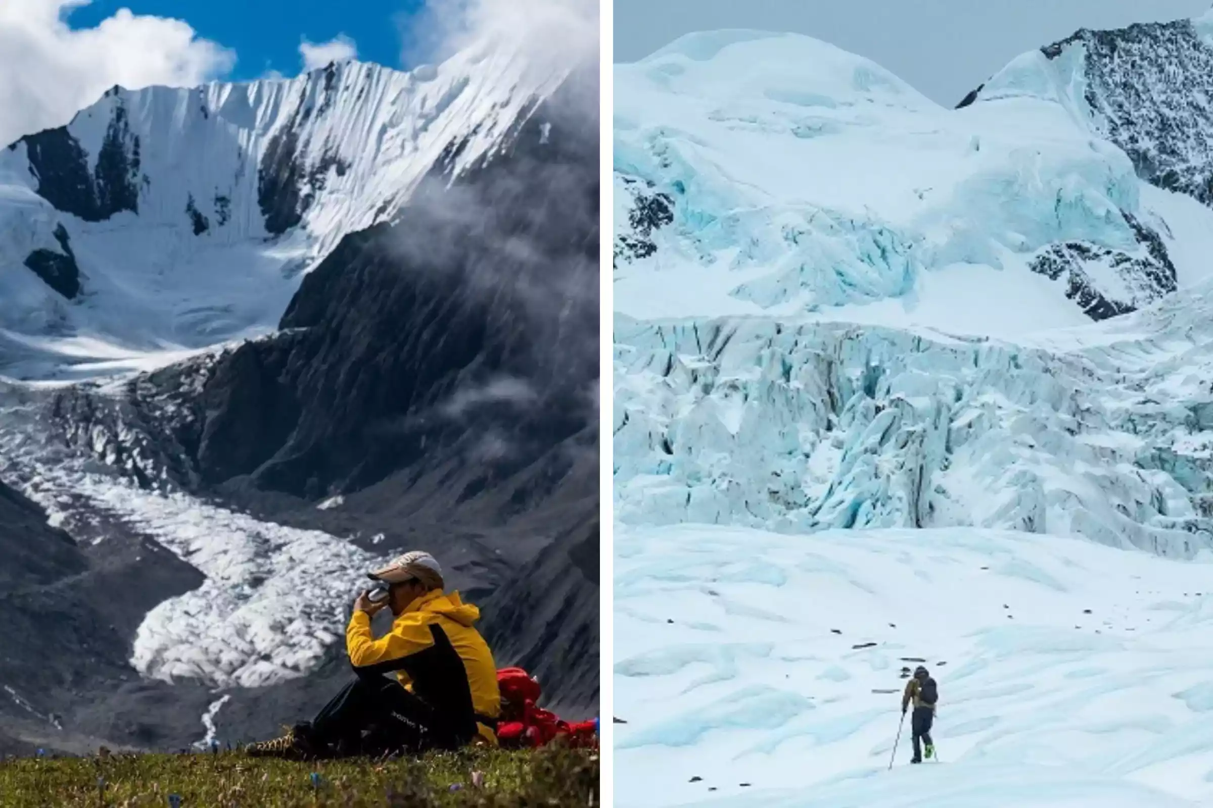
10 Glaciers
Glacier hiking at Leduomanyin is more than just a distant landscape; it's a unique, up-close-and-personal experience. While the Hailuogou glaciers are spectacular, cable cars and plank roads have transformed them into a tourist attraction. The glaciers at Shuangqiaogou in Siguniang Mountain are more of a backdrop, while the Leduomanyin glacier hike offers a more professional experience. Wearing crampons, you'll walk on the millennia-old glacier, interacting with it up close. Compared to a professional Antarctic glacier expedition, hiking at Leduomanyin is more accessible.
11Rainforest
If I could only recommend one rainforest hike, I'd choose Banna! Not because it's the easiest or cheapest, but because it's the only place in China where you can feel the pulse of a pristine rainforest.
Your Jino guide will teach you how to use natural minerals to create rainforest makeup, search for bamboo snakes in the morning mist, enjoy a rainforest feast using banana leaves as plates, and even climb a 20-meter-high banyan tree.

Hiking in the Xishuangbanna Rainforest is arguably the most interesting hike in China! It's China's only UN-certified tropical rainforest and the last remaining green wonder at 21° north latitude.
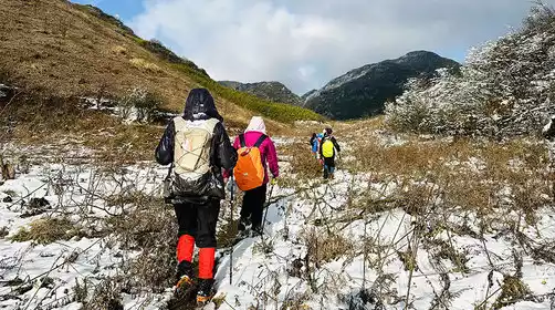
12 Grassland
If you are tired of the "straightforward" nature of the grassland, Kalajun has already redefined the ceiling of grassland hiking with the curves of the "human grassland"!
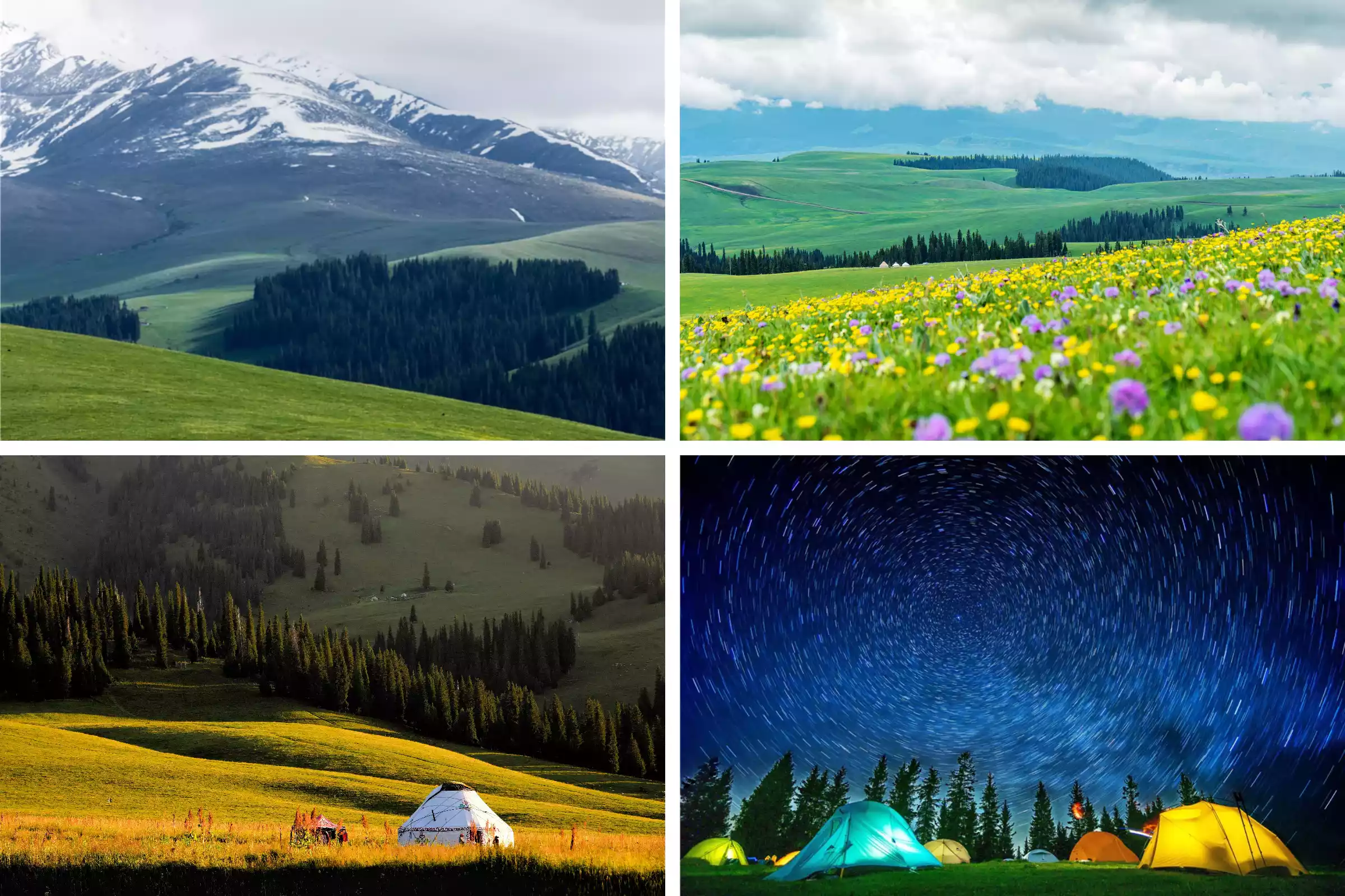
From May to July, wild flowers are everywhere in the mountains. Rose-purple primroses, followed by nasturtiums and thyme, turn the meadows into a "sky garden". The canyons and snow-capped peaks complement each other, and the forests and grasslands are inlaid, forming a natural picture frame.
13 Danxia
While other Danxia rocks compete for beauty, Wuyi Mountain has "rock charm" etched into its DNA. Hike along the rocky and floral trails, where tea trees grow tenaciously from the cracks of the Danxia rocks. Enjoy the scent of birdsong and the fragrance of flowers along the Tea Trail.
Here, you'll experience the visual impact of the red cliffs of Chibi and the secluded charm of the deep canyons. The Jiuqu River winds around the peaks like an emerald belt. Rafting and admiring the mountains is a picturesque sight, with red mountains, clear water, green trees, blue sky, and white clouds complementing each other. This unique Danxia landform is unique in China.
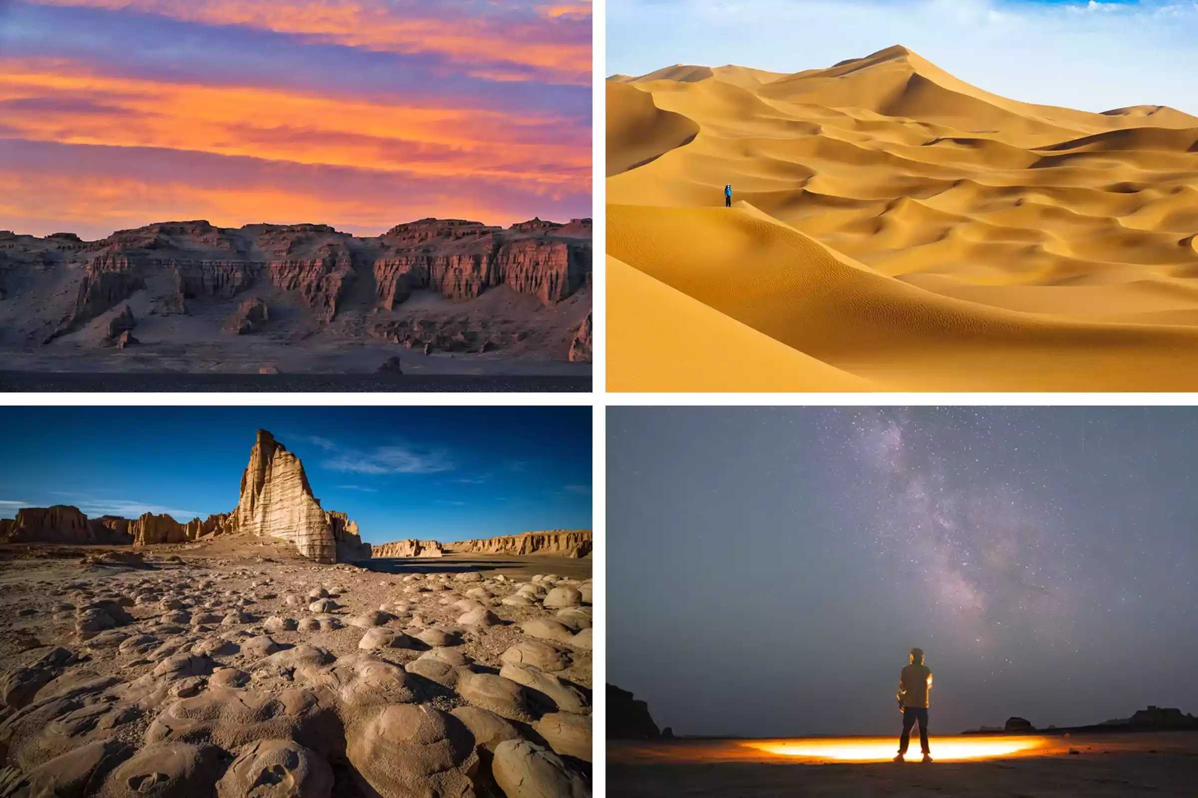
14 Gobi Desert
Unlike the Dunhuang Gobi Desert, the wind-eroded landforms of Dahaidao are in their "young and middle-aged" stage. Their uniqueness lies in the magnificence of the "Ancient Silk Road". The 50-kilometer uninhabited hiking route connects the Yadan Group, the Flaming Mountain Canyon, and the Kumtag Desert. The wind-eroded landforms look like an alien world in the dusk light and shadow.
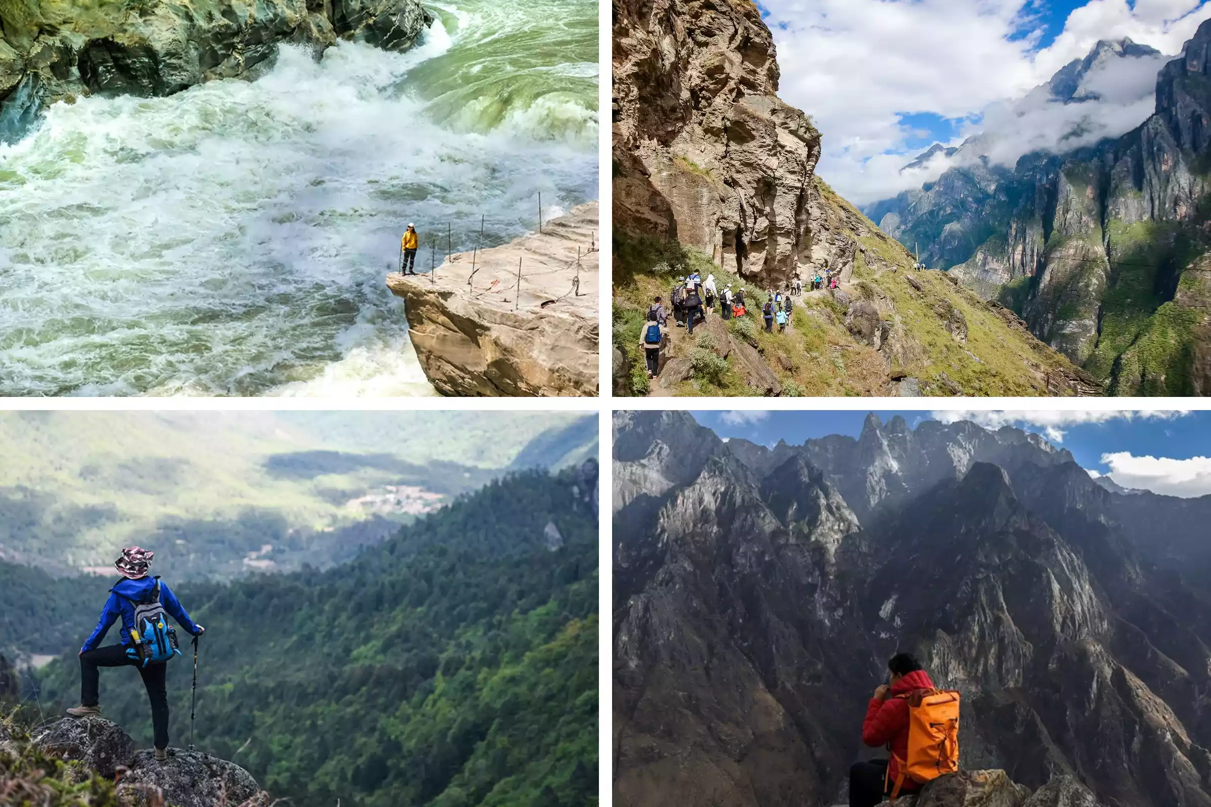
15 Canyon
Tiger Leaping Gorge, where the Jinsha River carves out one of the world's deepest canyons between Haba and Jade Dragon Snow Mountains, is a popular destination. The Tiger Leaping Gorge High Road Hiking Trail is one of the world's top ten hiking trails. The path follows a cliff face, with sheer cliffs on one side and the surging river on the other. The 168-step Warrior Staircase will get your heart racing. The "stunning balcony" at Halfway Inn faces the snow-capped peaks, and the reflection of the canyon sways in your coffee cup...
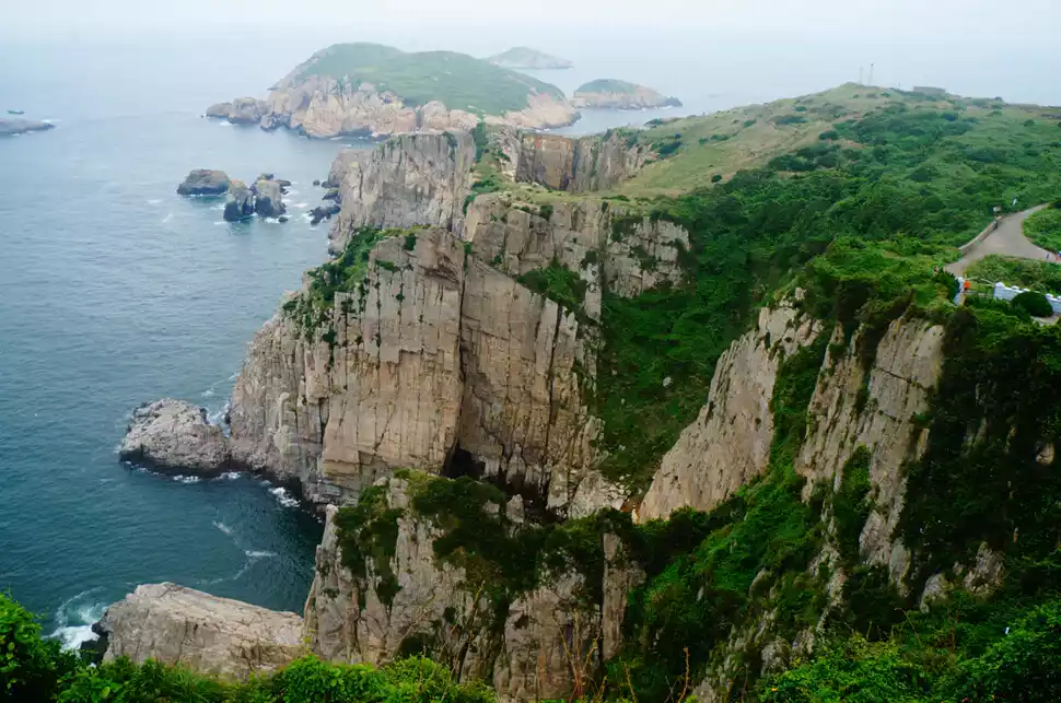
16 Coast
Unlike other coastlines, the advantages of Hong Kong's four trails lie in the free switching between the city and the mountains and the sea, the diverse landforms, and greater convenience.
The MacLehose Trail's volcanic columns, the Phoenix Trail's vibrant coastline, the Wilson Trail's mountain-sea corridor, and the Hong Kong Island Trail's urban skyline—all these coastal features are condensed within a 45-kilometer radius. Even more remarkable, each route offers comprehensive refueling facilities, allowing travelers to experience the full potential of the route even with minimal travel.
17 Ancient Trails
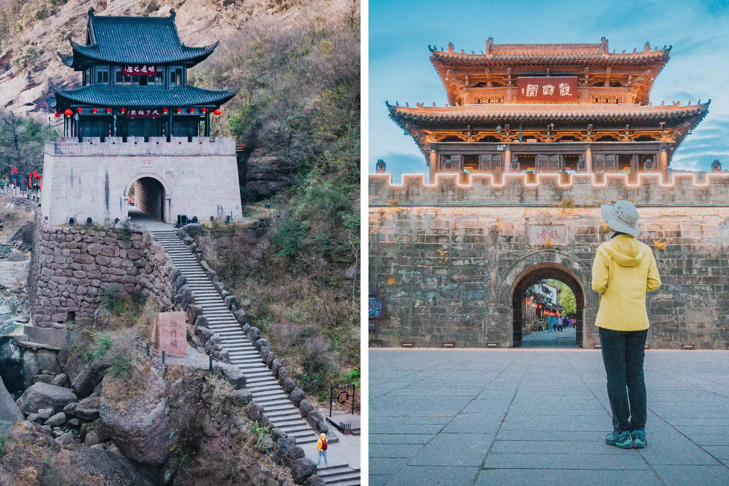
Compared to the commercial relics of the Ancient Tea-Horse Road, the hike along the Ancient Shu Road is even more breathtaking: the remains of the pre-Qin plank road in Mingyue Gorge are embedded in the cliffs, the Jialing River surges through the valley floor, and as you step onto the bluestone slabs of the Jinniu Road, the thousand-year-old cypresses on both sides, like green domes, shade the sky.
Cross Tianxiong Pass and stroll through Zhaohua Ancient City, built during the Eastern Han Dynasty and boasting over 1,800 years of history. At night, listen to a storytelling performance of the Three Kingdoms story, as if you've just fallen into a 3,000-year dream.
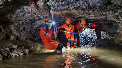
18 caves
Leye, in northern Guangxi, China, boasts the world's largest tiankeng complex, a relatively uncommercialized and less-visited destination. From the entrance of Tanjiakeng, you can rappel 120 meters to the bottom of the tiankeng, where a unique ecosystem exists. There's also a 40-meter descent through Fengzidang's three caves and pits, and the Tyndall Light Mystery. You can also traverse the stalactite forest of the Red Rose Hall amidst the roar of an underground river.
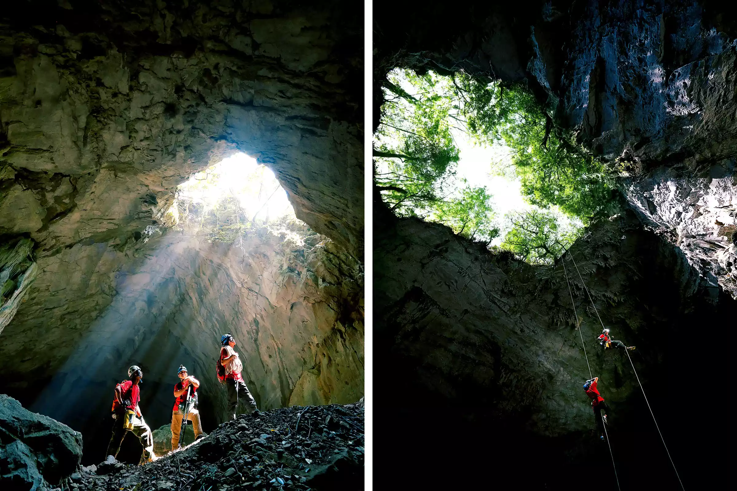
It's not a celebrity check-in, this original and in-depth experience is even more shocking~
19 Peak Forest
The peak forests of Xiangxi are unique in the world, made of quartz sandstone. The Golden Whip Stream winds through 3,000 stone pillars, and the prototype of the "Hallelujah Mountain" in Avatar is right within reach.
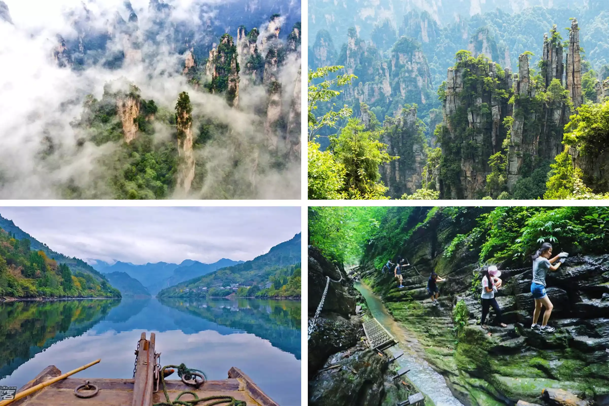
Binglang Valley's "Angel's Gate" natural bridge, known as the "Gate of Angels," offers a breathtaking view. Passing beneath a hundred-meter-high arch, you'll find a bottomless cenote beneath your feet, while a primeval forest teems above the bridge. This "looking up is like looking at a cliff, looking down is like looking at an abyss" experience is simply unattainable on Yangshuo's Yulong River Trail or the rural trails of Wanfenglin.
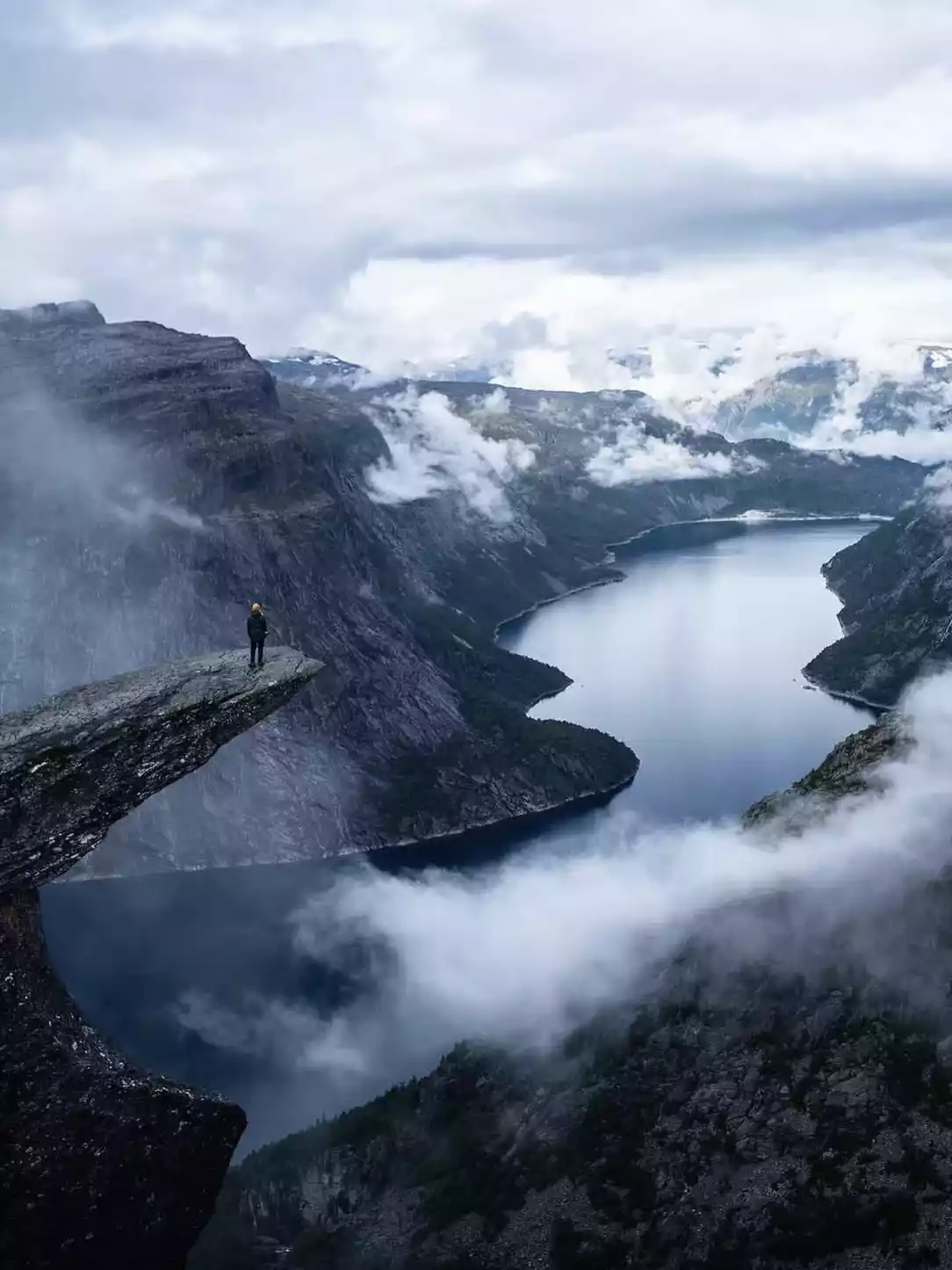
20 fjords
If you want to experience the essence of fjord landscapes, head to Norway! Norway's three most remarkable rocks are the Pulpit Rock, with its 604-meter vertical drop to the Lysefjord; the Miracle Rock, suspended a thousand meters below the surface, with just one cubic meter of rock wedged between two cliffs. Standing on the rock for photos requires courage; and the Devil's Tongue, with its 11-meter-long protrusion into the lake.
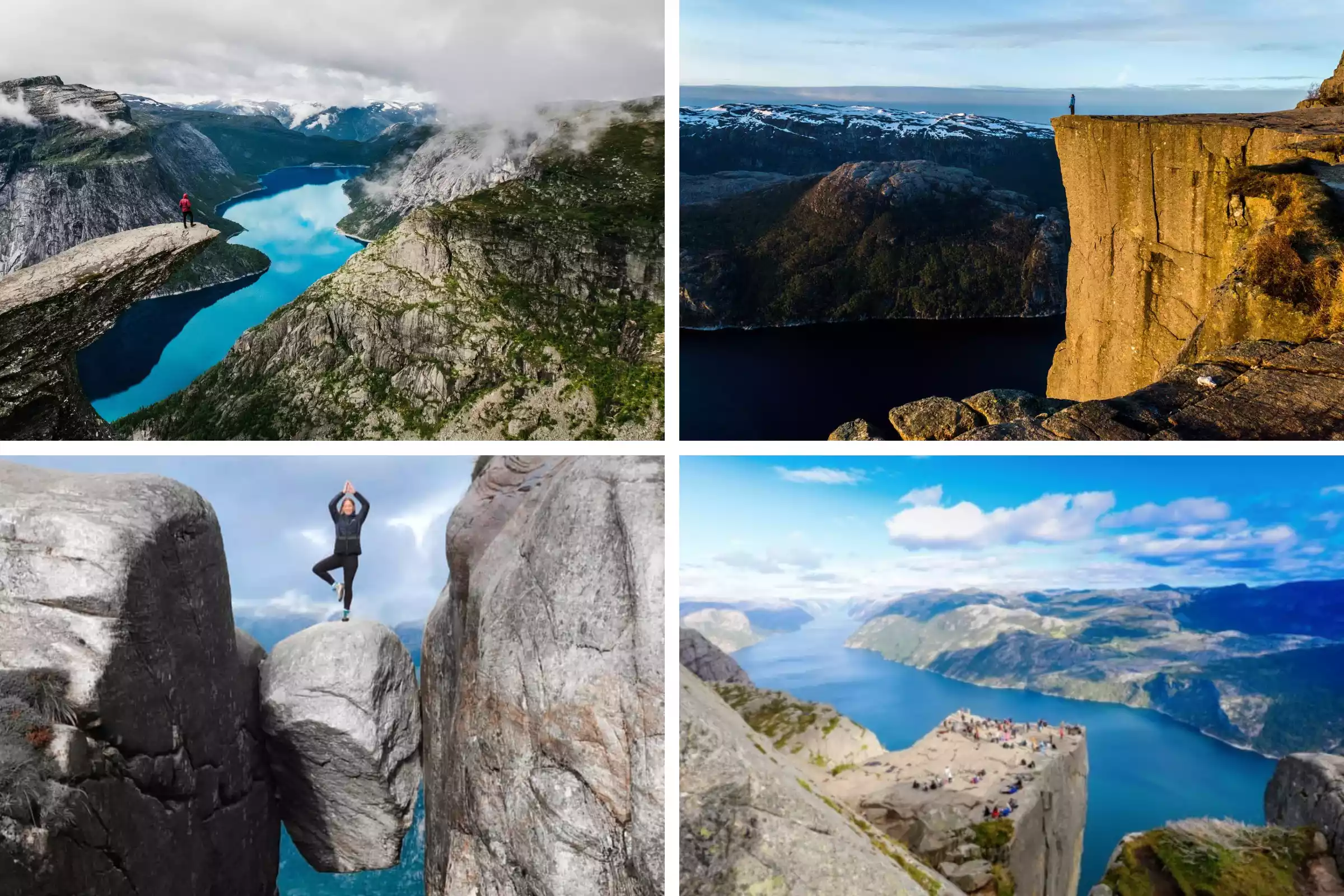
Compared with other fjord routes, Norway's fjord route allows you to more intuitively feel the U-shaped valley landforms of glacial movement and experience a more vertical drop.