Hiking the Rock Trail! Daily itinerary recommendations, including gear suggestions
Preface
Hello, my friends, today our outdoor product manager from Tourists Style will introduce to you the "Rock Road". Is this hiking route really so beautiful?
Let's see what he said:
Hello everyone, I am the outdoor product manager of Tourists Wind - Buheng.
I've hiked over 20 outdoor trails in China, visiting 55 cities across the country, but the Zhagana Crossing trail has always been on my mind! This May Day holiday, I headed to Zhagana to explore the route.
Zhagana, it is a truly magical place. Gannan, you are so foolish not to promote this line!
Today, I'll introduce you to Zhagana and the Rock Road from my perspective! I'll guide you through five key aspects of hiking: "Getting to Know Zhagana - Getting to Know the Rock Road - Choosing the Right Season - Gear Recommendations - and a Trip Log."
01 What is “Zhagana” and where is it?
Every time I see the word "Ga" on the streets of Gansu, the strong northwestern flavor hits me. This word means "small, young" in the northwestern dialect.
So what about "Zhagana"?
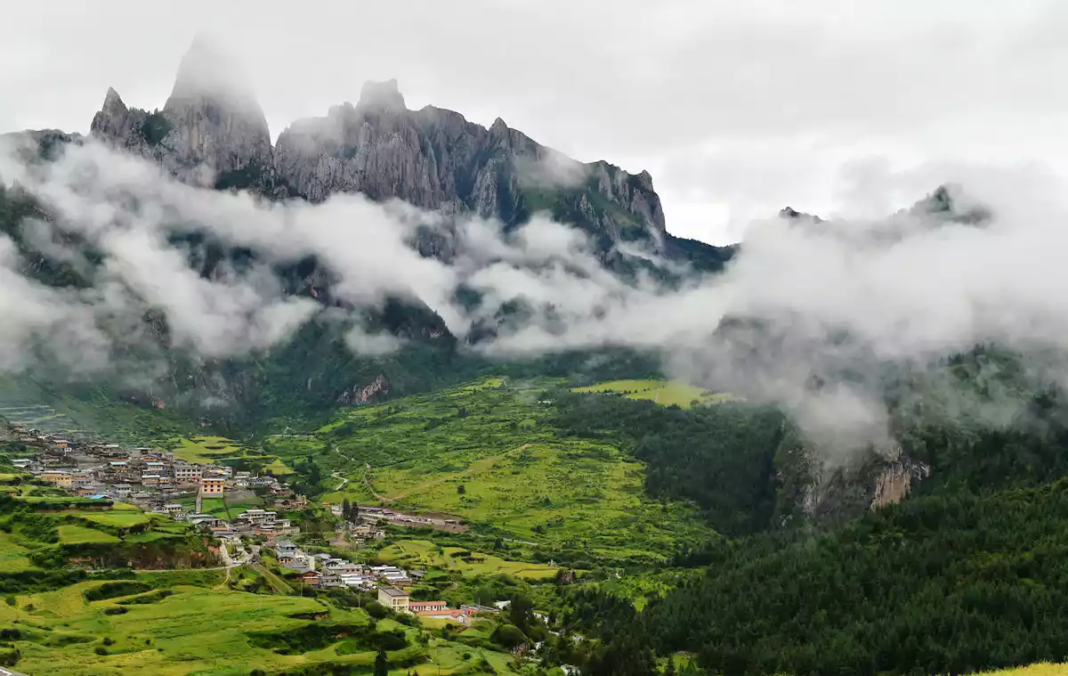
It is as unique as its name. "Zhaga" means stone mountain and "Na" means inside. Together, it means "stone box" or "a place surrounded by stone mountains."
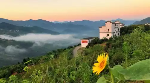
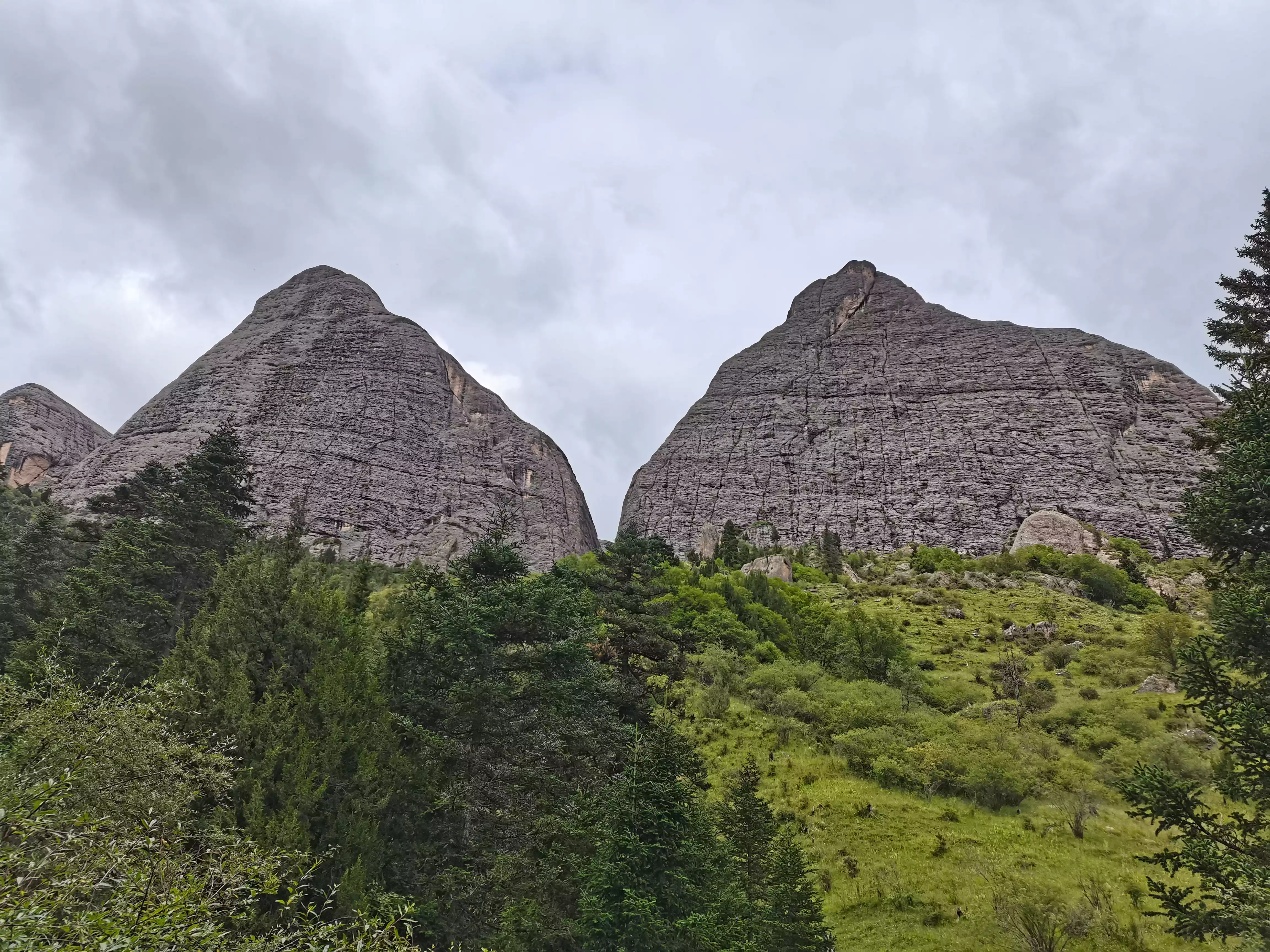
The name is so fitting! When I saw it with my own eyes, it was indeed true—the gray-white stone mountains majestically embraced the land, like a natural "stone city", instantly enclosing you in its secret realm.
02 First acquaintance with "Locke Road"
First impression of "Locke Road"
This time I went to Gansu specifically for the "Zhagana Crossing Line", which is the classic hiking line called "Rock Road" by hikers.
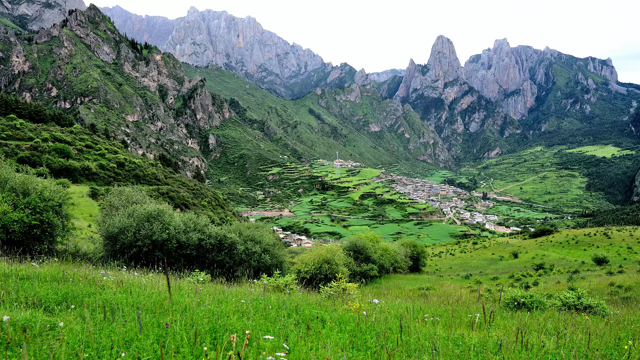
The entire journey from Zhagana to Zhuoni Dayu Valley is about 55 kilometers, with eight large and 12 small passes to cross, for a total elevation gain of 2,750 meters.
The "Locke's Road" is named after the scientific expedition of Austrian-American explorer Joseph Locke in the early 20th century. In 1925, Locke set out from Zagul Town, Zhuoni County, Gannan Province, and crossed Chebagou and Guanggai Mountains before finally arriving at Zhagana in Diebu County.
He praised Zhagana in his diary:
"It's the most beautiful scenery I've ever seen in my life. If the author of Genesis had seen the beauty of Zhagana, he would have placed the birthplace of Adam and Eve there..."
This description is now engraved on the cliff of Zhagana.
Is the "Locke Road" worth taking?
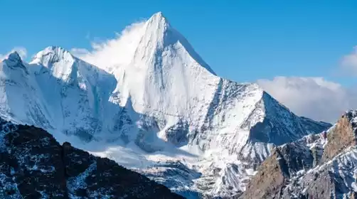
Zhagana was ranked fourth among the top ten non-famous mountains in China by China National Geographic and was rated as one of the world's 50 outdoor paradises by an authoritative American travel magazine.
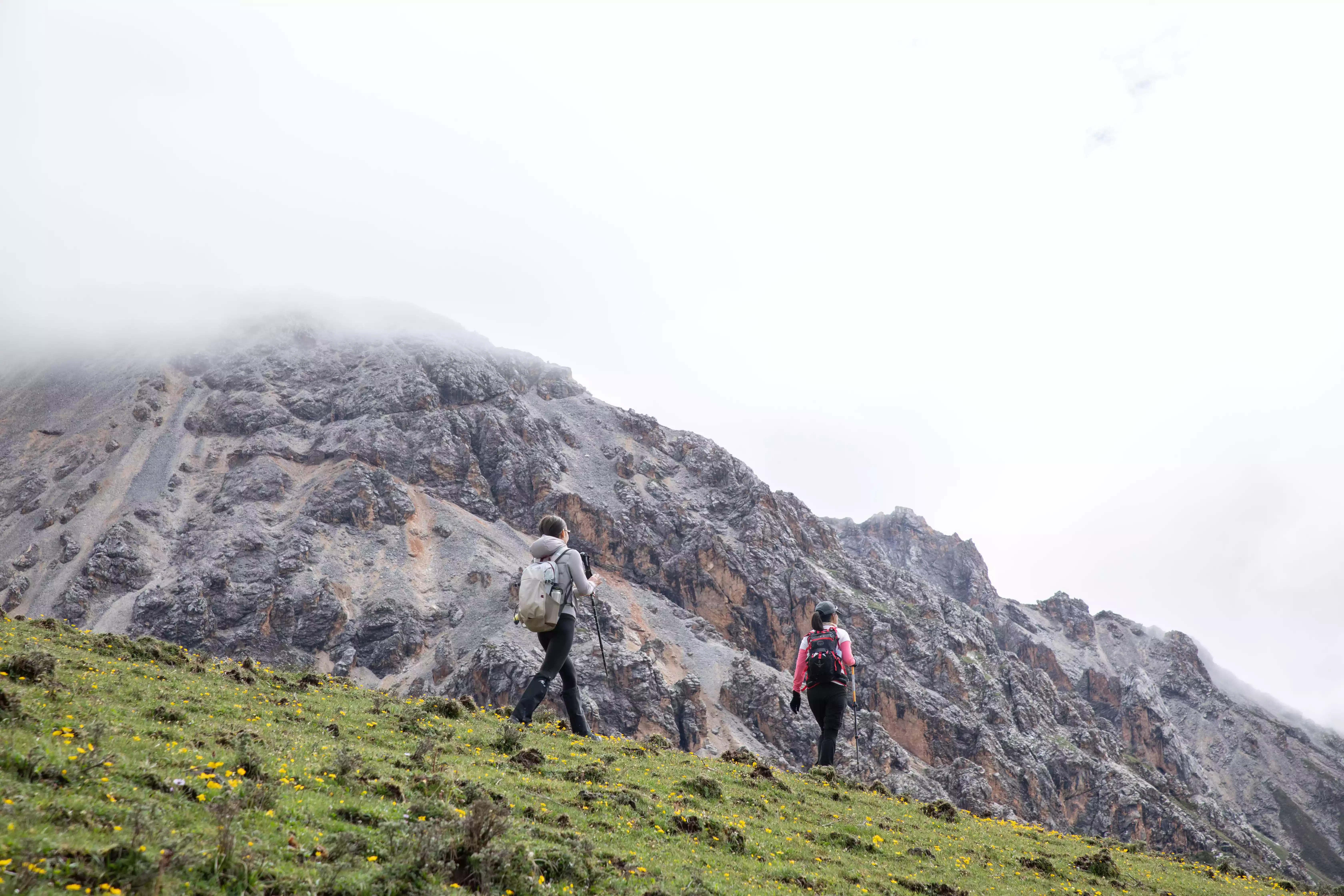
For more than 100 years, the "Locke Road" has attracted countless tourists to Gannan for its long history and mysterious travel scenery. It is also known by hikers as one of the "most beautiful hiking routes in China."
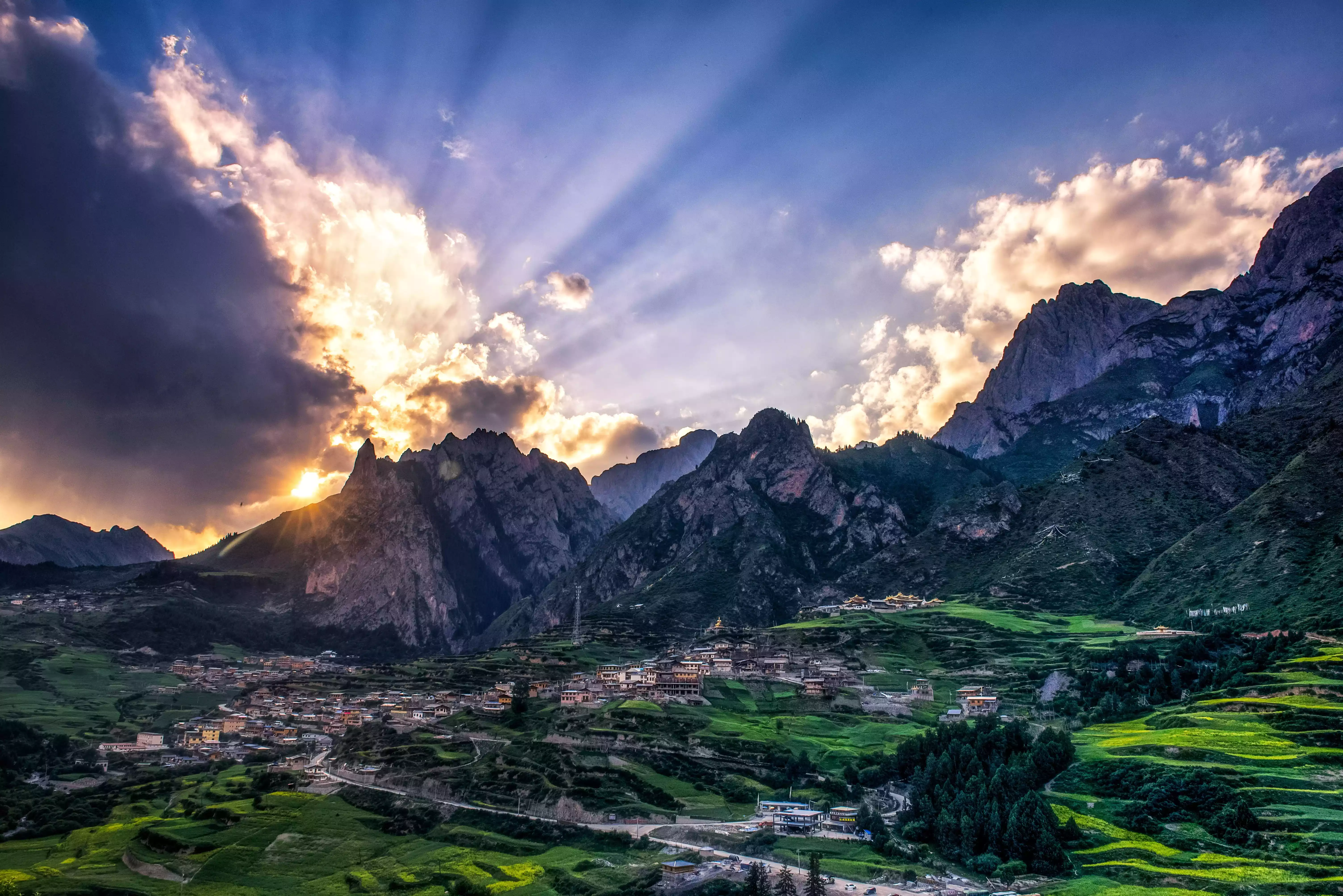
After all, it is difficult to find a route that allows backpackers to fully appreciate the snow-capped mountains, grasslands, canyons, strange peaks and rocks, caves, waterfalls and ethnic cultural landscapes in just 50 kilometers!
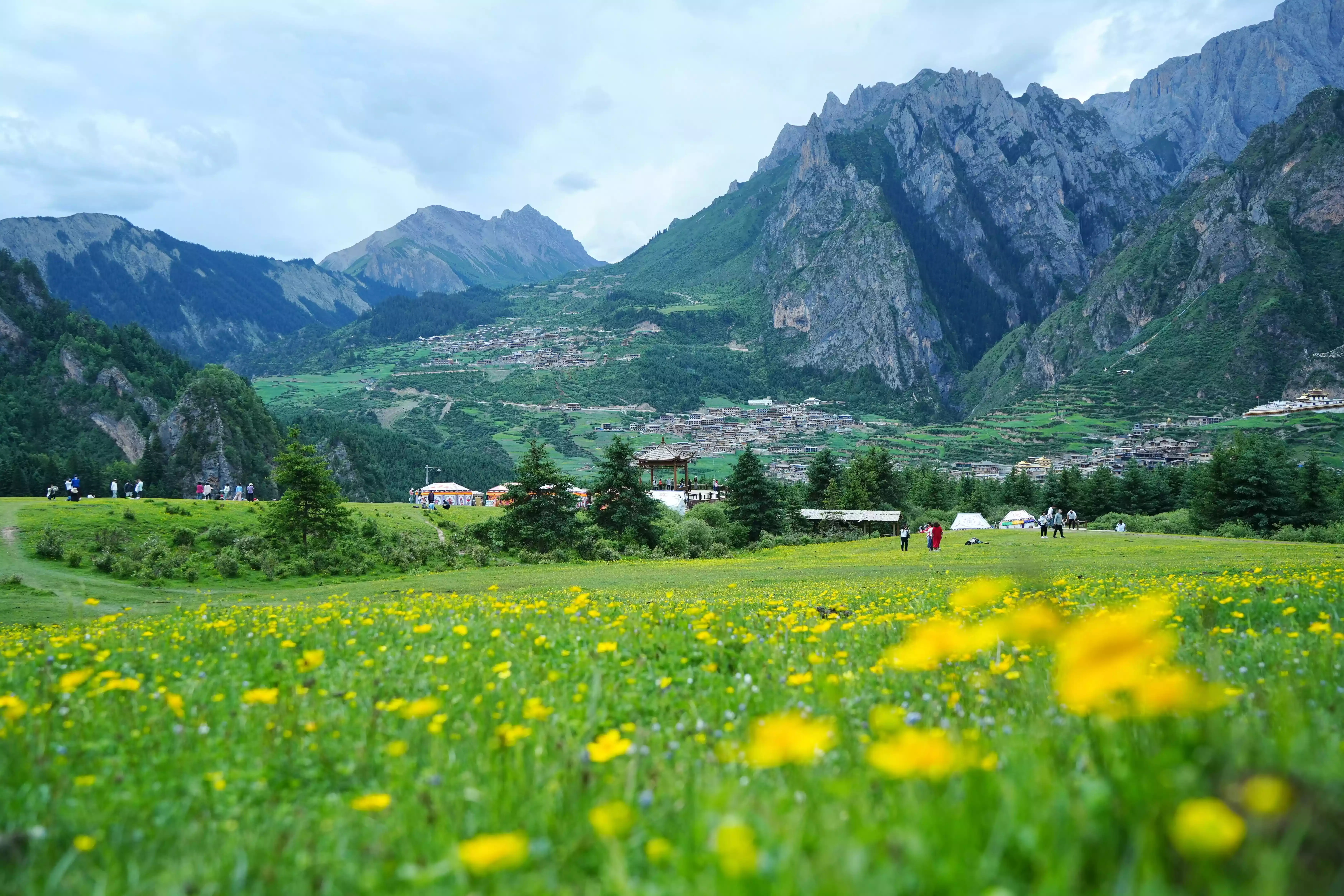
Milk Mountain
03 Season Selection
Let me first state the conclusion: the best seasons for Zhagana are July, August and October.
Zhagana is open for trekking from May to the end of October every year. May and June are the spring snow season, and the weather is more stable than the rainy season. However, you may still encounter snowfall during the hike, and the temperature will be relatively low at night, especially at the unnamed camp on the second day of the hike, which is at a high altitude and relatively cold.
The last time I went was during May Day, when the grass was mostly yellow with only a few hints of green. Usually after June, the grass starts to turn green in large areas.
If you like the sight of lush green grass and wildflowers, visiting in July or August is the perfect time. During this time, Zhagana is in its rainy season, with abundant vegetation, geraniums and irises blooming at the foot of the snow-capped mountains, creating a vibrant atmosphere, and the nights aren't too cold.
There is a little more rain in summer, but the clouds and mist after the rain are the soul of Zhagana. The morning mist rises from the valley like milk, and smoke from the Tibetan village curls up. Although the clouds and mist are beautiful, they may also block the full view of the snow-capped mountains.
If you prefer vibrant colors and picturesque light and shadows, autumn will absolutely stun you! October is the most recommended month for a visit. Starting from National Day, the weather stabilizes, the rainy season ends, and sunny days become more common. The outlines of the snow-capped mountains are clearly visible, and the grass begins to turn yellow. Snowfall is also normal.
As autumn colors gradually come, the birch trees, maple trees and shrubs in the mountains turn golden, orange-red and dark brown one after another. The whole valley seems to be on fire, forming a sharp contrast with the gray stone peaks and the azure sky.
The weather is clear and cool in autumn, the humidity is low, the roads are less likely to become muddy, and walking is more stable. However, at the same time, the temperature difference between morning and evening is also large, so you need to pay attention to wind protection and keep warm!
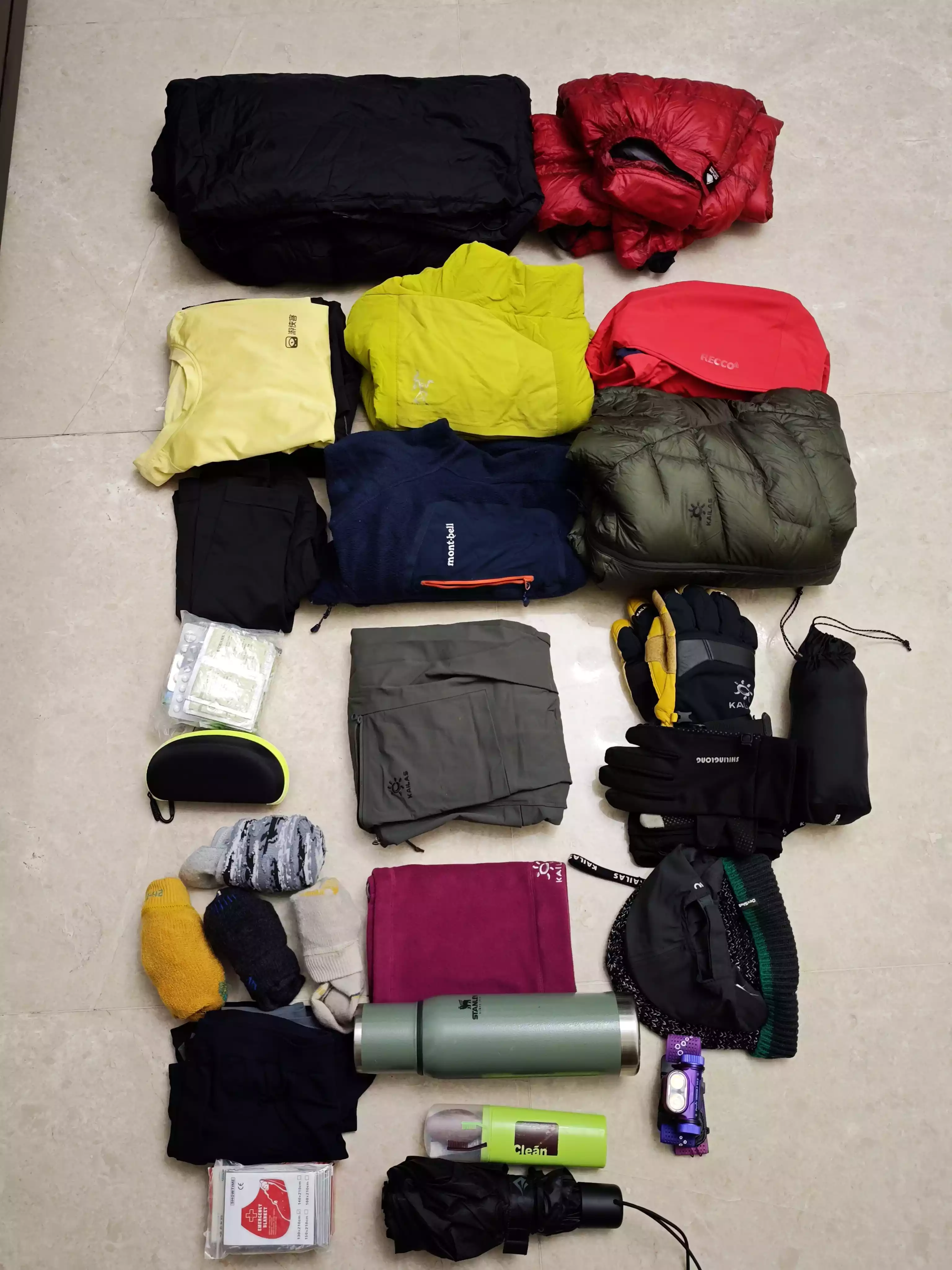
04 Equipment Recommendations
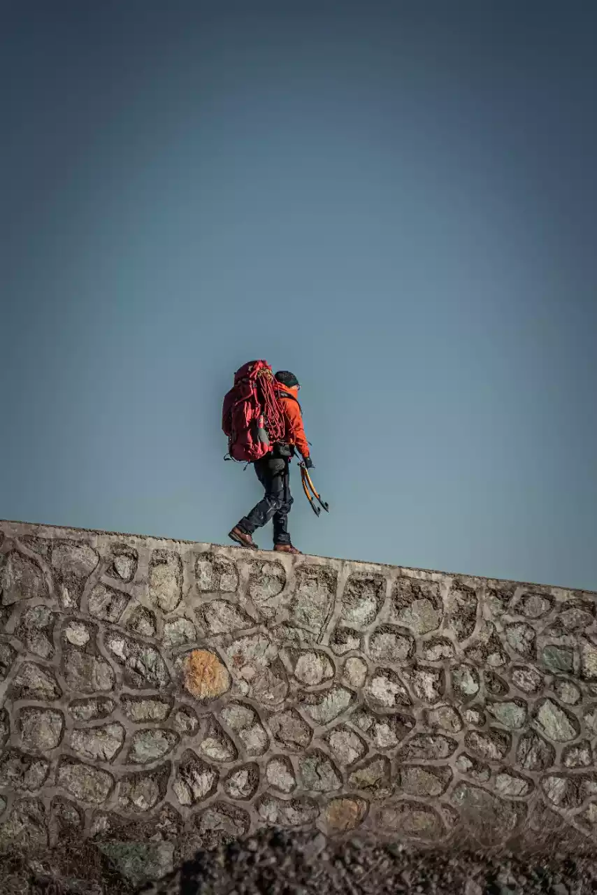
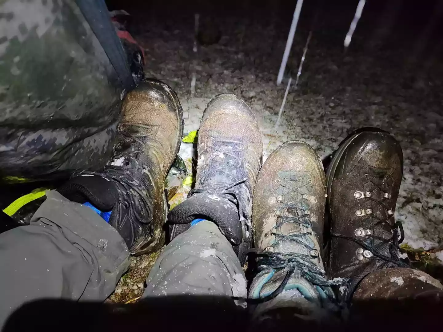
The terrain in Zhagana is primarily a mix of gravel, dirt, and grassland. Each day's hike involves switching between these different sections, and you'll experience both elevation gain and loss as you cross passes. Therefore, having a good pair of hiking shoes is crucial! Mid-high-top waterproof GTX hiking shoes are a must.
The Zhagana hike is a high-altitude hike. No matter when you go between May and October, thin down jackets and fleece are essential clothing!
If the weather is good during daytime hiking, you can wear quick-drying trousers and quick-drying long sleeves. In May and October, a thick down jacket is necessary for wearing in the camp at night.
When hiking in Zhagana, snowshoes and crampons are often essential items in May and October.
05 Travel Log
I divided the trip to Zhagana into 7 days. The first and last days were the gathering day and the return day. The main hiking trip was 4 days. From Zhagana to Dayugou Scenic Area, the hike was about 55 kilometers, with the highest altitude of 4,140 meters. The highest daily climb was 1,209 meters, and the difficulty was 5.5 stars (out of 7 stars).
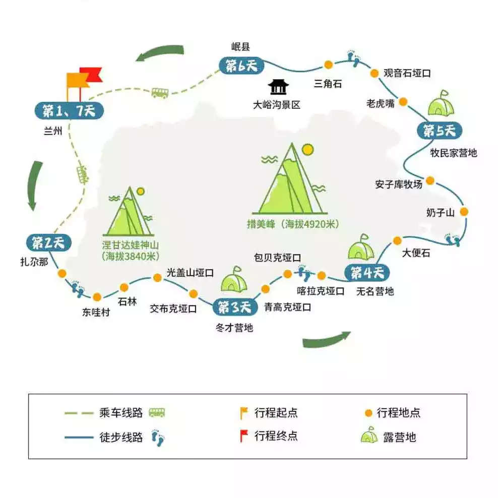
Itinerary diagram
Overall, it is quite difficult and suitable for tourists with experience in high-altitude hiking.
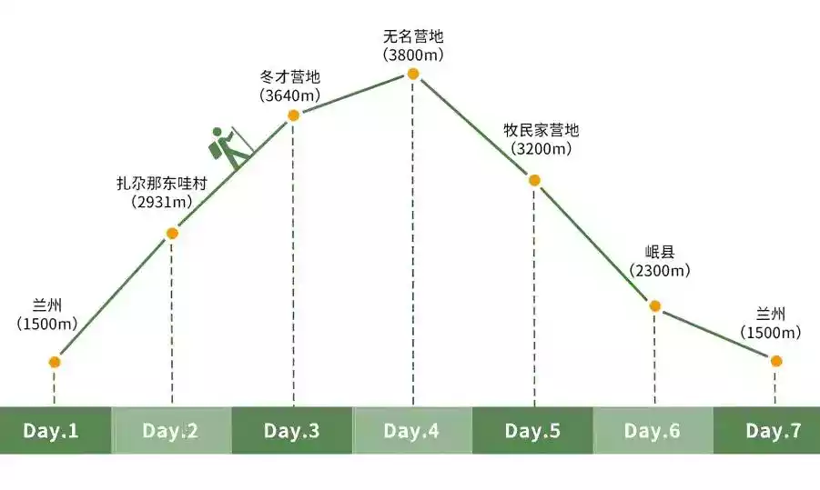
Schematic diagram of altitude changes
Hiking Day 1
Zhagana → Negandawa Sacred Mountain → Stone Forest → Guanggai Mountain Pass → Jiaobuke Pass → Dongcai Camp
Today is the third day of the trip and the first day of the hike. It was May Day, and the bus service to the scenic area was closed. Starting from the Zhagana Scenic Area, I walked 3 kilometers on the road and climbed 150 meters before reaching the starting point and entering the dirt road and mechanized farming path.
While the tractor-plowed path is long, it's relatively easy to walk, though there are a few steep sections that require some effort. It's about 9 kilometers long, all the way to the foot of the Guanggai Mountain Pass. Near the pass, the road turns to a dirt meadow and begins to climb, often resulting in muddy terrain.
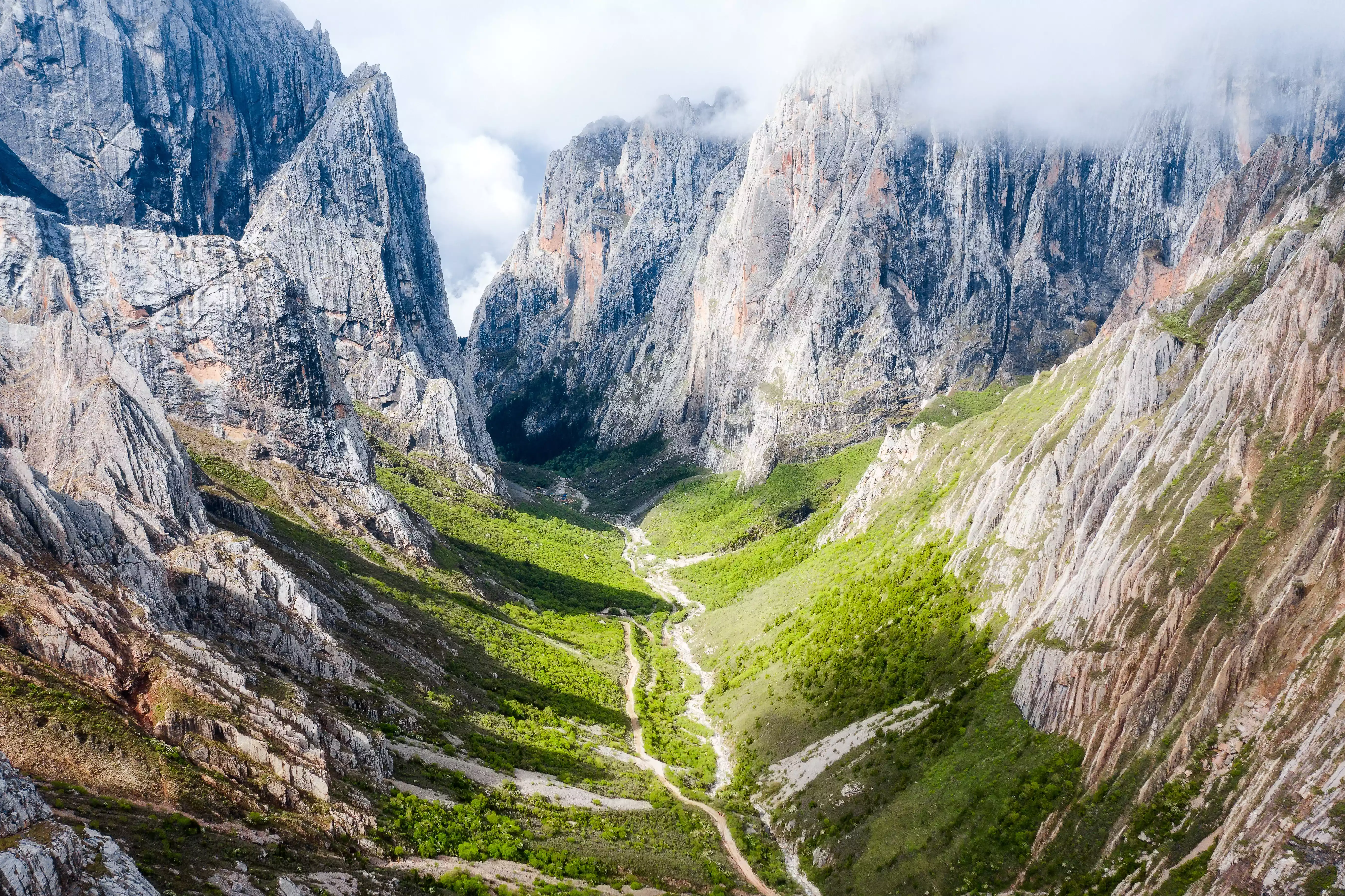
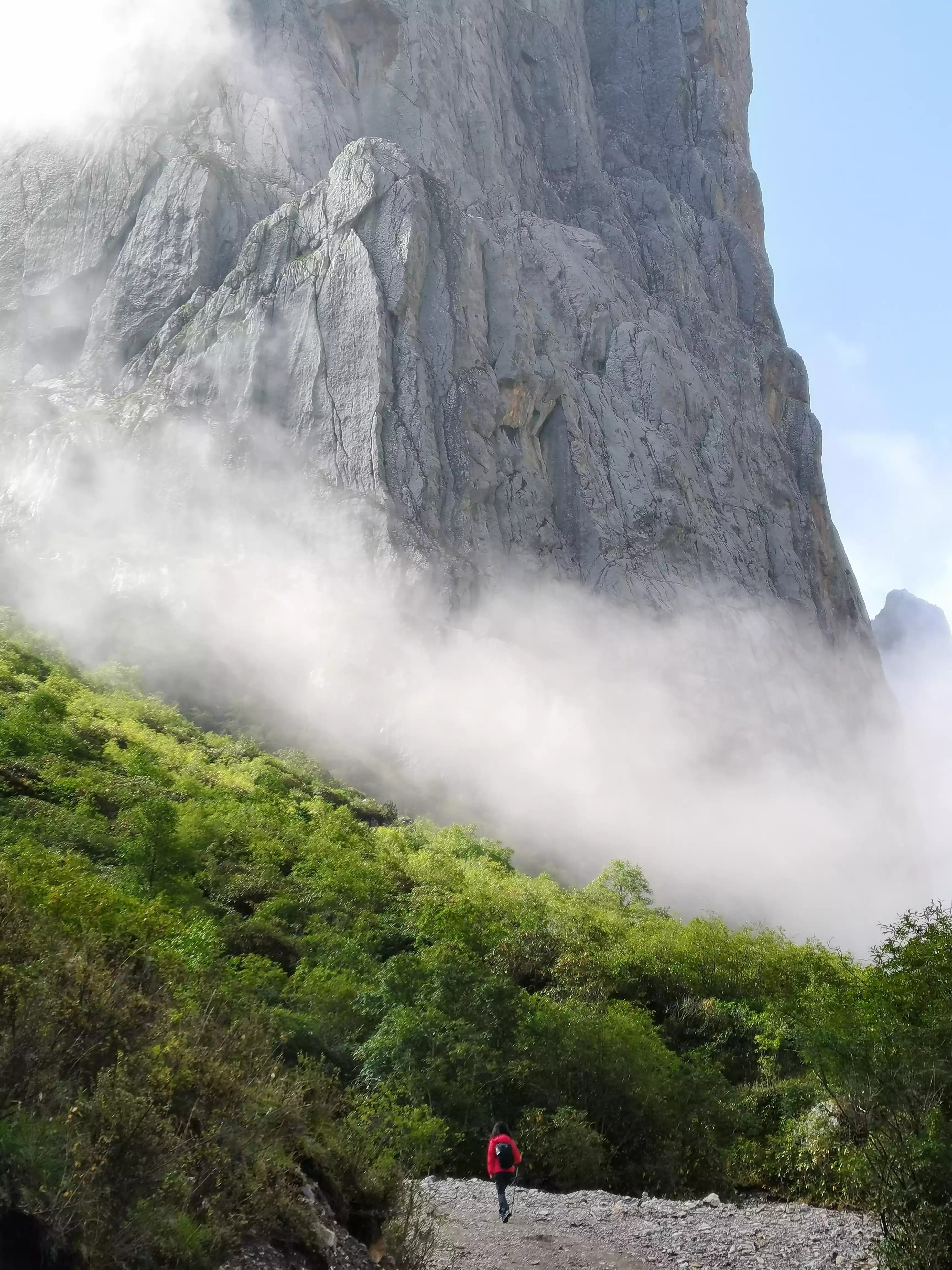
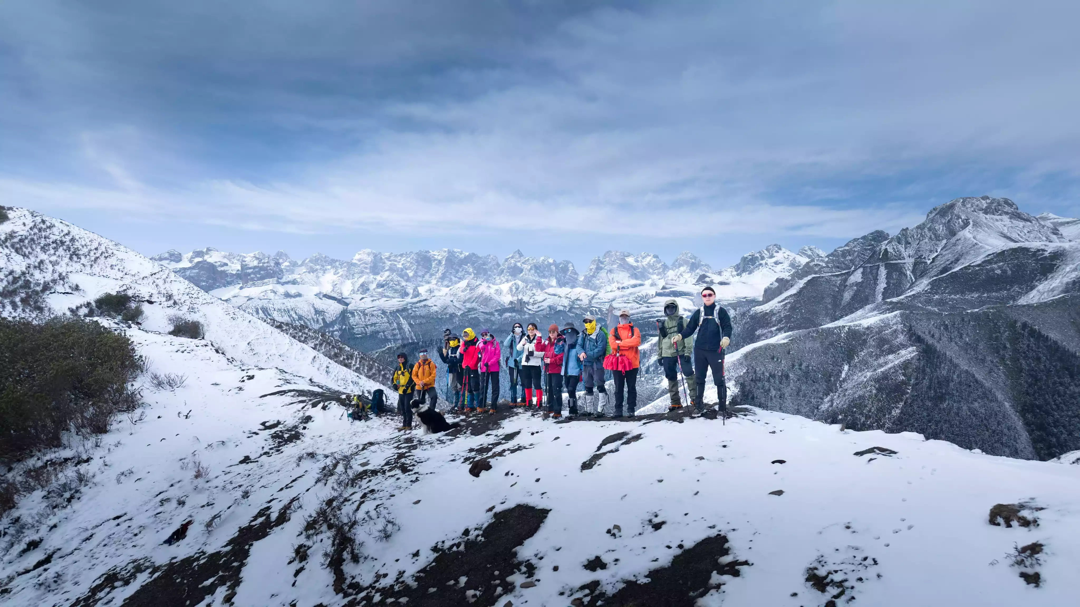
Guanggai Mountain Pass, at an altitude of approximately 3,980 meters, is the first major pass of the first day's hike. After crossing it, we descend a short distance before crossing a second, smaller pass. The surrounding rocky peaks, exposed and enclosing us like a city wall, felt like entering a secluded world.
Panoramic view before the last pass on Day 1
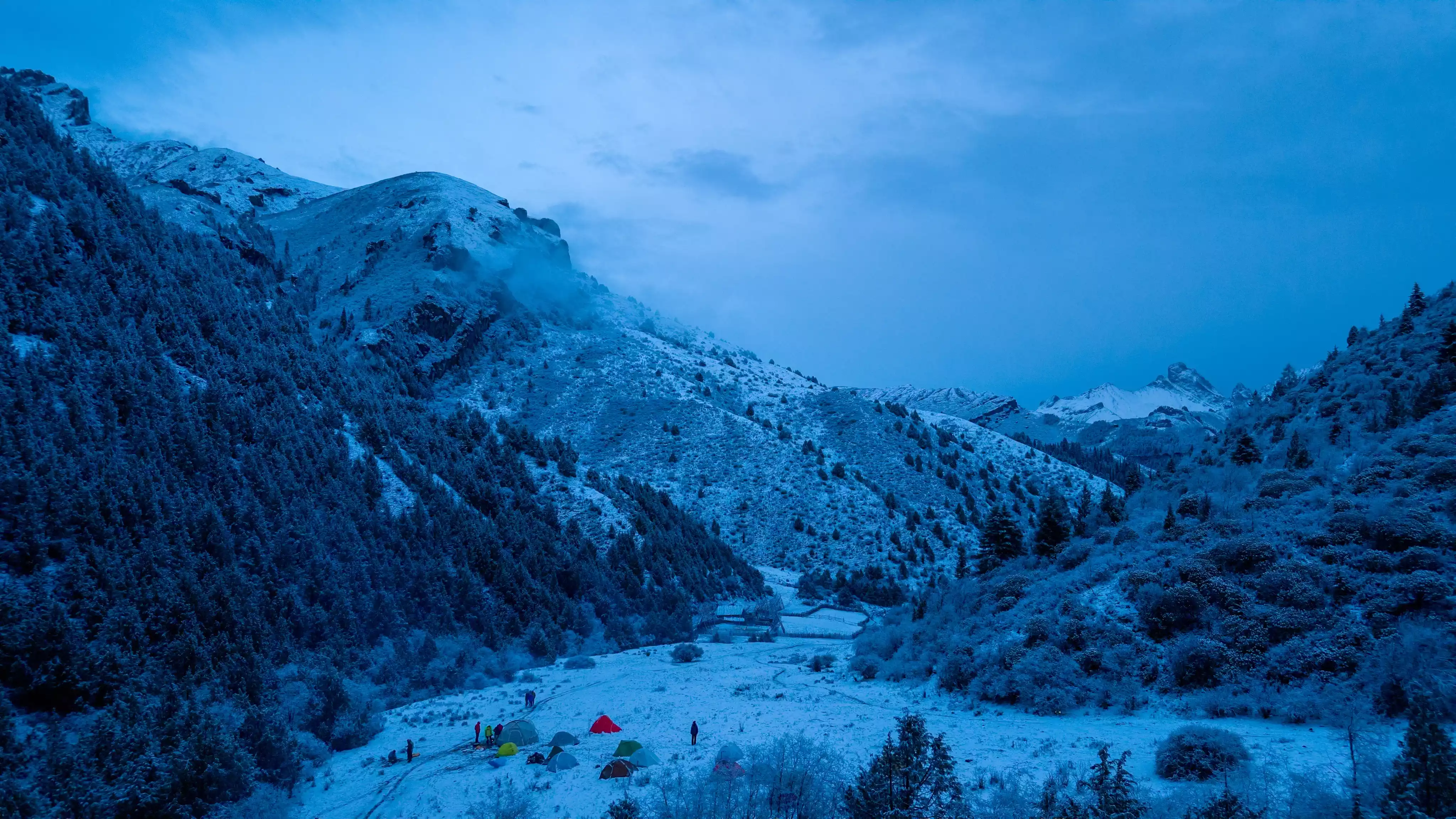
Jiaobuke Pass is the highest point on the first day of the hike, at approximately 4,050 meters. After crossing it, we walked downhill along the river valley for about five kilometers to reach Dongcai Camp.
The food at the camp was surprisingly good!
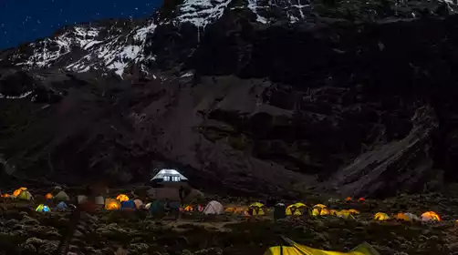
The camp is at the end of Dongcai Canyon, about 3,600 meters above sea level, surrounded by strange peaks. When you look up at night, the night sky is dotted with stars, which contrast with the silhouettes of the mountains. It is an ideal place to take star trails!
Hiking Day 2
Dongcai Camp → Qinggaoke Pass → Baobeike Pass → Kalake Pass → Wuming Camp
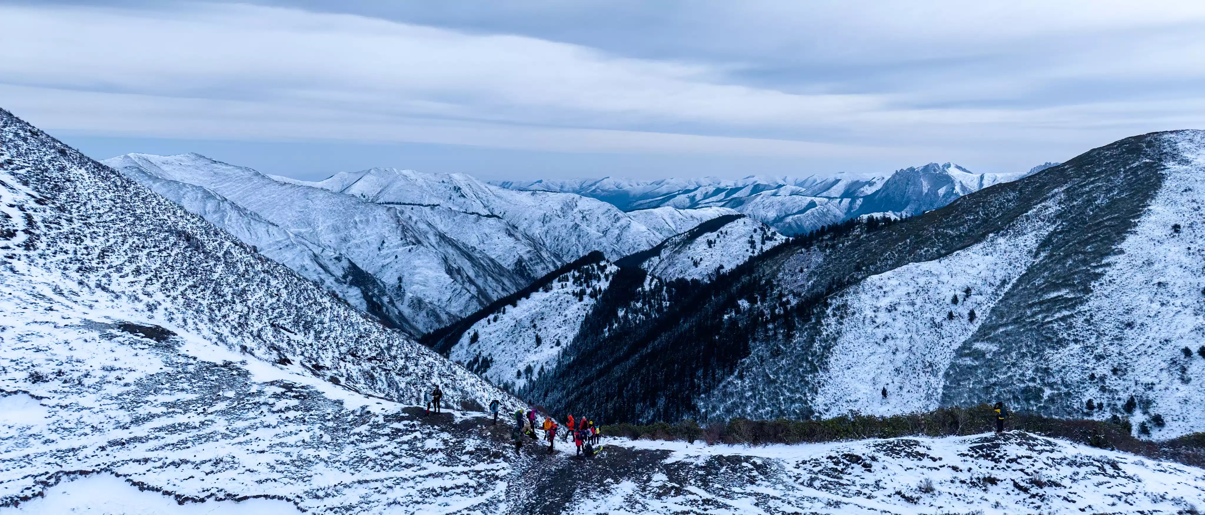
We woke up to the sound of birdsong and a light mist. After a simple breakfast, the real challenge began – the first stop was the Qinggaoke Pass at an altitude of 3,830 meters. We started climbing right after we set off.
After climbing to the top of the pass and looking back, the entire Dongcai Canyon was lying at my feet, and a sense of satisfaction came naturally. Then there was another small pass, which was not too difficult.
Adjust your breathing and set your sights on the next target: Baobek Pass.
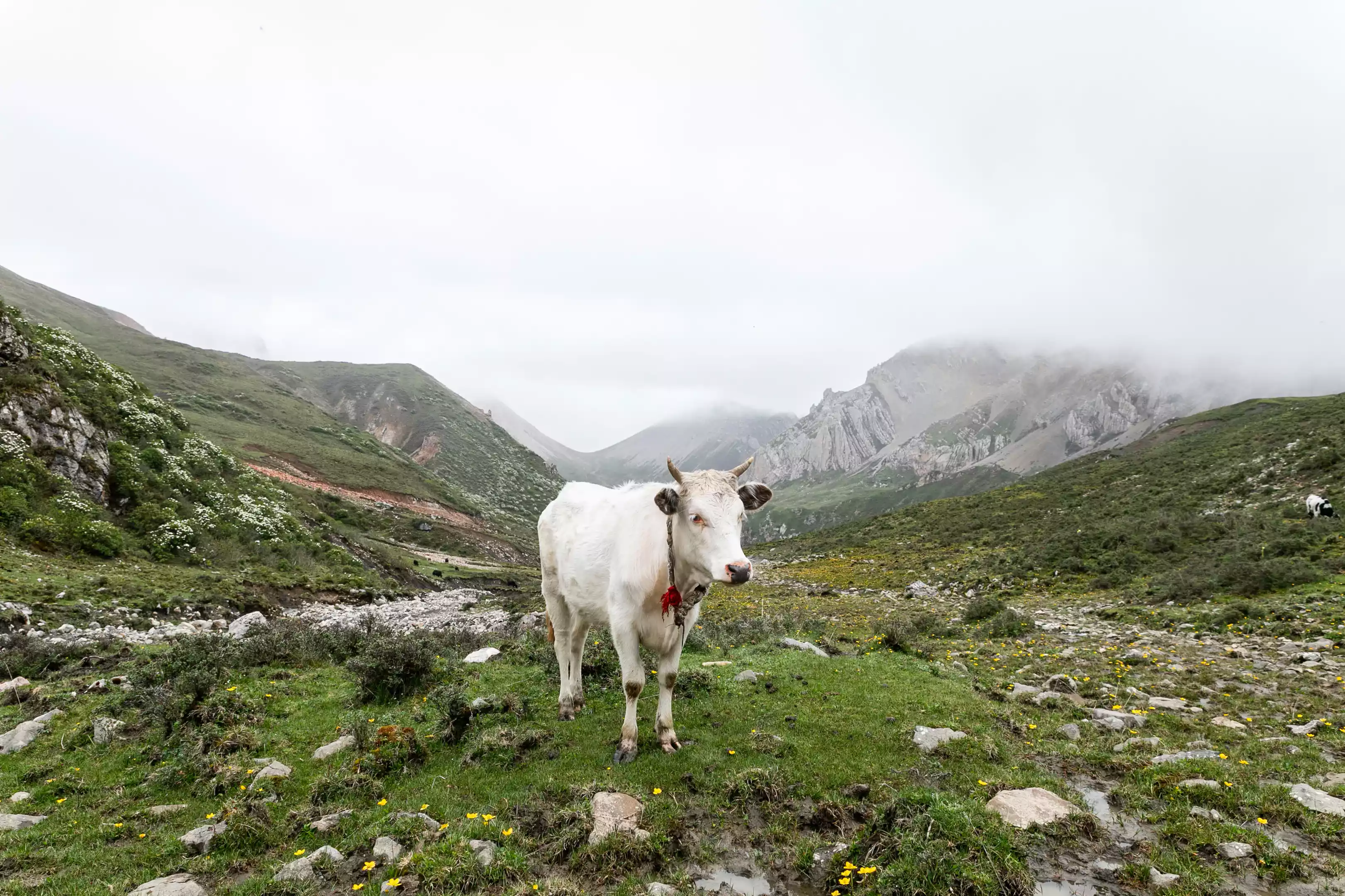
As we were walking, a slight "crackling" sound caught everyone's attention! Looking up, we saw dozens of agile blue sheep moving on the hillside.
When we arrived at the Baobek Pass at an altitude of 3,914 meters, we took a short breath and took a deep breath - the most critical test of the day was coming: the highest point of the entire journey, the Karak Pass at an altitude of 4,140 meters!
That section of the climb was indeed difficult, and the numbers on the altimeter jumped up bit by bit with difficulty.
But when you finally stand firmly on the pass at an altitude of 4,140 meters and look around at the vast and magnificent scenery, all your tiredness is instantly replaced by a huge sense of accomplishment!
However, the challenges are not over.
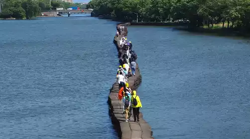
Shortly after crossing the pass, there is a gravel road about one kilometer long that requires extreme caution.
There is loose gravel under your feet and a steep slope on your side. You must take every step firmly and concentrate to pass safely.
After this section of road, we will cross the last small pass, the "Unnamed Pass". After crossing the pass, today's campsite, the "Unnamed Camp" at an altitude of about 3,800 meters, comes into view.
This is the highest camp on the entire route. Even in May, the mountains are still very cold, and there's usually snow. When it snows, it's so thick it creaks when you walk on it. Tonight, the silence is so still, and the stars seem especially bright and cold.
Hiking Day 3
Unnamed Camp → Dabianshi → Anziku Pasture → Herders' Camp
Today we set out from the unnamed camp, and the overall altitude was mainly decreasing. Although there were some small ups and downs to climb, it was obviously much easier.
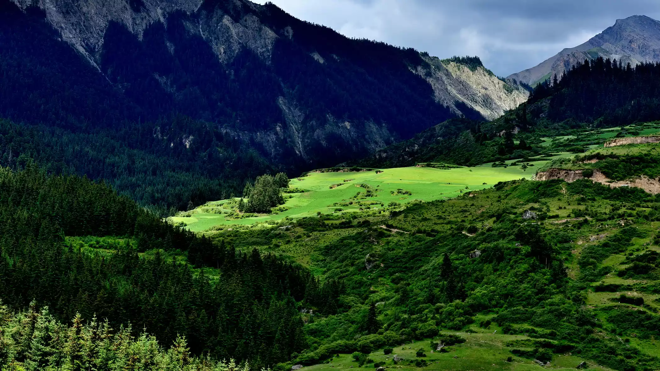
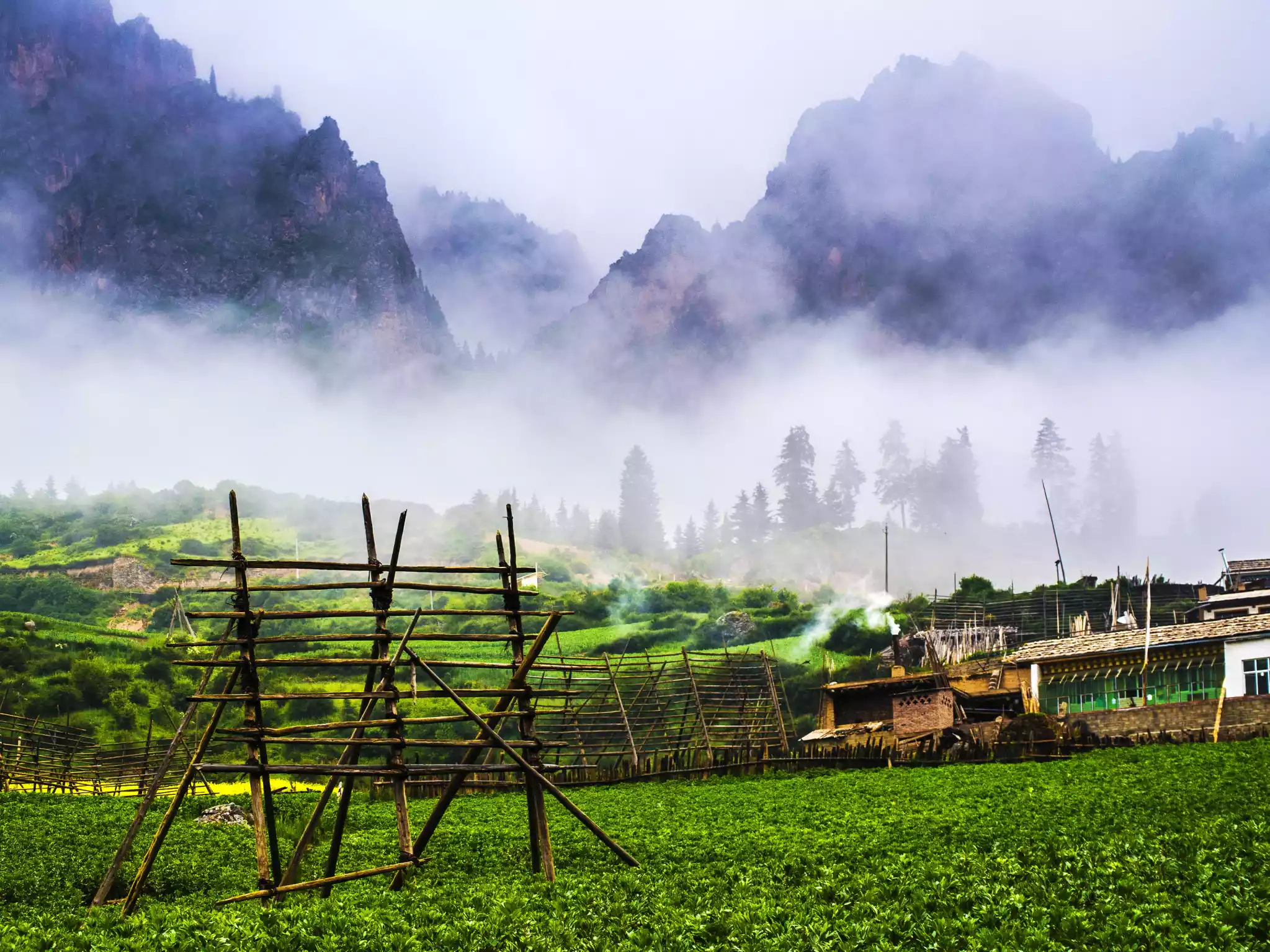
What I felt most clearly was that the landscape around us was quietly changing! The huge, rugged, bare rocky mountains that had accompanied us all the way were gradually receding, replaced by moist forests, open pastures, and more gurgling streams.
We happily descended along the clear stream, occasionally having to step on stones to cross. Just as we were feeling relaxed and ascending some gentle slopes, about 3 kilometers from our final campsite for the day—the herders' camp—the plateau weather suddenly changed! Just a moment ago, the sky was blue, then suddenly dark clouds rolled in, and small hailstones as big as beans came crashing down! A high-altitude jacket is a must!
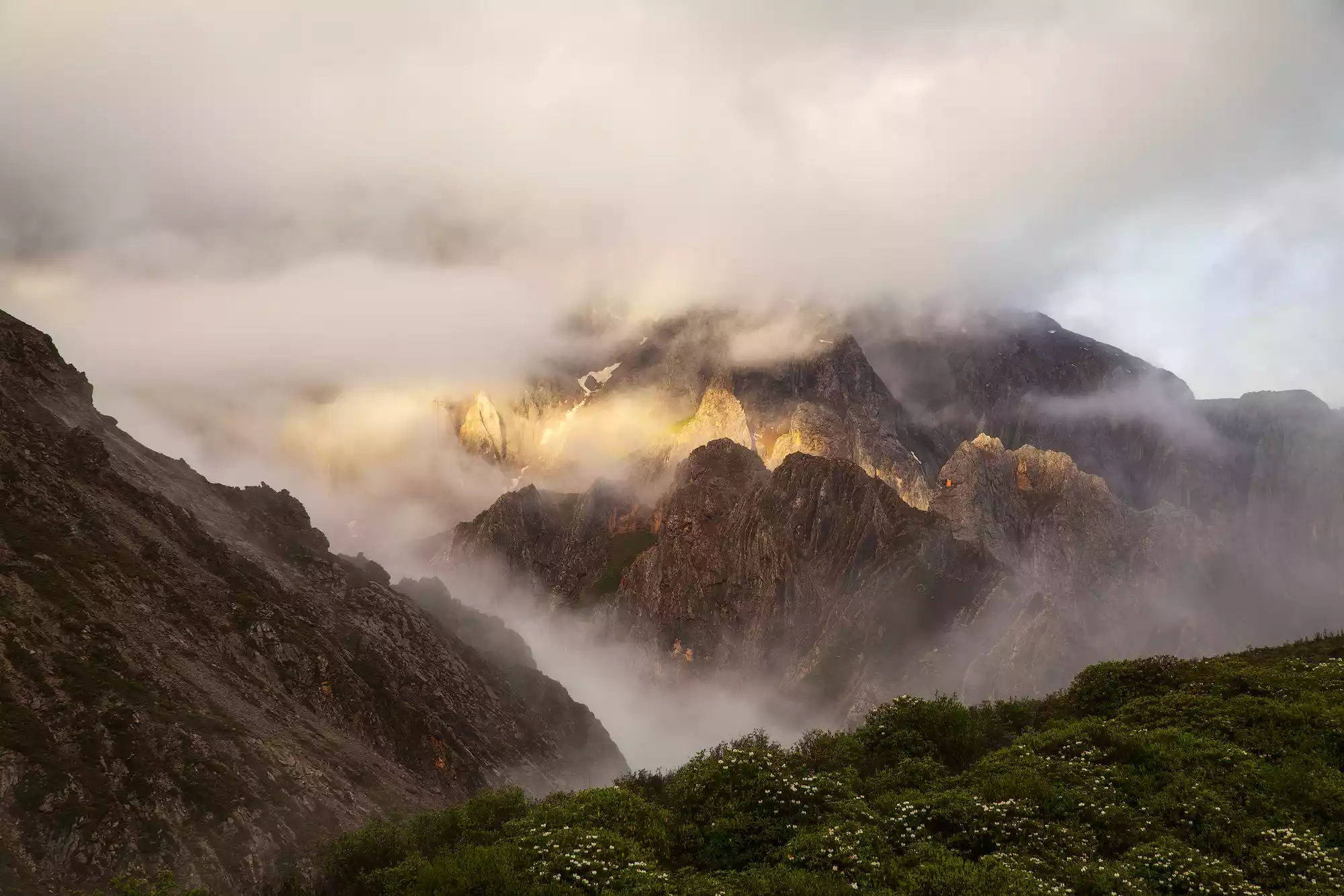
At the last small hill, I took a picture of the devilish scene of Zhagana: clouds and mist lingered in the mountains, and the stone mountains were looming, which was particularly shocking.
Finally arrived at the herdsmen’s camp, which was at a relatively low altitude of about 3,200 meters. It was truly the most comfortable camp throughout the entire trip!
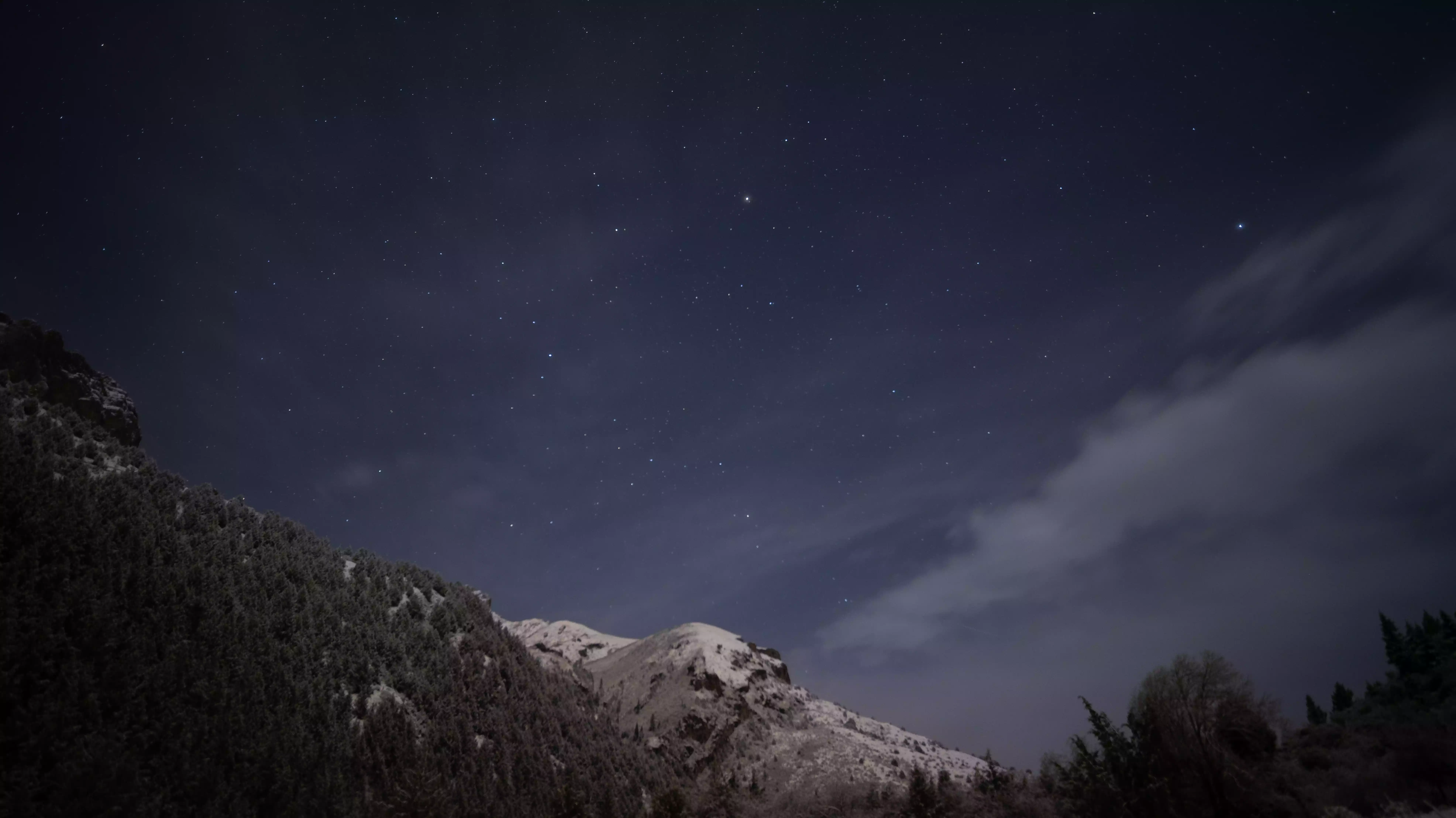
Starry sky over herdsmen's camp
The terrain was flat and open, very close to a stream, and surrounded by lush forest. Even more interesting was the presence of a few chubby little wild boars happily digging for food at the edge of the camp, adding a touch of life to the tranquil scene.
Hiking Day 4
Herders' Camp → Yitiantian → Guanyinshi Pass → Dayugou Scenic Area → Minxian County
Today is the last day of hiking. Starting from the herdsmen’s camp, there is one last pass - Guanyinshi Pass, which is 3,600 meters above sea level and is easy to reach.
Then we crossed a long valley. The valley bottom was deep and you could only see a sliver of sky when you looked up. It was very oppressive. After walking out of the valley, after a period of climbing, we started a continuous descent.
After reaching Guanyinshi Pass, the trail descended, and the mountain road gradually opened up, revealing lush forests and verdant grasslands. When I arrived at the scenic area's transportation station and boarded the scenic shuttle bus to the exit, my phone signal instantly became full as the bus jolted, signaling the end of the hike.
The mood at that moment was very wonderful - after just 4 days of traveling, the information pouring into my mobile phone seemed to be from another era, and those few days of quiet and pure time in the mountains really seemed like a lifetime ago.
But every mountain, every road, and every camp in Zhagana have become the most unique scenery in my memory.
The Zhagana Crossing is much more than just a hike.
We went from the magnificent stone peak forest to the quiet valley meadow. It was also a physical experience. The high altitude and multiple passes tested our endurance.
But the most precious thing is the experience of being completely immersed in pure nature, listening to the wind, watching the stars, and living next to the mountain goats.
If you yearn for freedom, there are mountains and rivers under your feet!
The secret of this "stone box"
It is worth exploring carefully for everyone who loves the mountains!