Day 1 Various locations → → Lhasa ★ Gathering day
All day
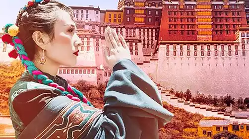
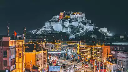
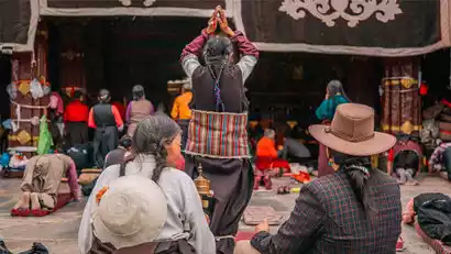
Today, tourists from all over the country will travel to Lhasa according to their own transportation methods. Please check in at the meeting hotel by submitting your "China-TravelNote + Name" ID. After check-in, it's recommended to rest and acclimate to the plateau to prepare for the upcoming trip. Tourists in good physical condition can visit Barkhor Street. Don't get too excited when you first arrive in Lhasa! On your arrival day, avoid showering, drink plenty of water, eat plenty of vegetables and fruits, eat light meals until you're 80% full, and go to bed late (going to bed early can cause nighttime awakenings and difficulty falling asleep). Avoid smoking and drinking. Numerous studies have shown that maintaining an open-minded and optimistic attitude can alleviate the physical discomfort caused by altitude sickness. If you feel unwell, please contact staff immediately for assistance.
Border pass matters
Due to the special nature of cross-regional travel, you need to apply for a border pass yourself for this route. It cannot be handled by an agent. You must apply for it at your registered residence/place of residence. Please fill in "tourism" for the reason of entry to Tibet.
Please indicate the destination on the border pass (must be printed, handwritten will not be accepted):
Tibet: the entire Tibet Autonomous Region, Shigatse Prefecture, Shannan Prefecture, and Ngari Prefecture;
Xinjiang: Kashgar Prefecture, Yecheng County;
The implementation standards of border passes vary from place to place. Please consult the local police station for details.
Day 2 Lhasa → Lujila Viewing Platform → Yanghu Rito Temple → Pumo Yumco
·morning
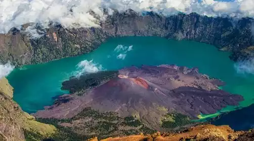
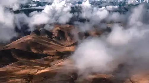
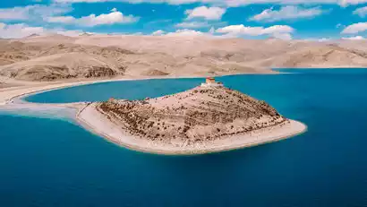
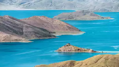
After breakfast, we'll depart for Tibet's renowned Yamdrok Lake. First, we'll ascend the newly constructed Lujila Observation Deck for a bird's-eye view of the lake. The tan islands within the lake resemble the ridged backs of prehistoric behemoths, framed by the azure waters. A sea of clouds billows from the distant mountaintops, creating a breathtaking visual experience.
·afternoon
Afterward, we'll visit Rito Temple, a temple nestled within the waters of Yamdrok Lake. Set on the shores of the emerald green Yamdrok Lake, it's a hidden gem, off-limits to most tourists. Enjoy a 360-degree panoramic view of the lake, a truly breathtaking visual experience. Perhaps you've visited Yamdrok Lake countless times, yet haven't yet discovered its otherworldly charm.
We left at the right time and stayed in a house by the Pumoyongcuo Lake at night. When the weather was good, the stars seemed to be within reach!
Day 3: Pumoyongcuo → Duoqingcuo → Qilin Gorge → Dingjie
·morning
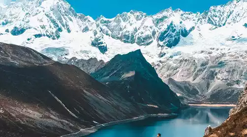
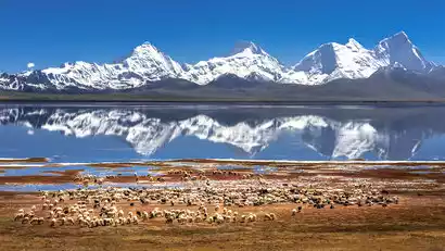
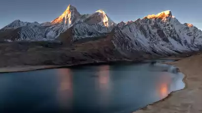
Today we got up early to photograph the sunrise at Pumoyongcuo. This is arguably one of the most beautiful viewing spots for Kulagangri: looking out from the north bank, the Kulagangri snow-capped mountains on the left stand proudly. We set up our cameras and waited for the moment when the sun would shine on the golden mountains.
·morning
We set off at the right time, following the new National Highway 219 over the Tarji Mountain Pass (5,500 meters above sea level) to Duoqingcuo. The lake reflects the 7,326-meter-high Zhuomulari Snow Mountain. The enchanting Goddess Peak and the mirror-like lake are set against the lush Pali grassland. The snow-capped mountains, lake, blue sky, and crimson sun complement each other, creating a beautiful painting.
·afternoon
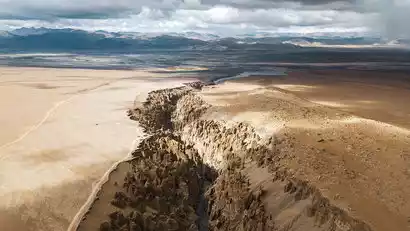
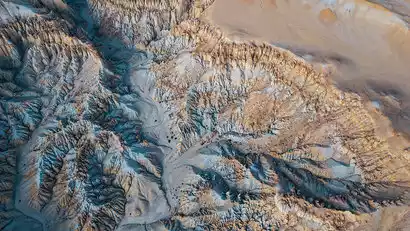
Then we came to the Qilin Gorge scenic area (a holy place for aerial photography), which is a stunning ground fissure hidden under the Himalayas. It is a unique karst landform formed after tens of millions of years of erosion and cutting by glaciers and snow water.
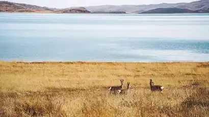
We'll return in time and continue on our journey. As we enter Dingjie County, we'll see the Amazhimi Snow Mountain. With some luck, we might even encounter wildlife in the Dingjie Wetland. We'll arrive in Dingjie County in the evening and check in.
Day 4 Dingjie → Zongcuo → Hundred Thousand Sand Dunes → Everest Base Camp → Basong Village
·morning
We woke up early and drove to Zongcuo, a newly discovered secret spot, to wait and photograph the sunrise. Here we could face the massive Amazhimi snow-capped mountains and freely create under the strong sense of oppression of the snow-capped mountains.
·morning
We set off at the right time and passed by the pools in Dingjie Wetland. The reflections were extremely beautiful, and occasionally wild animals such as black-necked cranes were seen playing around.
Continue westward and you will enter the core area of the Mount Everest Nature Reserve. Not far away you will reach the Lhotse Viewing Platform. Here you will see the unique Dingjie Sand Dunes, and at the end are the world's fourth highest peak, Lhotse, at an altitude of 8,516 meters, and the world's highest peak, Mount Everest, at an altitude of 8,844.48 meters. The landscape is rich in layers and very photographic.
·afternoon
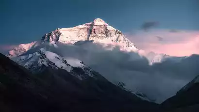
We then entered Everest National Park and transferred to a scenic bus at Zhaxi Zong Township for Everest Base Camp. This location offers a prime spot for photographing the sunset over Mount Everest, perfect for capturing snow-capped mountains. Amidst the biting cold wind and the lonely Mani piles, we bundled up in warm clothing and waited for the golden sun to rise above Mount Everest.
After the photo shoot, we left and took the scenic shuttle bus back to the village at the foot of Mount Everest.
Day 5 Basong Village → Gawu La Pass → Everest Fortress → Shishapangma → Saga
·morning
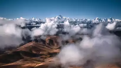
This morning, we arrived at the Gawu La Pass early, waiting to photograph the sunrise of four 8,000-meter snow-capped peaks: Makalu (8,463 meters), Lhotse (8,516 meters), Everest (8,844 meters), and Cho Oyu (8,201 meters) lined up in a row, giving us a panoramic view of the world's snow-capped peaks.
·morning
After capturing the sunrise and descending the mountain, we drove to Gangga Everest Castle for a photo op. With the castle ruins in the foreground and the towering Mount Everest in the background, it's easy to create unique snow-capped mountain photos.
·afternoon
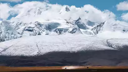
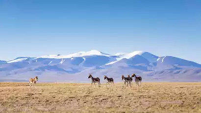
After the photoshoot, we continued westward. The stunning silhouette of Shishapangma would soon appear before our eyes, and with luck, we might even encounter Tibetan wild donkeys along the way. Pegucuo/Pekucuo, just in front of Shishapangma, and Gangpengqing Peak, at 7,299 meters, were reflected in the car window, creating a breathtaking sight.
Arrive in Saga in the evening and check in.
Day 6 Saga → Zhongba Sand Dunes → Mayumula Pass → Lake Manasarovar → Lake Laang → Tachin
·morning
After breakfast, we'll depart westward to Payang Town, a grassland town steeped in Western charm. Along the way, we'll be greeted by golden sand dunes, a magnificent sight set against the backdrop of snow-capped peaks and blue skies. Along the way, we'll photograph the Zhongba Sand Dunes. The nearby dunes echo the distant snow-capped mountains, creating a desolate, majestic, and tragic scene, captivating a captivating wild beauty.
·afternoon
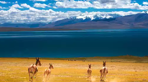
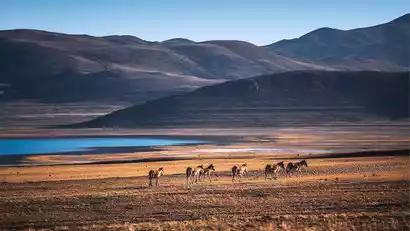
Then, we crossed the Mayumula Mountain Pass at an altitude of 5,211 meters. The river valleys before and after the pass are where Tibetan wild donkeys and Tibetan antelopes gather. I wish we were lucky enough to encounter and take pictures of them on this trip.
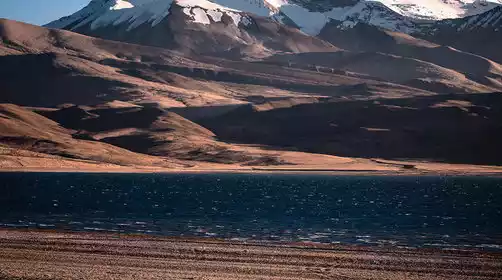
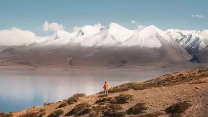
Continue your journey to Lake Manasarovar, one of the three sacred lakes in Tibet, and capture the blue sky where the water meets the sky.
I came to the ghost lake Laang Co at the right time to shoot the sunset. The sunset camera here is a good location to shoot the sunset over Mount Kailash, with the lake in the foreground and the sacred mountain in the background, which is rich in layers.
After the sunset photoshoot, we drove to Tachin to check in.
Day 7 Taqin → Dome Silver City → Ngari Dark Sky Park → Shiquan River
·morning
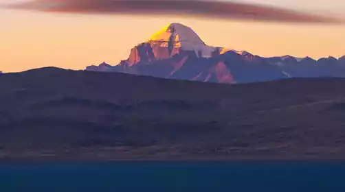
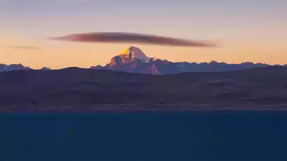
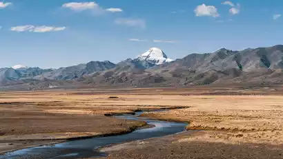
This morning, prime photography time awaits at Mount Kailash. We'll drive to a secluded vantage point with a canal in the foreground. Mount Kailash, bathed in the light and shadows of sunrise, is a scene of endless play, each minute presenting a different, breathtaking beauty. We'll take in the breathtaking beauty of this sacred mountain in Tibet.
·morning
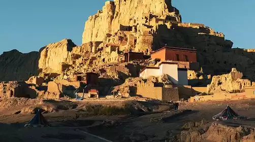
After leaving Tachin, we drove to the Silver Dome City for a photo tour. Silver Dome City is one of the most iconic attractions in the Zada Earth Forest. Resembling a roc, it was the first of the eighteen political powers of the ancient Zhangzhung Empire. After the photo shoot, we returned to Menshi Township for lunch.
·afternoon
We will continue our journey to Shiquanhe Town, the administrative center of Ngari Prefecture, to stay and rest.
·night
When night falls, drive to the Ali Dark Sky Park on the south side of the town to photograph the starry sky. It has the best night sky resources in the country. When you look up, you can touch the Milky Way. It is a rare place to photograph the starry sky in the northern hemisphere!
After the shooting, we returned to the hotel to check in.
8th Tianshiquanhe → Geji → Wumacuo → Geze
All day
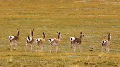
After breakfast, we set off for a relatively relaxing day through the heart of the Qiangtang River, heading towards Geze. As we approached Geji, wild animals such as Tibetan wild donkeys and Tibetan antelopes began to appear.
Continue on your journey, starting from Salt Lake City and embarking on the western section of the Great Northern Line of Ali. I believe that the colorful Wuma Co among them will surely amaze your camera.
After bidding farewell to Wuma Co, we followed a group of wild donkeys along the way and arrived at Gaizi County to check in, accompanied by the endless scenery along the way.
You can replenish some dry food and fruits here, and then rest early to recharge your batteries for tomorrow’s exciting journey into the uninhabited area!
Day 9: Gaize → G216 No Man's Land Crossing → Minfeng
All day
Departing at the right time, today we will cross the Qiangtang No Man's Land and travel along National Highway 216 from Gaize, Tibet to Minfeng, Xinjiang.
This is an 800km long uninhabited area, crossing plateau hills, alpine gorges, mid-mountain areas, aeolian sand dunes and Gobi plains along the way, passing through many of the most beautiful scenery of Qiangtang, such as Kahu Co, Kunchuk Co, Meima Co, Camel Lake, Shengli Pass, and Heishi North Lake.
Because it is rarely visited, this section of road is full of snow-capped mountains, lakes, and wild animals. In addition, the altitude difference on this section is huge, so you can experience all four seasons in one day. Come here once and you will brag about it for a lifetime!
Of course, today's drive is quite long, about 10-11 hours including photography time. 600km of the journey is at an altitude of over 5,000 meters, which may be a significant challenge for some. (Fortunately, the road is generally smooth and paved, so it's not bumpy or difficult to navigate.) Before departure, please bring appropriate anti-altitude medication and fruit, and get enough sleep. During the journey, please move slowly to prevent altitude sickness.
In addition, there will be no network or signal for most of the day, and you will be temporarily "disconnected" from the outside world. Please relax, embrace nature, and enjoy the rare tranquility!
Day 10 Minfeng → Hotan Yutagan Ancient City → Yecheng
·morning
After yesterday’s hard journey, we can sleep until we wake up naturally today.
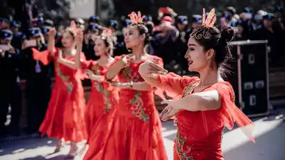
Depart after breakfast and arrive at the Hotan Yotgan Ancient City at noon. This small town in southern Xinjiang is steeped in Western regional charm. Its red and white architecture is a 1:1 replica of the ruins of the Khotan Kingdom. It's a perfect spot for travel photography and capturing exotic local culture. China-TravelNote specially arranged for a local Uyghur woman to be featured in this environmental portrait shoot.
·afternoon
Continuing west, we arrived in the afternoon at the border town of Yecheng, where we visited the Yecheng Zero Kilometer Monument, marking the Xinjiang-Tibet Highway. For those of us who had come all the way from Ngari Prefecture in Tibet, seeing Yecheng signaled the end of a perilous journey and the arrival of a bountiful land of abundant fruits and vegetables. Finally, we could eat and sleep well. From a material perspective, it was like a journey from hell to heaven.
Day 11: Yecheng → Shache → Kashgar Old Town → Kashgar ★ Disbandment Day
All day
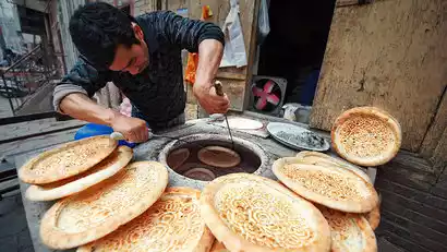
Yecheng is a small border town in Xinjiang with a strong ethnic minority style. Tall rows of poplar trees surround brightly colored small houses. Uyghur men and women wearing headscarves, small hats and deep facial features appear on the roadside, and there are many stalls selling naan on the street.
We left Yecheng at the right time and passed through Shache, a small town also full of Islamic exotic style. We stopped for a while to take pictures of street buildings and cultural scenes.
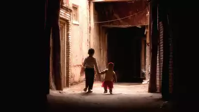
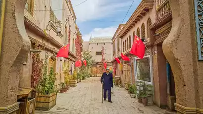
We then arrived in Kashgar and headed to Kashgar's Old City to photograph the local culture. Kashgar's Old City boasts a patchwork of houses, all in the Islamic style of earth, wood, and brick. Its maze-like streets were the setting for the film "The Kite Runner." Children playing in the alleys excitedly pose for photos, their bright eyes revealing their simple hearts.
After the photoshoot, we'll be transported to Kashgar Airport and then to Kashgar Railway Station. Everyone will bid farewell to Xinjiang and return home according to their flight or train schedules. This concludes our Xinjiang-Tibet Highway adventure. Upon your return, please be sure to leave a review on the China-TravelNote app to win a voucher. You can also share your work on the China-TravelNote Photography Network to share the breathtaking beauty of Xinjiang and Tibet with others!