Day 1 Various locations → → Lhasa ★ Gathering day
All day
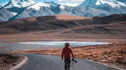
Today, tourists from all over the country will travel to Lhasa according to their own transportation methods. Please check in at the meeting hotel by submitting your "China-TravelNote+Name" ID. After check-in, it's recommended to rest and acclimate to the plateau to prepare for the upcoming trip. Tourists in good physical condition can visit Barkhor Street. Don't get too excited when you first arrive in Lhasa! On your arrival day, avoid showering, drink plenty of water, eat plenty of vegetables and fruits, eat light meals until you're 80% full, and go to bed late (going to bed early can cause nighttime awakenings and difficulty falling asleep). Avoid smoking and drinking. Numerous studies have shown that maintaining an open-minded and optimistic attitude can alleviate the physical discomfort caused by altitude sickness. If you feel unwell, please contact staff immediately for assistance.
Border Pass Related (Must Read)
This route requires a border pass. There are many border checkpoints. Currently, the pass processing hall is mostly used by individual tourists to Ali. Group tourists still need to go to the window to process it in their own name. The waiting time is long, which may seriously affect the itinerary. Therefore, tourists are required to apply for a border pass in advance at their registered residence or place of residence, and then go to the nearby police station to provide their second-generation ID card. The pass is usually issued on the spot (subject to the processing time of the police station).
Reason for travel to Tibet: Fill in “tourism”.
Destination: Tibet Autonomous Region, Shigatse Prefecture, Shannan Prefecture (Must be typed, handwritten is not valid!!)
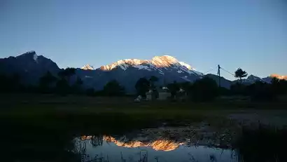
Day 2 Lhasa → Rito Monastery → Pumoyongcuo
·morning
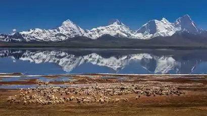
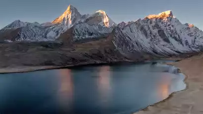
After breakfast, we'll depart for the inner ring of Yamdrok Lake. While you may have visited Yamdrok Lake countless times, you might not know the other side of the lake. We'll ascend to the newly constructed Lujila Observation Deck/Yamdrok Lake Observation Deck (at the Gangbala Pass) for bird's-eye views of the lake. The gray-brown islands within the lake resemble the ridged backs of prehistoric beasts, interspersed with the azure waters. A sea of clouds billows from the distant mountaintops, creating a breathtaking visual experience.
·afternoon
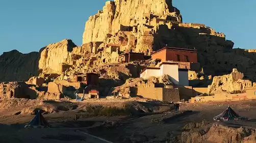
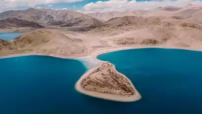
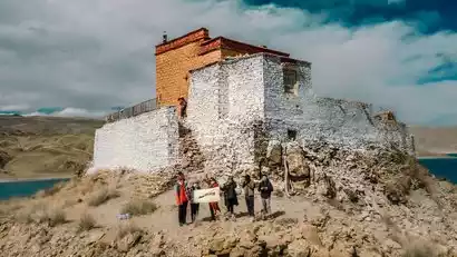
Approach the Yamdrok Lake Temple [Rito Temple], which is isolated and isolated on the shore of the jade Yamdrok Lake. It is a secret place that 99% of tourists cannot set foot in. You can have a 360° wide-angle view of the world of Yamdrok Lake, allowing you to experience the impact of the visual beauty.
We left at the right time and stayed in a house by the Pumoyongcuo Lake at night. When the weather was good, the stars seemed to be within reach!
Day 3: Pumoyongcuo → Baimalingcuo → Kangma
·morning
Today we got up early to photograph the sunrise at Pumoyongcuo. This is one of the most beautiful viewpoints for watching Kulagangri: looking out from the north bank, the Kulagangri snow-capped mountains on the left stand proudly. We set up our cameras and waited for the moment when the sun would shine on the golden mountains.
·morning
We set off at the right time and drove to the color township [Baimalingcuo], where we started a light hike and photographed the Kulagangri Mountains from a closer distance. After the hike, we went down the mountain and returned to the parking lot.
·afternoon
Continue the journey and drive over the Mondala Pass (5363 meters above sea level), where you can take photos of the Kulagangri Snow Mountain Group from afar: Kulagangri Peak I, Peak II, Peak III; Karezhan Peak I, Peak II, Peak III.
We then passed through the canyon area on the south side of the Himalayas and followed the new National Highway 219, passing by Pumoyongcuo again to take pictures, and then crossed the Tarji Mountain Pass (5,500 meters above sea level) and arrived in Kangma County to stay overnight.
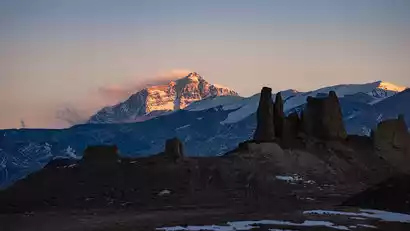
Day 4 Kangma → Duoqingcuo → Galacuo → Gamba
·morning
We set out in the morning and continued on our journey, taking photos of the Masanggang Peak, which is 7,145 meters above sea level.
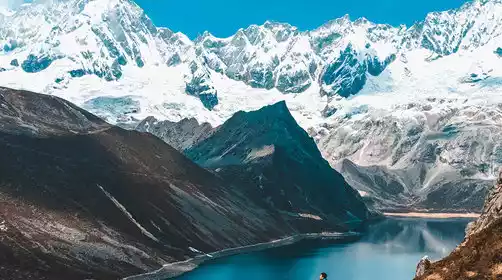
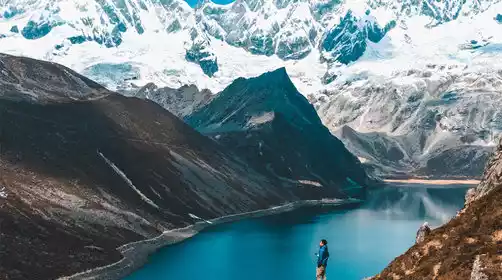
Arriving at Duoqingcuo Lake at the right time, the lake reflects the 7,326-meter-high Zhuomulari Snow Mountain! The charming Goddess Peak and the mirror-like lake are embedded in the lush Pari grassland. The snow-capped mountains, lake, blue sky and red sun complement each other, forming a beautiful picture.
·afternoon
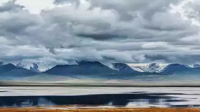
Continuing on, the journey from Gading Line Shaga Pasture to Chengna Pass is a great snow mountain scenic road. On clear days, you can see many snow-capped peaks along the border with Sikkim, India.
At Chengna Pass, you can also see the long Qudeng Nima Snow Mountain Range. Everywhere you look, it is magnificent and deep, beautiful like a movie frame. We stopped to take photos along the way.
After the filming, we stayed in Gamba at night.
Day 5 Gangba → Qilin Gorge → Dingjie County
·morning
This morning, we came to the viewing platform outside the Gangba Hotel, waiting to photograph the sunrise over the Himalayas and waiting for the morning light to illuminate the tops of the mountains!
·morning
Afterwards we headed towards the mountains, accompanied by snow-capped mountains all the way. Along the way we had the opportunity to photograph the China-India border mountain, Zhuomu Yumo, which is 6,730 meters above sea level.
·afternoon
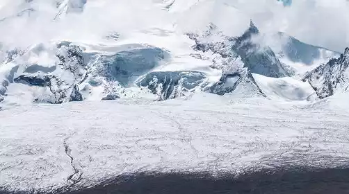
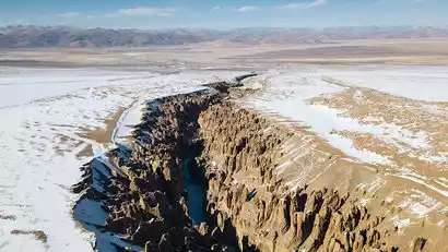
In the afternoon we came to the Qilin Gorge scenic area (a sacred place for aerial photography), which is a stunning ground fissure hidden under the Himalayas. It is a unique karst landform formed after tens of millions of years of erosion and cutting by glaciers and snow water.
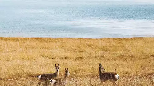
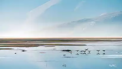
We returned in time and continued onward, entering Dingjie County. The Amazhimi Snow Mountain appeared before us. The wildlife in the Dingjie Wetland is also worth stopping to photograph. We will arrive in Dingjie County tonight and stay overnight.
Day 6 Dingjie → Zongcuo → Everest Base Camp → Basong Village
·morning
We got up early and drove to Zongcuo, a newly discovered secret place, to wait and shoot the sunrise. Here we can face the huge Amazhimi snow-capped mountains and create freely under the strong pressure of the snow-capped mountains.
·morning
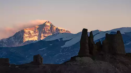
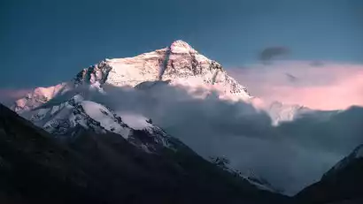
Departing at the right time, we passed by the Dingjie Wetland's water pools, where reflections were stunning and wildlife like black-necked cranes occasionally played. Continuing west, we entered the core area of the Mount Everest Conservation Area. Not far away, we reached the Lhotse Viewing Platform, where we could photograph the distant Lhotse, the world's fourth highest peak at 8,516 meters, and Mount Everest, the world's highest peak at 8,844.48 meters.
·afternoon
We then entered Everest National Park and transferred to a scenic bus at Zhaxi Zong Township for Everest Base Camp. This location is also a prime spot for photographing the sunset over Mount Everest, perfect for capturing snowy mountain scenery. Facing the biting cold wind and the lonely Mani piles, we bundled up in warm clothing and waited patiently for the moment when the sun would shine upon Mount Everest.
·night
After the photo shoot, we left and took the scenic shuttle bus back to the village at the foot of Mount Everest.
Day 7 Basong Village → Jiawula Pass → Jilong
·morning
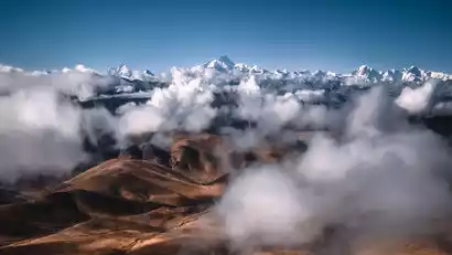
This morning, we arrived at the Gawu La Pass early, waiting to photograph the sunrise of four 8,000-meter snow-capped peaks: Makalu (8,463 meters), Lhotse (8,516 meters), Everest (8,844 meters), and Cho Oyu (8,201 meters) lined up in a row, giving us a panoramic view of the world's snow-capped peaks.
·morning
After the photoshoot, we continued westward. The stunning silhouette of Shishapangma would soon appear before our eyes, and with luck, we might even encounter Tibetan wild donkeys along the way. Pegucuo/Pekucuo, just in front of Shishapangma, and Gangpengqing Peak, at 7,299 meters, were reflected in the car window, creating a breathtaking sight.
Continue on, cross the Kongtanglam Pass (5236 meters above sea level), encounter the Jiannisar section of the Himalayan Ganesha Range, and photograph the Yangran Kangri (Jiannisar, the embodiment of the White Elephant God, the white elephant in the Lion Camel Ridge in "Journey to the West") at an altitude of 7422 meters. If you are lucky, you can also take a long-range photo of Manaslu Peak at an altitude of 8163 meters.
·afternoon
Then we went down all the way to Jilong Town, the "back garden of Mount Everest", which is a paradise surrounded by snow-capped mountains. On the right side of the road is the Riwubanba Peak with an altitude of 4,680 meters, and in the south stands the Lantanglirang Peak with an altitude of 7,227 meters. We enjoyed taking pictures of the snow-capped mountain feast.
We then drove to Jipu Village for a photo tour. Jipu Village is a hidden gem nestled deep in the canyon: fenced courtyards surround the village, with scattered Tibetan-style houses in the distance. These interplay with the trees, farmland, mountains, and prayer flags, creating a tranquil and peaceful atmosphere. With only the chirping of birds and the fragrance of flowers, this idyllic paradise nestled among snow-capped mountains will surely fulfil your every imagination of rural life.
The altitude of Jilong Valley is lower today, so we can have a good sleep at night!
Day 8 Gyirong → Gangga
·morning
Today, we'll take you to Nai Village, a thousand-year-old village on the China-Nepal border, to photograph the sunrise over the snow-capped mountains! Nai Village is surrounded by the famous snow-capped mountains that border China and Nepal: Qumugula Snow Mountain to the west, Shennv Peak to the west, Riwubanba Snow Mountain to the northwest, Pekugangri Glacier to the north, and Gruni Peak in Nepal to the southeast! There are also Five Finger Peak and Yangrangangri Peak!
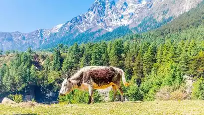
Under a blue sky and white clouds, a small village lies surrounded by snow-capped mountains. Smoke rises from chimneys and clouds billow upwards. Lush greenery lingers between the mountains, while yaks graze leisurely. The crisp tinkle of bells adorning their necks, combined with the occasional chirping of birds, creates a beautiful melody! It's truly enchanting!
·morning
After filming at Nomura, we drove off, once again looking back at Shishapangma. Today's drive will be long, so please bring some snacks and fruit in the car to quench your thirst and hunger.
·afternoon
Arrive in Old Tingri before dusk in the evening and drive to the sunset camera position to capture the sunset over Mount Everest with the ancient castle in the foreground! Then, stay in Gangga.
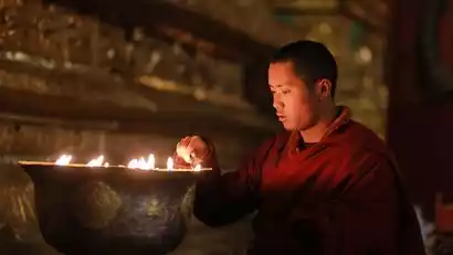
Day 9: Gangga → Sakya Monastery → Shigatse
All day
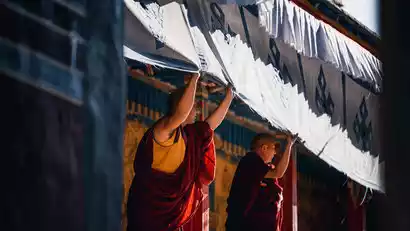
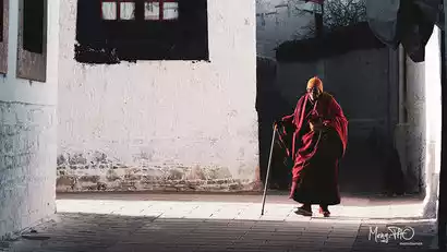
Today we visited Sakya Monastery, the main temple of the Sakya school, for a tour and photography. The walls of Sakya Monastery are painted in red, symbolizing Manjushri, white, symbolizing Avalokitesvara, and blue, symbolizing Vajrapani. This is why the Sakya school is often referred to as the "Flower Sect." We photographed the temple architecture and its culture. Afterward, we drove to Shigatse and stayed at our hotel that night.
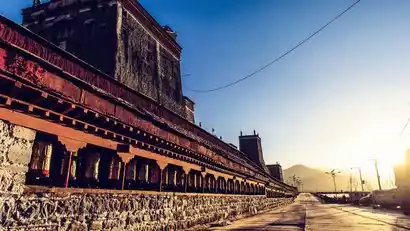
Day 10 Shigatse → Tashilhunpo Monastery → Lhasa ★ Disbanding Day
·morning
Today we visited Tashilhunpo Monastery to photograph its architecture and cultural scenes. Built in 1447, Tashilhunpo Monastery is one of the six major monasteries of the Gelugpa sect of the Yellow Sect and the seat of successive Panchen Erdeni from the Fourth onward. Built into a hillside, with its back against the mountain, the monastery boasts interconnected halls, stacked buildings, and golden roofs and red walls. The main complex is majestic, impressive, and resplendent. Inside, purple smoke rises from incense burners, and lights flicker on altars, revealing the various Buddha statues. Monks chant in the main hall, while devotees pay homage before the Buddha statues. The temple houses a 26-meter-tall indoor bronze statue of Jampa Buddha.
·afternoon
Afterward, we'll be dropped off at Lhasa Airport before returning to downtown, reluctantly bidding farewell to the holy city. If you have extra time, you can explore Barkhor Street and bring back gifts for friends and family. However, bargaining is crucial, and the choices are crucial. Our advice: have fun with small purchases, but exercise caution with valuables.