
Day 1 Shanghai → Longquan City Hotel
All day
7:15 Gather at the designated location of China-TravelNote and sign in.
We set off on time at 7:30. On the way, the team members introduced themselves to each other and helped the new members integrate as quickly as possible. The staff played interactive games and there was laughter and joy along the way.
Arrive at the Longquan City Hotel around 17:30, check in, find some food at your own pace, and go to bed early to recharge your energy for the next day's journey.
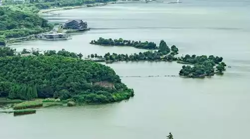
Go to Longquan City Station and take a taxi to the hotel, which is about 3.4 km away.
This line is quite intense, so people with health problems or poor physical fitness are not allowed to register. Please understand!
Day 2 Longquan → Junxi → Renkeng → Liyang
All day
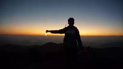
5:00 It’s still dark and early risers are about to set off.
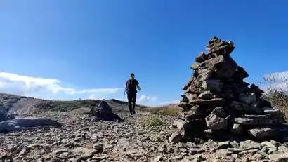
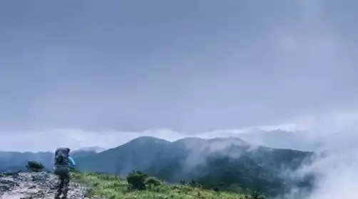
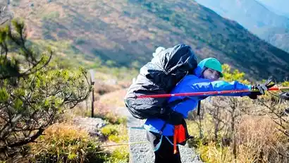
At around 5:45, we arrived at Junxi Village, the starting point of the hike. We got off the bus, did some warm-up exercises, and started hiking.
Today's route: Junxi - Renkeng - Wushiku Forest Farm - Fengyang Mountain - Huangmaojian (1929m) - Huangfengyangjian (1854m) - Oujiang River Source - Huangyang Mountain - Shaoxiangyan - Tiantang Mountain - Liyang Village.
The total distance is about 34km, with an elevation gain of about 3100m.
As we climbed the mountain along the ancient plank road paved with bluestone slabs, we occasionally saw abandoned ancient post stations. A sense of melancholy could not help but arise.
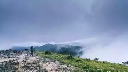
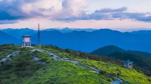
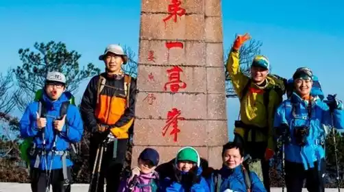
Climb to the summit of Huangmaojian, Zhejiang's highest peak at 1,929 meters, and rejoice! After crossing the scenic area, you'll enter the ancient trail and descend the mountain, enjoying a variety of vegetation zones along the way, including deciduous evergreen broad-leaved mixed forests, coniferous and broad-leaved mixed forests, mountain dwarf forests, and mountain shrubs and grasses.
Along the way, you can also see precious tree species such as the tulip tree and ancient broad-leaved forests with a very primitive forest appearance.
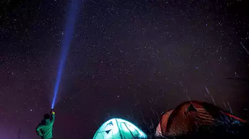
In the evening, we will have dinner at the farmhouse. Everyone can have a good rest at night because tomorrow we will have a new journey. If you are tired, you can choose to stay at the farmhouse for the next day.
Day 3 Liyang → Guomaojian → Liyang → Shanghai
All day
5:00 AM Continue the journey, leaving early and returning early. (Today's loop route, you can choose to stay at a farmhouse to rest).
The ninth peak of the original Qianba Line, Baishanzu (the second highest peak in Zhejiang), is now under strict mountain closure control, so the Guomaojian (1760m) facing it was chosen as its replacement.
Along the way, we saw towering trees, withered trees reborn in spring, and even the giant pandas of the plant world—fir trees. The air in the forest was incredibly fresh, not only making it easier to breathe, but also clearing the mind.
The whole journey is about 15km, with an ascent of about 1000m.
Return to the farmhouse around 11:00 and a celebratory dinner is essential!
Around 12:30, after lunch, we got on the bus for the return journey.
At around 14:30, we arrived at Longquan City Station, said goodbye to our local friends, and continued our journey.
Around 23:00, we returned to the starting point in Shanghai, said goodbye with tears, and agreed to have fun together again next time!