Canyon hiking Beijing
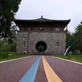
Nanshiyangda Canyon Forest Park
by Yuyuuu001
Jun 5, 2025
by Yuyuuu001
Jun 5, 2025
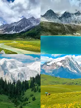
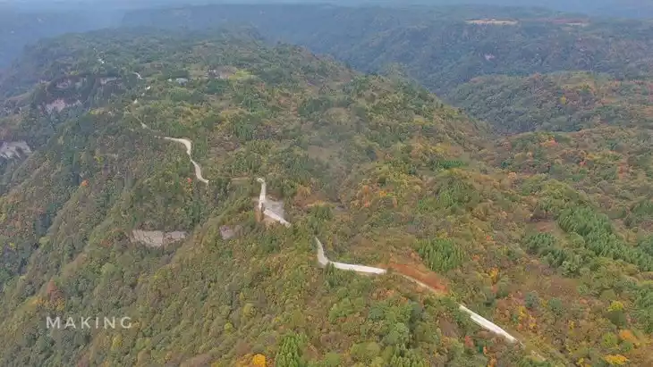
In Beijing’s outdoor community, some are obsessed with the rugged Jiankou Great Wall, others chase the sunrise and sea of clouds at Wuling Mountain, but true wilderness enthusiasts all have a secret spot in their hearts: the Nanshiyang Grand Canyon. It’s not on the list of 5A scenic spots, with no cable cars, no convenience stores, and no trendy photo walls, yet it quietly carries the title of “the last wild backbone of western Beijing” with its 34 kilometers of pristine canyon, 1600-meter-high cliffside plank roads, geological wonders spanning billions of years, and breathtaking mountain scenery that changes with the seasons!
Today, as a travel blogger who has trekked over 20 hiking routes around Beijing, I must tell you: if you want to see the most original, hardcore, and stunning landscapes in Beijing, Nanshiyang is the ultimate answer.
What is Nanshiyang Grand Canyon?
Location: Matao Village, Yanchi Town, Mentougou District, Beijing (about 1.5 hours from downtown)
Length: Approximately 34 kilometers, branching in a “Y” shape, with an astonishingly deep main valley
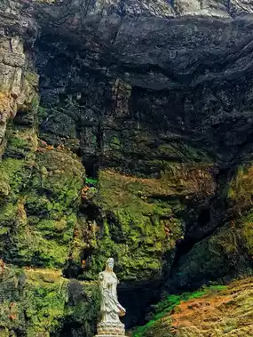
Geological Features: Typical North China limestone canyon landscape, featuring cliffs, peak forests, caves, and streams
Positioning: An undeveloped, pristine hiking destination suitable for intermediate to advanced outdoor lovers
Key point: This is not a “scenic area” but more like a “geological puzzle piece” left by nature on the western edge of Beijing.
Although some trails and signs have been officially set up, it still retains a wild spirit.
Hiking here requires not only physical strength but also good judgment.
Four Core Highlights, each frame looks like a National Geographic cover
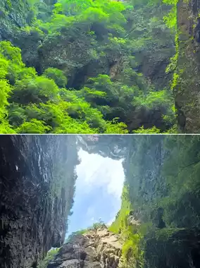
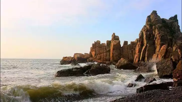
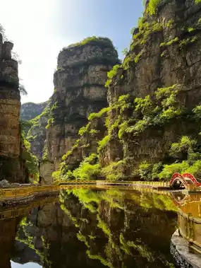
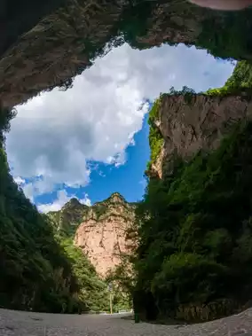
1. Towering Cliffs · One-Line-Sky Canyon
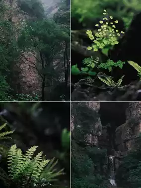
Shortly after entering the main valley, you’ll be welcomed by two towering gray-white rock walls soaring thousands of feet—this is the famous “One-Line-Sky.” Looking up, you see only a narrow strip of blue sky; beneath your feet is a rocky path, and the mountain wind howls in your ears, as if you’re walking through an ancient crustal fissure. In summer, cool breezes make it a natural air conditioner; in autumn, red leaves cascade down the cliff tops like fiery waterfalls.
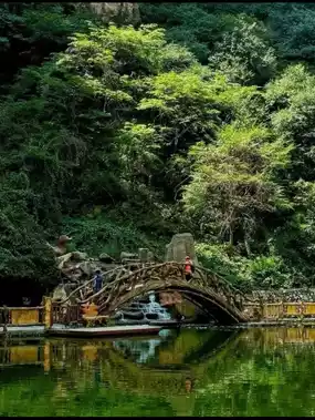
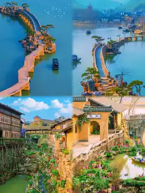
2. Cliffside Plank Road · Suspended Above the Abyss
An approximately 800-meter-long wooden plank road clings to the steep slope, with the mountain on one side and a hundred-meter-deep valley on the other! Walking here, your heartbeat races like a roller coaster. Especially after rain when mist swirls, it feels like strolling in the clouds. Photographers can capture epic shots that look like “walking inside a painting.”
Photo tip: Arrive before 7 a.m. to avoid backlighting; drone shots here are spectacular!
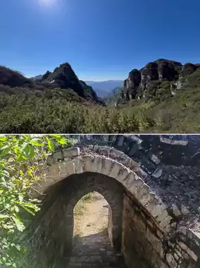
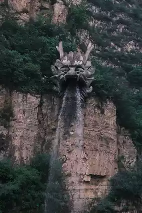
3. Strange Rock Matrix · Nature’s Sculpture Exhibition
Along the way, you’ll find bizarrely shaped rock formations:
- “General Rock” stands like an armored warrior atop the mountain
- “Lover’s Peaks” are two peaks side by side, as if embracing for a thousand years
- “Stone Waterfall” cascades from the mountain top, like frozen waves
These are all sedimentary rocks from 200 million years ago, uplifted and weathered by the earth’s crust, a living open-air geology textbook.
4. Scenic All Year Round · Nature’s Unfiltered Aesthetics
- Spring: Mountain peach and apricot blossoms dot the cliffs, full of vitality
- Summer: Lush greenery, babbling streams, perfect for cooling off
- Autumn: Layers of red leaves, yellow sumac, and yuanbao maple create a color explosion
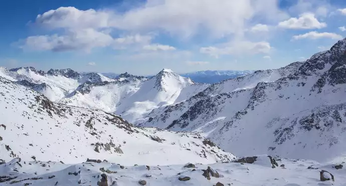
- Winter: Ice waterfalls hang from cliffs, snow covers peak forests, rivaling the secret realms of Changbai Mountain
Classic Hiking Routes Recommended (suitable for general challengers)
✅ Difficulty: ★★★☆☆ (requires some physical fitness)
✅ Suggested Duration: 5–6 hours (including photo breaks)
✅ Gear: Non-slip hiking shoes, windbreaker, trekking poles, plenty of water, energy snacks
[Lightweight Essential Route] Matao Village Entrance → One-Line-Sky → Cliffside Plank Road → General Rock Viewing Platform → Return the same way → Exit
About 8 kilometers total, 600 meters elevation gain, suitable for a weekend day hike
[Advanced Crossing Route] Enter from Matao Village → Nanshiyang Main Valley → Exit via Yuer Spring direction → Pick-up by car
About 15 kilometers total, requires advance transport planning, ideal for group challenges
📌 Friendly Reminders:
- No ticket booths at the entrance, currently free to visit (cherish this pure land!)
- Mobile signal is unstable; download offline maps (recommend “Two Steps” app)
- No public restrooms; plan accordingly
- Camping, open flames, and littering are prohibited; please carry out all trash
🚗 Driving Directions: Navigate to “Mentougou Matao Village” or “Nanshiyang Grand Canyon Entrance,” follow Provincial Road S217; the last 5 kilometers are mountain roads, drive cautiously if inexperienced
- 🚌 Public Transport: No direct bus; take M5 bus to “Matao Village Station” then taxi or hike in
- 🏕 Accommodation: Nearby farm stays (such as Matao Village homestays) offer mountain village night chats
- 🍱 Food: Bring your own snacks! No restaurants or vending machines inside the park
Post by LaylaLopez_21 | Oct 24, 2025