In-Depth Xinjiang Ili Self-Driving Guide: From Sayram Lake to Duku Highway, Encountering a Fairyland on Earth
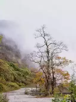
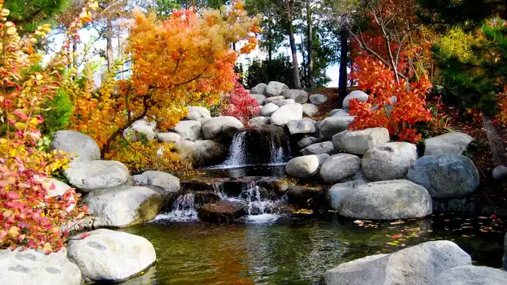
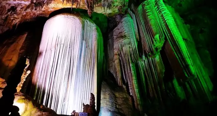
Qiongkushitai Village
by BenjaminPrice$54
Aug 22, 2025
by BenjaminPrice$54
Aug 22, 2025


The beauty of Ili is hidden in the embrace of snow-capped mountains and grasslands, nestled in the breath of lakes and forests. Only by self-driving can you unlock the pleasure of "freedom and unrestrained ease." This guide will take you on a 7-day loop starting from Urumqi, exploring every treasure and secret spot in Ili, leaving you with endless memories after the journey ends.
🌄 Itinerary Overview: 7-Day Self-Driving Loop Connecting the Highlights of Ili
This full self-driving route starts and ends in Urumqi, linking iconic Ili attractions such as Sayram Lake, Guozigou Bridge, Lavender Manor, Yizhao Highway, Zhaosu, Shata Ancient Road, Tekes, Kalajun, Qiongkushitai, Chapuqihai, Chaxi Grassland, Nalati, and Duku Highway. The total distance is about 1500 kilometers, covering diverse landscapes including lakes, grasslands, snow mountains, canyons, ancient roads, and cultural villages. You will experience both the grandeur of natural scenery and the tranquility of lesser-known secret spots.
📅 Daily Itinerary Details: From Dawn to Starry Sky, Capturing Ili’s 24 Hours
Day 1: Urumqi — Sayram Lake, Encounter the "Last Tear of the Atlantic"
- Route: Depart from Urumqi, drive southwest along the Lianhuo Expressway for about 550 kilometers, approximately 6-7 hours, arriving at Sayram Lake.
- Activities: Sayram Lake is the highest alpine lake in Xinjiang, with sapphire-blue waters known as the "Last Tear of the Atlantic." Upon arrival, you can drive around the lake (private cars are allowed in the scenic area with ticket and self-driving fees). It is recommended to enter from the south gate, stopping at viewing platforms such as Jiangtai, Dianjiangtai, and Swan Waters. Wait near Dianjiangtai at sunset to see the lake surface dyed golden-red with snow mountains reflected, perfect for stunning photos.
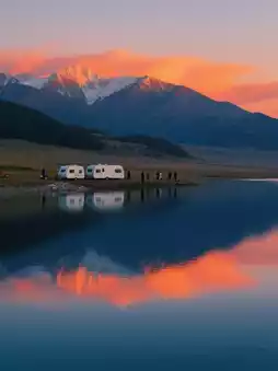
- Accommodation: Recommended to stay at the RV campsite or guesthouses near Dianjiangtai, where you can gaze at the starry sky at night, with the Milky Way reflected on the lake, peaceful and romantic.
- Tips: Sayram Lake is about 2071 meters above sea level; some may experience mild altitude sickness, so take it easy. It is windy by the lake, so bring a light jacket even in summer.
Day 2: Sayram Lake — Guozigou Bridge — Lavender Manor — Yizhao Highway — Zhaosu, Crossing Four Seasons in One Day
- Route: From Sayram Lake, drive about 30 kilometers southeast to Guozigou Bridge, then head to Huocheng Lavender Manor, followed by about 100 kilometers along Yizhao Highway to Zhaosu. Total driving time about 4-5 hours.
- Activities:
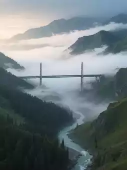
- Guozigou Bridge: Ili’s "internet-famous landmark," spanning a canyon with dense forests and winding rivers below. Capture panoramic shots from the viewing platform, especially magical in the early morning mist resembling a fairyland.
- Lavender Manor: Best viewed in June-July. Huocheng is China’s largest lavender planting base, with vast purple flower seas rivaling Provence, France. Walk into the fields for photos and buy lavender essential oils and other specialties.
- Yizhao Highway: Known as one of Xinjiang’s most beautiful roads, paired with Duku Highway as the "double gems." About 120 kilometers long, crossing the Wusun Mountains with challenging but breathtaking scenery including snow mountains, glaciers, grasslands, and valleys. Open only from June to October; vehicles with more than seven seats are prohibited.
- Accommodation: Zhaosu town offers many lodging options; recommended to stay near Tianma Cultural Park for easy next-day sightseeing.
- Tips: Yizhao Highway has many curves; drive carefully. Lavender blooms are short-lived; prioritize travel in June-July.
Day 3: Zhaosu — Shata Ancient Road — Tekes, Hiking the "Ancient Silk Road" under Snow Mountains
- Route: From Zhaosu, drive about 70 kilometers southwest to Shata Ancient Road, explore, then return to Zhaosu and drive about 80 kilometers northeast to Tekes. Total driving about 3-4 hours.
- Activities:
- Shata Ancient Road: An important passage of the Ancient Silk Road, famous for its pristine scenery of snow mountains, glaciers, forests, and rivers. After entering the scenic area, take the shuttle to the hot spring hotel, then hike or take an electric cart to the Muzart Glacier viewing platform. The glacier glows blue under sunlight, with cattle and sheep scattered on the grasslands below the snow mountains, like stepping into a primeval secret realm.
- Wusun Ancient Road (optional): If time and hiking experience allow, you can venture deeper from Shata Ancient Road into Wusun Ancient Road, a more challenging hiking route requiring prior planning, equipment, and guides to experience the raw wilderness beauty.
- Accommodation: Tekes town, China’s only Bagua (Eight Trigrams) city, with streets laid out in the Bagua pattern. At night, you can ride the Ferris wheel for panoramic city views.
- Tips: Wear comfortable sports shoes for hiking Shata Ancient Road; temperatures are low even in summer, so bring a thick jacket. Wusun Ancient Road is difficult; not recommended for beginners.
Day 4: Tekes — Kalajun — Qiongkushitai, Watching Light and Shadow Magic on the "Human Body Grassland"
- Route: From Tekes, drive about 30 kilometers southeast to Kalajun Grassland, then about 50 kilometers southeast to Qiongkushitai. Total driving about 2-3 hours.
- Activities:
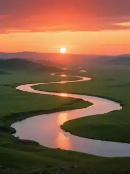
- Kalajun Grassland: A UNESCO World Natural Heritage site, famous for its "undulating human body-shaped grassland." In summer, the grass is lush and wildflowers bloom everywhere. Recommended to visit Kuokesu Grand Canyon, take the cable car to overlook the "nine bends and eighteen turns" river. At sunset, the river reflects multiple suns, a spectacular sight.
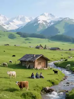
- Qiongkushitai: A lesser-known village with original wooden houses scattered on the grassland, backed by snow mountains and facing a valley, full of pastoral charm. You can hike to the back mountain viewing platform to overlook the entire village and winding river. The starry sky at night is brilliant, ideal for camping (contact local guesthouses in advance).
- Accommodation: Recommended to stay at the "Qingkong Jiyi" guesthouse in Qiongkushitai, with wide views and the ability to watch snow mountains from bed.
- Tips: Kalajun is large; taking the shuttle is advised. Some roads in Qiongkushitai are unpaved; drive carefully.
Day 5: Qiongkushitai — Tekes Bagua City, Unlocking the "City Without Traffic Lights"
- Route: Return from Qiongkushitai to Tekes, about 1.5 hours driving. The day is mainly for leisure.
- Activities:
- Tekes Bagua City: Named for its Bagua layout, the city has no traffic lights yet no traffic jams. Climb the central observation tower to see eight streets radiating like the Bagua diagram, appreciating ancient wisdom.
- Around Bagua City: Visit the Lijie Folk Tourism Area, preserving Kazakh, Uyghur, and other ethnic architectural styles. Try handmade ice cream, baked buns, and buy ethnic handicrafts.
- Accommodation: Tekes town, preferably near the Bagua City center for convenient evening strolls.
- Tips: Entrance to the observation tower requires a fee; visit before dusk to see both daytime city layout and nighttime lights.
Day 6: Tekes — Chapuqihai — Chaxi Grassland — Nalati, Immersed in the "South of the Great Wall"
- Route: From Tekes, drive about 50 kilometers southeast to Chapuqihai, then about 70 kilometers southeast to Chaxi Grassland, followed by about 100 kilometers southeast to Nalati. Total driving about 4-5 hours.
- Activities:
- Chapuqihai: Known as Ili’s "Little Erhai Lake," with sapphire waters surrounded by grasslands and forests. You can camp or picnic by the lake, enjoying the peaceful lake and mountain scenery.
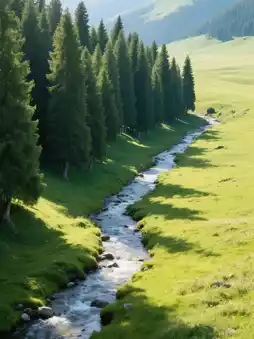
- Chaxi Grassland: Called "Little Switzerland of Ili," entrance fee 30 RMB per person, vehicles allowed inside. The grassland has dense spruce forests, babbling streams, and snow mountains nearby. Drive deep into the grassland, find an open spot to park, lie on the grass to sunbathe, and listen to the wind and birds.
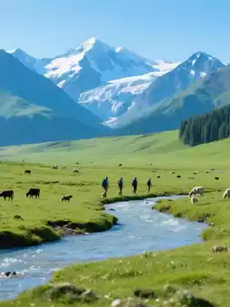
- Nalati Grassland: Upon arrival, stroll the river valley grassland, one of the world’s four major river valley grasslands. In summer, the grass is lush and wildflowers abound. Horse riding (about 200 RMB/hour) is available to experience nomadic life.
- Accommodation: Nalati town, recommended to stay near the scenic area for easy next-day exploration.
- Tips: Roads inside Chaxi Grassland are good but watch out for cattle and sheep. Nalati Grassland is large; choose to visit either the river valley or the aerial grassland depending on time.
Day 7: Nalati — Duku Highway — Urumqi, Crossing the "Hero Road with Four Seasons in One Day"
- Route: Depart from Nalati, drive about 500 kilometers north along Duku Highway back to Urumqi. Driving time about 8-10 hours (due to speed limits and possible traffic jams on parts of Duku Highway).
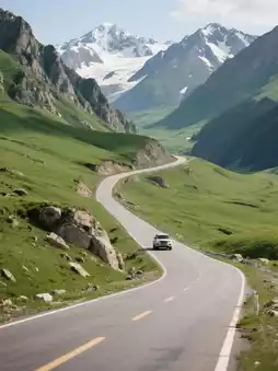
- Activities: Duku Highway is one of China’s most beautiful roads, 561 kilometers long, connecting northern and southern Xinjiang. Famous for "four seasons in one day, different weather every ten miles." Enter the northern section from Nalati, passing sites like Qiaolma Martyrs Cemetery (honoring road-building heroes), Hashilegendaban Pass (3400 meters altitude, possibly snowy in summer), and Dushanzi Grand Canyon. Along the way, you will see sudden changes from grasslands to snow mountains, forests to deserts, with every snapshot a scenic masterpiece.
- Tips: Duku Highway is open only from June to October; vehicles with more than seven seats are prohibited. Many curves and steep slopes require careful driving. Start early to avoid congestion. Bring warm clothes, snacks, and water as service areas are sparse on some sections.
Post by BenjaminPrice$54 | Aug 22, 2025