Live Your Best Lives
[Huangshi Ancient Architecture Collection] [Travel to Seek Beauty] [Huangjian Blog Graphic Collection]
Jumbo Heritage List © Epic Adventure of Jumbo Huang
does not deceive the dead, does not fail the living, and is worthy of the visitor
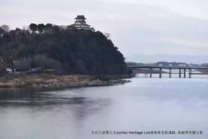
Chapter 2041: Giant pandas worship the water Dujiangyan, and sunbirds ask about Qingcheng Mountain
For any form of reprinting, please contact the author (WeChat, Jumboheritagelist or Huang_Jumbo).
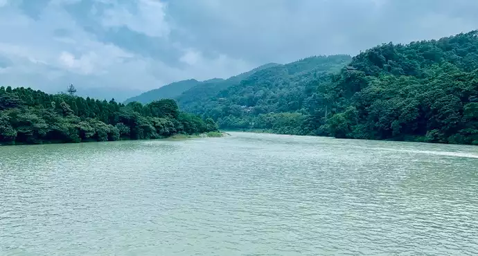
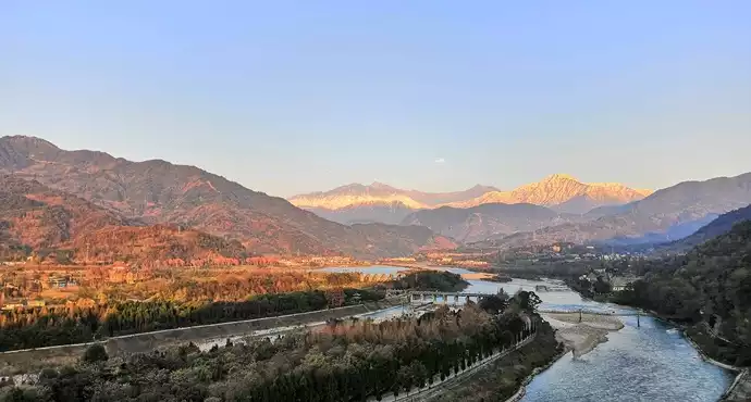
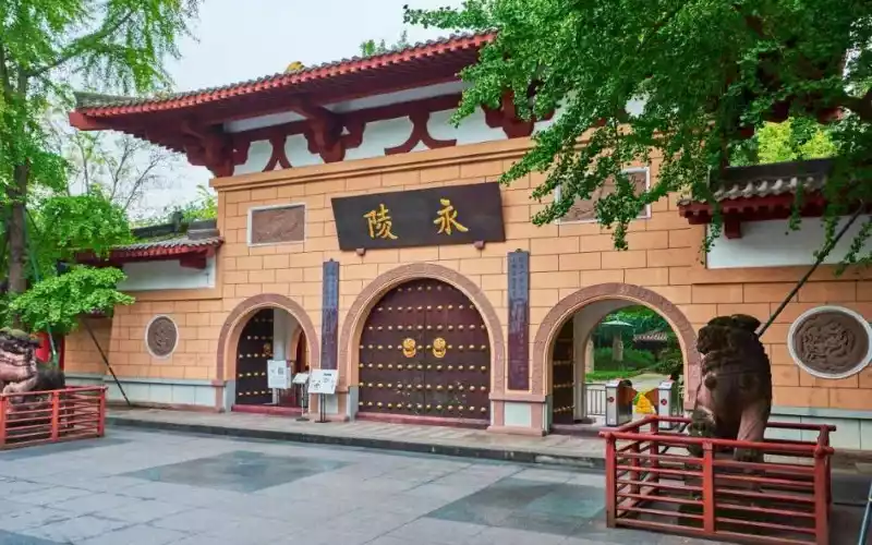
Dujiangyan is a large-scale water conservancy project built and used in our country in ancient times, located in the west of Dujiangyan City, Sichuan Province, 340 kilometers upstream of the Min River. Dujiangyan was built by Li Bing, the governor of Shu County in the Qin State during the Warring States period, and his son from about 256 BC to 251 BC. After renovation through the ages, Dujiangyan still plays a huge role for more than 2,000 years. There are many historical sites around Dujiangyan, mainly Erwang Temple, Fulong Temple, Anlan Bridge, Yulei Pass, Fengqiwo and Douxitai.
The entire Dujiangyan hub can be divided into two major systems: the head of the weir and the irrigation water network, of which the weir head includes three main projects: Yuzui (water diversion project), Feisha Weir (spill and sand discharge project), and Baopingkou (water diversion project), in addition to the inner and outer diamond embankments, herringbone embankments and other ancillary buildings. The Dujiangyan project is mainly based on water diversion and irrigation, and has comprehensive functions such as flood control and sand drainage, water transportation, and urban water supply. The Chengdu Plain it irrigates is the world-famous "Land of Abundance".
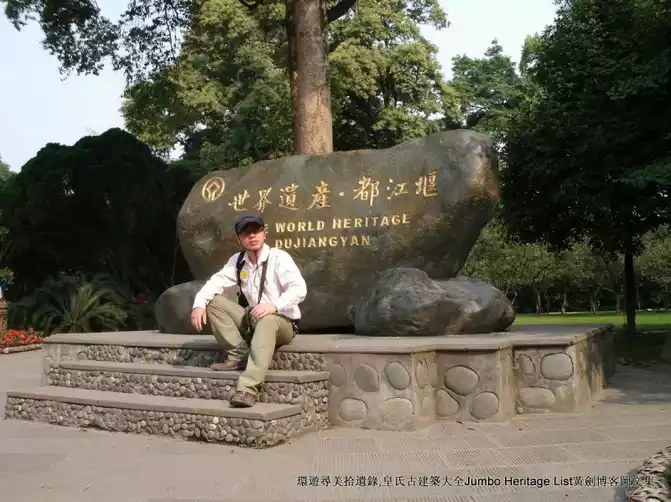
On July 7, 1980, Dujiangyan was listed as the first batch of provincial-level cultural relics protection units re-determined and announced by Sichuan Province. On February 24, 1982, it was announced as the second batch of national key cultural relics protection units. In 2000, Dujiangyan was included in the World Heritage List as a World Heritage Site together with Qingcheng Mountain as "a grand water conservancy project that is old, the only one in the world today, and characterized by damless water diversion".

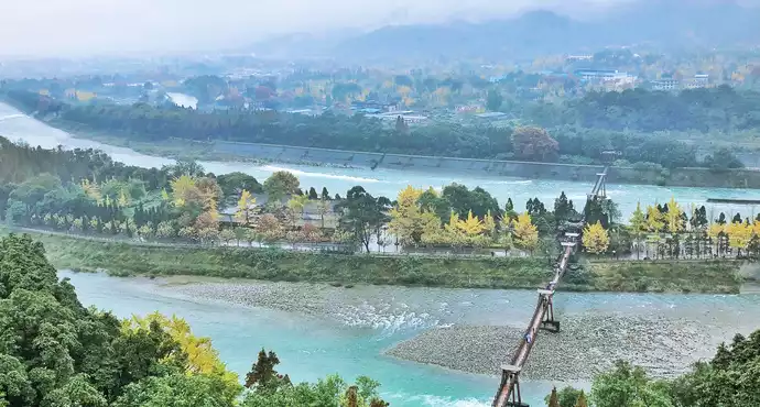
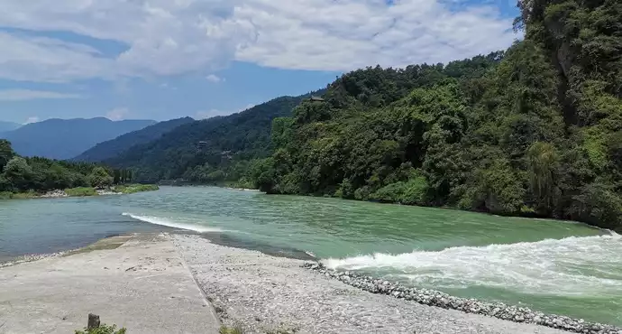
"Fish mouth" is the water diversion project of Dujiangyan, named because it is shaped like a fish mouth. It is located in the center of the river and divides the Min River into two rivers. The Waijiang River is located in the west, also known as the "Jinma River", which is the main stream of the Min River and is mainly used for flooding; The Neijiang River is located in the east and is an artificial water diversion main canal, mainly used for irrigation, also known as "irrigation river". The fish mouth determines the diversion ratio of the inner and outer rivers, which is the key to the entire Dujiangyan project.

The inner river intake is 150 meters wide and the outer river intake is 130 meters wide, and the river water is diverted proportionally at the fish mouth by using the topography and topography. When the water volume is low in spring, 40% flows into the outer river and 60% flows into the inner river to ensure water for spring plowing. During the spring and summer flood season, the water level rises and overflows the fish mouth, 60% of the water flows straight to the outer river, and 40% flows into the inner river, so that the irrigation area is protected from flooding. This is the so-called "four or six, flattened drought".

In addition, in ancient times, rafts were used to artificially change the diversion ratio of the inner and outer rivers. The raft is a kind of interception object with several logs as the skeleton, covered with bamboo mats on the outside, and filled with sediment inside. When needed, a number of rafts can be placed on one side of the river to reduce the amount of water on that side.Generally, this method is used to intercept the outer river in spring when there is less water to increase the water supply of the inner river, and then cut off the raft after the spring plowing is over and the water level rises to restore the water flow to normal. After 1974, permanent sluice gates were built at the mouth of the Waijiang River, thus replacing the raft to achieve cofferdam and flood discharge.

The current fish mouth is half-moon-shaped, made of slurry stone and concrete, 80 meters long, 39.1 meters wide at its widest point, and 6.6 meters high. The Yuzui embankment extends downstream to form the Vajra embankment, with an inner embankment of 650 meters and an outer embankment of 900 metres. Further down the King Kong Embankment are the Flying Sand Weir and the Herringbone Embankment.

There is also a Baizhang embankment on the east bank of the upper reaches of Yuzui, with a total length of 1,950 meters, which forces floods and sediment to the outer river and plays a role in protecting the bank. Yuzui, Baizhang Dike, and King Kong Dike, together with the flying sand weir and the mouth of the treasure bottle, play the functions of flood discharge, sand discharge and water regulation. The position of the fish mouth has been changing throughout history. The earliest fish mouth is located not far from the lower reaches of the Baisha River estuary; The current Yuzui is located 2,050 meters downstream of the Baisha Estuary, a location determined during an overhaul in 1936.

Dujiangyan fish mouth was damaged and cracked in the Wenchuan earthquake in Sichuan, but the impact was not significant after repair. The mouth of the treasure bottle is the water diversion project of Dujiangyan, which is an artificially carved gap on the cliff extending from Yulei Mountain to the Min River,

It is 120 meters away from the lower mouth of Feisha Weir, located under the Yulei Pass at the west gate of the ancient Guan County city wall, and was excavated when Dujiangyan was founded. The mouth of the vase is wide at the top and narrow at the bottom, with a bottom width of 14.3 meters, a top width of 28.9 meters, an average width of 20.4 meters, a height of 18.8 meters, and a gorge mouth length of 36 meters. The inlet inside the mouth, that is, the inlet of the inner river, is 70 meters wide, and the outlet outside the mouth is 40-50 meters wide, shaped like a "bottleneck", hence the name of the mouth of the treasure bottle.

The combination of the Vase mouth and the flying sand weir has the function of controlling the size of the water flow, which is the key to controlling the water inflow of the inner river. The water of the Neijiang River flows through the mouth of the treasure bottle, irrigating large areas of farmland in the Chengdu Plain; During the flood, the water level of the inner river rises higher than the Feisha Weir, and the flood enters the outer river and flows away, coupled with the constraints of the water flow at the mouth of the treasure bottle, it achieves the effect of flood control. After the Neijiang River flows into the mouth of the treasure bottle, it conforms to the high terrain in the northwest and low in the southeast, and continuously diverts along the large and small diversion canals, forming an artesian irrigation canal system that irrigates more than 10 million acres of farmland on the Chengdu Plain.

There are dozens of divisions engraved on the cliff on the left bank of the mouth of the treasure bottle, each with a spacing of one ruler, called "water rule", which is used to observe the rise and fall of the water level, and is the earliest water level ruler in our country. The number of sufficient water increases with the expansion of the irrigation area of Dujiangyan. In the Song Dynasty, the water was only ten strokes, and when the water level reached six, it was sufficient, and no matter how high it was, flooding would occur ("Song History": "Then it will be one foot, and it will stop at ten; Water and six rules, the flow is sufficient");

Yuan Dynasty was enough to use nine rules ("History of the Yuan": "Draw it with a ruler, compared to eleven.") Water and its nine, its people are happy, too much is worrying, and if there is none, it is difficult"). In the Qing Dynasty, sixteen were major floods, but now fourteen are needed to ensure spring plowing water, and the water carved on the cliffs has reached twenty-four strokes.

The hill on the right side of the mouth of the treasure bottle is called "Li Dui" because it is separated from the mountain. There is a Fulong Temple dedicated to Li Bing, also known as the Laowang Temple. After more than 2,000 years of rapid impact of the river, there was a huge cavity, and it was reinforced twice in 1965 and 1970. The flying sand weir plays a role in overflowing and draining sand, formerly known as "Shilang Weir", built during the Longshuo period of Tang Gaozong (661-663), and is the spillway and sand discharge channel of the Neijiang River, hence the name.

The Flying Sand Weir is a gap at 710 meters below the King Kong Embankment, located on the opposite bank of Hutou Rock, 240 meters wide, and the top of the weir is 2 meters higher than the riverbed. The Feisha Weir discharges the river water that exceeds the needs of the irrigation area into the outer river on its own, so that the Chengdu Plain is protected from flooding; It can also use centrifugal force to discharge a large amount of sand and gravel wrapped in the water from here to the outer river, avoiding siltation of the inner river, the mouth of the treasure bottle and the irrigation area.

The flying sand weir follows the principle of "low work weir", that is, the low work of the embankment top is the same height as the standard platform top on the opposite bank, so that the inner river water that exceeds the upper limit of the flow of the treasure bottle mouth overflows through the top of the weir and flows into the outer river. In the event of a major flood, the weir will burst on its own, allowing the river to return to the main flow of the Minjiang River. The water level of the Neijiang River reaches 14 strokes, and the flow rate is 385 cubic meters per second, which is enough water for spring plowing in the irrigation area.

If the height of the top of the Feisha Weir is the same as this water level, when the water in the inner river exceeds 14 rules, the excess river water can overflow from the Feisha Weir to the outer river. In addition, the Bao Vase Mouth not far downstream of the Feisha Weir has a good water control effect, even if the flow of the Neijiang River is as high as 3,000 cubic meters per second, the water inflow of the Treasure Bottle Mouth is about 700 cubic meters per second. The rapids down the Vajra Embankment are blocked by the flow restriction at the mouth of the treasure bottle, forming a migratory water outside the mouth, that is, Fulong Pond.

Coupled with the guiding effect of the Hutou Rock that jutted into the inner river on the opposite side of the Flying Sand Weir, the flood flooded over the Flying Sand Weir with a large amount of sediment and discharged into the Outer River. According to contemporary measurements, when the flow of the Minjiang River exceeds 1,000 cubic meters per second, 40% of the flood and 98% of the sediment are discharged from the Feisha Weir. The adjustment of the top height of the flying sand weir, coupled with the flow restriction at the mouth of the treasure bottle and the guidance of Hutouyan, can ensure that there is enough clean water in the diversion area and there is no threat of flooding.

The main role of the Dujiangyan project is to divert water for irrigation and flood control, and also has the functions of water transport and urban water supply. It splits the Minjiang River into two and diverts part of it to the east side of Yulei Mountain, so that the southern half of the Chengdu Plain is no longer plagued by flooding, and the northern half is free from drought. For thousands of years, the Minjiang River has turned harm into benefit here, benefiting agriculture and sericulture, turning the Chengdu Plain into a "country of abundance" where "water and drought follow people, do not know famine, and there is no famine", and then promote the governance, economic and cultural development of the entire Sichuan region.

When Dujiangyan was first completed, it was mainly shipping, supplemented by irrigation. The "Historical Records of the River Canal Book" records, "In Chengdu, this canal can be used for boats, and the surplus is used for irrigation, and the people enjoy its benefits." "The Min River and the Yangtze River were navigable, and the timber abundant in the upper reaches of the Min River could also be transported to Chengdu, making Chengdu the center of transportation in Shu since the Qin Dynasty.

In addition to the benefits of water transport, the benefits of Dujiangyan in agricultural irrigation have become more and more relied upon by the world with the development of irrigation canal systems. After the water source on the left bank of the Min River flows out of the mouth of the treasure bottle to the east side of Yulei Mountain, it flows to Chengdu along the two trunk canals excavated by Li Bing. During the Western Han Dynasty, Wen Weng, the governor of Shu County, opened a new trunk canal to divert the Min River to the eastern part of the Chengdu Plain. In the Eastern Han Dynasty, the "Wangchuan Plain" was "chiseled for twenty miles", so that the irrigation canal extended beyond the Muma Mountain Highlands of Shuangliu. At the same time, the diversion canal system on the right bank of the Min River continues to extend to the southwest of the Chengdu Plain on the basis of the Yangmo River opened up in the Li Bing era. After hundreds of years of development, by the Han Dynasty, the Dujiangyan irrigation area had developed from Pixian County in the Qin Dynasty to the front line of Chengdu to Pengxian, Guanghan and Xindu, with an irrigation area of "more than 10,000 hectares" (1 hectare in the Han Dynasty is about 70 acres today).

When the "Book of Han Geography" mentions the Chengdu Plain, it is said that "the people eat rice and fish, there is no worries about bad years, and the customs are not sorrowful". By the time of the Tang Dynasty, Gao Jian, the chief historian of Yizhou, opened the canal, and since then, the irrigation canal system has become more and more dense after many renovations, and the irrigation area has continued to expand. The effect of Dujiangyan has since changed to farmland irrigation.

According to Wang Anshi's "Epitaph of Lu Jun in Jingdong Criminal Prison", the irrigation area at that time had reached at least 12 counties in 1 prefecture, 2 armies and 2 states, of which Lu Guang alone was responsible for 17,000 hectares (about 1.377 million acres today). During the Qing Dynasty, the irrigation scope reached about 3 million mu in 14 prefectures and counties. By the time of the Republic of China, the irrigated area counted in 1937 (the 27th year of the Republic of China) was 2,637,100 mu;

The "Dujiangyan Water Conservancy Summary" published in 1938 (the 27th year of the Republic of China) recorded that the fields benefiting from Dujiangyan "include the breadth of 14 counties in western Sichuan...... about 520 acres". After the establishment of our country, we continued to expand and transform the irrigation system of Dujiangyan. At the end of the 1960s, the irrigated area reached 6.78 million mu; By the early 1980s, the irrigation area was expanded to the area east of Longquan Mountain and nearly 300 reservoirs were built, and the irrigation area was expanded to 8.58 million mu; Since then, further irrigation area transformation has expanded the irrigation area to more than 10 million mu,

The total water diversion reaches 10 billion cubic meters, making it the largest water conservancy project in the world with irrigation area. The effective management of Dujiangyan ensures that the entire project can still play an important role after more than 2,000 years. During the reign of Emperor Ling of Han, "Dushui Rafter" and "Dushui Chief" were set up to maintain the weir head project; During the Shu Han Dynasty, Zhuge Liang set up a weir official and "recruited 1,200 people to protect it" ("Water Classics Note: River Water"). Since then, the county magistrate of the weir head has been in charge. By the time of the Song Dynasty, the annual repair system that has been in effect to this day was formulated.

The weir body of the ancient bamboo cage structure is not stable under the impact of the Minjiang rapids, and the inner river channel cannot avoid siltation despite the sediment discharge mechanism. Therefore, the Dujiangyan needs to be regularly renovated to make it operate effectively. During the Song Dynasty, a system was established to cut off the flow and repair every year during the dry season in winter and spring, and the farm was idle, called "wearing and taoing".

years of repair time to repair the weir body and dig deep into the river.The depth of the beach is based on the stone horse buried at the bottom of the beach, and the height of the weir body is level with the water on the rock wall on the opposite bank. Since the Ming Dynasty, the use of horizontal iron instead of stone horses as a sign of the depth of the beach has been used, and there are three standing horizontal irons one foot long, located on the left bank of the mouth of the treasure bottle, cast in the Ming Wanli period, the Tongzhi period of the Qing Dynasty and 1927 respectively.

After the completion of the project, the predecessors also summarized a set of scientific maintenance systems, of which the most essential six words are widely known: deep beach and low weir. The "beach" in "Deep Taotan" refers to a section of the riverbed of Fengqiwo (that is, the shallow beach that silted up opposite the flying sand dam), where there will be sand and gravel accumulation after the flood every year, and it must be repaired diligently every year.

"Deep Taotan" means that during the annual repair, the riverbed should be washed to a certain depth, and the water inlet at the mouth of the treasure bottle is too large, which will cause waterlogging; If the water intake is too shallow, the water inlet at the mouth of the treasure bottle is insufficient, and it is difficult to ensure irrigation. For this reason, it is said that Li Bing buried the stone horse under the riverbed as a sign of deep exploration. "Low-working weir" means that when the flying sand weir is built, the top of the weir should be low, which is convenient for flood discharge and sand discharge, and plays the role of "diverting water to irrigate the field and diverting flood to reduce disasters". . .

It is generally believed that Dujiangyan was built by Li Bing, the governor of Shu County in the Qin state, and his son around 256 BC. The "Historical Records of the River and Canal Book" records: "Shu guards the ice, chiseles away from the pile, and avoids the harm of foam water; Through the two rivers in Chengdu". "Huayang Guozhi Shu Zhi" also records: "Li Bing is the Shu guard...... Thus, the Yangtze River was blocked to build a dam, passing through the Pi River and the Jian River, separating tributaries, and passing through the county in pairs for boats. "Blocking the river as a dam" is generally believed to refer to the construction of the watershed fish mouth, "chiseling away the pile" is to excavate the mouth of the treasure vase, and the sentences "passing through the two rivers" and "double passing through the county" refer to Li Bing presiding over the excavation of the two trunk canals leading to Chengdu. The stone statue of the Eastern Han Dynasty unearthed in Waijiang in 1974 has the inscription "Li Fujun Yu Bing", which is considered to be evidence that Li Bing founded Dujiangyan.

The traditional claim that Li Bing presided over the construction of Dujiangyan was not without questioning. The doubter's point of view is based on the analysis of ancient documents. They believe that "Moshui" is the ancient name of the Dadu River, not the Min River, which was commonly called "Jiang" in ancient times. Therefore, it has become questionable whether Li Bing's "chiseling away from the pile to avoid the harm of foam water" refers to the excavation of the mouth of the Dujiangyan treasure vase. The "Huayang Guozhi" records that the enlightened "Yulei Mountain to eliminate water damage" in ancient Shu Kingdom,

It corresponds to the evidence in the "Notes on the Water Classics" that "the river is not Tuo to the east, and the enlightened ones are also chiseled", which seems to be a key project that was opened by the enlightened Aquarius Mouth earlier than Li Bing. However, there are strong counterarguments against this claim. The mountain range where the mouth of the treasure bottle is located began to use the name "Yulei Mountain" as late as the Tang Dynasty, so the Yulei Mountain referred to in the "Huayang Guozhi" written in the Eastern Jin Dynasty should be elsewhere.

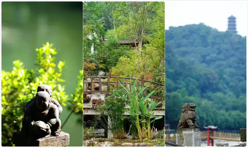
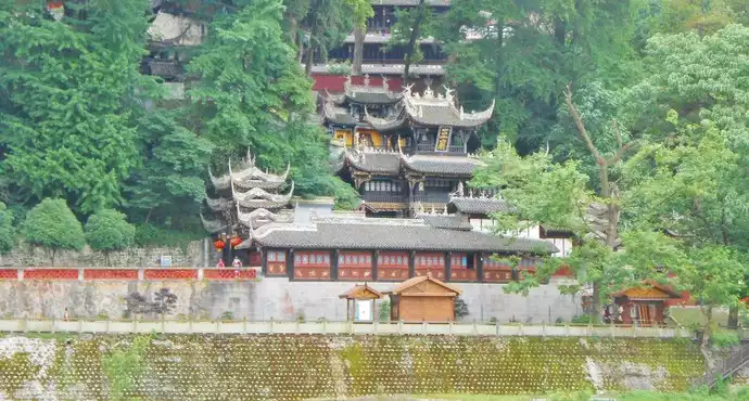
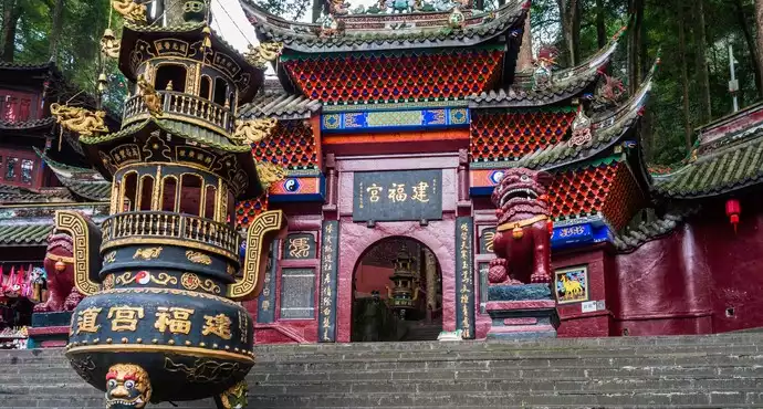
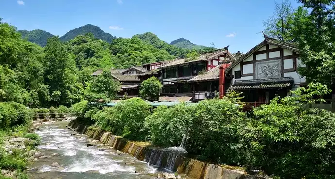
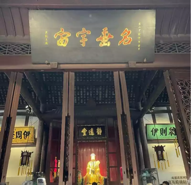
There are many historical sites around Dujiangyan, mainly Erwang Temple, Fulong Temple, Anlan Bridge, Yulei Pass, Fengqiwo and Douxitai. The Second King Temple is located at the foot of Yulei Mountain, known as the "Yulei Xiandu Second King Temple", and is a temple to commemorate Li Bing and his son. It was built during the Northern and Southern Dynasties, formerly known as Chongde Temple, and later rose and fell several times, and was named Erwang Temple after being rebuilt in the Qing Dynasty. There are many plaques, couplets and stone tablets related to Li Bing and his son and the Dujiangyan project in the temple. The main buildings include the main hall, the second hall, the sending hall, the hall of the Holy Mother, the hall of Laojun, the Kuixing Pavilion, etc., which are laid out according to the mountain terrain, interspersed between the mountains and forests, and can overlook the panoramic view of Dujiangyan from all the temples. The entire temple is tall and beautiful, majestic by the river, and majestic.On May 12, 2008, the ancient buildings of Erwang Temple collapsed in the Wenchuan earthquake, and then repaired the old as the old according to the Qing Dynasty system, and it has been renewed.

At the highest point of the northern end of the pile is a Fulong Temple. Legend has it that when Li Bing and his son controlled the water, they subdued the evil dragon in the river and locked it in the Fulong Pool under the pile, and later generations built a temple to worship this move. The temple was built in the Jin Dynasty and was renamed Fulong Temple in the early Northern Song Dynasty. The existing three-tiered temples were all rebuilt in the Qing Dynasty. There is a stone statue of Li Bing in the main hall, which was discovered in Jiangxin in 1974, carved in the first year of Jianning in the Eastern Han Dynasty (168), 2.9 meters high, weighing 4.5 tons, and has an inscription and the date of the statue on the chest, which is a very precious cultural relic.
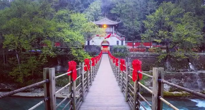
Anlan Bridge, commonly known as the Suo Bridge, spans the Dujiang Weir of the Minjiang River. In the past, bamboo cables were used as cables, wooden stakes as piers, and bamboo ropes were used to support the bamboo ropes, which were coherently constructed. It is covered with wooden planks and equipped with cables on the side, with a total length of more than 500 meters. The bridge was built before the Song Dynasty, destroyed in the war at the end of the Ming Dynasty, and rebuilt during the Qing Jiaqing period. . .

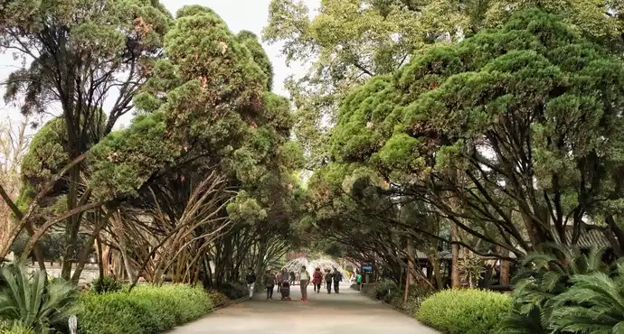
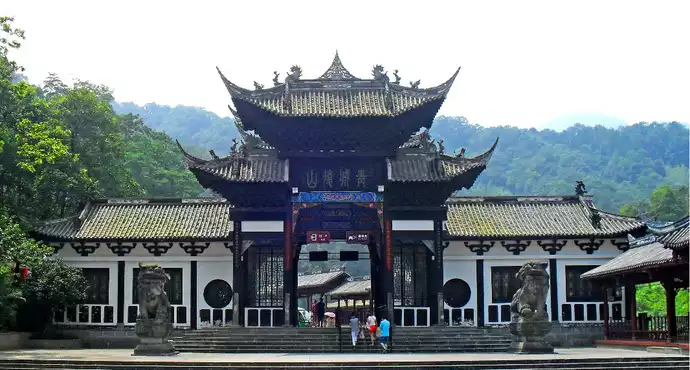
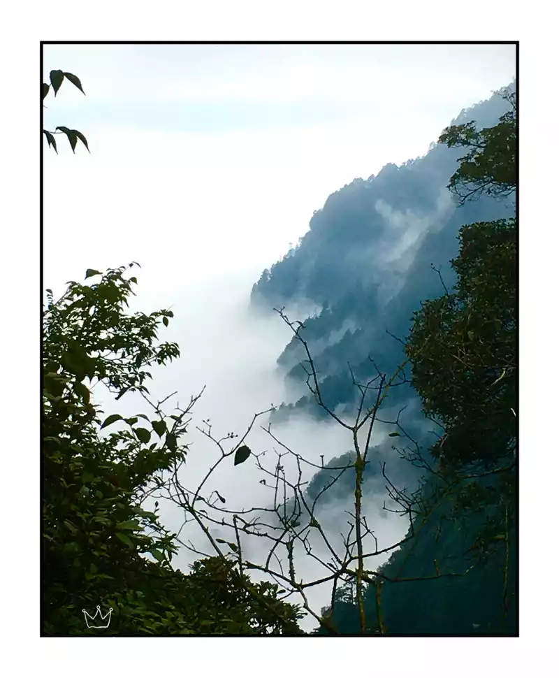
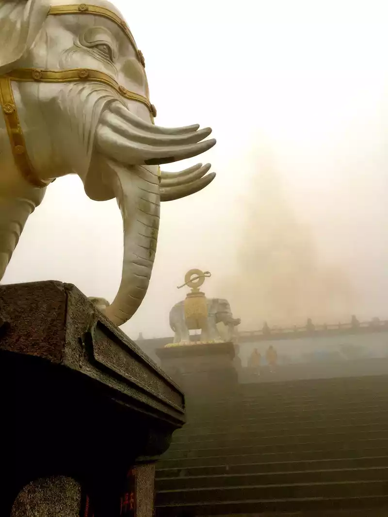
We visited the South Bridge and then took a car to Qingcheng Mountain, which is one of the birthplaces of Taoism in our country and one of the famous Taoist mountains. It is located in the southwest of Dujiangyan City, Sichuan Province, known as "Kehan Mountain" and "Zhangren Mountain" in ancient times, 68 kilometers east of Chengdu and 10 kilometers southwest of Dujiangyan Water Conservancy Project. The main peak is 1,600 meters above sea level. Among the famous mountains of Sichuan, it is as famous as the dangers of Jianmen, the beauty of Emei, and the heroes of Kuimen, and has the reputation of "Qingcheng and the world".

Qingcheng Mountain is a famous historical mountain and a national key scenic spot in our country, and was included in the World Heritage List as a World Cultural Heritage Site together with Dujiangyan in 2000. In the 2008 Wenchuan earthquake, Qingcheng Mountain was greatly affected. Qingcheng Mountain is the main part of Qingcheng Mountain Scenic Area, about 15 square kilometers, with beautiful scenery and many cultural relics and monuments. Due to the inconvenient transportation and dangerous terrain of Qingcheng's back mountain, the natural scenery is well preserved.

Qingcheng Mountain is the eastern branch of the southern section of the Qionglai Mountains, formed in an orogeny 180 million years ago. The rock formations are broken, undulating and obvious, so the mountain structure is complex.
There are currently two theories about the name of Qingcheng Mountain: Qingcheng Mountain has 36 peaks of yin and yang arranged in a ring, sharp cliffs and steep cliffs, "verdant and four-in-one, shaped like a city, so it is called Qingcheng".

Originally named "Qingcheng Mountain", because the ancient myth said that "Qingdu, crape myrtle, and the Heavenly Emperor lived", Buddhism developed rapidly in the Tang Dynasty, Buddhism and Taoism had a territorial dispute on the mountain, and the lawsuit was fought to the emperor, Tang Xuanzong believed in Taoism, and personally issued an edict to determine that "Guan Huan Taoist, the temple is outside the mountain", but the edict wrote "Qingcheng" as "Qingcheng", so it was renamed Qingcheng Mountain, which is not a legend, and the mountain still retains the full text of the Tang Dynasty inscription edict to support it.

Qingcheng Mountain is a famous Taoist mountain in our country and one of the birthplaces of Taoism. Legend has it that the Taoist master Zhang Daoling appeared in Qingcheng Mountain in his later years and emerged here, and since then, Qingcheng Mountain has become the ancestral mountain of the Heavenly Master Dao, and all generations of heavenly masters from all over the country have come to Qingcheng Mountain to worship the ancestral court.

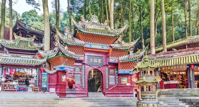
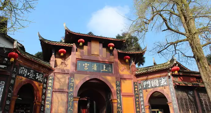
According to legend, the mountain god of this mountain is the ancient hermit "Kehan Zhangren", and Taoism is revered as Zhuling Tianzun, who can monitor the mountain gods of the world. The main Taoist buildings on Qingcheng Mountain include Jianfu Palace, Laojun Pavilion, Yuanming Palace, Shangqing Palace, Tianshi Cave, etc.
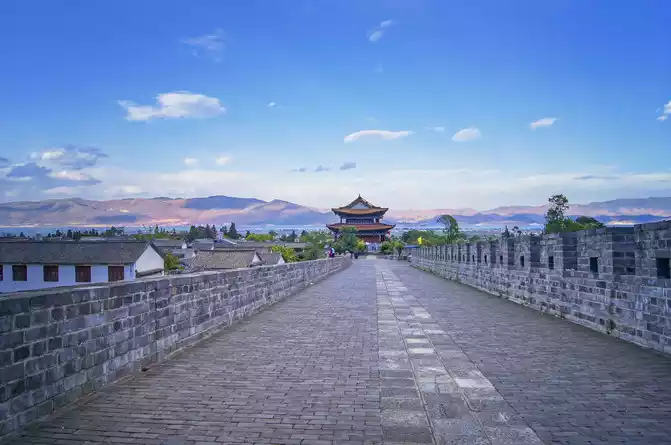
Tai'an Ancient Town. Tai'an Temple is located in the center of the ancient town. There are many restaurants and inns in the ancient town for tourists to rest.

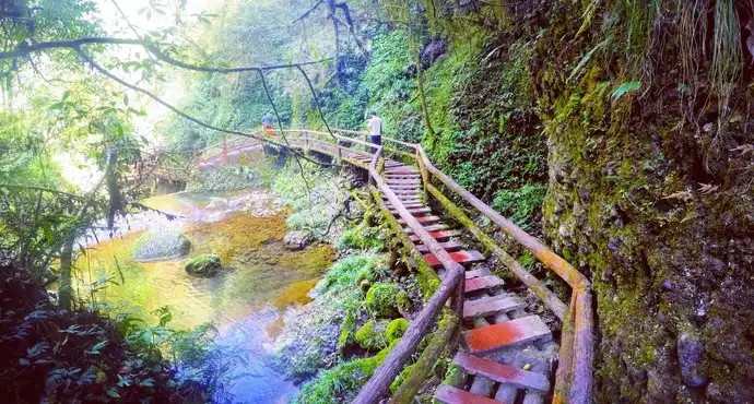
Qingcheng back mountain has Tai'an Ancient Town and Wulonggou. Known as Manhe Ditch in ancient times, it is about 8 kilometers long, and is named after the legend that there were five divine dragons hidden in the ditch in ancient times. The scenery includes Jinhuatuo, the Longyin Gorge plank road with excellent scenery, stalagmite rock, echo wall, etc.

Another village. Taohua Creek, located above Wulonggou, is named after the poem of the Southern Song Dynasty poet Lu You, "The mountains and rivers are doubtful and there is no way, and the willows are dark and the flowers are bright and there is another village". There are more than 20 farmers in the village who mainly develop tourism, which is another good place to climb the mountain and rest. Among them, Taohuaxi Resort Park is also located in Youyi Village.

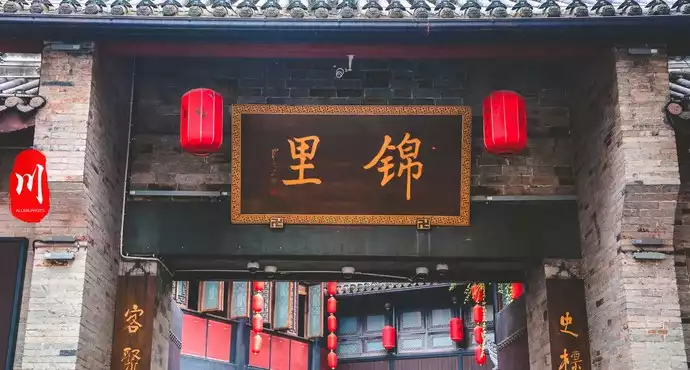
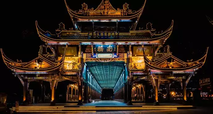
I climbed to the Shangqing Palace to visit, and when I finally walked to the Seven Truths Hall, I was already sweating profusely. I passed through the Yuxian Pavilion and continued to climb the mountain. After descending the mountain, I returned to the city, passed by the Sands Hotel, and came to Jinli again. This is an antique street, full of Chengdu snacks...

The next day, I had the opportunity to visit the Chengdu Giant Panda Base and see the giant pandas with my own eyes. Giant pandas, also known as giant pandas, commonly known as "pandas" or "pandas", are a type of mammal belonging to the carnivorous bear family, with a body color of black and white. Pandas are endemic to our country, and the main existing habitats are the mountainous areas around the Sichuan Basin in central and western our country and the Qinling Mountains in southern Shaanxi.

There are about 2,060 wild giant pandas in the world (2016 data). At the end of 2016, the International Union for Conservation of Nature (IUCN) downgraded the threatened level of giant pandas from "endangered" to "vulnerable". Due to the low fertility rate, the giant panda is rated as an endangered species in our country's Red Book of Endangered Animals and is our country's national treasure. Giant pandas are known as living fossils of the biological world.

The black and white coat color and cute appearance of giant pandas make them so popular that they have a large number of fans around the world. When the World Wide Fund for Nature was established in 1961, it was marked by giant pandas, which have become the most important symbol of endangered species protection. Giant pandas are also an important representative of our country to show friendship to each other in diplomatic activities, and American international governance scholar Joseph Nair bluntly said that giant pandas are regarded as an important pillar for our country to expand its soft power, which is similar to the British royal family.

Chengdu Giant Panda Breeding Research Base was established in 1987, located on the shallow hill on the side of Axe Mountain in the northern suburbs of Chengdu, Sichuan Province, is a famous research institution and tourist destination integrating giant panda scientific research and breeding, public education and educational tourism in our country and even the world, and is also a non-profit institution specializing in endangered wildlife research, breeding, conservation education and educational tourism. The base currently covers a total area of 1,530 acres, and the Chengdu Panda Base is based on the 6 giant pandas rescued from the wild in the early days of establishment, and has successfully increased the captive population of giant pandas to 152 as of 2015, becoming the world's largest captive giant panda artificial breeding population. In addition, there are red pandas, golden snub-nosed monkeys and other endangered wild animals in the base.

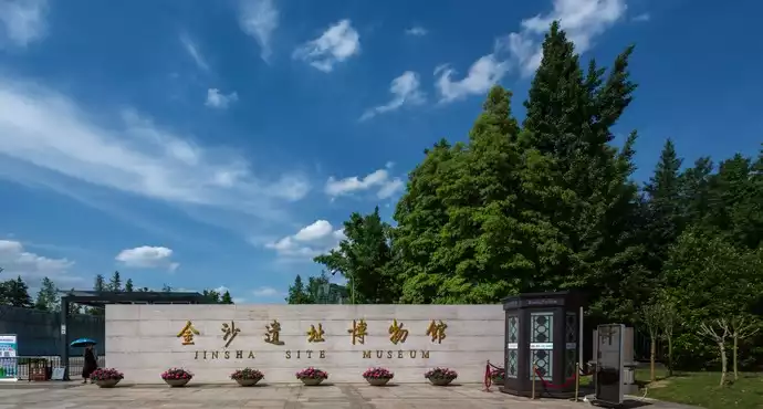
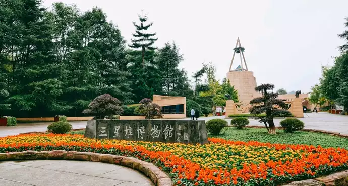
After returning to Chengdu, I came to visit the Jinsha site, which is a Bronze Age site located in Jinsha Village, Xisupo Township, Chengdu City, Sichuan Province, our country, located along the Modi River, covering an area of more than 5 square kilometers, and is one of the national key cultural relics protection units. 50 kilometers from the Sanxingdui site, the culture was dated from about 1250 to 650 BC, and was more prosperous in the first 1000 BC. The cultural relics of the Jinsha culture and the Sanxingdui culture have similarities, but there are no city walls, which is about the last phase of the Sanxingdui culture, representing a transfer of the center of governance in ancient Shu. On December 27, 2002, it was announced as the sixth batch of provincial cultural relics protection units in Sichuan Province. On May 25, 2006, it was listed as the sixth batch of national key cultural relics protection units. The Jinsha site is located in Jinsha Village, Supo Township, Qingyang District, Chengdu (now Jinsha Street, Qingyang District, Chengdu), and was first discovered in February 2001 when the construction site of Shufeng Garden Street was excavated. In 2007, the Jinsha Site Museum was built on the original site of the Jinsha site, displaying the site of the site sacrifice area and cultural relics.

There are more than 1,000 precious cultural relics cleaned up at the site, including: more than 30 pieces of gold, more than 400 pieces of jade and bronze, 170 pieces of stone tools, more than 40 pieces of ivory, the total weight of unearthed ivory is nearly a ton, in addition to a large number of pottery unearthed. From the perspective of the era of cultural relics, most of them are about the late Shang Dynasty (about the late 18th century BC - the end of the 12th century BC) and the early Western Zhou Dynasty (about 1046 BC - 771 BC), and a small part is the Spring and Autumn period (722 BC - 481 BC). Moreover, as the excavation progresses, the possibility of major discoveries cannot be ruled out. Among the unearthed gold artifacts, there are more than 30 pieces of gold masks, fish-patterned gold belts, sun god bird gold leaf, frog-shaped gold leaf, trumpet-shaped goldware, box-shaped gold ware, etc., of which the gold mask is basically the same as the bronze mask in Sanxingdui, Guanghan in terms of modeling style. The gold mask, the gold ornament of the sun god bird and the ten-section jade cong are known as the treasures of the Jinsha Site Museum and the town hall.

The gold decoration of the sun god bird is a circular gold leaf with a diameter of 125 mm and a thickness of 0.2 mm, divided into two layers, the inner layer is 52.9 mm of 12 hollow clockwise arc rays, symbolizing the sun, and the outer side is 4 hollow bird-shaped decorations, symbolizing the "golden crow negative sun". The gold belt is engraved with arrows piercing fish and birds, which is very similar to the decoration on the golden staff unearthed in Sanxingdui, and some scholars believe that this represents the legendary king "fish duck" in ancient Shu.

There are many kinds of jade unearthed, and very exquisite, the largest of which is about 22 cm high, the color is jade green, the carving is extremely fine, the surface has fine micro-carved patterns and human figure patterns, which can be called national treasures, and its modeling style is completely consistent with the Liangzhu culture, and its history is more than 1,000 years longer than the history of the Jinsha site.
More than 400 bronzes unearthed are mainly small artifacts, including bronze standing figures, bronze tigers, bronze bells, bronze bi, copper standing birds, etc., of which the bronze standing statues are almost the same as the bronze standing statues unearthed in Sanxingdui.

There are 170 stone tools unearthed, including stone figures, stone tigers, stone snakes, stone turtles, etc., which are the earliest and most exquisite stone tools found in Sichuan so far. The kneeling figures in it are lifelike, and experts believe that they are most likely slaves or prisoners of war of the nobility at that time, indicating that the Shu state was relatively powerful at that time. The shape of the stone tiger in the stone tool is simple and vivid.
Other artifacts unearthed include a large number of ivory, wild boar tusks, antlers, pottery, and wood. The excavation of the Jinsha site is of great significance to the study of ancient Shu and can rewrite the history of Chengdu and the ancient history of Sichuan. Previously, Chengdu had a written history that could be traced back to the late Warring States period when Zhang Yi built Chengdu. Analyzing the cultural relics unearthed at the Jinsha site, many of them are ceremonial vessels with special purposes, which should be the relics of the highest ruling class in the Chengdu Plain at that time. These relics are both similar in style to Sanxingdui cultural relics, but also have certain differences, indicating that the site has a relatively close relationship with Sanxingdui.

The nature of the Jinsha site is currently speculated to be a sacrificial relic, but due to the unearthing of a large number of jade, stone semi-finished products and raw materials, the possibility of workshop remains cannot be ruled out. However, judging from the large number of precious cultural relics unearthed and the surrounding large buildings and important relics, the area where the Shufeng Garden is located is likely to be the governance and cultural center of Chengdu. The Yuge and Yuyuan unearthed at the site show that the Jinsha culture is related to the culture of the Yellow River Basin and the Liangzhu culture of the lower reaches of the Yangtze River.
The gold ornament of the sun god bird unearthed at the Jinsha site has now been adopted as a "symbol of our country's cultural heritage", and is also part of the unofficial city emblem of Chengdu and the emblem of Jincheng College of Sichuan University.
The Sanxingdui site is located on the Duck River, 7 kilometers west of Guanghan City, Sichuan Province, our country, 4 kilometers away from Nanxing Town, about 40 kilometers south of Chengdu, and 26 kilometers away from Deyang in the north, and is a Bronze Age cultural site. The site is dated from 2800 BC to 1100 BC, divided into four periods, the first phase is the Baodun culture (former Shu culture), the second and third phases are the Sanxingdui culture (ancient Shu, 2000 BC-1400 BC), and the fourth phase is the Twelve Bridges culture (ancient Shu, the main remains are in the Jinsha site), which is about equivalent to the Xia, Shang and Zhou periods in the Central Plains. On January 16, 1987, it was announced as the second batch of cultural relics protection units in Sichuan Province. On January 13, 1988, it was listed as the third batch of national key cultural relics protection units.

The Sun God Bird Gold Ornament (also known as the "Four Birds Around the Sun" gold ornament) is a gold leaf unearthed in 2001 at the Jinsha site in Chengdu, Sichuan Province, which is a work of the late Shang Dynasty and is a national first-class cultural relic in our country, and one of the third batches of cultural relics prohibited from exporting exhibitions. The entire gold ornament is in the shape of a ring, with an outer diameter of 12.5 cm, an inner diameter of 5.29 cm, a thickness of 0.02 cm, and a weight of 20 grams. The gold ornament has a complex hollow pattern, divided into two layers, inner and outer, and the inner layer is equidistant around the perimeter with twelve rotating toothed rays; The outer pattern surrounds the inner pattern and consists of four identical birds flying counterclockwise. The four birds are connected to each other and fly in the same direction, opposite to the rotation direction of the inner vortex. The pattern is usually interpreted as follows: the four birds represent the reincarnation of the four seasons of spring, summer, autumn and winter, and the 12 light patterns on the inner layer represent the cycle of twelve months of the year. It may also be related to the legend of the "Golden Crow Negative Sun". Its composition analysis revealed that its gold content was as high as 94.2%. The gold ornament may have been an artifact used by the ancient Shu people for sacrifice. It is now in the Jinsha Site Museum in Chengdu and is the treasure of the museum's town hall.
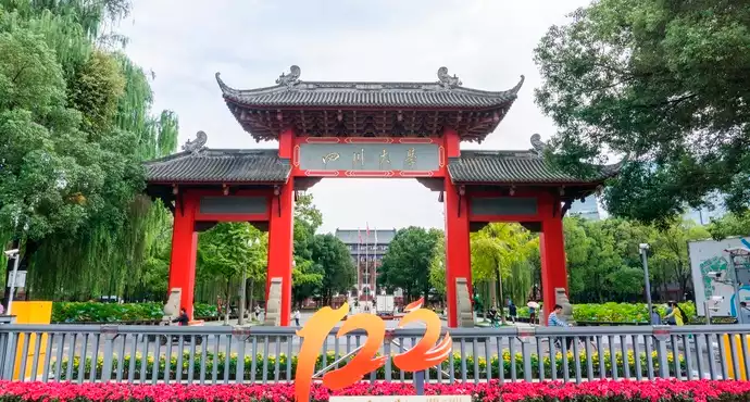
After I visited, I walked to the square of the museum, and saw a few beautiful female teachers taking pictures in the square with a group of children, I also walked over to join in the fun, leaving the Sands Museum, I went straight to Sichuan Southwest University of Finance and Economics, Southwest University of Finance and Economics referred to as Southwest University of Finance and Economics, Xicai, is a higher education institution directly under the Ministry of Education of our country, "211 Project", "985 Advantageous Discipline Innovation Platform Project" and the national double first-class plan first-class discipline construction university, It is also a pilot university of national education system reform and a certified member of EQUIS. The school consists of two campuses, Guanghua and Liulin, of which Guanghua Campus is located in Guanghua Village, Qingyang District, Chengdu, and Liulin Campus is located in Wenjiang District, Chengdu.
Southwest University of Finance and Economics is a financial institution with economics and management as the main body, finance as the focus, and includes law, liberal arts, science, engineering and other disciplines. As of April 2015, the university has 27 colleges (centers, departments) and other teaching units, 33 undergraduate majors, 11 first-level disciplines with master's degree awarding rights, 108 master's degree training majors (including 18 master's degrees), 5 first-level disciplines with doctoral degree granting rights, 57 doctoral degree training majors, and 4 postdoctoral mobile stations. It is known as "our country's financial talent pool" with 4 national key disciplines (finance, economics, accounting and statistics), 5 provincial key first-level disciplines and 4 provincial key second-level disciplines.
I passed by another park and saw a large number of middle-aged and elderly people dancing square dances in the park, it was a weekday around two o'clock in the afternoon, so many middle-aged people did not go to work, but danced in the park, I have to say that Chengdu people are too lazy.
Jumbo Huang citation resources: The Dujiangyan is an ancient irrigation system in Dujiangyan City, Sichuan, China. Originally constructed around 256 BC by the State of Qin as an irrigation and flood control project, it is still in use today. The system's infrastructure develops on the Min River (Minjiang), the longest tributary of the Yangtze. The area is in the west part of the Chengdu Plain, between the Sichuan basin and the Tibetan plateau. Originally, the Min would rush down from the Min Mountains and slow down abruptly after reaching the Chengdu Plain, filling the watercourse with silt, thus making the nearby areas extremely prone to floods. Li Bing, then governor of Shu for the state of Qin, and his son headed the construction of the Dujiangyan, which harnessed the river using a new method of channeling and dividing the water rather than simply damming it. The water management scheme is still in use today to irrigate over 5,300 square kilometres (2,000 sq mi) of land in the region. The Dujiangyan, the Zhengguo Canal in Shaanxi and the Lingqu Canal in Guangxi are collectively known as the "three great hydraulic engineering projects of the Qin."
[Huangshi Ancient Architecture] [Traveling in Search of Beauty] [Huangjian Blog Picture Collection]
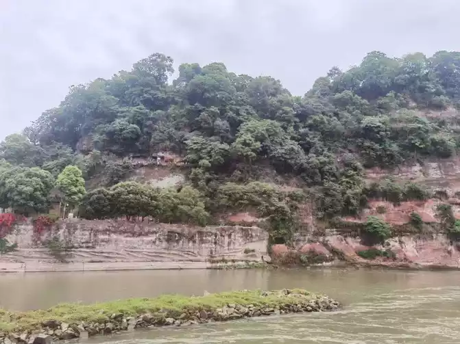
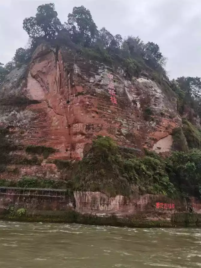
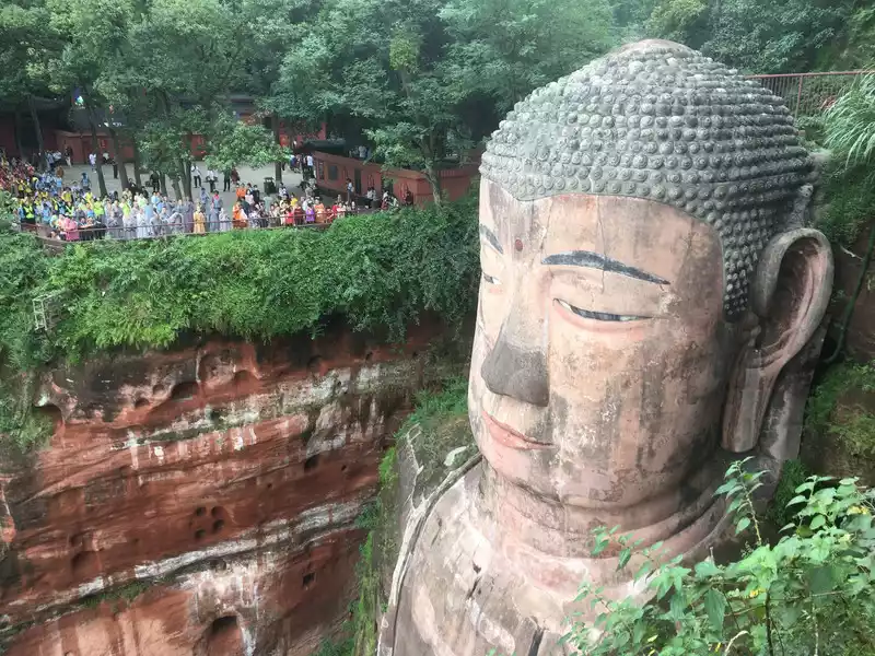
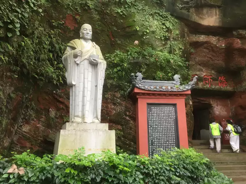
Episode 2042: The mountain is a Buddha leaning on a cliff, and the Buddha is a mountain facing the abyss


Number of days: 1 day, Average cost: 199 yuan, Updated: 2022.08.03

Number of days: 5 days, Average cost: 6000 yuan, Updated: 2025.01.03
Number of days:7 days, Average cost: 5000 yuan, Updated: 2020.09.23


, , Updated: 2023.10.26


Number of days: 6 days, Average cost: 3000 yuan, Updated: 2020-08-15 01:23
Number of days: 2 days, Average cost: 60 yuan, Updated: 2024.09.30