Live Your Best Lives
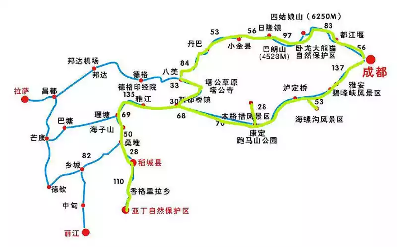
Since returning home from the depths of the Qinling Mountains in June, I have been staying at home, writing and painting to spend the hot summer. With the arrival of autumn, my restless heart became excited again, and I began to plan a new itinerary. At first, I set my sights on Gannan and western Sichuan, which I had always wanted to visit, and the classic ring line was basically determined after changing the plan again and again. But due to family affairs, it was delayed again and again until September, when my friend said that it was not suitable to go, and it started to get cold over there. When I opened the ink and checked, sure enough, there was already a forecast of rain and snow in the morning, and the temperature was close to zero. No way, just look forward to another year. So, I decided to visit two famous mountains that I had always longed for, Mount Emei and Mount Siguniang. And seize the time to do a good job. Unfortunately, the leader has something to do at home and cannot walk with me. In this way, the trip became a self-driving trip for me.
the afternoon, I boarded the train to Chengdu. Since the station stop, I have been wearing a mask, although there have been no confirmed cases in Henan for many days, but it is still best to be careful when going out, just in case. However, as soon as I entered the sleeper car, I found that I was the only one wearing a mask, and the other passengers were not wearing it, and some of them were scanning me with strange eyes. It seems that only by joining the crowd is the right way. I lay down on the lower bunk, put away my mask, opened my Ipad and started reading novels and movies. On the train, you have to stay for fifteen or sixteen hours!
nearly 9 o'clock in the morning, the train finally stopped next to the platform of Chengdu Station after being delayed for an hour. I hurriedly took my luggage and walked out of the station quickly, and took the car to the self-service pick-up point of the rental car, a parking lot on Jiulidi North Road. After mentioning the car, I followed the guidance of the soft female voice in the navigation and drove towards the first goal, Mount Emei.
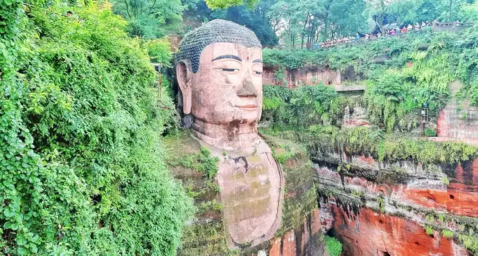
On the way to Mount Emei, I took a small turn and came to the foot of the Leshan Giant Buddha. In fact, the Leshan Giant Buddha is the common name of the common people for it, and according to some research, its official name should be: the Great Maitreya Stone Statue of Lingyun Temple in Jiazhou. Jiazhou is the name of Leshan in the Northern Zhou and Tang Dynasties, and the mountain on which the Great Buddha rests is Lingyun Mountain. The Big Buddha sat on the mountain, his hands on his knees, and it looked in front of it at the confluence of the three rivers of Tsing Yi River, Min River and Dadu River. Due to the heavy flooding in Sichuan in August, the Big Buddha was also affected, so during this time, tourists could not go down the Lingyun Plank Road to the big feet of the Big Buddha, and could only look at the whole picture of the Big Buddha at the top of the mountain. When I came to the side of the 1,051 buns of the Great Buddha, there was a large group of good men and women shouting slogans down the mountain under the leadership of the monks. I was not very interested in this, so I walked alone to the higher Dongpo Building. Before I came, I always thought that Dongpo Tower was the place where Su Shi used to study, and I also lamented that the ancients would really find a quiet and elegant place to study and study. After arriving, I learned that this building was actually the ancestral hall of Wei Zhongxian at the end of the Ming Dynasty, and later generations changed this place to a place to commemorate Su Shi because Wei was a traitor, and Su Shi was famous in history and was a native of Meixian County not far from here. With a sense of history, I walked down Lingyun Mountain. I drove towards Mount Emei to continue my trip.
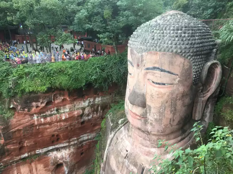 Due to the flood some time ago, the Leshan Giant Buddha was temporarily unable to go down to the big foot through the plank road.
 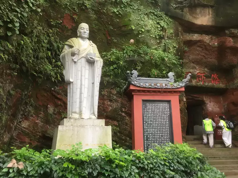 Builder of the Leshan Giant Buddha
 At 3 o'clock in the afternoon, I followed the navigation guide to the Wuxiangang parking lot of Emei Mountain. I stopped here for the convenience of coming down tomorrow. With simple luggage, I took the scenic sightseeing bus up the mountain. Because of the time (there are elderly people at home, it takes seven or eight days every time I come out) and age, in recent years, my travel has changed from climbing mountains to taking cable cars where there are cable cars, and sightseeing cars depending on the situation. It was already five o'clock when I arrived at Leidongping, and the sky began to darken, with light rain drifting in the sky and a little cold in the wind. I found the hotel I had booked in advance, put down my luggage, and came out to walk around the neighborhood. Leidongping is still six or seven kilometers away from the Golden Peak, which is an excellent place to transit and rest before going to the Golden Peak. Nearby is the Lingjue Temple, which was originally called the Thunder Temple, and was later renamed "Lingjue Temple" because the Qing Kangxi Emperor gave the imperial book "Lingjue" and a copy of the "Diamond Sutra". Outside the temple gate is a cliff, and the clouds are spectacular, but the most attractive thing is the groups of monkeys, and it even feels that this monkey is the real owner on Mount Emei. They come in groups of three or five, blocking the roads that people must pass through, begging for food and drink, and some take the initiative to take photos with tourists without invitation, scratching people's bodies. I observed carefully for a while and found that the monkeys here love ladies in red or colored clothes and pants, sometimes they grab the ladies' pants and don't let go of their claws, and some girls can't even cry when they want to leave. I can't help but sigh: Lustful monkey!For dinner, I asked for a plate of fried peanuts, a piece of mapo tofu, and a small bottle of Erguotou. After that, I wanted to go out for a walk again, but it was already raining lightly. I had to give up.
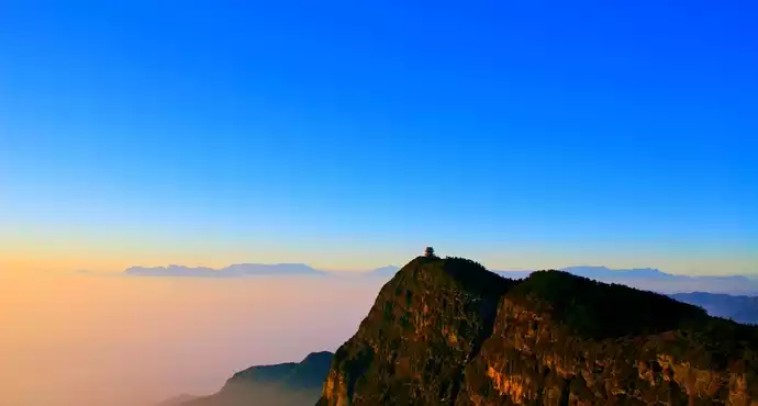
 Sea of Clouds on Mount Emei September
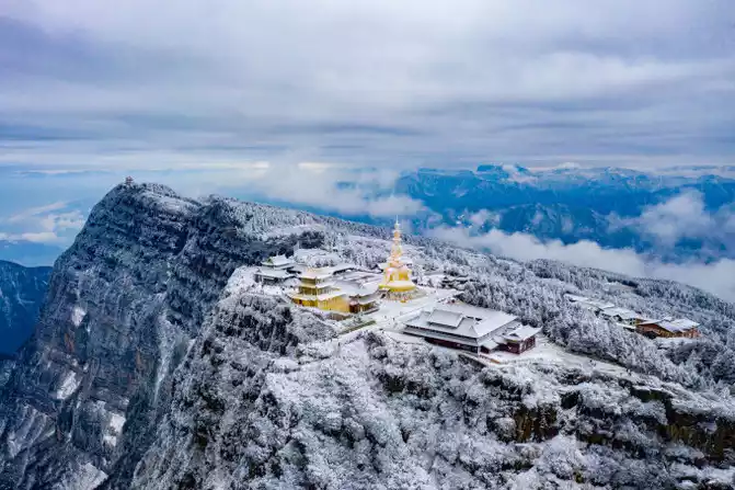
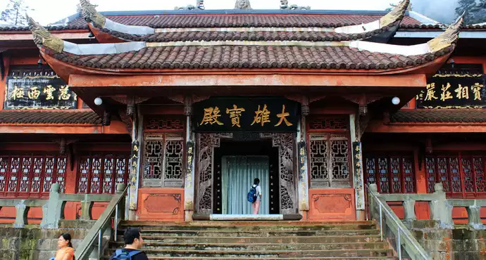
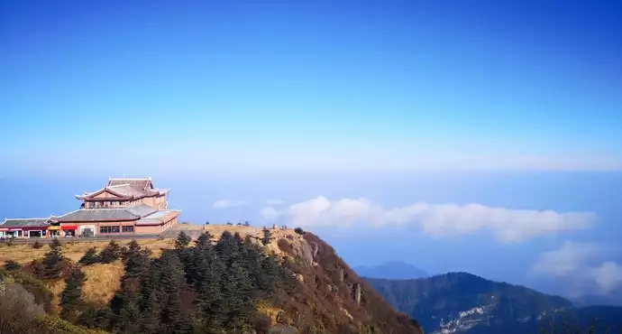
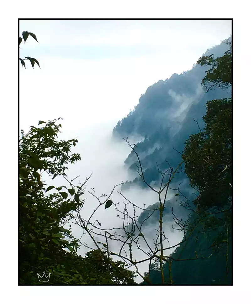
 When I woke up early in the morning, it was about 5:20 a.m., and I remembered what the hotel owner said yesterday that if it wasn't early at 5:10, it was raining outside. So, rest for a while. At about 6 o'clock, I got up to wash up and pack up, put my bag on my back and prepare to go to the golden top. When I went out, it was raining quite a bit, but since it came up, I had to get the golden top and take two steps! So, I walked up the hiking trail. It rained heavily, and I didn't have to walk long to feel that my shoes and shirt were soaked, and I saw that the rain didn't stop, so I took the cable car next to the Guiding Hall to reach the Golden Peak. When I stepped on the Golden Peak, I found that the sky was already bright, the rain was still falling, the fog was filled, and the cold wind was cold, which made people feel excited from the inside out. Until I walked to the highest level of Huazang Temple, that is, in front of the Golden Dome, I still couldn't see the appearance of this golden hall enshrined in the statue of Puxian, let alone see the four wonders of Emei, the sunrise, the sea of clouds, the Buddha's light and the holy lamp.
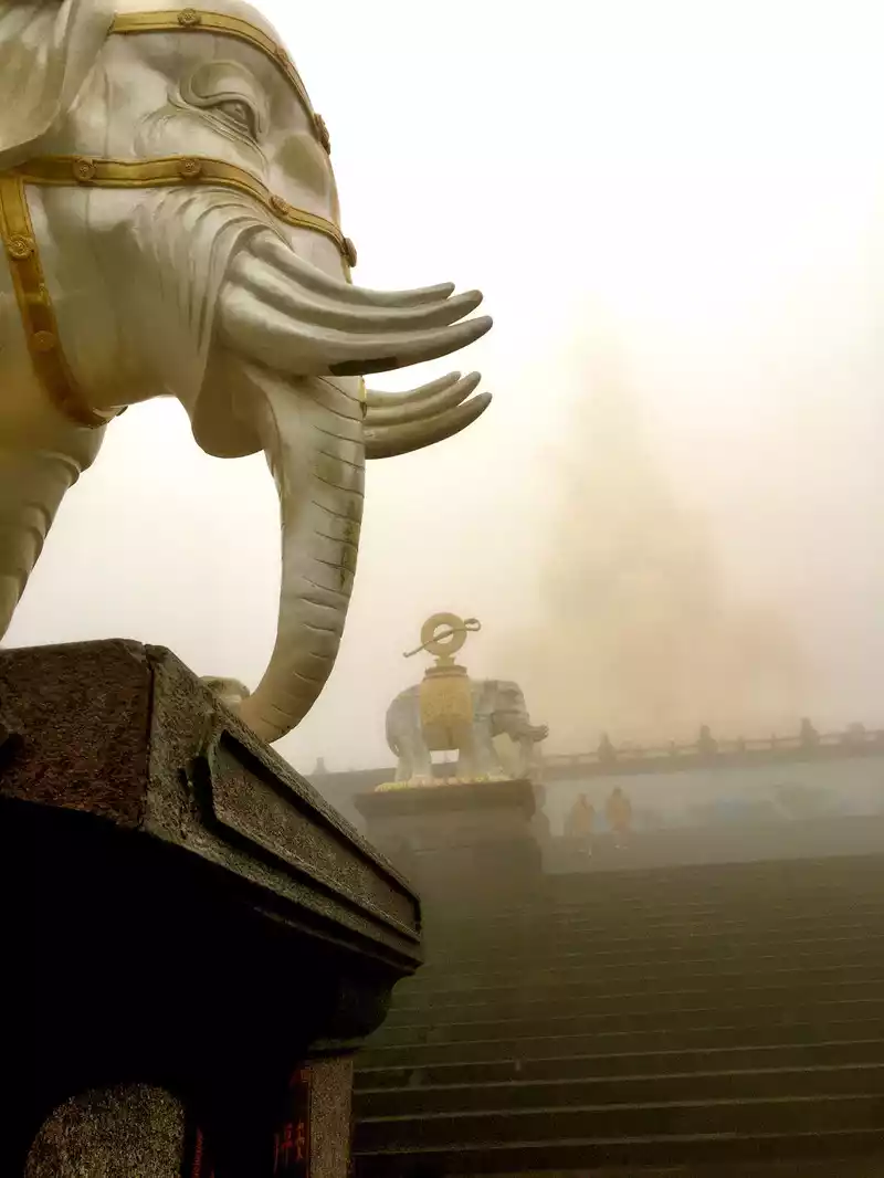 In the rain and mist, the golden top is faintly visible, and it is these elephants that can be seen clearly.
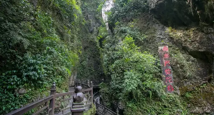
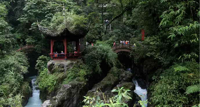
 When I went down the mountain and returned to the hotel, I was almost soaked, and my backpack, which was said to be waterproof, was also wet for two layers. After breakfast, in regret and reluctance, I took the car down the mountain. When the car arrived at Wanniansi Station, the rain had stopped. The higher the altitude, the more impermanent the weather, which is not surprising. After visiting Wannian Temple, I went all the way downhill and arrived at Qingyin Pavilion an hour later. This section of the mountain road is about two kilometers, full of steps, slightly slippery after the rain, and there are almost no other attractions except the mountains. Qingyin Pavilion is located at the "Double Bridge Qingyin", one of the ten scenic spots of Mount Emei, which is the place where the black and white waters flow out of the mountain, and the two rivers flow down through the two pavilions of Jieyu and Niuxin, hitting the boulders shaped like cow hearts in Bitan. What is even more amazing is Liu Guangdi, one of the six gentlemen of Wuxu, a couplet: "Two bridges and two rainbow shadows, one cow heart for eternity", chanting in this situation, can't help but make people high-five. It is said that in the middle of the night, listening to the clear sound of Ershui in Qingyin Pavilion is a rare opportunity. After passing the Qingyin Pavilion, I continued to move forward according to the guide, and successively passed several cliff carvings such as "Forgetting the Dust" given by the Kangxi Emperor, making up for the lack of cultural attractions in front of me. To the first line of sky, and further forward is the ecological monkey area, because the first day has already met the monkeys, so I stopped, turned back to Qingyin Pavilion through the small ring line, went down the mountain, and walked for about half an hour to reach the Wuxiangang parking lot.
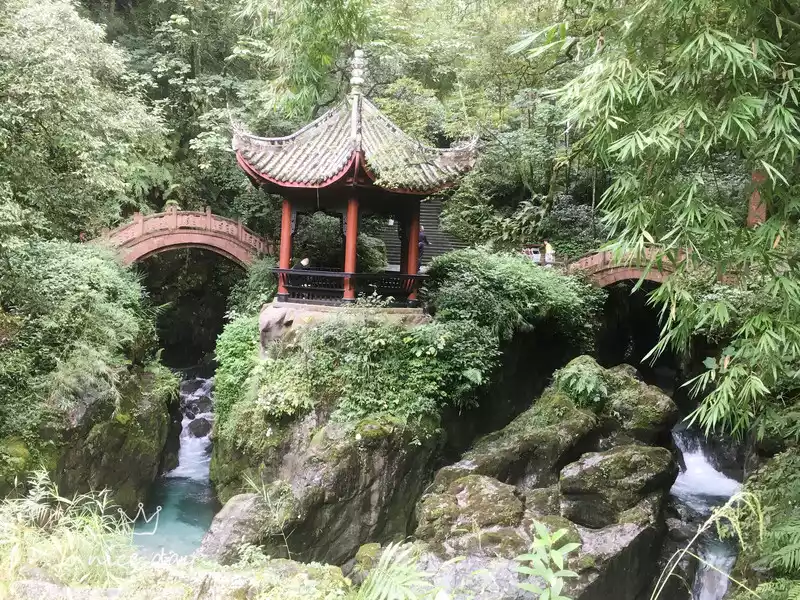 Shuangqiao Qingyin and Niuxinting
 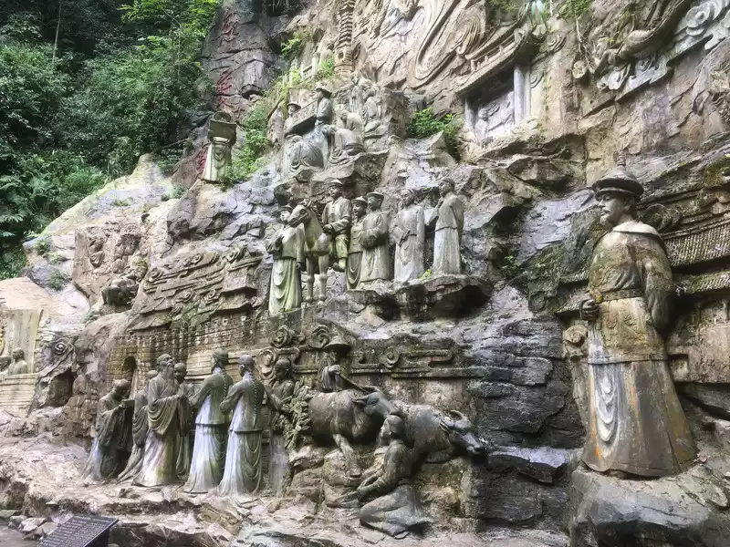 Kangxi searched for his father Moya
 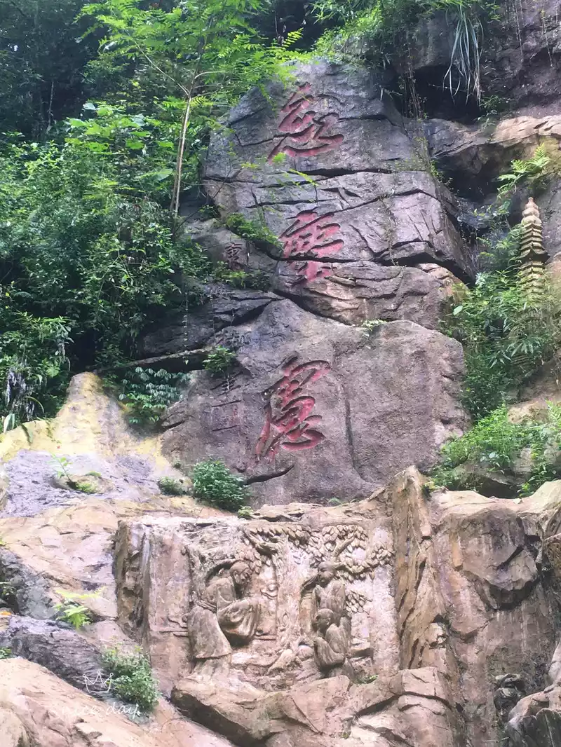 Kangxi Emperor's gift: forget the dust
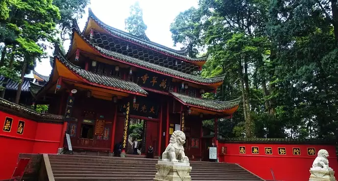
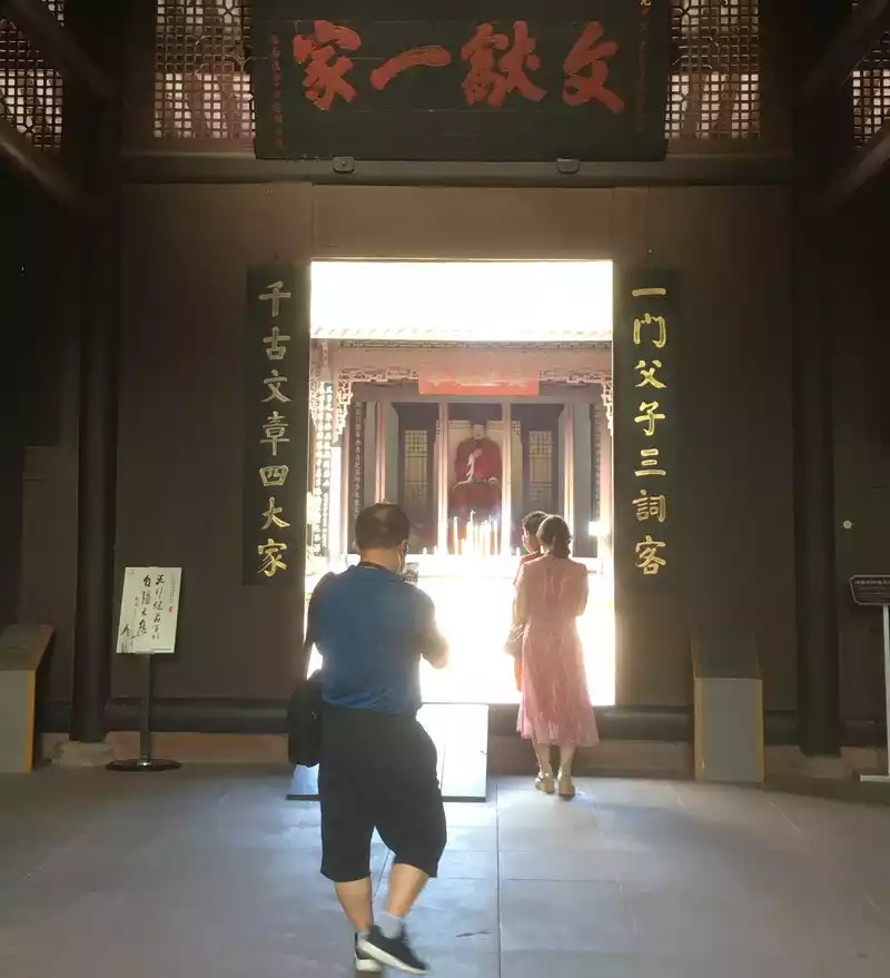
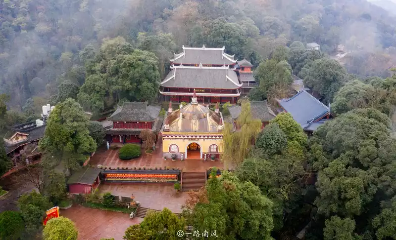
 Driving down the mountain, I went to the planned Meizhou to visit the long-awaited Sansu Temple. The Sansu Ancestral Hall is the former residence of the famous writers Su Xun, Su Shi, and Su Zhe of the Northern Song Dynasty, and in the first year of Hongwu in the Ming Dynasty, the house was converted into a shrine to worship the Three Su. After demolition, it is now a classical garden covering an area of 104 acres. Walking in the garden, the breeze blows in the face, accompanied by water and bamboo, and there are more than a dozen local men and women playing music and singing in the garden, although they can't understand what they are singing, but the music is elegant and soft and tactful, very good, and I can't help but feel refreshed. One of the great pleasures of visiting the cultural landscape is to appreciate the couplets written by literati in different eras, here is no exception, there are many couplets, worthy of careful taste, but the favorite is still the pair at the gate of the park, from the Kangxi and Yongzheng dynasties of the Qing Dynasty, the official to the Wenhua Hall Grand Scholar and the Minister of Personnel Zhang Pengxi's hand of "a father and son three words, four masters of ancient articles", not only flat and rhythmic, neat, but also fair in evaluation, with everyone's style. That night, he stayed overnight in Meizhou.
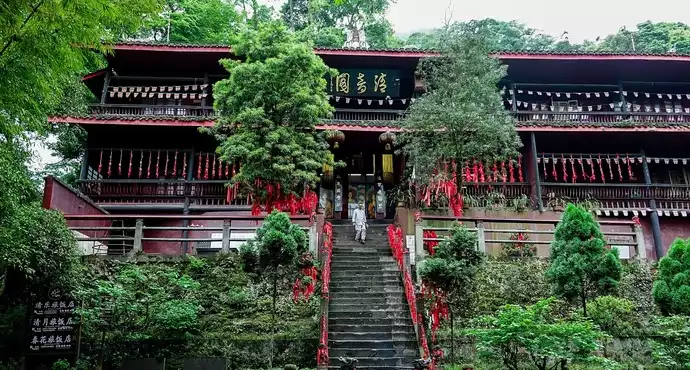
 Meishan Sansu Temple September
 Farewell to Sansu's hometown early in the morning. Today's trip is still very easy, 274 kilometers, and the destination is Rilong Town at the foot of Siguniang Mountain, which is now said to have been renamed Siguniang Mountain Town. But the first goal is to see the epicenter of the Wenchuan earthquake and mourn the dead who unfortunately died in the earthquake. In October 2017, my wife and I drove to Jiaju Tibetan Village and passed by here, because time was too tight to turn into the town.
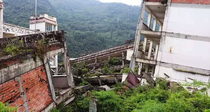
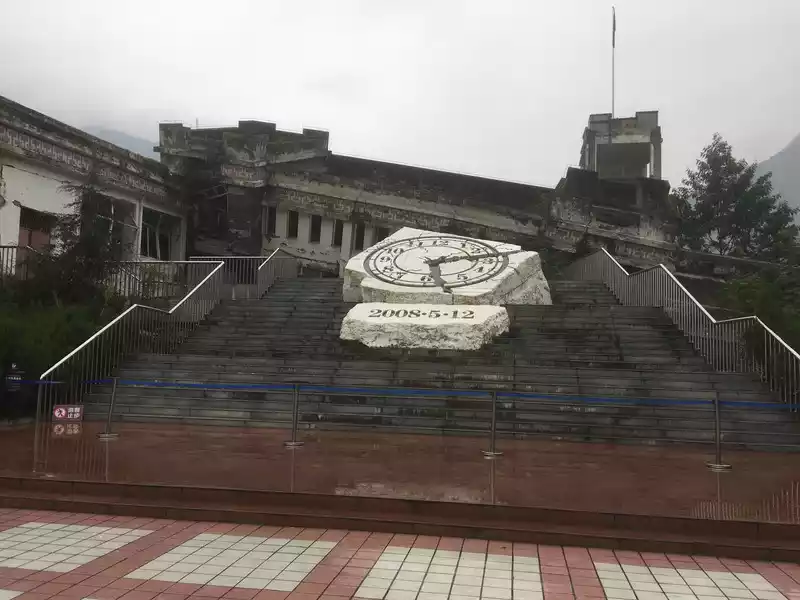
All the way high. The car got off the road in Yingxiu and entered the town not far away. A traffic police officer waved on the side of the road and signaled to turn into a marked parking lot. I obediently drove in. In fact, I later learned that there is still a parking lot at the epicenter site and the memorial hall, but this parking lot is far from there and you have to take the town's sightseeing bus. At 10 o'clock, in the intermittent light rain, I finally stood under Yingxiu's wordmark, next to the earthquake site of Whirlpool Middle School. The first thing you see when you enter the school gate is the commemorative sign on the ruins, a white clock dial, and below it is "May 12, 2008", the time of the disaster. I remember that at noon that day, a friend and I were having a drink in a restaurant across from the workplace, and the moment we were about to clink glasses, the cups that were supposed to be touched didn't touch, and it felt like someone was pulling my arm. We didn't take it seriously at the time, and after a few minutes, a waiter hurried in and told us to go downstairs to an open place, and we realized that it was the moment when the earth's crust was torn apart. In the blink of an eye, more than ten years have passed, and at this moment I am standing next to this ruin, seeing the buildings that were tilted and toppled in the earthquake, and the teaching buildings and dormitories have become several floors stacked together. According to reports, 55 people were unfortunately killed in the earthquake that year, including 43 students and 8 teachers.
 Yingxiu epicenter site, Whirlpool Middle School
 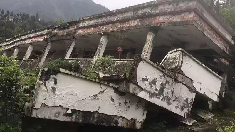 The collapsed school building in the school
 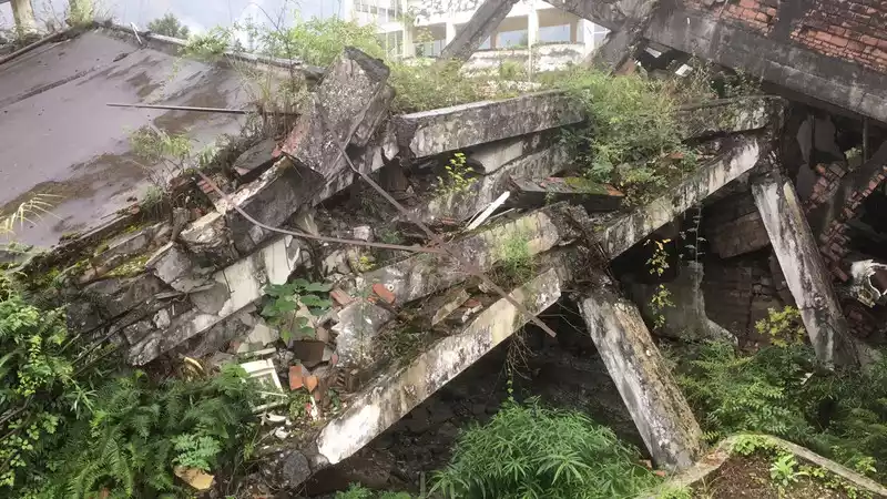 The five floors were stacked together
 After leaving school, I climbed up the hillside across the road to see the earthquake memorial hall and more comprehensively reviewed the days and nights that affected the hearts of people across the country after the earthquake. On the way back to the parking lot, I asked the sightseeing bus to park on the main street of Yingxiu Town and walked back by myself. The new Yingxiu Town was rebuilt on the original site, and now there are hotels and restaurants along the street, and at noon, although it is not very lively, it can be seen that people's lives should be good.
 Yingxiu Town rebuilt from the ruins of the earthquake
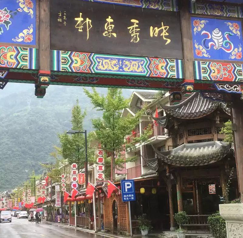
 Leaving Yingxiu, the car drove into China Panda Avenue. When this road passed in 2017, it should still be called Provincial Highway 303. There is no significant change in road conditions, but after the flood and mudslide disaster in August, the road is severely damaged, and some places have not been completely repaired. In the turbulent Dadu River, you can also see many trees and boulders washed down from the mountain. After passing through the Barang Hill Tunnel, the weather has changed, there is no rain and fog, but it is still cloudy. At four or five o'clock in the afternoon, I parked the car, walked around Rilong Town, and had dinner. Then I returned to the hotel to rest, recuperate, and prepare for the next day's trip to Changpinggou.
According to the previous strategy, today is a relatively difficult day. Siguniang Mountain Changpinggou is one of the three ditches of moderate difficulty, with a 5-kilometer wooden plank road, and the rest is a dirt mountain road. My goal is to hike to the mouth of the Two Rivers, which is also the farthest you can go on horseback. It is about 15 km round trip.
At nearly 9 o'clock, I took a sightseeing bus into the mountains. When I arrived at the gate of the mouth of the ditch, I started hiking, first passing a lama temple, not interested, and did not enter. Next is the plank road.The wooden plank road in Changpinggou is quite well paved, and it is elastic to walk on it, not like the stone road. The plank road stretches forward along the ups and downs of the ditch, with a slope but not much, and it does not feel particularly difficult to walk. The service facilities are relatively complete, and there will be long wooden chairs, toilets, etc. not far away for tourists to rest and emergency. Before I arrived at the Chongchongjiao Waterfall, I met a group of elderly people with a Shanghai accent, walking back slowly, and someone kindly reminded me: "Go slowly, it's so far." "Maybe he saw me with a backpack and trekking poles, as if I was preparing for a hike. Because I may spend a lot of time in the ditch, in addition to the camera, I also carried three bottles of water and some dry food, about 5 to 7 kilograms.
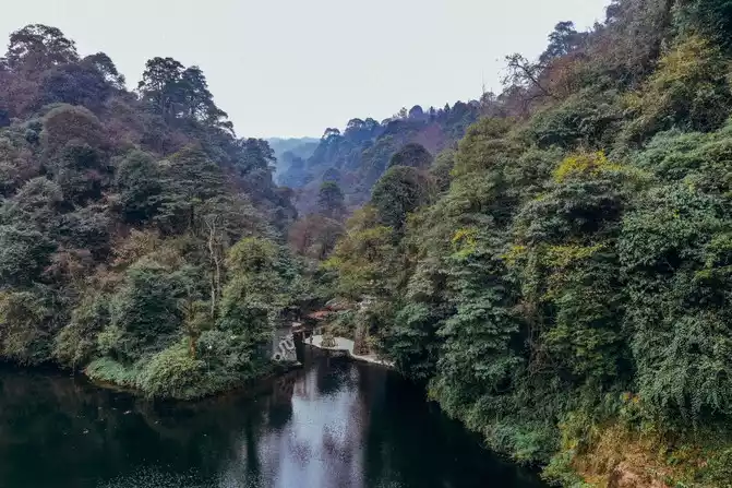
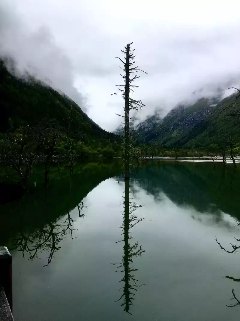
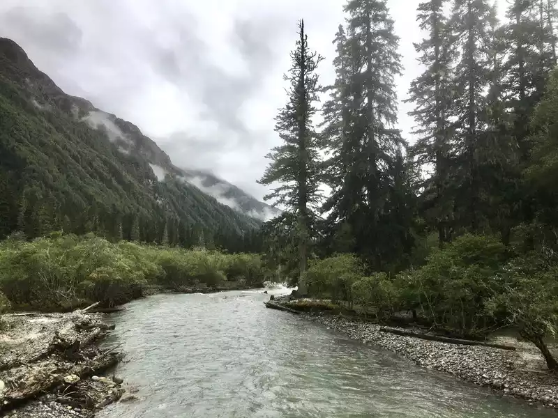 The scenery in Changpinggou is attractive
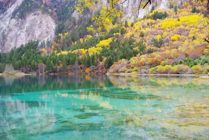
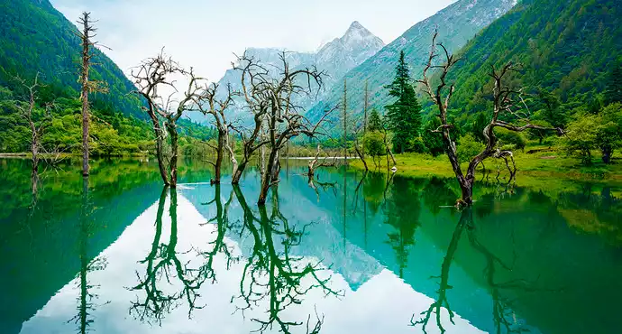
 Continuing on, passing the Chongchongjiao Waterfall, we came to the dry tree beach, where dozens of dead trees stood in a large area of water. The water is very clear, and the reflection of the mountains and trees reflects each other, which is beautiful. Further ahead is the dry lake, and the wooden plank road ends here. In front of it was a large forest, and a horse stepped out of the forest on a muddy road, and there were not many tourists, and occasionally a few people rode horses under the traction of the locals, swaying past them. The only advantage is that you don't have to ask for directions, just walk along the dirt road. Sometimes you will also encounter a stream flowing down the mountain, on which there is a set of wood, which is considered a bridge, and you can pass through it carefully. Out of the woods, there was a large lawn and a small lake, and the dry sea was in sight.
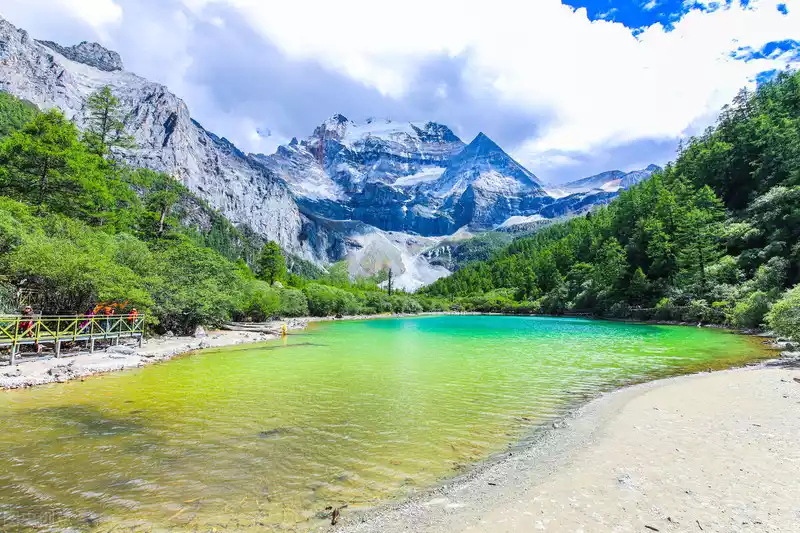
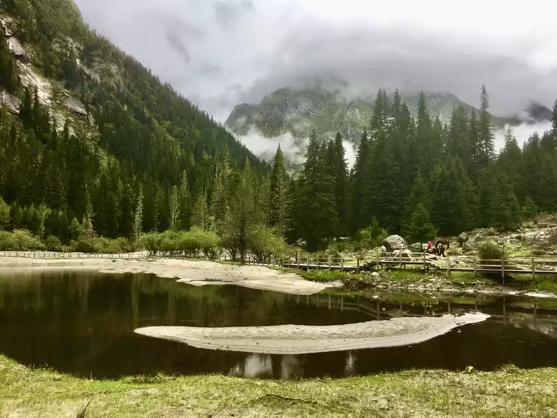 Changpinggou Shangganhaizi, when the weather is good, you should be able to see four snow-capped peaks side by side
 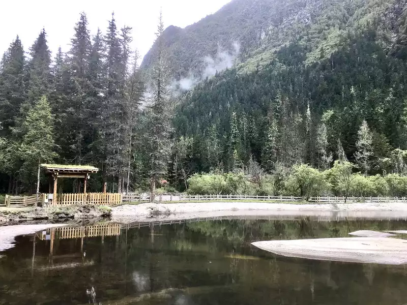 Changpinggou Shangganhaizi
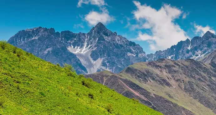
 The scenery of this lake is very beautiful, and the green mountains opposite are projected in the water, which is contrasted with the yellow wooden houses by the water, which is very interesting. The weather was not very powerful, sometimes cloudy and sometimes rainy, but at that moment a blue sky appeared, but Si Girliang Mountain was still behind the thick fog, and its true face was never seen. I took a few photos and moved on. The road became more and more muddy, and after turning the foot of a mountain, there was almost no way to go, so I could only find a slightly better place on the hillside on the side of the dirt road to jump around like a goat. Finally, I saw a few horses resting in front of me, and a few young people were posing there to take pictures, oh, the mouth of the two rivers has arrived. Looking at the watch, it was a little past 12 o'clock, and I had already hiked for two and a half hours. I didn't feel too tired, I didn't even drink much water, only an egg and two small pieces of chocolate were supplemented. Decided not to go any further and return. An environmental protection officer in the ditch also reminded me that the last train is at 5 o'clock, don't delay! So he turned around and walked back, returned the same way, walked on the plank road, took two breaks in the right place, had a simple lunch, and returned to the ditch at nearly 3 o'clock in the afternoon. The total duration is 5 hours and 20 minutes. The average is about 3 kilometers per hour. Because of the weather, the trip to Changpinggou is more like a hike in the mountains, with pleasant scenery and fresh air near the mountain, but unfortunately I couldn't see the true face of the fourth girl.
 The misty Changpinggou
 descends the mountain. Return to the hotel to rest. For dinner, we ordered two dishes and tasted the sea buckthorn wine made by the local Tibetans themselves. The first time I drank it, the liquor had a sweet and sour taste, which was a bit special.
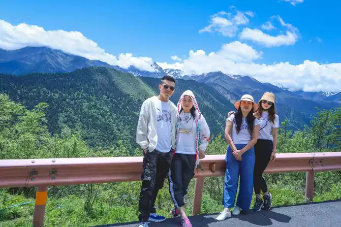
Today's itinerary is relatively easy. After breakfast, I drove to Shuangqiaogou. This is the most well-developed ditch among the three ditches of Siguniang Mountain, but it is also a ditch where you can't see Siguniang Mountain. The gate of the scenic spot is next to the road of Panda Avenue, which is very eye-catching, about 8 kilometers away from Rilong Town. Since the road is already connected here, the whole journey is accompanied by a sightseeing car, and tourists from the seven main attractions come down to wander around the neighborhood, and then get on the bus to rush to the next attraction.
 Siguniang Mountain Shuangqiaogou
 I drove from the gully entrance at an altitude of less than 3,000 meters to the end of the road 34 kilometers away, and the altitude had risen to 3,850 meters.As soon as I got out of the car, I felt cold and it was drizzling. I wandered aimlessly around the boardwalk, and saw almost nothing else except the redwood forest. So I got on the bus again and turned back to the attraction below. Although there are as many as seven scenic spots that can be seen when parking, the only ones that are slightly impressive are actually Siguniang Lake, Fish Dam and Ginseng Fruit Flat. In particular, Siguniang Lake has some similarities with the dead tree beach of Changpinggou, which is as horizontal as a mirror, and those trees that cannot be named stand in the water, with branches hanging or tilted, forming a symmetrical reflection on the water surface, which is very beautiful. On cloudy days, because I couldn't see the surrounding mountains clearly, especially the snow-capped mountains, this scenery gave me a lot of comfort. In Ginseng Guoping, I met the group of Shanghai old people who were walking halfway in Changpinggou the day before, and fate was tied to each other, we greeted each other in a friendly manner, chatted briefly about homely things, and took the car back to the gate of the scenic spot together. It only took three hours to turn around. I feel that the effect and feeling of viewing are much worse than that of Changpinggou, perhaps because of the road, which is convenient to play, reduces hiking, and also reduces communication with nature during hiking, which greatly reduces the fun of visiting. It can be said that it is a highway to gain and a highway to lose.
 Shuangqiaogou Siguniang Lake
 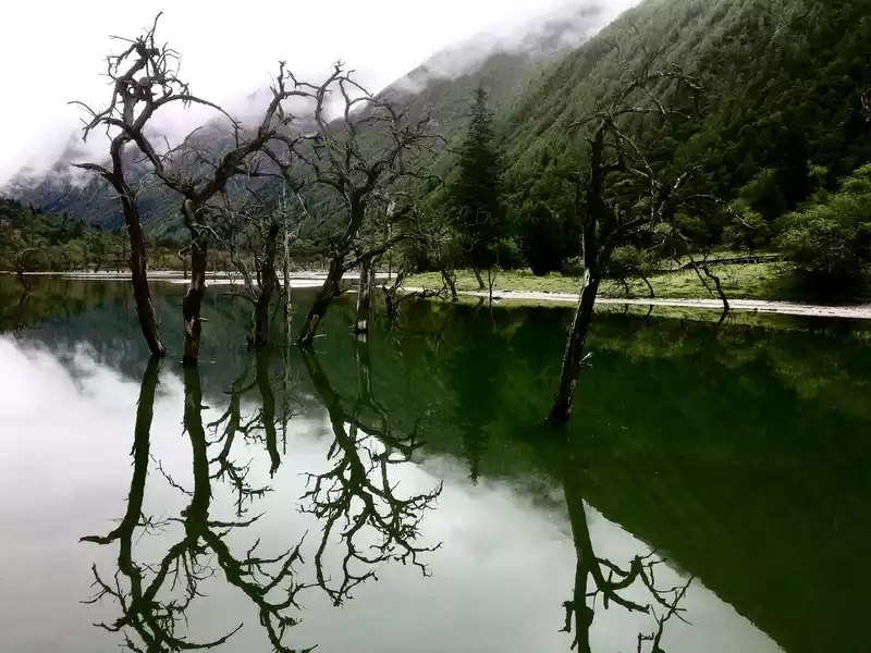 Shuangqiaogou Siguniang Lake
 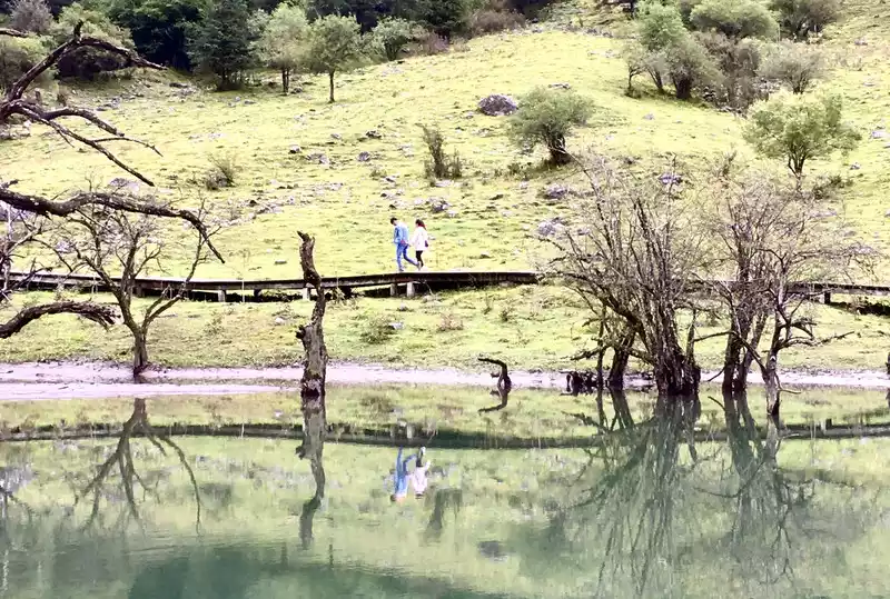 Shuangqiaogou Siguniang Lake
 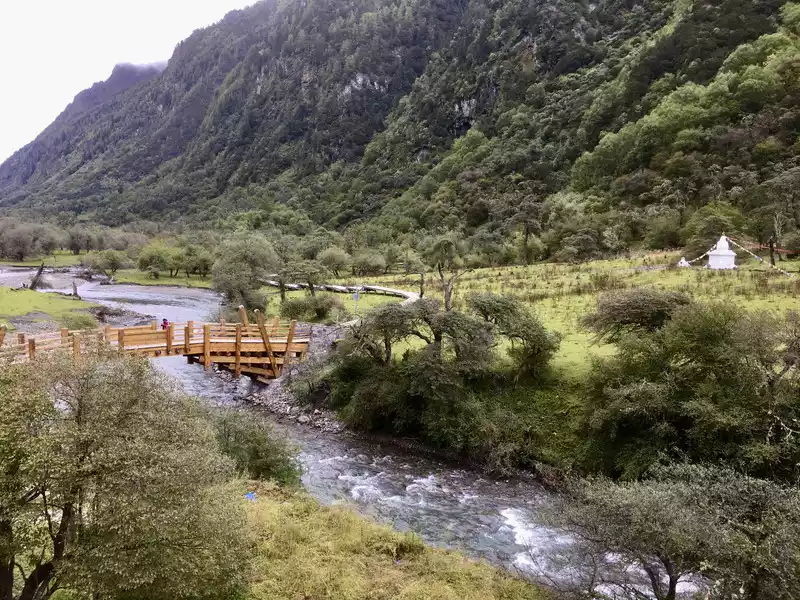 Shuangqiaogou Ginseng Flat
 I said goodbye to Shanghai tourists, cherished each other, and embarked on the road back. Since it was about two hours ahead of schedule, I decided to take the old path over Mount Barang. The first two times I passed this mountain were tunnels, close to it, but I also saw less scenery. This time it's to make up for it. When I was about to reach the entrance of the tunnel, there was a fork in the road, and the road sign pointed out the pass leading to the mountain, so I turned up. The road conditions are okay, there are many curves, many of which are 180-degree big curves, which may be a small test for people who run less mountain roads. I have become accustomed to driving on many mountain roads, but I am still very cautious. When I climbed over the top of the mountain, there were clouds and mist around me, and I couldn't see anything, so I had to concentrate on looking at the way down the mountain. When we arrived at the pass, the fog was a little lighter, and many cars and motorcycles were parked on the side of the road, and the stone monument of "Top of the Panda Kingdom" stood in the field on the side of the road.
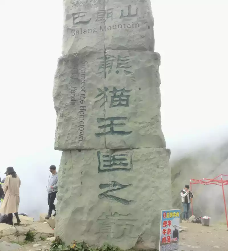 The "Top of the Panda Kingdom" stele located at the pass of Balang Mountain
 The altitude here is about 4,500 meters, the wind is strong, it is very cold, I saw some vendors barbecuing, and I also leaned over and asked for a few skewers of yak meat and potatoes, which is a souvenir of the first time I crossed Balang Mountain. After eating, drive down the mountain. The fog became smaller and smaller, and the temperature also felt high, until I saw the water of the Dadu River, I knew that I had reached the bottom of the mountain. Returning along the original path of Panda Avenue, you can occasionally see a striking prompt on the side of the road, informing the driver that there is a national treasure giant panda resting in the mountains and forests next to it, and do not honk. I also looked into the distance a few times, but the woods were dense and I couldn't see anything. Soon, the car returned to Yingxiu Town, I turned on the navigation (there was no mobile phone signal all the way from Balang Mountain to Yingxiu), turned to the Duwen Expressway, and after more than an hour, I was already looking around on the streets of Wenchuan County.
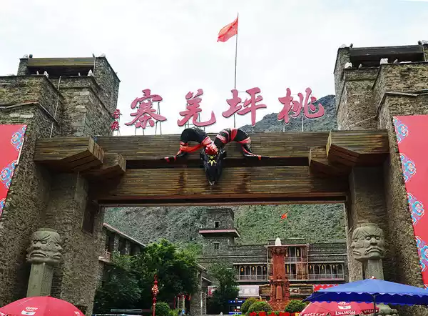
Wenchuan was also remembered by me because of the earthquake. In the county seat, there are no earthquake-related relics anymore, and on the map you can see a place called the Bell Tower Earthquake Site Square, but I didn't find it. Perhaps in that big earthquake, the damage here was not very serious, and the most serious should be the county seat called Beichuan. I walked along the Minjiang River from the bridge to Guozhuang Square, and went to see the Chinese Qiang City, only to know that Wenchuan is one of the four major Qiang counties in the country, and the Aba to which it belongs, the full name is Aba Tibetan and Qiang Autonomous Prefecture. It seems that this should be a place where Qiang culture is relatively intact. Then, I went to the Wenchuan Museum, but unfortunately I arrived a little late and it got off work. So, I had to walk back and forth on the road to the competition, cross the cultural square, walk across the Minjiang Bridge, head towards the county hospital, and return to the city through the worry-free Yulun Bridge.The county seat is built with small characteristics, clean streets, and complete living facilities, which should be very convenient. Seeing the slogan of "health care Wenchuan" in the county, I know that the current Wenchuan should take health preservation as one of its own efforts For dinner, I chose to taste the old Qiang bacon claypot rice in the cultural square, and ordered a wonton by the way. Tomorrow is the last day of planning, and time will not be as easy and leisurely as today.
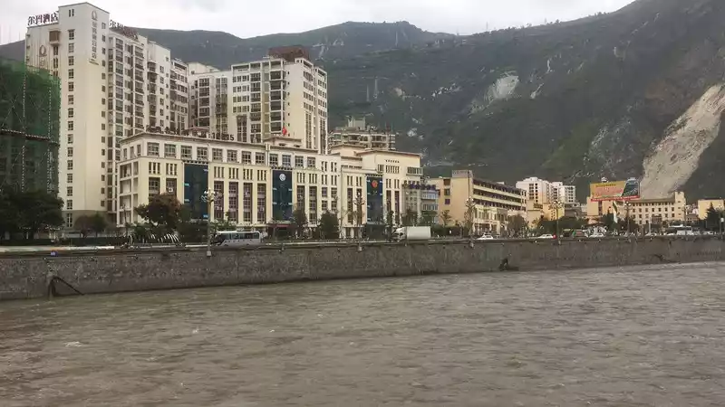 Wenchuan County, located on the edge of the Min River
  Wenchuan Cultural Square, the logo of Qiang City, China is very conspicuous September
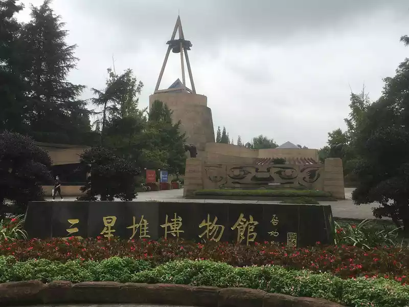
 Because the trip the day before was two or three hours earlier than planned, there was a window this morning, and it was temporarily decided to add a content: visit Sanxingdui Museum. Sanxingdui Museum is located in Guanghan, about 120 kilometers away from Wenchuan, with a high speed and a little more than two hours. So, I set off from Wenchuan at 6 o'clock in the morning, and there were not many pedestrians and cars on the road, and occasionally I encountered one or two large trucks speeding on the highway. I arrived at Sanxingdui at 8 o'clock. Based on my usual experience and my personal needs, the best way to visit such a museum is to listen to the guide's explanation and then focus on it yourself. Although the cost of the tour guide is relatively high, one was hired, which proved to be very necessary.
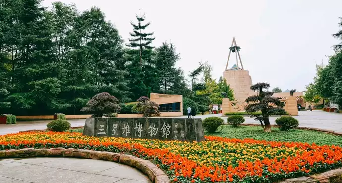
 The gate of the Bronze Museum of Sanxingdui Museum
 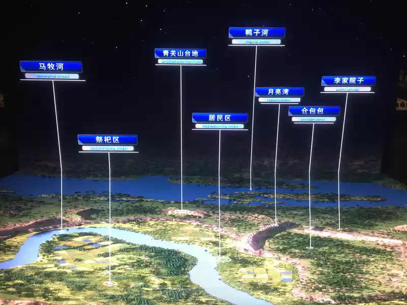 Introduction to Sanxingdui Ruins
 Under the guidance of the tour guide, I started with the historical staging of the Sanxingdui site, and then learned about the pottery used by the people who lived here four to five thousand years ago, and speculated on their living conditions at that time; Then I saw the bronzes in the earth, especially the masks worn by wizards or psychics, which are very distinctive, and I remember reading the report on the cultural relics unearthed at the Sanxingdui site very early, and I was most concerned about these bronze masks, thinking that they should be left on the earth by aliens. Finally, there are gold and other artifacts found in the site. Although these cultural relics are all ceremonial vessels, from the tradition of the ancients to "serve the dead as if they were alive", combined with the ground remains of the Sanxingdui site, such as the city wall, we can also know what kind of situation their lives and social activities were in at that time. The explanation lasted about an hour, and what impressed me the most was the tall Dali Man, the golden scepter and the sacred tree, except for those bronze masks. There are also bronze and jade surface decorations, the workmanship is very fine, and I even wonder if there was such a high level of production thousands of years ago. After the tour guide's explanation, I turned backwards, starting from the bronze museum and ending with the comprehensive museum, and had a deeper understanding of some of the artifacts and texts that I had not finished just now. Looking at the watch, it was already more than 11 o'clock in the morning, and before I knew it, I had been here for three hours. I feel that this temporary addition is too worthwhile, adding a lot of color to the whole trip and drawing a successful end.
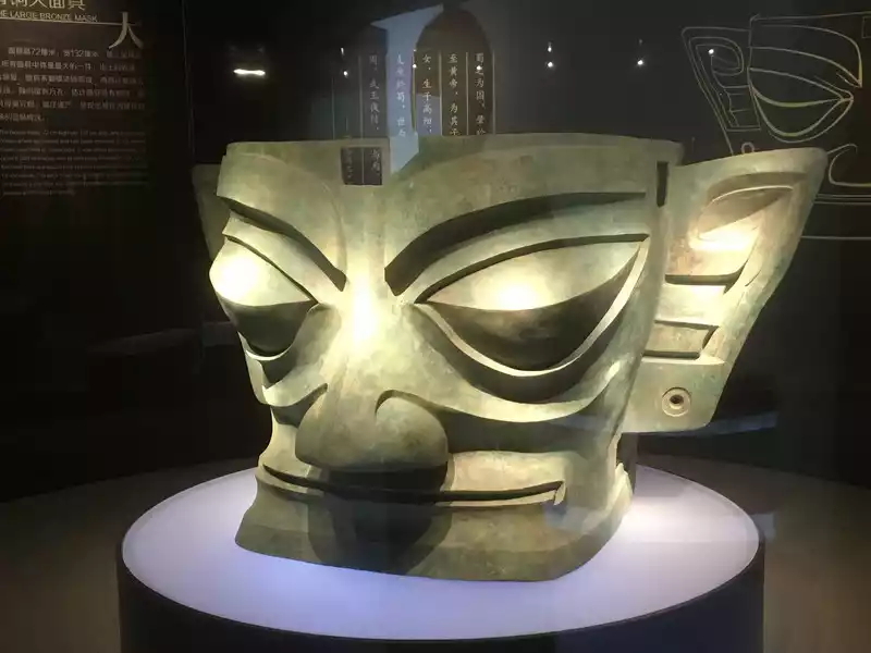 The most representative bronze mask in Sanxingdui cultural relics
 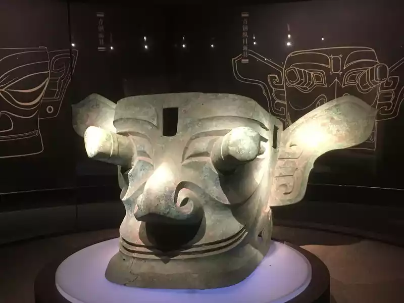 The most representative longitudinal bronze mask in Sanxingdui cultural relics, it is said that its prototype may be the first king of Shu, Silkworm Cong.
 It's time to leave.
Sanxingdui is not far from Chengdu, and the place to return the car is 50 kilometers, which can be reached in about an hour. In less than one o'clock, I was already at the self-service return point on Jiulidi North Road, locked the car on my mobile phone, and completed the return procedures. Then follow the navigation guide to the rapid bus stop.As a result, I didn't find the bus stop, but I found that I was standing at the entrance of Metro Line 7, so I went down directly to take the bus and soon arrived at Chengdu East Railway Station. Seeing that it was still early, I changed the high-speed rail to G90 at 3:05 p.m. At a little after 8 p.m., the car arrived in Zhengzhou East. The whole trip ended successfully, two hours ahead of schedule.
The biggest advantage of self-driving travel is that you are free, the time is in your own control, and the itinerary can be adjusted at any time according to the actual situation. So, this became my main way to travel after retirement. However, like this time, a person's self-driving must endure loneliness and loneliness while enjoying freedom, which is also one of the prices of freedom. Fortunately, compared to freedom, this price is really nothing.
Number of days: 10 days, Average cost: 2900 yuan, Updated: 2021-07-04 05:20
Number of days: 10 days, Average cost: 10,000 yuan, Updated: 2021.10.04
Number of days: 4 days, Average cost: 5000 yuan, Updated: 2024.11.02
Number of days: 5 days, Average cost: 1000 yuan, Updated: 2021.04.20
Number of days: 2 days, Average cost: 400 yuan, Updated: 2020.06.23
Number of days: 3 days, Average cost: 2000 yuan, Updated: 2023.01.06