Live Your Best Lives
............................................................................ The preface .............................................................................................
1. Roadmap: Chongqing - Luding Bridge - Moses Ancient Town - Hailuogou - Tagong Temple - Moshi Park - Xindu Bridge - Daocheng Aden - Xindu Bridge - Ya'an - Chongqing
2. Preparation: Soak in water and drink rhodiola a week in advance. Daocheng Aden Scenic Area requires the epidemic prevention health code of the national government service platform, which can be scanned and entered on the spot. Bring ID card, student ID card, raincoat, sunscreen, lipstick, mask, jacket, sweater, thick pants, long pants, short-sleeved shorts, underwear, socks, towel, shampoo, shower gel, power bank, thermos cup, snacks, fruit, beef jerky, chocolate, rhodiola
4.During the epidemic, Daocheng Aden Scenic Area is restricted, and it is recommended to book hotel and scenic spot tickets in advance.
———————————————————— Travelogue Text————————————————————————
This year's epidemic has made us experience a lot, and the overly stressful life has aroused the idea of free flight. I always want to go outside and experience another experience. So I thought of a holy place I had wanted to go to for a long time - Daocheng Aden. Prepare everything and go.
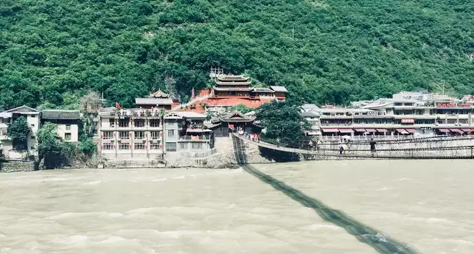
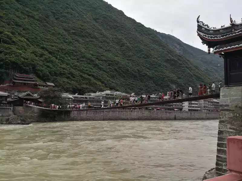
The wooden barrel Yayu we ate for lunch in Ya'an, this time finally allowed us to find the "sword" on Yayu's head. Continuing on, we arrived and toured Luding Bridge in the afternoon. Luding Bridge is located in the west of Luding County, Ganzi Tibetan Autonomous Prefecture, Sichuan Province, often called the Dadu River Iron Cable Bridge, which is the gateway to Ganzi Prefecture, the throat of Kangzi transportation, and an important passage from the interior of Sichuan to the Kangzang Plateau. The Luding Bridge bridge body is composed of 13 iron chains with thick bowl mouths, including 9 bottom chains and 4 handrails, each of which is interlocked by 862 to 997 iron rings made by hand from wrought iron, with a total weight of more than 21 tons. The bottom chain is covered with wooden planks, and the handrail and the bottom chain are connected by small iron chains, so that the 13 chains are a whole. The abutment is the foundation of the fixed ground dragon pile and the sleeping dragon pile; The bridge pavilion is an ancient Qing style building. On the other side of the river, the ancient building on the hillside is the historic Guanyin Pavilion, which is a temple. However, when the Red Army flew to capture the Luding Bridge, it was the Red Army's "Flying Luding Bridge Point Headquarters" and the artillery and machine gun positions, and it was under its cover that the 22 warriors of the Red Army bravely climbed over the 13 iron cables, shattering Chiang Kai-shek's dream of making Zhu Mao "become the second Shi Dakai". Walking on the bridge, the turbulent Dadu River under your feet, the sound of the wind howling in your ears and the screams of the crowd make people shiver. The tour took nearly two hours, and we left Luding and continued to today's terminal, Moxi Ancient Town. The ancient town of Moxi is built on a sloping high platform surrounded by mountains on the east, west, and north sides, and the entrance to the ancient town diverges into two roads. One leads to the ancient town, the other passes through the new city, and converges around the city to form a circle. In the ancient town paved with stone slabs, the buildings are gathered next to each other on both sides of the road. The more distinctive is the Catholic church built by French missionaries in 1918. In 1935, the Red Army's Long March passed through this place, and Chairman Mao Zedong stayed in the Catholic church and held the famous Moxi Conference. Subsequently, the Red Army snatched the Luding Bridge, and Chairman Mao followed the main force of the Red Army across the Luding Bridge. When we came here, it was about 5 o'clock in the afternoon, we visited the Catholic Church, the Moxi Red Army Long March Memorial Hall, and chose a highly acclaimed yak soup pot in the ancient town in the evening, which tasted quite good. Return to the hostel in the evening to rest and prepare for tomorrow's trip to Hailuogou.
 Luding Bridge
 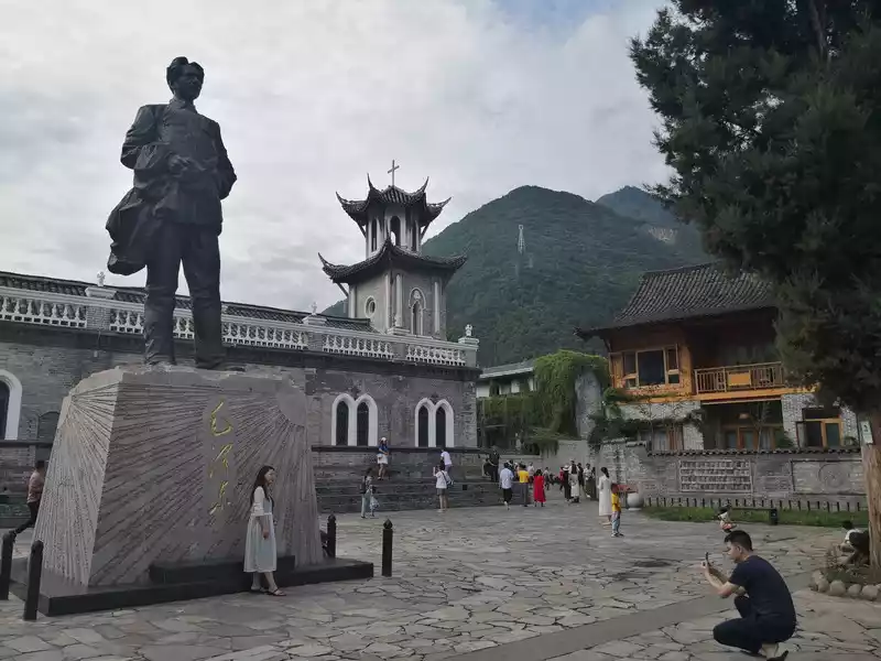 Moxi Ancient Town - Chairman Mao Statue and Catholic Church
 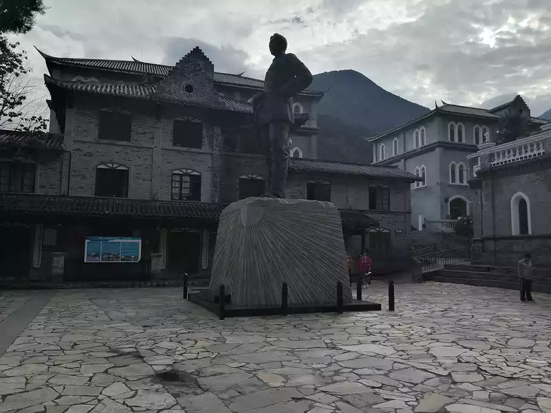 Moxi Ancient Town - Chairman Mao Statue and Catholic Church
 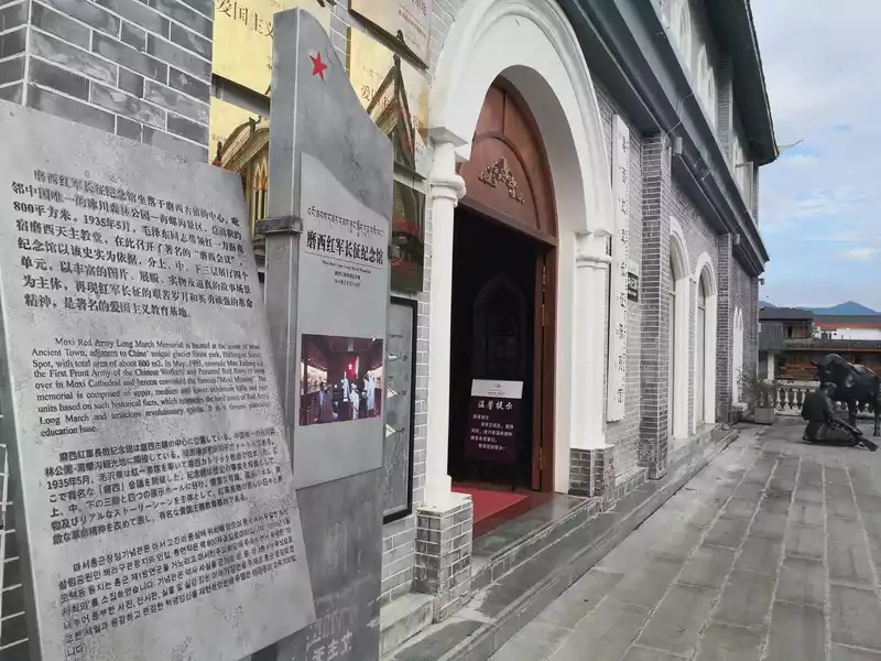 Moxi Ancient Town - Red Army Long March Memorial Hall
 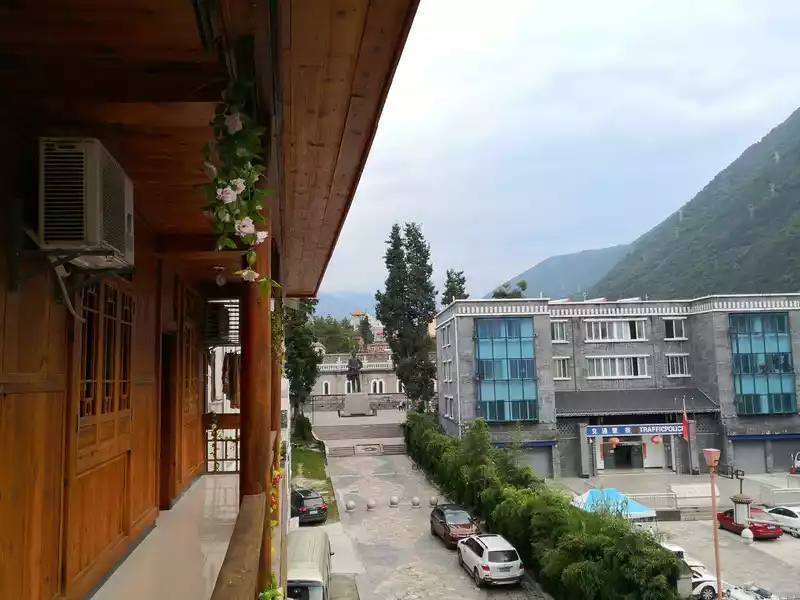 Moxi Ancient Town (we stayed in an inn where you can see the Catholic church and Mao Zedong sculptures)
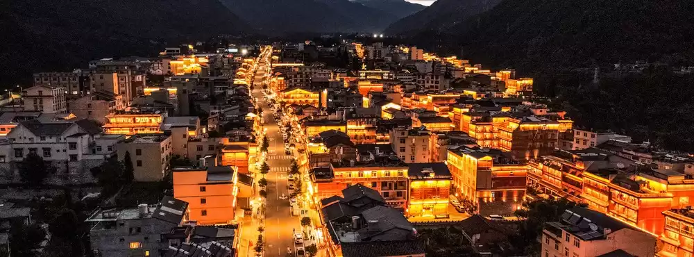
 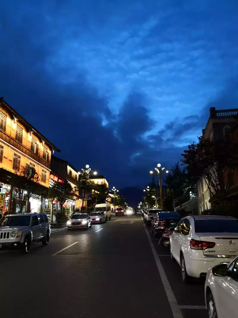 The ancient town of Moxi - a fantastic night view. Original photo, absolutely no color grading.
 On August 9, 2020, I got up at 7 a.m. and entered Hailuogou Glacier Forest Park at about 8 o'clock.
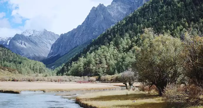
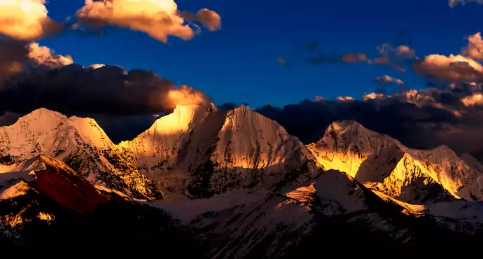
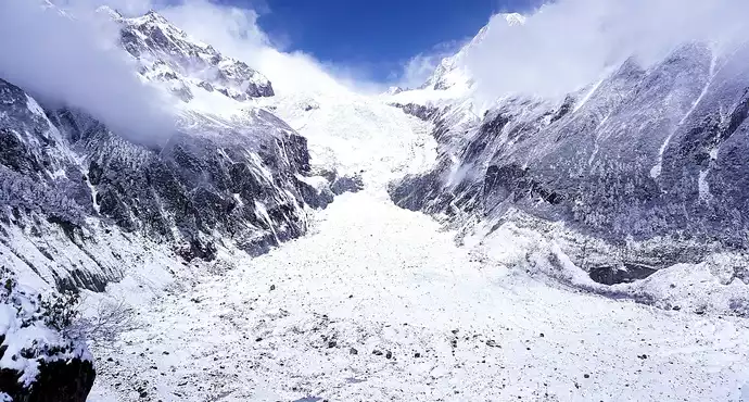
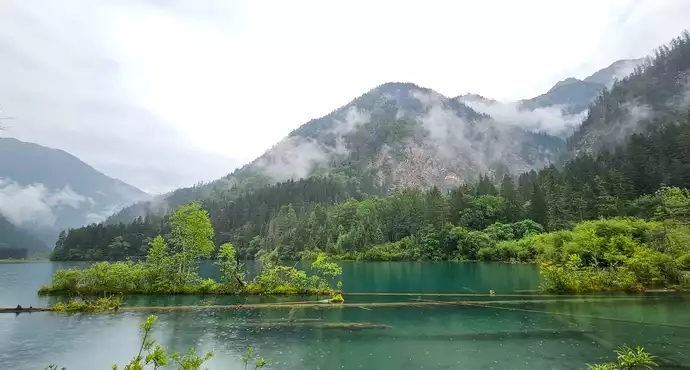
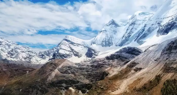
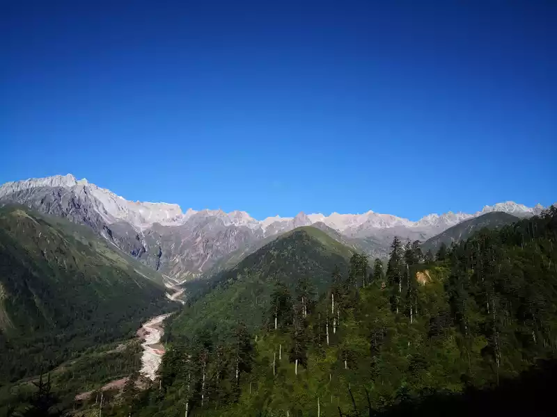
Hailuogou National Forest Park, located in Luding County, Ganzi Tibetan Autonomous Region, Sichuan Province, is 319 kilometers away from Chengdu and 49 kilometers away from Kangding, and is one of the only remaining low-altitude glaciers in the world. Hailuogou tourist attraction is located between the canyons. The terrain here is complex, the climate type is special, and the mountains are lush and lush. The climate is pleasant, with an average annual temperature of around 15 degrees Celsius. The summit is covered with snow all year round, with an average annual temperature of around -9 degrees Celsius. Hailuogou tourism resources have three characteristics: First, Hailuogou is located at the foot of the mountain, under the sun, looking at the Gongga Snow Mountain that is snowy all year round, magnificent, radiant and magnificent. Second, Hailuogou Glacier is the lowest glacier at the same latitude in China, with the lowest point being 2850 meters above sea level, and the glacier tongue extends 6 kilometers into the primeval forest, and the glacier and forest coexist. Hailuogou Glacier is a modern glacier formed 1600 years ago. There is a large icefall more than 1,000 meters wide in the ditch, falling 1,080 meters, which is unparalleled in the world. Third, in this icy and snowy glacier world, there are dozens of hot spring spots, and tourists can take hot spring baths on the glacier. We took a sightseeing bus ride for nearly an hour on the rugged mountain road to Camp No. 3, from low to high altitude, different vegetation and landscapes were presented in front of us, and finally took the cable car to Camp No. 4, where we saw the stunning No. 1 Glacier Icefall up close. It is like a galaxy pouring down from the blue sky. Unless you see it with your own eyes, there are no words that can describe its magnificence and greatness. Further up, there is Red Stone Beach, with cluttered stones spread on the hillside, and melted ice water flowing over the mountains, simple and pure. Coming down from Camp No. 4, we came to the glacier tongue at the foot of the mountain, which actually looked like two caves, and the locals told us that the gray thing at the entrance of the cave was not a stone, and if you look closely, it shows a light blue color, in fact, it is ice, at such a low altitude, it will not melt, it is really magical. At around four o'clock in the afternoon, we returned to Moxi Ancient Town and ended today's trip to Hailuogou. I had a local barbecue for dinner, and the most novel thing for me was that I grilled something called "Yanghe", which tasted okay, but I couldn't get used to it.
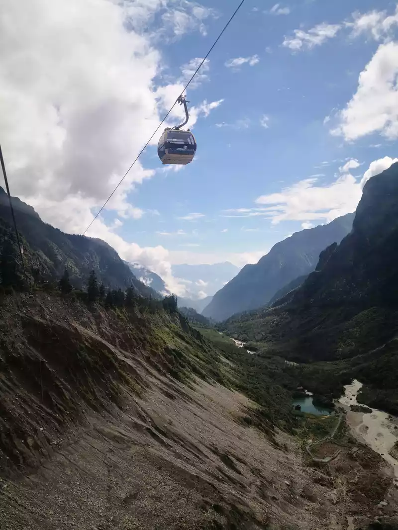 Take the bus to Camp 3 and then take the cable car from Camp 3 to Camp 4
 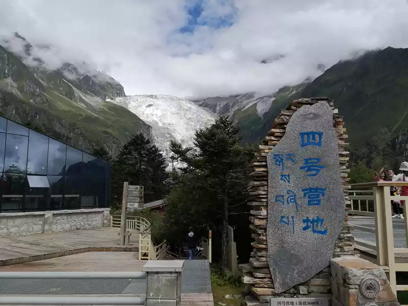 Hailuogou No. 4 Camp
 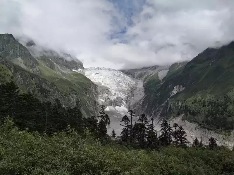 Hailuogou No. 4 Camp - Watching Glacier No. 1
 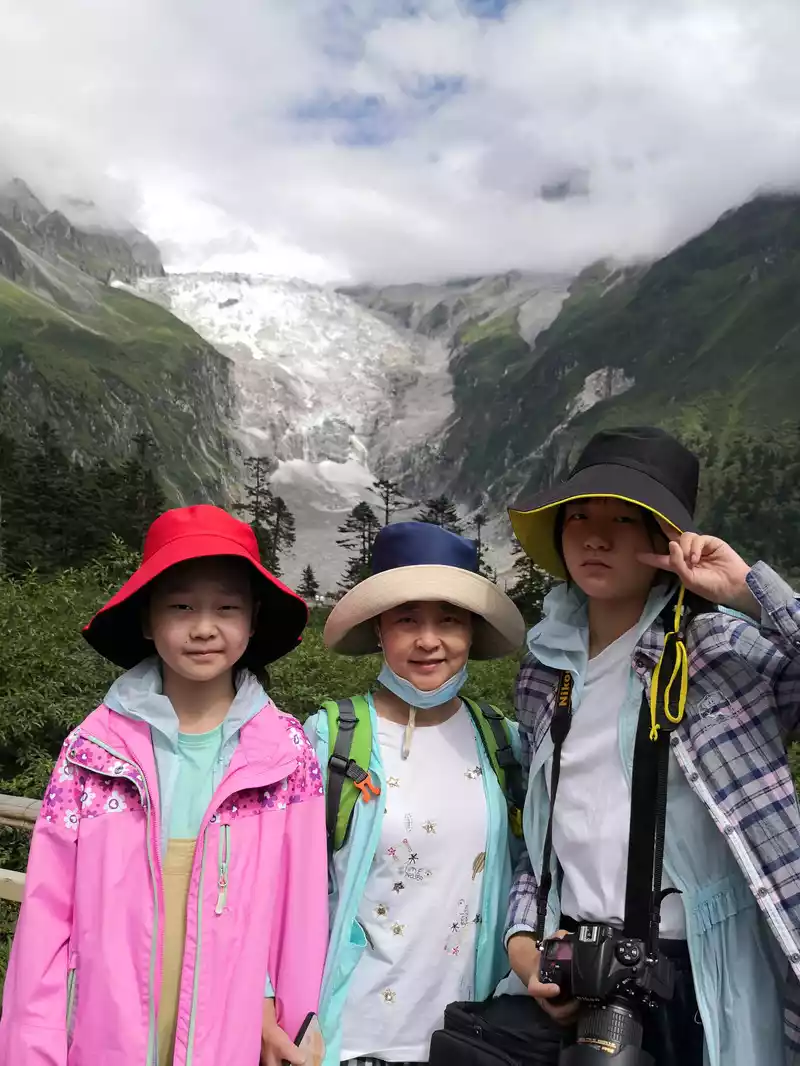 Hailuogou No. 4 Camp - Watching the No. 1 Glacier On
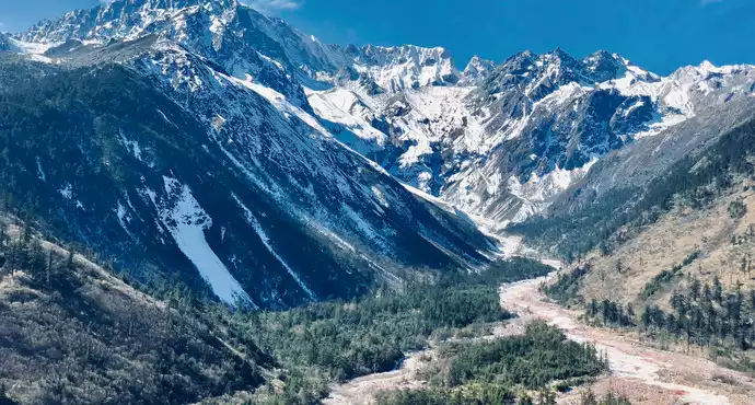
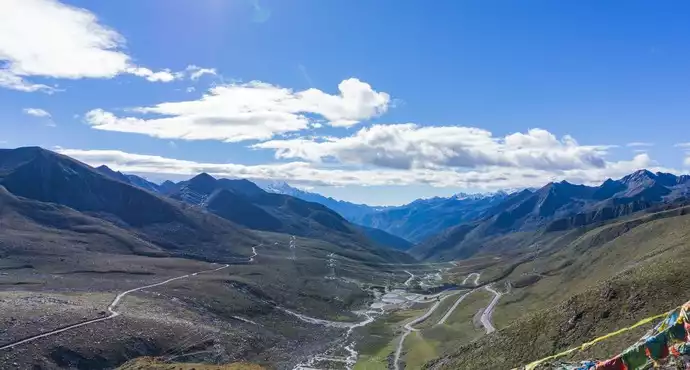
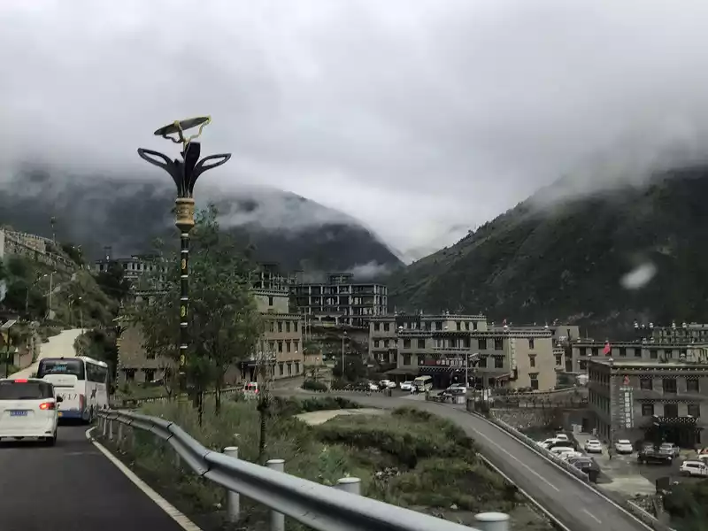
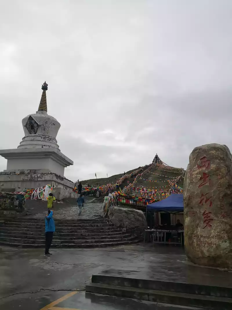
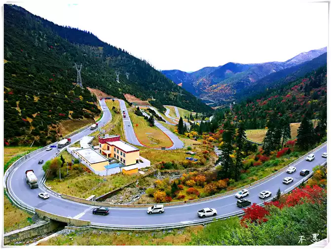
 We have to travel along National Highway 318, and we have to climb several mountains at an altitude of 4,000 meters, which is very difficult to think about, but the scenery is definitely good. As soon as I left Moxi Ancient Town, I went in the direction of Yanzigou, and passed by Red Stone Park on the way, where the red stone is much redder than the foot of Hailuogou, of course, it is much more beautiful, and the red substance covered with stones is a kind of microorganism, which reproduces in the unique ecological environment of the mountains, constituting a strange landscape where life and history coexist. Continuing to move forward, we began to climb over the Jakarta Snow Mountains, the road surface is very good, because there are very few cars in the early morning, and the driving mood is relatively happy, and the snow-capped mountains on both sides, the blue sky, and the green vegetation cover a beautiful and spectacular picture. The higher we went, the higher we went, and when we reached the top of the mountain, we also met a group of mountaineers, only to learn that this was a mountaineering training base. The highest peak of Zheduo Mountain is 4,962 meters above sea level, the pass is 4,298 meters above sea level, and the altitude difference with Kangding City is 1,800 meters, which is the first high mountain pass that needs to be crossed on the Sichuan-Tibet line, so it is known as the "first pass of Kangba". Zheduo means curved in Tibetan, and it is written in Chinese as the word "Zheduo". The winding mountain road of Zheduo Mountain is indeed nine bends and eighteen bends, winding back and forth like the word "many", turning a corner and another turn, no wonder the locals have a saying: "Erlang Mountain that scares people to death, Zheduo Mountain that scares people to death". When we came to the observation deck on the top of the mountain, we hurriedly passed by, because there were many tourists at that time, parking was difficult, so we looked at the observation deck not far down the mountain, and the mountains in the distance were printed with the words "Kangding Love Song", which was very conspicuous, and the nearby 318 and the river were staggered on the alpine meadows, which was actually the most obvious scenery in the local area all the way. Go down to the pass, and head towards Xinduqiao and Kangding Airport. Because the road is being built in the direction of Xinduqiao recently, and we have to go to Tagong Grassland, Tagong Temple and Moshi Park, we chose the direction of Kangding Airport. The road to the airport is beautiful, with a colorful separation line in the middle, which is beautiful. Finally arrived at the airport, there is an observation deck on the top of the mountain, Kangding Airport is not big, but although the sparrow is small, it is a civil airport, located in Zheduo Mountain Simucuo, Kangding City, at an altitude of 4290 meters. The airport is about 38 kilometers away from Kangding city and is the third highest altitude airport in the world. The road conditions ahead are roughly the same, all up and down the mountain, we are very close to Baiyun, like walking on the heavenly road, although the road is far, but it feels beautiful. Almost noon, we came to the Tagong grassland. The scenery of the Tagong grassland is picturesque, and on the grass, a wide variety of wildflowers bloom and are colorful. When tourists wander in the sea of flowers, they suddenly feel like they are floating. The Yala Sacred Mountain in Tagong rises from the grassland, majestic and spectacular, covered in silver all year round, surrounded by clouds, set off by the vast green grassland and the splendid Tagong Temple, showing a beautiful plateau scenery. At noon, we came to Tagong Temple, which is a famous Sakya (Flower Religion) temple in Ganzi Prefecture, and the temple architecture combining Chinese and Tibetan styles is magnificent, but the epidemic is not over, the temple is not open, and we only watch and feel quietly outside. After lunch at a restaurant next to the temple, continue on to Moshi Park. Moshi Park Scenic Area is a national 4A-level tourist attraction, a geological science popularization center, one of the birthplaces of King Gesar, and one of the eight beauties of Daofu. The world's geological wonder, China's only plateau stone forest landscape, a diversified scenic spot integrating sightseeing, experience, scientific research and popular science value, is known as "the eighth beauty of China's most beautiful landscape avenue". It has eight wonders: magnificent grassland, graceful wetland, fantasy ink stone, characteristic houses, plateau flower sea, golden autumn, white pagoda holy temple, and sunrise and sunset.Take a sightseeing bus into the scenic spot, which is a long wooden trail, winding, and the surrounding mountains and meadows are contrasted, which is great! Walking further inside, a gray stone forest appeared in front of you, which is Moshi Park. The view from a distance is so visually impactful, but we want to appreciate it up close, so we go down to the foot of the mountain and blend into it, and we feel how small we are. We passed by the Ecological Garden, Animal Paradise, Ink Stone Square, Ten Thousand Swords and Exotic Planets. What we remember the most is the exotic planet, the rocks buried underground hundreds of millions of years ago, which have undergone thousands of years of tempering and erosion, carving out a variety of stone forests. Walking into the depths of the Mylonic Rock Forest is like stepping on an exotic planet and being in another world. I wanted to go to the Geological Museum to take a look, but it is being renovated, which is a bit of a pity. Starting from Moshi Park and heading to today's destination, Xindu Bridge, two kilometers close to Xindu Bridge, a purple landscape came into view. This is the lavender estate in Xinduqiao. The two children cheered and jumped, and as soon as they got out of the car, they rushed away, which I knew was their favorite. In the large lavender, the blue sky and white clouds, the green mountains, and the cool breeze, the children kept posing there with the camera, I really hope that time can stop at that moment, forget the unhappiness and annoyance, and let the joy and calm fill the air. On this day, I came to Xindu Bridge smoothly. Xindu Bridge is a fascinating "photography paradise", located at the intersection of the south and north lines of National Highway 318, and is a picturesque paradise. Magical light, endless grasslands, winding streams, golden cypress poplars, rolling mountains, Tibetan villages scattered among them, cattle and sheep grazing peacefully...... The plains of western Sichuan bloom beautifully. This is the Xindu Bridge, the fascinating "world of light and shadow" and "photographer's paradise".
 Set off from Hailuogou, pass through Swallow Gully, and cross the Yaga Terrier. Beautiful scenery 1 on the way: The sky is really blue,
 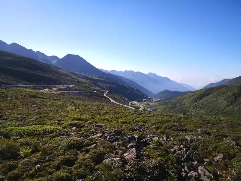 Depart from Hailuogou, pass through Swallow Gully, and cross the Yaka Terrier. Beautiful scenery 2 on the way: This is a roadside parking area at the top of the Yaka Terrier, we look back at the road we came from
 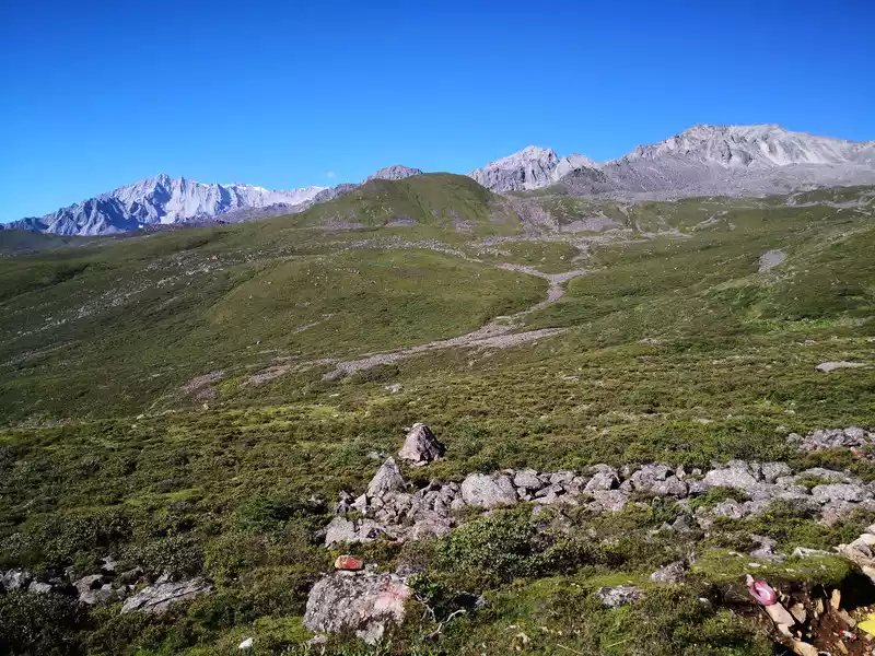 Hailuogou departs, passes through Yanzigou, and crosses the Yaga Terrier. Beautiful scenery 2 on the way: This is a roadside parking area at the top of the Yaka Terrier, we look at the mountain next to it
 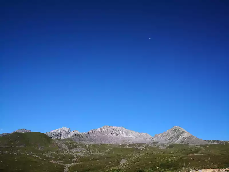 Hailuogou departs, passes through Swallow Gully, and crosses the Yaka Terrier. Beautiful scenery on the way 4
 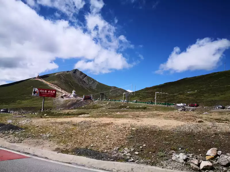 Yajia Terrier descends the mountain, passes through Kangding city, and begins to climb over Zheduo Mountain. This is the Zheduo Mountain Pass, and on the left is the snow viewing platform
 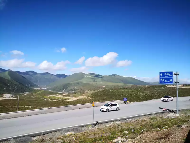 A little down from the Zheduo Mountain Pass, there is an observation deck.On the opposite hillside are the four words of Kangding Love Song
 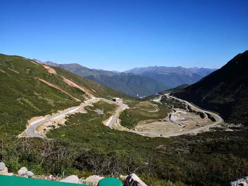 Zheduo Mountain downhill
 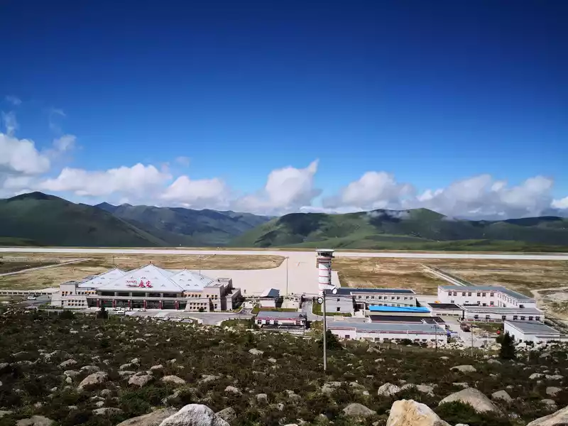 Zheduoshan Pass walks 8 kilometers forward to Kangding Airport
 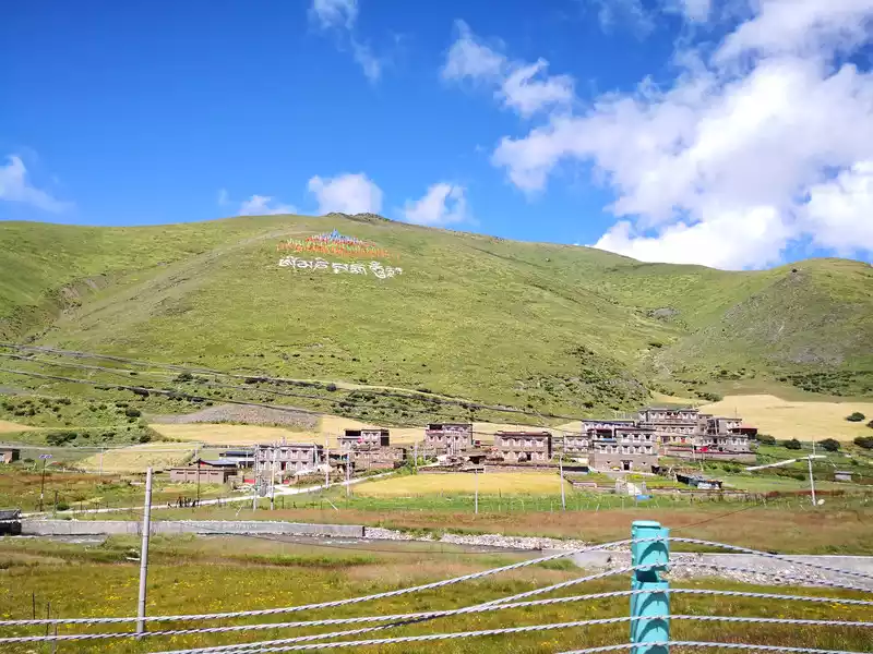 There are Tibetan characters on many hillsides along the way
 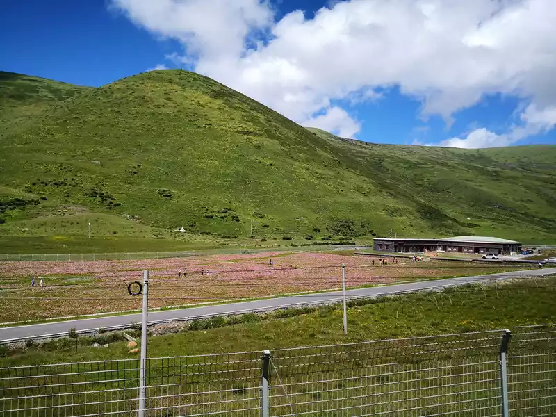 A sea of grassland flowers passing by
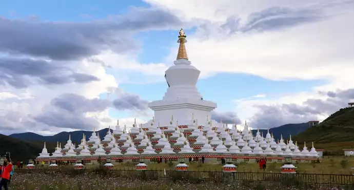
 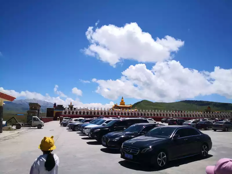 Muya Zunsheng Tower
 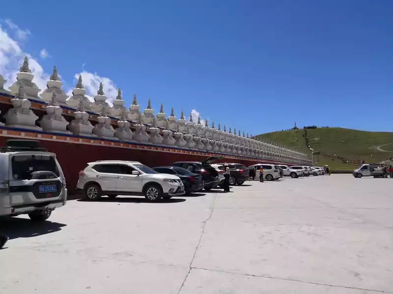 Muya Zunsheng Pagoda: Outer wall
 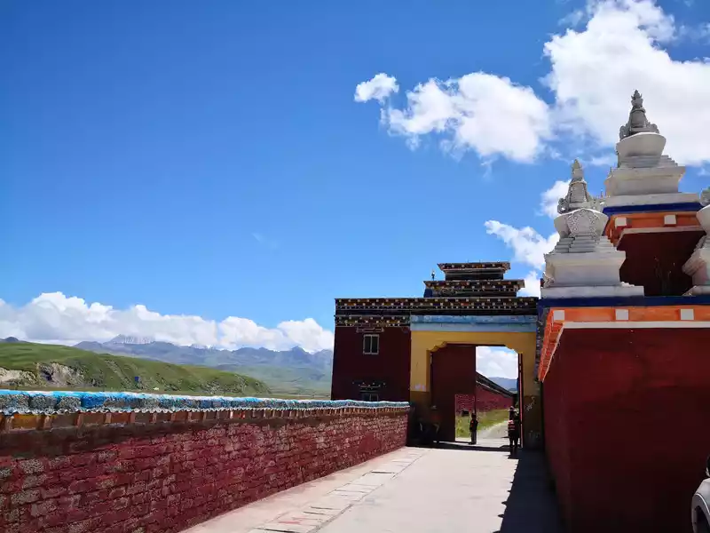 Muya Zunsheng Tower: Import
 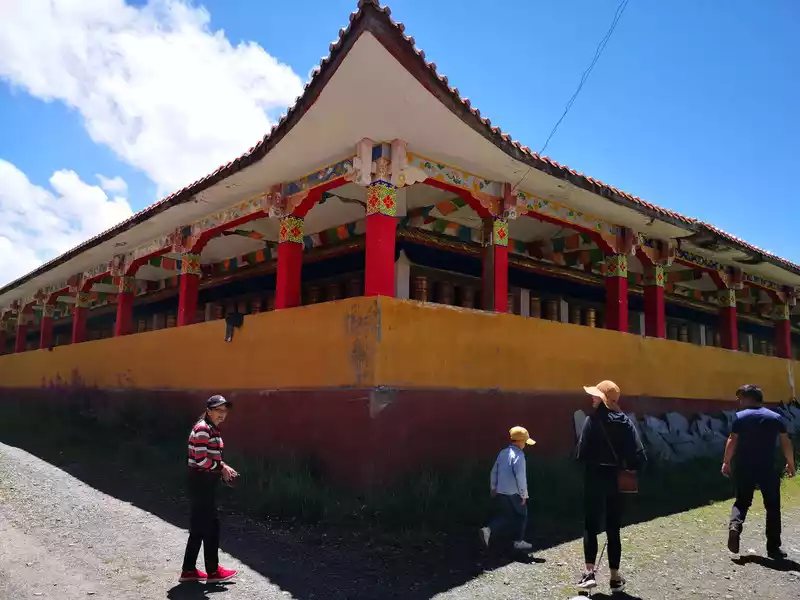 Muya Zunsheng Tower: After entering, the cloister next to the tower
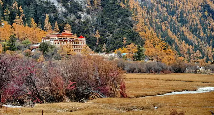
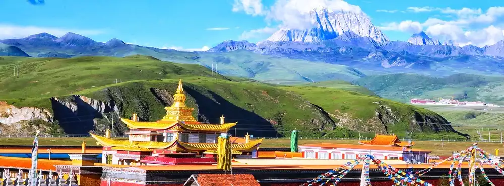
 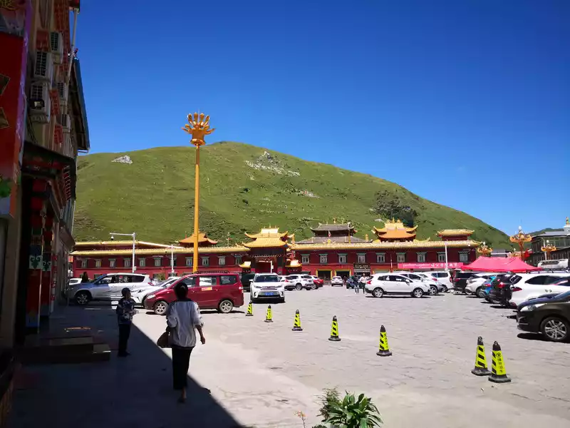 Opposite is Tha Gong Temple
 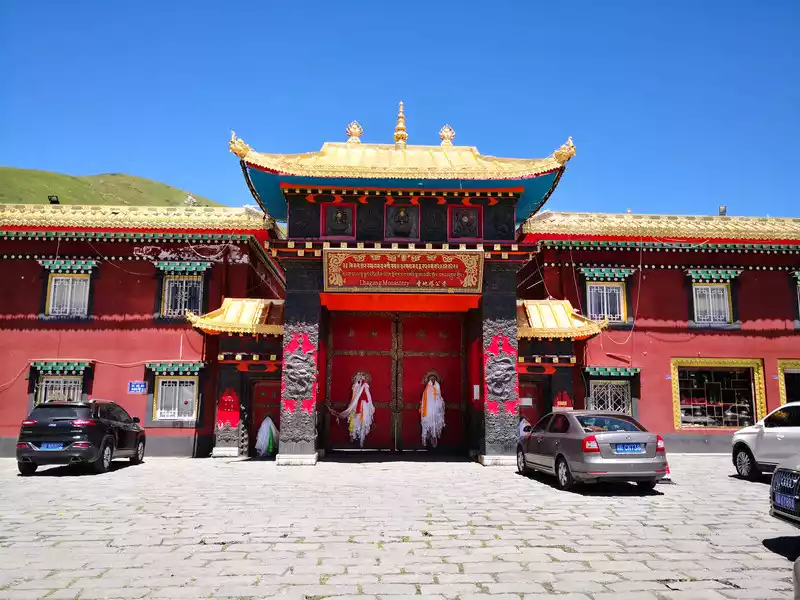 The gate of Tagong Temple
 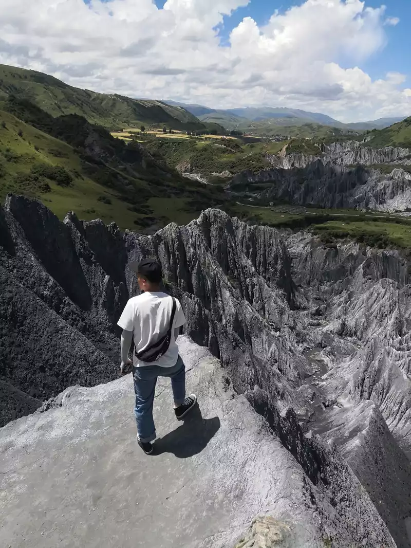 Inkstone Park
 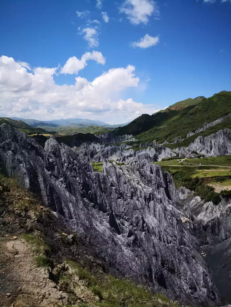 Inkstone Park
 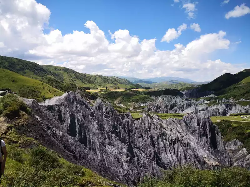 Inkstone Park
 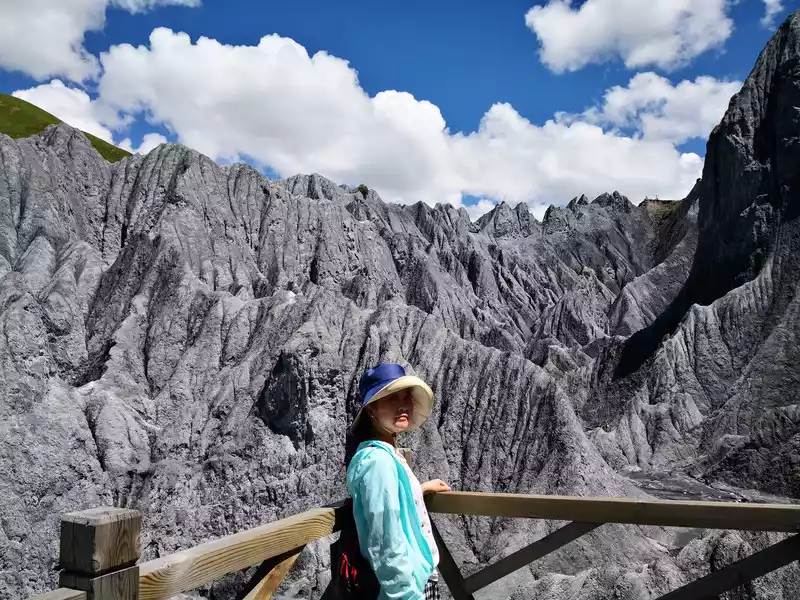 Inkstone Park - An Exotic Planet
 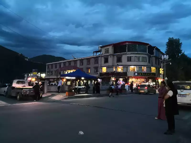 Shinto Bridge at night.This is the bridge, below is the river
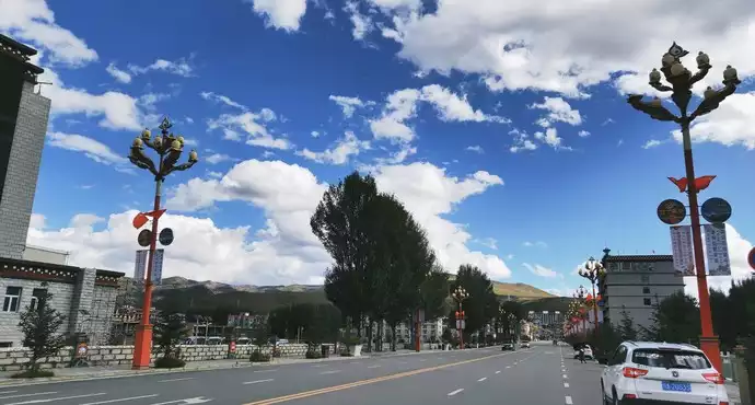
 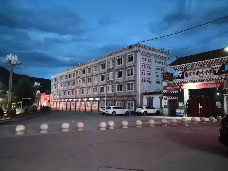 Xindu Bridge, Kangding Tibetan Middle School
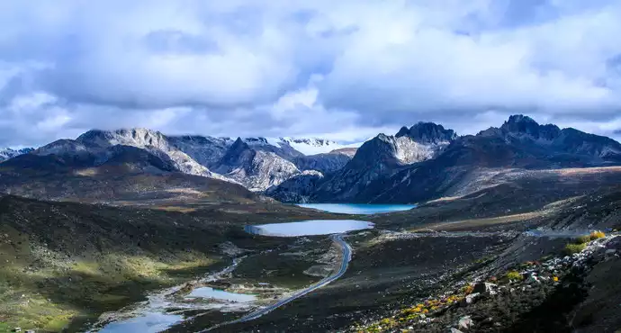
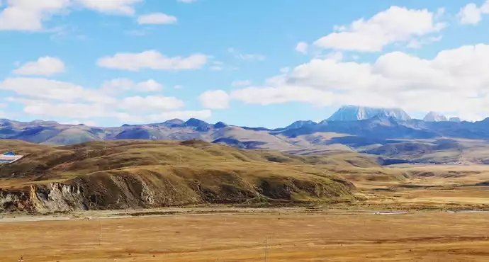
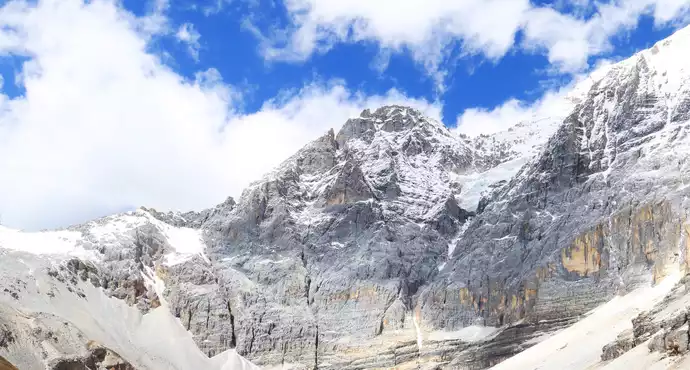
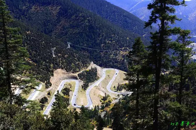
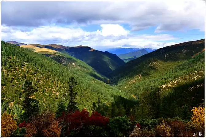
 Today we have to climb several high-altitude mountains. Not long after leaving Xindu Bridge, we passed through Yajiang County, which is rich in matsutake mushrooms and is the hometown of matsutake mushrooms, with an altitude of only more than 2,000 meters. Subsequently, we will climb over the first Scissor Bay Mountain. Scissors Bay Mountain, its Tibetan name is "Jamanaza", which means Yangzi Pass. The pass is 4,659 meters above sea level and is one of the highest passes in the Khamba area via National Highway 318. There is the famous "Eighteen Bends of the Heavenly Road", each turn is a 180-degree turn, which is a test of the body and driving, we come to the observation deck, look down, the road is like a spirit snake coiled on the mountain, and the vehicles coming and going seem to be smart. Continue to move forward and cross the Nimagong Sacred Mountain, which is 4668 meters above sea level. The scenery of the mountains in western Sichuan is indeed beautiful, making people linger in it. Further forward began to cross the Kazila Mountains. Kazila Mountain is a mountain located on the border between Litang County and Yajiang County in Sichuan Province. The altitude is 4718 meters. Due to the higher altitude, the trees are even sparse, mainly alpine meadows. Looking at the mountains here, the mountains are stacked, one layer is farther than the other, and the color is lighter than the other, until the edge of the sky, it is really like walking on the "heavenly road". As they crossed the Kazila Mountains, the fog began to dissipate, and the clouds in the air began to increase, one was white and flawless, and the other was dark and psychedelic, changing rapidly. However, only in her arms can you feel this beautiful scenery. Mount Kazila is a mountain, but it doesn't feel like it's a mountain, as if it's a beautiful pasture, which makes people feel refreshed. On the way up the mountain, I met a large group of yaks, a piece of black, and there were scattered yaks in the distance, like black gold scattered on the green lawn, beautiful! The children all screamed. Standing at the Shanyakou Observation Deck, the mountains stretch in the distance, and different levels of green show the characteristics of western Sichuan. At noon, we came to the city in the sky - Litang, Litang County is 4,014 meters above sea level, which is the highest county in the world. From here, the road began to diverge, one went to Mangkang to Tibet, and the other was to Daocheng Aden. There is the famous Litang Temple, also known as Changchun Keer Temple, but due to time constraints, I couldn't go, so let's save it for next time. We had lunch here, and before we were in time, we went to the East Gate of Litang, which is also the main road to Tibet. After taking photos here, we embarked on the road to Aden, Daocheng. Continuing forward, the scenery on both sides changed slightly, and it turned out that we came to Rabbit Mountain. Rabbit Mountain is located in Daocheng County, Sichuan Province, in the north of Haizishan Nature Reserve. From a distance, it looks like rabbit ears standing in the wind, and the mountain is very peculiar, growing on the peak where no grass grows, which is quite spectacular and magnificent. When the weather is good, you can drive along the highway, and from a distance, it looks like a little rabbit is frightened, watching you in a panic! Surrounded by steep ice erosion peaks and forest landforms, against the crystal clear Haizimen, the real is wonderful. Further on, it is close to Haizi Mountain, Haizi Mountain has an average altitude of 4,500 meters, and the highest peak is 5,020 meters above sea level, with a total of 1,145 large and small Haizi, like a thousand diamonds scattered by God, shining in the mountains like a thousand diamonds scattered by God, and its scale and density are the highest in China, so it is called Haizi Mountain. Haizi Mountain is also the largest ancient ice relic on the Qinghai-Tibet Plateau, and is known as the "Daocheng Ancient Ice Cap". Entering the pass of Haizi Mountain, large and small stones and Haizi complement each other, forming a different landscape. The wind is strong, the sky is blue, and the clouds are very transparent, which makes people admire the magic of nature. The further we go, the closer we get to our destination. On the way, we passed many pagodas and resplendent temples, including a temple on a cliff, which amazed us and was called Rewu Temple. The area is large and magnificent, and I really don't know how people repaired it at that time, and I can't help but admire people's wisdom and ability. Climbing over Haizi Mountain, the terrain was slightly flat, until about four o'clock in the afternoon, we arrived at Daocheng County, there were poplar forests planted on both sides of Daocheng County, as if soldiers were welcoming us, I think autumn must be beautiful and spectacular. Gradually, we came to Daocheng Shangri-La Town, which is very close to the scenic visitor center, but after the smooth road, there is another mountain road, and you can overlook the entire Shangri-La Town halfway up the mountain. Finally, we arrived at our accommodation, the Holy Lake Beauty Hotel. Where we lived, we looked up and saw a majestic mountain, and the next day we learned that the mountain was called Niulang Sacred Mountain. White clouds surround the top of the mountain, and the fairy aura is floating.
 Nimagong Sacred Mountain
 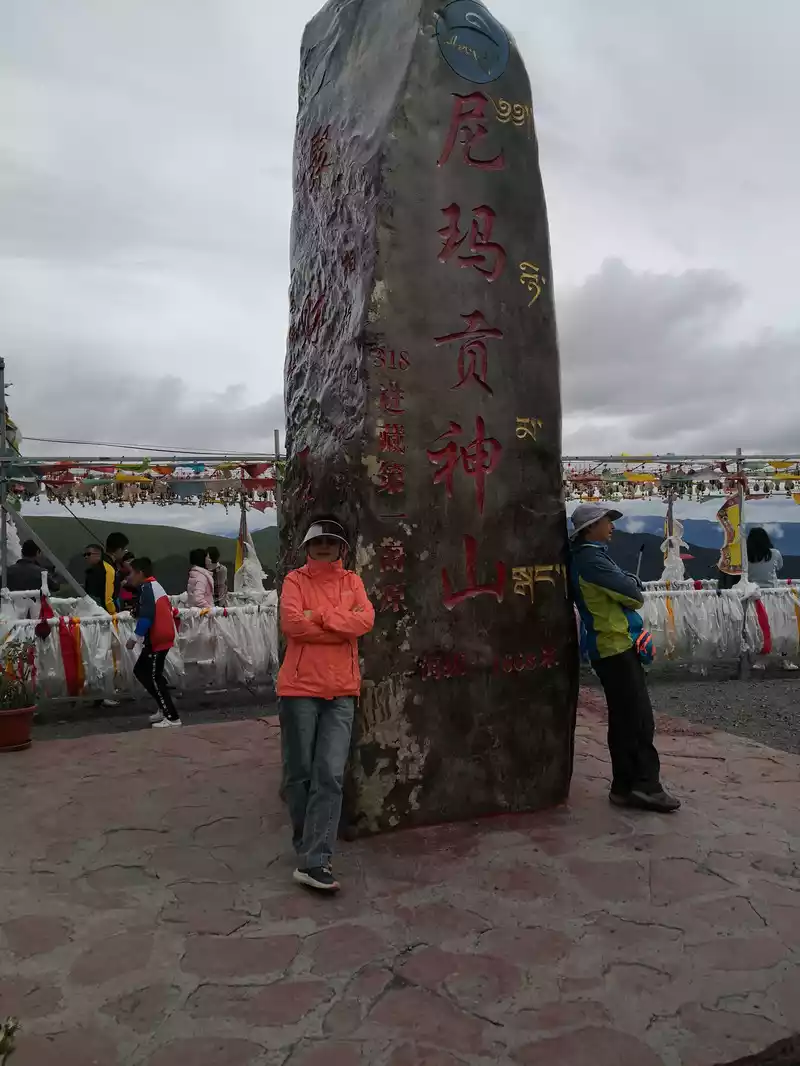 Nimagong Sacred Mountain
 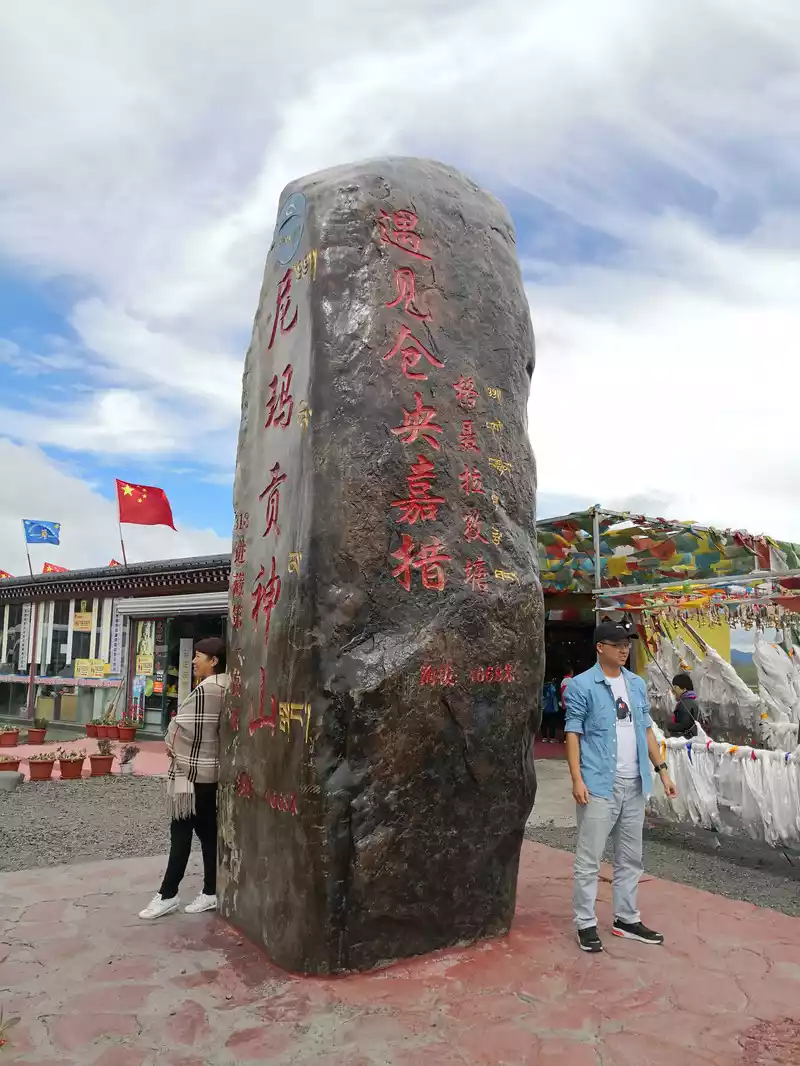 Nimagon Sacred Mountain
 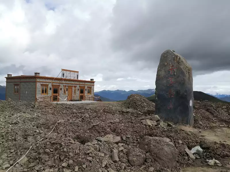 Kazira Pass. Under reconstruction
 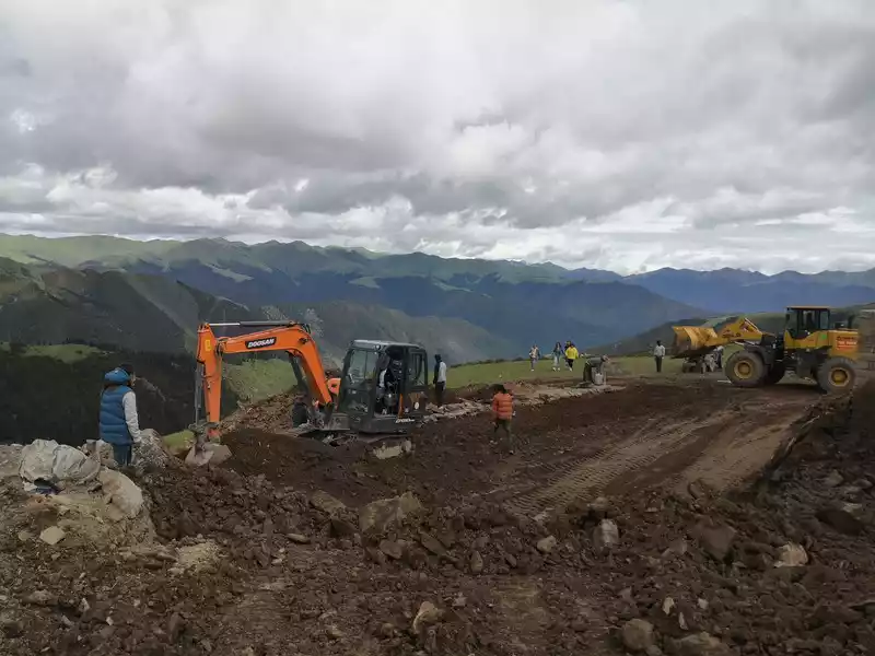 Kazira Pass. Under reconstruction
 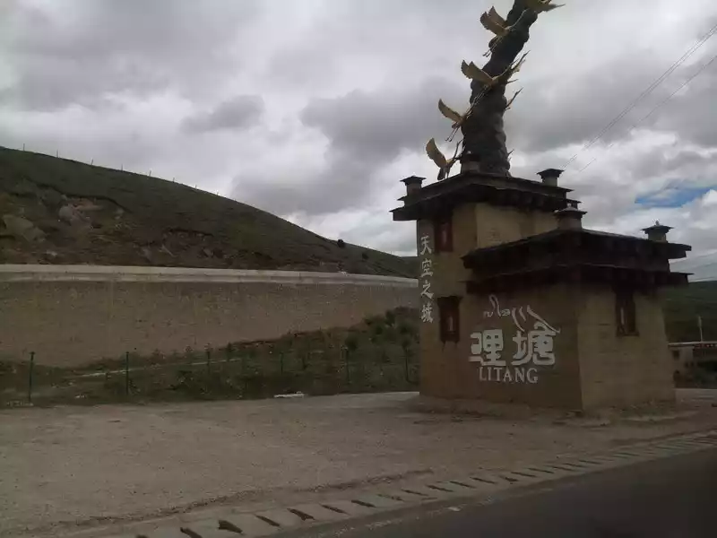 is about to enter Litang County, on the side of National Highway 318
 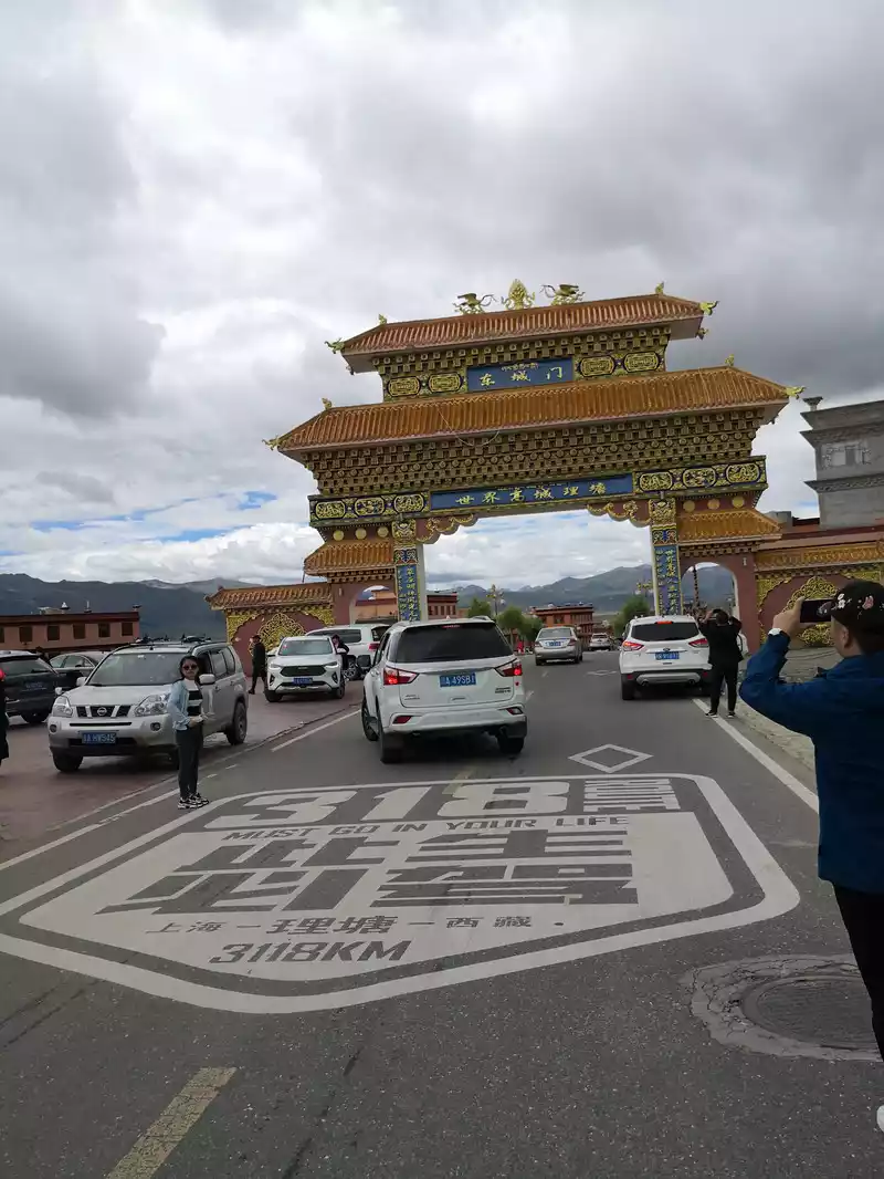 East Gate of Litang County, National Highway 318 A must-drive in this life!
 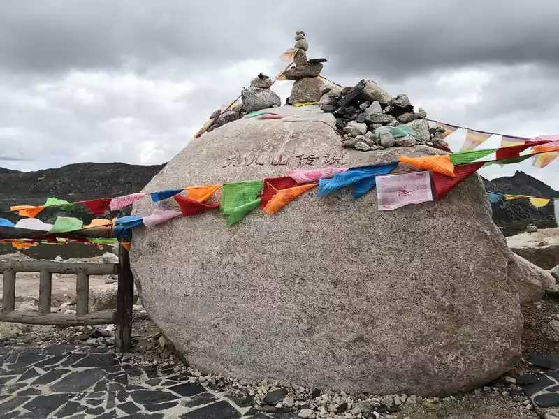 Rabbit Mountain, 4696 meters above sea level
 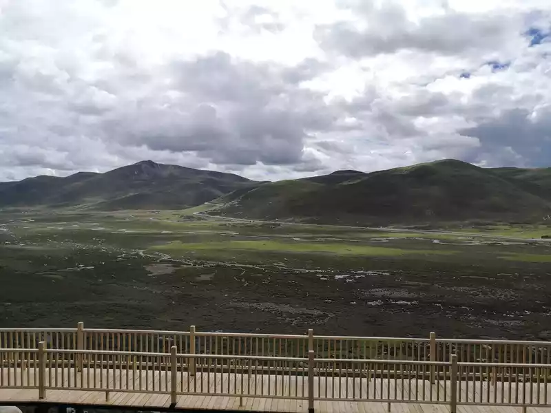 There is a viewing platform not far down from the Rabbit Pass
 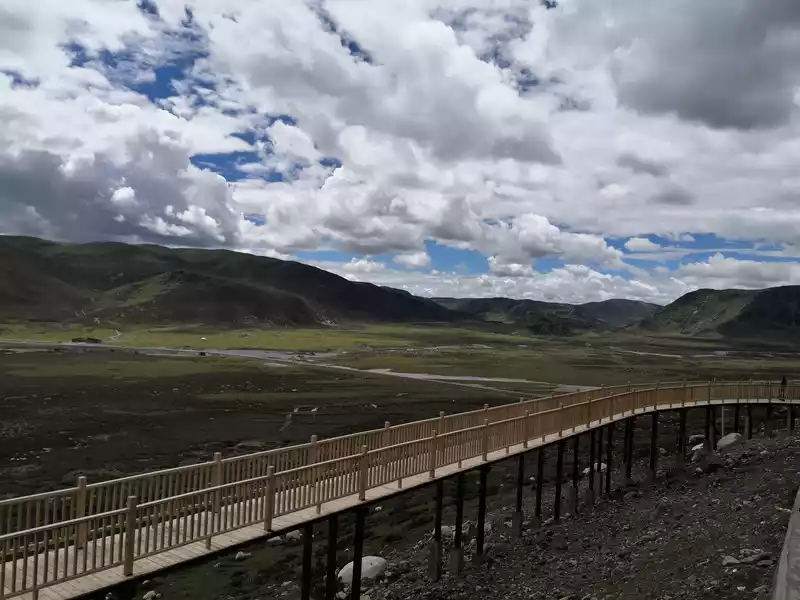 There is a viewing platform not far from the Rabbit Pass
 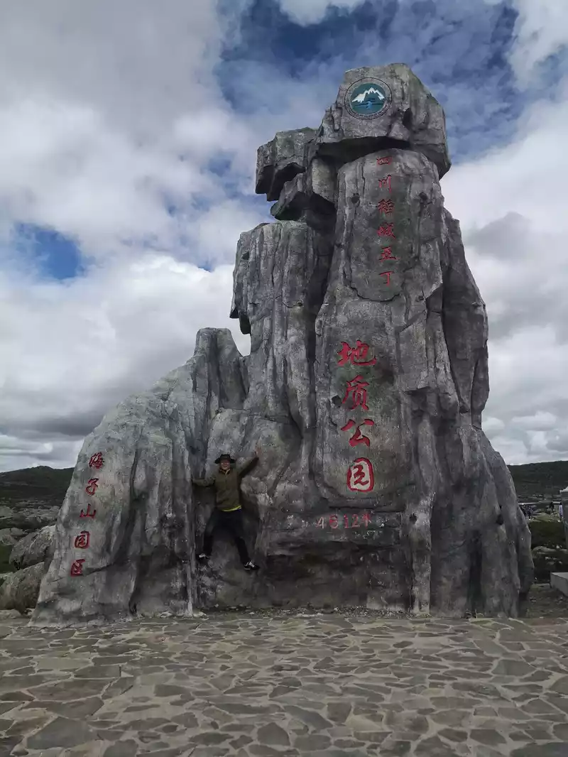 Haizi Mountain, 4612 meters above sea level
 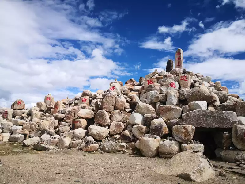 Haizi Mountain, the world's oldest ice remains.
  Poise Hill Service Station
 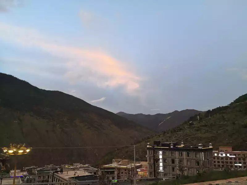 Arrive at Shangri-La Town, sunset
 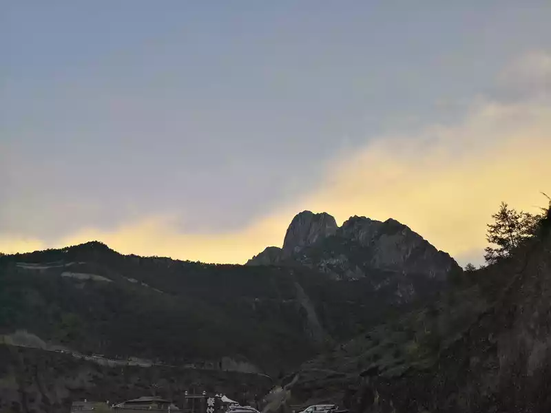 Sunset in Shangri-La Town.Opposite is the Cowherd Sacred Mountain.
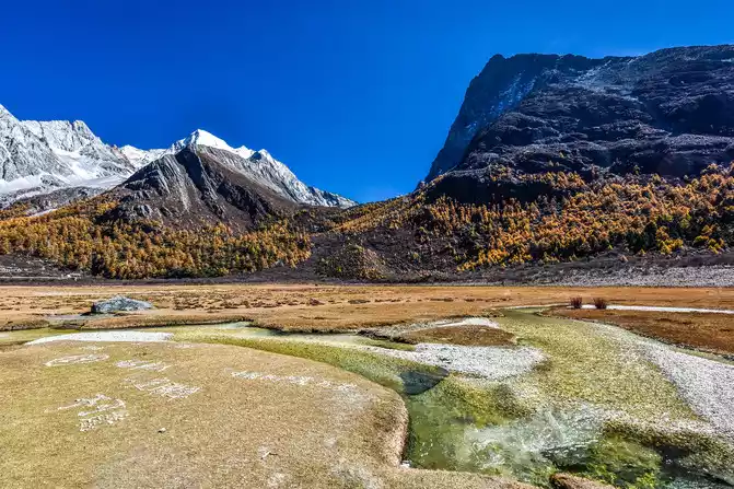
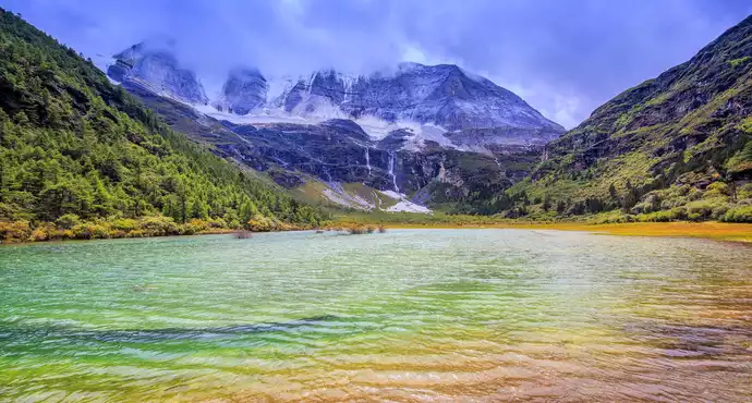
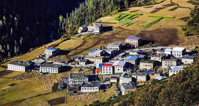
 to take a sightseeing bus and get off at Zhaguan, pass through Chonggu Meadow and Chonggu Temple to the Pearl Sea to get close to Xiannai Day, one of the main sacred mountains of the Three Pillars. The entire short line is 3 kilometers round trip, which takes two or three hours. Because the time was not rushed, we set off for the visitor center at eight o'clock in the morning, and the weather was good today, and the sun came out. We bought tickets online, and we only need to scan our ID card to enter. After entering, I took a sightseeing bus for an hour, this hour is really a hell of the body, because the car is driving on a total of more than 200 180-degree curves, I have never felt some discomfort in people who have never received motion sickness, the car has been climbing up, after crossing a mountain, the three main sacred mountains of Xian Nai Ri and Charlotte Dorji are presented in front of our eyes, the top of the mountain is covered with snow, their tallness and majesty are full of praise, at this time enjoying the paradise of the eyes, throwing aside the discomfort. We passed through the smallest village of 8 households, called Yeerhong Village, and then drove flat through several mountains, gradually descending the mountain, and when we went down, we could see the Aden Village located halfway up the mountain, Aden Village is 34 kilometers away from Shangri-La Town, and the Aden Nature Reserve is named because it relies on the village, known as the "last Shangri-La". The small village is hidden between snow-capped mountains and forests, surrounded by undulating desolate mountains, and against the blue sky, the outline of the mountains is blue and black. At the end of the valley, the majestic Xian Nai Ri Snow Peak is bathed in the sun without reservation, concise and steep, like a few stick figures outlined. There are 28 households in the village, and the placement of each hidden house is very casual, but if you look closely, you will feel that they seem to have been carefully designed by the master and coordinated with nature. Around the Tibetan village, the flat highland barley also seems to be carefully arranged, all the way to the steep end of the hillside, faithfully decorating the beauty of Aden Village. Accommodation can also be in Aden Village, where you can see a different bright starry sky at night if the weather is good. The car went down the mountain, down to the mountain pass, and reached the end of the sightseeing bus to collapse, where people took out oxygen cylinders to take oxygen, afraid of high reactions, our family was fine, there was no reaction. Starting from Zha Guanbeng, we walked along the wooden plank road, with tall vegetation and gurgling snow-capped mountains and flowing water on both sides, and occasionally Buddhist murals on the large stones on both sides, with bright colors and vivid images. It may have taken more than ten minutes, we came to Chonggu Meadow, which is also a tourist rest stop, if you take a long line, you can take a battery car here, and take a short line and walk forward. As soon as you arrive at the ancient meadow, there is a large green grassland in front of you, and the Shenshan Charlotte Dorji stands on the opposite side, majestic and spectacular. Charlotte Dorjee means "Vajra Hand Bodhisattva", representing bravery and strength. On the right is the golden Chonggu Temple, Chonggu Temple occupies the best geographical location in the Aden Nature Reserve, standing in front of Chonggu Temple, with an almost exaggerated blue sky on top, green and yellow grass under your feet, in the distance is a thousand-year-old snow-capped mountain, and behind you is a canyon that has been sleeping for ten thousand years. Behind the ancient temple is the Xiannai Ri Sacred Mountain, which means "Guanyin Bodhisattva", representing kindness and kindness. This sacred mountain is like her representative, generous and majestic, capable of accommodating everything in the world. We headed towards Chonggu Temple, visited the temple for a while, and continued towards the Pearl Sea (Dolma Latso), the road became steep, and we obviously slowed down, because climbing the mountain at high altitude is not easy. Stopping and walking, we finally came to the Pearl Sea. The Pearl Sea, known as "Dolma Latso" in Tibetan, is a sea formed by the melting snow of Xiannai Day. The sea of pearls in the dense forest is like an emerald inlaid on the lotus throne, rippling blue waves, sparkling waves reveal infinite beauty, around the lakeside, the ginseng is like a screen, and the Xiannai Ri Sacred Mountain next to it is reflected in the lake, which is dazzling. There are cryptographic flower squirrels everywhere in the green vegetation along the way, they are not afraid of people at all, a squirrel is still running around on the railing of the plank road, it looks very cute, a little boy feeds it with a mineral water bottle to drink, and people and animals live in harmony. Coming down from the Pearl Sea, we came to the rest stop, which was almost sold out, and we could only take out our own things to simply satisfy our hunger.
After a period of rest, we came to Chonggu Meadow. The large meadow looks like green cotton, soft and delicate, the snow melt water flowing down the snow-capped mountains forms a small stream here, shuttling through the meadow, the water flow is clear, inadvertently touched, so cold, really snow water, in such a beautiful scenery, we stop and go, while admiring and feeling, as the saying goes, "life is not for rushing, but to feel the road", isn't it? On the way back to the Chonggu service station, there was also a cryptographic squirrel that followed us for hundreds of meters, and I think it must want to see our world with us! After the whole short-term tour, it was nearly four o'clock in the afternoon, we took the sightseeing bus back, returned to the visitor center at nearly five o'clock, because we didn't eat at noon, we chose a soup pot restaurant early, ate their matsutake mushroom stewed pork ribs, the taste was really good, the boss's attitude was also super good, and he sent a beef ball worth 38 yuan, I had to like one.
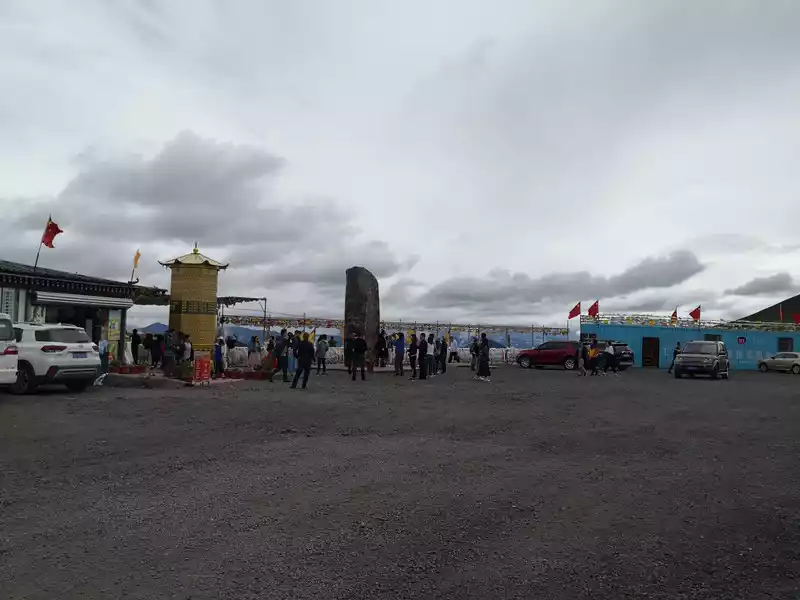
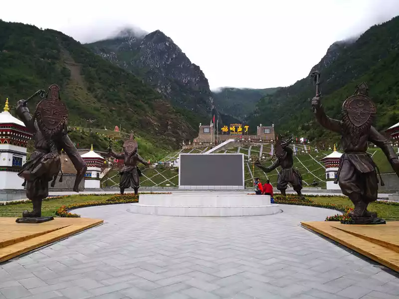
 Daocheng Aden Scenic Area Square.
 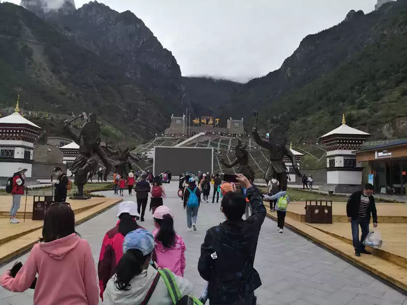 Daocheng Aden Scenic Area Square.
 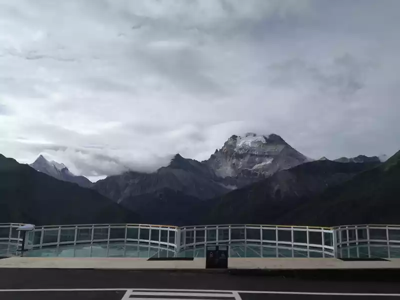 Depart from Daocheng Aden Scenic Area and go to Chonggu Temple and Xiannai Ri. Scenery on the way
 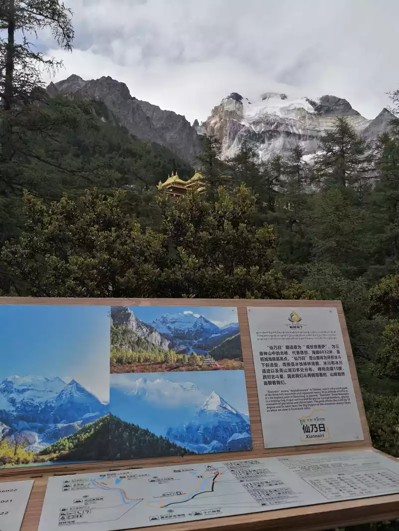 Depart from Daocheng Aden Scenic Area and go to Chonggu Temple and Xiannairi. Scenery on the way
 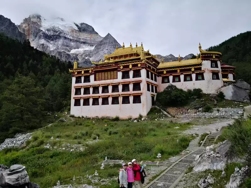 Chonggu Temple
 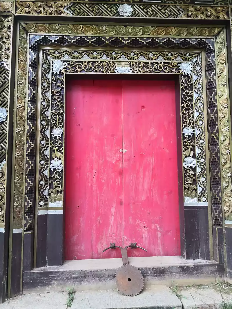 Chonggu Temple side door. Walked up dozens of steps, red ones, chic door locks.
 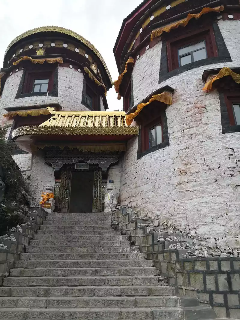 Chongguji Temple Gate
 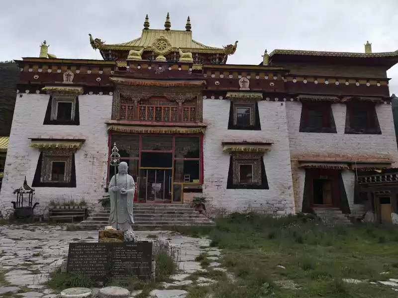 Inside Okikoji Temple
 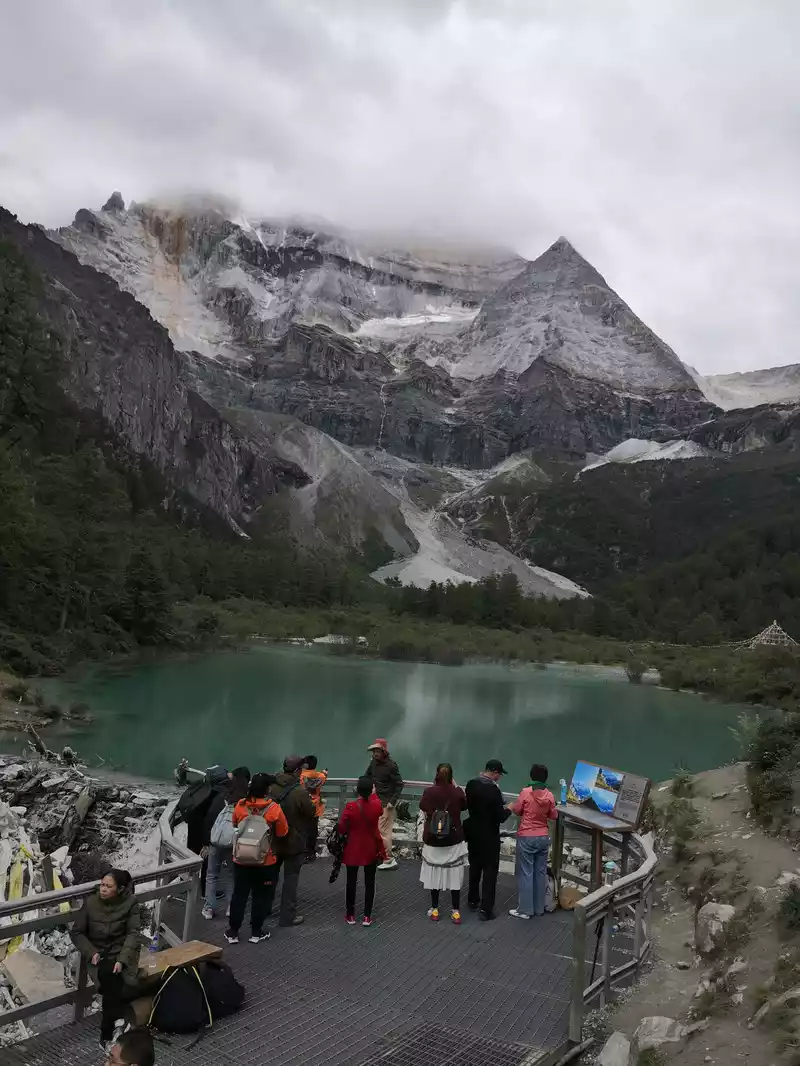 Immortal day
 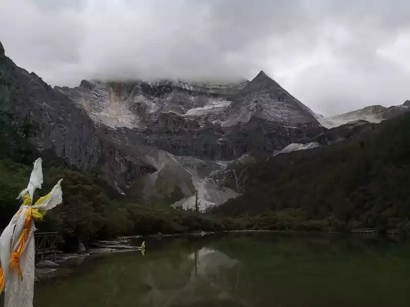 Immortal Sun, Pearl Sea
 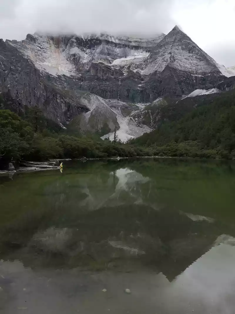 Xiannai Sun, Pearl Sea
 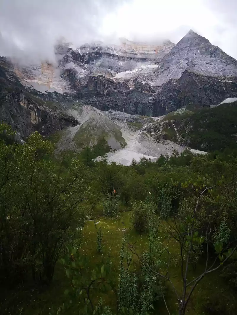 Immortal day
 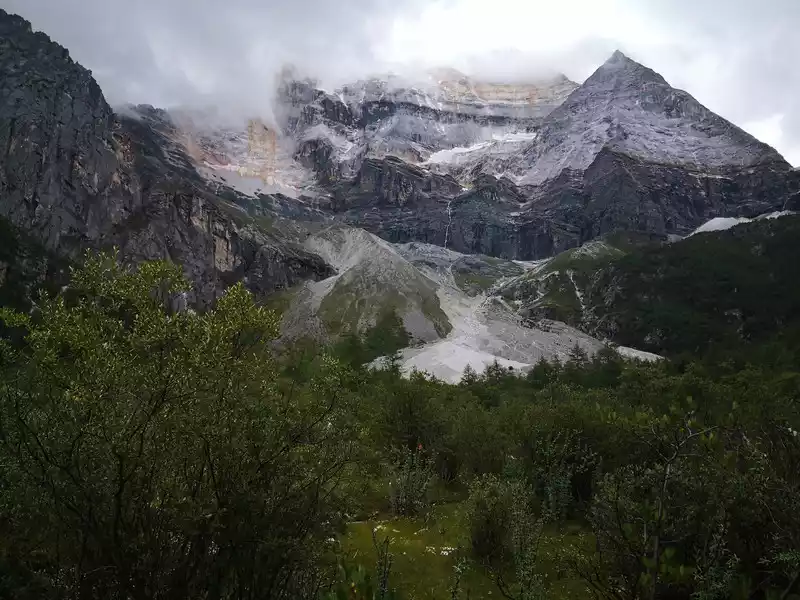 Xiannairi
 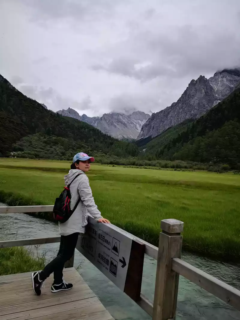 From the Sennai Sun, we walked around the Chonggu Meadows.
 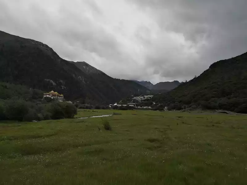 From the sun of the Sensei, we walked around the ancient meadow. On the left side of the picture is Okikoji Temple, and on the right is the sightseeing bus ride point
  Dinner.Matsutake mushroom chicken soup, delicious August
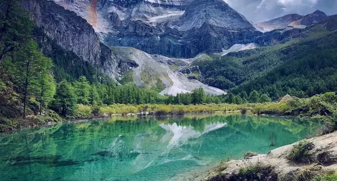
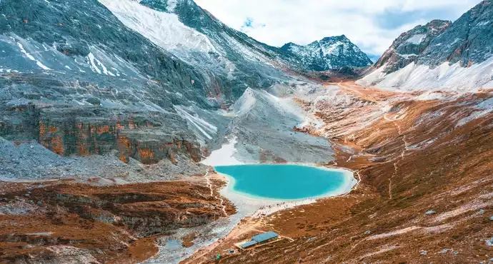
 The long line is to take a battery car to Luorong Cattle Farm in Chonggu Meadow, and then start to hike 5 kilometers to the final point, which is also what we are looking forward to, the most beautiful milk sea and five-color sea. But today the weather is beautiful, and the sun shines on the snow-capped mountains. The beginning of the trip was still to take a sightseeing bus like yesterday, arrive at Zha Guanbeng, walk to Chonggu rest station to buy a ticket and take a battery car, and after a 20-minute drive to Luorong Cattle Farm. When I came to the Luorong Cattle Farm, it was 9:30 a.m., and when I looked up, I saw the Yangmai Yong Sacred Mountain in the Three Lords of the Sacred Mountain, which means "Manjushri Bodhisattva", representing wisdom. The large grassland below is dotted with small golden flowers, green, yellow and snow-capped mountains are mixed, and the beauty of the world is presented here. The further you go, the more the pace of climbing, the higher and higher the altitude, the steeper and steeper, the first section of about 2 kilometers can be ridden forward, but we still give up because we are afraid that the horseback riding will increase the height. Our family encouraged and supported each other to move forward, uncomfortable, stopped to take two breaths of oxygen, and looked at the beautiful and spectacular scenery along the way, so that we came all the way to the desperate slope, this slope was extremely steep, we had to take our time, finally climbed to the top of the slope, I thought victory was just around the corner, but when I looked up, there was a higher steep slope, the mood at that time could not be described in words, give up, not reconciled, continue, looking at the towering hillside, I was a little afraid. But life is like this, whether it is good or bad, you have to make a choice that you think is appropriate at the moment, so our family chooses to continue. There is a fork in the road on the Despair Slope, a flat road on the left leads to the Milk Sea, and a steep road on the right leads to the Sea of Five Colors. We choose to be bitter first and then sweet, and walk the five-colored sea. On the way to the top, the second sister suddenly shouted loudly, and I looked up and saw that two rock sheep were running fast on the opposite mountain. I was about to pick up my DSLR to take a picture of them, but they were long gone. After a short period of excitement, we reached the top of the mountain and saw a sea, but not a five-colored sea, we took a short break and walked forward, and the five-colored sea appeared in front of us. The five-color sea is also known as Deng Chongcuo, the relic sea also means auspicious sea, the five-color sea is named after the refraction of light, its real name is "Shan Zengcuo", it is located between Xiannai Ri and Yang Maiyong, at an altitude of 4,700 meters, the lake surface is round. The snow-capped mountains reflect the lake, presenting fantastic colors. While admiring her beauty, it rained lightly, and the raindrops fell on the water, like jumping elves, moving on the sacred lake, but the rain stopped after a while. Standing on the slope and looking down to the left, a milky blue, moon-like sea appeared in front of us, she was the sea of milk. Milk Sea, also known as Orongcuo, 4,500 meters above sea level, ancient glacial lake, shaped like water droplets, surrounded by snow-capped mountains, the lake water is clear and blue, and is famous for its exquisite and elegant water color emerald blue. The milk sea is in the shape of a scallop in the mountain hollow of Yangmaiyong, with blue snow water in the middle and a circle of milky white surrounded by this circle of milky white, which is roughly the origin of the name of the milk sea. The water near the shore is slightly black, and the bottom is the deposition of ancient plants, the light green area inside, and the deep blue water surface, which is translucent. The sea flows slightly, and the sunlight keeps passing over it through the clouds, so it also changes its brilliance like a jewel, sometimes gloomy, sometimes dazzling, sometimes erratic. The edge of the sea is filled with patches of meadows and broken leaves, soft, like a green flannel, carefully caring for this gem. The meadow is surrounded by hard stone walls and sand and gravel beaches, which are particularly cold. She is like a plateau pearl guarded by Yang Maiyong. We went down to get close and appreciated her beauty around the sea of milk. There is beauty from all angles, there is no superfluous language, only the sound of the SLR camera "clicking", which is a cheer for her beauty. At about three o'clock in the afternoon, we walked back, and the way down the mountain seemed easier and shorter. When we were about to arrive at the Luorong Cattle Farm, we once again saw the two rock sheep we saw on the five-colored seamount on the roadside slope, and now they were very well-behaved, allowing us to keep filming and watching. Going down to the cattle farm, Yang Maiyong's whole picture became clear, allowing us to admire her to the fullest. Today's itinerary can be described as "hell of the body, paradise of the eyes", go back to the hotel to have a good night's sleep, and maybe you can still dream of the rare beauty of this life!
 I got up early today and went into the mountains again. Empty square
 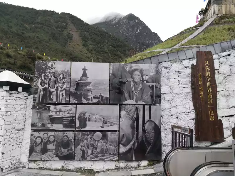 I got up early today and went into the mountains again. Daocheng Aden is also the filming location of the movie "Passing by Your World".
 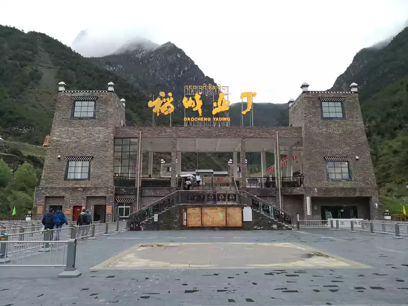 I got up early today and went into the mountains again. Empty square
 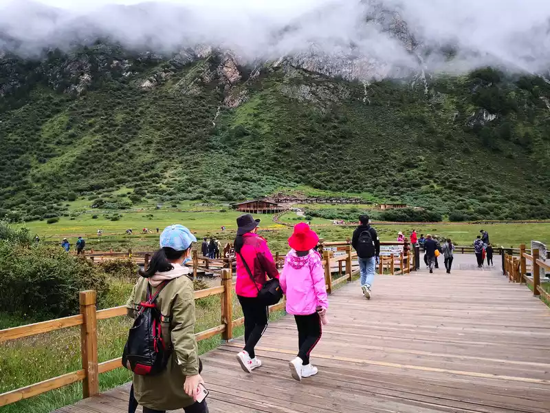 Take the sightseeing bus, arrive at the Luorong Cattle Farm, and start to stop after getting off the bus. The opposite building is the Luorong Cattle Farm Aden Station.
 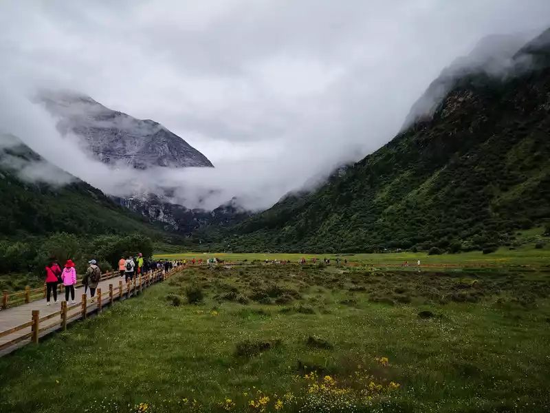 Los Angeles Cattle Farm
 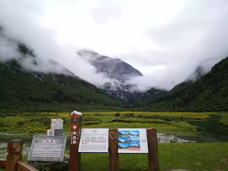 Los Angeles Cattle Farm. Opposite is Yangmai Yong Sacred Mountain.
 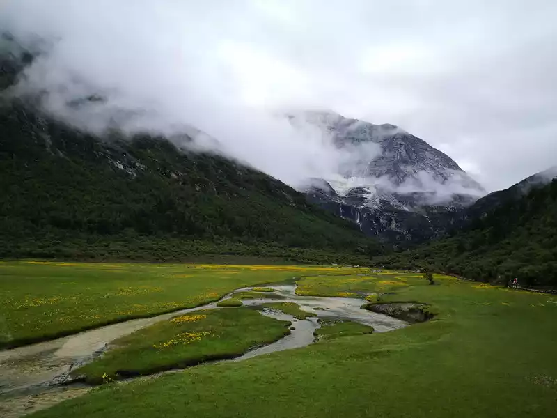 Los Angeles Cattle Farm. Opposite is Yangmai Yong Sacred Mountain.
 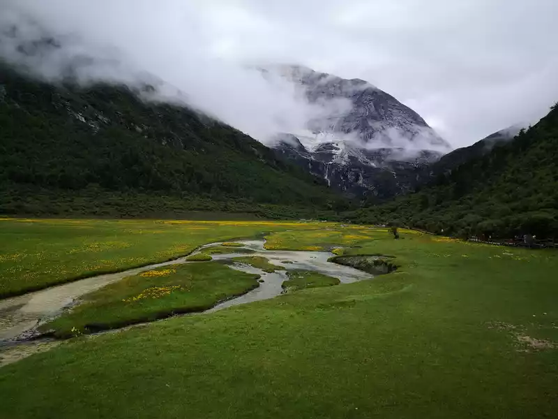 Los Angeles Cattle Farm. Opposite is Yangmai Yong Sacred Mountain.
  Los Angeles Cattle Farm. Opposite is Yangmai Yong Sacred Mountain.
  After many hardships and mountains, we finally came to the Sea of Five Colors and the Sea of Milk. We thought this lake was a five-colored sea, but the goose was not, and the five-colored sea was 400 meters away. But this lake is also beautiful.
  After many hardships and climbing over many mountains, we finally came to the five-colored sea and the milk sea. We thought this lake was a five-colored sea, but the goose was not, and the five-colored sea was 400 meters away. But this lake is also beautiful.
 After many hardships and mountains, we finally came to the Sea of Five Colors and the Sea of Milk. We thought this lake was a five-colored sea, but the goose was not, and the five-colored sea was 400 meters away. But this lake is also beautiful.
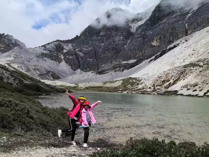
 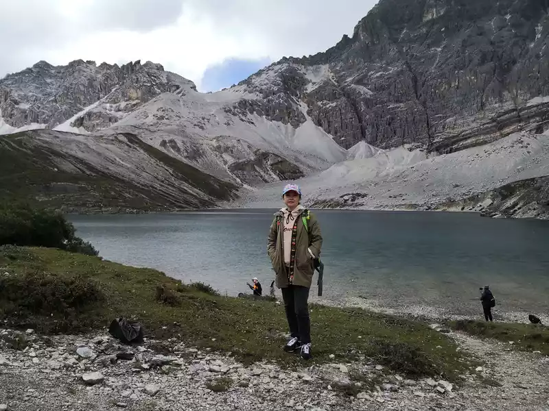 This is the five-colored sea, very beautiful. Pictures can't express its beauty!
 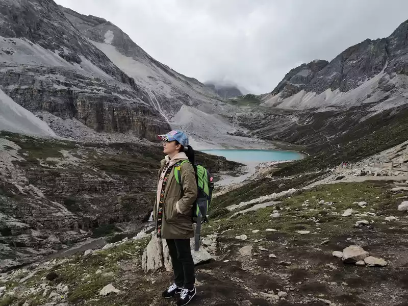 Head to the Milk Sea, which is a vista.
 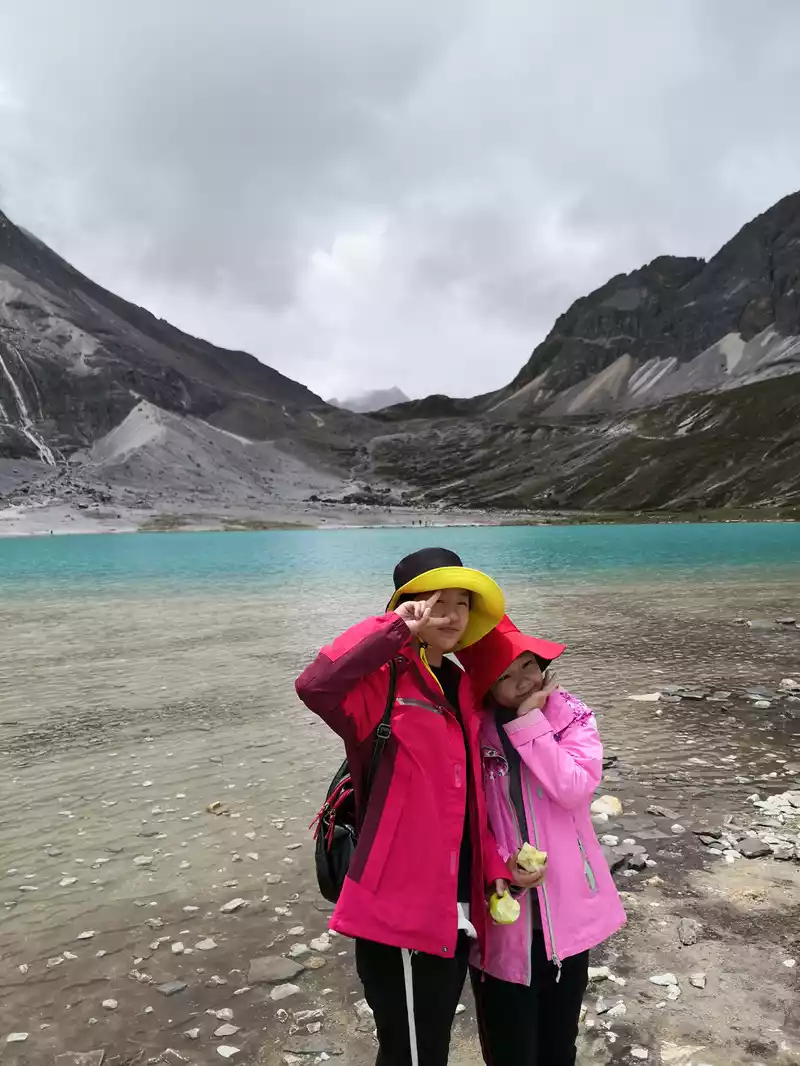 Sea of Milk. The view is stunning!
 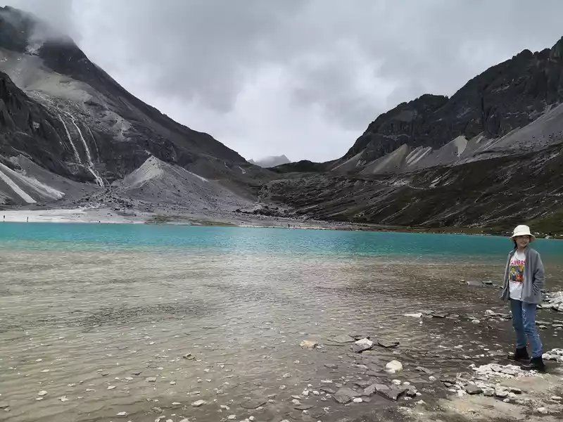 Sea of Milk. Beauty...... Touch your heart!
 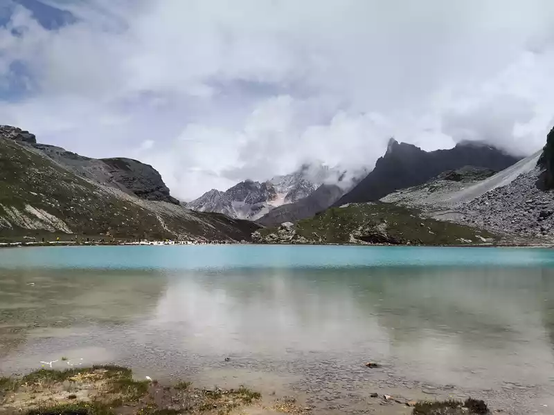 Sea of Milk
 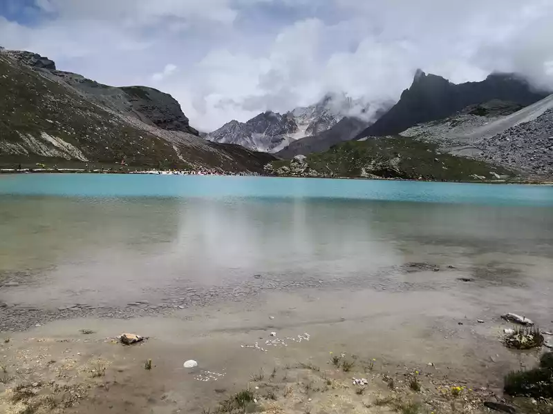 Milk Sea
 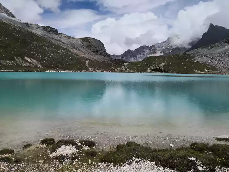 Sea of Milk
 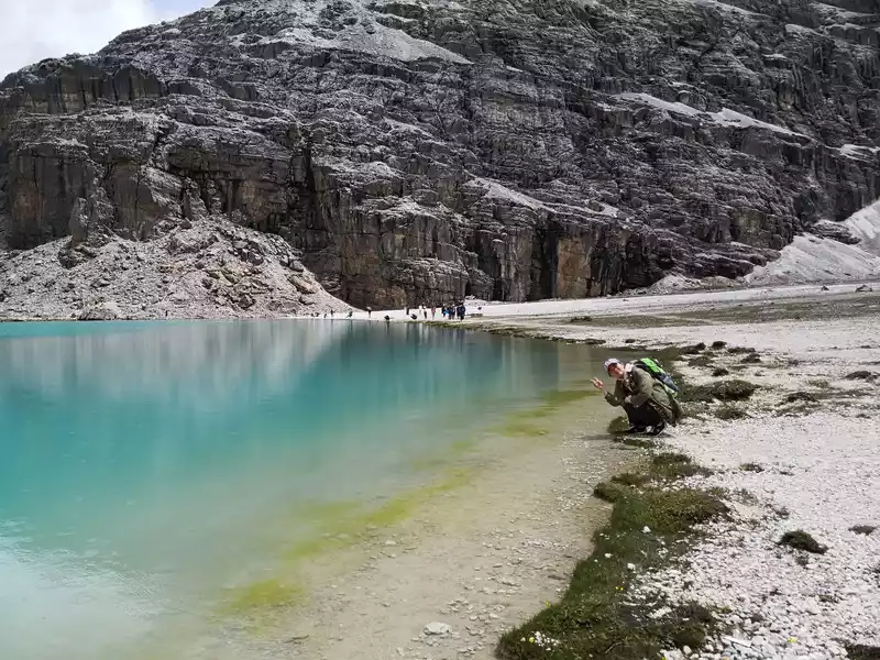 Sea of Milk
 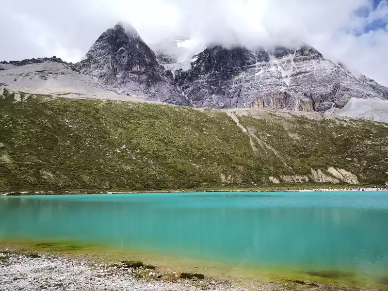 Sea of Milk
 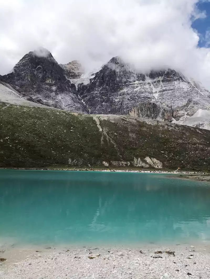 Milk Sea
 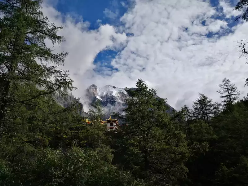 On the way back to Shangri-La Town, pass by Chonggu Temple again. The sun came out, the clouds dispersed, and the golden light of the ancient temple was shining, and the Immortal Sun Sacred Mountain showed its complete face.
 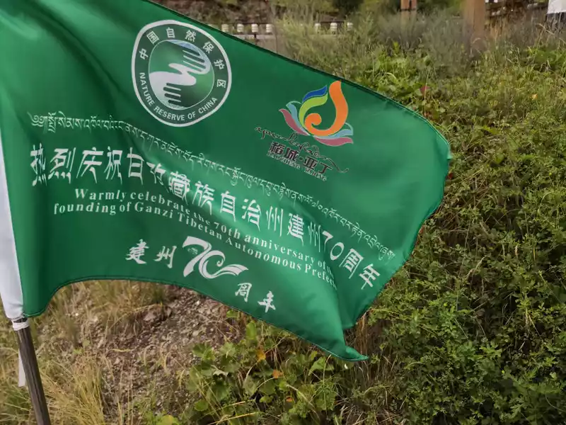 The 70th anniversary
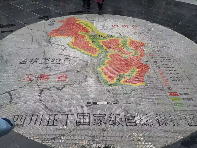
 of the founding of Ganzi Tibetan Autonomous Prefecture
feel the beautiful scenery along the way again, and I cherish it very much, because I don't know how long it will take to enjoy his beauty next time. In Yajiang County, which is close to Xinduqiao, we also bought some matsutake mushrooms on the road, which looked good.
 Shangri-La Town in the early morning.
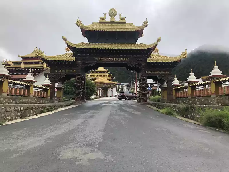
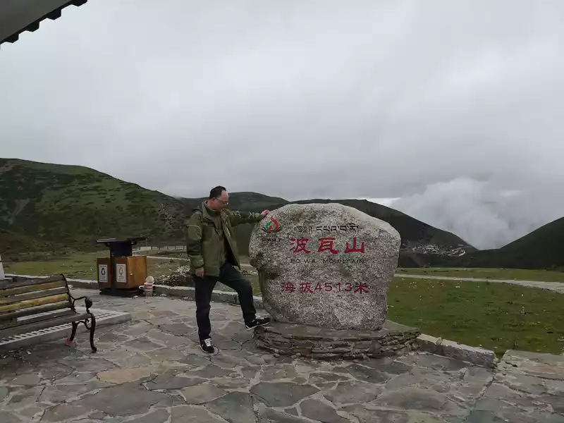 Mont Poise Service Station. In the distance on the right side of the picture is Rewu Temple.
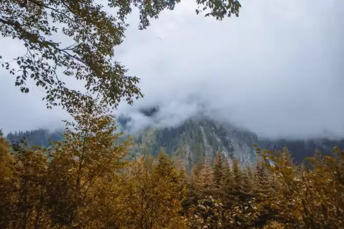
 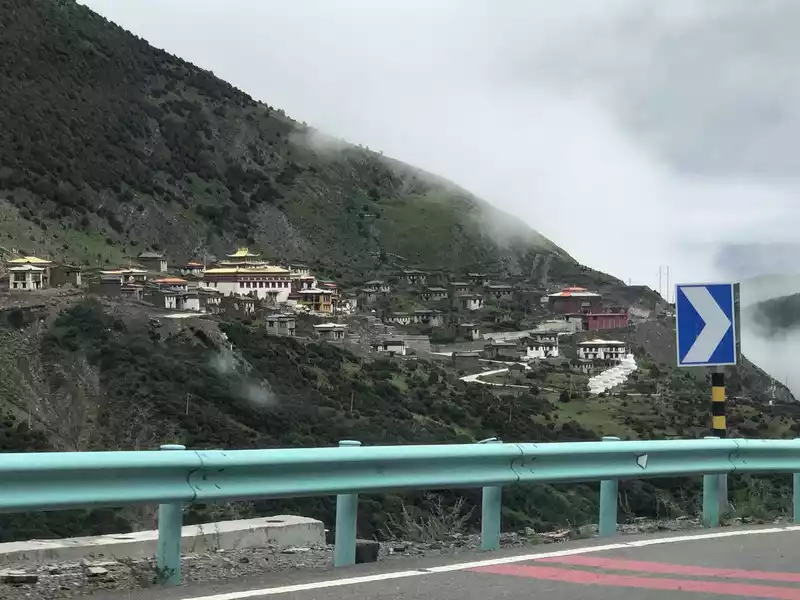 Rewu Temple, located in Sera Township, Powa Mountain, Daocheng, opposite Powa Mountain, is suitable for viewing from a distance. Rewuzang means "where the jar is broken, that is, the place where the temple is built". Legend has it that a high monk of the Pazhu Kagyu (White Sect) Dalong Sect was ordered by his master to carry an earthen jar on his back, find a site to build a temple, and named it after the place where the earth pot he carried on his back was broken. The temple was built at the end of the Southern Song Dynasty, with a history of more than 600 years, and there are two Rewu temples, the upper Rewu Temple is the White Sect, and the Lower Rewu Temple is the Flower Sect. In these two temples of different denominations, the monks live in harmony and the monks' houses are staggered, which is unimaginable elsewhere.
 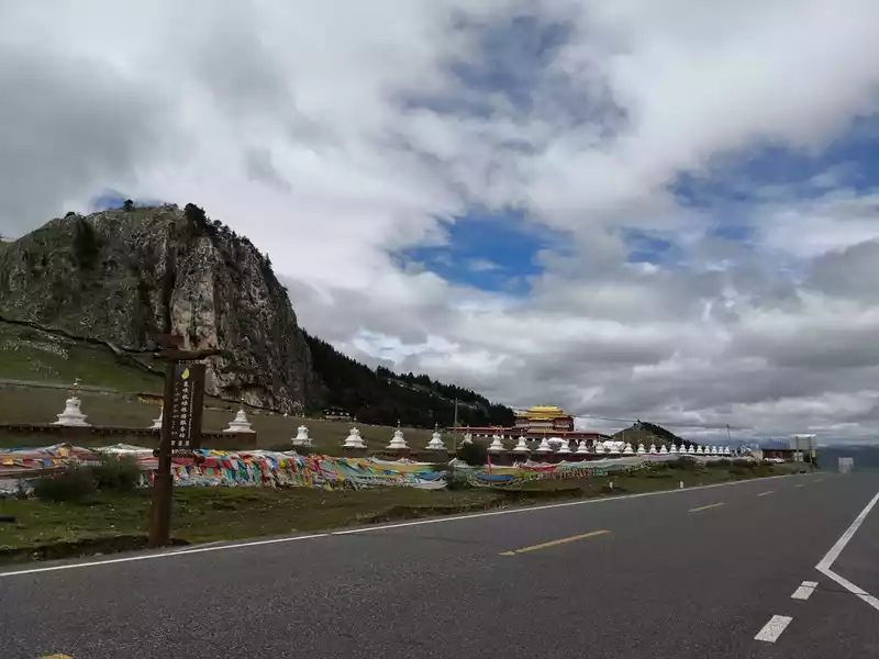 Passed by many temples, this is another temple, forgot the name
  Lunch on the grass by the side of the road at noon. Quick hot rice. Next to it is a military radar station (I won't stick it here).
  Come to Nimagong Sacred Mountain again
 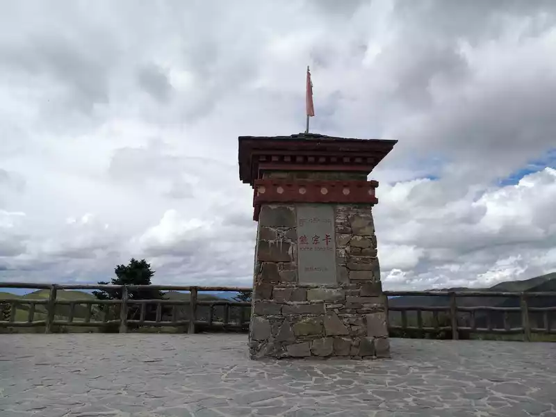 Xiong Zongka Service Station
 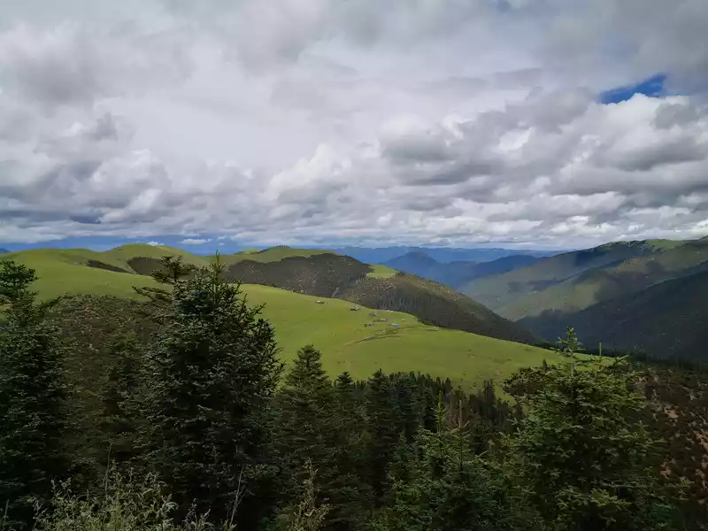 The grassland next to the Xiong Zongka service station
 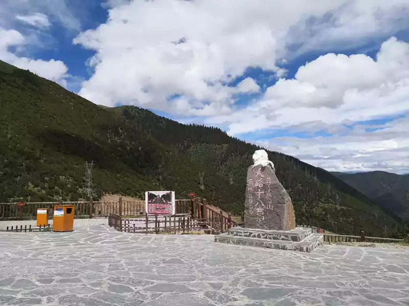 Scissors bend the mountain. Eighteen bends of the heavenly road
 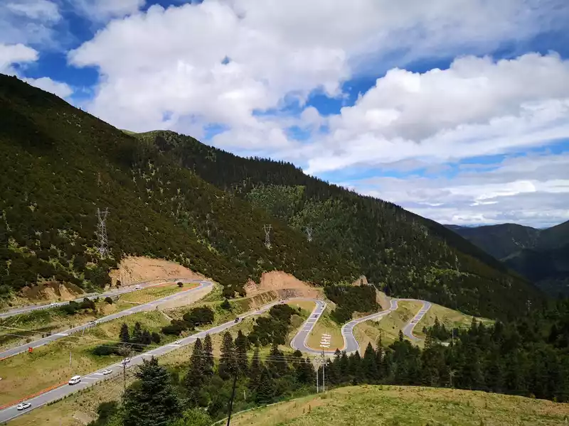 Scissors bend the mountain. Eighteen bends of the heavenly road
 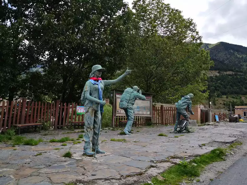 Sculpture on the side of the road.
 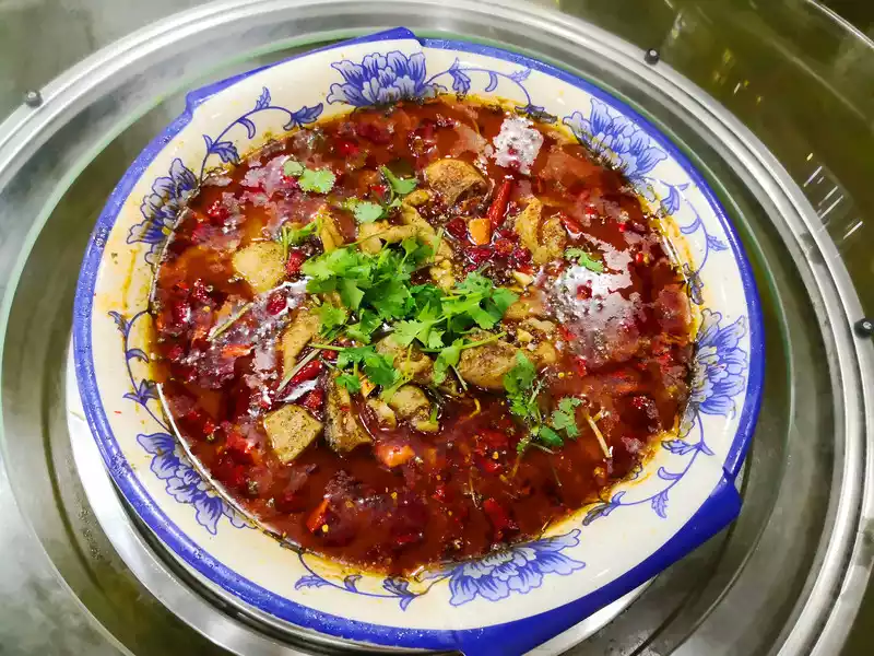 Dinner in the town of Xinduqiao. Internet celebrity restaurants eat spicy boiled fish, and the taste is okay.
 because the section from Xindu Bridge to Zheduo Mountain was under traffic control, and we set off at half past six in the morning. Because we didn't stop too much in Zheduo Mountain when we came, this time we played for a while at the Zheduo Mountain Pass Snow Viewing Platform, and there were few people at half past seven, so that we could enjoy it quietly here. We braved the cold wind and looked at the mountains and winding mountain roads in the distance from the top of the mountain at an altitude of 4,298 meters. We have been looking for distant places, in fact, all the beauty we pass by is far away. After a long drive, we returned home around 6 pm.
 Fold many mountain passes
 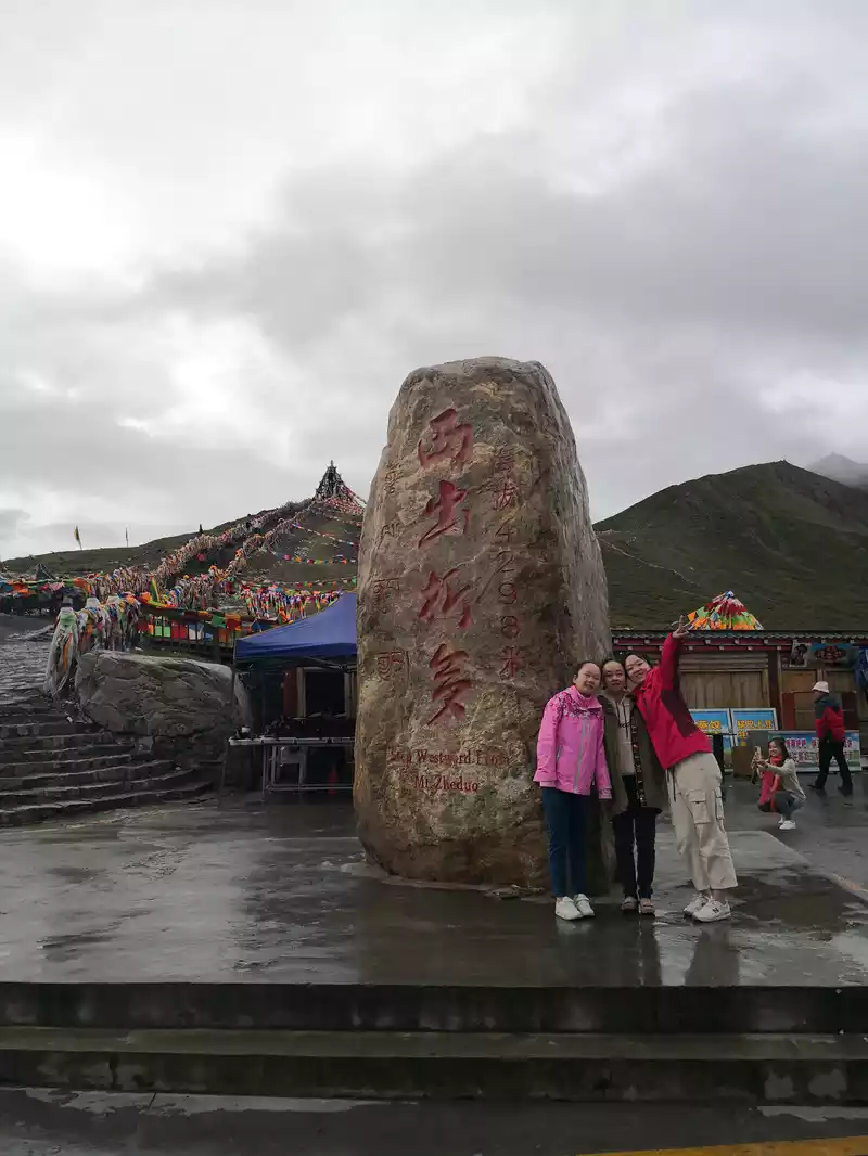 Fold the mountain pass
 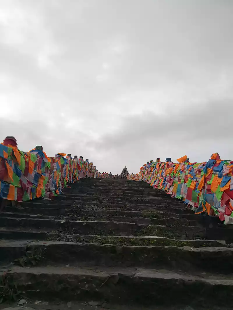 Fold the pass and walk up the steps to the top
 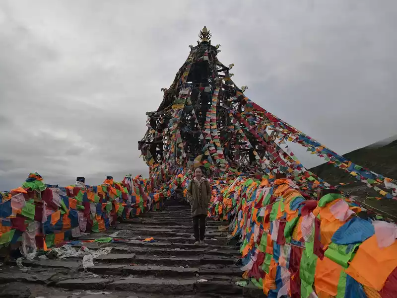 Zheduo Pass, the top of the mountain
 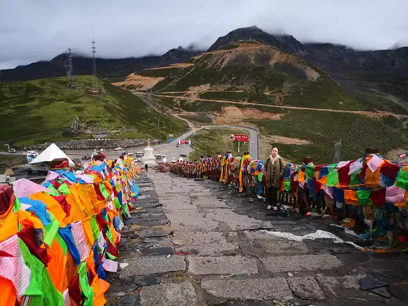 Zorita Pass, stand at the top of the mountain and look down
 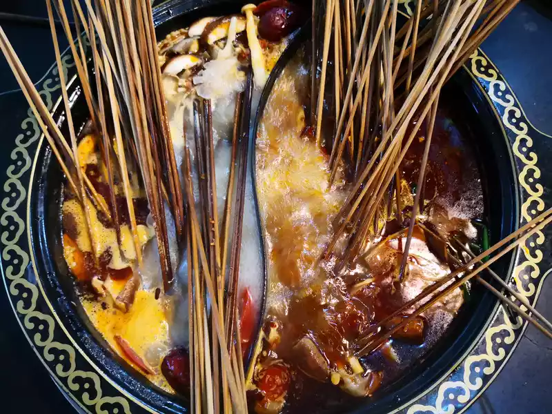 Return home safely. It was already dark, and there was no time to put down the luggage, and dinner was near the doorstep, and the familiar skewers were incense.
 I have to say that Daocheng Aden left a deep and beautiful impression on us!

Number of days: 3 days, Average cost: 500 yuan, Updated: 2021.06.05
Number of days: 3 days, Average cost: 700 yuan, Updated: 2022.07.19
Number of days: 3 days, Average cost: 7888 yuan, Updated: 2020.09.21


Number of days: 2 days, Average cost: 1200 yuan, Updated: 2020.09.20
Number of days: 4 days, Average cost: 1690 yuan, Updated: 2024.06.18
Number of days: 3 days, Average cost: 500 yuan, Updated: 2025.01.05