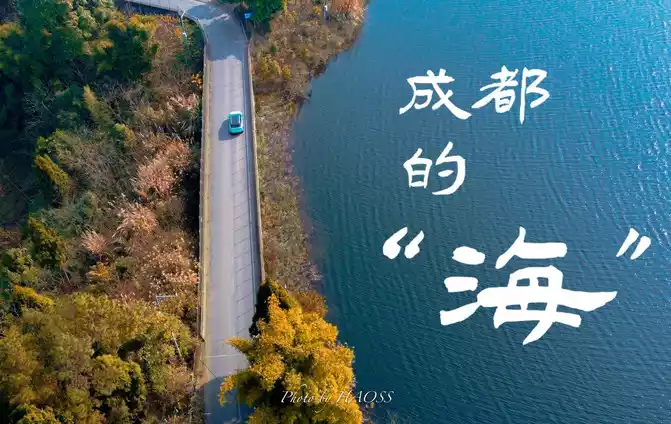
Live Your Best Lives
Regions passed: Chengdu > Ya'an > Luding > Moxi Town Hailuogou > Hongshitan > Kangding > Xinduqiao > Litang > Daocheng Shangri-La Town > Yading Village> Tagong > Bamei > Siguniang Mountain > Wolong > Yingxiu > Chengdu
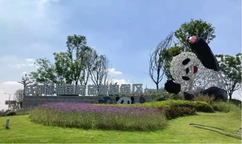
Departing from Shenzhen on July 13 (Saturday) and flying to Chengdu. Rented a tour charter with a driver. The driver picked him up at the airport and went directly to Daocheng. Daocheng Aden, Siguniang Mountain eight-day tour, comfortable 5-seater off-road vehicle. Departed on the 13th, returned to Chengdu on the 20th, and returned to Shenzhen in the late afternoon.
Itinerary points:
1. Self-driving, chartered car, and group: From Chengdu, the highway only goes to Yingxiu, and the road to Xinduqiao and the subsequent roads are all two-lane wide national highways or provincial highways. There are countless extended trucks on National Highway 318, so very good driving skills are required. From Xindu Bridge to Shangri-La Town, the mountain climbs over many mountains of more than 4,000 meters, including the 4,696-meter Rabbit Mountain, and many landslides. When the reflex is high, it is easy to have a headache and sleepiness, and it is not recommended to drive by yourself. It is also not recommended to join a group. The bus chassis is high, the air is not circulated, and passengers on the winding mountain road are like sitting in a cradle, and no matter how experienced the driver and passengers are, they will get motion sickness. Therefore, chartering a car with a driver is a good choice. Car rental. Eight days, 6,300 yuan, all the expenses of the chartered car, fuel, tolls, the driver's accommodation and labor services (generally the driver eats with us), insurance, etc., the car is the driver's own, affiliated with the travel agency, Honda SUV. Local tyrants can also choose Land Rover or Mercedes-Benz.
2. Weather:
In the plateau area, it usually rains at night. Before going, I checked the China Weather Network and the forecast was rain. But it really rained in Hailuogou, and it was at night. Aden is exposed to sunlight throughout the day. Therefore, before traveling, you don't have to bring a raincoat, and when you arrive at the local area, you can see the situation. They are sold in supermarkets.
3. Hotel reservation:
Many hotels do not have elevators, and climbing stairs is very deadly. Breakfast is usually only charged 10 to 15 yuan per person. Hotels are booked by themselves as much as possible, and those who rely on others to book are prone to all kinds of unnecessary troubles.
4. Aden Scenic Sightseeing Bus:
From the ticket office of the scenic spot to the sightseeing bus drop-off point, the altitude is from 2,900M to 3,800M. The diesel sightseeing car keeps turning around to climb/descend the mountain, and many passengers on the bus who claim to be old drivers have motion sickness, and every trip has motion sickness and vomiting. Therefore, it is useful to buy enough motion sickness patches at the pharmacy before traveling.
5. Horseback riding in Aden Scenic Area: Those who weigh more than 85KG are not allowed to ride mules and horses. There are scales on site.
6. Aden Scenic Area Sunscreen: At an altitude of 4,600M, a little sunlight will make the skin feel hot. Except for rain, of course. Sunglasses, hats...
7. Aden Scenic Area Coldproof: At an altitude of 4,600M, even if the sun is shining and the wind is slight, it is biting. In the plateau area, the weather is changeable. Therefore, a thick jacket is a must.
8. Trekking poles: Necessary for mountaineering, preferably two per person. Before leaving, you can ask the driver, many of them are prepared on board. You can also ask the hotel. Many tourists bought trekking poles locally, and when they left, they were too lazy to bring them back and stayed in the hotel. Go to Aden for a long time, don't think trekking poles are troublesome.
9. Carry medicines: Don't eat too much for dinner. It is best to have cold medicine, whole intestine pills, and motion sickness patches.
10. Altitude sickness: As long as you don't live in a plateau area, high altitude sickness is inevitable. At an altitude of 4 kilometers, you have to walk more than ten kilometers, and those who usually exercise a lot have a large lung capacity and a higher rebellion are more obvious. When there is a high reaction, the stronger the body, the more fragile it is. On the contrary, it's okay to have low blood pressure.
11. Itinerary plan: Online packages, you can increase the number of days, you only need to chat with the online service staff to make up the price difference. On the sixth day, I had to drive from Shangri-La Town to Danba County, plus parking on the road, which was estimated to take 11 hours, so I added one day, stayed at Xindu Bridge, and then went to Siguniang Mountain.
12. Charter fee: Online travel agencies let you just take a deposit of 400 yuan, and then pay the balance through other means, such as to the driver. It is recommended that you take a full picture directly to avoid the travel agency playing tricks. This kind of trickiness, once there is a dispute, such as an accident, it is difficult to claim. I offered to shoot the full amount, but the other party was very reluctant.
Day 1.13 Saturday Chengdu > Ya'an > Luding > Hailuogou/Moxi Town about 6 hours, 300 kilometers, 1,500M above sea level
Highlights of the day (passing through): Luding Bridge, Moxi Ancient Town, Hailuogou Hot Spring, etc.
Food: Beef soup, the local yak beef offal soup is good. Four people can order a small pot or a medium pot, usually adding two pounds of cooked yak meat to it. The amount is very sufficient, but unfortunately it is a plateau area, so it is best not to drink.
Altitude: Chengdu: 500M, Ludingqiao 1,700M, Moxi Town: 2,918M
Weather: Chengdu: 31°C/21°C Cloudy, Ya'an: 28°C/20°C Showers to light rain, Moxi Town: 24°C/16°C Rain at night
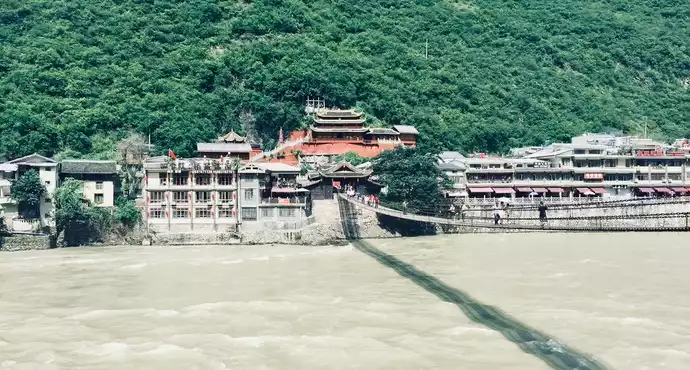
Itinerary: Fly from Shenzhen to Chengdu in the morning, land at ten o'clock, the driver picked us up at the airport at about eleven o'clock, and set off directly to Moxi Town.Eat lunch in Ya'an City at one o'clock. You can find old shops with good reviews on the reviews, and the pasta is very good. At three o'clock, I passed through Luding County and visited Luding Bridge. Very nice attraction. The local cherries are almost finished in mid-July. Shenzhen sells more than 90 catties, and local sales are 30-35, which is very sweet. Peaches are also good. Luding Bridge, the timid, especially the elderly, just take a look. The bridge cable is very shaky. It takes about 40 minutes to walk around the bridge. After shopping, I rushed to Moxi Town, and it was past six o'clock.
After checking in, you can go to the Red Army Long March Memorial Hall in the town. See with your own eyes the various equipment of the Red Army of that year, broadswords, muskets, the simplest rifles, Czech light machine guns and so on. How can the ruling authorities be honest and fair, strengthen team faith, and unite the people of all ethnic groups across the country to avoid the end of the national army. With such rudimentary equipment and a team of 30,000 people, defeating the national army with a full set of modern equipment is a lesson from the previous car and a lesson from the back.
Luding Bridge is located in Luding County, Sichuan Province, and is an iron cable suspension bridge across the Dadu River, which is an important passage from the interior of Sichuan to the Kangba Tibetan area. The familiar story of flying over the Luding Bridge in primary school Chinese textbooks is now you can feel its thrill for yourself.
The deck of the Luding Bridge is built with iron cables and wooden planks, and tourists can stand on the bridge, feel the rushing river water rushing from under their feet, and recall the revolutionary martyrs who charged here. After walking the Luding Bridge, you can also go to the exhibition hall at the bridgehead to visit the battle scene of "flying to capture the Luding Bridge" and receive patriotic education.
Luding Bridge was built in the forty-fourth year of the Kangxi Dynasty in the Qing Dynasty, and the three-character plaque of "Luding Bridge" was hung on the head of the bridge, and there is still a stele of Kangxi's "Imperial Luding Bridge" on the east side of the bridge. In May 1935, the Red Army's Long March reached here, and the commando team led by 22 warriors braved the rain of bullets and bullets, crawled forward along the iron cables, and eliminated the bridge to defend the enemy in one fell swoop, and the Red Army crossed the Dadu River. If you don't have the guts, you can cross the bridge. Many middle-aged women walk a few steps and return.
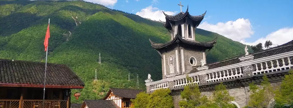
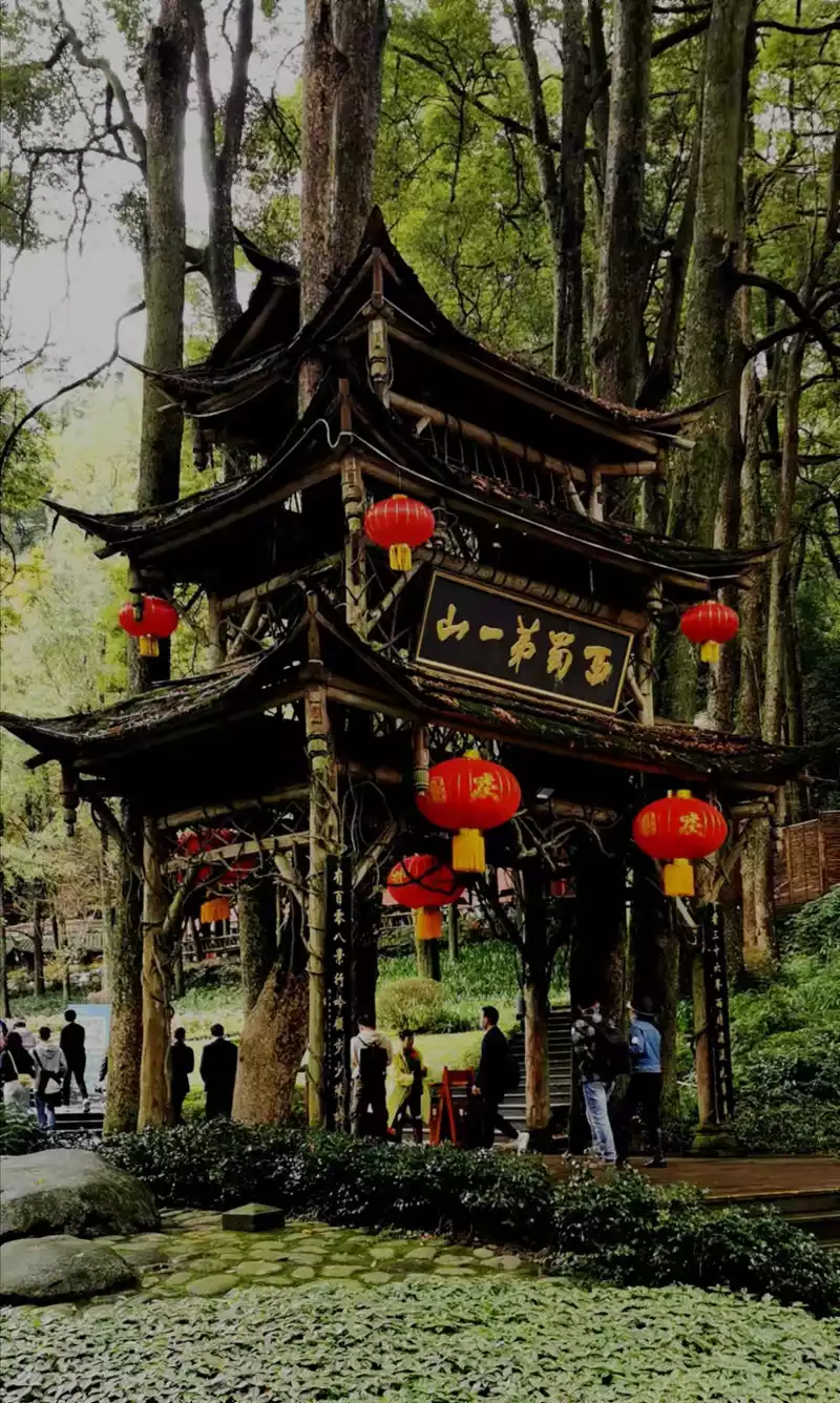
Moxi Ancient Town is located in Luding County, at the mouth of Hailuogou, which is the only place to enter Hailuogou Scenic Area, and is also famous all over the world because of Hailuogou. The ancient town has a long history, and most of the towns are ancient buildings of the Ming and Qing dynasties, especially one of the Gothic churches built by French missionaries, and the worship bells have been ringing for a century.
Moxi Ancient Town has a long history, since ancient times, it has been the settlement of Han, Tibetan, Yi and other ethnic groups, and most of the ancient buildings left over from the Ming and Qing dynasties in the town are simple and quiet. It is worth stopping in the town that the Gothic church built here by French missionaries back then, with a very different style, appearing in such an ancient town, although extremely different, but also has a unique flavor. The Moxi Catholic Church is famous not because it is a Catholic church in Tibet, but because of a meeting held here. The temporary garrison of the Red Army during the Long March was held here in 1935.
The Moxi Red Army Long March Memorial Hall is in the town, less than 50 meters away from the Long March Hotel.
On May 29, 1935, the Red Army, which had been marching continuously, arrived in Moxi Town, and at about 10 o'clock in the evening, Comrade Mao Zedong camped in the priest's room of the Catholic Church, and convened Comrades Zhu De, Zhou Enlai, Wang Jiaxiang, Zhang Wentian, Qin Bangxian, Chen Yun, and Deng Xiaoping, who arrived in Moxi on the same day, to hold a meeting, which was called the "Moxi Conference" in the history of the Long March. The Moxi Conference laid the foundation for the Ludingqiao Conference on May 30 and served as a preparatory meeting. Everyone knows what happened next, which is the famous battle of flying to capture Luding Bridge. If the Red Army had not captured the Luding Bridge, China's modern history would probably have to be rewritten. The 13 chains are responsible for the fate of the country.
Day 2.14 Sunday Hailuogou > Hongshi Beach > Kangding > Xindu Bridge about 4 hours, 180 kilometers, 3,300M above sea level
Highlights of the day (passing through): Hailuogou Glacier Park, Hongshi Park, Love Song City Kangding, Zheduo Mountain, Photography Paradise Xindu Bridge, etc.
Altitude: Xinduqiao 3,444M
Weather: Kangding: 20°C/12°C light rain, Xinduqiao Town: 19°C/11°C light rain
Itinerary: Depart at half past seven in the morning and go to Hailuogou. The scenic spot is about 500 meters away from the town. You can take the sightseeing bus to the end of Camp 3 first, and if you have time, go down from top to bottom to Camp 2 and No. 1. See below for details. After visiting Hailuogou, you can have a simple lunch in the town and then rush to Xindu Bridge. On the way we passed Red Pebble Beach Park, a very nice view, worth stopping. Winding through the Gongga Mountain Nature Reserve, it is estimated that the mountain fog is very thick, and you can get off the bus to take pictures. It was about seven o'clock in the afternoon when I arrived in Xinduqiao, and finding a good restaurant to have a meal was the best choice. Since the altitude is close to 3K, remember not to eat too much. If the burden on the stomach is too heavy, it will aggravate hypersensitivity, may vomit, and make it difficult to sleep.
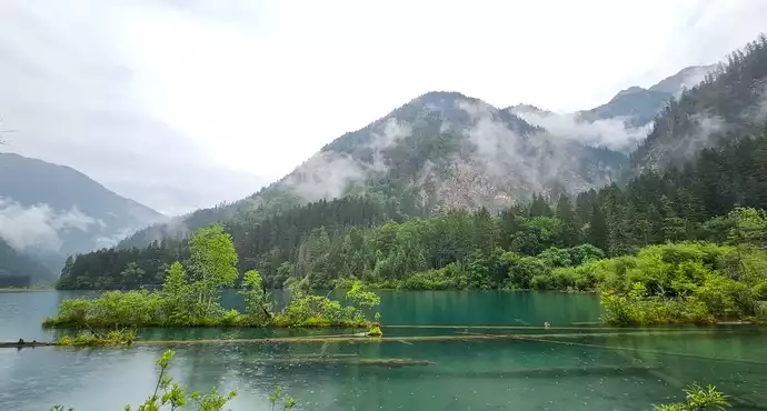
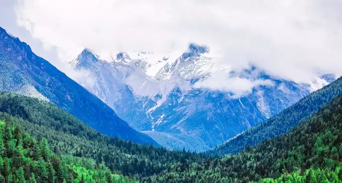
Hailuogou Scenic Area is located on the southeastern edge of the Qinghai-Tibet Plateau, on the eastern slope of Gongga Mountain, at the junction of 4 counties of Luding, Kangding, Jiulong and Ya'an in Ganzi Tibetan Autonomous Prefecture, Sichuan Province, covering an area of 906.13 square kilometers, consisting of six scenic spots: Hailuogou, Yanzigou, Mozigou, Nanmenguangou, Yajiageng and Moxi Terrace, with "National Key Scenic Spots", "National Nature Reserves", "National Geoparks", "National AAAAA-level Tourist Attractions", and the only one in China Glacier Forest Park" and the National Ecotourism Demonstration Zone, which is the crowning picture of Gongga Mountain, the "King of Shu Mountain", and the fascinating "Shambhala Gateway"; It is 286 kilometers away from the provincial capital Chengdu, 76 kilometers away from the state capital Kangding Love Song City, and 50 kilometers away from the red city of Luding County.
In this vast, ancient and magical land, the footprints of the ancestors have been left in diligence and exploration. It is home to 13 ethnic groups such as Han, Yi, Tibetan, Bai and Mongolian, with more than 10,000 people, and is a multicultural corridor in the Kangba region, where Han, Yi, Tibetan and other ethnic cultures, Eastern and Western cultures, and red cultures converge and integrate. It is located in the transition zone from the Qinghai-Tibet Plateau to the Sichuan Basin, with a mild climate and unique characteristics in the natural environment, climatic conditions and tourism resources: the sacred Gongga Mountain (7,556 meters above sea level) is the highest mountain in the world (up to 6,656 meters); The symbiosis of magnificent glaciers and forests is amazing; The majestic icefall is like a galaxy pouring down from the blue sky, which is spectacular; The primeval forest is towering, green and lush; The sweet mountain spring water either gushes out from the ground or becomes a clear stream or a waterfall on the stone, soft and gentle, and the jade beads hang the curtain; The mirror-like hot spring clusters and many high-quality hot and cold mineral springs that can be bathed and drunk can be called "the world's best"; The largest red stone beach group makes people sigh at the magic of nature; High mountains, low-altitude modern glaciers, mountain lakes, hot springs, primeval forests, rare animals and plants are rich in species, forming a complete bioclimatic zone in the world, allowing you to experience the natural changes of "one ditch has four seasons, ten miles of different days".
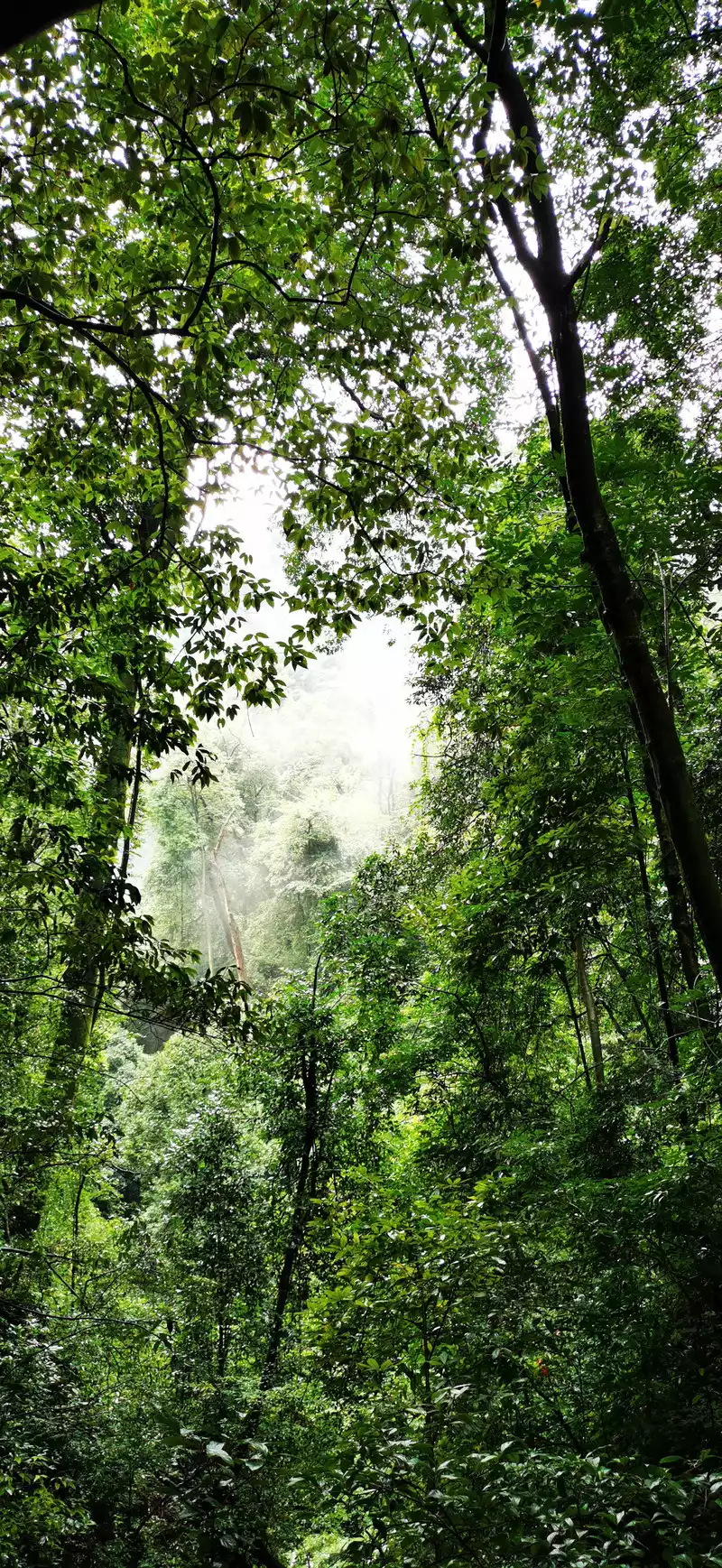
Hailuogou Scenic Area integrates natural scenery, history and culture, tea horse culture, red culture and folk culture, integrating sightseeing, leisure, recuperation, summer escape, ecology, scientific research, exploration, mountaineering, photography and other tourism, and jointly builds the most attractive tourist destination on the West Ring Road of Sichuan tourism. Backed by the 7,556-meter-high Gongga Mountain, the "King of Shu Mountain", it is known for its majestic and perfect glacier icefalls, huge red stone beaches and churning hot springs, and is the only glacier forest hot spring park in China. Hailuogou Glacier is one of the many glaciers on the eastern slope of Gongga Mountain, with its tail extending into the primeval forest area for 6 kilometers, but the altitude is only 2,850 meters, which is the lowest altitude among glaciers at the same latitude and the lowest and largest oceanic modern glacier in Asia. This allows tourists of average physical fitness to have the opportunity to climb the glacier and experience this wonderful scenery. Around the glacier, the unique landscape of glaciers, glacial lakes, subglacial rivers, ice caves, ice cracks, ice steps, ice mushrooms, and U-shaped glacier canyons is eye-opening. Due to the ultra-low altitude of Hailuogou Glacier, you can climb the glacier in a single suit except in winter.
Theentrance to the scenic spot is located in Moxi Town, and after purchasing a ticket, you can take a sightseeing car to move forward. If you are short on time, you can take the bus directly to Camp 3. After passing through Shanshuping and Bamboo Forest, we arrived at Camp No. 1, which is dominated by a large area of yew forest. Camp 1 went 8 kilometers and arrived at Camp 2 on the side of the hot water ditch. From a distance, the smoke is thick, this is the most famous hot water ditch boiling spring in Hailuogou, and the spring water is continuous all year round. Camp 2 has 10 open-air hot spring pools of different sizes and an open-air hot spring swimming pool. Not far from the pool is a dense primeval forest with beautiful scenery. Enjoying the beautiful scenery while soaking in the hot springs is extremely comfortable. If it snows, you can enjoy the spectacle of snowflakes flying in the misty open-air hot springs, which is a rare experience. Leaving Camp No. 2, we passed through the only ancient moraine lake in Hailuogou - Shuihaizi and arrived at Camp No. 3. The real glacier landscape starts at Camp 3, which is also a good place to see the sunshine and golden mountain landscape of Gongga Mountain. Camp No. 3 has two hotels, if you want to take pictures of the scenery of Rizhao Jinshan, you must live here.
Get off at Camp 3 and there is a small road on the right to Glacier No. 1. When you arrive, you can only return the same way. Follow the hiking trail through the black pine forest to the glacier observation deck, the distance is about 3 kilometers, and the round trip is enough for 2 hours. After coming down, you can take the cable car directly to Camp 4 (the only way), where you can take pictures of the glacier from a better angle and experience the spectacle of the big icefall up close.
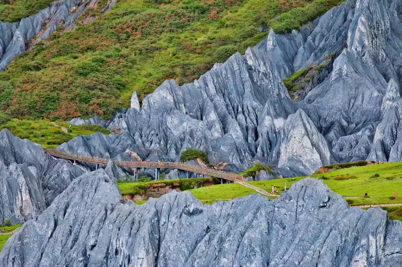
Hongshitan is located in the estuary area of Yajiageng and Yajiageng in Hailuogou Scenic Area, Sichuan Province. It is known as the world's Red Rock Park. Due to the unique humid and moist climate of Hailuogou, the red matter covered with stones here can reproduce in the unique ecological environment of the mountains, forming a peculiar landscape.
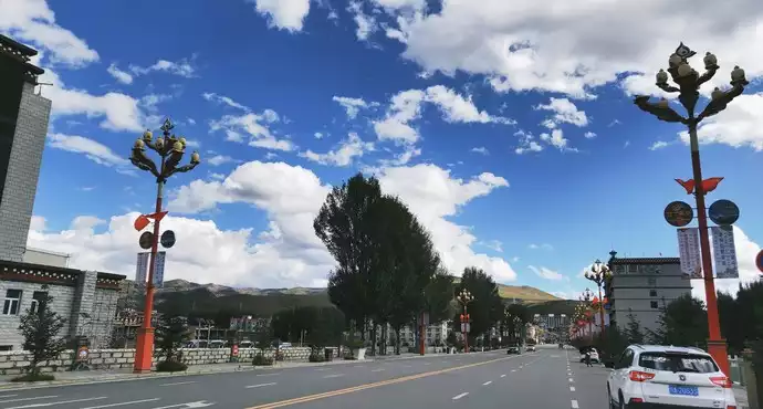
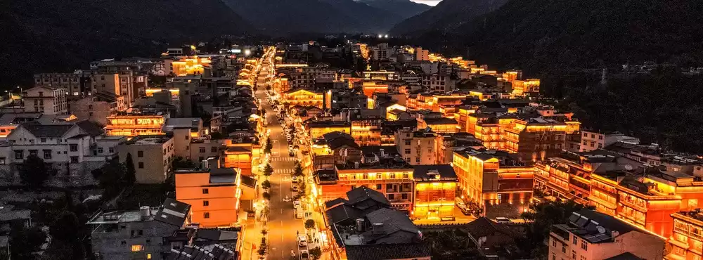
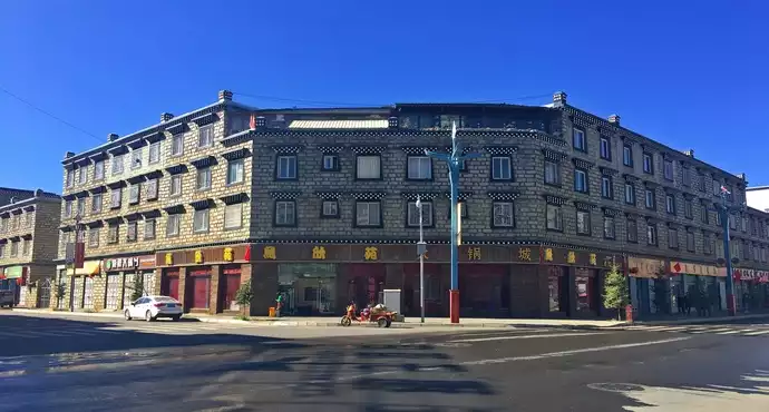
Kangding's hot "Kangding Love Song" sang popular Kangding, and also sang popular Paoma Mountain. Kangding is the hometown of love songs and the birthplace of Kangba Guozhuang culture. Kangding has both strong Tibetan culture and Han customs, where you can feel the blend of Chinese and Tibetan cultures.
Kangding is a small city, tourists can walk around the streets, and various Tibetan cultures such as Tibetans, lamas, Tibetans, and Tibetan food abound on the streets.There are small vendors selling local products on the street, so buy some as a souvenir or go for a Tibetan meal to get into the local life.
"Kangding Love Song", also known as "On the Mountain", is one of the most representative folk songs in Sichuan, arranged by Wu Wenji and Jiang Dingxian, and sung by Yu Yixuan in 1947. After that, "Kangding Love Song" was sung all over the country and was widely circulated.
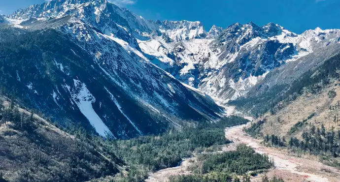
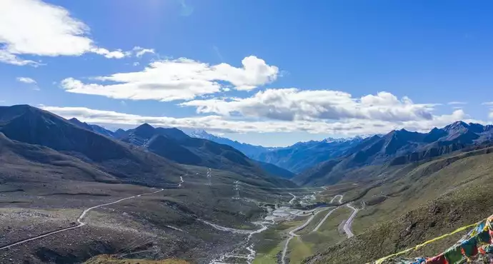
Zheduo Mountain is located in Ganzi Prefecture, Sichuan Province, with an altitude of 4,962 meters, and is the first pass of Kangba. Zheduo Mountain is also an important geographical boundary, with the plateau uplift to the west, the Yalong River, the alpine canyon area on the right, and the Dadu River. The Dadu River Basin is in a transitional zone in terms of ethnicity and cultural form, and there are mainly Tibetan branches known as "Jiarong". Its area can reach the area of Jinchuan in Aba Prefecture, Sichuan Province to the north, east of Zheduo Mountain is a mountainous area, and west of Zheduo Mountain is the eastern part of the Qinghai-Tibet Plateau, the real Tibetan area. "Zheduo" means curved in Tibetan, and it is written in Chinese as the word "Zheduo". Standing at the top of the mountain, you can see the "King of Shushan", Mount Gongga, which is 7,556 meters above sea level. Since the opening of the Erlangshan Tunnel, Mount Zeduo has become the first challenging mountain on the Sichuan-Tibet Line, where National Highway 318 passes through a 4,298-meter pass and descends all the way to the photographer's paradise - Xindu Bridge.
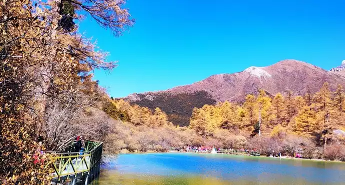
Xindu Bridge, also known as East Russia, is located at the fork of the north-south line of National Highway 318 Sichuan-Tibet and is known as the "photographer's paradise". Here you can photograph endless meadows, winding streams, golden autumn leaves, large areas of cattle and sheep foraging on the hillside, and scattered Tibetan villages. Just press the shutter to get a beautiful landscape photo. Playing in Xinduqiao and admiring her unparalleled charm, mountains, water, trees, cows, and grass are intertwined, and you will feel as if you are in an idyllic landscape painting. No wonder it is known as the "world of light and shadow" and "a photographer's paradise". No one will take Xindu Bridge as the end of the trip, this is just a post station on the way into Tibet. From Chengdu, you can get there in one day along National Highway 318, and then take National Highway 317 (Sichuan-Tibet North Line) or continue west on National Highway 318 (Sichuan-Tibet South Line). The above scenery needs to be led by a local guide to take pictures.
Day 3.15 Monday Xinduqiao > Yajiang > Litang > Shangri-La Town, Daocheng County About 7 hours, 420 kilometers, 2,700 meters above sea level
Highlights of the day (passing through): Kazila Mountain, Rabbit Mountain, Haizi Mountain, Daocheng White Pagoda, Qingyang Forest, Red Grassland, etc.
Altitude: Yajiang County 2,200M, Litang County 3,256M, Shangri-La Town 3,218M
Weather: Daocheng: 17°C/8°C Ask the hotel front desk by phone, the weather forecast is extremely unreliable.
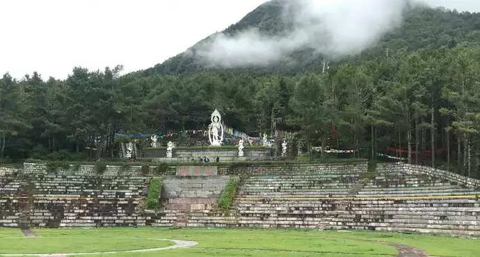
Itinerary: The theme is to take a car and go all the way around the mountain. You can choose to have lunch in Litang. If the return time is tight and you don't consider stopping at Lidang, you can consider going to Changchun Keer Temple this time. Multi-ethnic areas where various religions come together. Even if it is the same religion, there are different factions. There are stairs on the side of the main hall to climb to different floors, where various statues of the same sect and different sects are placed. The door may be locked, and a local guide and familiarity with the temple's lama are required to unlock the door for a visit. Tibetan Buddhism allows both men and women to practice, so lamas can also get married and start a family. There is an explanation in the statue.
Passing by the White Pagoda in Daocheng County, you can go down to take pictures when you have time. There are countless white pagodas along the way, but this one is just a little bigger.
When you arrive in Shangri-La Town, you need to prepare your equipment for the next day's mountaineering. In the first few days, it is easy to take a long time, and it is recommended to take a long line tomorrow. You need to prepare a little dry food, one highland barley cake per person, plus two small ham sausages, a bottle of warm water, and a bottle of functional drink. When the reaction is high, you can't eat anything. And of course oxygen cylinders. A bottle of 20 yuan in the supermarket is fine, and more than 50 bottles in those pharmacies are probably useless. Oxygen concentrations are too high, which is not a good thing. The three of us prepared six bottles, and I used three.
Sufficient cash needs to be prepared. In the Aden scenic spot, only cash is accepted. Includes small sightseeing tickets (80/person), guide fee (400 for long routes, 200 for short routes), and 300 per horse for horseback riding.
Climbing crutches!! If there is a high reaction, it is best to prepare two for one person, which is very useful to go down the mountain. The hotel reception is available for borrowing.
Kazila Mountain is 4,718 meters above sea level and is located at the boundary between Litang County and Yajiang County. Because of the high altitude, there are few trees, mainly alpine meadows. When crossing the Kazila Mountains, the clouds in the sky are changeable, white and flawless for a while, and dark and psychedelic for a while.
Changchun Keer Temple, located in Litang County, Ganzi Prefecture, Sichuan, also known as: Litang Temple, is the largest temple of the Gelug sect in the Kangba area, built by the third Sonam Jia Cuo in 1580. Changchun Cole is Tibetan, which means: Maitreya Buddha Dharma Wheel. Tibetan Buddhism has a saying: there are three major temples in Lhasa, Andotar Monastery below, and Litang Changchun Keer Temple. It can be seen its status.
Changchun Keer Temple is located on the northern hillside of Litang County, covering an area of more than 500 acres, up the mountain, high and low. The main hall is located on a high place in the center of the temple, towering and towering, with buildings such as the Maitreya Hall, the Great Sutra Hall, the Thousand Buddha Hall, and the Dharma Temple. The beams of the hall are painted with unique Buddhist murals, with complex lines and various forms, all of which are lifelike.The golden dome of the Red Palace is located at the back of the temple, with the spiritual pagoda of the first and second fragrant root living Buddhas, the copper gilded pagoda body is carved with various patterns, and is also inlaid with red turquoise, dzi, agate, coral, amber and other treasures, the craftsmanship is exquisite and unique. If you are lucky, you can also see the ancient "Kangyur", "Danzur" Buddhist scriptures and the bed of the 10th Panchen Lama, which are the treasures of the town temple.
Every year on the third day of the sixth month of the Tibetan calendar, it is the Jockey Club in Litang, also known as the "June Turning Mountain Festival", and the Changchun Keer Monastery will hold a grand celebration to worship the sacred mountain, and there will be a 10-day jockey club, which is very lively. The butter flower fair on the 15th day of the first month of the Tibetan calendar every year is known as "a must-have in Kang District".
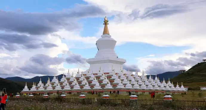
The Daocheng White Pagoda is located at the head of the Daocheng Bridge, behind the Daocheng gas station, the pure square arrangement is the base of the Daocheng White Pagoda, the white pagoda is divided into 3 parts, the spire, the tower body, the tower base, the pedestal is placed with rows of prayer wheels for Tibetans to worship devoutly, the pagoda identity is 3 parts, and a Bodhisattva is enshrined on the top. Because the tower is white, it is named White Pagoda. Standing on the top of the tower, you can overlook the entire Daocheng County.
This white pagoda is also known as Zunsheng Tallinn and Victory Pagoda, and is called Langjie Qudeng in Tibetan. It is said that when Shakyamuni was nirvana, many relatives prayed for the World-Honored Dharma Body to stay for a long time, and the Buddha instructed to build the Victory Pagoda and personally bless and consecrate it to represent the Dharma Body. From the center of the county, it takes about a quarter of an hour to twenty minutes to walk to the White Pagoda. In the center of the square base, a tall white pagoda stands on a high pedestal in the center. Around the main tower, there are more than 100 small white pagodas, and the four walls of the base are inlaid with eight rows of prayer wheels. The white pagoda of Daocheng, under the blue sky and white clouds of the Kangnan Plateau, the white pagoda is solemn and majestic. At dusk, local residents came to conduct evening lessons on the turret.
Day 4.16 Tuesday Daocheng Aden Scenic Area Long-term Tour > Shangri-La Town, 2,700~4,700M in the scenic area
Highlights of the day (passing through): Luorong Cattle Farm, Xiano Dorji Sacred Mountain, Milk Sea, Yangmai Yong Sacred Mountain, Five-Color Sea, etc.
Altitude: Chonggu Temple 4,145M, Pearl Sea 4,265M
Weather: Aden: 22°C/10°C Light rain
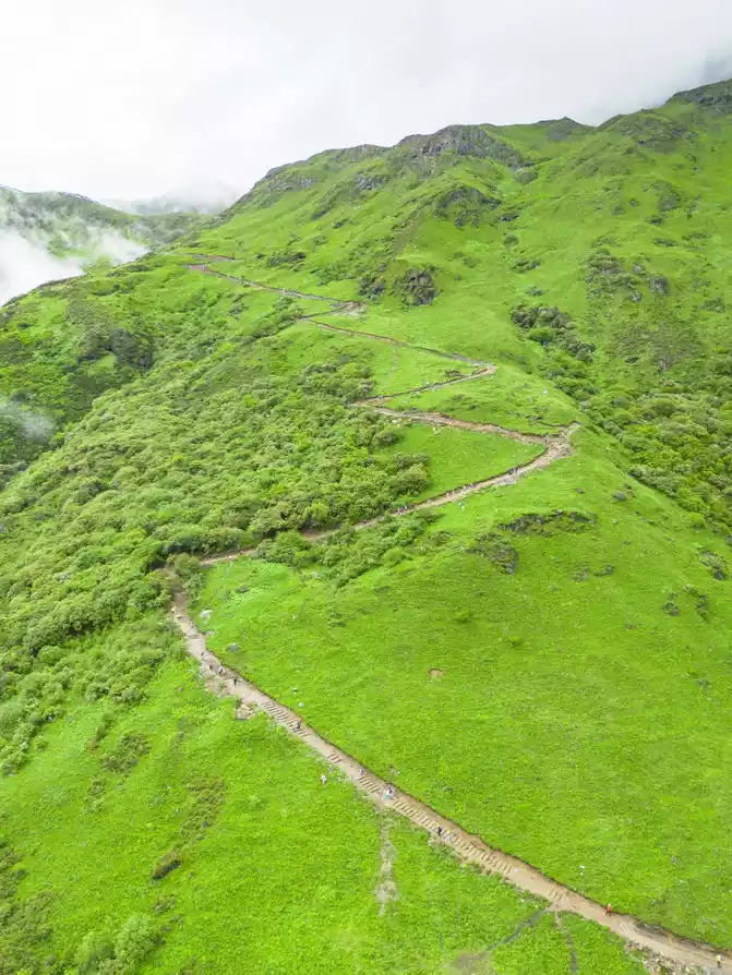
Itinerary: You must leave early in the morning, and it is best to go out to the scenic spot at 7 o'clock. The reason is that the number of mules and horses in the Luorong Cattle Farm is limited, and if you want to ride a horse, you can only wait for the horse to come down, plus queuing, which may take more than 90 minutes. After entering the scenic spot, take a sightseeing bus (38-seater minibus) from the ticket office 2,900M directly to Zhaguanbeng 3,800M. The sightseeing car kept turning for nearly an hour, it is recommended to close your eyes and recuperate, don't miss the scenery outside the car, otherwise it is easy to get motion sickness. After walking to Chonggu Temple, you can consider hiring a local tour guide, more than 400 yuan. He can help with luggage and help. We didn't pay attention to it, and when we came back, we all felt it was necessary. I bought a small sightseeing ticket, which can go directly to Luorong Cattle Farm 4,180M. If your physical strength is very strong, you can show your physical strength on the way back and walk back to Chonggu Temple instead of taking a car.
Luorong Cattle Farm to Milk Sea, a total of 5 kilometers. There are one-way mules and horses, which can be ridden for 3 kilometers, and the remaining two kilometers of mountain roads are very steep and need to be walked by yourself. There was no horse riding on the way back. We left at 7:45 and had to wait for 90 minutes, so we didn't ride a horse. As a result, the physical strength was exhausted up the mountain, and when the mountain was descended, oxygen was inhaled all the way. In the opposite direction of the Milk Sea to the Five-Colored Sea, there is also a lake, which you can go to if time permits. If you don't want to go, it is recommended to go to the Milk Sea first, and then to the Five Colors Sea. If you go to the five-colored sea first, the slope is too big and difficult to climb. In the evening, there is a Chongqing Fuqiao bath in the town, so you can consider relaxing.
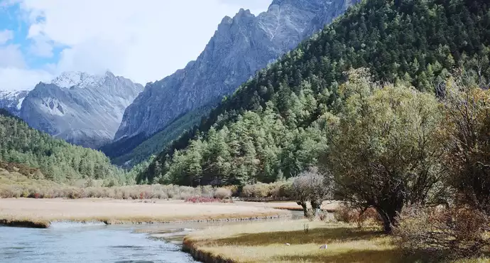
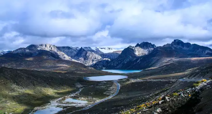
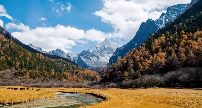
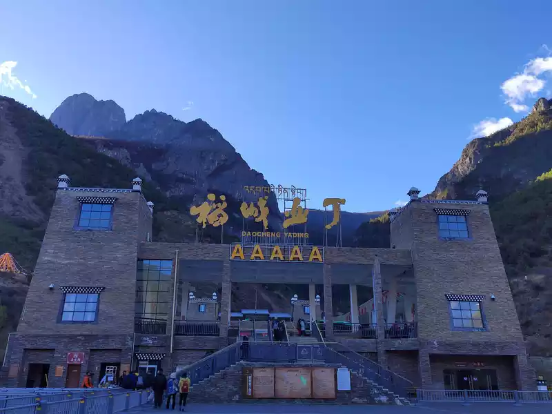
Daocheng Yading Scenic Area is located in Riwa Township, Daocheng County, Ganzi Prefecture, Sichuan Province, which is a national nature reserve and a provincial scenic spot, and is known as the "Shangri-La Wonderland". Aden Scenic Area belongs to the alpine canyon scenic area, with an altitude of 2,900 meters (Gongga Estuary) and 6,032 meters (Xiannairi Peak), covering an area of 1,344 square kilometers, presenting beautiful alpine canyons and natural scenery, which is the core area of China's Shangri-La Ecotourism Zone, known as the "Soul of Shangri-La".
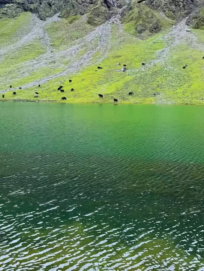
Luorong Cattle Farm is one of the well-known attractions in the Aden Nature Reserve, and it is a pasture for Tibetans grazing nearby. The cattle farm is surrounded by continuous alpine meadows, and in spring and summer, wildflowers bloom on the meadows, which is very spectacular. The Gongga River passes through the cattle farm, and herds of cattle and sheep graze leisurely by the river and on the hillside, creating a harmonious scene.
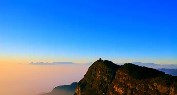
Xiano Dorji is located at the junction of Daocheng County and Muli County, Liangshan Prefecture, and is one of the three main snow mountains. Dusk is a good time for viewing, the sunset shines obliquely on the snowy peaks from the west, the entire snow peak is bathed in soft sunlight, and the exposed rocks and ice and snow bodies are rendered extremely gorgeously.
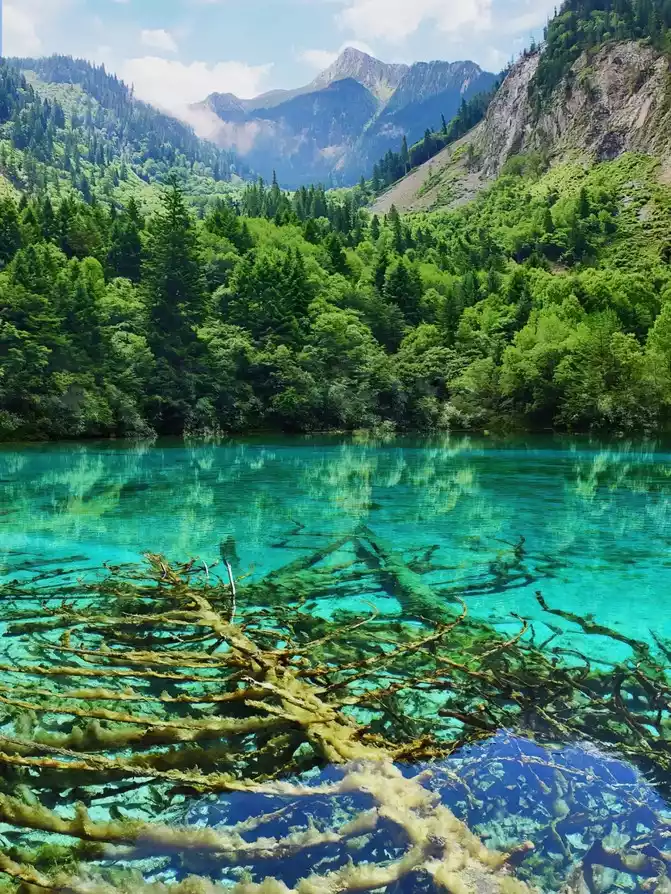
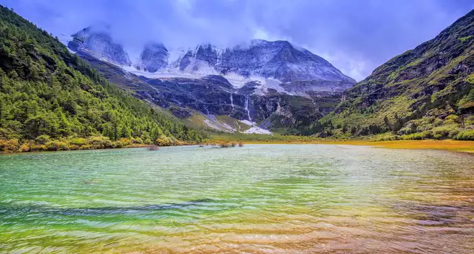
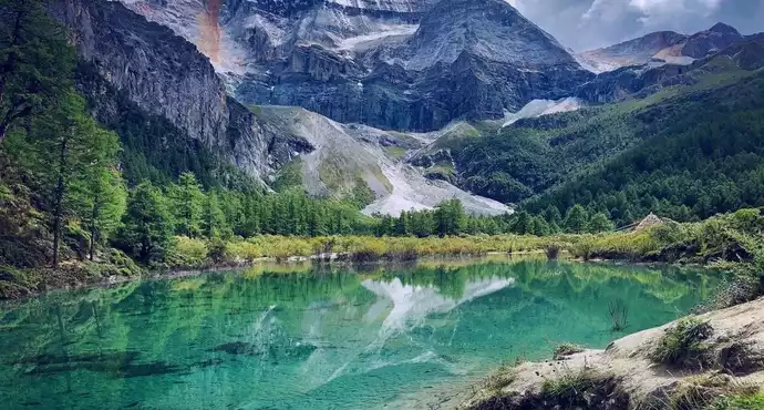
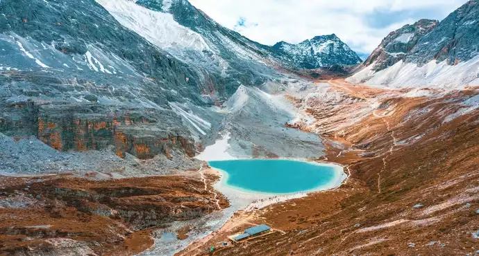
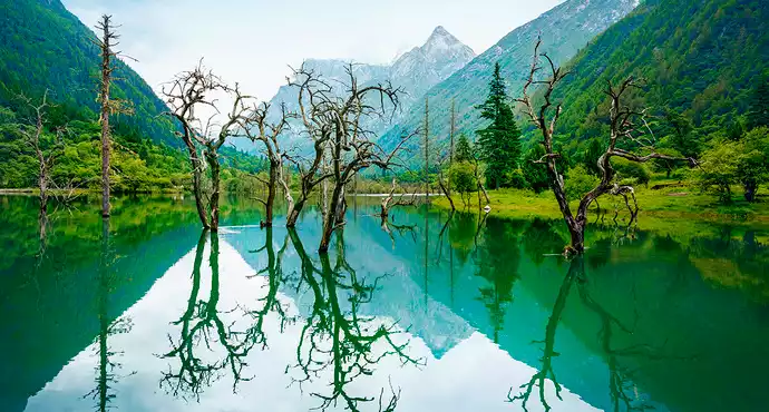
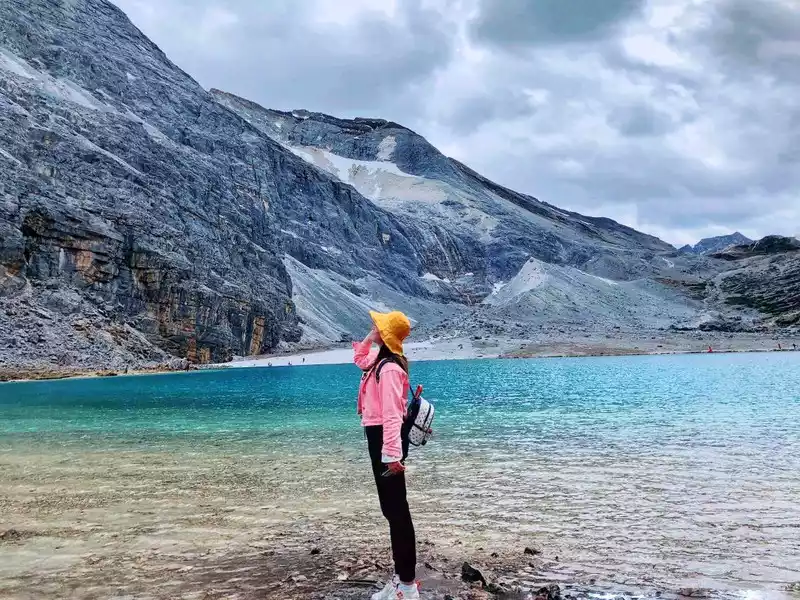
The Milk Sea, also known as Luorongcuo, is located in the mountain hollow at the foot of the Yongshen Mountain in Yadingyangmai, Daocheng, and is an ancient glacial lake shaped like a droplet, because there is a circle of milky white calcareous deposits on the edge of the lake, so it is called the Milk Sea. From Luorong Cattle Farm to Milk Sea, you can only hike or rent horses from the Cattle Farm Horse Gang, due to its high geographical location, the mountain road is relatively rugged, and there are certain requirements for physical fitness, so you need to pay attention to safety when going.
Yang Maiyong Tibetan means: Manjushri Bodhisattva, located in the Aden Nature Reserve, at an altitude of 5,958 meters, is the southern peak of the snow-capped mountains of the three lords of Aden, ranking first among the three lords.
The name of the five-colored sea Tibetan is: Mudicuo, located on the sea of milk, between Xiannai Ri and Yang Maiyong. It is named because when exposed to sunlight, it produces five different colors.At an altitude of 4,500 meters, after a steep slope on the right side of the Milk Sea, the lake has a circular surface and clear water, which is spectacular when reflected by the sun. The five-colored sea is a sacred lake in the hearts of locals, and it is said to be able to "reverse history and predict the future". Buddhist texts praise the lake, saying that it is as famous as Tibet's Yang Zhuoyongcuo.
Day 5.17 Wednesday Daocheng Aden Scenic Area Short-term Visit> Shangri-La Town, 2,700~4,600M above sea level in the scenic area
Highlights of the day (passing through): Chonggu Temple, Chonggu Meadow, Pearl Sea, Xiannai Ri Sacred Mountain, Zhuomala Cuo, etc.
Weather: Aden: 24°C/10°C Light rain
Itinerary: Today's itinerary is very easy, and you can go out after 8 o'clock in the morning. At the entrance of the scenic spot, you need to buy a sightseeing ticket of 60 yuan (original price 80), and the other party needs to look at the photos you took on the first day to prove that you entered the mountain on the second day. If you want to hire a tour guide in Chonggu Temple, 200 yuan per person. If the weather is nice, you will have the opportunity to take the perfect photo.
Okikoji Temple is located at the foot of Mt. Sennohijin at an altitude of 3,880 meters. The original temple was seriously damaged, and there was a ruined wall in the eye. Chonggu Temple belongs to Gonggalangjiling Temple, where Zhaba chants scriptures and chants Buddha, and the Buddha statue of Shakyamuni is enshrined in the sutra hall.
In the Aden Scenic Area, the ancient temple is in an excellent location. Located in Chonggu Temple, opposite are the three sacred mountains that have not changed for thousands of years, meadows full of wildflowers at their feet, and the steep and majestic Aden Gorge behind them. Chonggu Temple is like the gate of heaven, guarding the sacred Shambhala kingdom. In 1928, when Joseph Locke came here for an investigation, he lived in Chonggu Temple for three days, and through the windows of the temple, he looked out at the quiet and peaceful village of Aden under the moon, which is the original shape of the beautiful Blue Moon Valley in James Hilton's "The Vanishing Horizon".
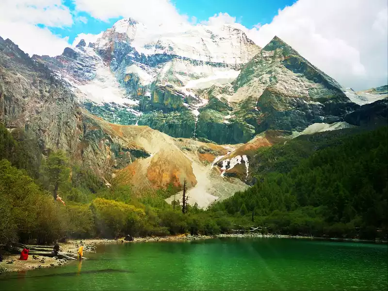
The Pearl Sea, known as "Dolma Latso" in Tibetan, is a sea formed by the melting snow of Xiannai Day. The area is about 0.1 square kilometers. The sea of pearls in the dense forest is like an emerald inlaid on the lotus throne, rippling blue waves, shimmering waves reveal infinite beauty, and the lakeside is surrounded by ginseng like a screen. In spring, the rhododendrons by the lake bloom brilliantly, and in autumn, the forests are dyed, reflecting the colorful world, which is dazzling.
Xian Nai Ri is one of the three main sacred mountains of Aden, located in the Aden Nature Reserve of Daocheng County, and is the north peak of the three main snow mountains, and the peak is covered with snow all year round. Surrounded by mountain lakes, glaciers, and woods, it is a paradise for photography enthusiasts. Visitors can enjoy the majesty of Mt. Kamiyama from the observation deck of Sennohi, and take photos that look like wallpaper, which are breathtakingly beautiful.
Day 6.18 Thursday Shangri-La Town > Xinduqiao about 7 hours, 420 kilometers, 3,444M above sea level
Weather: Xinduqiao: 19°C/10°C Yin
Itinerary: Return to Xinduqiao and rest. On the way, you can visit the Evergreen Cole Temple.
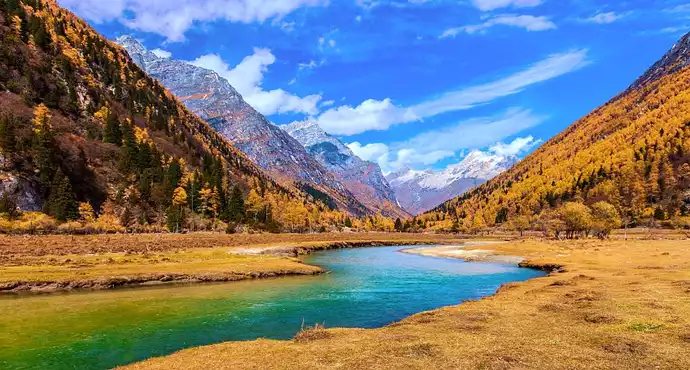
Day 7.19 Friday Xinduqiao > Tagong > Bamei > Ganzi Danba County > Siguniang Mountain about 6 hours, 420 kilometers, 2,968M above sea level
Highlights of the day (passing through): Tagong Grassland, Yak Valley, Bamei Stone Forest, Yala Snow Mountain, Jiaju Tibetan Village, etc.
Altitude: Tagong 3,732M, Bamei 3,546M, Danba County 2,066M, Siguniang Mountain Shuangqiaogou 2,968M
Weather: Xiaojin Siguniang Mountain Scenic Area: 16°C/11°C Rain
Itinerary: Depart early in the morning. Before arriving at the hotel, you will pass through Shuangqiaogou, and you must arrive before half past three in the afternoon. You can play first and then check into the hotel. The tour lasts about three or four hours. Shuangqiaogou is five kilometers from the hotel.
After visiting Aden, don't have too high requirements for Shuangqiaogou. You can take a sightseeing bus directly to the redwood forest, and then slowly get off the bus. The scenery is still good, you can take pictures with the yaks, and experience the reason why flowers grow on cow dung on the grassland.
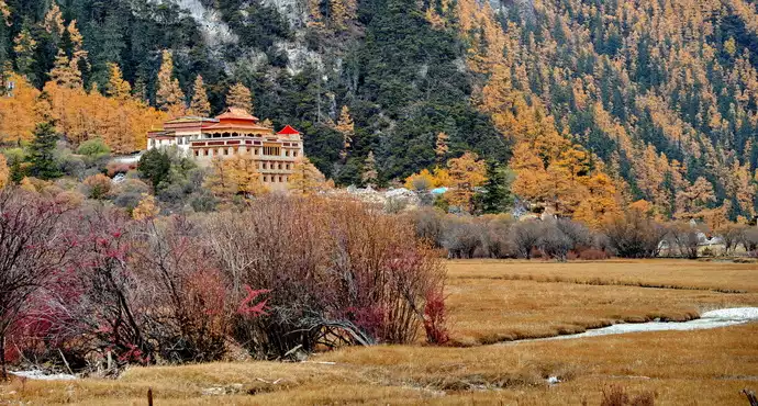
Tagong Grassland is located 113 kilometers northwest of Kangding City, on both sides of the Sichuan-Tibet Highway. Ta Gong Tibetan means "place that the Bodhisattva likes." Tagong Grassland is backed by the famous Yala Sacred Mountain, with flat terrain, abundant water and grass, and herds of cattle and sheep. There are Tagong Temple and Muya Golden Pagoda on the grassland, and the green grass is scattered with herdsmen's tents, creating a harmonious plateau Tibetan scenery.
The Tagong Grassland Scenic Area is mainly composed of the towering Yala Snow Mountains, the undulating grasslands and the splendid "Muya Golden Pagoda" on the grassland. The scenic spot has Tagong Temple, Tagong Temple Tallinn, Yala Snow Mountain and other scenic spots. Tagong Temple is known as the "Little Jokhang Temple" and is one of the pilgrimage sites for Tibetans in the Khamba area. Yala Snow Mountain, also known as Yala Sacred Mountain, is one of the four sacred mountains in Tibet.
Tagong Grassland hosts 1-2 traditional horse races every year, when herders dress up in festive costumes and gather in Tagong Grassland from all directions to celebrate traditional festivals. The horses galloped on the racetrack, and the thrilling equestrian performances burst into applause, cheers, and whistles, merging into a sea of joy.
Bamei Town used to be the county seat of Qianning, where the houses are magnificent, integrating architecture, religion, culture, art and ethnic customs. The scenery is mainly plateau and grassland scenery. If Xinduqiao is called "a photographer's paradise", then the scenery of Yamei is beyond measure.The gorgeous scenery of Bamei soil and stone forest is comparable to the famous limestone karst stone forest in South China, but it is very special in terms of geological genesis, landscape characteristics, micro-geomorphology and natural environment.
The Bamei soil and stone forest landscape is located near the 36th class of National Highway 317, which forms the famous Xianshui River fault zone along the line of "Kangding-Daofu-Luhuo", which is the most typical and concentrated near Bami. It is contrasted with wide meadows, rolling snow-capped mountains, charming Tibetan villages and earthen and stone forests, forming a wonderful style painting.
Yala Sacred Mountain is located in the southeast of Bamei Town and is owned by Huiyuan Temple. The mountain is majestic, and the top of the mountain is covered with snow all year round, which is a sacred mountain worshipped by Huiyuan Temple and surrounding Tibetans. The record of the mountain in the ancient Tibetan book "Sacred Mountain Zhi Yi Entering the Way of Liberation" is called the "second Shambhala". Yara's climb was difficult, and in August 1999, a male expedition team from Japan, Kazu Yamagishi, tried to climb but was unsuccessful. Legend has it that on the steep cliff north of Youcuo Waterfall, there is a cave that hides the armor and scriptures left by King Gesar during his campaign, which serve as the treasure of the sacred mountain of Yala.
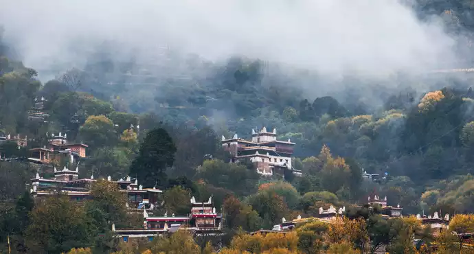
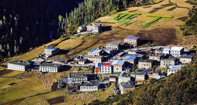
Jiaju Tibetan Village is located in Danba County, Ganzi Prefecture, about 8 kilometers away from the county seat, and is a Tibetan residential village with Jiarong Tibetan characteristics.
"Jiaju" means a hundred households in Tibetan, and the village is as the name suggests, on the hillside with a relative height difference of nearly a kilometer, Tibetan-style buildings are scattered among the green trees, dotted with smoke and clusters of peach blossoms, which looks quiet and chic. The village generally has one floor for each household, and the village building sits north and faces south, all of which are wood and stone structures. The wooden frame and eaves are red, and the walls are painted white or the primary color is mixed with white. Every year on the eve of the Spring Festival, the masters will carefully paint the walls of the village building according to traditional customs and use the local "white mud" as the main raw material, so that the entire Tibetan village is dressed in white costumes.
Visiting the Tibetan village, the panoramic view from the hillside opposite the village is very spectacular. After walking into the Tibetan village, you can only see scattered Tibetan-style buildings. Most of the buildings are 3 or 4 stories of buildings, and the bottom floor is a captive livestock, and there are pot village rooms, living rooms, scripture halls and family watchtowers, etc., and some buildings also have balconies. The white walls are painted with the sun, moon, stars, and religious motifs, which is beautiful and spectacular.
If you want to enter the homes of local Tibetans for "home visits", you usually have to give the homeowner a two-yuan ticket, but it is not fixed, the homeowner may not accept it when he is in a good mood, you can visit the interior decoration and structure of these beautiful small buildings, but don't rush into the sutra hall. When you meet a hospitable host, you will be invited to drink butter tea and eat tsampa, and feel the enthusiasm of the collector.
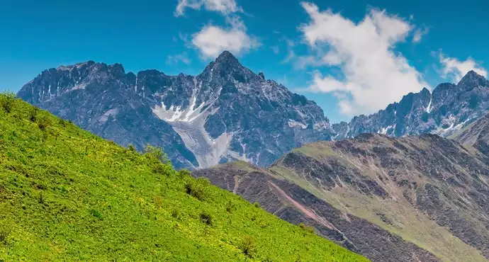
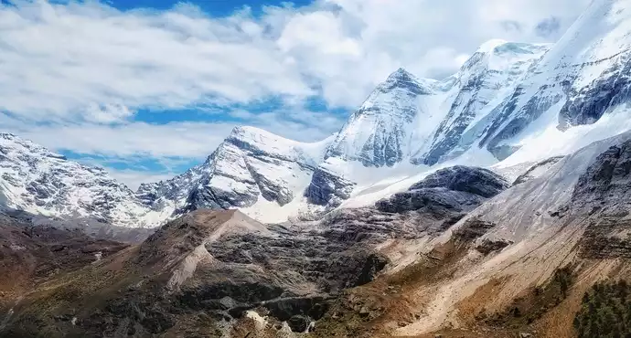
Siguniang Mountain Scenic Area is located in Rilong Township, Xiaojin County, Aba Tibetan and Qiang Autonomous Prefecture, covering an area of more than 2,000 square kilometers, consisting of Siguniang Mountain, Balang Mountain, Shuangqiaogou, Changpinggou, Haizigou and other parts. Siguniang Mountain is famous for its majestic and upright mountain, the mountain is steep, pointing straight to the blue sky, covered with ice and snow, and silver light. The foothills are densely forested, green grass, and clear streams are gurgling, just like a beautiful southern European scenery, known as the "Alps of the East". At the turn of spring and summer, the grass here is green and flowery, and it is a good summer pasture. The natural ecology in the scenic area is well protected, the vegetation is lush, and there are many species of organisms. There are more than 30 species of national first- and second-class protected animals such as golden snub-nosed monkeys, wildebeest, snow leopards, red pandas, hairy-crowned deer, Tibetan horse chickens, argal sheep, black bears, etc., and are known as "the paradise of pheasants and thrushes". The surface of Siguniang Mountain is mainly composed of sandstone, slate, marble, limestone and crystalline limestone from the Mesozoic and Paleozoic eras. Most of these rocks are resistant to weathering and erosion, and the peaks are sharp and steep, plunging into the sky. It is surrounded by more than 20 peaks four to five thousand meters high covered with ice and snow.
Day 8.20 Saturday Siguniang Mountain > Wolong > Yingxiu > Chengdu about 5.5 hours, 480 kilometers, 500 meters above sea level
Highlights of the day (passing through): Maobiliang Observation Deck (full view of Siguniang Mountain), Balang Mountain, Wolong, 512 earthquake site, etc.
Altitude: Yingxiu Town 892M
Weather: Chengdu: 30°C/23°C Rain
Itinerary: Changpinggou in Siguniang Mountain, there is no sightseeing car, it takes four or five hours to walk back and forth, the scenery is estimated to be similar to Shuangqiaogou, if you don't have enough time, you can give up. Departing at half past seven in the morning, I stopped by Wolong to see the national treasures, as well as the Yingxiu Wenchuan earthquake site, which is very shocking and worth feeling the strength of the motherland. You can arrive at Chengdu Airport at 3 p.m. Before every trip, I can't wait to play for ten days and a half, but usually by the seventh or eighth day, I am tired. Therefore, go home.
Maobiliang is located near Provincial Highway 303 in Xiaojin County, Aba Tibetan and Qiang Autonomous Prefecture, and is a must-pass place from Balang Mountain to Rilong, and the best point to see the whole view of Siguniang Mountain and the sunrise and sunset. Overlooking from the cat's nose bridge, Haizigou in front and Siguniang Mountain behind, the scenery is absolutely shocking.
Balang Mountain is called Balang La in Tibetan, which means strange willow mountain, and is 5,040 meters above sea level. Looking up, the peaks overlapped. The alpine meadows along the way are beautiful, like huge carpets covering the mountains, and herds of cattle and sheep are happy.
Between the blue sky and white clouds, the vast sea of clouds floats on the mountainside, dividing the majestic mountains into upper and lower parts, with alpine meadows with colorful wildflowers above and mysterious and deep primeval forests below.The upper and lower mountain roads and the pass area of Balang Mountain are more than 4,000 meters above sea level, the mountains are high and steep, but the scenery is extremely beautiful, with white clouds like the sea, snow-capped mountains, undulating meadows, and "infinite scenery on dangerous peaks".
Crossing Balang Mountain, the peaks twist and turn, and the mist is hazy. Looking from the top of the mountain, white clouds cover the long canyon, the wind is surging, the waves are magnificent, and it is spectacular. There are also dense primeval forests in the valley, and wonderful pines and vines hang in the forest.
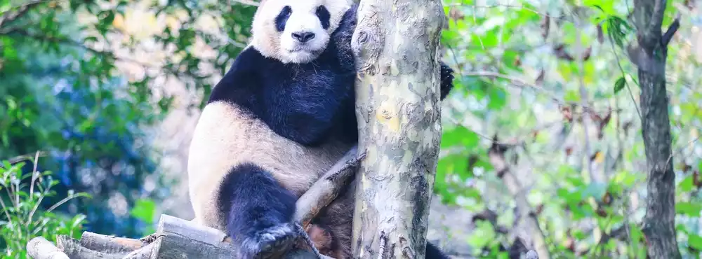
Wolong China Giant Panda Garden Shenshuping Base is located in Gengda Town, Wolong Nature Reserve, at an altitude of 1,700 meters, the base covers an area of 150 hectares, built with the assistance of the Hong Kong Special Administrative Region Government, with a total investment of 230 million yuan. It is divided into three areas, namely: Shenshuping Giant Panda Breeding and Breeding Visiting Area, Captive Giant Panda Rewilding Training Area and Wild Release Area. At present, the open giant panda breeding and breeding visit area covers an area of 450 acres, with 59 sets of giant panda enclosures, which can accommodate 60-80 giant pandas, and related supporting facilities include tourist reception center, science popularization education center, scientific research office area and giant panda hospital.
Yingxiu Town is located at the south gate of Aba Prefecture, and the ruins of Whirlpool Middle School in Yingxiu Town are shocking, and they can't control their tears, lamenting that the destructive power of nature is really infinite, and human beings are still small in front of it.
Atthe intersection of Yingxiu Town, Wenchuan County, there stands a huge stone with the words "5.12 epicenter Yingxiu" written on it, and several big characters are particularly eye-catching. This boulder was rolled down by the collapse of the mountain during the earthquake, and here we mourn the dead in silence, and may the natural disasters stay away from the land of China.
The "5.12 Wenchuan Earthquake" caused more than 5,000 deaths and more than 3,000 missing people in Yingxiu Town, which was the most serious casualty in all disaster areas. The earthquake also led to a large number of secondary disasters: landslides, collapses, etc., causing nearly half of Yingxiu Town's infrastructure and cultivated land to be lost.
Number of days: 3 days, Average cost: 1000 yuan, Updated: 2021.10.06
Number of days: 1 day, Average cost: 100 yuan, Updated: 2024.07.18


Number of days:8 days, Average cost: 6,000 yuan, Updated: 2025.08.17
Number of days: 8 days, Average cost: 6000 yuan, Updated: 2020.09.12

Number of days:7 days, Average cost: 3600 yuan, Updated: 2020.04.17


Number of days: 5 days, Average cost: 6000 yuan, Updated: 2023.04.20