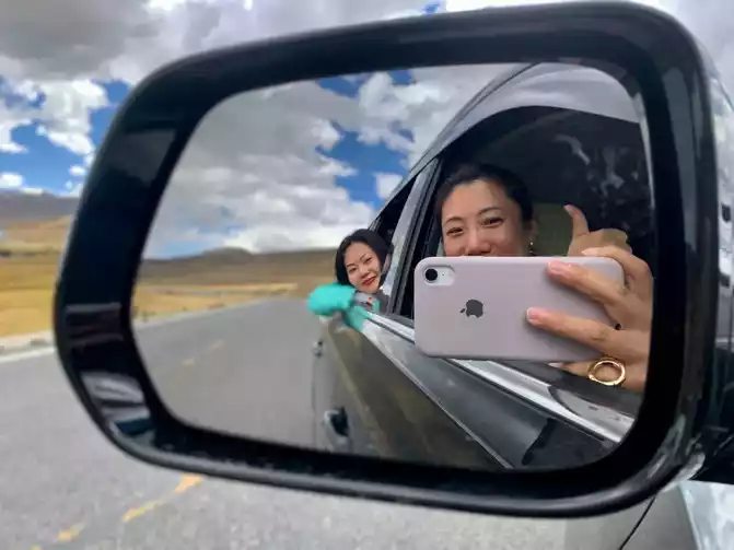
Live Your Best Lives
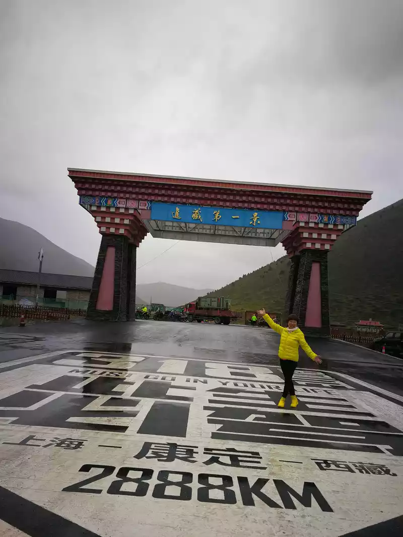
After waiting for 20 years, the trip to Tibet began with the 318 Sichuan-Tibet Line.
The first time I entered Tibet was cautious and conservative, and I booked a boutique self-driving group through China-TravelNote: with a Tibetan driver: Shilang Enzhao (the correct and polite name is Enzhao, Tibetans have no difference between names and surnames, all names are taken by the living Buddha), we warmly call him Enzhao Big Brother; Oxygen tanks, rhodiola raw materials, glucose powder, headache powder and other highly responsive emergency items are provided with the vehicle throughout the process; all the way the hotel can basically supply oxygen; With these auxiliary conditions, I feel at ease.
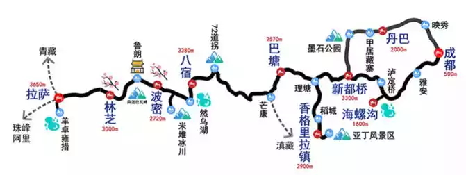
National Highway 318, starting from People's Square in Huangpu District, Shanghai, and ending at the China-Nepal Friendship Bridge in Nielamu County, Shigatse City, with a total distance of 5,476 kilometers. Via Shanghai - Suzhou - Huzhou - Xuancheng - Wuhu - Chizhou - Anqing - Huanggang - Wuhan - Jingzhou - Yichang - Enshi - Chongqing - Dazhou - Guang'an - Nanchong - Suining - Ziyang - Chengdu - Ya'an - Ganzi - Changdu - Nyingchi - Lhasa - Shigatse.
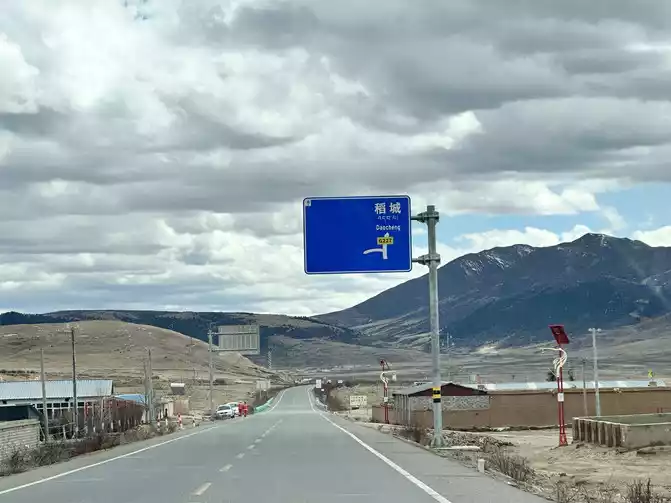
Our itinerary starts in Chengdu and ends in Lhasa. Passing through Chengdu - Ya'an - Hailuogou - Kangding - Xinduqiao - Litang - Daocheng Yading - Batang - Mangkang - Basu - Bomi - Lulang - Nyingchi - Lhasa, the whole journey is 12 days, about 2680 kilometers. The design of the whole itinerary is very scientific to adapt to the high reaction, all the way from low to high, step by step. So there is no discomfort in the body.
Tashi Dele!
September 24, 2020
on the plane
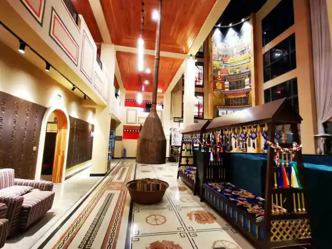
The night flight flew from Shanghai to Chengdu (so that there was no need to ask for leave for this day) and stayed at the Chengdu Tibet Hotel. Tibet Hotel is a five-star hotel, with distinctive Tibetan characteristics rushing towards you, and you can feel the breath of the end at the starting point, which makes Miss E and I so excited that I can't sleep.
September 25 On the road
,Chengdu (500 meters above sea level) - Luding Bridge (1300 meters above sea level) - Hailuogou (1600 meters above sea level)
A beautiful day starts with waking up with butter sweet tea + authentic tsampa. Brother Enzhao picked us up, packed our luggage, and we set off from Chengdu all the way to Lhasa.
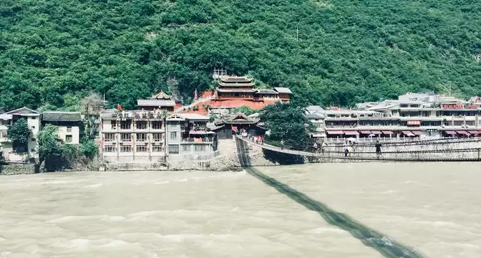
Basically, I was on the road all day, driving more than 260 kilometers. On the way, it passed the Luding Bridge, also known as the Dadu Bridge, built in 1706 and is a ferrata bridge across the Dadu River, with a total length of 103.67 meters and a width of 3 meters, consisting of 13 chains, which is famous at home and abroad for the battle of "flying to capture Luding Bridge".
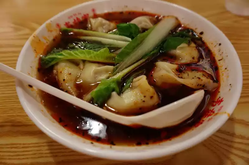
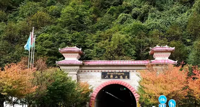
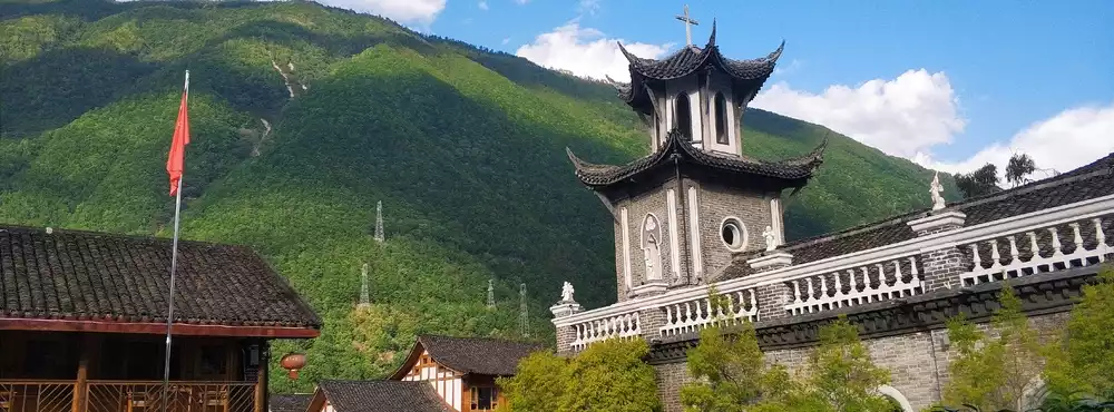
In the afternoon, we continued to drive, passing through the Erlangshan Tunnel and various mountain roads around A, and arrived at Moxi Town at 6 o'clock. The town of Moxi was quite lively, and while it was still bright, I strolled all the way and found the Red Army Long March Memorial Hall, which was the former site of the Fourth District Soviet established by the Fourth Front Army of the Chinese Workers' and Peasants' Red Army in 1935, for more than half a year. This is also the Moxi Catholic Church, where Chairman Mao stayed during the Long March. Following in the footsteps of the chairman, we found the "Tibetan Banquet" restaurant in the depths of the church for dinner.
The first night I stayed at the cliff hot spring hotel in Moxi Town, there are really hot springs, really on the edge of the cliff, you can look up at the mountains and soak in the hot springs. But we have a more important task, soaking Rhodiola.
On September 26, I hiked
Hailuogou Glacier Forest Park (3600 meters above sea level) - Kangding (2560 meters above sea level) - Xindu Bridge (3500 meters above sea level).
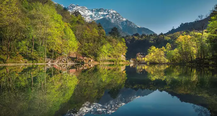
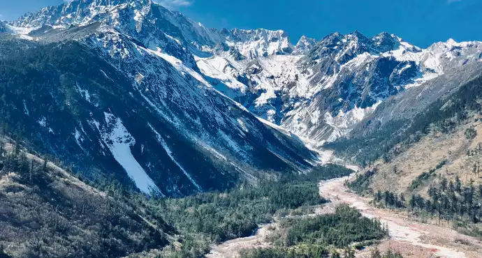
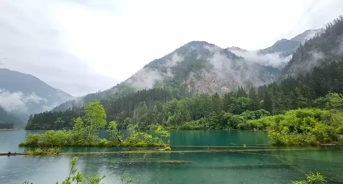
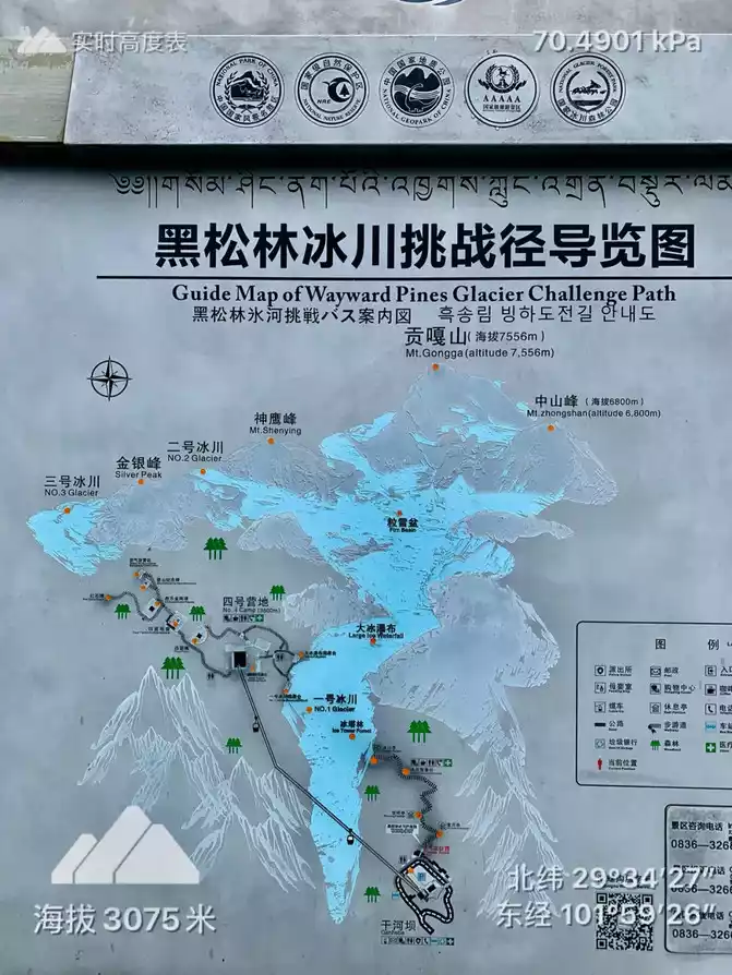
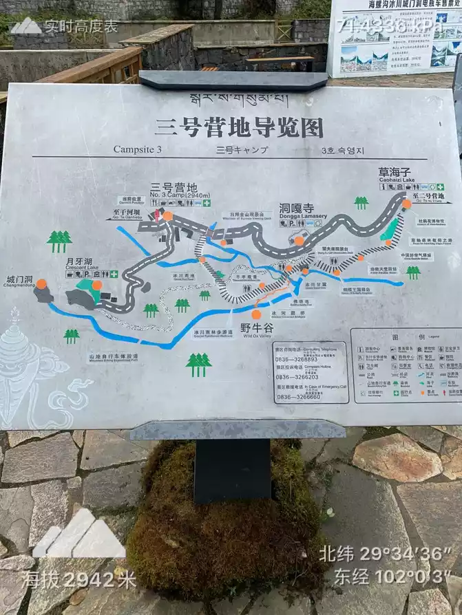
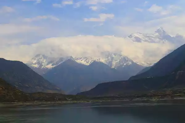
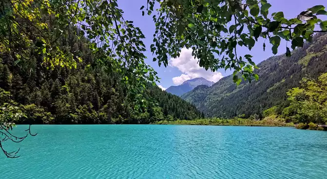
Hailuogou is located in Moxi Town, Luding County, Ganzi Tibetan Autonomous Prefecture, Sichuan Province, on the eastern slope of Gongga Mountain, and is an extremely high mountain on the eastern edge of the Qinghai-Tibet Plateau. Hailuogou is located at the foot of Gongga Snow Peak and is famous for its low-altitude modern glaciers. It is only a 5-minute drive from Moxi Town, arrive at Hailuogou Glacier Forest Park at 9 o'clock in the morning, and after entering the scenic spot, change to a bus and drive for more than 1 hour to Caohaizi and then transfer to a battery car to reach Camp 3 directly.
*It is recommended to walk down the mountain road, and when you meet people who climb the mountain in retrograde with us, you will not be very angry.
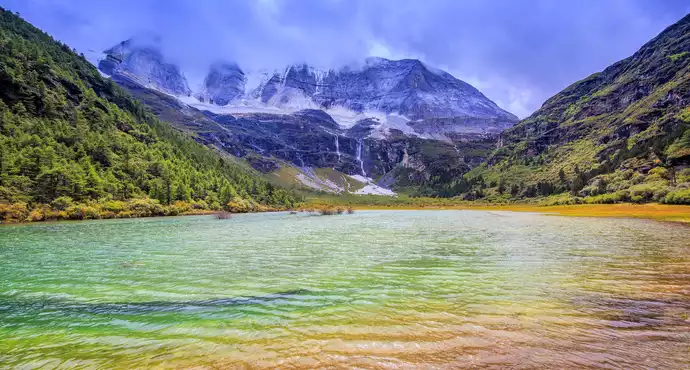
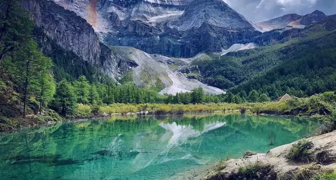
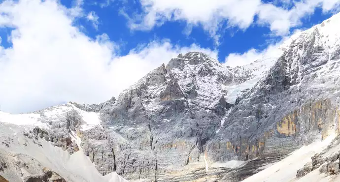
From Camp 3 to Camp 4, you need a cable car + hike to climb the mountain, you can see the glacier at the closest distance, whether you can see the glacier depends on the clouds and mist, the fog is too heavy to see anything. When we arrived at Camp 3, it was still drizzling and foggy, so we had to give up Camp 4 and miss the glacier up close. The old landscape platform 1.8 kilometers up is also foggy, in short, there is no chance to see the true face of the snow-capped mountains.
We continued from Camp 3 to Camp 2 all the way down through the Glacier Forest Park. The average altitude is about 3,500 meters, and the road down the mountain is easy to walk and you can breathe. Wherever the road needs to go uphill a little, take a big breath every three steps and stop every five steps.
The forest area in Hailuogou is 70 square kilometers, most of which is primeval forest, with strong biodiversity and rich ornamental plants. 38 species of rare plants have been confirmed in the ditch, including one national first-class protected plant, 7 second-class protected plants, and 13 third-level protected plants; There are 150 species of wild vertebrates, including 6 species of national first-class protected animals and 22 species of second-class protected animals. The vast majority of these rare animals and plants are monotypic genera, sub-relics and endemic species. The Gongga Mountain area, including Hailuogou, is one of the areas with the most preservation of ancient and primitive biological species in China, which is called the "refuge" of animals and plants during the Quaternary glacial period by the botanical and zoological circles, and hundreds of species of ornamental plants in the ditch, including magnolias, rhododendrons, orchids, primroses, gentians, lilies, snow lotuses, wild osmanthus, yew and other flowers, dozens of epiphytic plants such as arboreal rhododendrons and epiphytic trees, and more than 100 species of extra-large plants, trees on drifting gravel, etc., vegetation division, There are dozens of community types such as evergreen and seasonal plant communities.
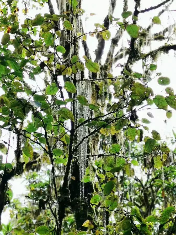
Walking through the Glacier Forest Park, you can feel the magical plants of nature, there are glaciers, hot springs, plateau rhododendrons, tulip fir, yew, various wild mushrooms, there are "hanging noodles", there are many red pandas, little raccoons (although we only see their tree holes and not the deity). With all kinds of curiosity and excitement, we walked for 5 hours, mainly down the mountain, and we survived. Walk back to Caohaizi and wait for the bus to return to the gate of the scenic spot.
Hailuogou is recommended to stay for a day and walk slowly, we entered at 9 a.m. and left the scenic spot at 4 p.m. Take dry food with you for lunch. You can buy some corn, beef jerky and other foods in the scenic area, or it is recommended to prepare light dry food such as energy bars to fill your stomach lightly. If the jacket is not waterproof, you can prepare a light raincoat, which is heavy and rainy.
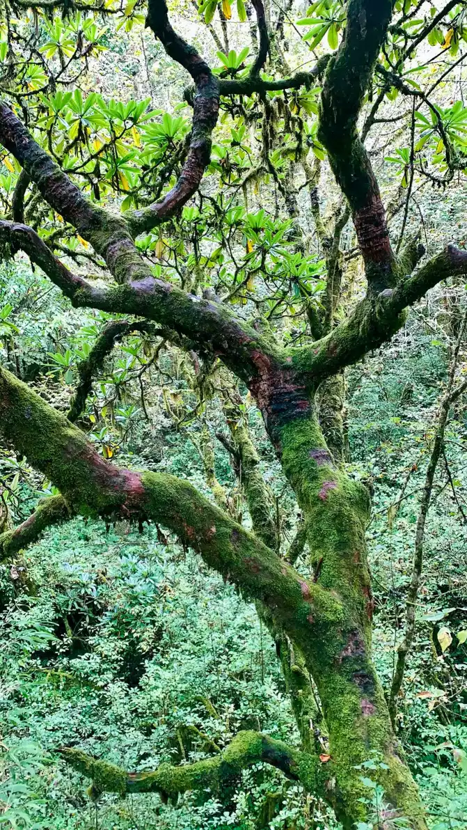
800-year-old alpine rhododendron with pink flowers.
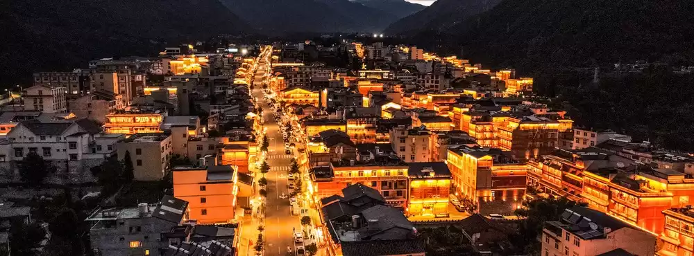
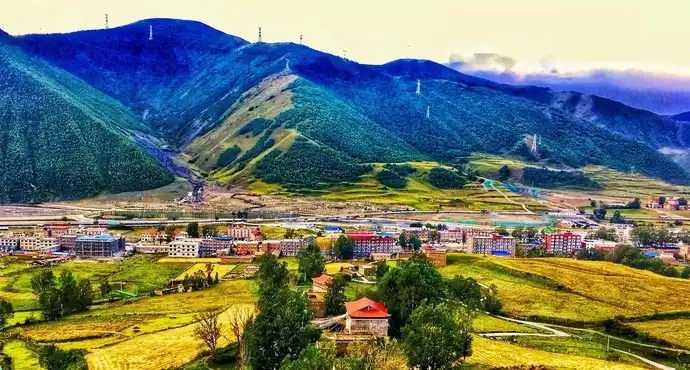
At around 4 o'clock, I had a meal in Moxi Town that I didn't know if it was lunch or dinner, and continued west. Originally, the journey of more than 2 hours was due to the traffic jam on G318, so we chose to go over the mountain (4400 meters above sea level), which was farther and higher but faster, but it was dark. We sped for more than an hour on a mountain road where we couldn't see our fingers. Finally arrived in Kangding at 9 o'clock, stayed at the Kangding Yangzongling Art Hotel in Xinduqiao, the hotel is so beautiful, I can't help but take pictures, or Rhodiola is too excited to drink too much? !
on September 27 on the road
Eighteen bends of the mountain road - Kazila Mountain (4,700 meters above sea level) - Litang (4,104 meters above sea level) - Rabbit Mountain (4,696 meters above sea level) - Haizi Mountain (4,500 meters above sea level) - Daocheng Yading (3,764 meters above sea level)
hummed Kangding love song and went out early in the morning to continue westward. Indeed, it was not.
After passing the eighteen bends of Tianlu, Kazila Mountain, and Rizhao Jinshan, and then drove out of G318 from Litang, all the way south to Shangri-La Town in Daocheng Aden, More than 400 kilometers of roads were driven.
Rabbit Mountain is actually a very small stone.
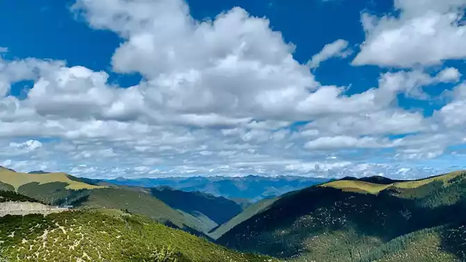
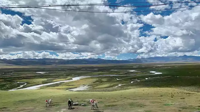
Haizi Mountain is amazing, I have never seen such a large-scale and continuous stone mountain. Located in the northern plateau area of Daocheng County, with an area of 3,287 square kilometers and an average altitude of 4,500 meters, it is the largest ancient ice body relic on the Qinghai-Tibet Plateau, and is famous for its "Daocheng Ancient Ice Cap". The highest point in the region is "Guoyin Rize", with an altitude of 5,020 meters and a total of 1,145 large and small lakes, which is unique in our country. Tibetans call the mountain lake Haizi, so it is called Haizi Mountain.
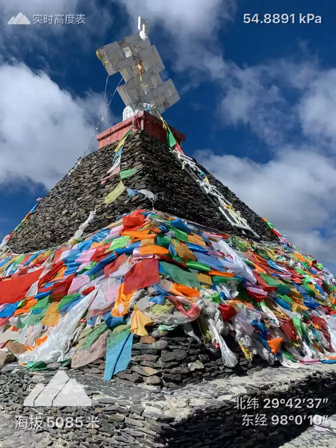
On the way, you will pass many mani piles, which are called "Duobang" in Tibetan, which means built stones. In the mountains, intersections, lakes, and rivers all over Tibet, you can almost see altars made of stones and stone slabs. Mani piles are also known as "god piles". Most of these stones and slabs are engraved with six-character mantras, wise eyes, statues of gods, and various auspicious patterns, which are also masterpieces of Tibetan folk artists.
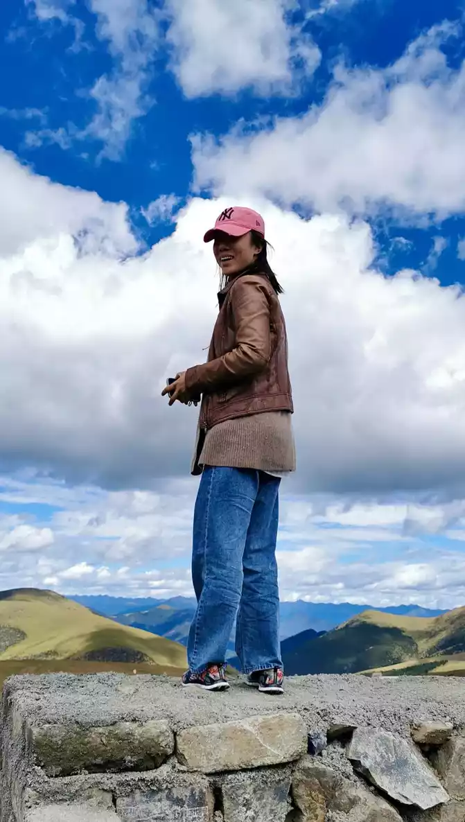
The sky is high and the clouds are low, and it feels within reach, or is our altitude high? The average altitude is more than 4,000 along the way. In addition, we also found that with high altitude, the air pressure also decreases, so breathing becomes thinner. Shanghai is 4 meters above sea level, with an air pressure of more than 100 pa, and an altitude of more than 4,000 meters above sea level is basically about 50 pa. We didn't open the oxygen tank!
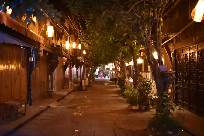
In the evening, he stayed in Shangri-La Town in Aden, Daocheng, for two nights. Rhodiola continues to soak.
On September 28, in Daocheng
Aden (average altitude of 4,500 meters)
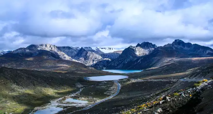
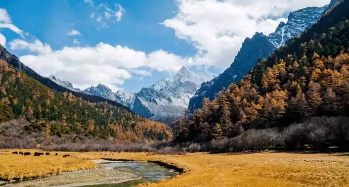
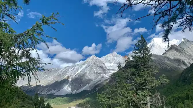
Daocheng Aden is mainly composed of three mountains of "Xian Nai Ri, Yang Mai Yong and Xia Nuo Dorji" and the surrounding rivers, lakes and alpine meadows, the north peak of Xian Nai Ri Peak is 6,032 meters above sea level, the south peak of Yang Maiyong Peak is 5,958 meters above sea level, and the east peak of Xiano Dorji Peak is 5,958 meters above sea level. As of October 2019, it is one of the most complete and pristine alpine natural ecosystems in China.
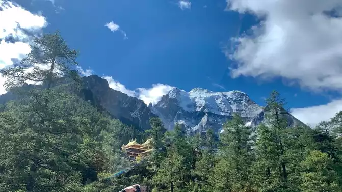
It is a 5-minute drive from Shangri-La Town to the gate of the scenic spot, and like Hailuogou, you must first transfer to the bus in the scenic area for about 1 hour, and it feels like you have been climbing over the mountains, and every time you can see the Xiannai Ri Snow Peak in the distance at the turn of the mountain road, it attracts an exclamation followed by the click of a mobile phone to take pictures.
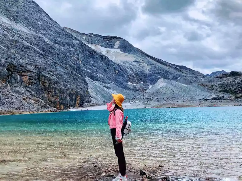
The bus arrives at the station and gets off the bus, there is a short line and a long line. The short line goes to Chonggu Temple and Dolma Latso (Cuo, which means lake), all the way around Xiannairi Snow Peak, 1.5 kilometers one way, and 2-3 hours of hiking back and forth. The long line goes to the Milk Sea and the Five-Colored Sea, all the way around Xiano Dorji Snow Peak and Yangmaiyong Snow Peak, 5 kilometers one way, and 3-4 hours of climbing back and forth. The average altitude is about 4,500 meters. Continue to change the battery car for more than 20 minutes to reach Luorong Cattle Farm, and we take a long line.
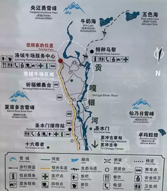
The Luorong cattle farm is very beautiful, and the weather is really powerful. We are ready for this tough battle, pack light, and don't have any extra weight in our backpacks except for water and energy bars. I didn't carry a mobile power bank, and when I entered Daocheng Aden, I directly turned on the airplane mode to maintain the battery to the maximum. Anyway, iPhone + Unicom = not at all.
The ecological protection of Daocheng Aden is very good, small animals can be seen everywhere, and they are not afraid of people, they are all wild, including rock sheep, small squirrels, Tibetan horse chickens and invisible national first- and second-level protected animals wildebeest, red panda, sambar deer, white-rumped deer, forest musk deer, leopard golden cat, antelope, spotted antelope, black bear, short-tailed monkey, etc.
Our pace is basically the same, three steps a small breath, five steps a big breath, high slope or many steps, stop for a while and then continue climbing. After walking for nearly 3 hours, I found that there was still the last kilometer when I was close to collapsing, and I was in a dilemma.
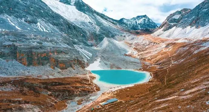
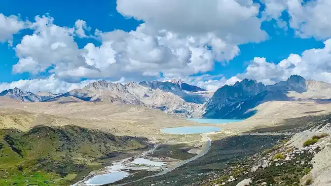
Finally, at two o'clock in the afternoon, we arrived at the final fork, 400 meters away from the Five Colors Sea but 75 degrees vertical, and 600 meters away from the Milk Sea. Let's talk about the latter. The moment I saw the milk sea and the glacier, I really wanted to cry, not because I cried beautifully, but because I was tired. The excitement of feeling victory and joy for oneself, the body obviously can't keep up with the rhythm, and can only vent emotionally.
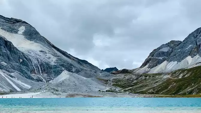
Milk Sea
Five-colored sea
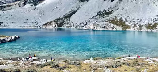
Turning around Kung Fu Miss E pulled me to the hillside and to the five-colored sea. After walking dozens of steps, I decided to give up, and Miss E continued to the five-colored sea without looking back, that kind of firmness was the fearlessness and bravery of the Red Army's Long March. Before I could go down dozens of steps, the "little motor" had disappeared into the crowd.
The body has limits, but limits can also be constantly broken. It took us 4 hours to climb to the top, and it took us 1.5 hours to trot all the way down the mountain back to Luorong Cattle Farm, worried that we wouldn't be able to catch the bus out, because it was already half past 3 when we went down the mountain. At every corner and turn, you can see snowy peaks and beautiful scenery from different angles. Have you ever taken a photo from this angle? Take another one. It seems that this angle is more beautiful, let's take another one. The great rivers and mountains of the motherland!
Because the sunset time is very late, basically around 8 pm, the sun's rays are the most soft around 4-7 pm. When it shines on the snow-capped mountains, it emits golden light, the softest light of the day.
On September 29, on the road
, Litang (4014 meters above sea level) - Maoya Prairie (3800 meters above sea level) - Sister Lake - Batang (2575 meters above sea level)
is already on the fifth day at an average altitude of 4500 meters, and it is basically very well adapted. Rhodiola is a spiritual pillar, I don't know if it's useful to drink it, just drink it. With blue sky and white clouds, any mental illness can be cured, and you will be refreshed all the way and in excellent condition.
Friends who have driven G318 say that the current national highway is well repaired. Indeed, except for the section from Batang to Mangkang, which is under construction, the road conditions of other sections are excellent.
Maoya Prairie
Sister Lake
There is a natural hot spring in Batang, where you can roll up your trousers and soak your feet, and the hot spring water foams up to your calves, which is very comfortable.
On September 30, on the road
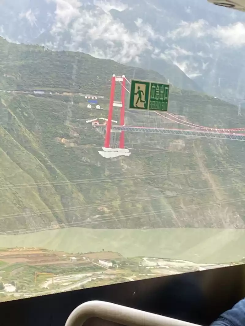
Mangkang (3869 meters above sea level) - Dongda Mountain (5130 meters above sea level) - Nujiang 72 turns - Basu (3280 meters above sea level)
got up early in the morning, and Brother Enzhao said that today's road is very difficult to drive, and some road sections will also lead to more traffic jams. The clouds and mist in the early morning are hazy and hazy.
confused along the way, and I don't know how many mountains I crossed. Finally, the Tibetans from Ganzi, Sichuan Province entered Tibet, and there were more mountains in addition to mountains. Today, more than 500 kilometers of mountain roads will be driven. At this time, I feel so happy to have Brother Enzhao.
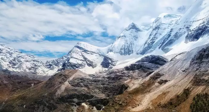
You don't have to look at the altitude numbers, and the body can also feel that the air in Dongda Mountain is extremely thin, the air pressure is lower, and the breathing becomes heavier, similar to the cold air in the early morning in Shanghai in winter. Dongda Mountain is located in Zuogong County, Tibet, and the height of the latest survey and mapping Dongda Mountain Pass is 5,130 meters, which is close to the base camp of Mount Everest and is the highest pass on the entire Sichuan-Tibet line. This area is a typical alpine shrub meadow belt, including alpine willow, gentian, golden dew, rhododendron, etc.The dripping snow water of Dongda Mountain is woven into silk mountain streams, spinning trickling spring water, and flowing into the great rivers along the winding stream. The silver-clad Dongda Mountain Canyon is covered with mountains and snow, and colorful prayer flags set off the beautiful scenery of Dongda Mountain Pass in the ice and snow.
It is better to hear than to see the 72 turns of the Nu River. The 72 turns of the Nu River refer to the 4,618-meter-high Yela Mountain Panshan Highway (located between Bangda Town and Basu County on the southern Sichuan-Tibet line, 16 kilometers), passing through the Nu River in the middle, with steep slopes and dangerous roads, known as "99 turns", "108 turns" and "99 bends in Sichuan and Tibet". There are more than 72 hairpin bends, we count more than 130 bends.
After driving down the mountain for more than an hour, Brother Enzhao parked the car and turned off the engine, and the brake pads needed to find a quiet sound.
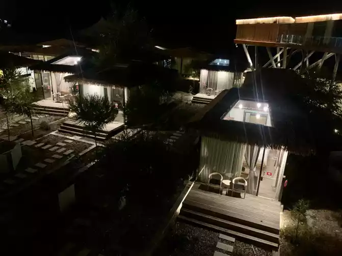
All the way to the stars and the moon, we arrived at Basu Ranwu Lake. For the starry sky room, we drove more than 100 kilometers (nearly 2 hours) to the Suran Wuhu International RV Camp. Today is the night of the Mid-Autumn Festival. Miss E's friend saw the Milky Way last time at Ranwu Lake! Our naked eyes and equipment are relatively poor, and the Milky Way is probably out of play.
The camp is built along the lake and is a starry sky house with a skylight. We communicated with the camp in advance and added a plug-in heater to the room, worried that the air conditioner would be cold if it did not heat up. The toilet and shower room in the room are all available and dry and wet are separated. With a heater, the cabin is extra warm. The camp also provides standard RV water and electricity supply, which is indeed worthy of the word "international".
It's a pity that we arrived late and didn't see the beauty of the sunset. However, the moon on 14 is already round and big, with a red and yellow moon halo. We had dinner at the lakeside restaurant, and in order to celebrate the National Day + Mid-Autumn Festival, the camp arranged a bonfire party and set off fireworks twice in a row.
Continue to the next article
Number of days: 4 days, Average cost: 3000 yuan, Updated: 2021.09.29

Number of days: 6 days, Average cost: 2000 yuan, Updated: 2022.10.30
, , Updated: 2022.07.19
Number of days: 2 days, Average cost: 500 yuan, Updated: 2020-03-31 20:19
Number of days: 5 days, Average cost: 1800 yuan, Updated: 2021-07-25 22:59
Number of days:7 days, Average cost: 3375 yuan, Updated: 2020.10.18