Live Your Best Lives
Continued from "Meeting the Great Beauty of China, Feeling Poetry and Distance, Walking on the Land of the Motherland, Part 1 of the Comprehensive Chapter (4) G318 Sichuan-Tibet Line Self-Driving Tour Book (Part I)" Meet
the Great Beauty of China, Feel Poetry and Distance, Walking on the Land of the Motherland, Part of the Series (5) G318 Sichuan-Tibet Line Self-Driving Tour Book (middle).
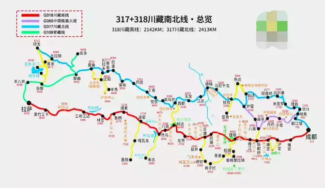
The highway connecting Sichuan and Tibet is called the Sichuan-Tibet Line, which is divided into the Sichuan-Tibet South Line and the Sichuan-Tibet North Line, the southern line is what we usually call National Highway 318, and the northern line is National Highway 317. The road conditions and scenery of these two highways into Tibet have their own merits. However, in comparison, the road conditions of National Road 318 are better, and the catering and accommodation along the way are more complete, which is the first choice for most travel enthusiasts to drive into Tibet for the first time.
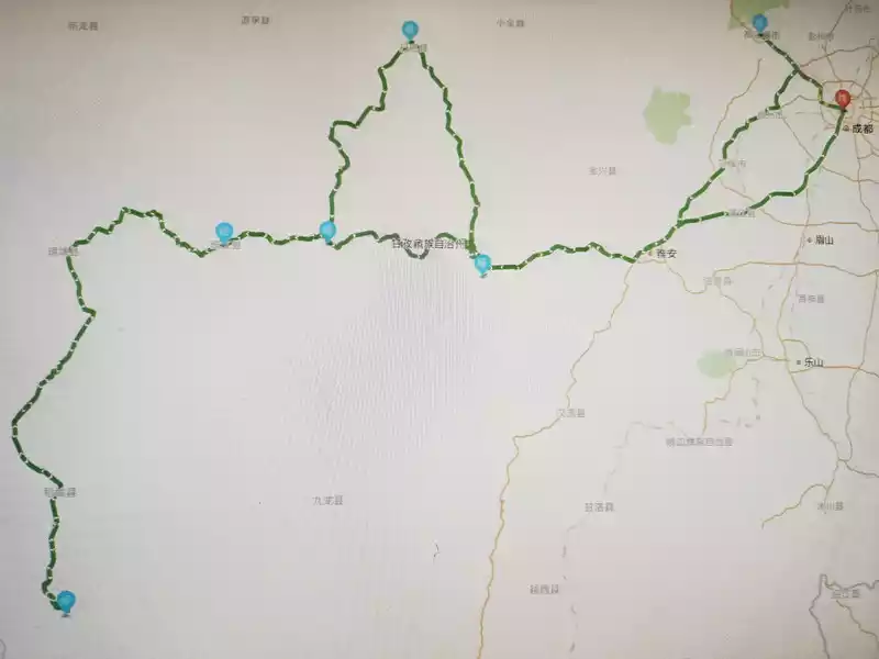
Schematic diagram of G318 Sichuan-Tibet Line (download picture online)
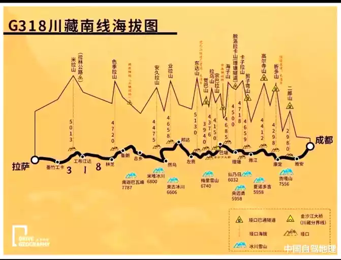
Schematic diagram of altitude of the southern line of the G318 Sichuan-Tibet Line (download picture online)
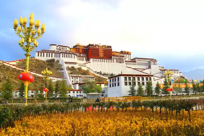
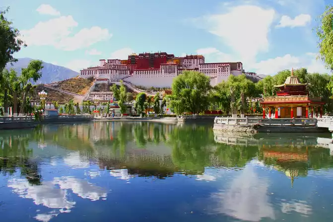
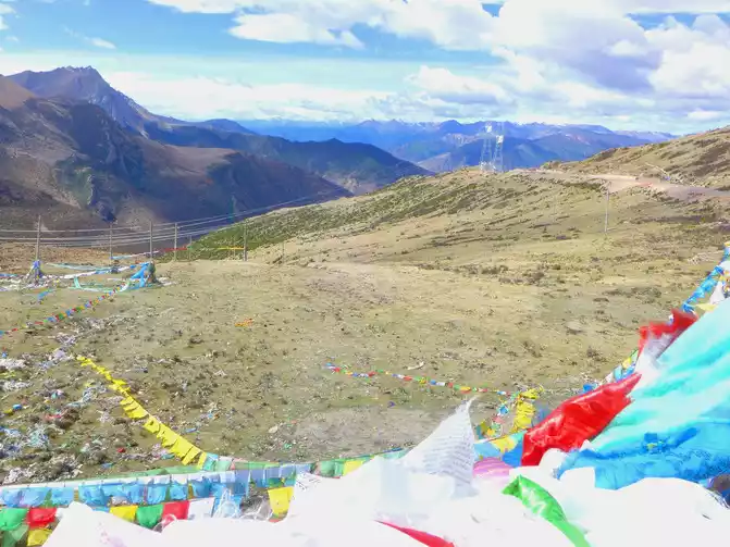
Tibet-Lhasa-Potala Palace Square-Potala Palace
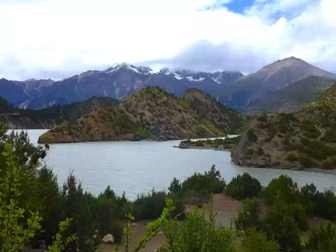
Tibet-Basu-Palong Zangbo River
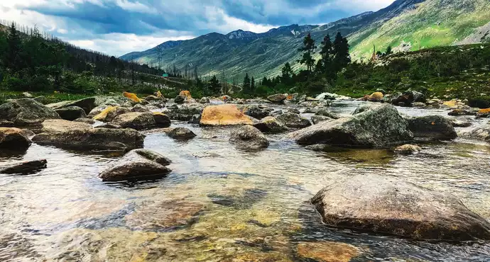
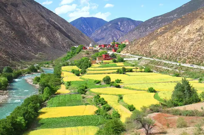
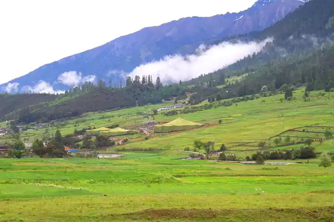
Sichuan-Batang-Scenery along the way
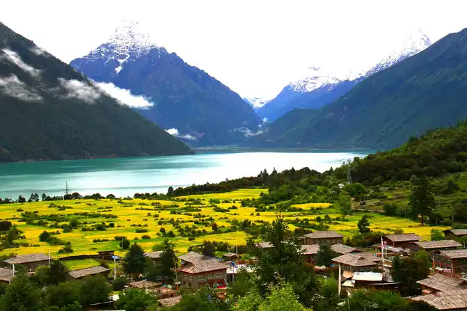
Tibet-Gongbu Jiangda-Basuncuo-Jiba Village
Tibet - Nyingchi - Bayi District - Gala Village Peach Garden
Tibet-Basu-318 National Road Section-Scenery along the way
The G318 Sichuan-Tibet Line is the most essence and most dangerous section of the Chinese landscape avenue of National Highway 318, only this section of the road, beautiful, complex, changeable and steep, the altitude has increased steeply from a few meters to more than 5,000 meters, dozens of mountains such as Erlang Mountain and Zheduo Mountain are in front of you, and the turbulent rivers such as the Dadu River, Jinsha River, and Lancang River are accompanied by turbulent rivers on the left and right. Majestic mountains, magnificent rivers, alpine snowfields, forests and glaciers encompass almost all the natural landscapes, like a visual feast waiting for you. Due to the rich natural scenery, profound cultural heritage, and severe challenges along the G318 Sichuan-Tibet Line, it has become the most popular and popular self-driving tour route in our country.
Tibet - Lhasa - Potala Palace Square - Potala Palace
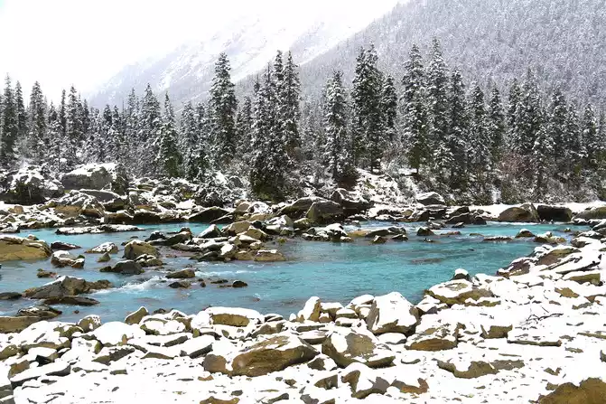
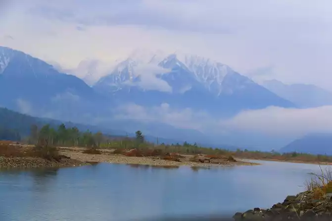
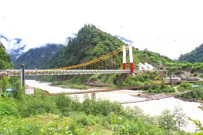
Tibet - Basu - Ranwu Lake
Tibet-Nyingchi-Bayi District-Gala Village
Tibet - Nyingchi - Milin - Suosong Village - Overlooking Nanga Bawa Peak
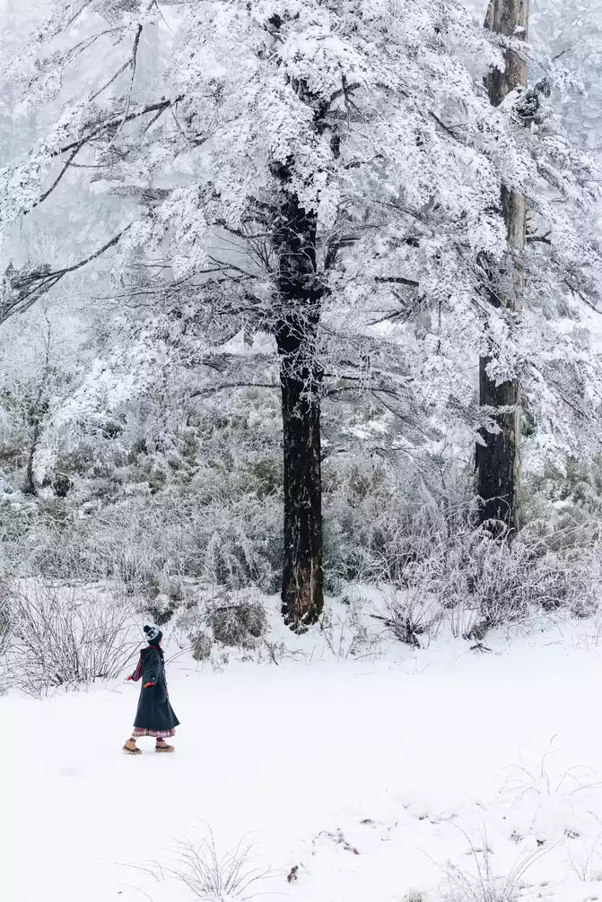
Tibet-Nyingchi-Lulang
Tibet-Bomi-Gangxiang Nature Reserve-scenery along the way
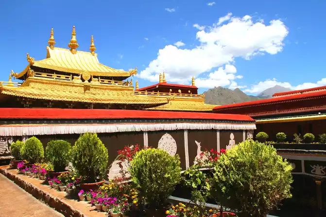
Tibet-Lhasa-Jokhang Temple
Tibet-Basu-Ranwu Lake
Without walking through 318, you don't know the difficulties of the Sichuan-Tibet Road; I haven't walked through 318, let alone the most beautiful corridor in China. The most beautiful scenery is always on the road, G318 Sichuan-Tibet Line, the scenery will definitely not disappoint you.
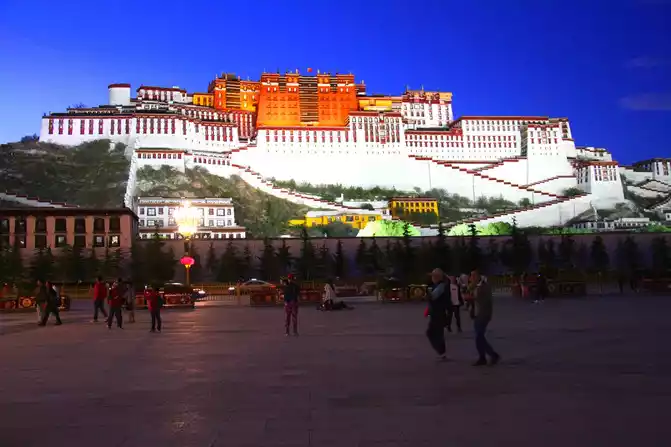
Tibet - Lhasa - Potala Palace Square - Potala Palace Night View
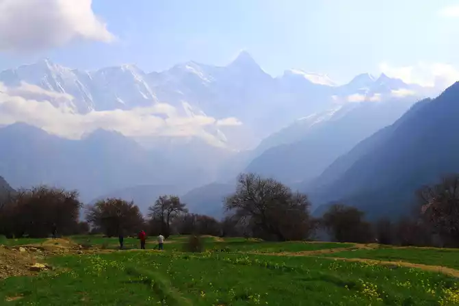
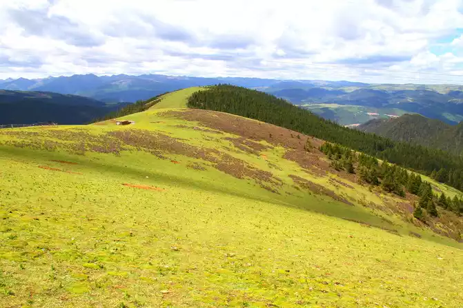
Sichuan - Litang - Kazila Mountain Pass - Alpine Meadow
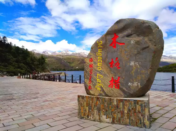
Sichuan-Kangding-Mugecuo (Kangding Love Song Scenic Area).
Tibet - Nyingchi - Milin - Suosong Village - Brahmaputra River
Tibet-Basu-Laigu Glacier
Tibet-Nyingchi-Lulang
marvel at its danger and beauty!
Fourth stop: Batang - Mangkang - Zuogong (260 kilometers)
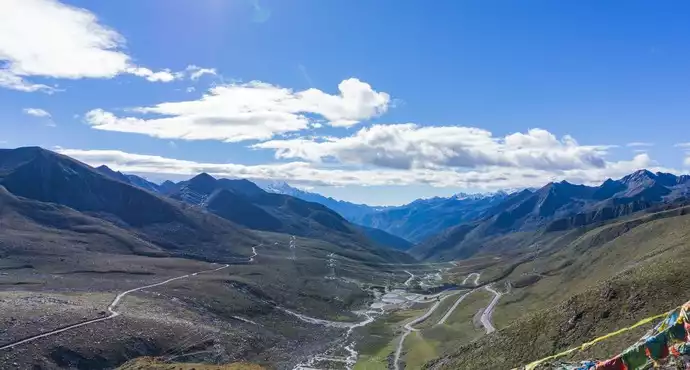
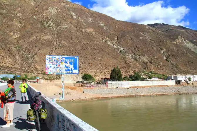
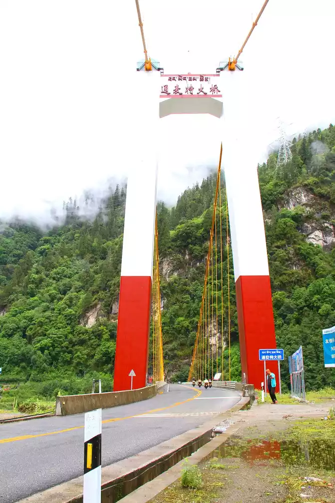
After leaving Batang not far from Zhubalong Township and crossing the Jinsha River Bridge, he climbed mountains and wading all the way and went through hardships, and finally began to enter the Tibetan border, and was able to immerse himself in the complex and colorful scenery of the Jinsha River, Lancang River and Nujiang River basins. Before entering the first county seat in Tibet, which is also the intersection of the Sichuan-Tibet line and the Yunnan-Tibet line, and Mangkang at an altitude of 3,860 meters, it is necessary to cross the Dzongbala Mountain Pass at an altitude of 4,150 meters and the Lau Mountain Pass at an altitude of 4,376 meters.
Sichuan-Batang-Jinshajiang Bridge
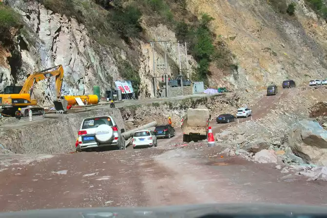
Tibet-Mangkang-G318 Sichuan-Tibet Line-Road Repair Section
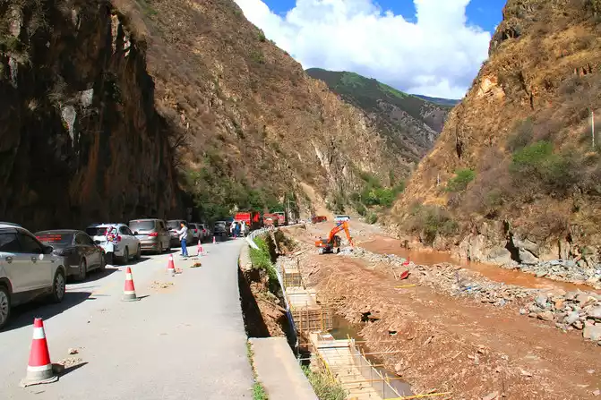
Tibet-Mangkang-G318 Sichuan-Tibet Line-Road Repair Section
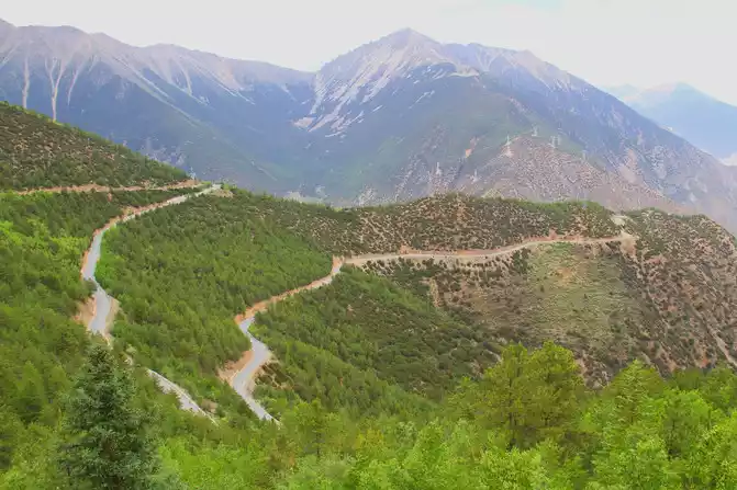
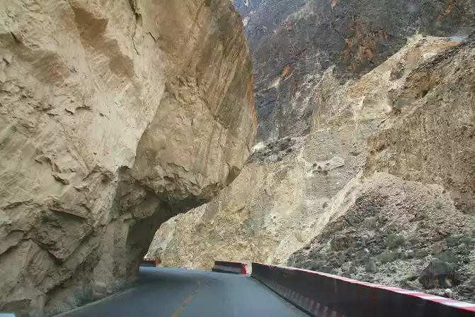
The mountain road out of Mangkang is rugged and begins to enter the Lancang River Grand Canyon. The relative drop of the Grand Canyon is more than 1,000 meters, the river is turbulent in the deep valley, and the 318 National Highway is rugged on the steep cliffs, allowing us to appreciate the high altitude drop and difficult side of the 318 National Highway. The section of Jueba Mountain Yakou, which is not high above sea level and only 3911 meters, is a famous dangerous section in the Hengduan Mountain area because of the many sharp curves on the winding mountain road and poor road conditions.
Tibet-Mangkang-Juepa Mountain Pass
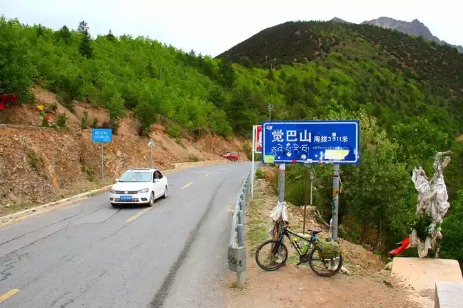
Tibet-Mangkang-Juepa Mountain
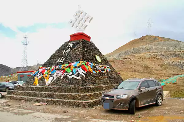
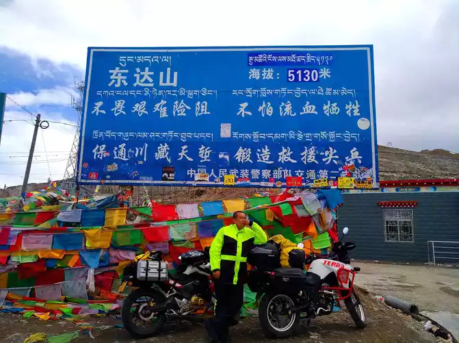
After that, it will usher in the first alpine pass with an altitude of more than 5,000 meters since entering the G318 Sichuan-Tibet Line, that is, the Dongda Mountain Pass at an altitude of 5,130 meters. This altitude is only a little lower than the famous Everest Base Camp (5,200 meters above sea level). On one side of the mountain is the rushing Lancang River, and on the other side of the mountain is Zuogong. It was also called the "forbidden zone of life", and it was often windy and rainy on the high mountains, and even snowed all year round. Due to the harsh environmental and climatic conditions, the road conditions in this area are average, so you need to pay attention to controlling the driving speed and driving carefully for safety.
Crossing this higher mountain pass is a challenge and test for every self-driving G318 Sichuan-Tibet line travel enthusiast. After going down the mountain, we continued to another post station, Zuogong County at an altitude of 3,750 meters.
Tibet-Zuogong-Dongda Mountain Pass
Tibet-Zuogong-Dongda Mountain Pass
Tips
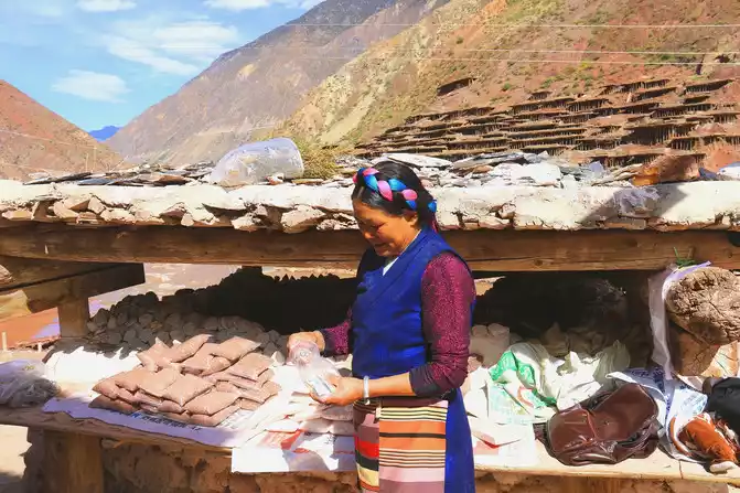
1. If you have enough time and are interested when passing through Mangkang, you can drive south along National Highway 214 for about 100 kilometers to the Mangkang Ancient Salt Field located in Naxi Ethnic Township. First, you can enjoy the unique scenery of the ancient salt fields on both sides of the Lancang River; Second, you can personally feel the hardships of the working people in hand-making salt by the Lancang River for thousands of years.
2. The condition of the 214 national road is good, and the number of vehicles coming and going is far less than that of the G318 Sichuan-Tibet line.
3. There are landmark buildings at Dongda Mountain Pass that can be taken as a souvenir. Due to the high altitude here, you need to move slowly when watching the scenery, and the stay time should be short rather than long, so as to avoid high reactions.
Tibet - Mangkang - Lancang River - Millennium Ancient Salt Field
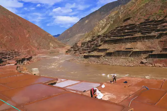
Tibet - Mangkang - Lancang River - Millennium Ancient Salt Field
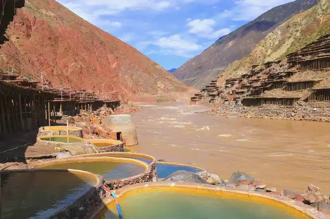
Tibet - Mangkang - Lancang River - Thousand-year-old salt field - villagers
selling their own salt
Tibet-Mangkang-214 National Highway-Scenery along the way
The fifth stop: Zuogong - Basu - Ranwu (300 km)
Thenext point of Zuogong is Bangda, which is famous for having Bangda Airport in Changdu City. It is also the intersection of the north-south Sichuan-Tibet line.
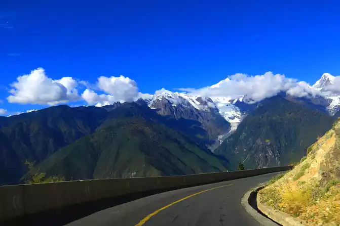
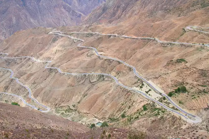
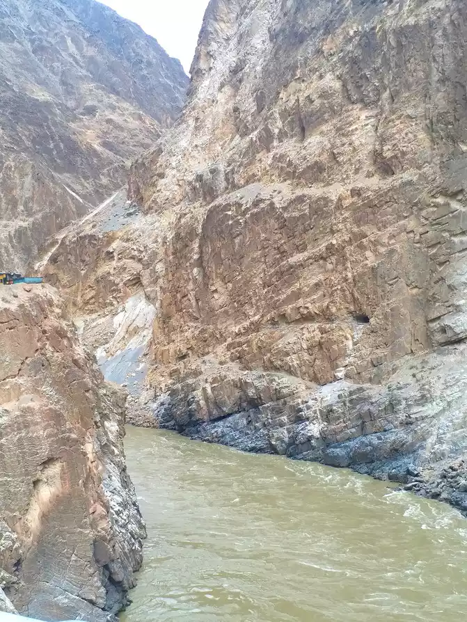
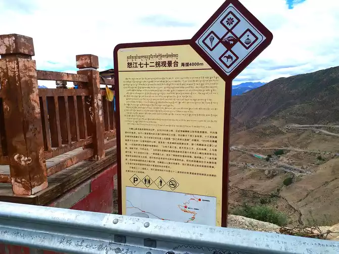
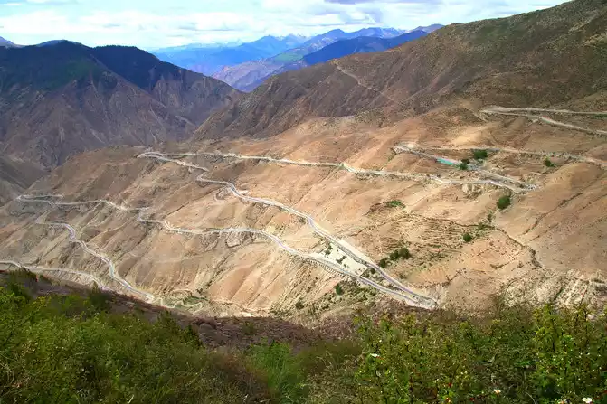
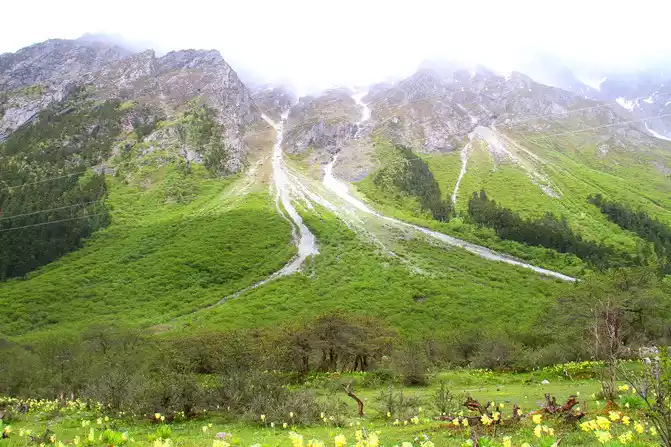
After climbing the 4,658-meter-high Yela Mountain Pass from Bangda, National Highway 318 continues to turn down along the steep ridge here, all the way down to the Nu River, forming the majestic Nujiang 72 turn. As the only way to pass through the Sichuan-Tibet Line, it is precisely because of its danger that it is more challenging for self-driving travel enthusiasts. When driving a car to the mountain and standing on the observation deck to look down from a high place, the scenery in front of you makes everyone who is there sigh.The tiger's mouth driving through the end of the 72 turn, which is also a dangerous section of the Nujiang Grand Canyon on the Sichuan-Tibet line, the road surface is narrow, there are many sharp curves, and the line of sight is poor, so you need to concentrate and move forward slowly.
Tibet-Basu-Yelashan Yakou
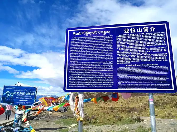
Tibet-Basu-Yelashanyakou
Tibet-Basu-Nujiang 72 turn
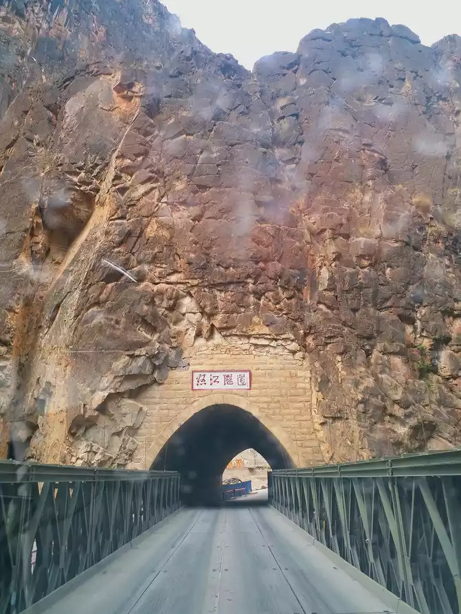
Tibet-Basu-318 National Highway Nujiang Grand Canyon Section-Nujiang Tunnel
Tibet - Basu - National Highway 318 Nujiang Grand Canyon Section - Tiger Mouth
Tibet-Basu-318 National Highway Nujiang Grand Canyon Section - Nujiang on the side of the highway
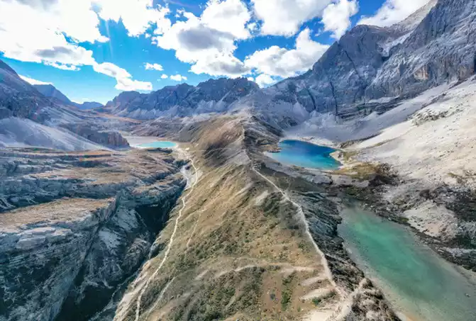
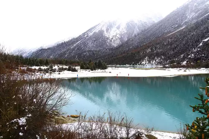
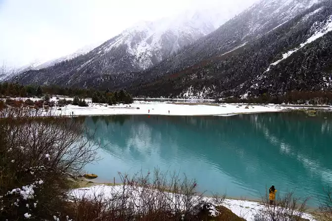
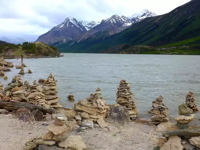
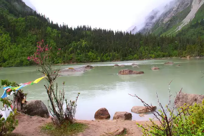
After passing through the Eight Su (3,260 meters above sea level), and then crossing the watershed between the Nu River and the Brahmaputra River, the relatively gentle mountain pass and the Anjula Mountain Pass at an altitude of 4,325 meters, the Nu River Basin enters the legendary and mythical Brahmaputra River Basin. After crossing the pass, we went all the way down and soon came to the beautiful Ranwu Lake, which is 3,850 meters above sea level. Ranwu Lake has a surface of 22 square kilometers, consisting of 3 lakes connected up and down, with snow-capped mountains, meadows and blue skies, with beautiful scenery, and is a must-visit attraction for Sichuan-Tibet line tourism.
Tibet-Basu-Anjula Mountain Pass
Tibet-Basu-318 National Road Section
Tibet-Basu-318 National Highway-Scenery
along the way
Tibet-Basu-Ranwu Lake
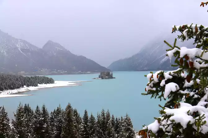
Tibet-Basu-Ranwu Lake
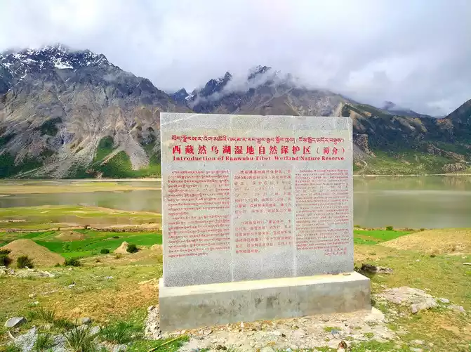
Tibet-Basu-Ranwu Lake Wetland Nature Reserve
Tips
1. There is a special observation deck at the 72nd turn of the Nu River, where you can park and rest and overlook the spectacular scene of 72 turns.
Tibet-Basu-Nujiang 72 Daogui Observation Deck
Tibet-Basu-Nujiang 72 Daogui Observation Deck-Nujiang 72 Daogui Observation Deck-Nujiang 72 Daogui
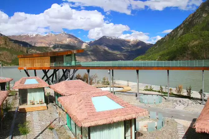
2. Ranwu Town has formed a tourist station, with convenient food and accommodation, as well as high-end resort hotels. There are not only Ranwu Lake and Ranwu Lake Wetland Reserve, but also Laigu Glacier, Laigu Village and other scenic spots to visit.
3. Although refueling along the way is basically not a problem now, self-driving travel still needs to develop a good habit of filling up the fuel tank halfway and filling up at the gas station.
Tibet-Basu-Ranwu Lake
Tibet-Basu-Ranwu Lakeside Tourist Resort
Tibet-Basu-Ranwu Lake Wetland Nature Reserve
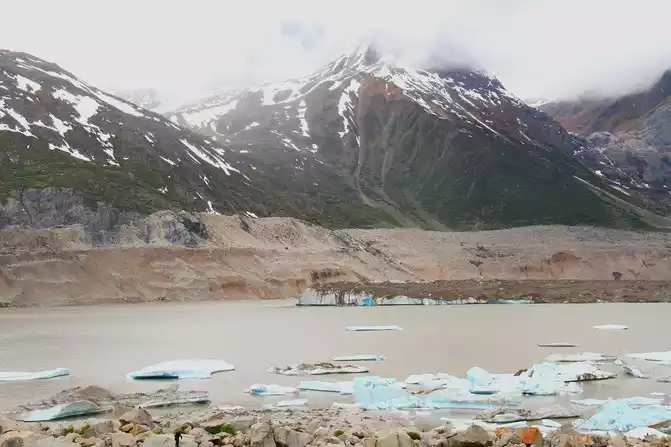
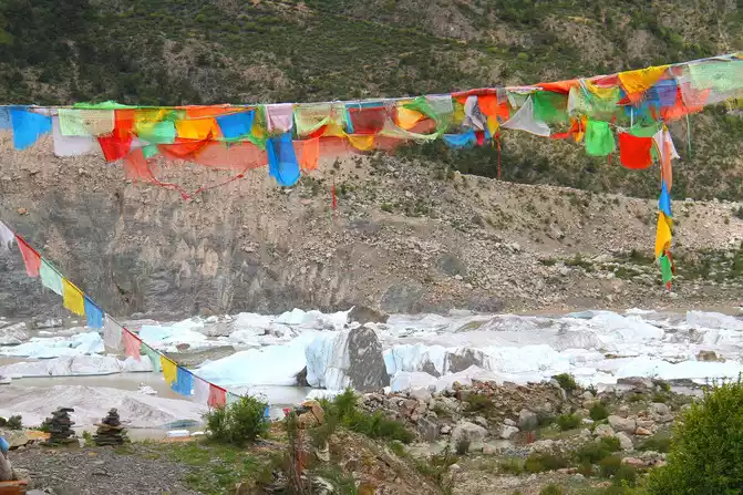
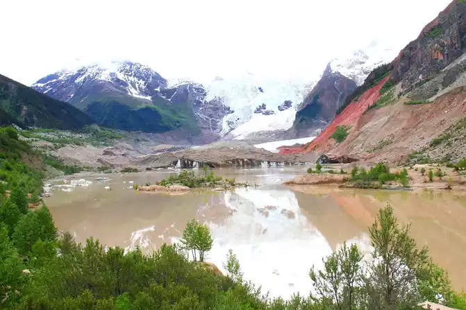
Tibet-Basu-Laigu Glacier
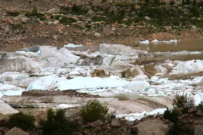
Tibet-Basu-Laigu Glacier
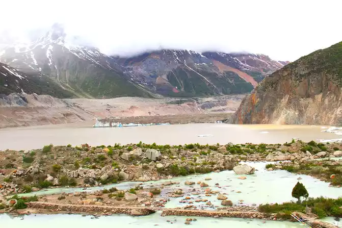
Tibet-Basu-Laigu Glacier
Sixth stop: Ranwu Lake - Bomi (120 km).
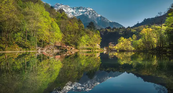
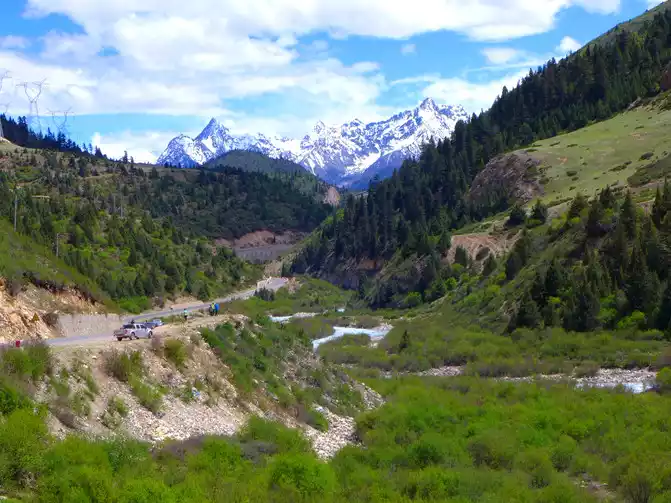
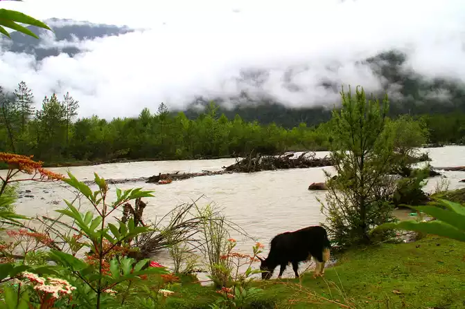
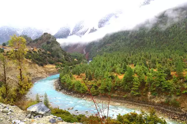
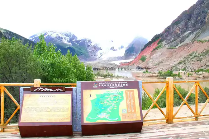
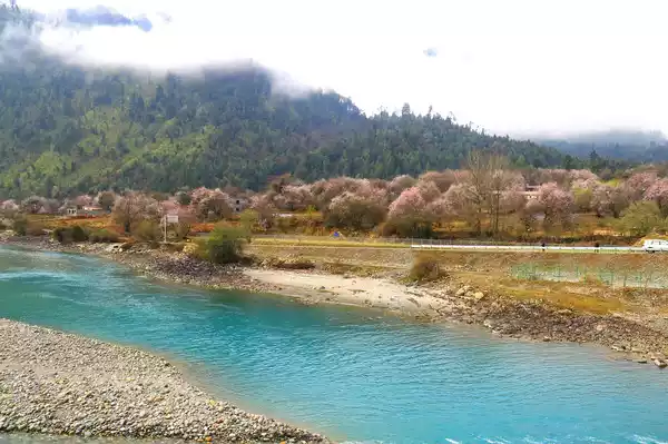
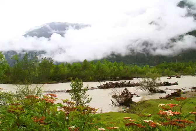
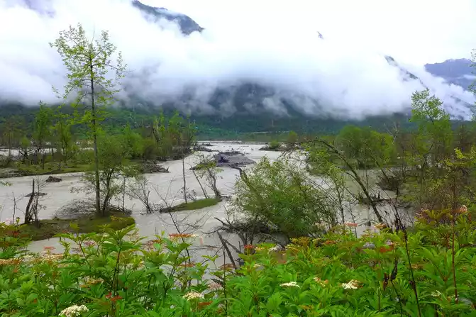
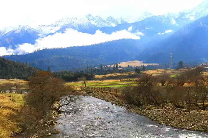
Leaving Ranwu Lake, continue westward along the G318 Sichuan-Tibet Line, the beautiful Palong Zangbo River is accompanied all the way, the scenery is beautiful, frequent stops to enjoy the scenery and take pictures, and not far away to the Midui Glacier Scenic Area located in Yupu Township, Bomi County. Midui Glacier is the world's lowest oceanic glacier, with a complete range of glaciers, especially the coexistence of huge ice basins, many avalanches, giant ice waterfalls, ice lakes, and villages. Midui Village, a small village at the foot of the Midui Glacier, is a quiet Tibetan village, with Tibetan-style courtyards scattered in order, trees, prayer flags, grain drying fields, etc., forming an idyllic natural style, which is very beautiful.
Tibet-Basu-Palong Zangbo River
Tibet-Basu-Palong Zangbo River
Tibet-Basu-Palong Zangbo River
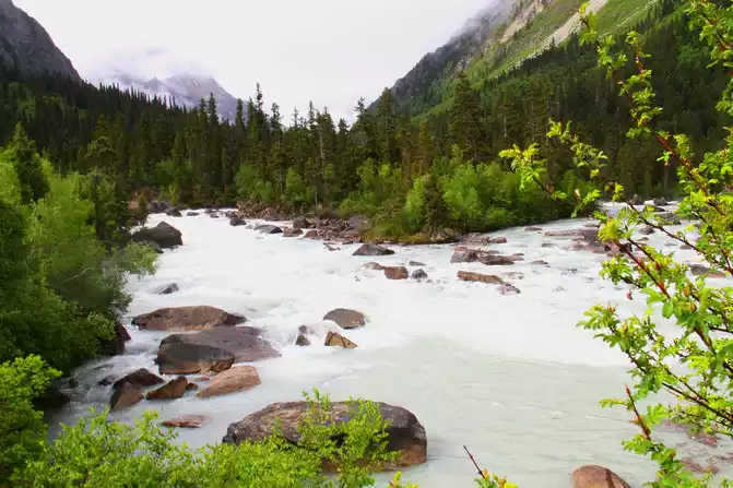
Tibet-Bomi-Palong Zangbo River
Tibet-Bomi-Palong Zangbo River
Tibet-Bomi-318 National Highway-Scenery
along the way
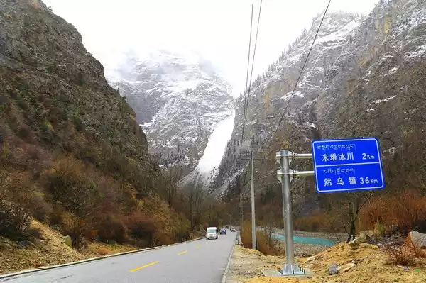
Tibet-Bomi-Midui Glacier
Tibet-Bomi-Midui village
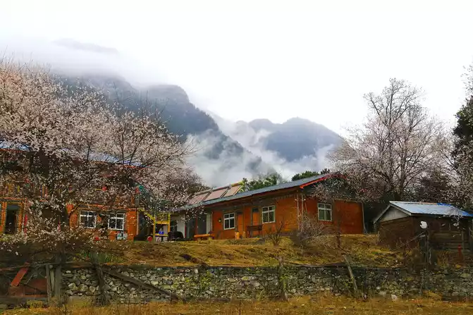
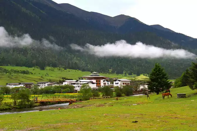
closer you drive the car to Bomi, the denser the forests on both sides of the highway, and the gentler the terrain, which is a rare section of the road that can bring pleasure to the driver. Coming to Bomi, which is only 2,750 meters above sea level and has many famous scenic spots, it is an ideal place to rest.
From Bomi to the south, you can go south to Mozha Highway, known as the "Lotus Secret Realm", which is the last county in our country to have a highway. In the past, due to inconvenient transportation, it still retains a mysterious color and has become the most desirable place for people who love to travel.
Tibet - Bomi - National Highway 318 - scenery
along
the way< img src="https://dimg04.c-ctrip.com/images/0106a120009nzq0ni73D8_W_671_0_Q90.jpg?proc=autoorient" / >
Tibet - Bomi - 318 National Highway - Villagers in the mountains
Tibet-Bomi-Galang National Wetland Park
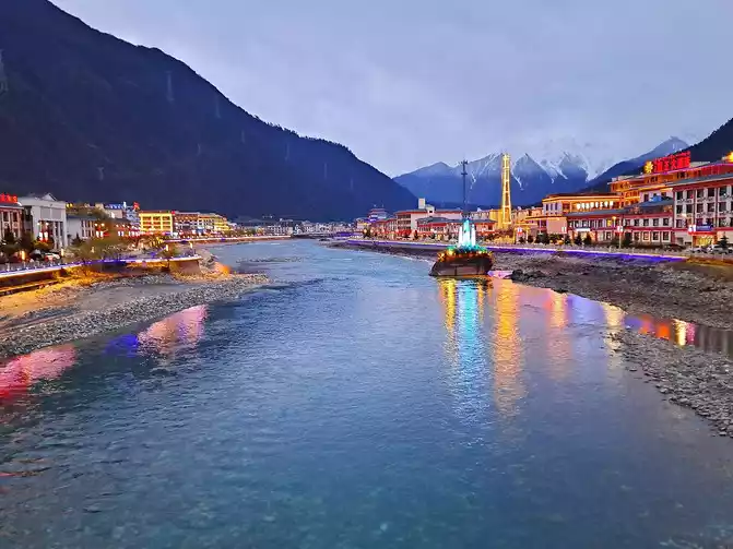
Tibet-Bomi-County-Night Scene
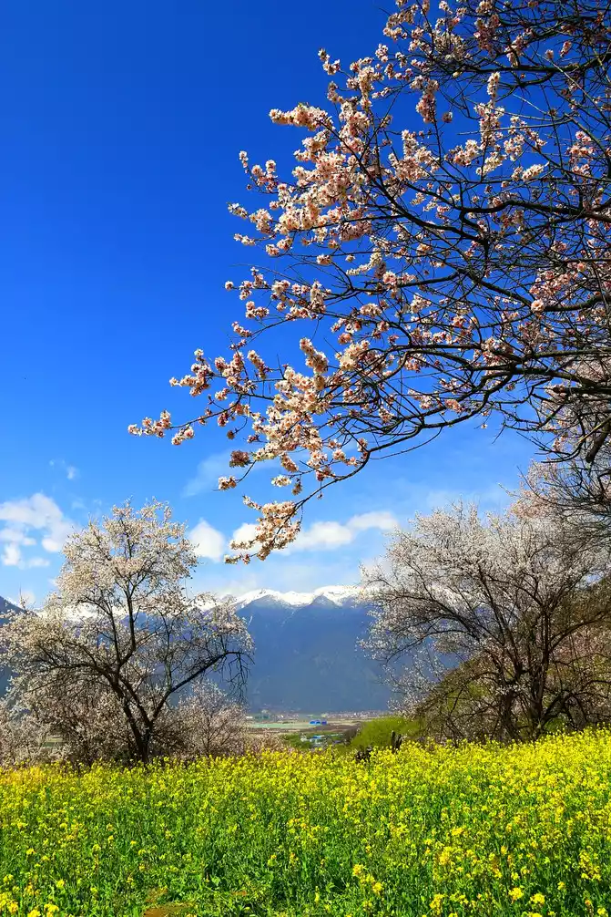
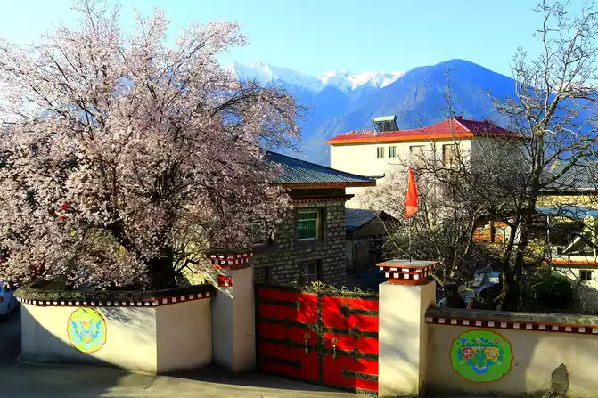
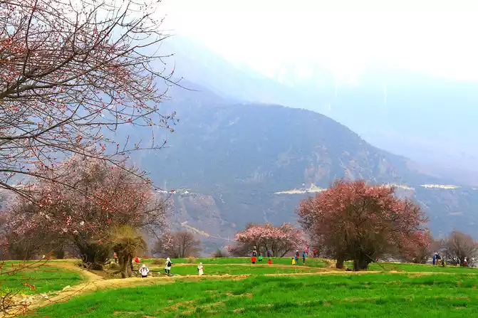
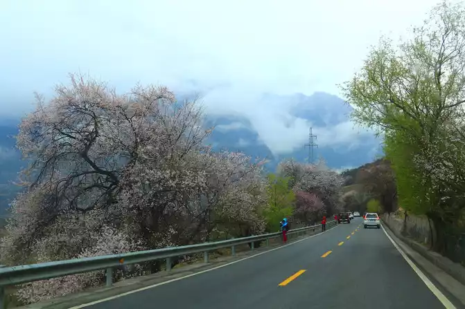
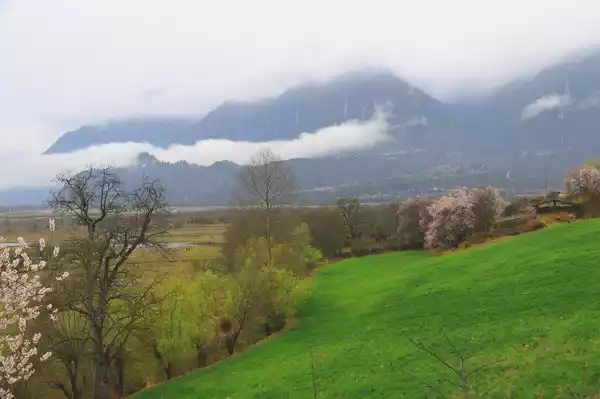
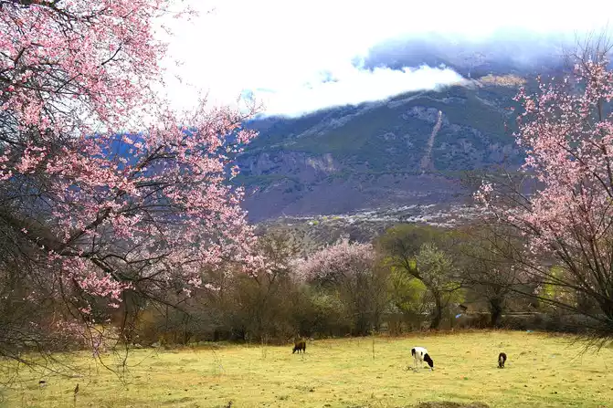
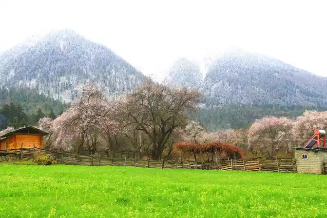
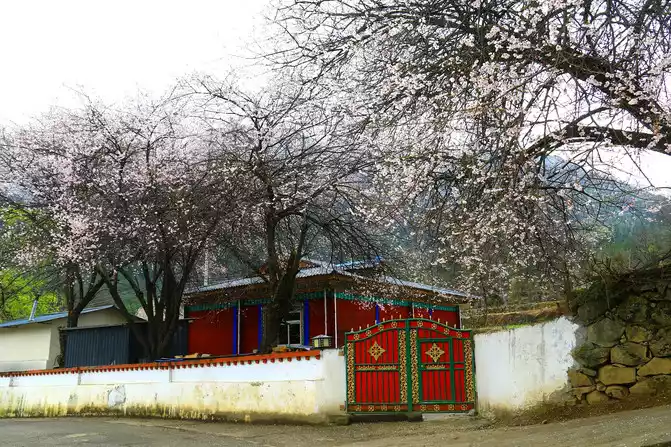
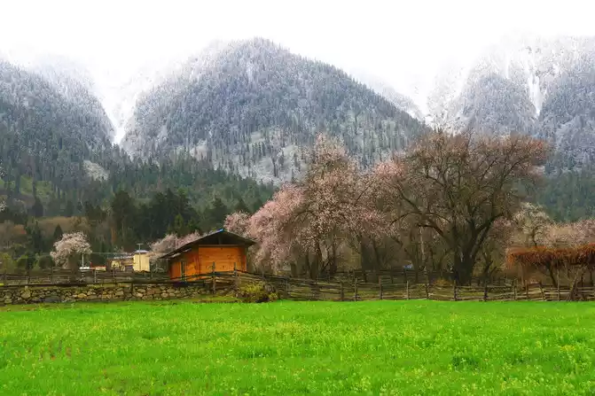
If you come to Bomi during the peach blossom season in March and April, there are many blooming peach blossoms on both sides of National Highway 318, attracting tourists to stop and watch. The prestigious Bomi Peach Blossom Gully stretches for dozens of kilometers, and you can see enough of the peach blossom scenery all the way.
Tibet-Bomi-318 National Highway-Scenery along the way
Tibet-Bomi-Galang National Wetland Park
Tibet-Bomi-Galang National Wetland Park
Tibet-Bomi-Bomi Taohuagou
Tibet-Bomi-Bomi Taohuagou
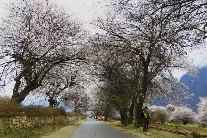
Tibet-Bomi-Bomi Taohuagou
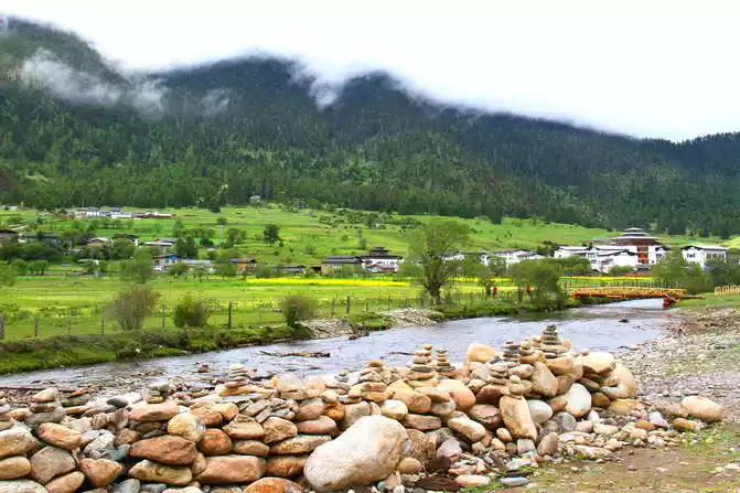
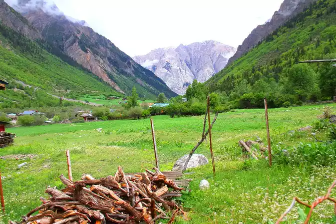
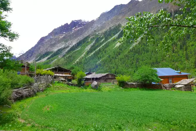
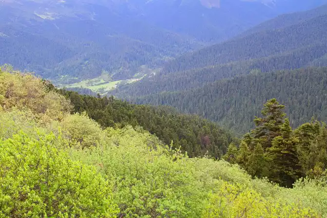
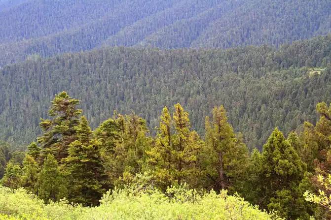
In addition, there is also the spruce forest of Bomigang Township, which has been rated as one of the top ten most beautiful forests in China by China National Geographic magazine, and the most beautiful village in China - Gang Village. The pristine natural scenery, the strong rural atmosphere, and the unique Tibetan style are all worth stopping for a while and walking around.
Tibet-Bomi-Gangxiang Nature Reserve
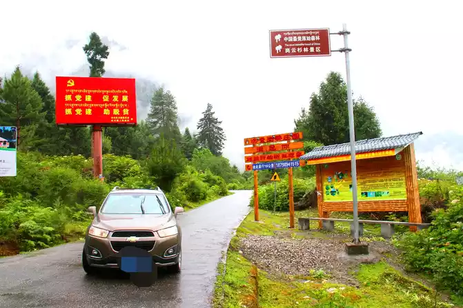
Tibet-Bomi-Gangxiang Nature Reserve-Gangxiang Spruce Forest Scenic Area
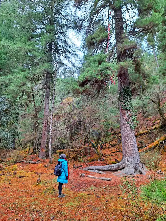
Tibet-Bomi-Gangxiang Nature Reserve-Gang Village
Tibet-Bomi-Gangxiang Nature Reserve-scenery
along the way
Tips:
1. The Midui Glacier Scenic Area is less than 10 kilometers away from National Highway 318, and after buying a ticket at the gate, you can drive the car directly into it for several kilometers and park it in the parking lot of Midui Village. If you don't stay in Ranwu, some families in Midui Village provide food and accommodation, and the altitude here is very low, only about 2,000 meters.
Tibet-Bomi-Midui Glacier
Tibet-Bomi-Midui Village
2. Gangxiang Spruce Forest Scenic Area and Gangcun are both in the Gangxiang Nature Reserve, not far from Zhamu Town, the county seat of Bomi. There is a spectacular spruce forest that stretches for tens of kilometers, and you can enjoy the pristine jungle scenery in pure nature. The villages and pastoral scenery in Gang Village are beautiful, and Tibetan families can also provide simple catering services.
Tibet-Bomi-Gangxiang Nature Reserve-Gangxiang Spruce Forest Scenic Area
Tibet-Bomi-Gangxiang Nature Reserve-Gangcun
Tibet-Bomi-Gangxiang Nature Reserve-Gangcun
Tibet-Bomi-Gangxiang Nature Reserve-scenery
along the way
3. Although the Meza Highway from Bomi to Motuo has been opened to traffic, the road conditions often change greatly due to the influence of special geographical structure and climatic environment. In addition, it is said that due to the restrictions of traffic conditions, the "double in, single out" one-way traffic system is now implemented in Motuo.
Tibet-Motuo-Mozha Highway-Galonla Tunnel
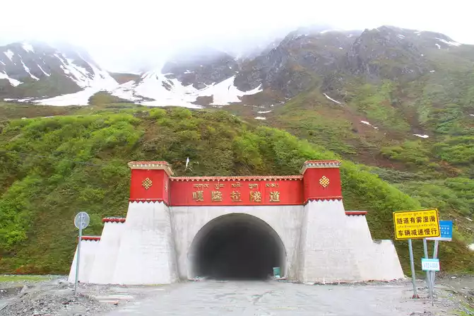
Tibet-Motuo-Mozha Highway-Scenery along the way
Seventh stop: Bomi-Lulang (160 km).
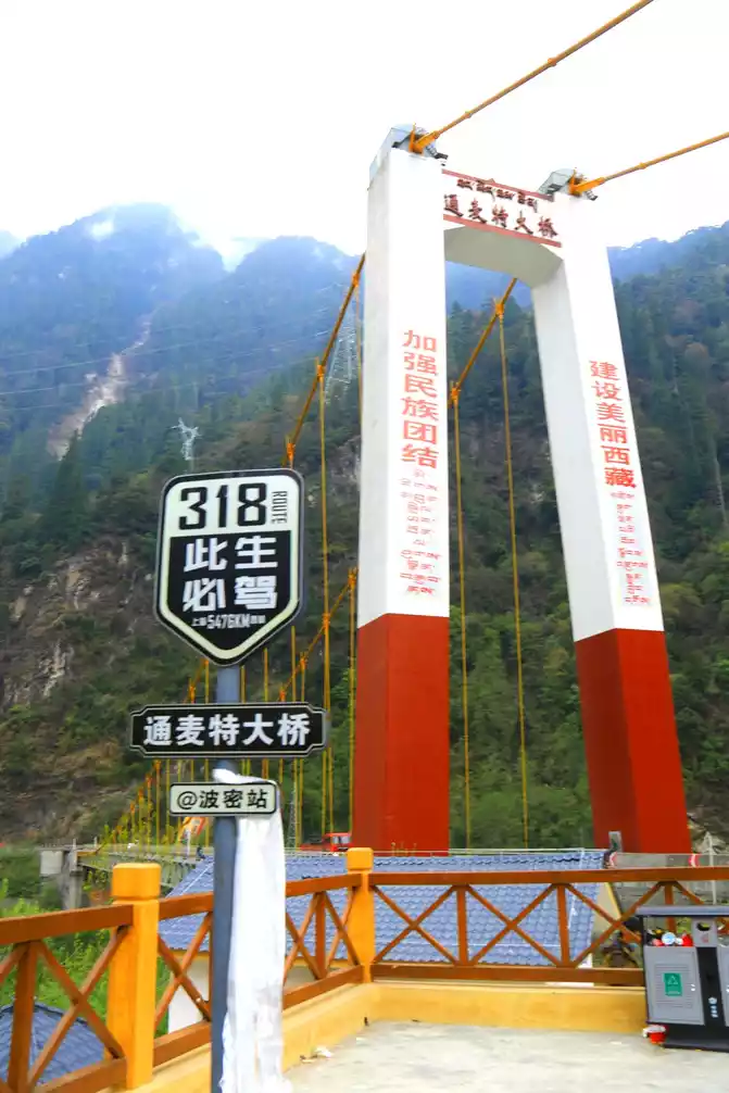
Leaving Bomi and walking in the direction of Lulang, you will pass through the legendary Tongmai Natural Danger. In the past, due to the complex geographical structure of this area, serious natural disasters such as landslides, roadbed collapses and mudslides often occurred, and sometimes the road was blocked for more than ten hours or even three days. A few years ago, the state invested heavily in rebuilding the Tongmet Bridge and the Zhilonggou Bridge here, and avoided the places where landslides and mudslides often occurred before, and excavated several tunnels one after another, fundamentally changing the traffic conditions of National Highway 318 passing through this area. Since then, the natural danger of Tongmai has completely become history. Now, it only takes a dozen minutes to drive a car to successfully pass through this place that was once known as the "natural danger of Tongmai", and the dangerous road becomes smooth, fast and safe. After passing Tongmai, we continued to move forward and came to another place that is particularly suitable for staying - the international tourist town of Lulang.
Tibet-Bomi-Thongmai-Thongmai Bridge
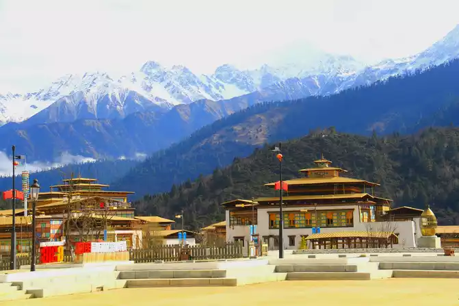
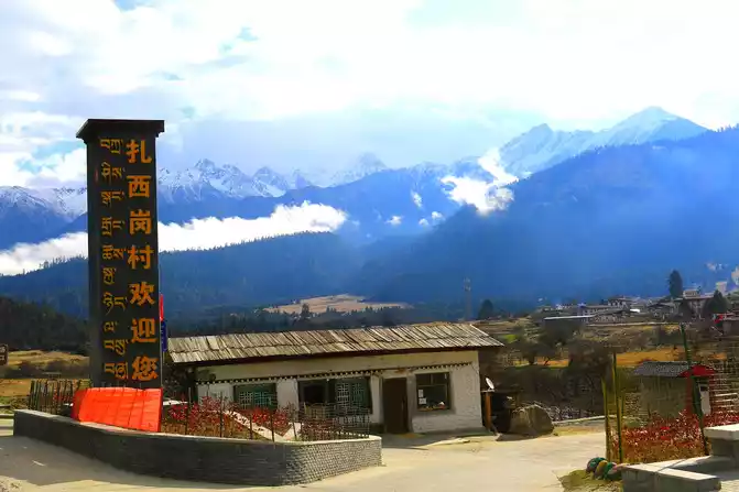
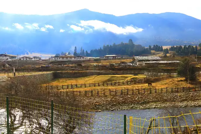
Lulang (3285 meters above sea level) is located in Bayi District, Nyingchi District, is a quiet town surrounded by forests and mountains, the town is an idyllic scenery of wooden houses and fences, with mountains and mist in the distance, alpine meadows and wildflowers, and beautiful and peaceful scenery. Lulang has now developed into an international tourist town, not only accommodation, catering and other business places, but also many high-end hotels and resorts, plus it has a beautiful environment, becoming a place for many tourists on the Sichuan-Tibet line to stay, relax and visit. In and near the town, there are Lulang Huahai Ranch, Tashigang Village, Lulang Forest Sea and other scenic spots.
Tibet-Nyingchi-Lulang
Tibet-Nyingchi-Lulang
Tibet-Nyingchi-Lulang
Tibet-Nyingchi-Lulang-Tashigang Village
Tibet-Nyingchi-Lulang-Lulang Linhai
Tibet-Nyingchi-Lulang-Lulang Linhai
Tips
1. There is a parking lot and observation deck in front of the Tongmai Bridge, where you can park and rest and take pictures. Walking to the left side of the bridge, you can take pictures of the three bridges spanning the river in different eras, which has become a confirmation of economic development and social progress.
Tibet-Bomi-Thongmai-Thongmai Bridge
Tibet-Bomi-Thongmai-3 bridges across the river in different
eras
2. Lulang has a beautiful environment and fresh air, which is worth staying in, relaxing, slowing down, and appreciating and enjoying everything here. The most beautiful time in the town is early in the morning, with clouds and mist and beautiful scenery, which makes people feel refreshed and linger. Don't miss it just because you sleep in.
Tibet-Nyingchi-Lulang
Tibet-Nyingchi-Lulang
Tibet-Nyingchi-Lulang
Tibet-Nyingchi-Lulang
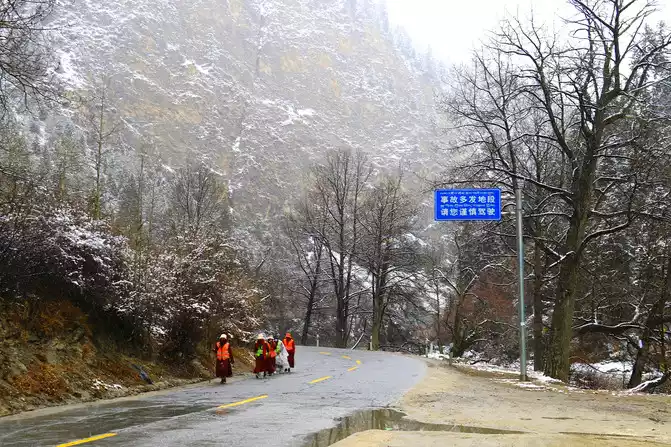
3. There are many beautiful scenery along the G318 Sichuan-Tibet Line, but there are often many cars and people, and the traffic is very busy. When stopping to rest or take pictures on the way, be sure to park your car in a place that does not affect or hinder traffic safety. When crossing the road, pay special attention to passing vehicles. When you go out, you must always tighten the string of "safety".
Go down to "Meet the Great Beauty of China, Feel Poetry and Distance, Walking on the Land of the Motherland, Part of the Series (6) G318 Sichuan-Tibet Line Self-Driving Tour Book (Part II)"

Number of days: 2 days, Average cost: 1000 yuan, Updated: 2025.04.05


Number of days: 4 days, Average cost: 4000 yuan, Updated: 2020.09.25
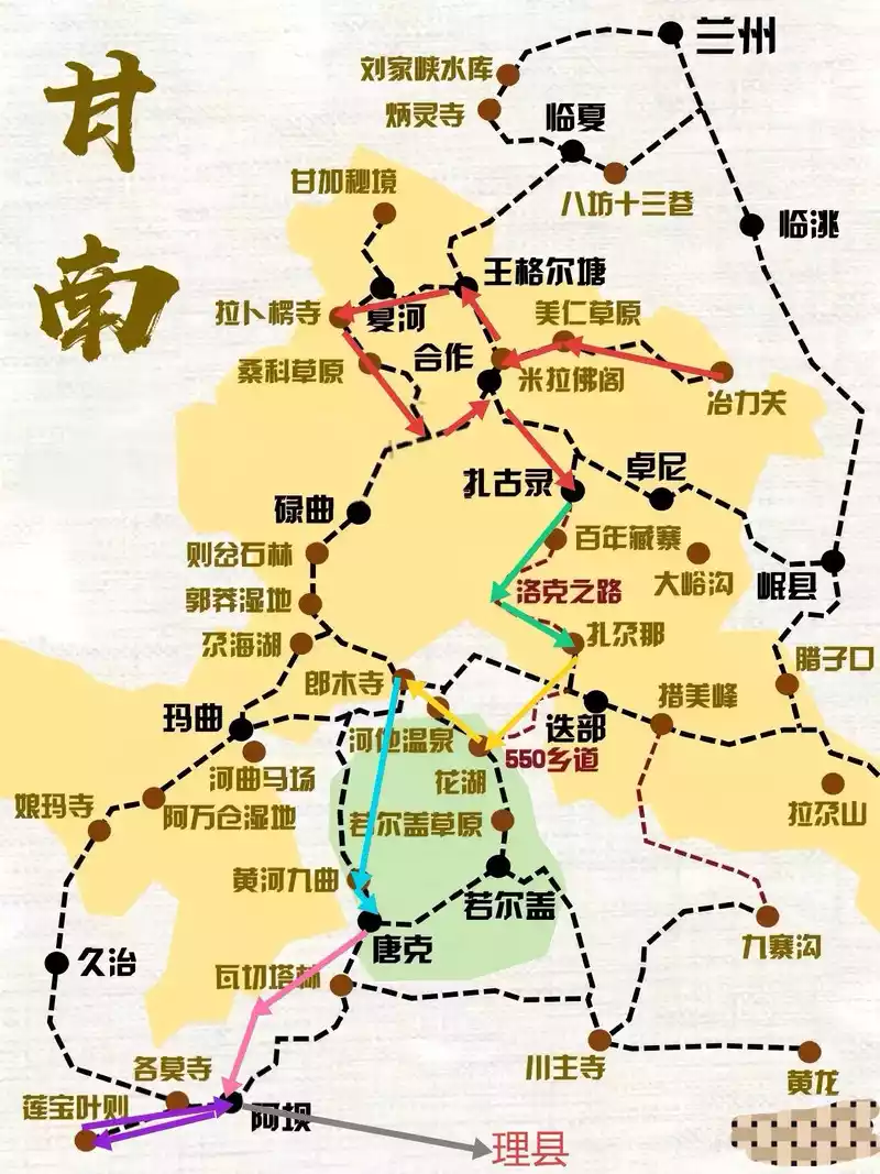
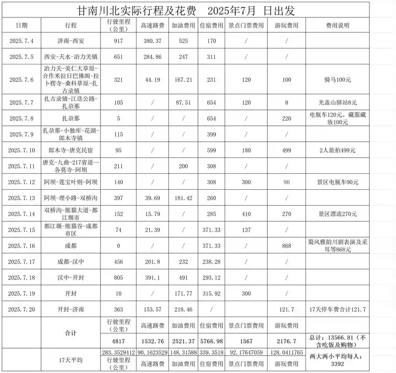

Number of days: 17 days, Average cost: 3300 yuan, Updated: 2025.07.30

Number of days: 5 days, Average cost: 1500 yuan, Updated: 2024.12.19
Number of days: 3 days, , Updated: 2023.02.20
Number of days: 2 days, Average cost: 500 yuan, Updated: 2025.03.01