Duoxiong La Mountain
What are the most recommended things to do in Duoxiong La Mountain?
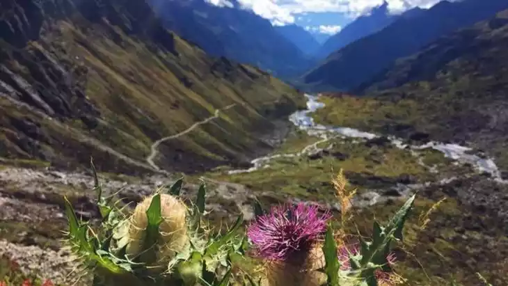
- Hike or trek along scenic trails across the high-altitude mountains.
- Enjoy panoramic views of snow-capped peaks and valleys.
- Photograph alpine flora, unique rock formations, and Tibetan landscapes.
- Observe local wildlife and grazing yaks in natural pastures.
- Experience Tibetan culture in nearby villages and monasteries.
Introducing Duoxiong La Mountain
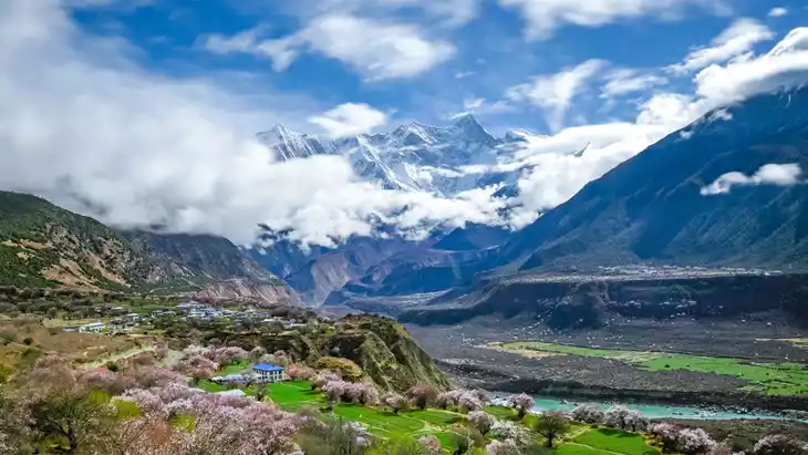
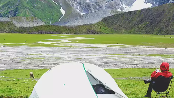
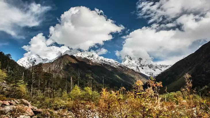
Duoxiong La Mountain, located at the junction of Medog County and Milin County in the Tibet Autonomous Region, is the first obstacle for hikers hiking in Medog. It is about 4,500 meters above sea level. Because it is near the snow line, you can see both snow and gurgling streams.
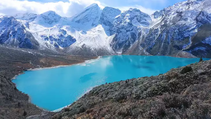
The strong winds at the pass keep Doxiong La Mountain shrouded in mist and clouds for much of the year. Winter is particularly dangerous, with heavy snow blocking the mountain. Due to the lack of weathering, the terrain is covered in a thin layer of soil, with pebbles beneath. This rugged terrain leads to avalanches, both large and small, every winter.
Furthermore, Doxiong La Mountain is very cold, similar to the temperatures at Everest Base Camp, which are around freezing even in the summer. The difference is that the sun rarely shines on Doxiong La Mountain year-round. After crossing Doxiong La Mountain and descending the slopes, you can reach Medog, a mountain that attracts a constant stream of tourists every year!
Climate and best time to travel
Climate: Plateau subarctic semi-arid monsoon climate
Best time to travel: June to November
Recommended number of days and locations for visiting
1 day
Tickets
free
Attraction opening hours
June to October every year
Most Popular FAQs for Duoxiong La Mountain
What is the history and significance of this attraction/city?
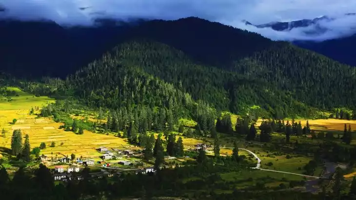
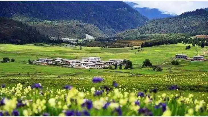
Duoxiong La Mountain is part of the high-altitude Nyingchi region in Tibet, known for its pristine alpine environment and strategic position along Tibetan cultural routes. It holds ecological and cultural significance, preserving traditional Tibetan pastoral lifestyles.
Where is it located and how do I get there (metro, bus, taxi, walking)?
Located in Nyingchi, Tibet, Duoxiong La Mountain is accessible via road from Nyingchi city. Visitors usually reach it by private car, tour vehicles, or taxi. Walking and hiking are mainly used for exploring trails on the mountain itself.
What are the opening hours and best times to visit?
The area is open year-round, but the best time to visit is from late May to September when weather conditions are favorable and landscapes are lush and clear.
What is the entrance fee/ticket price, and how to buy tickets (online/offline)?
There may be a minor entrance or permit fee, typically purchased offline at local checkpoints or through tour operators.
Do I need to book tickets in advance, and how far in advance?
Advance booking is generally not required for individual visitors, but organized tours can be booked a few days in advance, especially during peak tourist season.
How much time is needed to fully explore it?
Half a day to a full day is recommended to hike trails, enjoy viewpoints, and visit nearby villages or monasteries.
What are the must-see highlights or main areas inside?
- Mountain summits and ridges with panoramic views
- Alpine meadows and pastures
- Nearby Tibetan villages and traditional monasteries
- Observation points for local wildlife and yaks
Are guided tours or audio guides available (and in which languages)?
Guided tours are available in Chinese and occasionally English through local tour operators; audio guides are rare.
What are the best viewpoints or photography spots?
- Summit viewpoints for mountain panoramas
- Along alpine meadows and valleys
- Near Tibetan villages or yurt clusters
- Sunrise and sunset locations for dramatic lighting
What is the recommended route or itinerary inside?
Start from the base, hike trails toward summit viewpoints, explore nearby alpine pastures, visit local villages, and return via scenic paths for sunset photography.
Are night visits, light shows, or special tours available?
Night visits are generally not feasible due to high altitude and limited facilities; special tours may occur during local Tibetan festivals.
Is it crowded, and when are the least crowded times/days to visit?
The mountain is usually peaceful and not crowded. Weekdays and early mornings offer the quietest experience.
What facilities are available (toilets, food, water, rest areas, shops)?
Facilities are limited: basic rest areas, small food stalls, and minimal toilet access near trailheads or villages.
Is the attraction accessible for elderly, children, or disabled visitors?
Access is challenging due to steep terrain and high altitude; elderly and children should be cautious, and disabled access is limited.
Is cash needed or are cards/mobile payments accepted?
Cash is preferred; mobile payments may work in some towns but are unreliable on remote mountain trails.
What restaurants or cafes are available inside or nearby?
Local Tibetan-style eateries and small food stalls are available near villages or trailheads.
Are there vegetarian/vegan/halal food options?
Vegetarian options are limited; Tibetan cuisine is mainly meat-based. Halal food may be found in Nyingchi town but is rare on the mountain.
What hotels or accommodations are close to the site?
Basic guesthouses and Tibetan homestays near trailheads or villages; larger hotels are located in Nyingchi city.
What other attractions or landmarks are nearby and easy to combine in a day trip?
- Bomi County scenic spots
- Basum Lake
- Nearby Tibetan monasteries
Are there souvenir shops and what are the typical souvenirs?
Small shops sell Tibetan handicrafts, prayer flags, yak wool products, and traditional jewelry.
What are the best transportation options to continue the trip after visiting?
Private car, local bus, or tour vehicles are recommended to continue traveling in Nyingchi Prefecture or return to Nyingchi city.