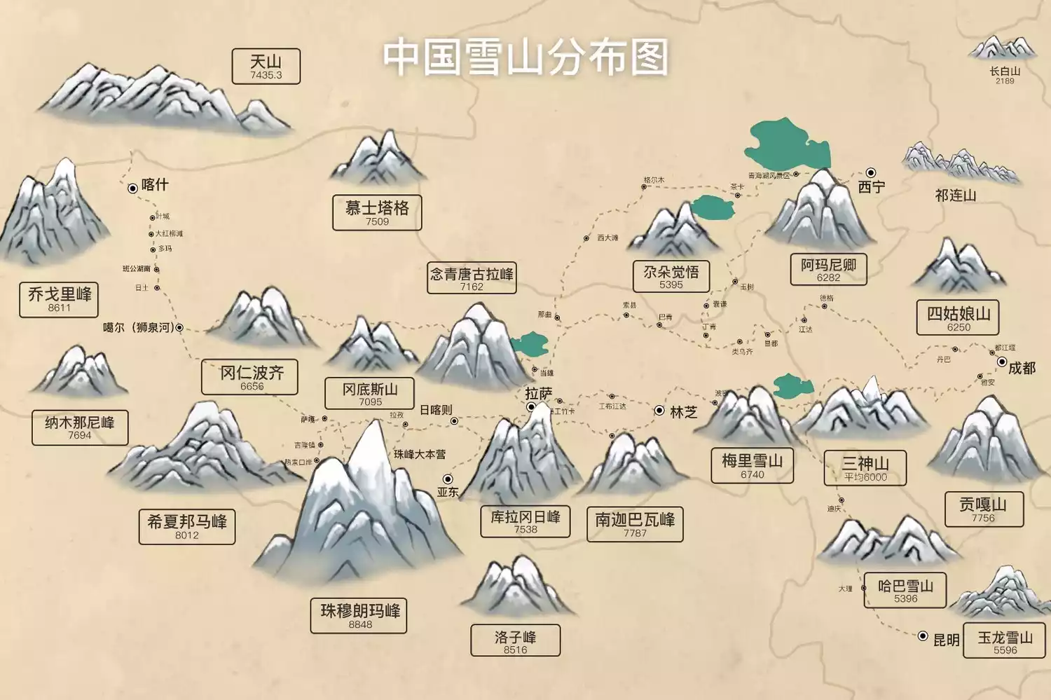
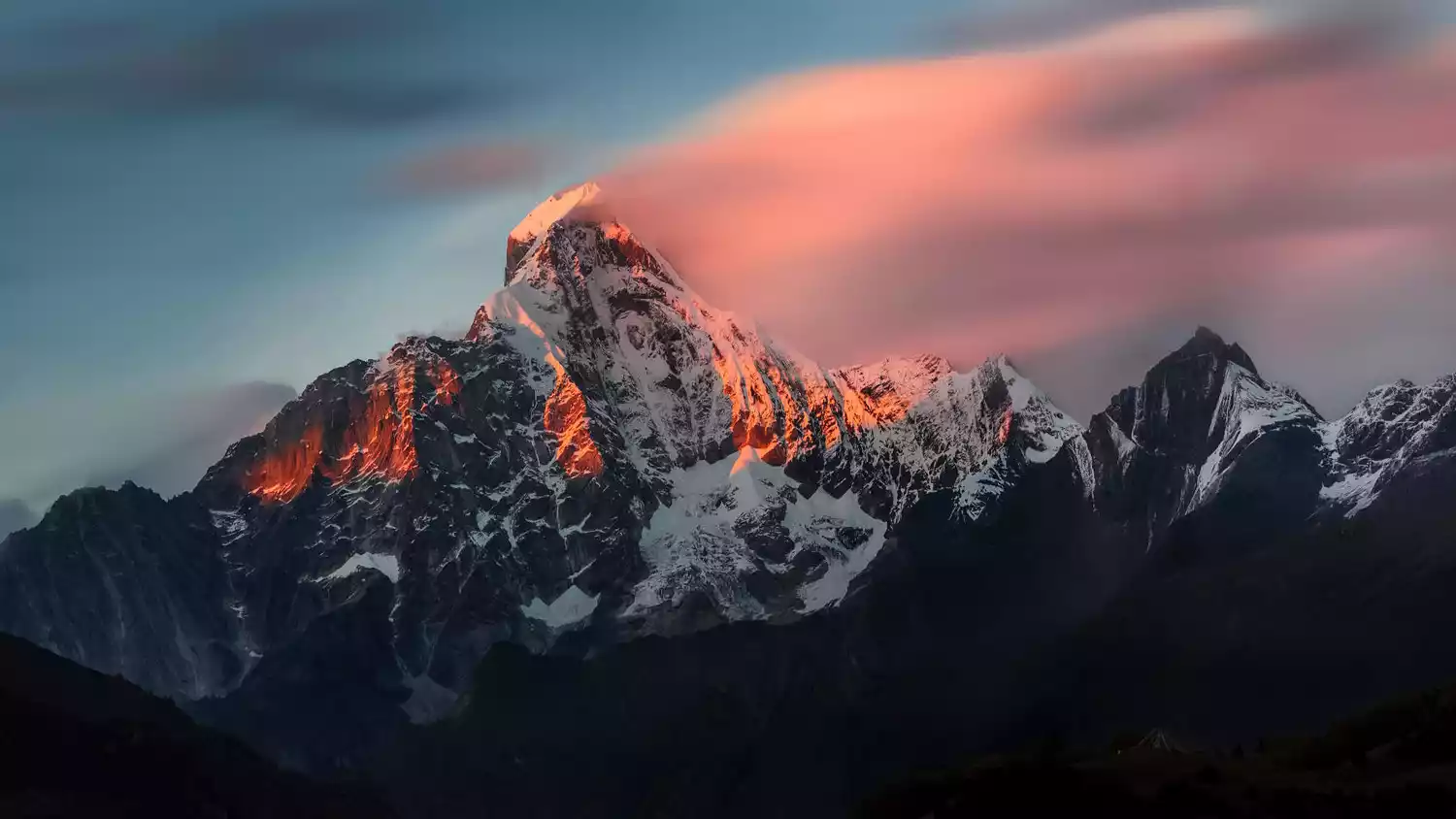
The most comprehensive map of snow-capped mountains in China, listing the 20 most worthwhile snow-capped mountains in China
Preface
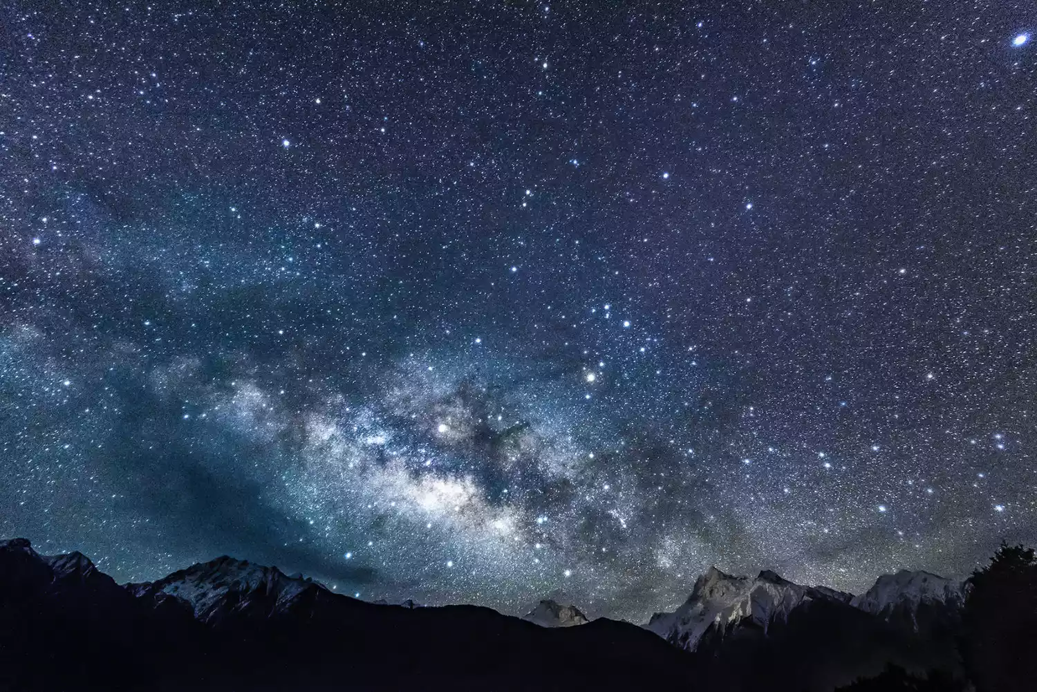
I have always believed that the two things that shock me most in the world are the vast starry sky and the majestic snow-capped mountains.
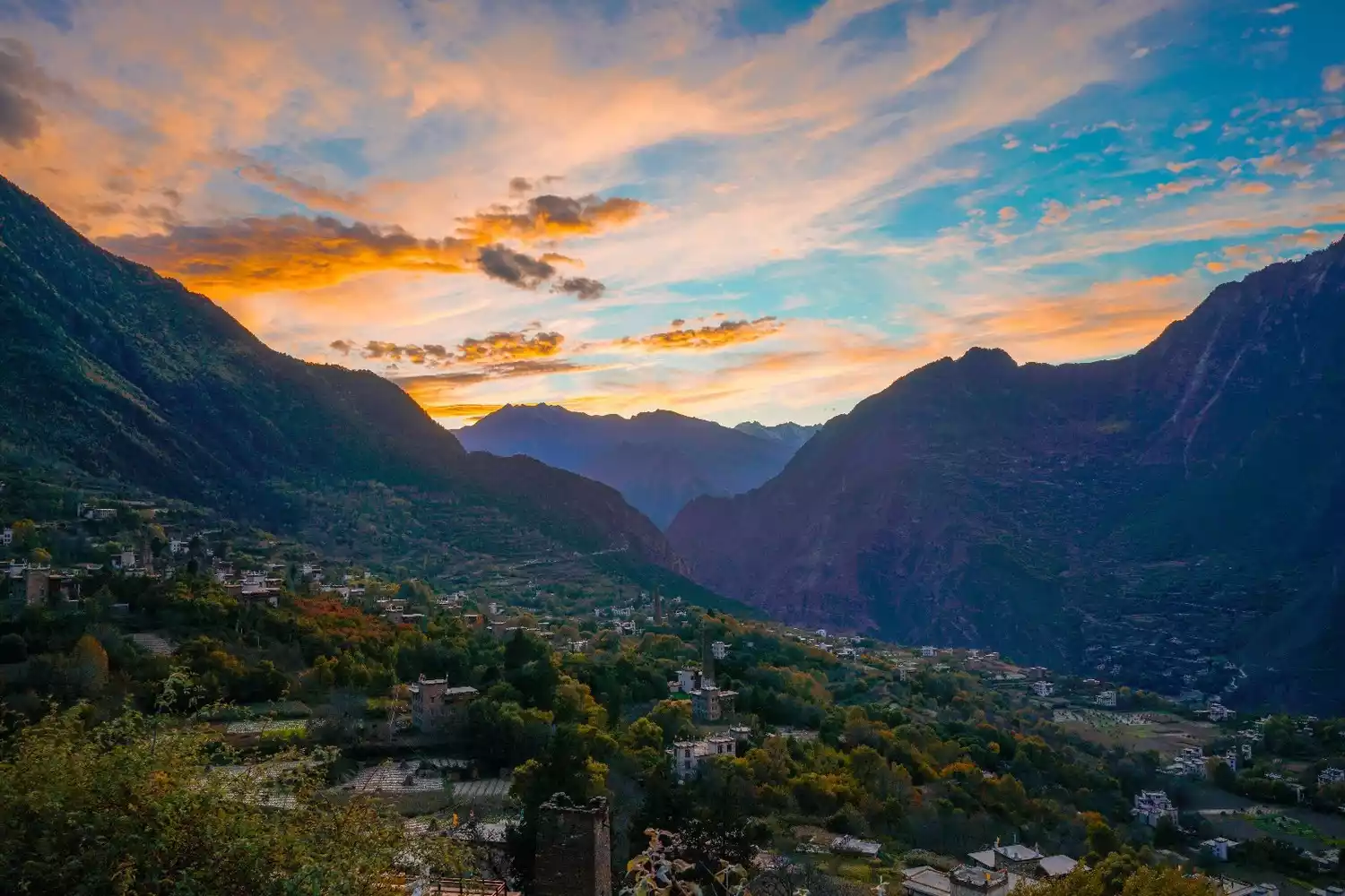
Over the years, I've been constantly surrounded by snow-capped mountains. Their initial awe and majesty are unmatched by any other natural scenery! Northwest Sichuan, China, is home to many breathtaking snow-capped mountains! Mount Everest, Mount Gongga, Mount Kailash, Muztagh Ata...
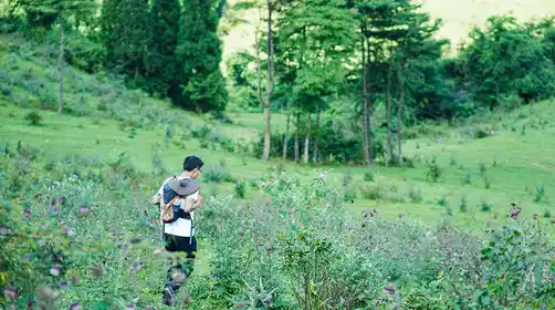
Perhaps we may not be able to fully describe the charm of every snow-capped mountain, but if you are tired of the explosion of technological information in modern cities and want to slow down, pursue poetry and distance, and take a look at the extremely dangerous and tempting snow-capped mountain ice cream yourself,
Today, let me let the major snow-capped mountains love and fight each other, and arrange the most stylish snow-capped mountain competition in the Sichuan-Tibet-Xinjiang region!
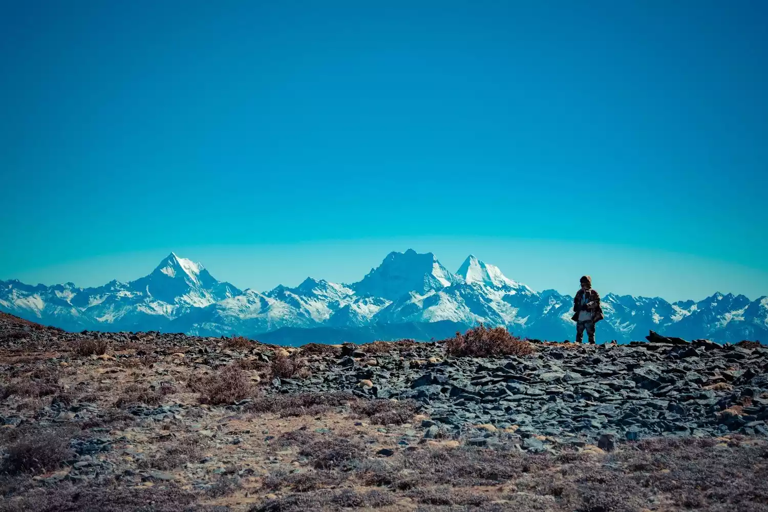
Distribution map of snow mountains in China
[This ranking is random and in no particular order]
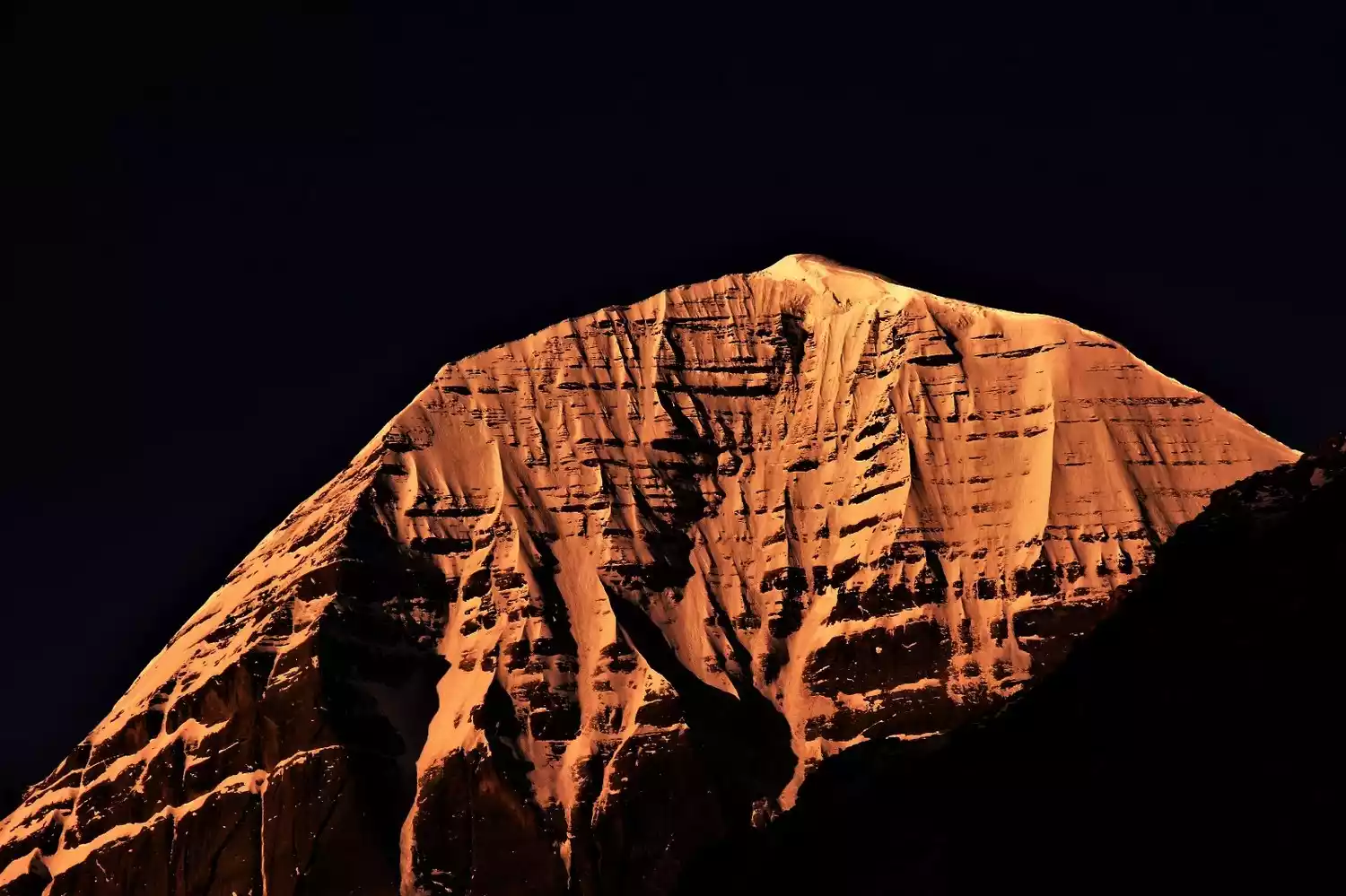
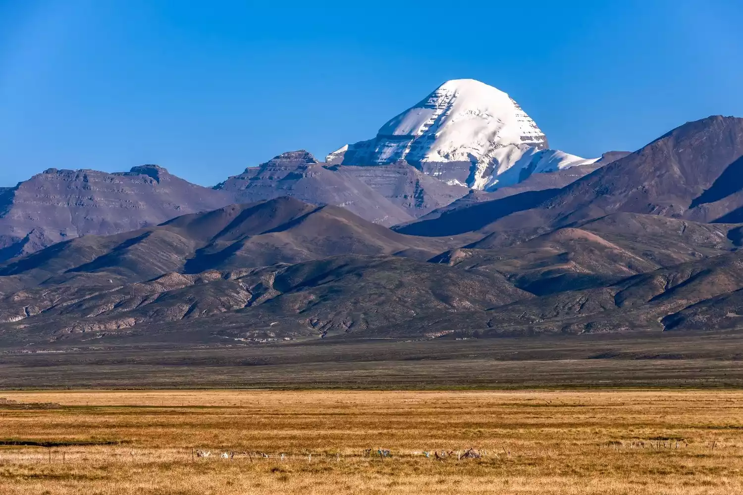
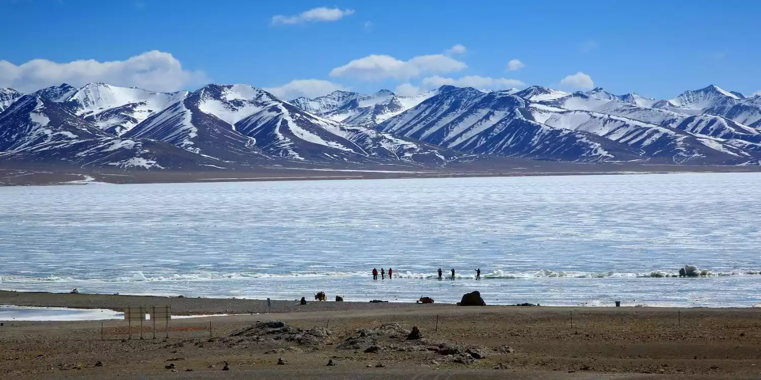
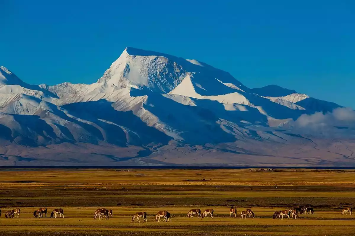
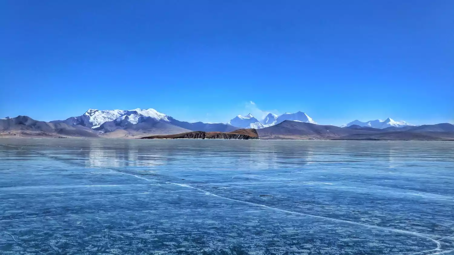
TOP1 Mount Kailash
Reasons for being on the list: "King of the Holy Mountain" and "Abode of the Gods"
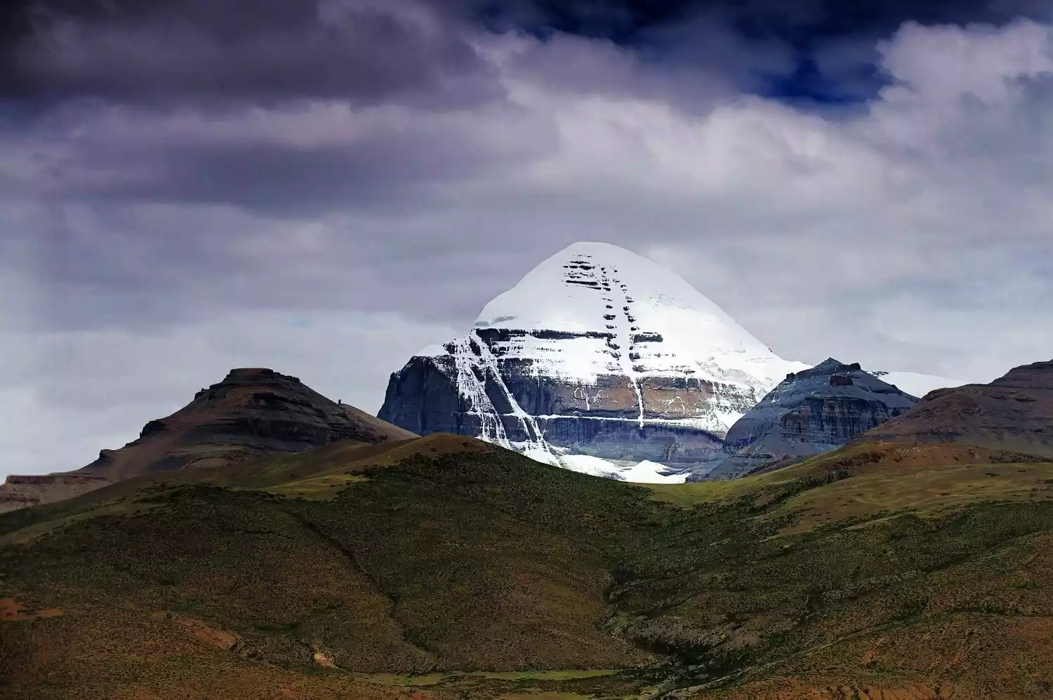
Location: Northern Purang County, southwestern Tibet Autonomous Region
Altitude: 6656 meters
Recommendation index: ★★★★☆
Mount Kailash, I think many people have heard of it, especially after the release of the movie "Mount Kailash", many people have come to visit, and it seems that going here has become a fashion.
Mount Kailash, which means "Mountain of Gods" in Tibetan, is the main peak of the Gangdise Mountains. The Gangdise Mountains run across the Kunlun Mountains in the north and the Himalayas in the south, lying like a giant dragon on the vast plateau of Ali in western Tibet.
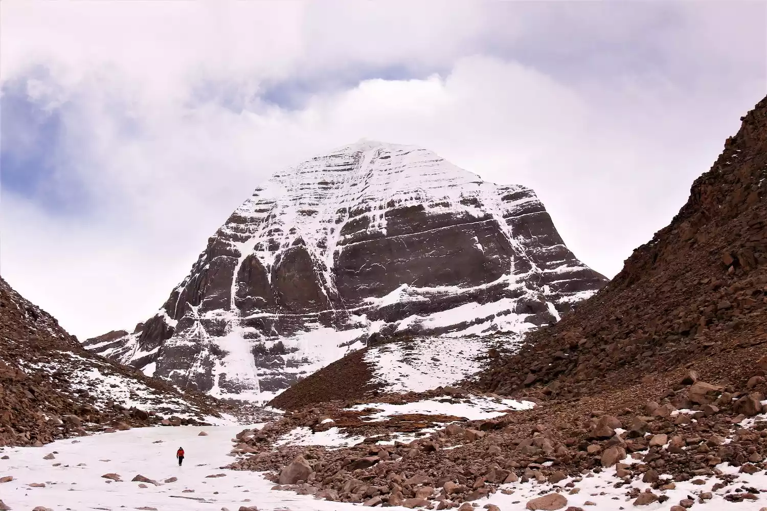
It is considered the center of the world by Hinduism, Tibetan Buddhism, the original Tibetan Bon religion, and ancient Jainism. Legend has it that circumambulating the sacred mountain once can cleanse a lifetime of sins, while circumambulating it ten times can save one from the sufferings of hell in samsara. Pilgrims flock to the mountain every year.
For centuries, Mount Kailash has been a place of fascination for pilgrims and explorers, but no one has been able to climb this sacred mountain, or no one has dared to violate the center of the world.
Mount Kailash is famous throughout the world. People come here because it is a sacred mountain, not a fashion. Come with your awe for life and reverence for the sacred mountain.
Tickets/Opening Hours
All day
Mount Kailash has now established a sacred mountain and lake scenic area, managed by a travel agency. Entrance fees are 200 yuan per person. Tibetans do not need to buy tickets.
Transportation Overview
There is one bus from Shigatse to Ali every day, which departs at 12 noon and arrives at Tachin (the starting point of the circumambulation) at 8 am the next morning.
There are also regular buses from Ali to Shigatse passing through Tachin every day, and there are also regular buses from Lhasa to Ali passing through.
Note: If your vehicle is not heading to Tachin, you can get off at the fork in National Highway 219 and then walk for more than half an hour to your accommodation in Tachin.
Best time to travel
The best months for circumambulating the mountain are September and October, but it's already quite cold. Another option is May to late June, when good weather is more common and can last for 6-8 days. The rainy season begins in early July, with the heaviest rainfall in July and August.
You cannot circumambulate the mountain in winter as it is closed.
Tips:
You must apply for a border pass to go to Mount Kailash. There will be checkpoints in Lazi and Baga to check the border pass. You will pass through it from the southern line of Ali to Tarqin and from Tarqin to Purang. There may be mobile checkpoints at times.
For the Bon religion in Ngari, circumambulating the sacred mountain is done counterclockwise, while Tibetan Buddhists walk clockwise. Both groups coexist harmoniously, each moving forward for their own beliefs.
TOP2 K2
Reasons for being on the list: "The second highest peak in the world" and "the border between China and Pakistan"
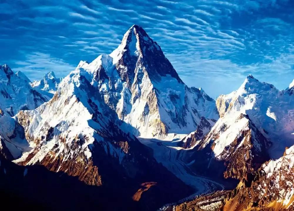
(Photo taken by @Huadu Dragonair)
Location: Chinese side, in Taxkorgan Tajik Autonomous County, Xinjiang Uyghur Autonomous Region
Altitude: 8611 meters
Recommendation index: ★★★★★
Mount Chogori, known as the "Father of Ten Thousand Mountains", is commonly known as K2 internationally, which is its more common name.
K2, which means "tall and majestic" in Tajik, is the highest peak in Pakistan and the second highest peak in China and the world, with an altitude of 8,611 meters, second only to Mount Everest.
For billions of years, it has stood leisurely on the top of the mountains, waiting for the bravest climbers to discover it.
K2, known as the "Savage Giant," consistently tops the list with a climbing mortality rate exceeding 27%. Half hell, half heaven, K2 is known in the mountaineering community as "the savage peak" and "the peak of no reward." It's also rumored to be a mountain that rejects women. To date, only five women have reached the summit, all of whom died tragically.
Tickets/Opening Hours
All day
No tickets
Transportation Overview
From Yecheng, you can charter a car along the Xinjiang-Tibet Highway to Maza, then follow a simple road for 25 kilometers to Mazadala. From here, it takes a six-day hike, covering 90 kilometers, to reach the K2 Base Camp (Yinhongtan, 3,924 meters above sea level).
Note: This section of the road requires crossing the Agleda Tomb at an altitude of 4,800 meters to enter the Klechin River Valley. It is necessary to avoid the sudden rise of the Klechin River in July and August, when neither humans nor animals can pass.
Best time to travel
The climate in the K2 region is extremely harsh. The rainy season, from May to September, often causes river valleys to surge due to rising temperatures, melting snow, and precipitation, making access to the mountains difficult. From mid-September to mid-April, strong westerly winds arrive, bringing harsh winters.
Therefore, the best time for mountaineering activities should be arranged from May to early June. Although the river water is rising at this time, it is not too serious.
From July to August every year, the temperature at the top of the mountain is slightly higher and the good weather lasts longer, which is also a good time to reach the summit.
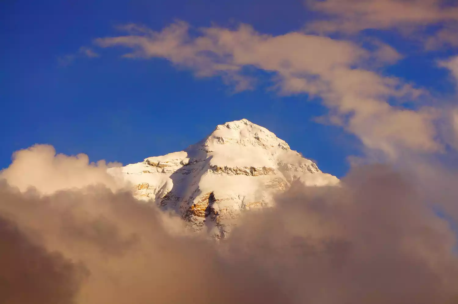
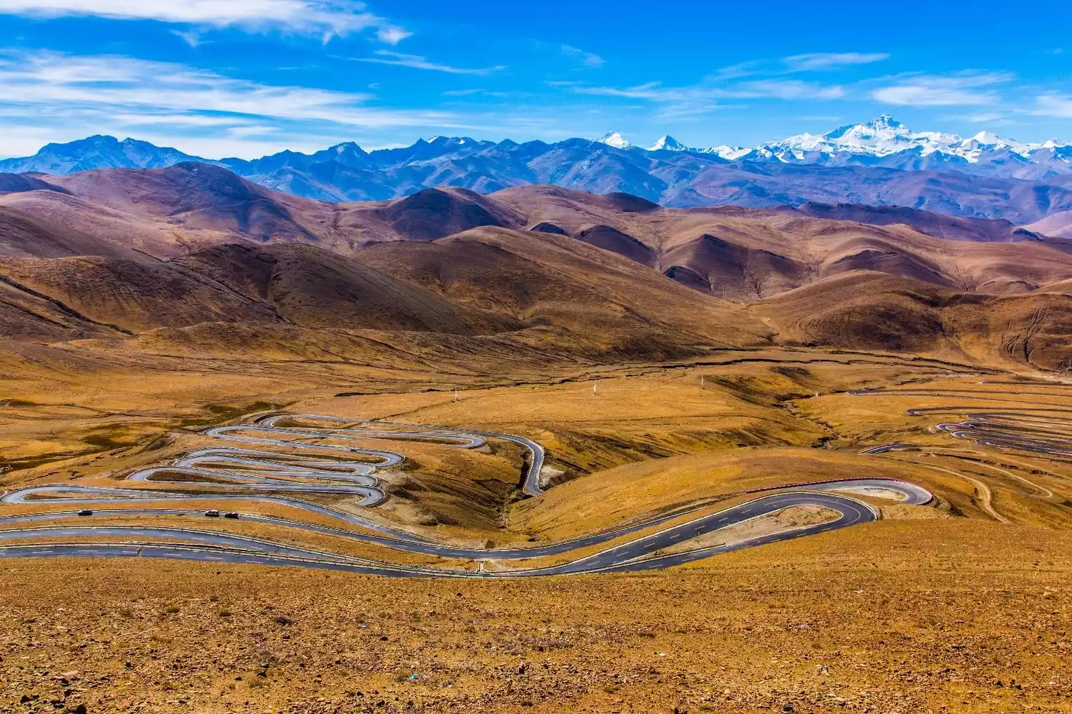
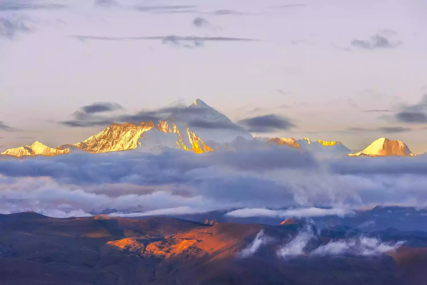
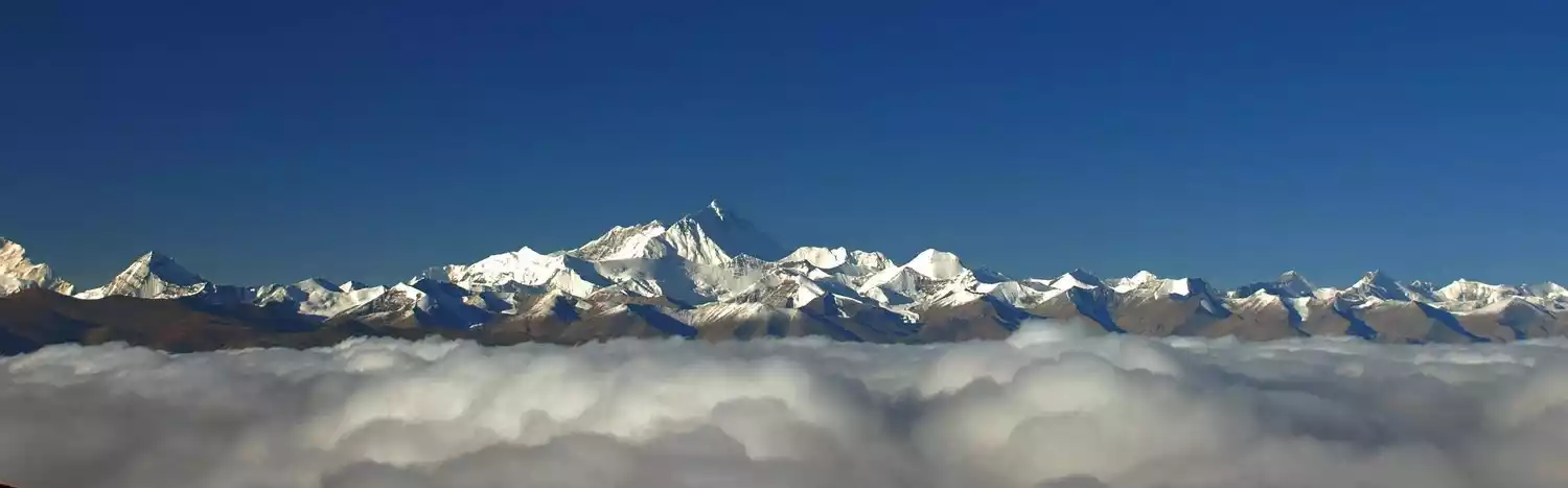
3. Mount Everest
Reasons for being on the list: "The highest peak in the world" and "Mother Earth"
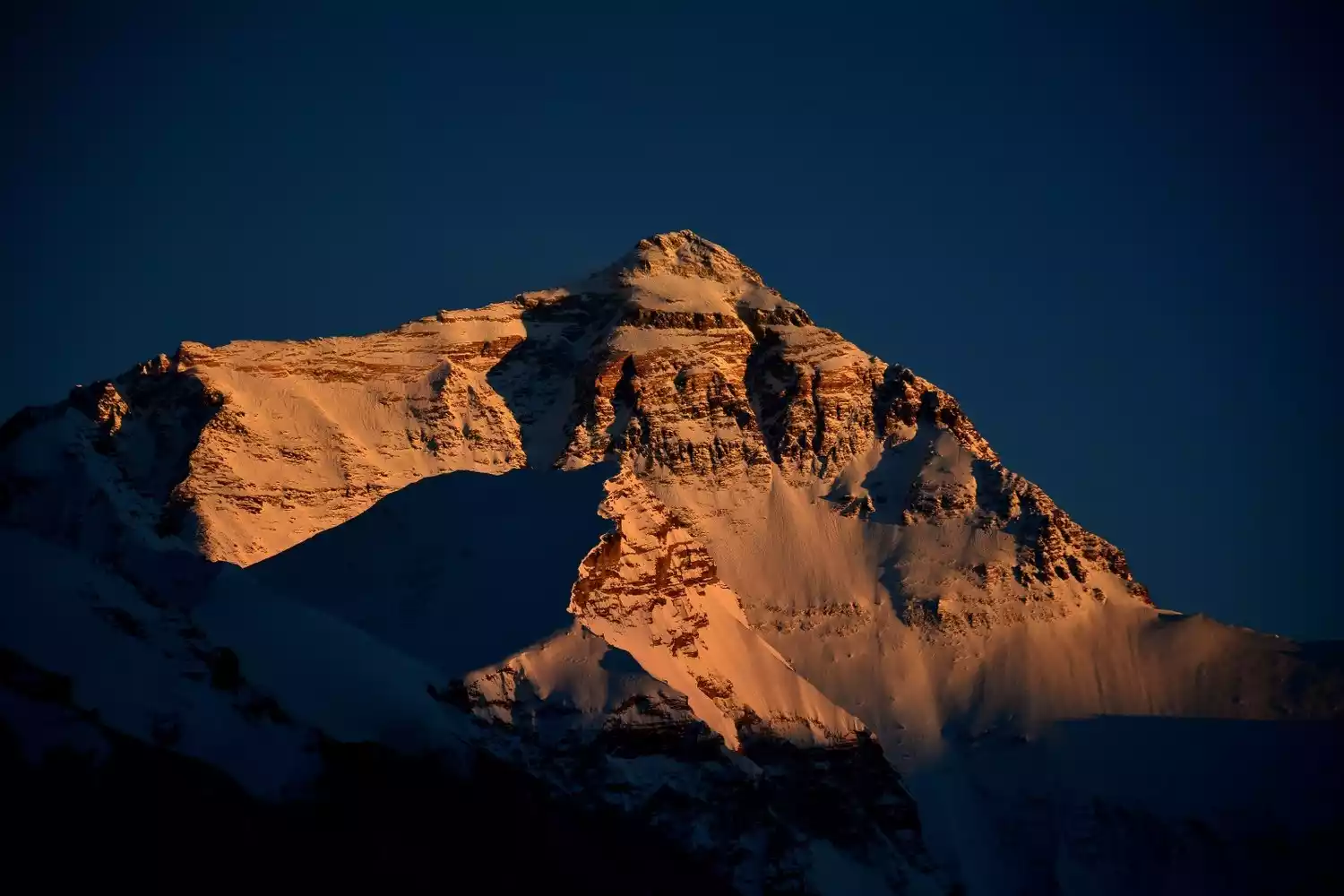
Location: The northern part is located in Tingri County, Tibet, China; the western slope is in Zhaxi Zong Township, Tingri County; the eastern slope is in Qudang Township, Tingri County; there is the Everest Base Camp; the southern part is in Nepal.
Altitude: 8844.43 meters
Recommendation index: ★★★★★
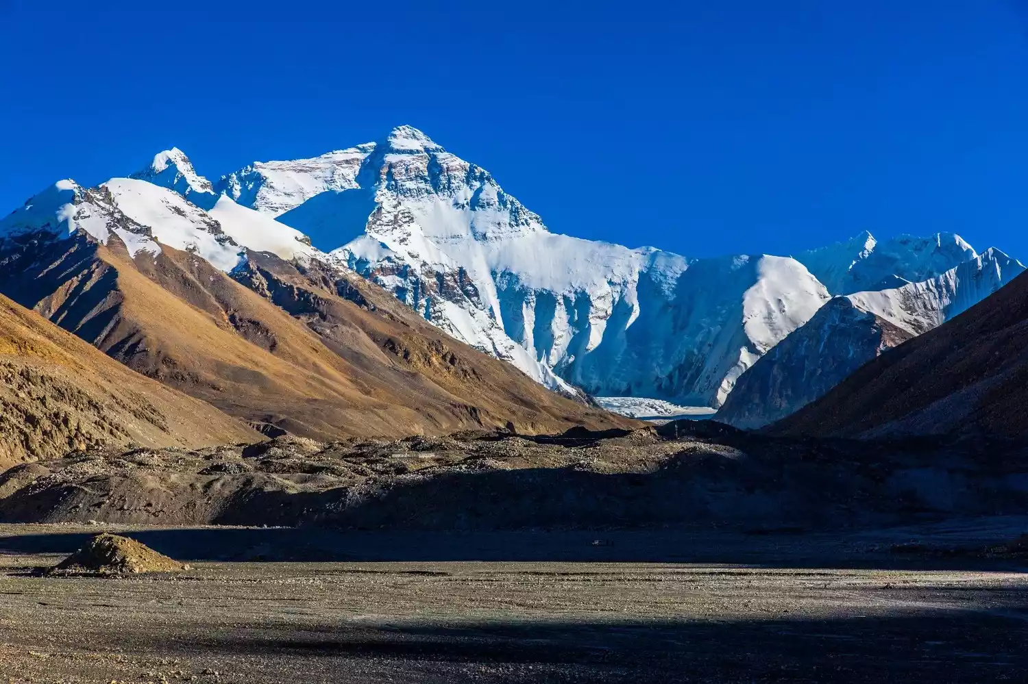
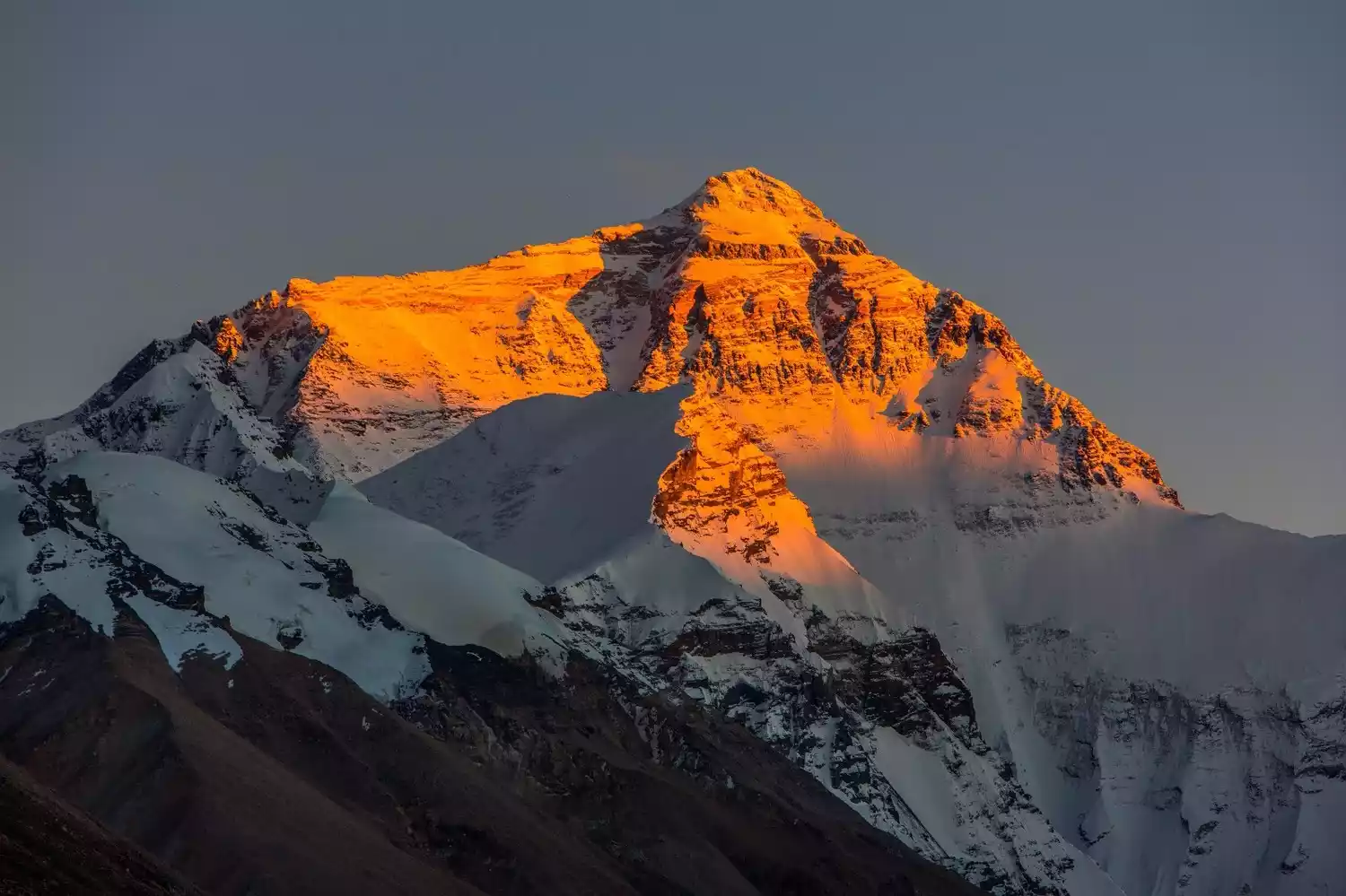
Mount Everest is the highest peak in the world. It is located on the border between China's Tibet Autonomous Region and the Kingdom of Nepal. Nepal calls it Sagarmatha.
In fact, Mount Everest is a large horned peak with a prominent but not sharp top. It is located in the middle section of the Himalayas. Together with Lhotse, Makalu, Cho Oyu and many nearby peaks over 7,000 meters, it forms the most majestic alpine area in the world.
In Tibetan, "Qomolangma" means goddess and "Langma" means third, because there are four other peaks near Mount Everest, with Mount Everest ranking third.
Mount Everest stretches roughly east-west, with its northern slopes bordering the Qinghai-Tibet Plateau and boasting a relatively gentle terrain. Glacial erosion and river cuts into its southern and eastern slopes create a height difference of over 6,000 meters over a horizontal distance of approximately 53 kilometers. Resembling a gigantic pyramid, the mountain towers majestically and towering into the sky. Its terrain is extremely rugged and the environment is extremely complex.
Tickets/Opening Hours
All day
First, you need to go through the mountain entry procedures at the hotel at the Xin Dingri intersection, then rent a car to Mount Everest or drive yourself. The entrance fee to the Dingri Mount Everest intersection is 180 yuan.
You also need to pay a road construction fee and a vehicle entrance fee based on the number of wheels, which is 100 yuan per wheel, plus a handling fee of 5 yuan.
Transportation Overview
It is not difficult to hitchhike from Shigatse or Lhatse to New Tingri, but the chances of getting a ride for the remaining 100 kilometers to the base camp are relatively low, so it is recommended to charter a car from Lhasa.
Note: The eco-friendly bus service from Basong to Rongbuk Monastery in the Mount Everest region has been cancelled. It is recommended that you drive directly to Rongbuk Monastery when chartering a car.
Best time to travel
The climate on Mount Everest is harsh, with few sunny days and often violent storms.
There are two best seasons for climbing Mount Everest: May and September to October. During these two periods, the wind speed at an altitude of over 8,000 meters is relatively low, and there is little rain or snow.
Tips:
The "Mount Everest Ban" some time ago actually targeted the core area of the Mount Everest National Nature Reserve, that is, the area above Rongbuk Monastery.
The descent distance from the Everest Base Camp to Rongbuk Monastery is only about 2 kilometers, which actually has no impact on people's viewing of Mount Everest.
4. Lhotse
Reason for being on the list: "The fourth highest peak in the world"
Location: Southeast of Shigatse City, Shigatse Prefecture (approximately 3 kilometers south of Mount Everest)
Altitude: 8516 meters
Recommendation index: ★★★☆☆
 (Photo taken by @Soul Sand)
Lhotse is the fourth highest peak in the world. Lhotse means "Southern Peak" because it is located 3 kilometers south of Mount Everest, separated by a col commonly known as the "South Col." To the north is Zhangzi Peak. In Tibetan, Lhotse is also known as Dingjie Xiesangma, meaning "beautiful blue fairy."
 (Photo taken by @冷谜)
The mountain is bounded by the north ridge and the southeast ridge. Its east side is within the territory of Qudang Township, Tingri County, Tibet Autonomous Region, China, and its west side belongs to the Federal Democratic Republic of Nepal.
This "fairy mountain" has an extremely rugged terrain and a complex environment, with dense glaciers of all sizes and an unpredictable climate. To date, no one has successfully climbed the eastern slope from the Chinese side.
Tickets/Opening Hours
All day
free
Transportation Overview
From Lhasa, drive along the China-Nepal Highway through Gyantse and Shigatse to Sheger, a total distance of 670 kilometers, which takes about two days. Then go south along the simple road through Pazhuo District. After driving 110 kilometers, you will reach the end of the Rongbuk Glacier - Rongbuk Monastery at an altitude of 5,154 meters.
Ordinary tourists usually view the mountain from a distance while chartering a car or driving on the Shigatse-Mount Everest route.
Best time to travel
The wind speed is slightly lower than that of Mount Everest, but the rainfall is heavier than that of Mount Everest. From early June to mid-September every year, heavy rain and avalanches frequently occur, stirring up a sky full of snow and fog.
From mid-November to mid-February of the following year, northwest winds blow from the south, causing the temperature on the mountain to drop to as low as -60℃.
Only in spring from early March to late May, or in autumn from early September to late October, is the climate relatively stable, with several periods of good weather.
TOP5 Siguniang Mountain
Reason for being on the list: "The Alps of the East" and "The Queen of Shu Mountain"
Location: Siguniangshan Town, Xiaojin County, Aba Tibetan and Qiang Autonomous Prefecture, Sichuan Province.
Altitude: The main peak, Yaomei Peak, is 6,250 meters above sea level
Recommendation index: ★★★☆☆
Located in Rilong Town, Xiaojin County, Aba Prefecture, Mount Siguniang is comprised of four continuous peaks. Perpetually covered in snow, they resemble four beautiful young ladies, each draped in white veils, standing in sequence above the Milky Way between Changping Valley and Haizi Valley, hence the name.
The main peak of Siguniang Mountain, Yaomei Peak, stands at 6,250 meters above sea level. Known as the Eastern Alps, it is the highest peak in the Qionglai Mountains. To the south of Yaomei Peak are Sanguniang Peak, Erguniang Peak, and Dagonuniang Peak.
Of the Four Sisters, the youngest is the most slender and graceful. The "Four Sisters" often refer to this highest and most beautiful snow-capped peak. These four sisters stand shoulder to shoulder, perpetually crowned by white clouds, draped with glaciers, and bound by emerald forests. Each one is pure and smooth, graceful and elegant, earning them the nickname "Queen of the Shu Mountains."
Tickets/Opening Hours
Siguniang Mountain Scenic Area:
Peak season: 7:30-16:00, off-season: 8:00-15:30; last admission after 15:30.
Peak season (April 1st - November 30th): Changpinggou 70 yuan (sightseeing bus 20 yuan), Shuangqiaogou 80 yuan (sightseeing bus 70 yuan), Haizigou 60 yuan
Off-season (November 1st - March 30th): Changpinggou 50 yuan (sightseeing bus 20 yuan), Shuangqiaogou 50 yuan (sightseeing bus 70 yuan), Haizigou 40 yuan
Transportation Overview
There are currently no direct flights to Mount Siguniang. You can first go to Chengdu Shuangliu International Airport, and then take a bus from Chengdu Chaidianzi Bus Station to the Mount Siguniang Scenic Area.
Buses depart from Chengdu's Chadianzi Passenger Transport Center for Mount Siguniang at 6:30 AM, 7:00 AM, 7:30 PM, and 12:00 PM daily, stopping at Rilong Town. The journey takes about five hours and costs 63 yuan per person. The fare from Dujiangyan is 40 yuan per person.
Best time to travel
The Siguniang Mountain Scenic Area is known as "a day trip to visit all four seasons, a year-round tour", and each season has its own attractions.
July and August are the best months to visit Mount Siguniang. During this time, the mountain is covered with blooming flowers, and you can also go down to the ravine to feel the cool water from the snow-capped mountains.
In addition, from mid-September to mid-October, the autumn colors of Siguniang Mountain are very charming, but the temperature is slightly lower, so please keep warm.
Tips:
1. Special tourist routes have been opened in Siguniang Mountain, including mountaineering, crossing, video recording, ice climbing, rock climbing and rafting.
2. The outdoor activity ticket is 150 yuan and is valid for 3 days. You can enter the ditch for camping or crossing only with the ticket and signed procedure form.
3. If you climb a mountain with an altitude of more than 3,500 meters without permission, you must pay the expenses that should be borne by you after receiving assistance from relevant organizations and institutions.
TOP6 Tolimu Peak
Reason for being on the list: "The highest peak of Tianshan Mountain"
Location: Wensu County, Aksu Prefecture, near the border between China and Kyrgyzstan
Altitude: 7443.8 meters
Recommendation index: ★★★★☆
Since the Chinese mountaineering team successfully reached the summit in 1977, almost no one has set foot here in the past 30 years.
Anyone who has visited Xinjiang is familiar with the world-renowned Tianshan Mountains, and Tomur Peak is the highest peak in the range. "Tomur" means "iron" in Uyghur. Millions of years of wind, rain, and torrents have shaped Tomur Peak into a crisscrossing, orderly layering of ridges and troughs. Its summit is perpetually capped with snow, and its towering peaks, their sharp, unstoppable peaks piercing the clouds, create a striking contrast with the vibrant colors of the mountains in the distance.
Tickets/Opening Hours
Tomur Peak Nature Reserve: 10:00-20:00
Tuomur Nature Reserve costs 8 yuan per person. Car rental fee is 200 yuan.
Transportation Overview
Drive 1,000 kilometers from Urumqi to Aksu City, then head north through Wensu and drive 70 kilometers to Taklak Ranch, enter the Pingtaizi Tourist Area of the Tomur Peak Nature Reserve, and then hike north along the Qionglan River Valley to reach the southern slope of Tomur Peak.
The current mountaineering base camp is located at an altitude of 3,900 meters on the Xiqiong Tailan Glacier. From this camp, you can see the Tomur Peak and the Kochikar Peak at an altitude of 6,342 meters.
Best time to travel
May-September
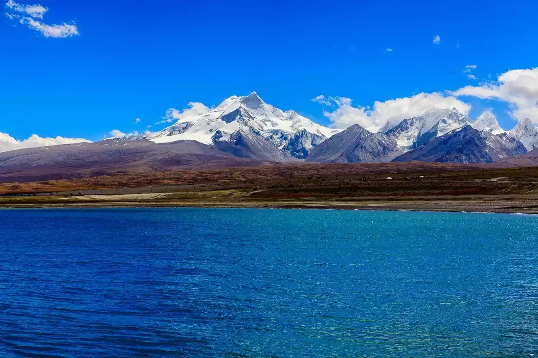
7. Nyainqentanglha Peak
Reason for being on the list: "The beautiful legend of Namtso"
Location: Dangxiong County, Tibet Autonomous Region, China, on the south side of Lake Namtso.
Altitude: 7111 meters
Recommendation index: ★★★☆☆
Mount Nyainqentanglha is the main peak of the Nyainqentanglha Mountains. It is located on the southern shore of Lake Namtso and runs across the central and eastern Tibet. It is 1,400 kilometers long and has an average width of 80 kilometers. It is one of the main mountain ranges in China's Qinghai-Tibet Plateau.
In religion, it is a famous guardian deity throughout Tibet and the main deity of the Mountain of Gods in the northern grasslands. Both Bon and Tibetan Buddhism believe that this mountain is a place of meditation and gathering for all the vidyadharas who have achieved the right results, and they respect it very much.
In ancient Tibetan mythology, in the pantheon of Bon or Tibetan Buddhism, and in the folk songs and legends of local shepherds and hunters, Mount Nyainqentanglha and Lake Namtso are not only the most eye-catching sacred mountains and lakes in Tibet, but also lovers and couples who depend on each other for life and death.
Tickets/Opening Hours
All day
Namtso Scenic Area general ticket: 120 yuan
Transportation Overview
Tour route: Starting from Lhasa, take National Highway G319 (Qinghai-Tibet Highway) to enjoy the magnificent scenery of the northern Tibetan grasslands. Pass the Nyainqentanglha Mountain Observation Deck, cross the Nagenla Pass, and it takes about 5 hours to reach the Zaxi Peninsula in the Namtso Scenic Area.
Hiking Route: Starting from Dangxiong, continue along the Qinghai-Tibet Highway. About 100 meters past a large prayer flag, the road crosses a river. Do not cross the bridge. Turn right and follow the riverside path to Ningzhong Township into the mountains. At the end of the path is a small village by the river. This is the starting point for the hike.
Best time to travel
May to September every year
Because Mount Nyainqentanglha is located in the hinterland of the continent, the barrier effect of the mountain range blocks the cold current from the northwest and the warm current from the Indian Ocean. It basically has a semi-arid continental climate and is a place with relatively high annual precipitation.
Snowstorms often occur in spring, so mountaineering activities are generally best done from May to September.
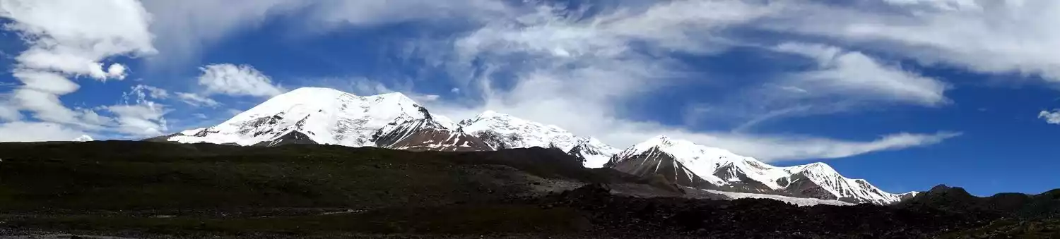
8. Muztagh Ata Peak
Reasons for being on the list: "Father of Iceberg" "Giant White Bun"
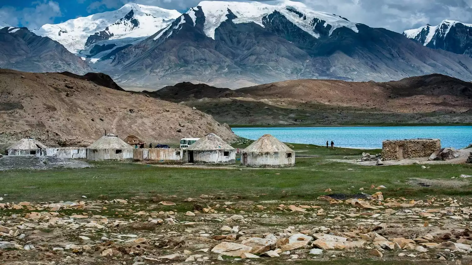
Location: Located at the junction of Akto County and Tashkurgan Tajik Autonomous County, Xinjiang Uygur Autonomous Region.
Altitude: 7509 meters above sea level (generally recognized in the mountaineering community as 7546 meters).
Recommendation index: ★★★☆☆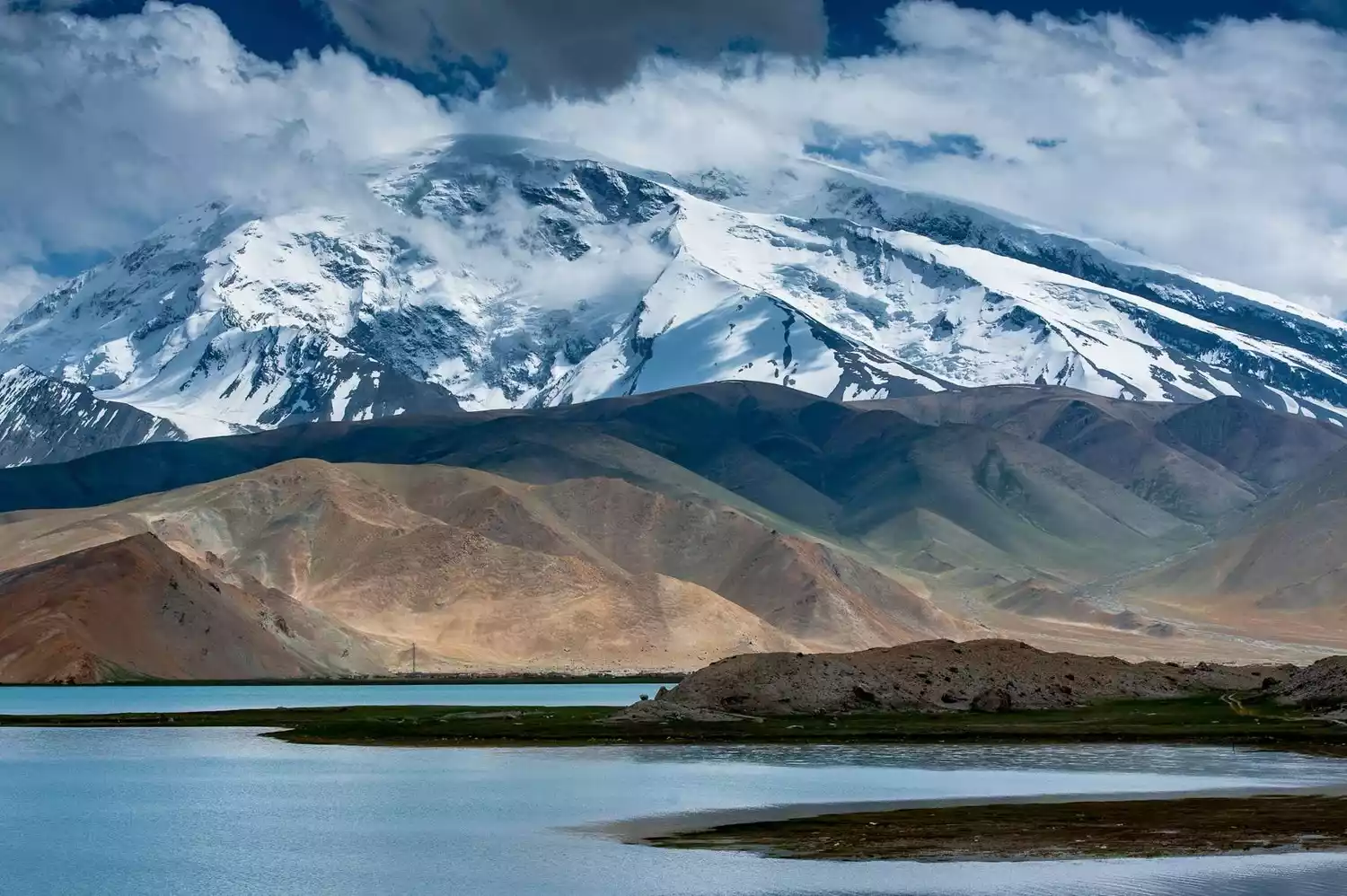
In Uyghur, "Mushi" means ice, "Tage" means mountain, and "Ata" means father. "Muztag Ata" means "Father of Iceberg".
Muztagh Ata's rounded summit is perpetually covered in snow, and more than a dozen glaciers nestle in the valley below, resembling a white-haired old man. Surrounding Muztagh Ata are Kongur Peak and Kongur Jiubie Peak, three towering peaks that stand like pillars of jade against the beautiful Pamir Plateau, becoming its symbol and representative.
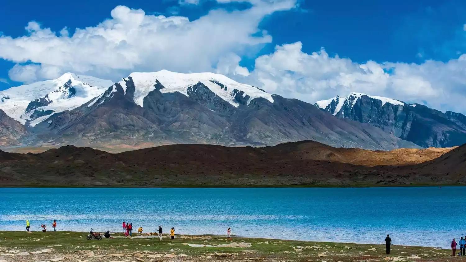
Many more people come here with the piety of pilgrims to appreciate the beautiful scenery of Muztagh Ata and Karakul Lake, or to explore the profound cultural heritage hidden deep under Muztagh Ata and Karakul Lake.
Tickets/Opening Hours
All day
No tickets
Transportation Overview
National Highway 314 passes by the foot of Muztagh Ata, and vehicles traveling from Kashgar to Khunjerab will pass by Muztagh Ata Peak.
The road is about 200 kilometers away from the mountaineering base camp, so you need to charter a car to get there.
Best time to travel
In the summer and autumn seasons from June to September, the colorful tents are like blooming flowers, making the desert Gobi and snow-capped mountains and grasslands look particularly enchanting.
Tips:
As a general tourist, there are several ways to visit Muztagh Ata:
1. Enjoy the beautiful scenery of the mountains and the lake at the edge of Karakul Lake.
2. Travel around Karakul Lake.
3. Climb to Glacier No. 4.
If you want to challenge mountain climbing, you must apply for a mountain climbing permit from the Xinjiang Uygur Autonomous Region Sports Committee or Mountaineering Association.
Muztagh Ata is very steep. In addition to choosing the best time, there are many things that need to be prepared, such as physical training.
9. Daocheng Three Sacred Mountains
Reason for being on the list: "The last Shangri-La"
Location: Daocheng County, Ganzi Prefecture, Sichuan Province
Altitude: North Peak, Xiannairi, 6032 meters above sea level; South Peak, Yangmaiyong, 5958 meters above sea level; East Peak, Xialangduoji, 5958 meters above sea level
Recommendation index: ★★★★☆
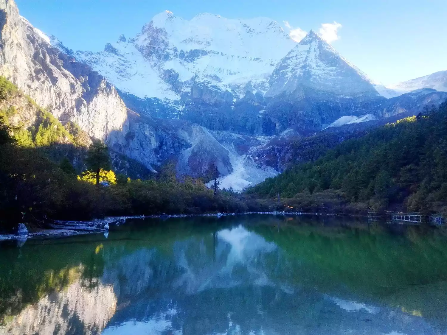
For those who are keen on snow mountain tourism, not visiting Daocheng would be a lifelong regret, because Daocheng's sacred peaks, namely the three snow mountains of Yading, are extraordinary, mysterious and spiritual, which is breathtaking.
Daocheng Yading's Three Sacred Mountains are known as the Three Protectors Snow Mountains. They consist of three snow-capped peaks: Xiannairi (6,032 meters), Yangmaiyong (5,958 meters), and Xianuoduoji (5,958 meters), situated close together yet distinctly separated, and arranged in a "品" (Chinese character "品") shape. They represent Avalokitesvara, Manjushri, and Vajrapani, respectively. The three peaks, perpetually capped with snow, echo each other from afar, reaching up to the sky.
According to the Buddhist text "Sacred Land Zanri Mixiang," of the world's twenty-four sacred mountains, Sanshan is ranked eleventh. Its zodiac sign is the Rooster, making it a sacred place for worship and pilgrimage to the gods and for accumulating merit. It is said that circumambulating the mountain once is equivalent to the merit of reciting 100 million Mani, and pilgrimage in the Year of the Rooster in the Tibetan calendar doubles the merit. It is a place that many Tibetans aspire to circumambulate once in their lifetime.
Three snow-capped peaks stand tall and white, like sharp swords piercing the sky. Below the snow line, glaciers plunge into the emerald green primeval forest. Snow-capped mountains, steep cliffs, precipitous cliffs, lakes, glaciers, grasslands, forests, and streams create a quiet and peaceful paradise for us.
Tickets/Opening Hours
7:00-18:30
The ticket is included in the Aden Scenic Area ticket.
The ticket price for the Yading Scenic Area is 150 yuan/person + the sightseeing bus is 120 yuan/person. The battery car fee from Chonggu Temple to Luolong Cattle Farm is 50 yuan/one way and 80 yuan/round trip.
Transportation Overview
To reach the Yading Scenic Area, you need to charter a car from Daocheng County, but it can only go as far as Riwa Township. From Riwa to Yading Village, you need to change to the scenic area's sightseeing bus.
It takes about one and a half hours from Daocheng to Riwa, and about one and a half hours from Riwa to Yading Village. The round-trip bus fare from Daocheng to Riwa is 400-700 yuan per car, and if you share a car, it's about 50 yuan per person.
Best time to travel
April to June and September to November (July to August is the rainy season)
If you want to visit in the best season, you have to go in autumn (September-October), and October is the best month. The rainy season has passed in October, and the weather is relatively stable. The sky is clear most of the time, and the Three Sacred Mountains will be revealed generously.
Tips:
The Yading scenic area is large and the journey is long, so we recommend staying overnight in Yading Village. Accommodation in Yading Village is mainly in houses and inns, which are relatively affordable. There's no need to book in advance outside of peak seasons like Golden Week.
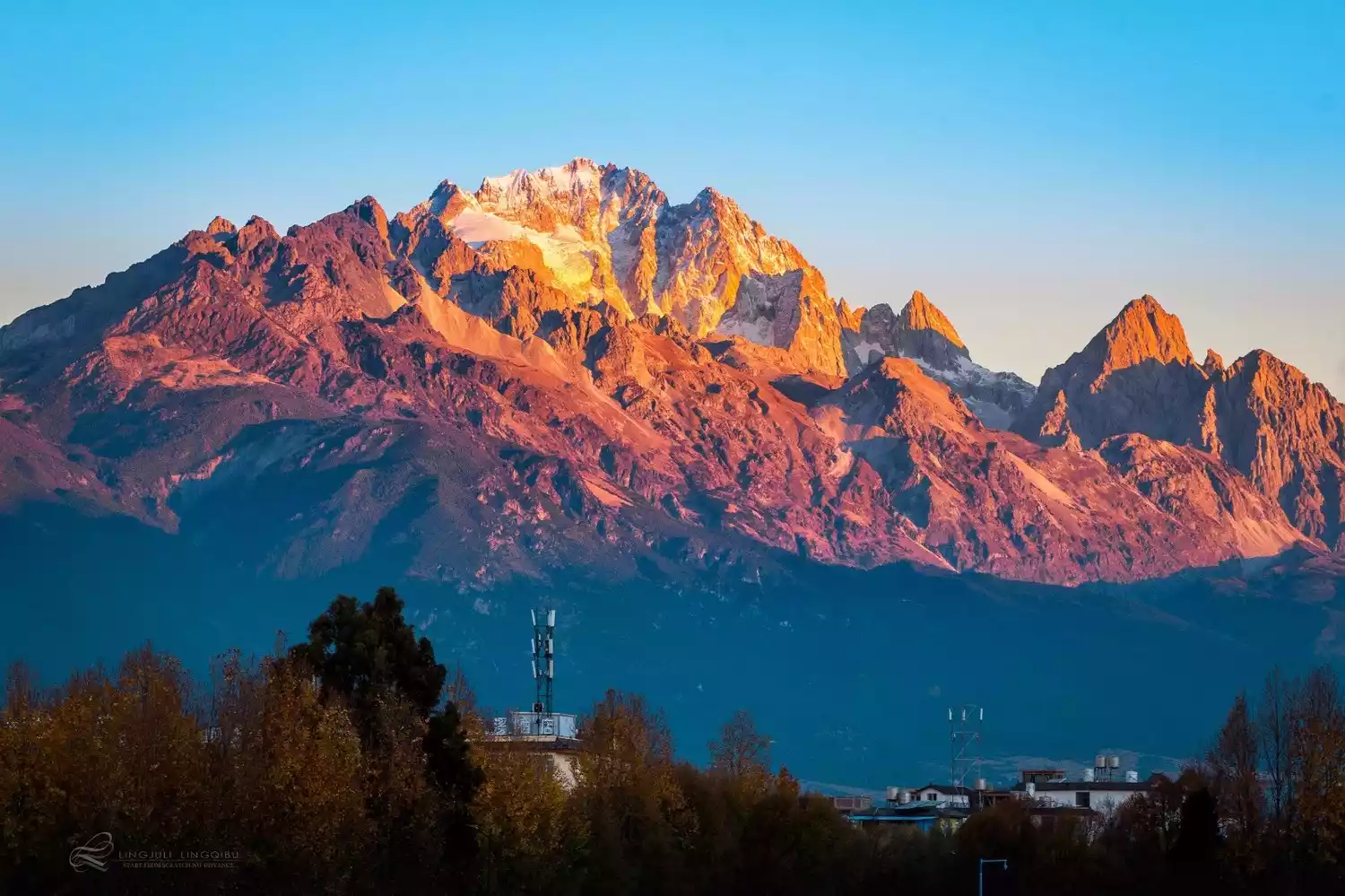
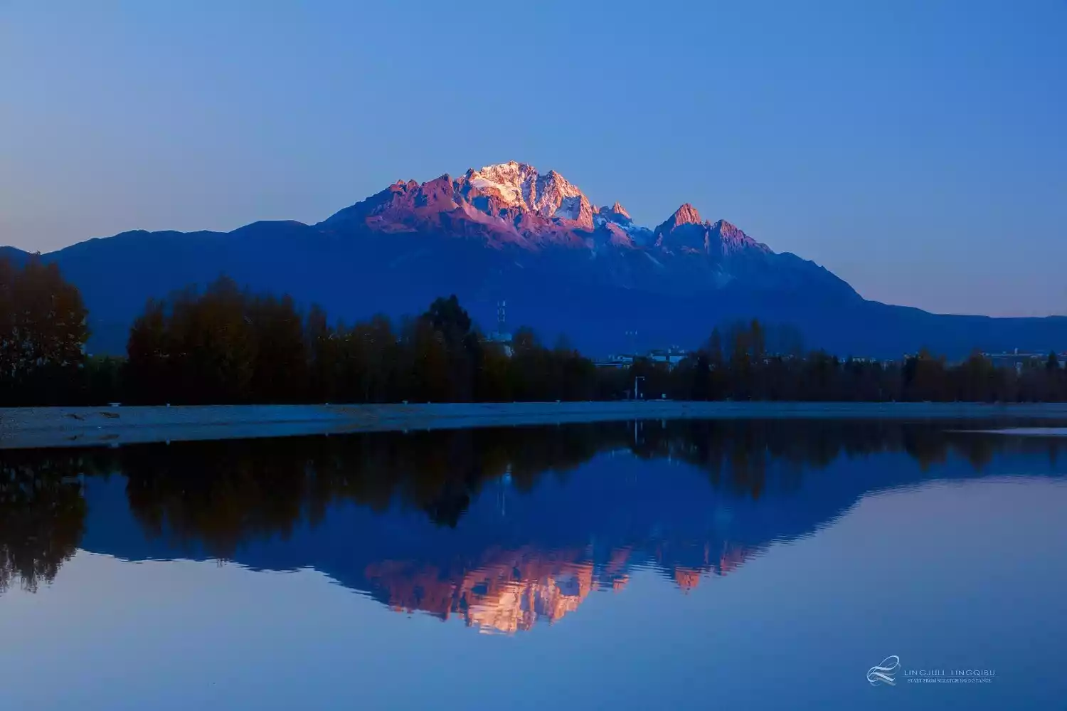
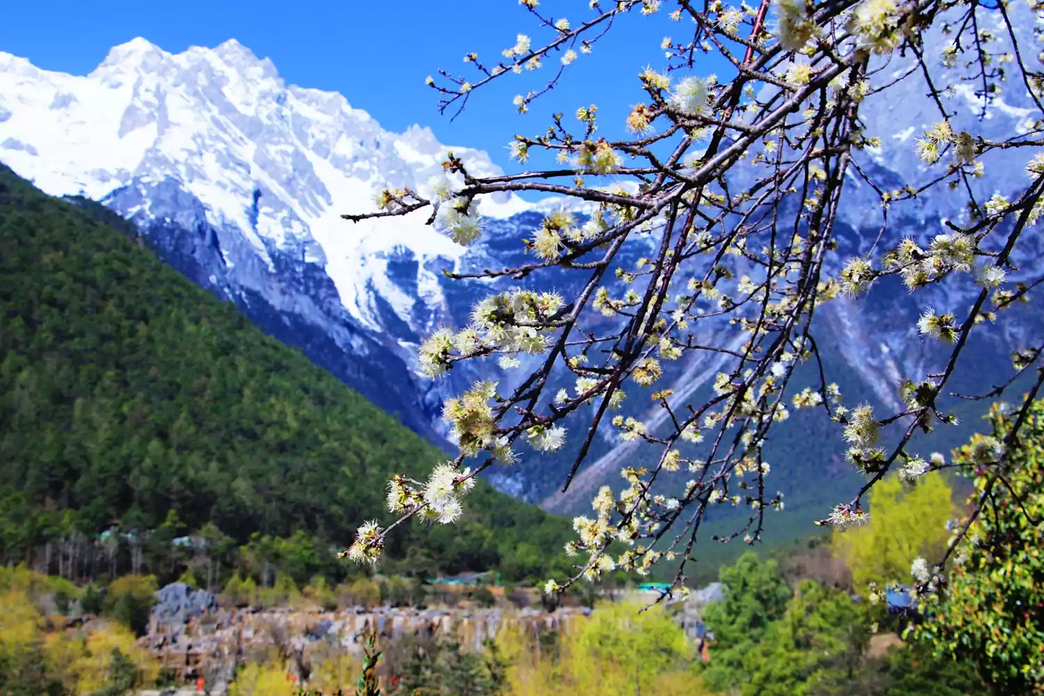
TOP 10 Jade Dragon Snow Mountain
Reason for being on the list: "Black and White Snow Mountain" and "Guardian of the Naxi People"
(Photo taken by @Zero Distance LJL)
Location: About 15 kilometers north of Lijiang City, Yunnan Province
Altitude: The highest peak, Fanzidou, is 5,596 meters above sea level
Recommendation index: ★★★★☆
(Photo taken by @Zero Distance LJL)
Yulong Snow Mountain is one of the sacred mountains and settlements of the Naxi people. The Naxi people call the snow mountain "Boshi Olu", which means "silver mountain rocks with white sand".
The snow mountain is 35 kilometers long from north to south and 13 kilometers wide from east to west. It has 13 peaks, with the main peak, Fanzidou, at an altitude of 5,596 meters. Against the backdrop of the azure sky, it looks like a silver jade dragon dancing eternally, hence the name Yulong Mountain.
Because the rock formations of Jade Dragon Snow Mountain are mainly limestone and basalt, with distinct black and white, it is also called the "Black and White Snow Mountain." It is renowned for its treacherous, unique, beautiful, and graceful appearance. With the changing seasons and the weather, sometimes clouds billow, with the Jade Dragon appearing and disappearing; sometimes the sky is as azure as water, with the peaks glittering and dazzling; sometimes the clouds are girded with waistbands, with the snow-capped peaks gleaming in the clouds and the hills and mountains emerald green below; sometimes the rosy clouds are radiant, and the snow-capped peaks are as beautiful as if covered in red gauze, appearing incomparably gorgeous.
The entire Yulong Snow Mountain combines various natural landscapes of the subtropical, temperate and frigid zones, forming a unique "Spring Snow" main landscape that is a spectacular sight.
 (Photo taken by @影妹妹)
Tickets/Opening Hours
Yulong Snow Mountain Scenic Area:
All year round: 09:00-18:00.
Jade Dragon Snow Mountain Cableway:
07:00-18:00 all year round
Package:
Big Jade Dragon Pass: 190 yuan (includes entrance fee, Dongba Valley, Jade Pillar, Dongba Pantheon, Jade Water Village, Yufeng Temple, Dongba Kingdom, a total of 6 attractions) (excluding the ancient city maintenance fee of 80 yuan)
Individual travelers:
Mountain entrance fee: 80 yuan (a la carte tickets are available for the six scenic spots of Dayulong). Ancient city maintenance fee: 80 yuan. Half-price admission for students (not valid for the cable car) and military officers (also valid for the cable car). All other IDs are not valid.
Glacier Park Cableway: 172 yuan. Yunshanping Cableway: 77 yuan. Yaoniuping Cableway: 82 yuan.
Transportation Overview
Chartering a car to Jade Dragon Snow Mountain costs 60-100 yuan per day; you can also take bus No. 7 from Red Sun Square near the waterwheel to Jade Dragon Snow Mountain for 15 yuan per person. Alternatively, you can take the cable car company's bus to the mountain, which departs from the Guluwan Hotel every morning.
Best time to travel
It is suitable all year round, and the best time is from February to June.
The average annual temperature of Yulong Snow Mountain is 11.3℃, the average temperature of the coldest month is 3.0℃, and the average temperature of the hottest month is 17℃.
The rainfall in Lijiang Jade Dragon Snow Mountain is mainly concentrated from June to October; there is very little rainfall from November to April of the following year.
Tips:
The main developed tourist attractions (spots) in Yulong Snow Mountain are:
Glacier Park, Ganhaizi, Blue Moon Valley, Yunshanping, Yakping, etc.
The typical tour route is from Lijiang - Ganhaizi - Baishui River - Yunshanping.
Starting from Baishui River, you can take the Yunshanping Cableway up the mountain. Horseback riding is not recommended. All horseback riding trips up the snow-capped mountains are 100% traps, and you won't see any of the attractions at all. Skiing: Skiing is available year-round at Yulong Snow Mountain. Take the Yulong Snow Mountain enclosed cable car up to the four-season ski resort at an altitude of 4,506 meters (round-trip cable car costs 172 yuan).
11. Mount Gongga
Reason for being on the list: "King of Shushan"
Location: South of Kangding, Ganzi Tibetan Autonomous Prefecture, Sichuan Province.
Altitude: 7556 meters
Recommendation index: ★★★★☆
The title "King of Sichuan Mountains" is enough to describe it. Mount Gongga, meaning "holy mountain" in Tibetan, is the highest peak in Sichuan Province. It is the eleventh highest peak in the world and the highest in Sichuan Province, earning it the reputation of "King of Sichuan Mountains."
Surrounded by 45 peaks over 6,000 meters above sea level, it is the dream of many mountaineers and the second most difficult mountain to climb in China after Meili Snow Mountain.
(Photo taken by @Z妹)
The mountain is towering and majestic, with breathtaking scenery. Its perpetual snow caps the mountain, and from afar, it looms above a vast sea of clouds, a majestic and mysterious presence that inspires awe. Especially when the sky is clear, and the sun is shimmering on the mountain, the splendor of Mount Gongga, like a golden mountain, is truly unimaginable.
The Gongga Mountain Scenic Area is centered on Gongga Mountain and consists of Hailuogou, Muge Co, Wuxuhai, Gongga South Slope and other scenic areas. It covers an area of 10,000 square kilometers and is a national scenic spot.
Tickets/Opening Hours
8:00-17:00, last admission at 14:00.
There is a cable car at the foot of Mount Gongga that takes tourists up the mountain. The cable car costs 160 yuan and allows you to see the ice waterfall.
Transportation Overview
Kangding has special tourist buses going to Mount Gongga. There are also several buses departing daily from Chengdu Shiyang Station to Mount Gongga (to Tianwan).
Best time to travel
The best seasons to visit Mount Gongga are for mountaineering and for photographing and viewing the scenery.
The best time to go mountain climbing is from May to June, when the dry and rainy seasons are alternating. The temperature is suitable, the rainfall is light, and the roads are not too muddy.
The best time to photograph Mount Gongga is from October to mid-May of the following year, when the weather is clear.
If you want to go to Hailuogou to enjoy the beautiful scenery of meadows, forests and lakes, it is best to go there in summer and autumn, especially in autumn when the leaves turn red and yellow, the scenery in the mountain stream is even more beautiful.
Tips:
Things you can’t miss when visiting Mount Gongga:
1. See the golden mountain in the sun from the main peak of Gongga
2. Stroll through the ecological paradise of Hailuogou
3. Drink a pot of hot butter tea in Gonggar Temple
4. Hike on a spectacular glacier
5. Take a dip in the mountain hot springs
6. Try Kham cuisine
12. Bogda Peak
Reason for being on the list: "The First Sacred Mountain in Xinjiang"
Location: Fukang City, Xinjiang Uygur Autonomous Region.
Altitude: 5445 meters
Recommendation index: ★★★☆☆
Bogda, meaning "sacred, supreme, spiritual mountain" in Mongolian, is a sacred mountain in the hearts of the people. Composed of three closely-knit peaks, it is perpetually capped with snow, earning it the nickname "Sea of Snow." At its foot lies the famous scenic spot "Heavenly Lake," making it a popular destination for mountaineers and tourists.
No matter where you are in Urumqi, as long as you look to the south and raise your head, you can see the majestic mountains stretching from east to west, and the towering snow-capped peaks that never melt all year round. That is the famous Bogda Peak of Tianshan Mountains.
Tickets/Opening Hours
All day
No tickets
Transportation Overview
To get to Bogda, you can first go to Tianchi Scenic Area, rent a horse from Tianchi and ride there, or you can start from Tianchi on foot.
Another way is to start from Baiyanggou under Tianchi Lake and go to Bogda Mountain Base Camp.
Best time to travel
The best time to visit Bogda every year is from June to October. In the midsummer season, the melted ice and snow flow down and merge into more than 30 large rivers, irrigating the oasis at the foot of the mountain. The scenery is charming and the mountains are fragrant.
Tips:
In order to protect the water sources of major cities in Xinjiang, in 2010, Changji Prefecture issued the "Tianshan Tianchi Scenic Area Protection and Management Regulations", which stipulates that in the future, anyone entering the Tianshan Tianchi Scenic Area for hiking, mountaineering, scientific research, filming and other activities must first obtain approval from the Xinjiang Tianshan Tianchi Scenic Area Management Committee.
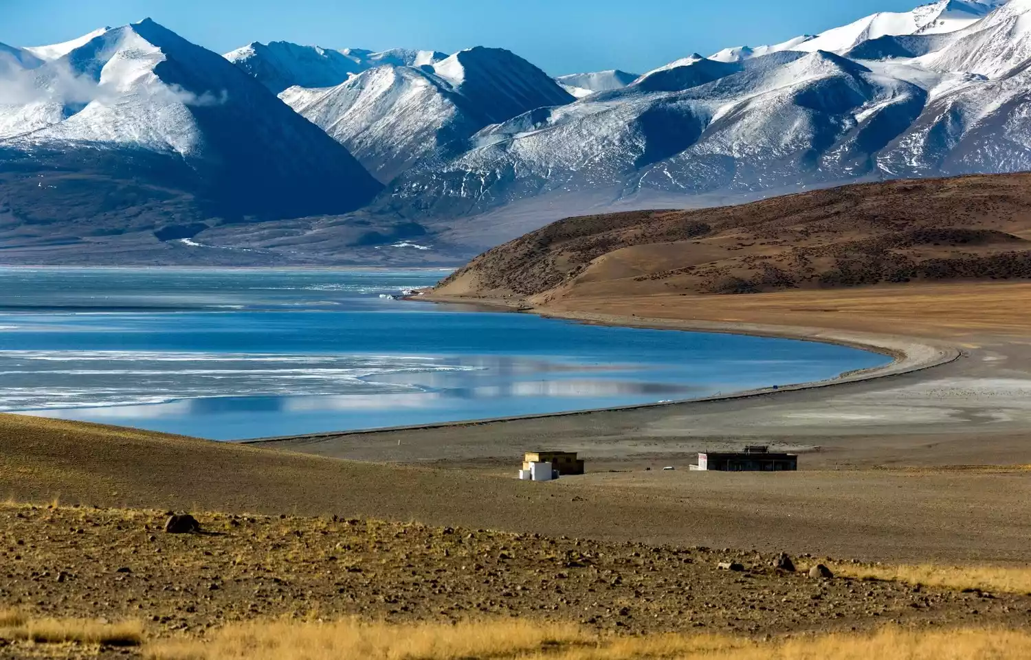
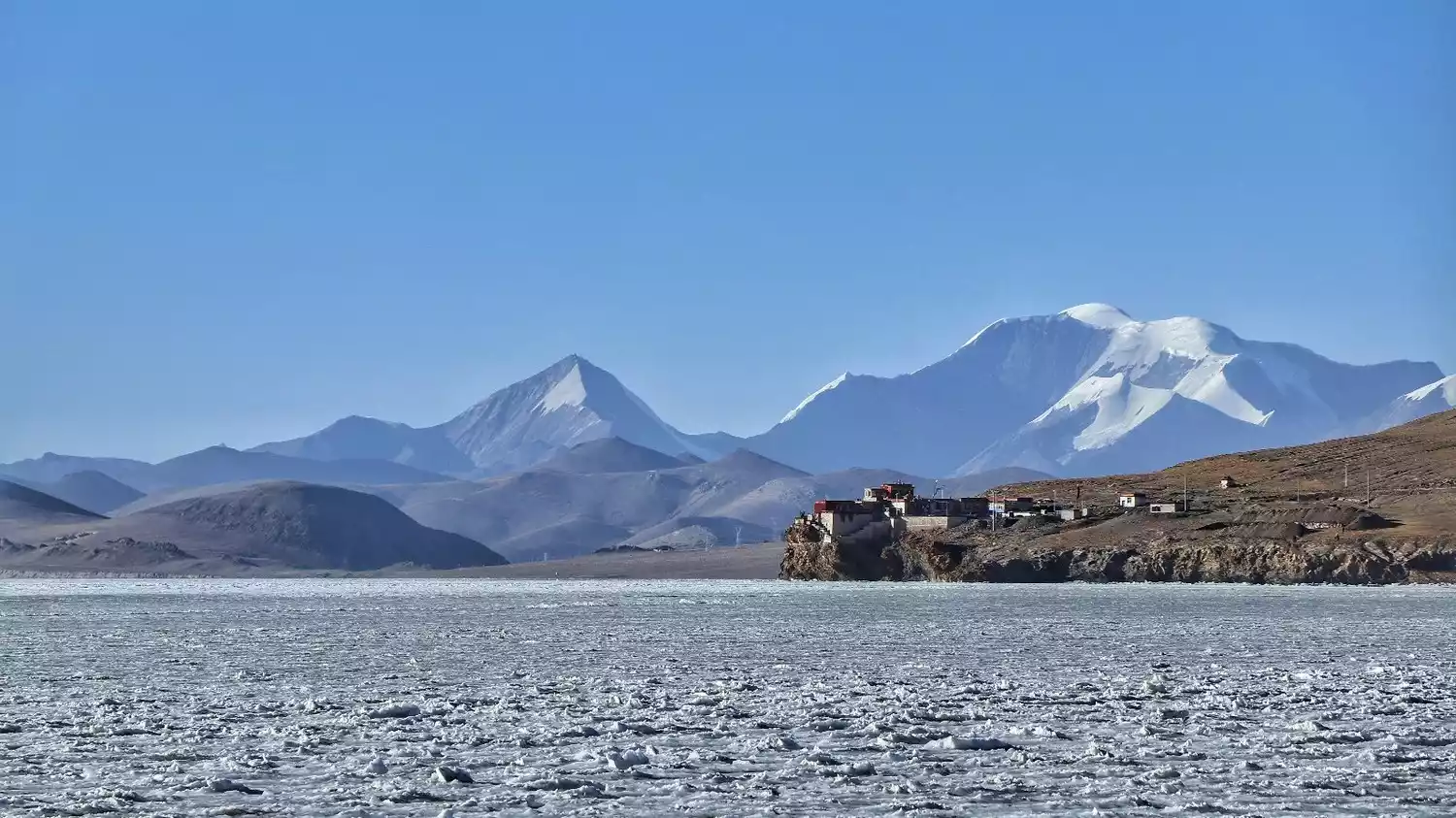
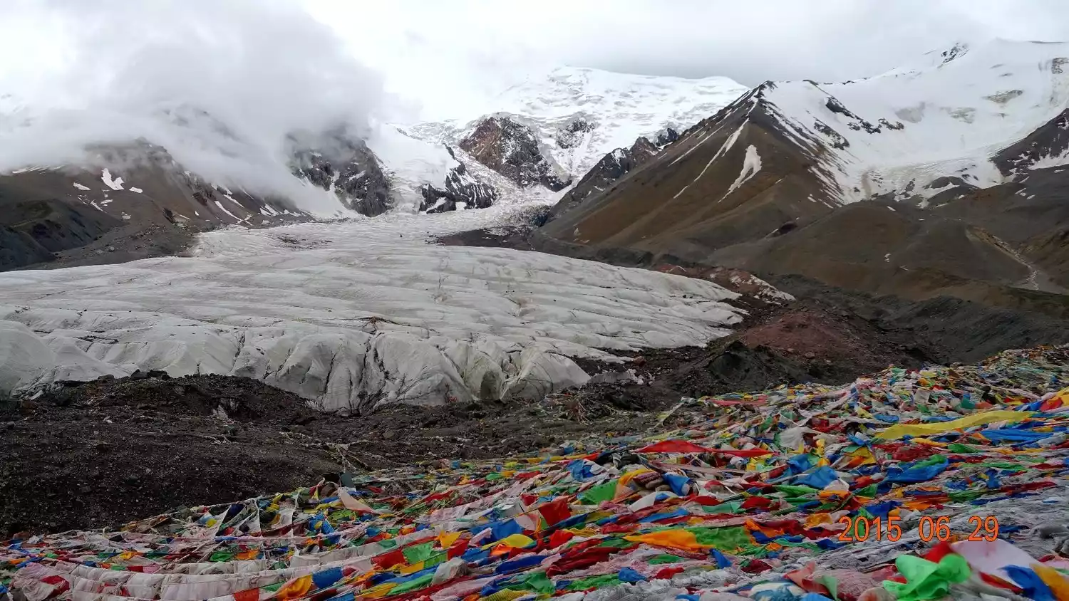
13. Namunani Peak
Reason for being on the list: "Mountain of Our Lady"
(Photo taken by @胖顾哥)
Location: Ritu County, Ngari
Altitude: 7694 meters
Recommendation index: ★★★★☆
(Photo taken by @紫逍遥TL)
Mount Namuani is one of the main peaks of the Himalayas. Ranked as the fifth of the Himalayan goddesses, it wields wisdom, happiness, and longevity, and is also known as the "Fifth Goddess." To the left of Mount Namuani is the "Holy Lake" of Lake Manasarovar, and to the right is the "Holy Mountain" of Mount Kailash. On the other side of the road is the "Ghost Lake" of Lake Laang. This is the center of the world for Tibetans.
Mount Namuani contains the largest glacier complex in the Chinese Himalayas. Surrounding the peak are five massive glaciers, their surfaces riddled with crevasses and steep cliffs. It is said that the waters of Lakes Manasarovar and Laangco are formed by the melting snow from these glaciers.
(Photo taken by @紫逍遥TL)
Tickets/Opening Hours
All day
free
Transportation Overview
There are two routes into the mountains: one is to go south from Urumqi, the capital of Xinjiang Uygur Autonomous Region, along the Xinjiang-Tibet Highway, through Yecheng Shiquanhe to Purang, a total distance of 3,044 kilometers.
The other route runs west from Lhasa, the capital of Tibet, through Shigatse and Saga to Purang, covering a total distance of 1,433 kilometers.
Best time to travel
The best time to climb is from May to late June, when good weather is common and can last for 6-8 days. The rainy season begins in early July, with the heaviest rainfall in July and August.
Tips:
You can watch the sunrise and sunset near Jiwu Temple.
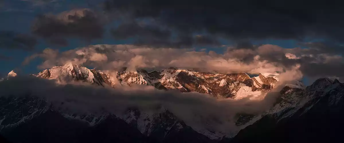
14. Mount Namjagbarwa
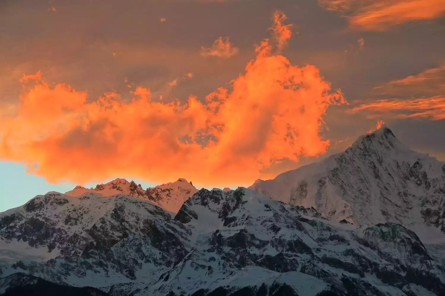
Reason for being on the list: "The Father of All Mountains" "China's Most Beautiful Snow Mountain" was selected by China National Geographic
(Photo taken by @我是我部门)
Location: Nyingchi Prefecture, Tibet, at the intersection of the Himalayas, Nyainqentanglha Mountains, and Hengduan Mountains.
Altitude: 7782 meters
Recommendation index: ★★★★☆
Mount Namjagbarwa is the highest mountain in Nyingchi. Light clouds rise up, and graceful cloud waterfalls slide down leisurely, surrounding the mountainside like white satin. The sword-like snow peaks emitting a cold blue light are looming in the gaps between the clouds.
This reclusive beauty has lived in seclusion year-round in the Himalayas. Among the 7,000-meter peaks, Mount Namjagbarwa is the tallest and 15th highest peak in the world. In 2005, China National Geographic named it China's most beautiful snow-capped mountain, dubbing it "Paradise in the Clouds."
Mount Nanga Bawa embodies almost every beautiful mountain imaginable, but unfortunately, it is rarely revealed. Due to the perpetual sea of clouds, even locals can only see its true beauty a few times a year. A British explorer once waited for a month at the foot of Nanga Bawa without being able to see its true form.
Tickets/Opening Hours
All day
free
Transportation Overview
Take a bus from Nyingchi to Pai Township (Pai Town), 80 km southeast of Bayi Town. Minibuses depart from the bridgehead of Bayi Town at around 8:00 every morning. The fare is 60 yuan per person and the journey takes about 4 hours.
From Pai Township, continue about 18 kilometers to the Zhibai Viewing Platform, and then hike a few kilometers to Zhibai Village. There are no regular buses for this section, so you'll need to charter a car, which costs over 200 yuan.
Zhibai Village is only 5km away from the main peak of Mount Namjagbarwa, and the scenery along the way is very spectacular.
Best time to travel
The rainy season in this area is relatively long, generally lasting from May to September each year, especially in July, August and September, when it rains almost every day and the cloud cover is also very heavy, so the peaks are shrouded in clouds and mist all day long.
February to April and October to November each year are the transition periods between the dry season and the rainy season, which are good times to choose mountain climbing.
Tips:
According to statistics, the number of days when Mount Namjagbarwa appears is only 65 days on average each year, so you should be prepared for the possibility of not seeing it.
There are several main viewing spots for Mount Namjagbarwa, including the viewing platform of the Yarlung Zangbo Grand Canyon Scenic Area, Zhibai Village, Sejila Pass, Suosong Village, etc.
Suosong Village is relatively simple and faces the snow-capped mountains. Peach blossoms bloom here every spring, and photographing the snow-capped peaks hidden by the flowers is also a favorite of many photographers.
TOP15 Kulagangri Peak
Reason for being on the list: "The highest peak in Shannan" and "Four Sacred Mountains"
Location: Lhoza County, Shannan Prefecture, Tibet
Altitude: 7538 meters
Recommendation index: ★★★★☆
(Photo by @Flyer.W)
Kulagangri Peak, located in Lhozhag County, Shannan Prefecture, Tibet, is known as one of the "Four Sacred Mountains" of central Tibet. It is the 20th highest peak in China and the highest in Shannan Prefecture, Tibet, standing tall on the main ridgeline of the central Himalayas.
Kulagangri is composed of three peaks, with six peaks over 7,000 meters standing side by side with it. From a distance, the peaks stand side by side, like a towering snow barrier.
(Photo by @Flyer.W)
Before Buddhism was introduced to the snowy plateau, there were four sacred mountains in Tibet: the Eastern Sacred Mountain Wodegongjie, the U-Tsang Sacred Mountain Yala Xiangpo, the Qiangtang Sacred Mountain Nyainqentanglha, and the Southern Sacred Mountain Kulagangri.
With the prosperity of Buddhism in Tibet, the concept of the four sacred mountains of Tibetan Buddhism has become more well-known, and Kulagangri is one of the four traditional sacred mountains in Tibet.
The Kulagangri ridge runs east-west, with steep cliffs towering thousands of feet high on either side, creating a breathtaking sight. From afar, the peaks stand side by side, resembling a towering barrier of ice and snow, a truly spectacular sight.
(Photo by @Flyer.W)
Tickets/Opening Hours
All day
free
Transportation Overview
From Lhasa, drive south through Langkazi to Munda Mountaineering Base Camp, a total distance of 280 kilometers. The base camp is located on the northern foot of Kulagangri, at an altitude of 4,490 meters on the ice fan.
Best time to travel
The mountain climbing weather is bad in mid-April every year, with low temperature and large daily temperature difference. The best time to climb is from April to May or from September to October.
TOP 16 Shishapangma
Reason for being on the list: The only 8,000-meter peak located entirely in China
Location: In the middle of the Himalayas, about 120 kilometers southeast of Mount Everest.
Altitude: 8012 meters
Recommendation index: ★★★☆☆
Shishapangma, meaning "severely cold climate, harsh and unpredictable weather" in Tibetan, is a Tibetan term for fourteen peaks over 8,000 meters in the world. Six of these, including the highest peak, Mount Everest, are located in China, but five of these are border mountains. The only 8,000-meter peak entirely within Chinese territory is Shishapangma, located in Niemula County, Shigatse, Tibet.
This is one of the modern glaciation centers of the Himalayas. The entire Kukangri Range boasts 6,000 square kilometers of glaciers and permanent snow, some of which are located around Shishapangma Peak. The crisscrossing crevasses and occasional massive ice and snow avalanches present numerous challenges for climbers. On May 2, 1964, a Chinese mountaineering team achieved the first summit.
Tickets/Opening Hours
All day
No tickets
Transportation Overview
First, take a bus from Lhasa along the China-Nepal Highway through Gyantse and Shigatse to Sheger, a distance of 670 kilometers.
Go west for about 138 kilometers through Dingri Menha Dun, continue west for 50 kilometers and then head south. Follow the simple road for 20 kilometers to reach the northern foot of Shishapangma. On the north side of the Yebokangjiale Glacier is the mountaineering base camp at an altitude of 5,114 meters.
Best time to travel
The climate characteristics of Mount Shishapangma are generally similar to those of Mount Everest. April and May, and October and November are the best seasons for climbing and viewing Mount Shishapangma.
TOP17 Mount Merdo
Reason for being on the list: "Black Cult Mountain"
Location: At the border of Xiaojin County and Jinchuan County in Aba Prefecture, Danba County, Ganzi Tibetan Autonomous Prefecture, Sichuan Province
Altitude: 5105 meters
Recommendation index: ★★★☆☆
Mount Meldo is the oldest sacred mountain of the Tibetan Black Sect of Buddhism, the cultural center of the Jiarong Tibetans, one of the four sacred mountains in Tibet, and a symbol of national heroes.
According to the "Chronicle of the Sacred Mountains of Merduo," the mountain boasts 108 sacred sights and over a thousand scenic spots. Standing atop Merduo Mountain, one can gaze eastward at the Golden Summit of Mount Emei and westward at the distant Gangdise Snow Mountains of U-Tsang. Looking down, one can admire eight silver rivers, like eight pure white hadas, winding around the 56 beautiful peaks of Merduo Mountain.
The 56 magnificent peaks symbolize the unity and friendship of the 56 ethnic groups in China. Located at the junction of Tibetan and Han areas, Mount Merduo itself is a symbol and witness of the harmonious coexistence between the Tibetan and Han peoples.
Mount Merdo is as famous as the Himalayas and Mount Gangdise in Tibet, and is listed as one of the four sacred mountains. In particular, its magical and wonderful features have made it devoutly worshipped by religious believers at home and abroad. Tibetan monks feel that it is a great merit to be able to make a pilgrimage to Mount Merdo.
Tickets/Opening Hours
All day
free
Transportation Overview
To reach Danba, you need to go to Chengdu first and then take a bus.
Best time to travel
Every year on the tenth day of the seventh lunar month (the birthday of General Meldo), believers from all over the country will gather at the Meldo Temple to pay homage to General Meldo and circumambulate the sacred Meldo Mountain. It is an important local festival.
Tips:
When photographing Mount Melduo, shooting horizontally can best capture the mountain's vastness and sweep, perfectly depicting its undulating lines. Shooting vertically can easily convey the height and steepness of the peaks, enhancing the sense of depth. Generally speaking, vertical shooting is the most common method for photographing mountain scenery. The best spot to view Mount Melduo is in Zhonglu Township.
TOP18 Gaduo Awakening
Reason for being on the list: "The most mysterious sacred mountain"
Location: Zaduo Town, Chengduo County, Yushu Prefecture, Qinghai
Altitude: 5395 meters
Recommendation index: ★★★☆☆
Tickets/Opening Hours
All day
free
Transportation Overview
The bus from Xining to Qingshuihe Town runs eight times a day at 11:00, 12:30, 14:30, 15:30, 16:00, 17:00, 18:00, and 18:30. The fare before 15:00 is 154.5 for ordinary buses, and the fare after 15:00 is 170.5 for sleeper buses. The journey takes about 11 hours.
From Qingshuihe Town to Zaduo Town, the shared car fare is 40 yuan per person;
Best time to travel
Yushu has a high-altitude and cold climate, with only cold and warm seasons throughout the year. The average annual temperature is -0.8 degrees. The warm season lasts for about 5 months, from May to September.
The best time to circumambulate the mountain is between May and October. May is not recommended, as the snow has not yet melted, the vegetation is sparse, and the air is thin, making breathing difficult. July and August offer stunning scenery, with blooming flowers and lush green meadows. September and October are after the rainy season, and the weather is relatively stable.
Depart from Golmud | 6 days and 5 nights
6-Day Off-Road Trip to Hoh Xil and Sanjiangyuan | Across Northwest Uninhabited Areas
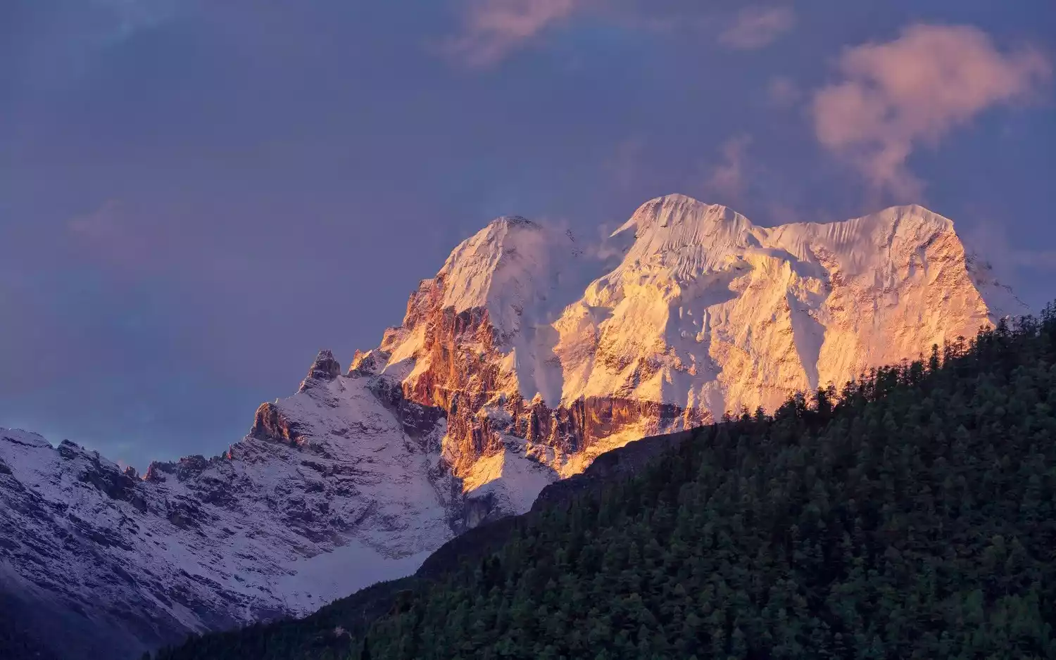
¥5980 From 588 people have registered Register nowTOP19 Meili Snow Mountain
Reason for being on the list: "The sun and moon in my heart"
(Photo taken by @Zero Distance LJL)
Location: Eastern part of Zayu County, Tibet and western part of Deqin County, Yunnan.
Altitude: 6740 meters
Recommendation index: ★★★★★
(Photo by @yxk-wy)
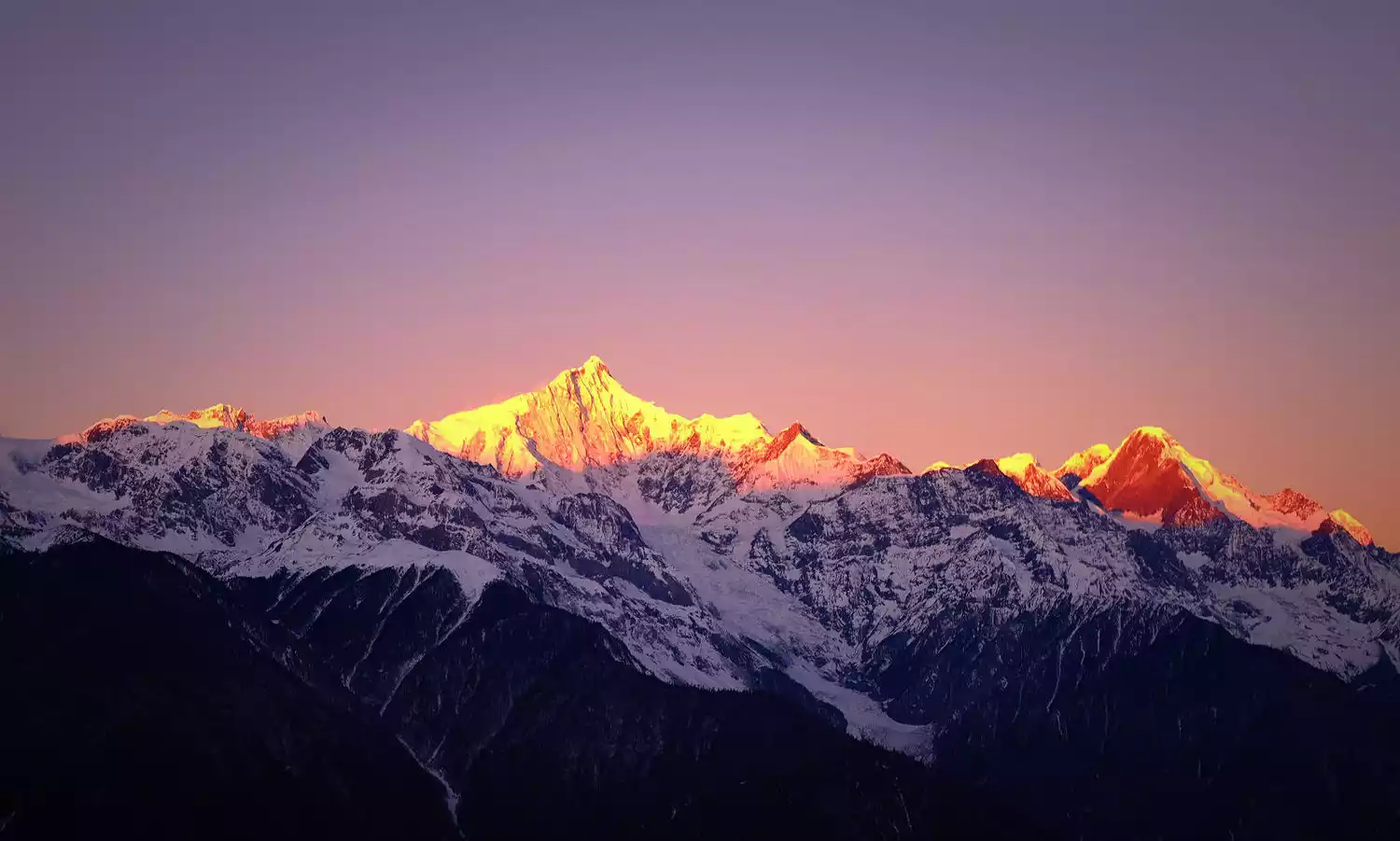
Meili Snow Mountain, also known as Prince Snow Mountain, is the first of the Eight Sacred Mountains in Tibet and is known as Kawagebo Snow Mountain in Tibetan areas. Its highest peak, Kawagebo Peak, reaches 6,740 meters above sea level, making it the highest peak in Yunnan Province. Its main peak remains an unconquered "virgin peak" and is the only peak prohibited from climbing for cultural protection.
The word "Meili" means medicine mountain in Tibetan. It is named after the abundance of various precious medicinal materials. It is also a holy place of Yungdrung Bon religion. It is known as one of the four sacred mountains of Tibetan Buddhism along with Mount Kailash in Tibet, Mount Amnye Machen in Qinghai, and Gaduo Jowo in Qinghai.
(Photo taken at @诗与远方88F)
The famous "Sunlight Shining on Golden Mountain" is a sight that countless backpackers yearn for. This rare sight often occurs in the early morning hours of clear days, when sunlight suddenly shines on the snow-capped peaks, gradually expanding to create a stunning spectacle that lasts for about 20 minutes before the entire mountain turns white, losing its golden appearance.
(Photo taken by @映雪佳人)
Tickets/Opening Hours
07:00-16:00 (Monday-Sunday, January 1st-December 31st)
Package 1 (including Jinsha River Bay, Wunongding, Feilai Temple, and Mingyong Glacier): 228.00 yuan
Package 2 (including Jinsha River Bay, Wunongding, and Feilai Temple): 150.00 yuan
Package 3 (including Jinsha River Bay, Wunongding, Feilai Temple, and Yubeng Village): 230.00 yuan
Meili Snow Mountain Avalanche Ticket: 55 yuan
Transportation Overview
【Shuttle Bus】
1. There is a daily bus from Shangri-La County to Deqin. The fare is about 67 yuan and the journey takes about 5-6 hours.
2. The shuttle bus from Deqin to Feilai Temple and Xidang Hot Springs is irregular. For more information, please call Deqin County Bus Station at 0887-8413322
【Charter】
1. From Deqin, you can take a taxi to Feilai Temple, the one-way fare is about 30 yuan; from Deqin to Mingyong Glacier, the one-way fare is about 150 yuan, and the round-trip fare is about 200 yuan; from Deqin to Xidang Village, the one-way fare is about 180 yuan
2. There are minivans from Feilai Temple that go to Xidang Village. You can arrange to share a ride with others. The specific price can be negotiated with the driver. Remember to negotiate the price with the driver and make sure to confirm the destination and itinerary in advance to avoid unnecessary trouble.
Best time to travel
The best time to view Meili Snow Mountain is from October to May of the following year. During this period, the probability of seeing the main peak and other peaks is the highest.
TOP20 Amnye Machen Mountain
Reason for being on the list: "Father of the Yellow River"
Location: Northwest of Maqin County, Guoluo Prefecture, Qinghai Province
Altitude: 6282 meters
Recommendation index: ★★★★★
(Photo taken by @地龙0611)
 (Photo taken by @地龙0611)
Amnye Machen Mountain, also known as Maji Snow Mountain, means "Grandfather God's Mountain" in Tibetan and is located in the eastern section of the Kunlun Mountains. "Ani" in Tibetan means "old ancestor" and also implies a beautiful heart, happiness, or generosity. "Machen" in Tibetan means the largest mountain at the source of the Yellow River and also implies grandeur and majesty. Amnye Machen Snow Mountain is not only naturally stunning, but also shrouded in mystery through various legends.
The local Tibetans believe that the Amnye Machen Snow Mountain is one of the twenty-one sacred snow mountains of the "Bokawa Jiangong" and that it is the fourth of the nine gods who created the world, Sparqiao Belag, a mountain god with immense power and magical powers who dominates the mountains, rivers and the earth.
Tibetans have a deep faith in gods. The Amnye Machen Peak has such great divine power that it naturally becomes a place of pilgrimage. During the "Year of the Sheep" in the Tibetan calendar or the years when the Shenmen (Niguo), Xuemen, and Gangguo are separated, pilgrims carry simple luggage, cooking utensils and food, and worship around the mountain, expressing their devout worship in order to eliminate sins and ascend to heaven.
Tickets/Opening Hours
All day
free
Transportation Overview
Departure: There are three buses from Xining to Dawu Town, Maqin County every day, at 8:45 in the morning, 9:15 in the morning and 18:00 in the evening. The journey is 441 kilometers and takes about 8 hours.
It takes 5 hours to charter a car from Maqin County to Xueshan Township, which is the closest to the Amnye Machen Snow Mountain, and the cost is about 800-1000 yuan.
You can also charter a car from Lajia Township to Xueshan Township, which takes about 4 hours and costs about 600-800 yuan.
It takes about an hour to drive from Xueshan Township to the viewing platform.
Best time to travel
Between January and April every year.
Conclusion
The world's most unique mountains each have their own unique charms, but the most extraordinary and beautiful are truly found in China. Snow-capped mountains hold a unique meaning for humanity that no other landscape on Earth can match.
Even though we have traveled a lot and seen a lot, the secret of the Third Pole, those sacred mountains surrounded by snow clouds all year round, has become our eternal mystery - we have never stopped discussing the snow-capped mountains, but have never tried to understand them.