[Eastern Xinjiang Guide] Depart from Urumqi, a 2-hour train ride to the Eastern Tianshan Mountains
Preface
If your impression of Xinjiang is "the towering Tianshan Mountains, the endless yellow sand, and the barren Gobi Desert," if your idea of Xinjiang is "a piece of Qiang flute music and a few sounds of Hujia," if your idea of Xinjiang is only "grapes and Hami melons"...
Then it's time to head to Xinjiang. The rapidly evolving region boasts not only Instagram-worthy dessert shops but also off-the-beaten-path delicacies once renowned within Xinjiang but now trending on TikTok.
Some people say that if you come to Xinjiang, your camera will be very busy and you should bring enough memory cards because Xinjiang has world-class scenery.
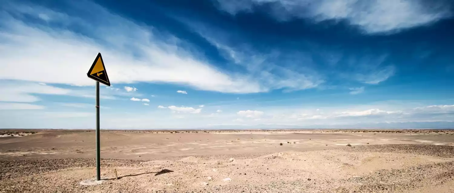
Some people also say that Xinjiang is too far away. The plane flew for two hours but was still in Xinjiang. Going from Urumqi to Hotan is equivalent to crossing four provinces and cities.
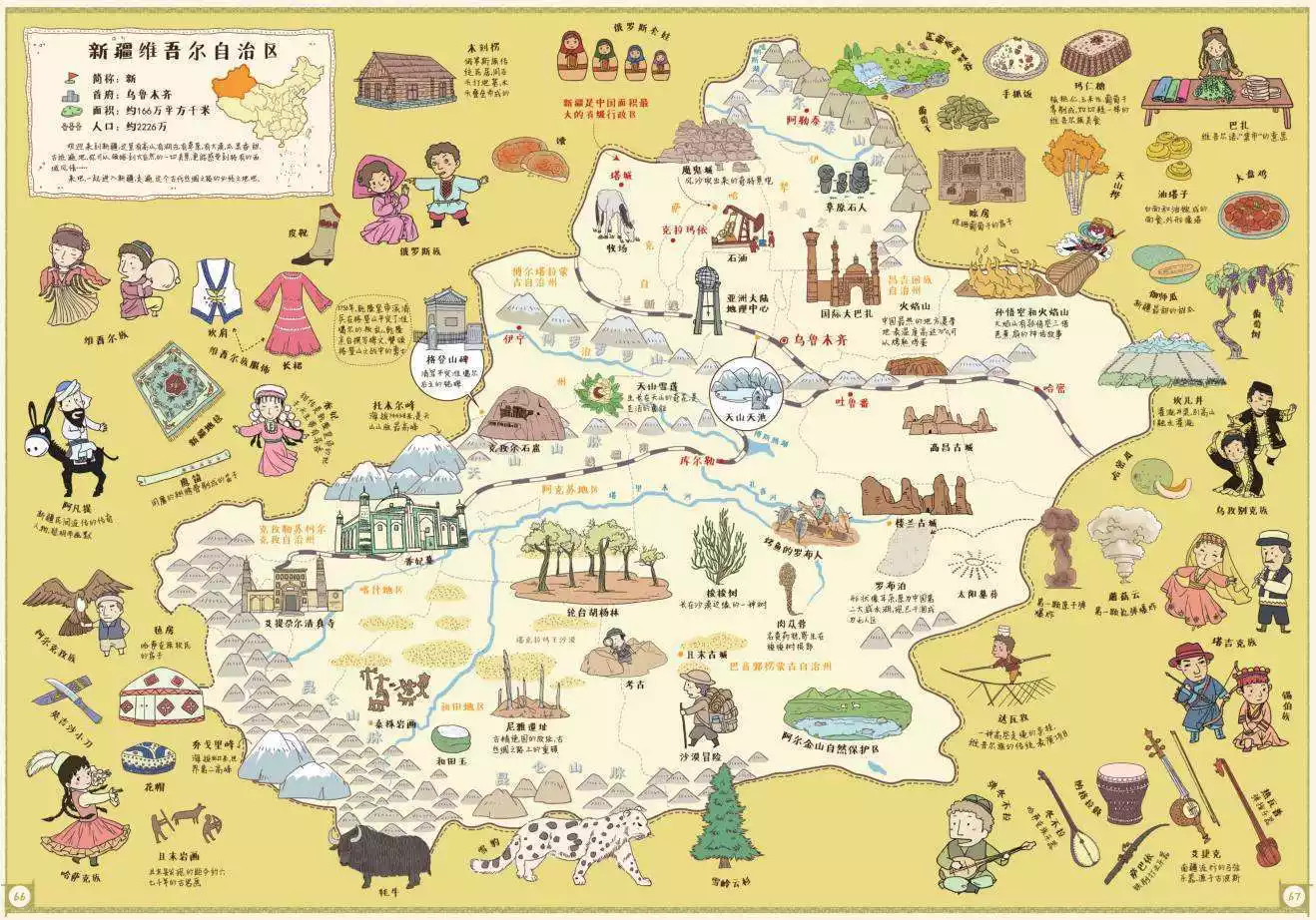
But these won't stop you from visiting Xinjiang, as its beauty still captivates millions. With 1.66 million square kilometers of beautiful scenery, Xinjiang is the largest province in my country (accounting for one-sixth of the country's total area).
So how big is Xinjiang? Xinjiang's total area is equivalent to three times the size of France, four times the size of Japan, seven times the size of the United Kingdom, 11 times the size of Shandong Province, 16 times the size of South Korea, 40 times the size of Taiwan, and 99 times the size of Beijing.
Overview of Xinjiang in the Western Regions
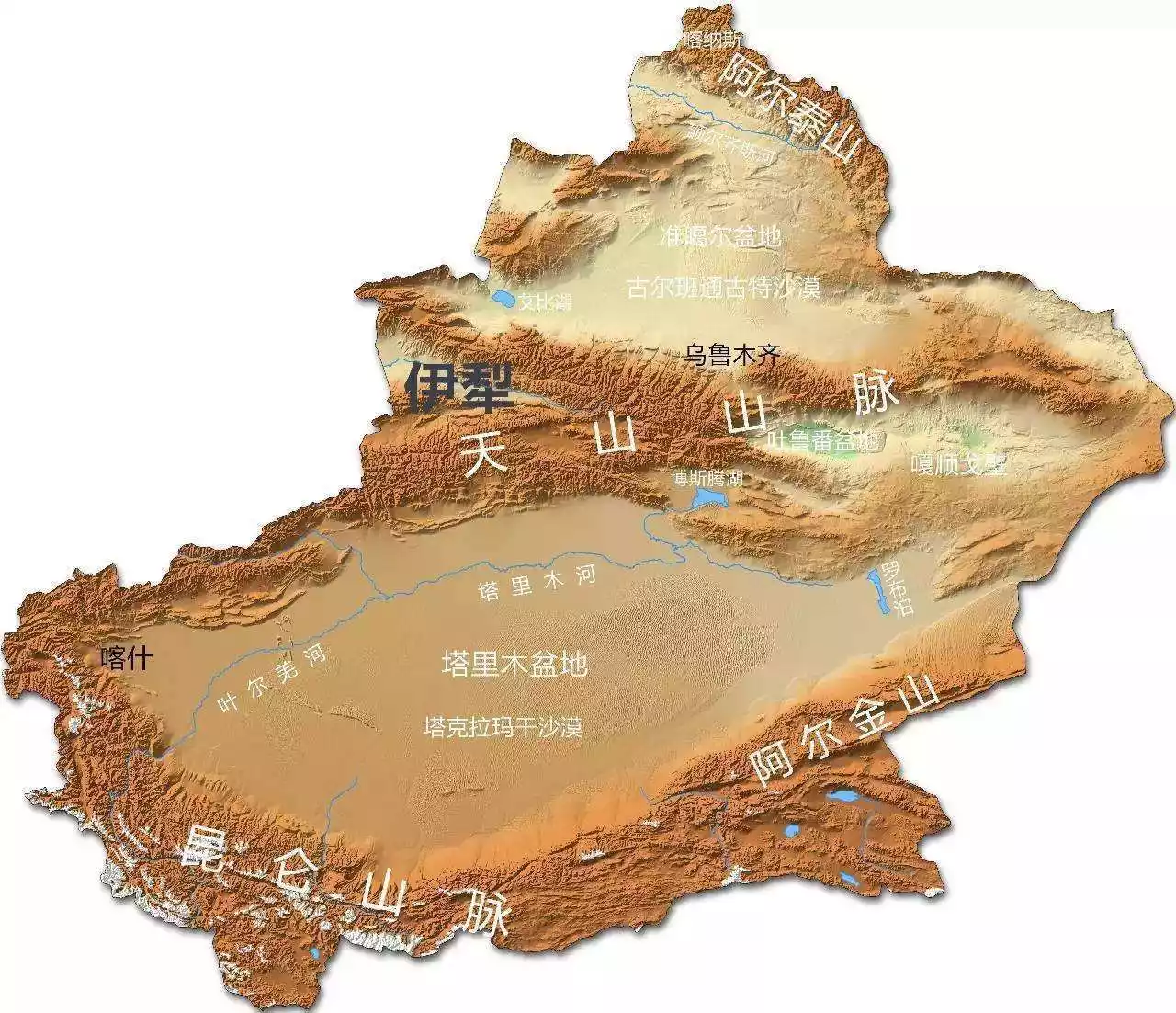
First, let’s take a look at the topographic map of Xinjiang. Usually, when we talk about the topography of Xinjiang, we only need to look at the word “Jiang”. The word “bow” on the left side of Xinjiang represents the winding land border line of more than 5,600 kilometers in northwest China. At the same time, bows and arrows are also weapons used to guard the border.
The small "土" character embedded in the bow character always reminds us that there are still many Chinese territories outside the Xinjiang border, which were ceded in the unequal treaties that were forced to be signed in history.
The three horizontal lines represent the three mountains from north to south: the Altai Mountains, the Tianshan Mountains and the Kunlun Mountains, and the two fields represent the Junggar Basin in northern Xinjiang and the Tarim Basin in southern Xinjiang.
Tips:
Xinjiang was called the Western Regions in ancient times. After the unification of the north and south of the Tianshan Mountains in the 24th year of Emperor Qianlong's reign in the Qing Dynasty (1759), it was also called "Xinjiang" or "Western Regions Xinjiang".
It borders Gansu to the east, Tibet to the south, the Ulungur River (now the Ulungur River), the Irtysh River, and Khovd to the north, and the Aigus River (now the Ayagus River), Balkhash Lake (now Lake Balkhash), and the Pamirs to the west. The Tarim and Junggar Basins lie to the north and south, respectively, while the Tianshan Mountains stretch from east to west.
The northern part of the mountain was originally inhabited by the Dzungar tribe, inhabited by Mongolian herders; later it was opened up as a settlement area, where Hui, Han, and Uyghur immigrants, as well as soldiers and civilians from the Manchu, Xibe, and Suolun ethnic groups, moved in. The southern part of the mountain was inhabited by the Hui tribe, inhabited by Uyghurs.
Today, Xinjiang borders eight countries, including Russia, Kazakhstan, Kyrgyzstan, Tajikistan, Pakistan, Mongolia, India and Afghanistan.
Careful friends will find that the character "疆" (jiang) in the New "畺" Daily building in the city center is missing the left radicals "弓" and "土".
It is understood that on October 1, 1965, to celebrate the 16th anniversary of the founding of the People's Republic of China and the 10th anniversary of the establishment of the autonomous region, Mao Zedong rewrote the title of the Xinjiang Daily. However, the character "江" (jiang) in Mao's rewritten title was missing the left radicals "弓" (bow) and "土" (earth), leaving it as "畺" (畺).
Was the character “畺” intentional or unintentional?
It is said that during his lifetime, Mao Zedong fought tirelessly to recover the 1.66 million square kilometers of Chinese territory that had been plundered by foreign powers. Chairman Mao declared that until these territories were recovered, he would never use the "bow" and "earth" characters to the left of the character "疆" (Xinjiang).

Tips:
There is no "畺" in the "Cihai", but it is in the "Ciyuan", pronounced as jiang, meaning border, the same as "疆" and "壃".
#号外#
According to Xinhua News Agency: At 9:05 am on August 8, 2019, as the C8802 "Fuxing" EMU train left the Urumqi Station platform, the first EMU from Urumqi to Korla officially departed, marking the entry of Xinjiang's conventional railway into the EMU era.
Urumqi and Korla are nearly 500 kilometers apart. The train journey between the two cities has been reduced from 12 hours to just over five, and now takes just over three. It is reported that in the future, a total of 20 "Green Giant" trains will be deployed, providing high-density, multi-directional service to Yining, Shihezi, Kuitun, Wusu, and other cities.
After the "Fuxing" train was put into use in Xinjiang, people of all ethnic groups in Xinjiang not only enjoyed the convenience brought by the "public transportation" of the Lanzhou-Xinjiang High-Speed Railway, but also allowed more people to experience the convenience and services of the bullet train on conventional railways.
In fact, as early as 2014, Urumqi opened high-speed trains to Turpan, Shanshan and Hami. China Speed also performed excellently in Xinjiang, further shortening the running time of high-speed trains between Urumqi and Hami and Turpan (Urumqi to Hami shortened to within 3 hours, Urumqi to Turpan shortened to within 1 hour).
(Screenshot from the 12306 Ministry of Railways official website)

(Screenshot from the 12306 Ministry of Railways official website)
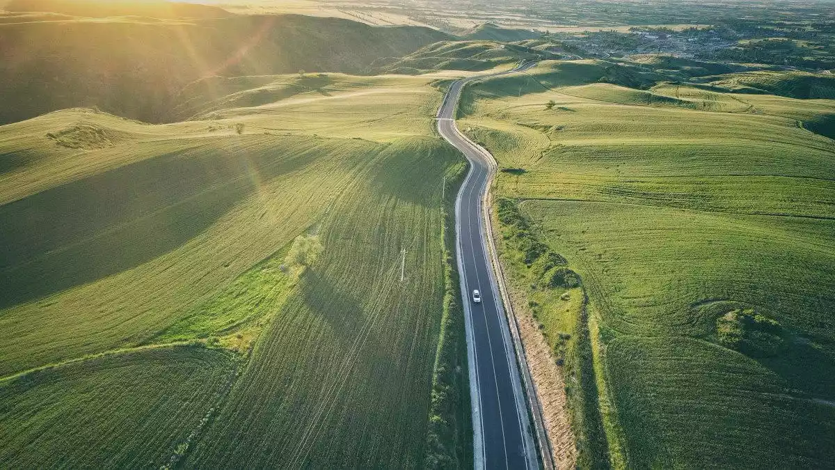
As the saying goes: To get rich, build roads first. With the rapid development of transportation, the vast Xinjiang region is no longer just a 10-hour drive away. While the distance between us and beautiful scenery and delicious food hasn't shortened, the time it takes is getting shorter.
1. Turpan
When it comes to Turpan, it can be said that everyone knows it. It is not an exaggeration to say that it is the most famous business card of Xinjiang. From seven-year-old children to eighty-year-old old men, Turpan may be the Xinjiang in their hearts.
Turpan's fame stems from two places: Grape Valley and Flaming Mountain. The description of Grape Valley in elementary school textbooks is a paradise for most children. The story of Sun Wukong borrowing the palm-leaf fan three times in Journey to the West has sparked curiosity about Flaming Mountain.

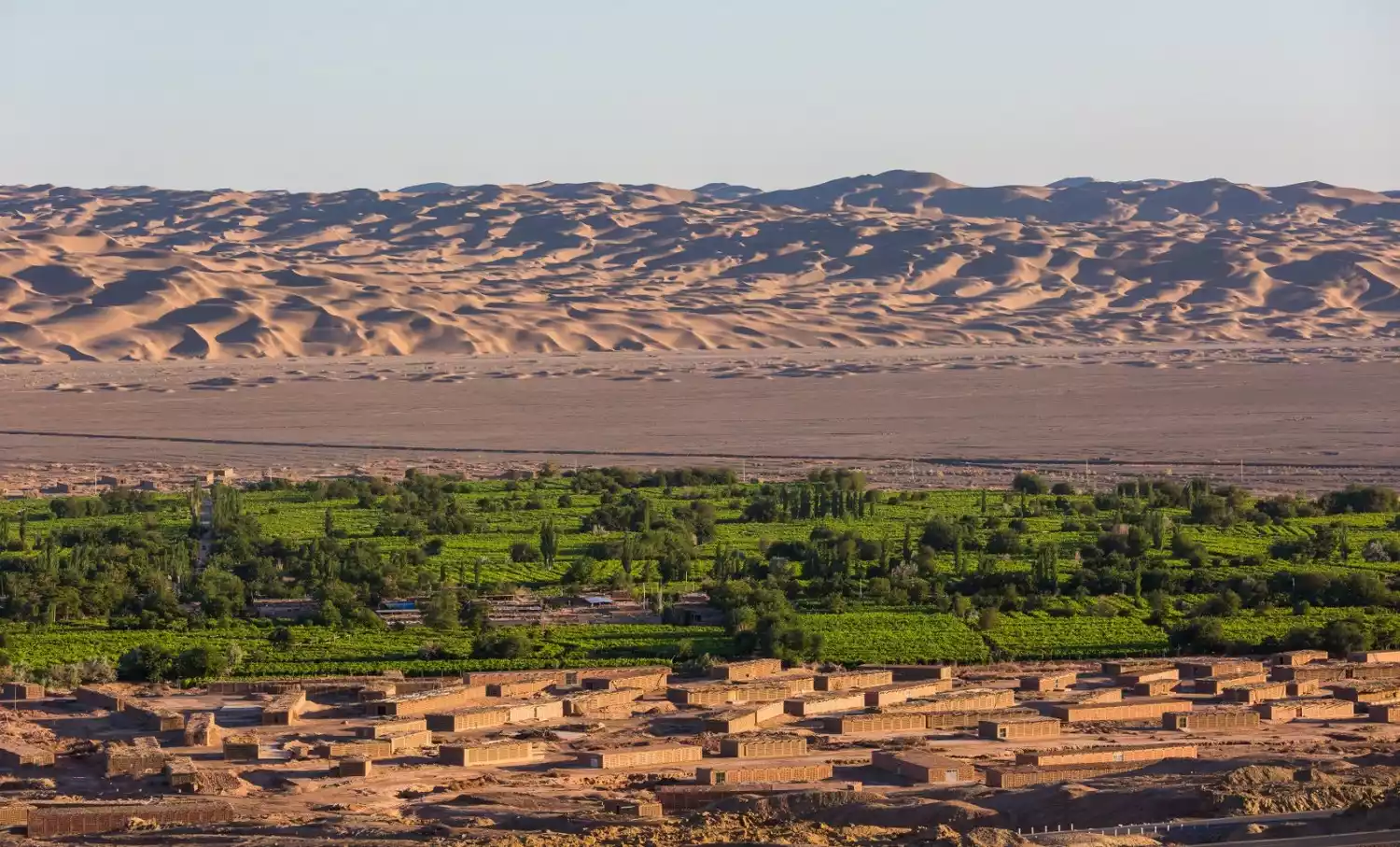
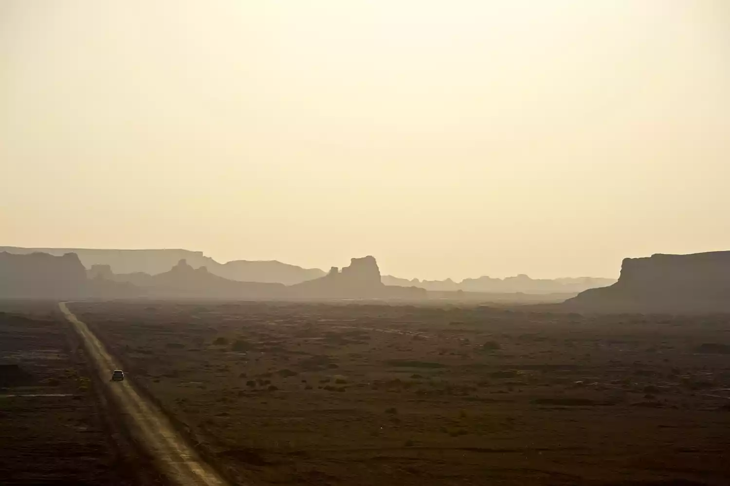
Turpan City is located in the mountain basin of the eastern Tianshan Mountains in Xinjiang, also known as the Turpan-Hami Basin. While small, the Turpan Basin is incredibly deep, appearing from the air like a small depression. Centered around Lake Aydingkol (at -155 meters, the second lowest point in the world after the Dead Sea in Jordan at -391 meters), it forms three distinct rings, extending from low to high.
The outer ring is composed of numerous high mountains, notably the northernmost peak of the eastern Tianshan Mountains (Bogda Peak, at 5,445 meters). The middle ring is primarily composed of gravel Gobi Desert, with all manner of unusual rocks and fossils scattered across the desert. The inner ring is a fertile plain oasis, where every valley is filled with delicious fruits and vegetables, and plump cattle and sheep.
Yet this small "depression" exemplifies Xinjiang's natural ecological environment and oasis agricultural civilization. Not only does it boast oases, deserts, and rivers, but it also boasts abundant fruits, grapes, and grasslands. Despite its dry, dry climate, Turpan boasts the world's largest and most complex underground water conservancy project: the karez.
How to get to Turpan
Turpan is only 182 kilometers away from Urumqi, the capital of Xinjiang. It is very convenient to travel to Turpan from Urumqi, with various options. The G30 Lianhuo Expressway, National Highway 312, Lanzhou-Xinjiang Railway, High-speed Railway, and Southern Xinjiang Railway all intersect here. Turpan Jiaohe Airport has flights to many places.
<Train>
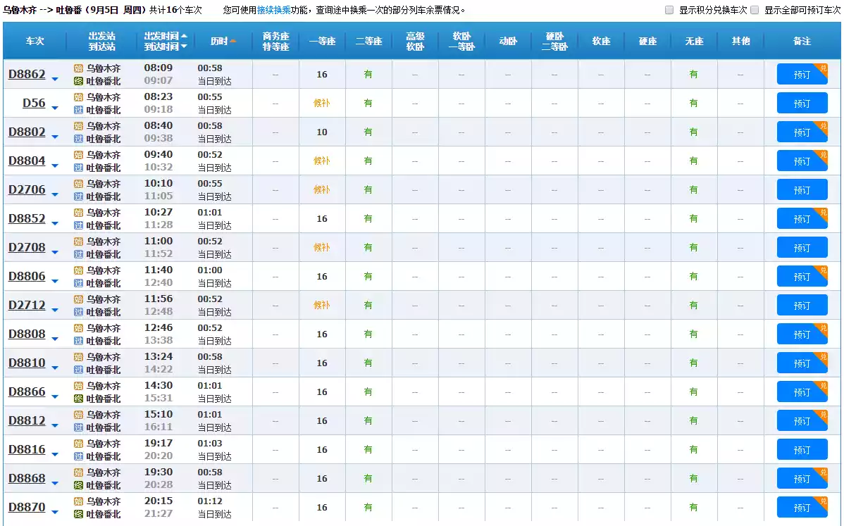
There are many trains from Urumqi to Turpan, including slow trains prefixed with K, tourist trains prefixed with Y, and high-speed trains prefixed with D. The train takes about 2.5 hours, and the high-speed train takes about 1 hour. There are many choices of schedules, and travel is convenient. It can be said to be the preferred mode of transportation.

<Aircraft>
Turpan Airport is located at the lowest altitude in my country. The construction of a high-quality airport at 155 meters below sea level, which withstands the high temperatures of Turpan's summer each year, is truly a miracle. Currently, Turpan has direct flights to Kashgar, Aksu, Yining, Xi'an, Lanzhou, and other cities.
<Self-driving>
Driving to Turpan is generally the first choice for local tourists from Urumqi, Changji, Shihezi and other places. They will also pass through Dabancheng, Salt Lake and other places along the way.
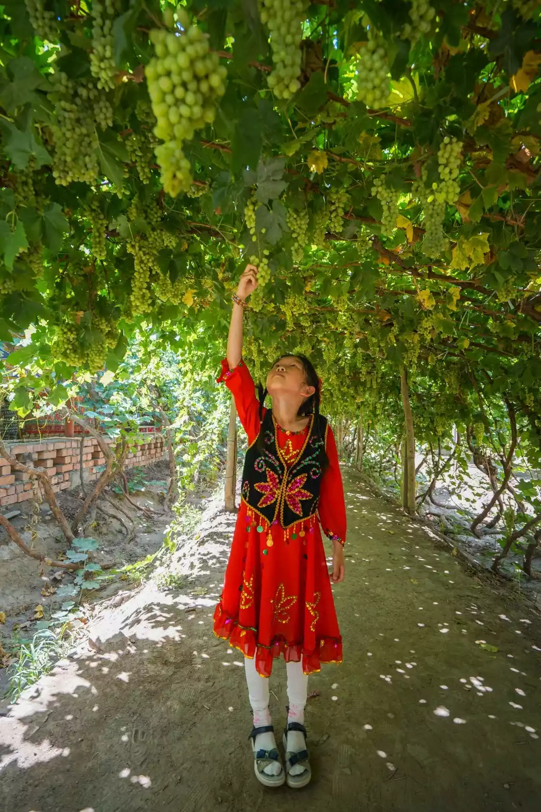
1. Grape Valley
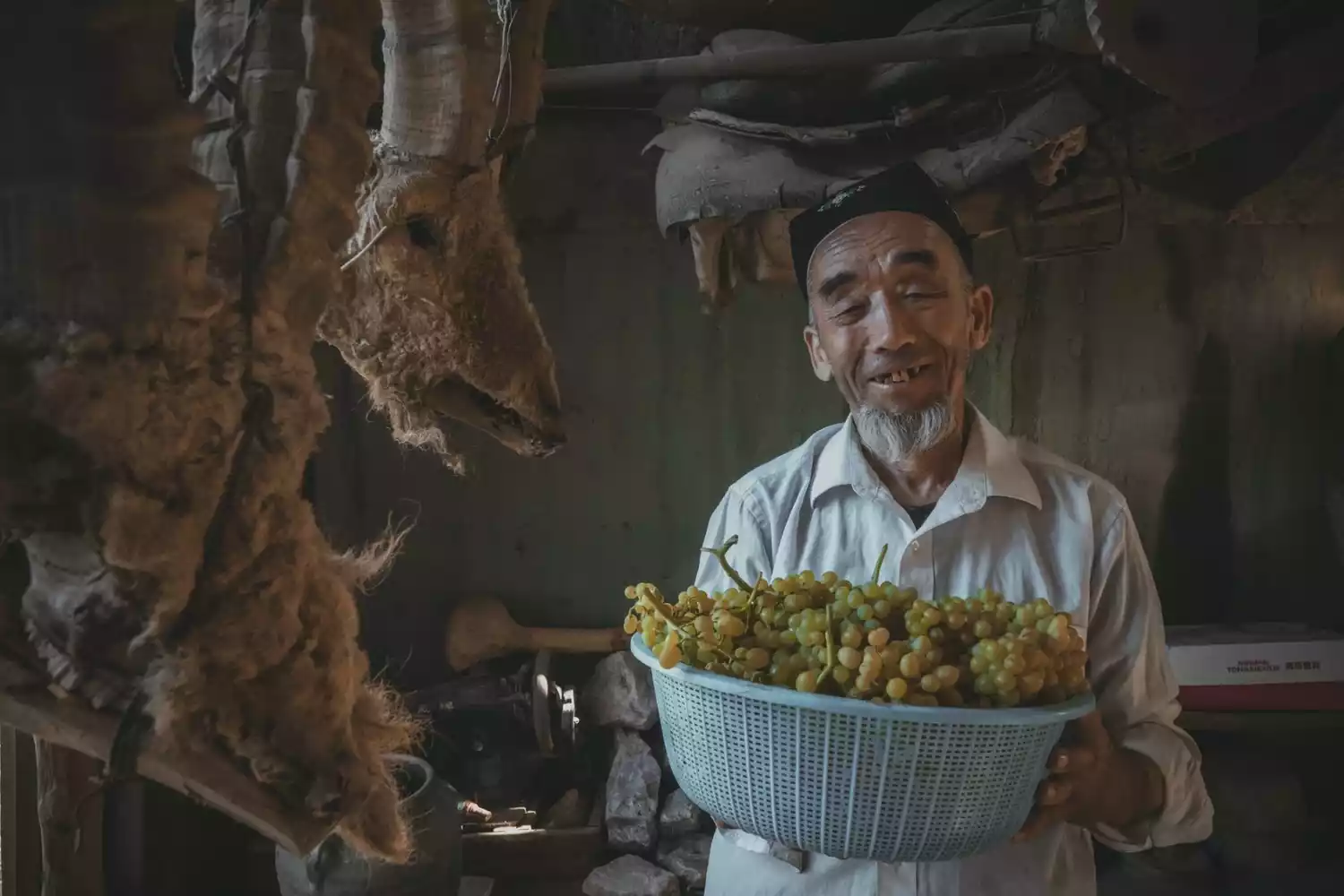
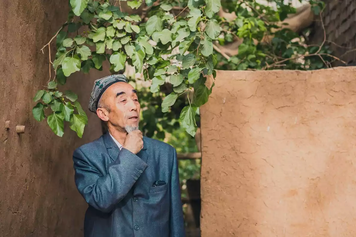
Surrounded by barren deserts, Turpan boasts numerous oasis valleys, one of which is Grape Valley. This long, narrow, and gently sloping valley stretches approximately 8 kilometers from north to south and 2 kilometers from east to west. Locals call it "Buyiluke," meaning "a place planted with grapes."
For me, Grape Valley is a natural grape museum. Hearing that there are hundreds of grape varieties in Grape Valley makes my mouth water. But I personally don't like purely sweet grapes; they're really "overwhelmingly sweet." I prefer grapes with a sweet and sour taste.
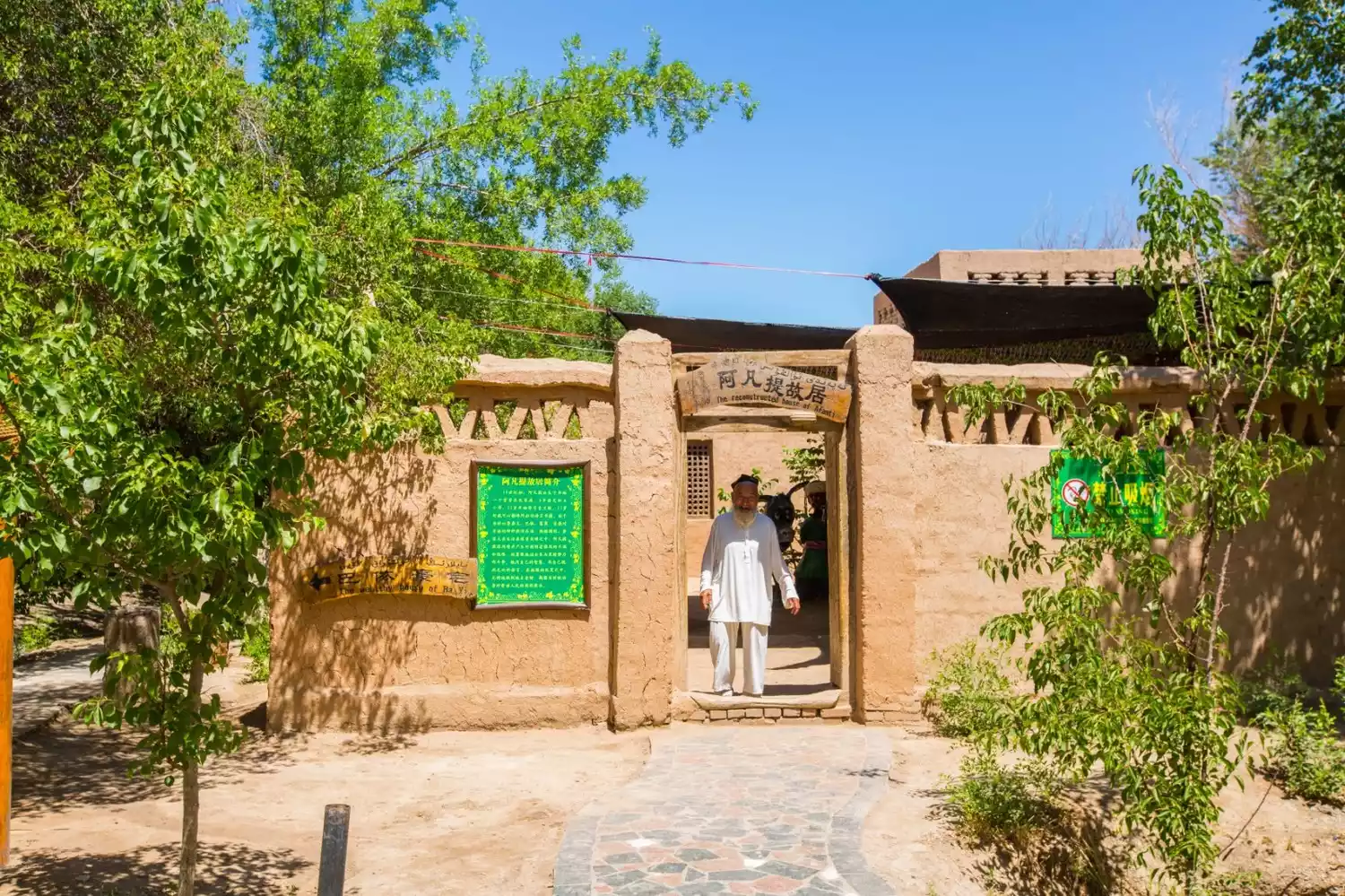
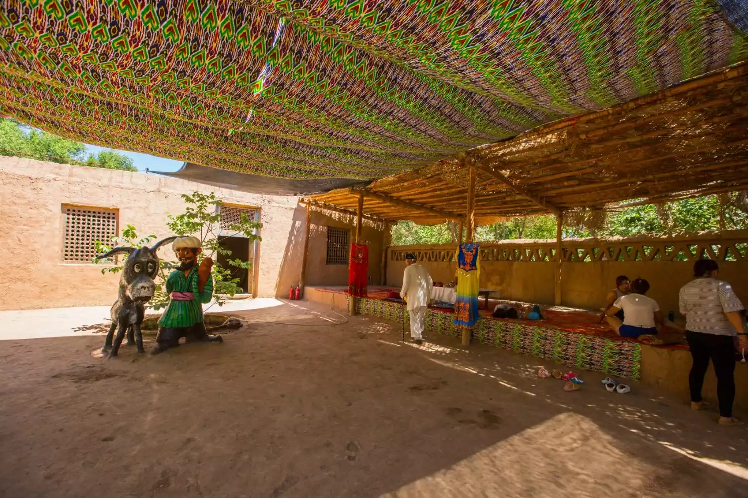
#Afanti's Home#
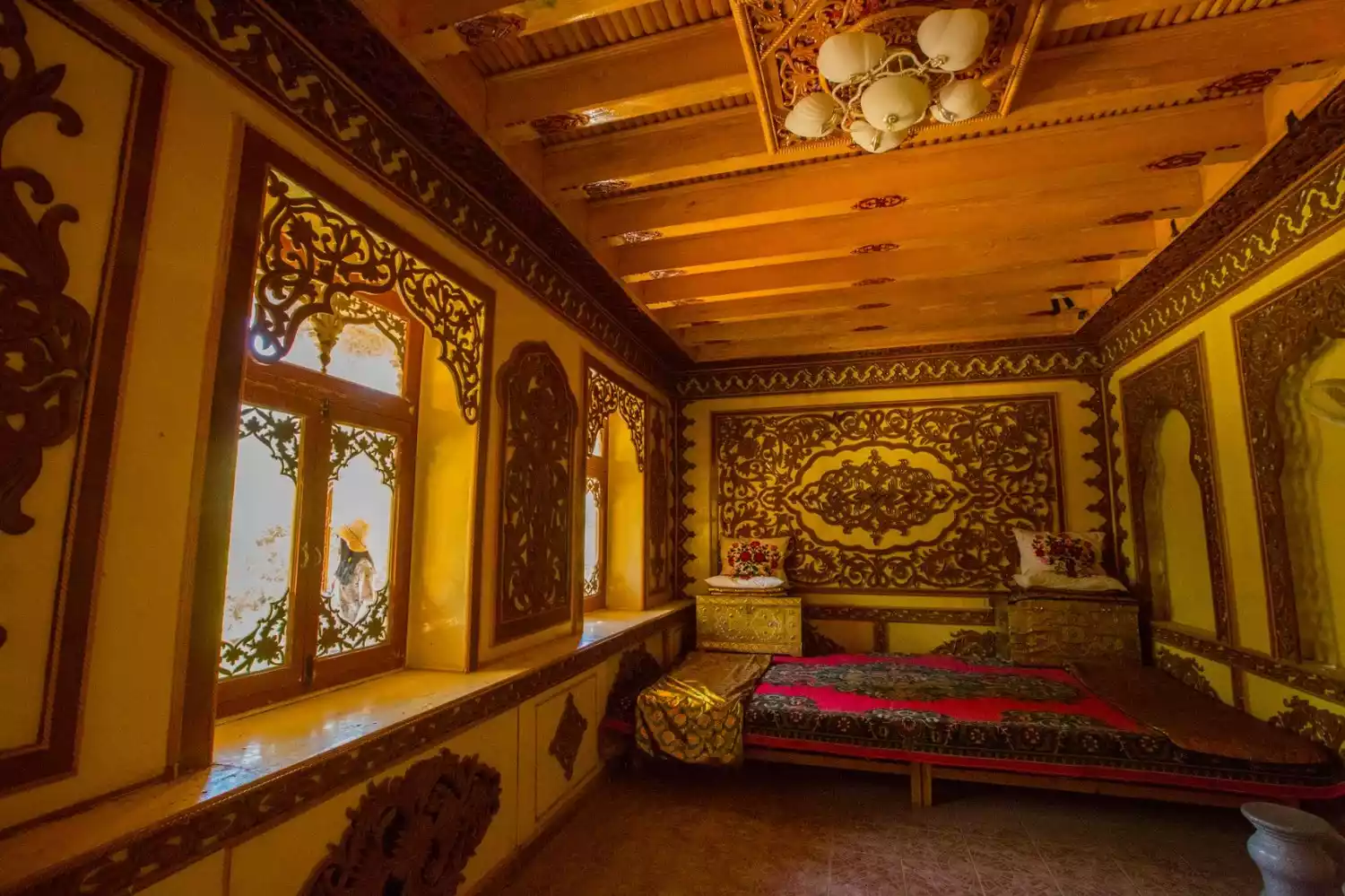
Many parents bring their children to Turpan for the "Grape Valley" featured in their textbooks. The donkey-riding Afanti in the fairy tale is a character from an animation, but Afanti actually existed. His real name is Nasreddin Afanti, a legendary figure active among the Muslim ethnic groups in Morocco and Xinjiang. He possessed wisdom, was well-read, and had a knack for telling jokes.
"Afanasiy's House" in the Grape Valley Scenic Area is relatively dilapidated and simply furnished, which to a certain extent reflects the living conditions and standards of ordinary people in Turpan.
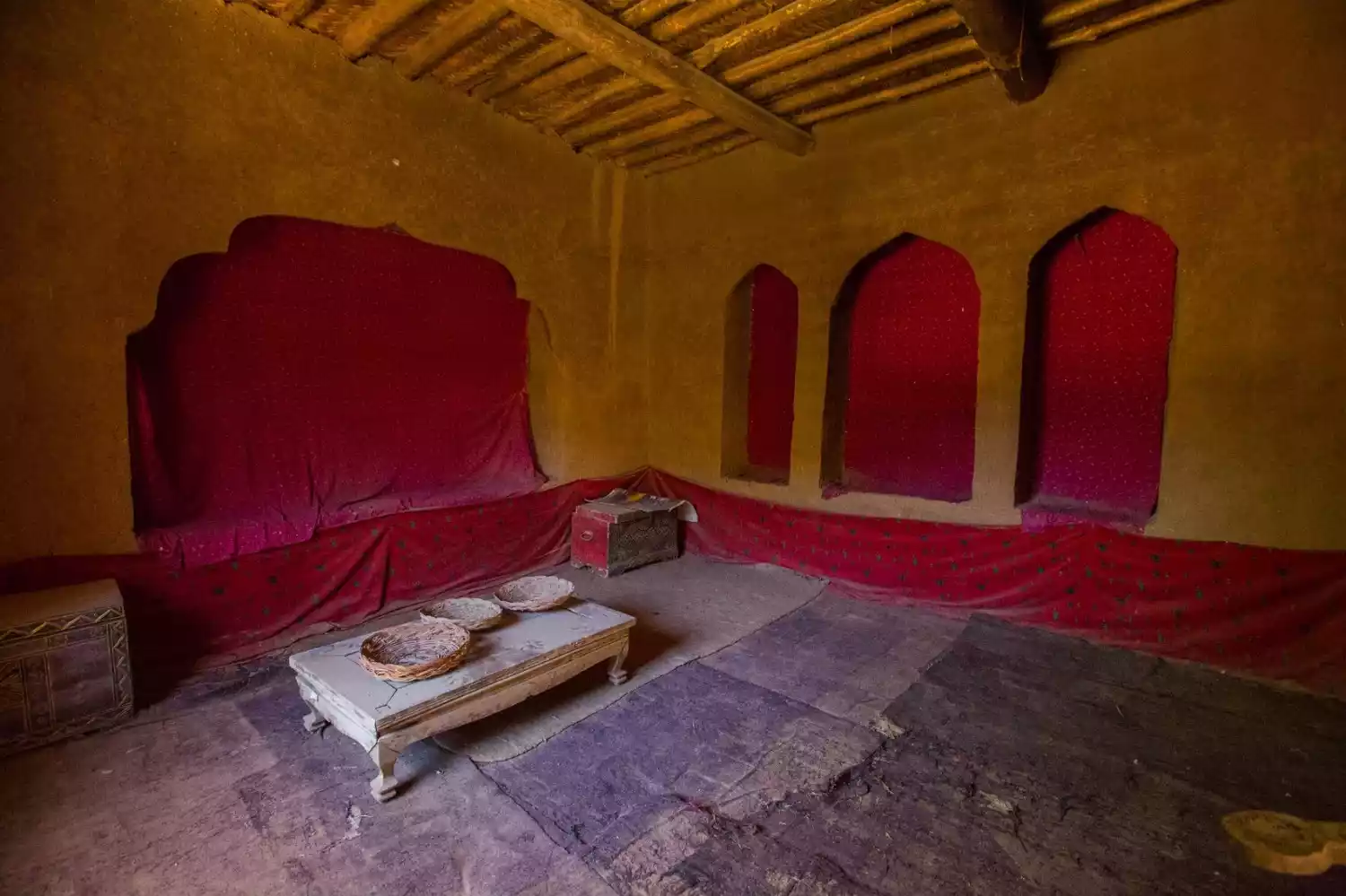
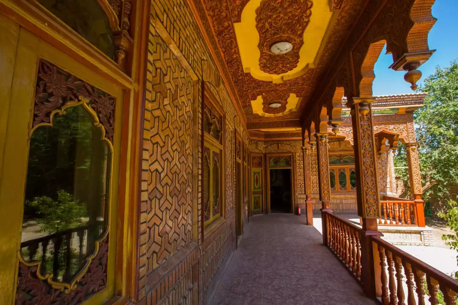
#Bayi Master's House#
"Bayi Laoye" does not refer to a specific person. It originally referred to landlords and wealthy people. Now it can also be used to refer to generous wealthy people.
Master Bai’s mansion is located in the backyard of Afanti’s home. The overall decoration is high-end and elegant, revealing the word "rich" everywhere. The house has a wooden exterior wall and a corridor with a strong Islamic style.
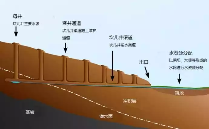
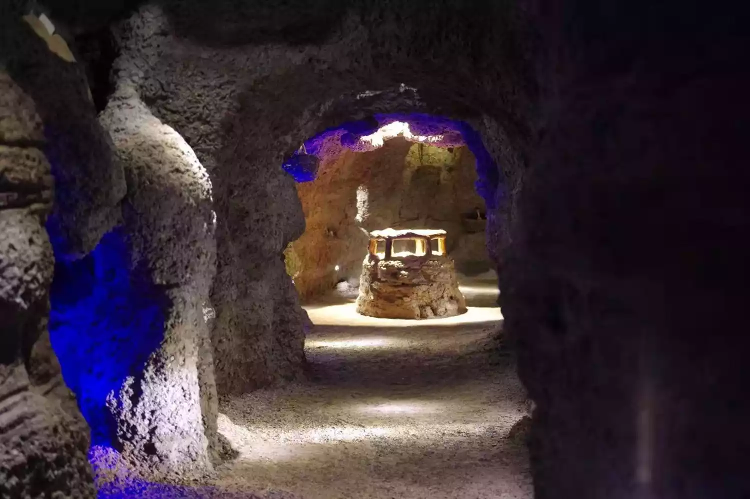
2. Karez
Karez is one of the most complex and greatest water conservancy projects in the world, and is the crystallization of the wisdom of the ancient working people of my country.
The environment prompts humans to create. It is precisely because Turpan has a dry climate and the average annual evaporation exceeds the precipitation by nearly 200 times that the locals used their wisdom and hard work to create the karez in order to survive.
People took advantage of the slope of the mountain and the meltwater from the ice and snow in the eastern Tianshan Mountains to ingeniously create a magnificent underground water conservancy project - the Karez, which diverted underground flow to irrigate farmland.
Because it is hidden underground, the water will not evaporate in large quantities due to heat or strong winds. For thousands of years, the karez has nurtured all living things in Turpan and is a necessary condition for their survival.
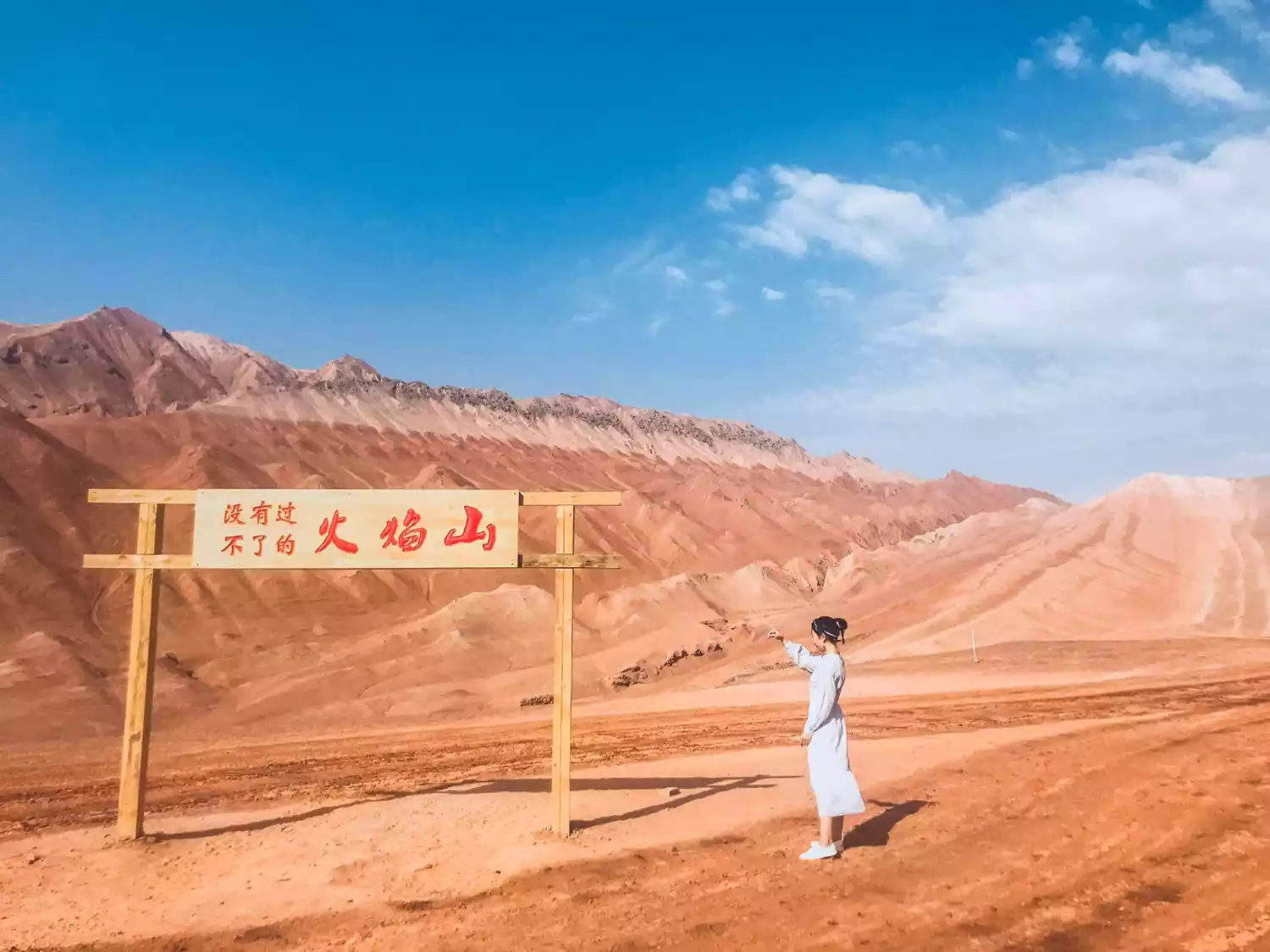
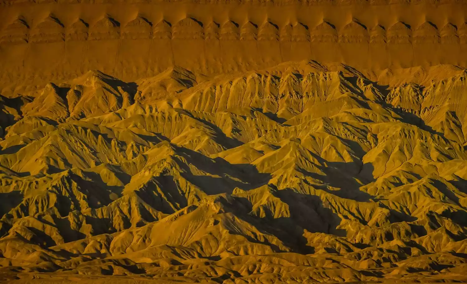
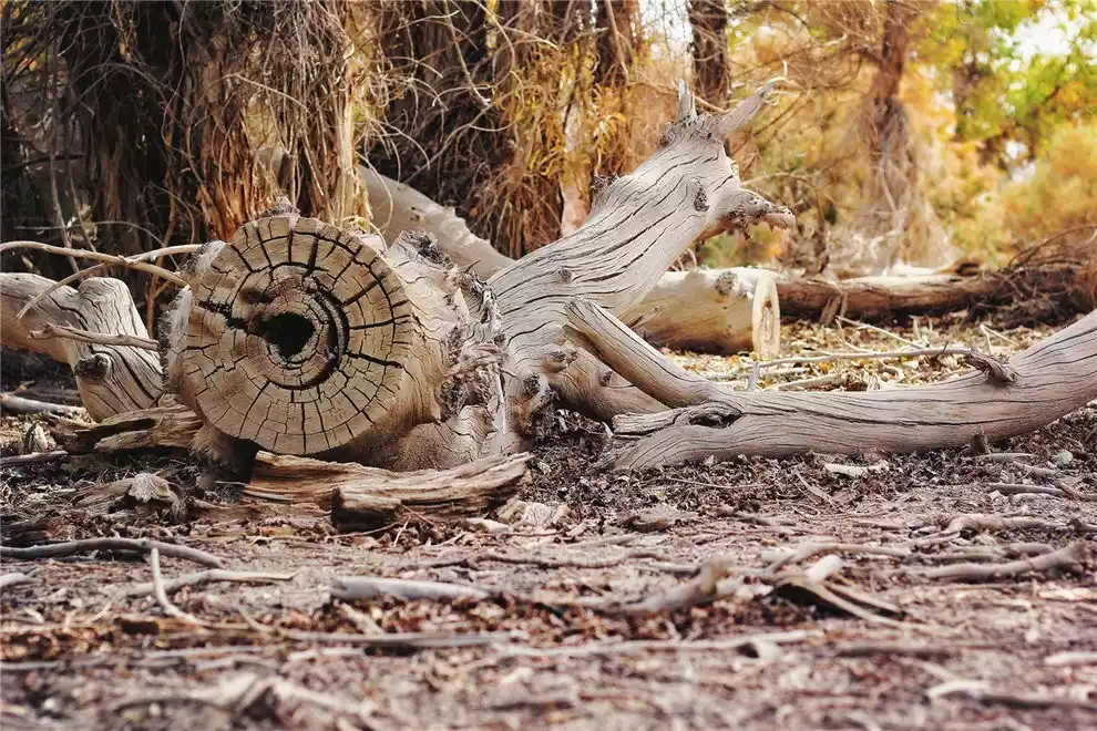
3. Flaming Mountain
Ancient books call the Flaming Mountain "Chishi Mountain", which means "Red Mountain" in Uyghur. It is composed of red sandstone, runs east-west, and lies across the Turpan Basin. It is nearly 100 kilometers long and about 9 kilometers wide from north to south.
The story of Sun Wukong borrowing the palm-leaf fan three times in Journey to the West has added a lot of legendary mythology to the Flaming Mountain, making it famous far and wide.
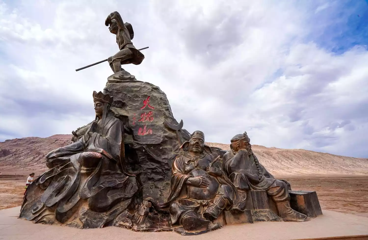
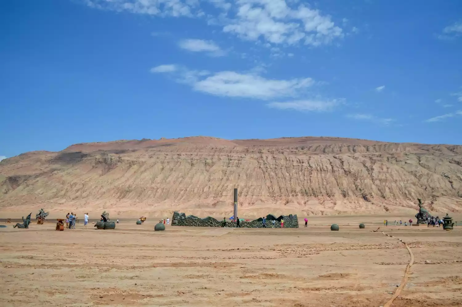
Numerous scenic spots and attractions are now based on the "Flame Mountain." For example, the 4A-rated Flame Mountain scenic area, located along National Highway 312, features a giant land-based thermometer, which monitors the ground temperature in real time. A statue depicting Tang Monk and his four disciples on their journey to the West stands there, welcoming visitors from all directions.
If you have time and opportunity, you might as well drive another 20 minutes to the Flaming Mountain Grand Canyon, where you can experience the original scenery of the Flaming Mountain. Here, you can choose from the following three options:
<1>Hiking
Walking on the red sandstone, we take one step at a time towards the Flaming Mountain, perhaps to prove that "there is no Flaming Mountain that cannot be crossed."
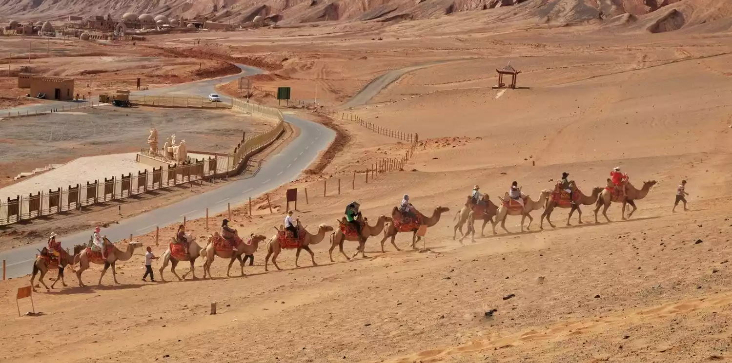
<2> Camel riding
If you're looking for a different way to experience the flaming red mountain, you can also choose to ride a camel. The price is 100 yuan per person, and each camel is limited to one person. A staff member will lead the camel team. However, I personally don't find camel riding very comfortable; it's a bit bumpy. If you're in good physical condition and the weather is good, I recommend walking up the mountain.
<3>Sand buggy
A new way of driving has emerged in recent years, the sand off-road vehicle, 4 people in a car (excluding the driver), 80 yuan per person. This is relatively more exciting, especially when we drive it ourselves, but generally the staff will not let us drive. If you are a man with very experienced driving, you can negotiate with the staff with an A license, but you bear the risk at your own risk. He is unwilling to get in your car, hahahaha.
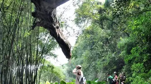
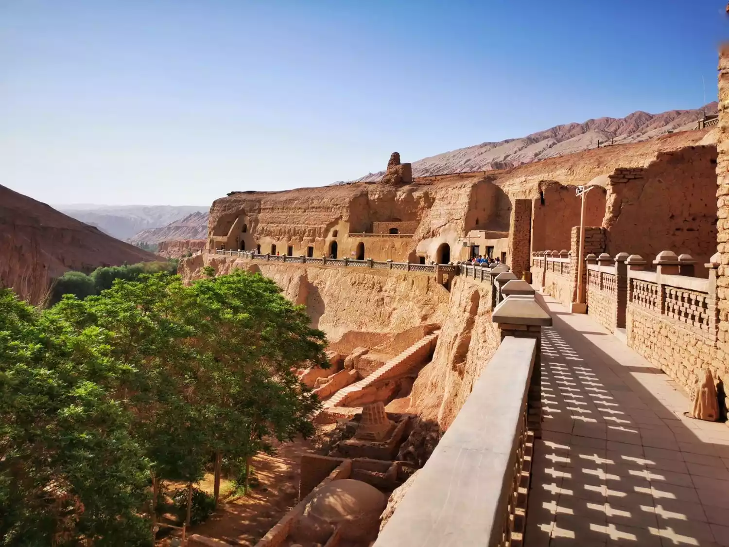
Hidden deep in the cliffs on the west bank of the Flaming Mountain Grand Canyon, the Bezeklik Thousand Buddha Caves were once a royal monastery of the Gaochang Uighur Kingdom. Of the 83 caves carved here, 57 remain, including over 40 with murals, covering a total area of 1,200 square meters. This makes it the largest and most richly muraled grotto complex in Turpan and one of the largest Buddhist cave temple sites in Xinjiang.
It is said that in the early 20th century, many so-called "explorers" came to Xinjiang in the Western Regions and cut and peeled off more than 90% of the murals in the Thousand Buddha Caves and transported them back to their countries in batches.
If you see murals and Buddha sculptures from Xinjiang in the Tokyo National Museum in Japan, the British Museum in the UK, the National Museum of Korea, etc., there is no doubt that yes, they are artistic treasures from the Bezeklik Thousand Buddha Caves.
Most of the things that could not be taken away were also destroyed by them. Coupled with the later "Destroy the Four Olds" campaign, Bezeklik can be said to be riddled with holes, which is very regrettable.
Today, the Bezeklik Thousand Buddha Caves, which have been sleeping for thousands of years, have awakened painfully, showing their scars to the world and once again becoming the focus of world attention.
However, while marveling at the relatively well-preserved masterpieces of the Mogao Grottoes in Dunhuang and the Yulin Grottoes, the traces of destruction in the Bezeklik Thousand Buddha Caves serve as a greater warning to the Chinese people.
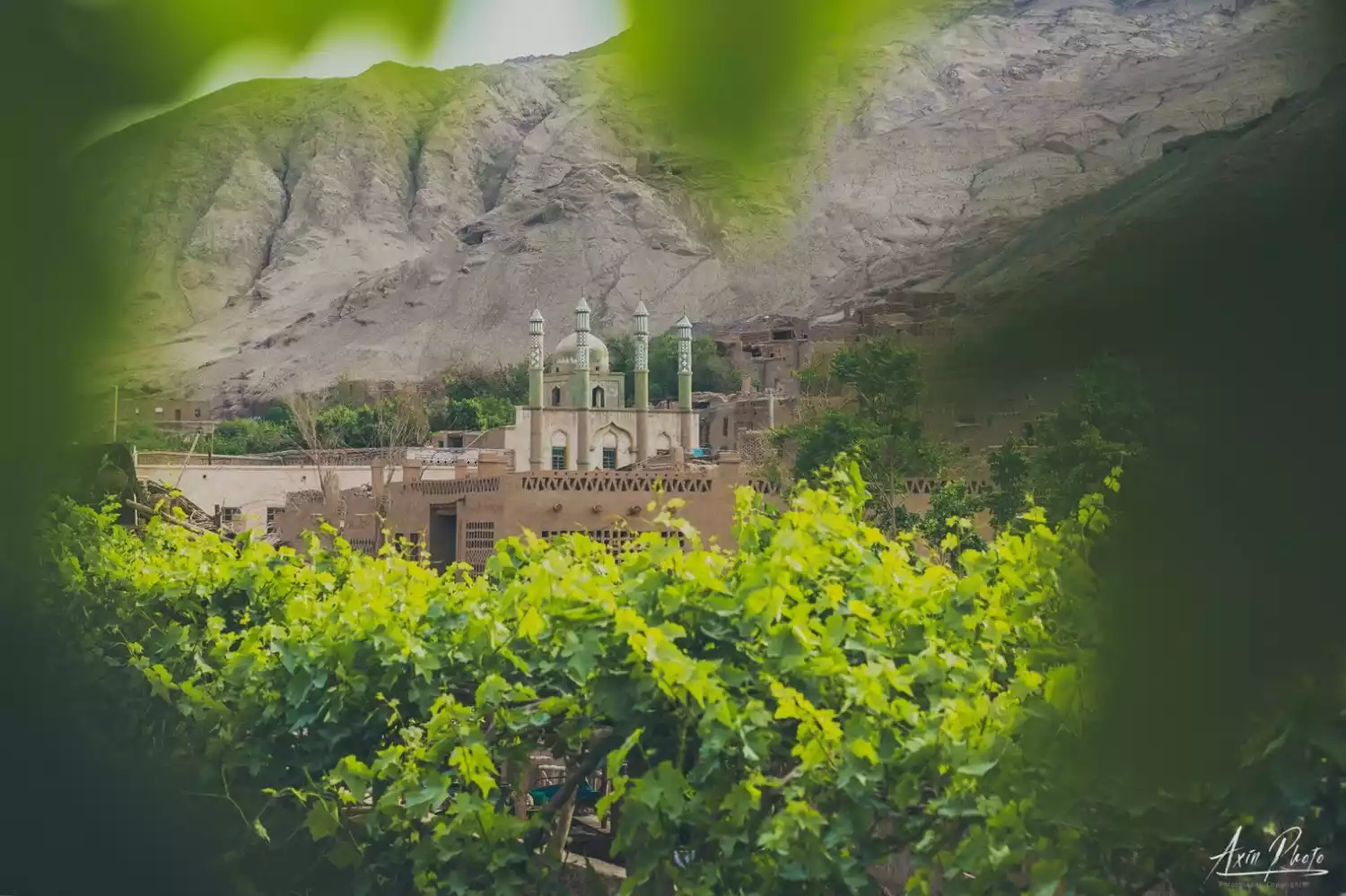
4. Tuyugou
The Turpan area is not just a Gobi desert, there are also oasis villages. [Tuyugou-Mazar Village] is one of the most representative villages.
The so-called "Mazar" actually means "tomb". This ancient village has a history of more than 1,700 years. More than 200 households in the village are scattered around the mosque. The Uyghur people living here still retain the most traditional folk customs.

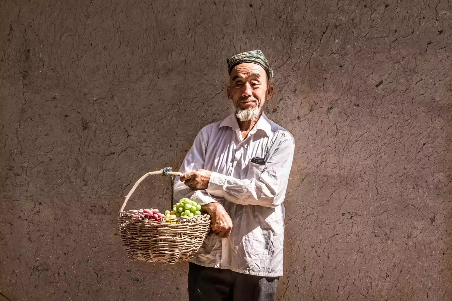
If you come in spring, you will find that the whole village is filled with the fragrance of mulberries. The mulberry trees here are thousands of years old and very tall, completely different from the mulberry trees in our Jiangnan area.
If you come here in summer, the sweetness of the grapes will make your mouth water, and you will want to crawl under the grape racks to taste them.
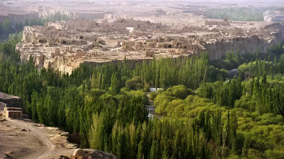
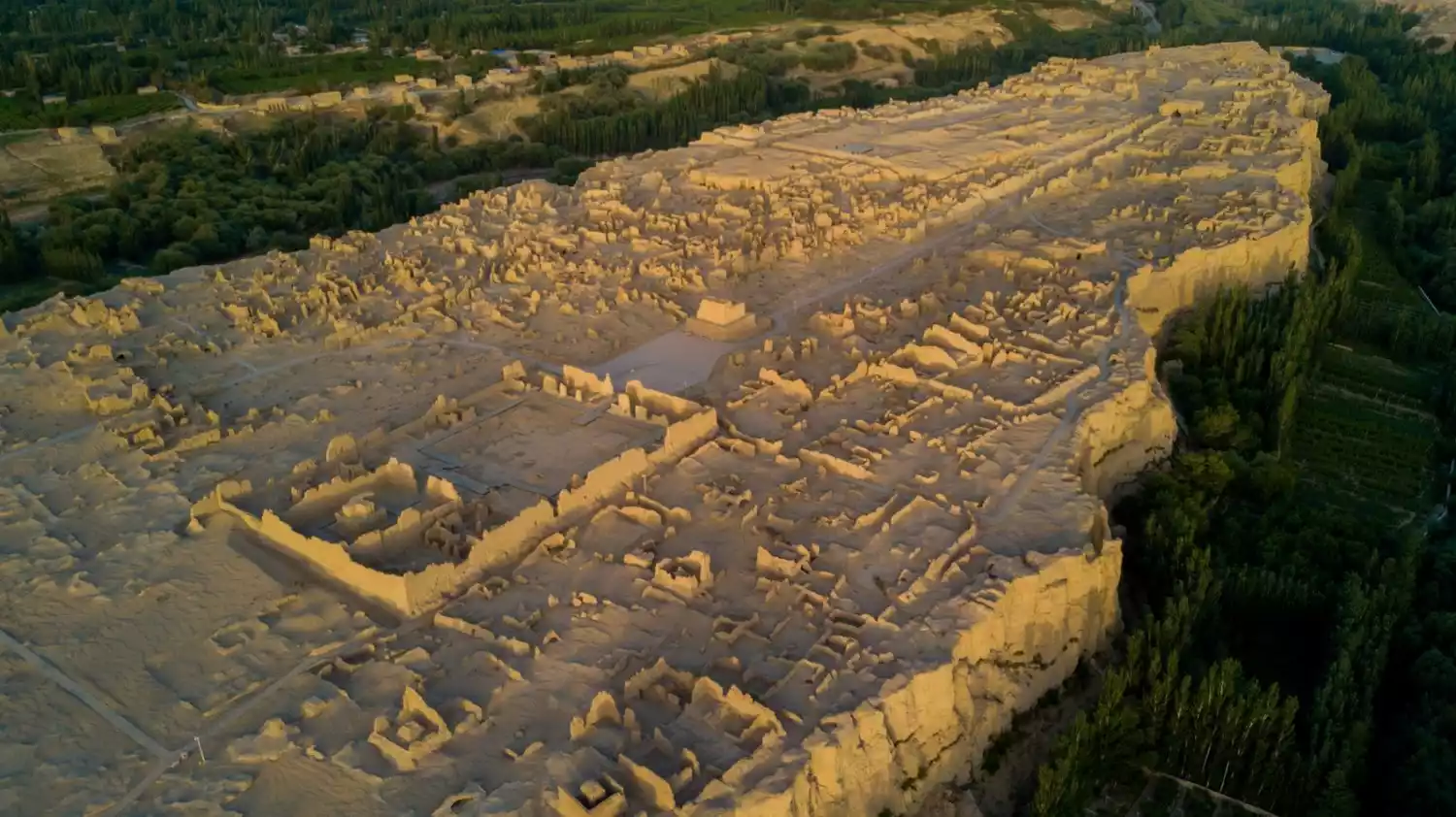
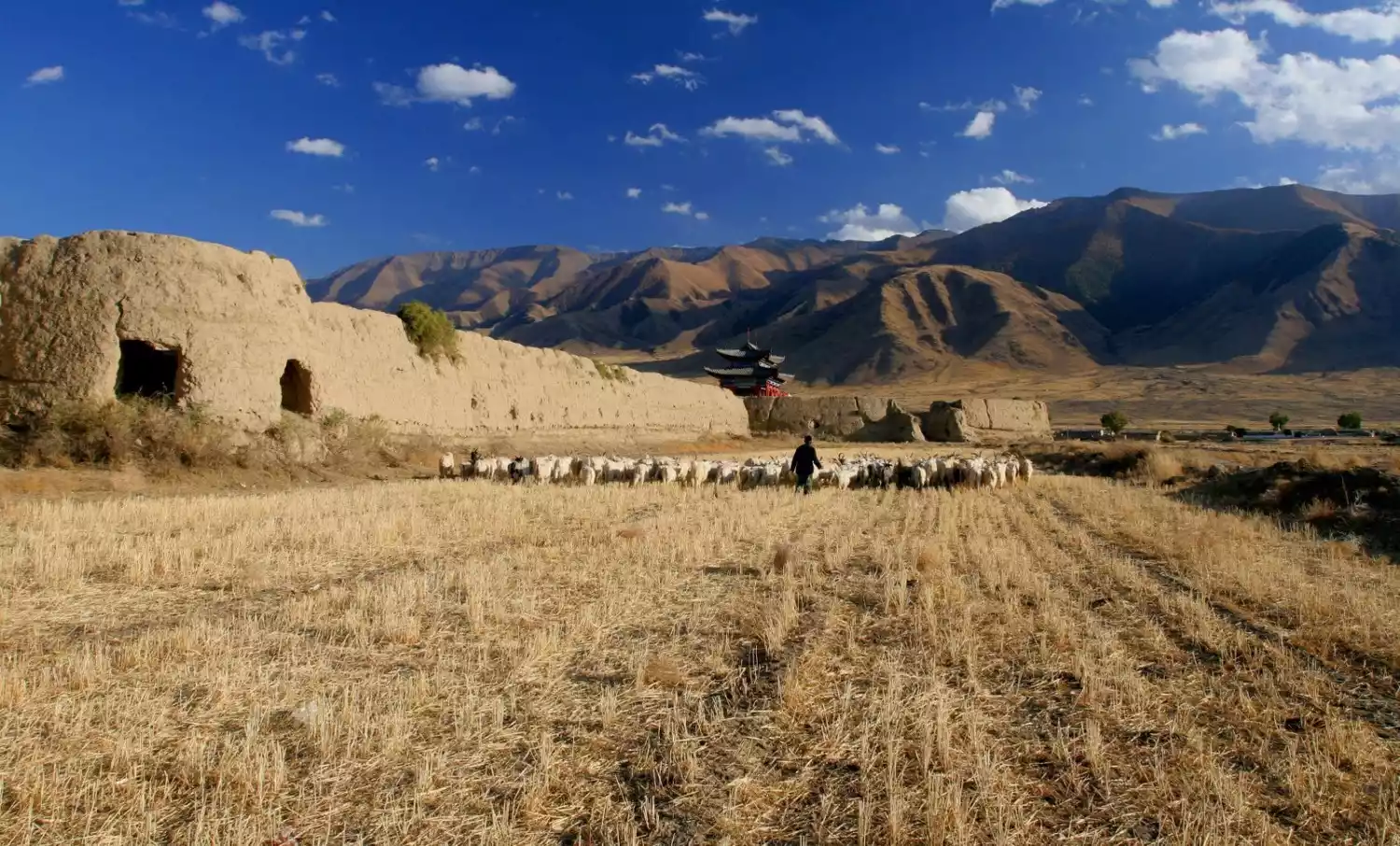
5. Jiaohe Ancient City
About 10 kilometers west of Turpan City, Xinjiang, there is a "capital without city walls". It is more than 2,000 years old. It was built by the people of the Cheshi Kingdom, one of the 36 countries in the Western Regions, on the alluvial fan (a willow-shaped river island) at the southern foot of Bogda Mountain in the Turpan Basin.
“In the daytime, I climbed the mountain to watch the beacon fire; in the evening, I watered my horses beside the Jiaohe River.” The Jiaohe River split into two from the north, passed around the island, and then merged into one, guarding this thousand-year-old city ruins for generations.
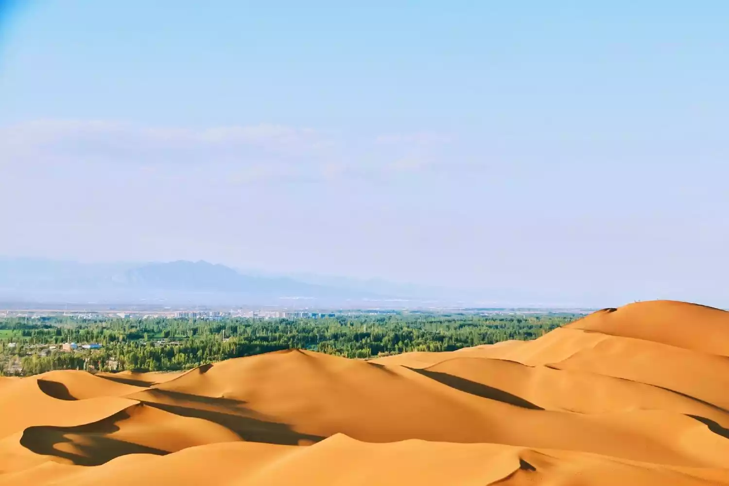
2. Shanshan
Shanshan, part of Turpan City, is famous for the Kumtag Desert, part of the Taklamakan Desert. As the city closest to the desert, it has remained uninhabited for thousands of years, and the city has never attempted to move into the desert. It embodies the harmonious coexistence of man and nature.
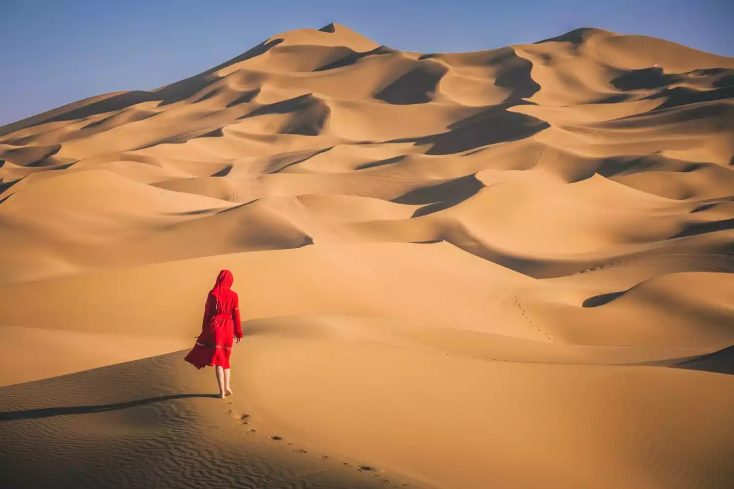
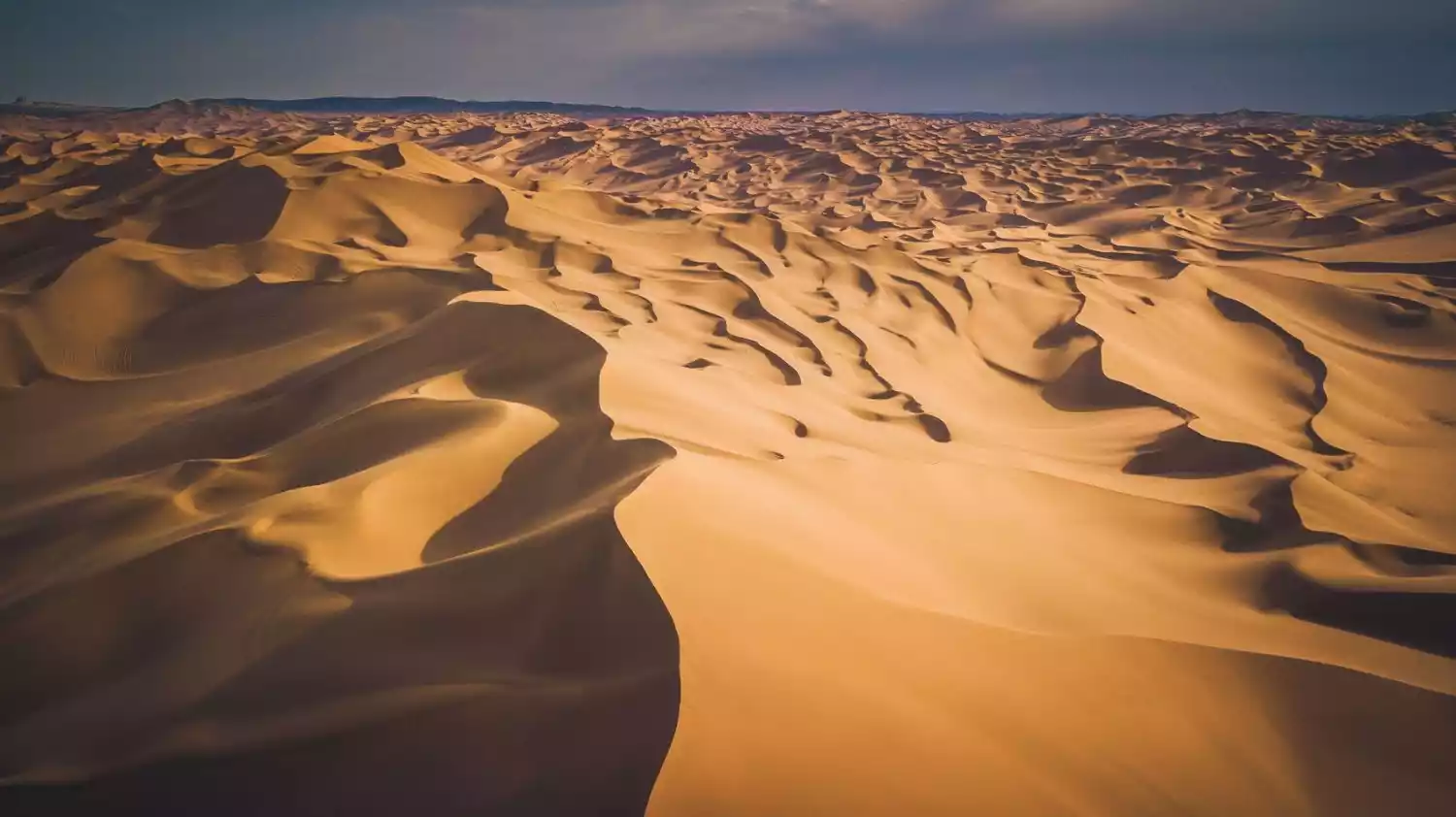
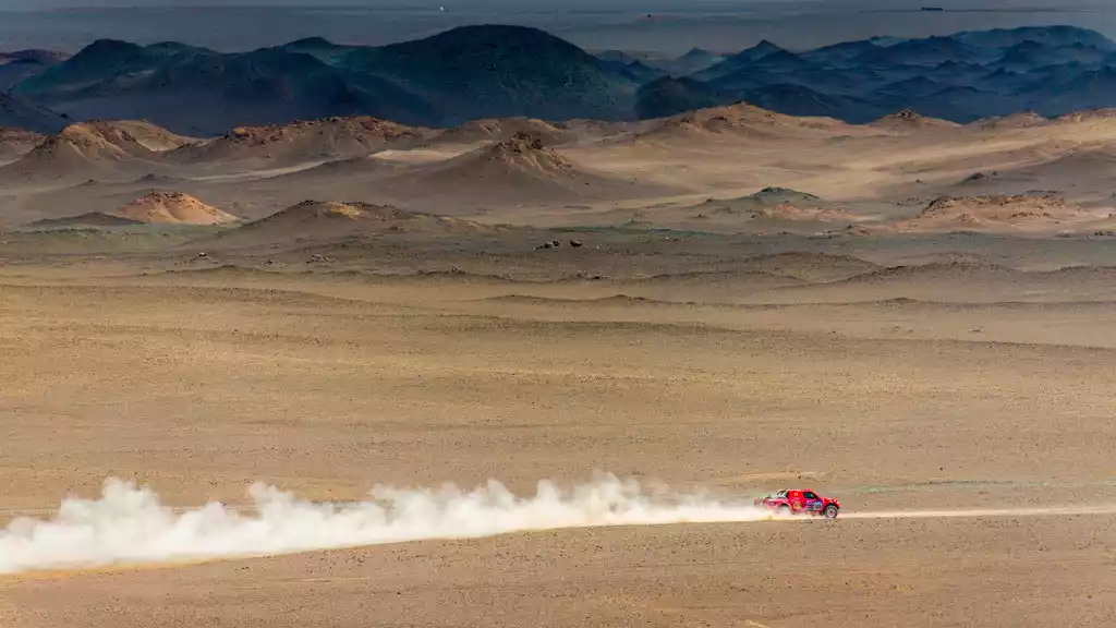
1. Kumtag Desert
Why has Shanshan always held the world record for the closest distance between a city and a desert?
Why is the city so close to the desert but has not been swallowed up?
After researching the relevant literature, perhaps the best explanation is wind direction. The Kumtag Desert is a sand mountain, not a dune. Desert migration requires the help of wind; without it, the sand simply cannot move. However, the wind direction in Shanshan has remained unchanged for thousands of years. They converge at the southern end of Shanshan's old city, coexisting in a friendly manner without overstepping boundaries.
Tips:
❶Sand hill: refers to a hill, sand pile, sand ridge or other loose material formed by the action of wind.
❷Sand dunes: refers to large sand dunes, giant sand dunes or sand dune chains with a relative height of more than 100 meters.
In fact, the southern edge of the Kumtag Desert is another channel of the ancient Silk Road, the Great Sea Road. Due to the harsh environment and dangerous and long roads, the Kumtag Desert was called "the great trouble of ghosts and monsters" in the Tang Dynasty. Now it is called "the most beautiful feather-shaped desert" with very beautiful curves.
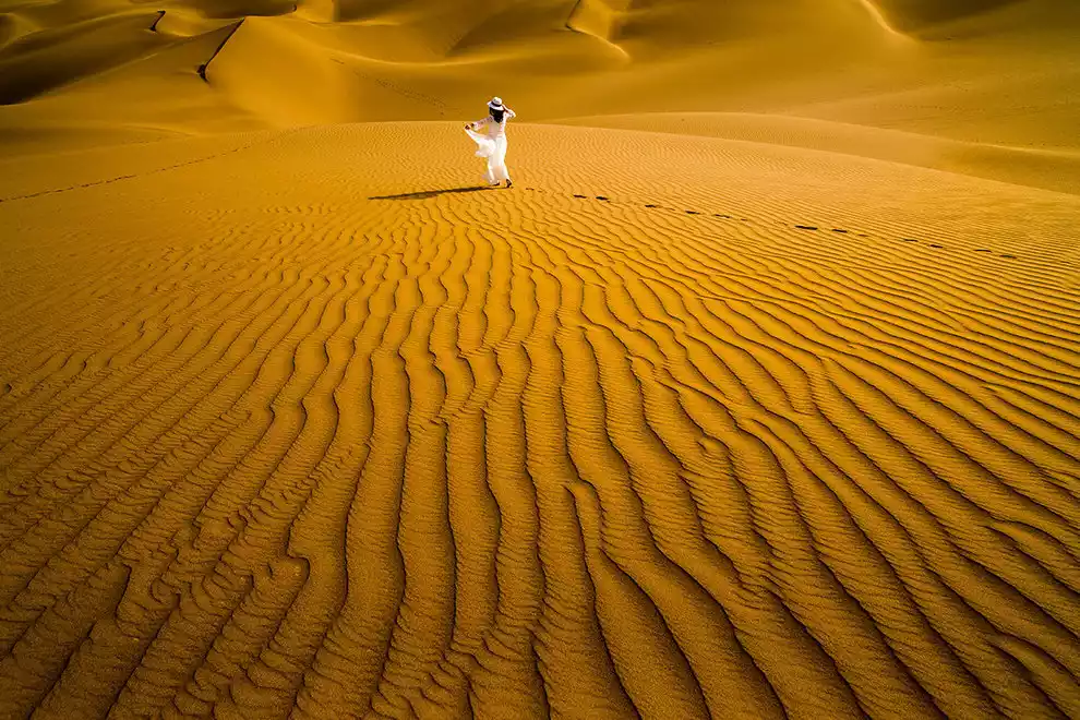
If you come to Kumtag Desert, you can play like this:
<Outdoor Hiking and Camping>
There is actually a campsite in the Kumtag Desert. If you have two days and one night, you might as well try desert camping here. You can experience the sunrise and sunset, rolling clouds and starry sky in the desert without leaving the city.
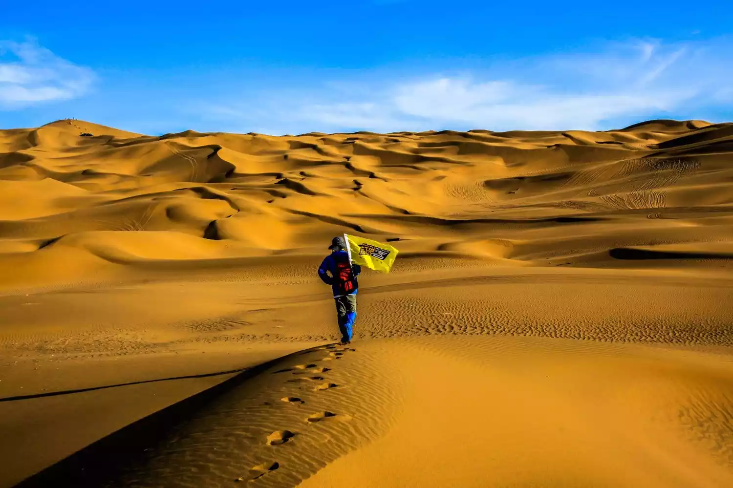
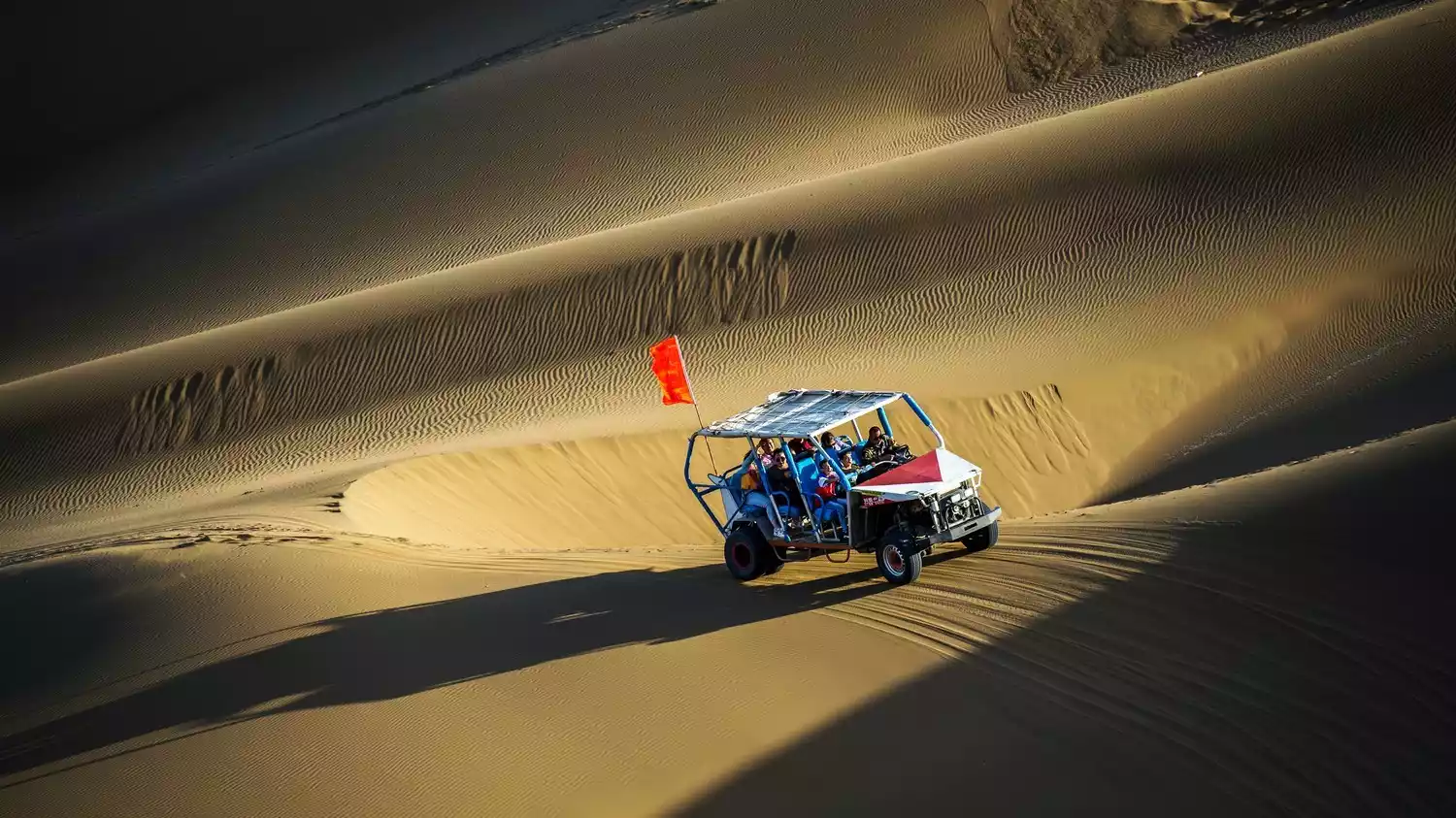
Desert Surf Car
If you are on a day trip, you might as well experience the desert surfing car. After entering the scenic area in the evening, you can go to the sand hill to wait for the sunset. After sunset, take a desert surfing car and face the uneven terrain of the desert, letting the car run wildly and ups and downs in it.
ps: Different driving routes have different charges. It is recommended to choose a route that suits your price range according to your own situation (different prices actually mean different distances. The higher the price, the longer the distance and the longer the ride time)
<Sandboarding>
The children's favorite is probably sandboarding. The sand here is fine and the sand is thick, so the speed is not too fast and it is very safe. However, the most frustrating part of sandboarding is going up the hill. It may only take a few seconds to go down the hill, but it takes a lot of effort to climb up. Generally, you will be exhausted after sliding down twice.
PS: Sandboard rental is 30 yuan/piece (including 10 yuan deposit)
3. Hami
Usually, when we talk about Hami in Xinjiang, your first thought is the place where Hami melons are produced in abundance. It is not an exaggeration to say that Hami is a city famous for its melons.
In fact, the locals call Hami melons "sweet melons" (there are many varieties). Hami melons were already a tribute variety during the Yongping period of the Eastern Han Dynasty. It wasn't until the Qing Dynasty that they were offered as tribute by the King of Hami and given as a reward by Emperor Kangxi, earning the name Hami melon. An old saying goes, "No melon is more abundant than in Hami" and "Melons offered as tribute truly come from Hami."

In fact, Hami is a city with a long history in the Western Region of Xinjiang. It is also the first stop of the Silk Road entering the Western Region of Xinjiang.
Yiwulu was Hami's earliest name. Because of its strategic location at the crossroads between China, the Xiongnu, and the Western Regions, there was a saying: "If the Han Dynasty controls Yiwulu, it can reach the Western Regions; if the Xiongnu controls Yiwulu, they can sever the Han Dynasty's ties with the Western Regions." This demonstrates Hami's ancient strategic importance. After the establishment of the Western Regions by the Western Han Dynasty, Yiwulu was subordinate to the Western Regions Protectorate, connecting China with the Western Regions and even further afield, Europe. Later, because "Yiwulu" was difficult to pronounce, the "Lu" was omitted during the Eastern Han Dynasty, resulting in the name simply being "Yiwu."
My second impression of Hami: desert and Gobi everywhere.
In fact, Hami's desert accounts for less than 2% of its total area of 138,900 square kilometers, and the Gobi Desert accounts for only 28%, with the rest being hills. According to historical records, over 2,000 years ago, a significant portion of Hami's land was cultivated. There's a reason Hami's melons are so delicious.
How to get to Hami
<Train>
There are numerous trains running from Urumqi to Hami, including K-trains, T/Z-trains, and D-trains. The high-speed trains offer a wide variety of options and are convenient, making them the preferred mode of transportation. High-speed trains only take about two and a half hours, while trains are longer, making them the preferred choice.

<Aircraft>
Hami is one of the first cities in Xinjiang to establish a hub for air travel. It's a dual-use military and civil airport, 313 kilometers east of Dunhuang Airport and 514 kilometers west of Urumqi International Airport. Currently, Hami enjoys convenient transportation links with Urumqi, Xi'an, Chengdu, Shanghai, Kashgar, and other cities.
1. Hami Ghost City
Northwest China boasts several "devil towns," such as the well-known Yadan, Wuerhe, and Qitai. Xinjiang boasts four major ghost towns: Wuerhe, Qitai, Ruoqiang, and Hami. Hami, however, is considered the most extensive of these, surpassing the others in terms of size, variety, and intricate design.
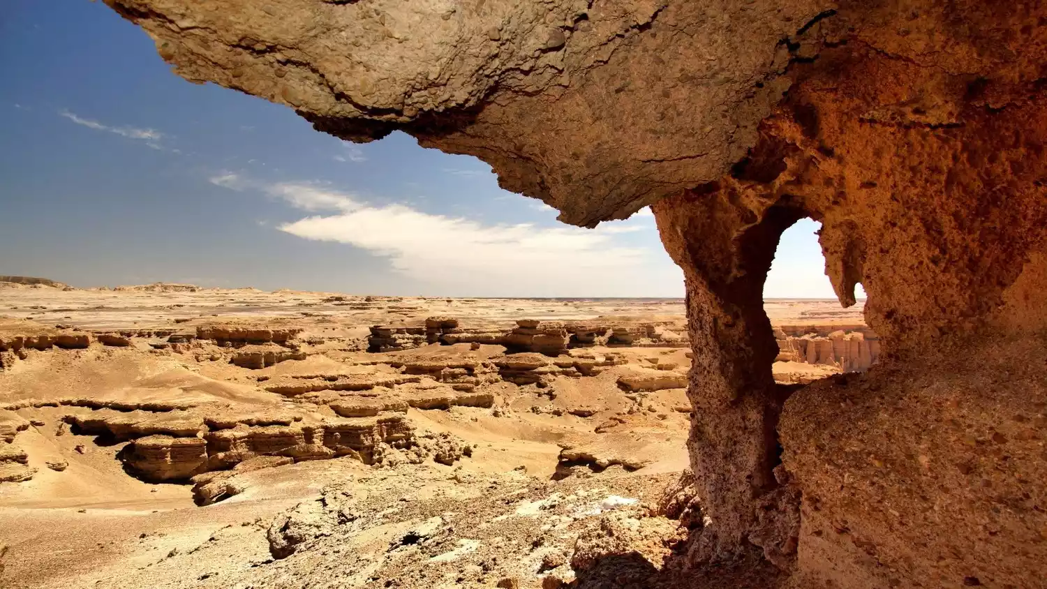
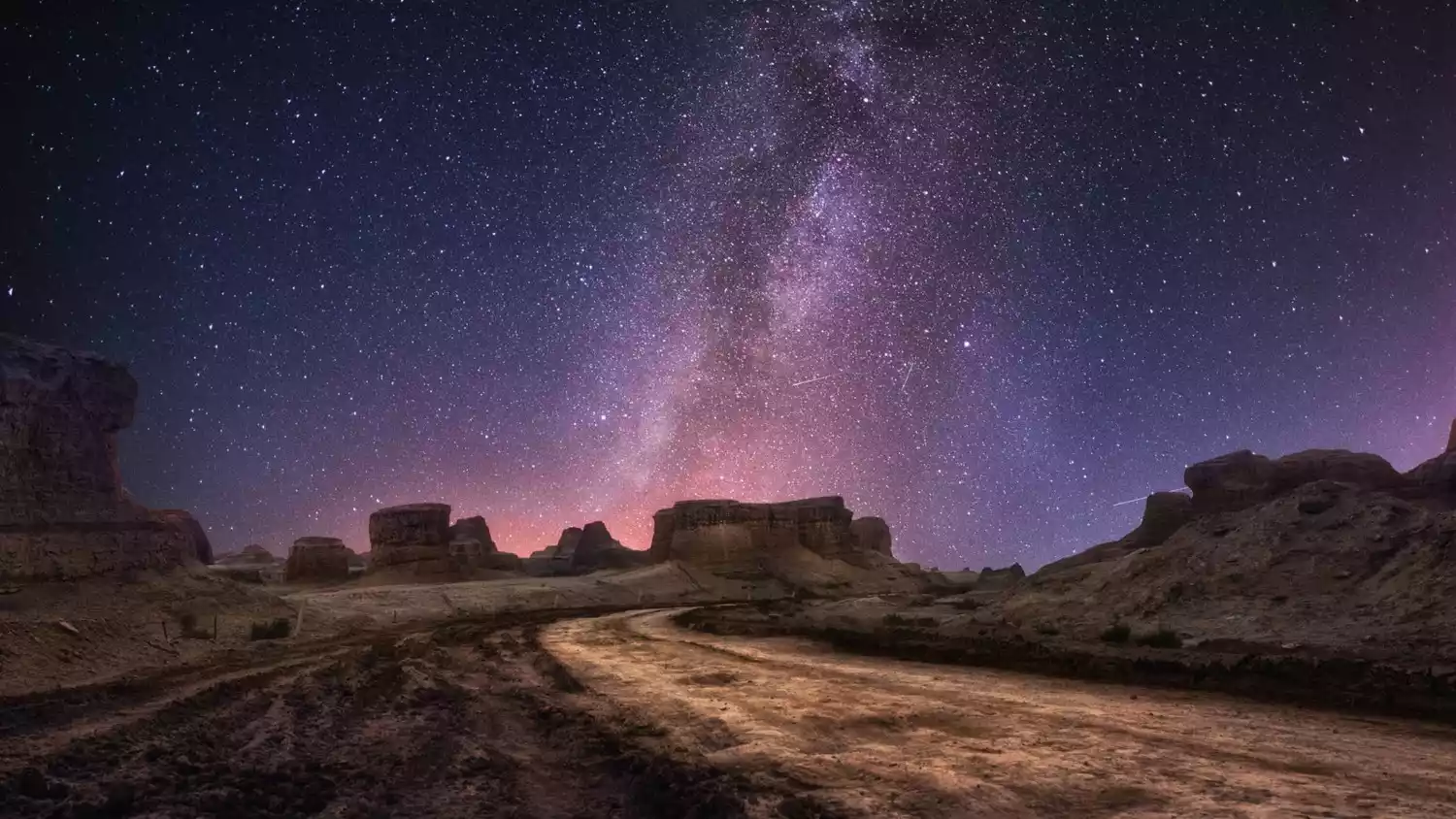
There are two special features of Hami Ghost City:
1. Ancient Tombs
Hami is the first stop of the ancient Silk Road entering the Western Regions. According to historical records, the current Hami Ghost City has an ancient castle wall built artificially on the northern line of the ancient Silk Road. The remaining ruins make it a perfect combination of natural and cultural landscapes, and also add some mysterious atmosphere to this place.
2. Paleontological Fossils
There are many ancient biological fossils on the fossil beach of Devil City, which seem to take you into the mysterious ancient times in an instant, allowing you to feel the tremendous changes of the world and experience the mystery of the magical carvings and the majestic and magnificent spirit.
If you head south from here, you will reach the famous "Sea of Death" Lop Nur Desert.
2. Okaido
The Dahai Road, also known as the Shahai Road, is named after the vast sand sea. The name comes from the Dunhuang document "Xizhou Tujing" from the mid-Tang Dynasty, which states: "The Dahai Road. The right path leaves the border of Liuzhong County (now Rukqin County) and goes southeast to Shazhou (now Dunhuang) for 1,360 miles. The sand is constantly shifting, making travel difficult. The springs and wells are salty and bitter, and there is no grass. Travelers carry water and food, walking on sand and rocks, making travel difficult and arduous."
Legend has it that during his journey westward to seek Buddhist scriptures, the Tang monk Xuanzang lost his way and lost his water in the Moheyan Desert, walking for four nights and five days. Fortunately, a skilled horse found a source of water and led him out of the desert. This story happened in the uninhabited area of Dahaidao today.
The Hami Dahaidao, connecting Turpan and Dunhuang, served as a bridge connecting Chinese and Western civilizations along the ancient Silk Road. Opened and used since the Han Dynasty, it was considered the most mysterious and arduous route of the ancient Silk Road. After the Tang Dynasty, it gradually faded from public view, becoming a mere memory. Even today, the Dahaidao remains shrouded in mystery, attracting countless brave explorers, both Chinese and foreign.
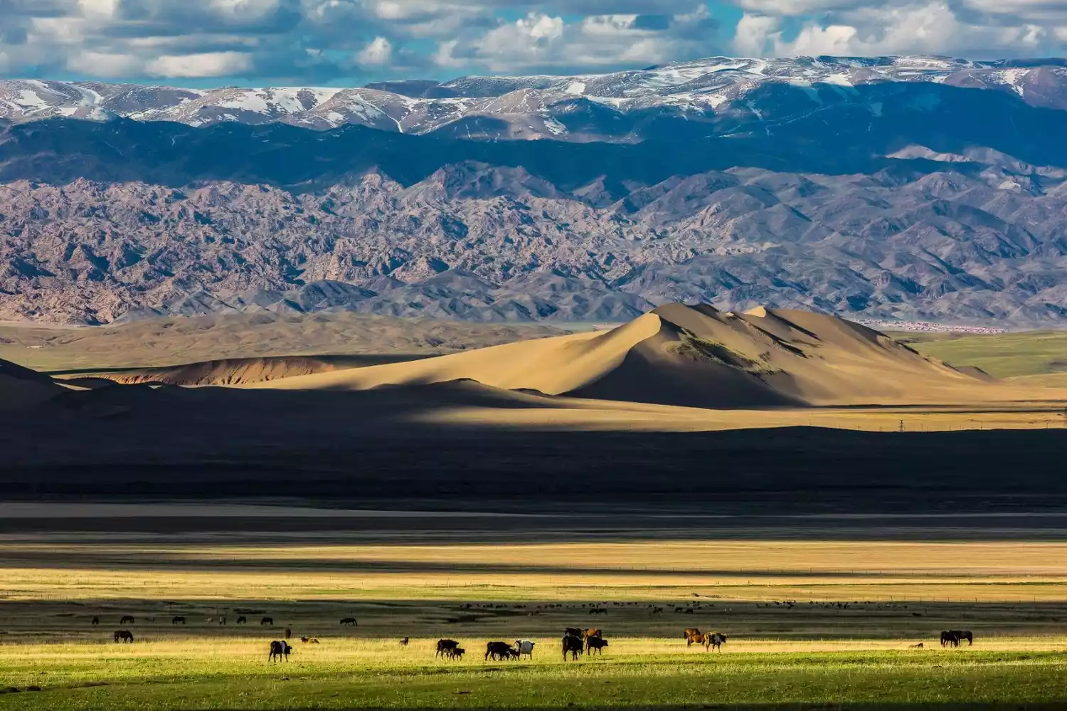
3. Barkol
Speaking of grasslands in Xinjiang, there is not only Yili, there is also a place called Barkol Grassland in Hami.
Perhaps because of the high altitude, whether it is morning or evening, whether it is summer or autumn, the grassland always has the color of early autumn, as if the true green of the grassland can only be seen at noon.
It's often said that in Xinjiang, you can experience four seasons in one day, with the weather changing dramatically every ten miles. On the Barkol grasslands, the hues shift with the sunlight, allowing you to experience the transition between summer and autumn.
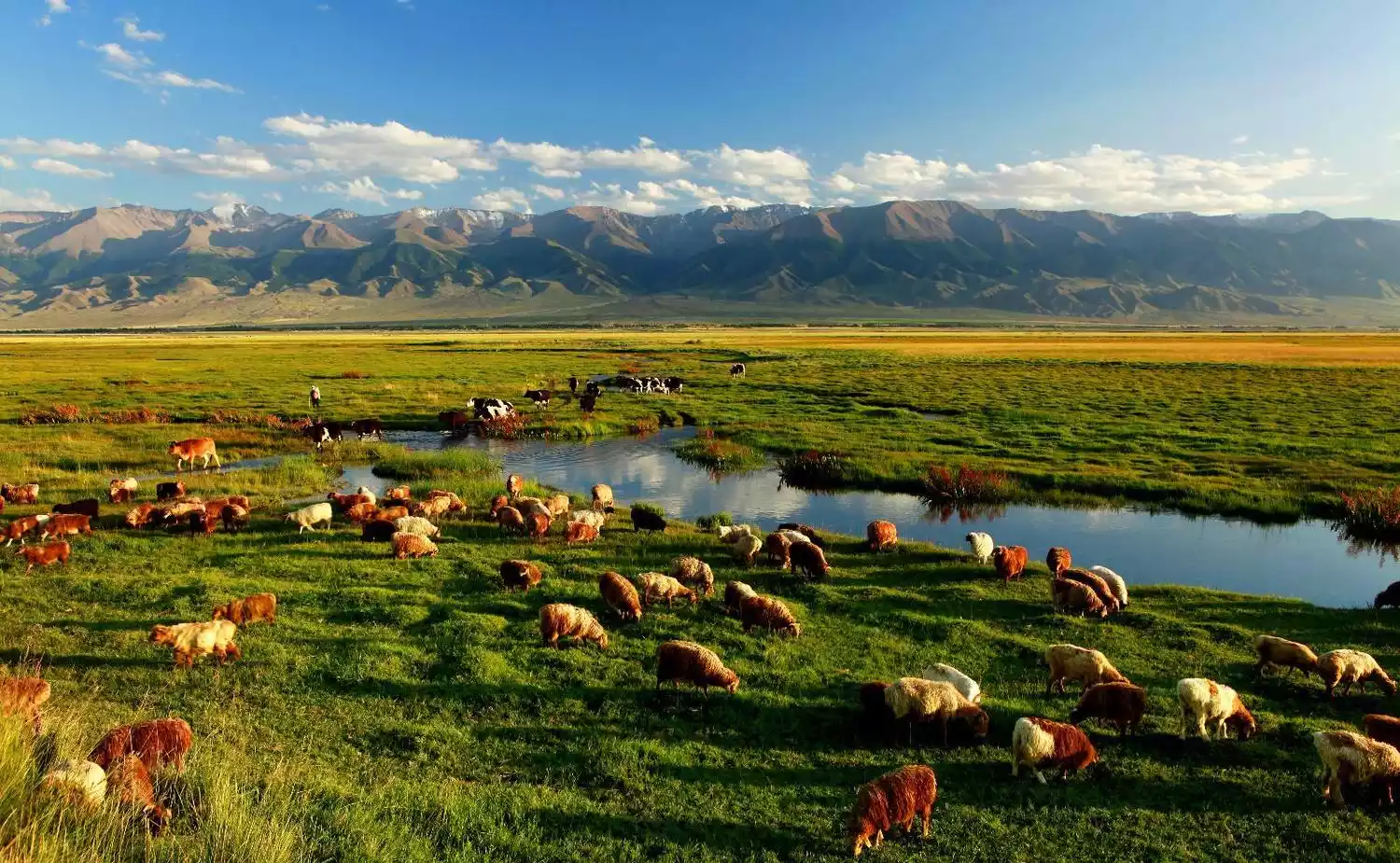
When we drove over the Eastern Tianshan Mountains and stood at the Tianshan Temple on the Tianshan Pass, overlooking the entire Barkol Grassland, we instantly felt a sense of refreshment and joy. It was truly like "standing on the top of the mountain, overlooking all the other mountains."
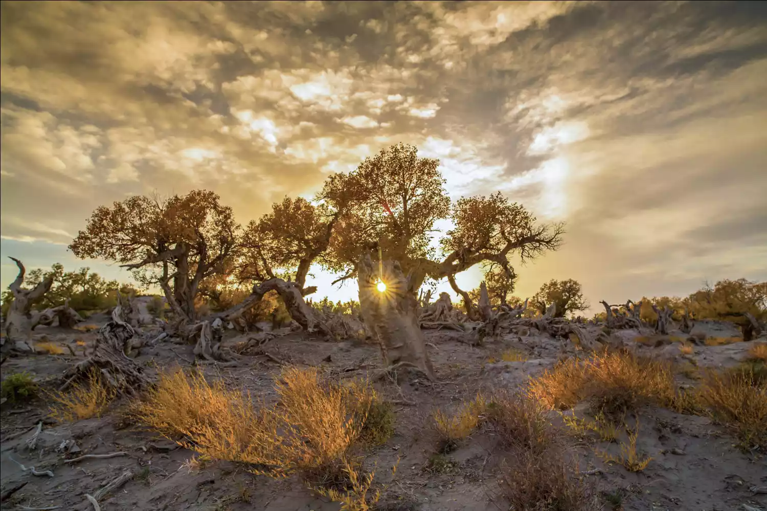
4. Yiwu Populus euphratica Forest
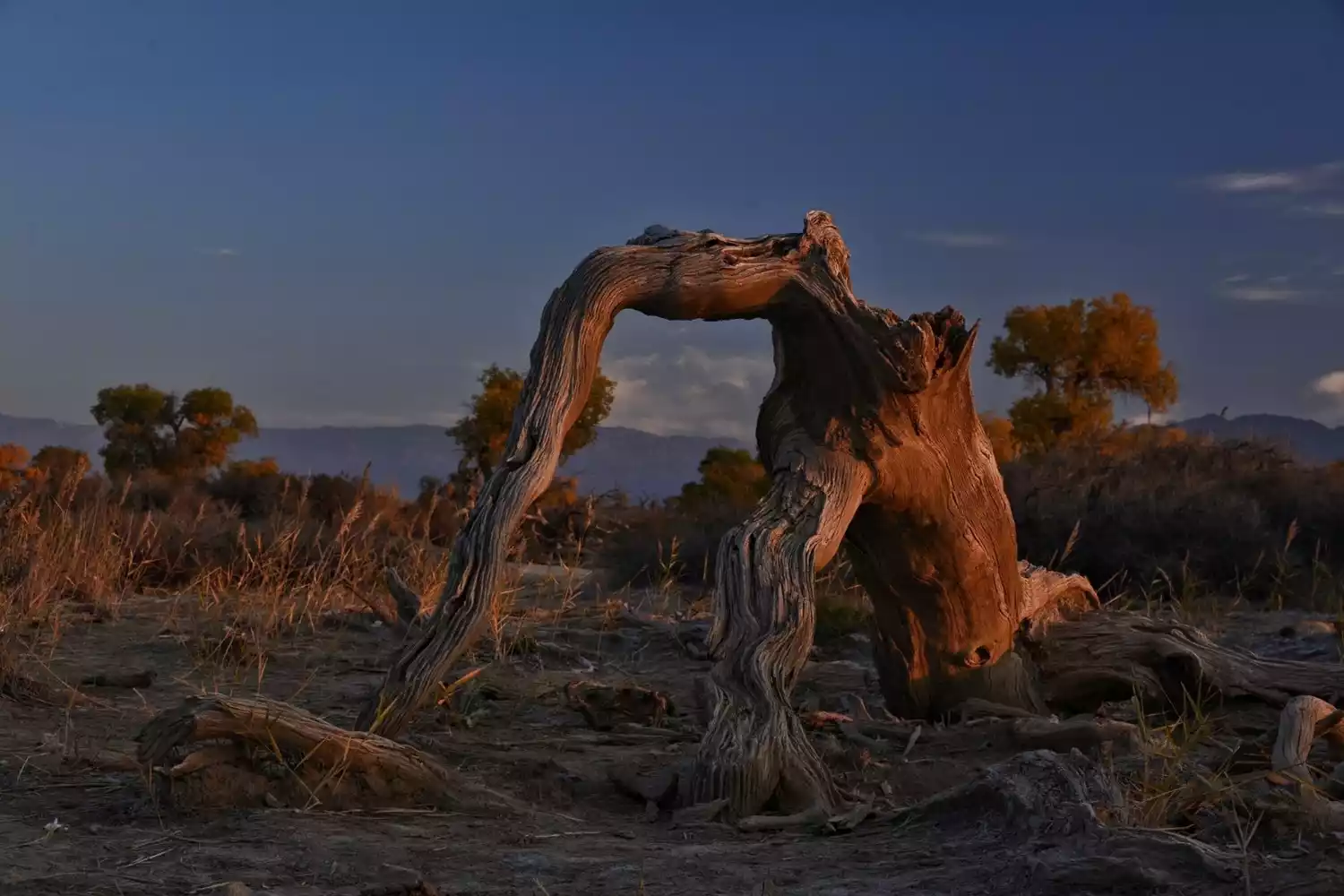
A friend once told me that the most beautiful tree in the world is the Populus euphratica, bar none. Perhaps it's because the Populus euphratica "grows for a thousand years, stands proudly for a thousand years, and endures for a thousand years." Each tree stands in an unrepeatable posture, and once standing, its presence becomes eternal, a myth.
To the east of Naomao Lake in Hami lies the Yiwu Poplar Forest, a pristine poplar forest identified by experts as the world's oldest, most distinctively shaped, and best accessible. Here, you can witness the poplars' thousand-year-old youth, three-thousand-year-old strength, six-thousand-year-old vicissitudes, and nine-thousand-year-old awe.
The 38-kilometer-long scenic road in the scenic area is lined with old poplar trees on both sides, with the age ranging from one thousand to nine thousand years. It seems as if they have experienced countless reincarnations and welcome generations of visitors.
4. Qitai
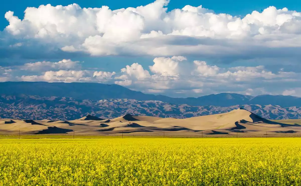
1. Jiangbulake
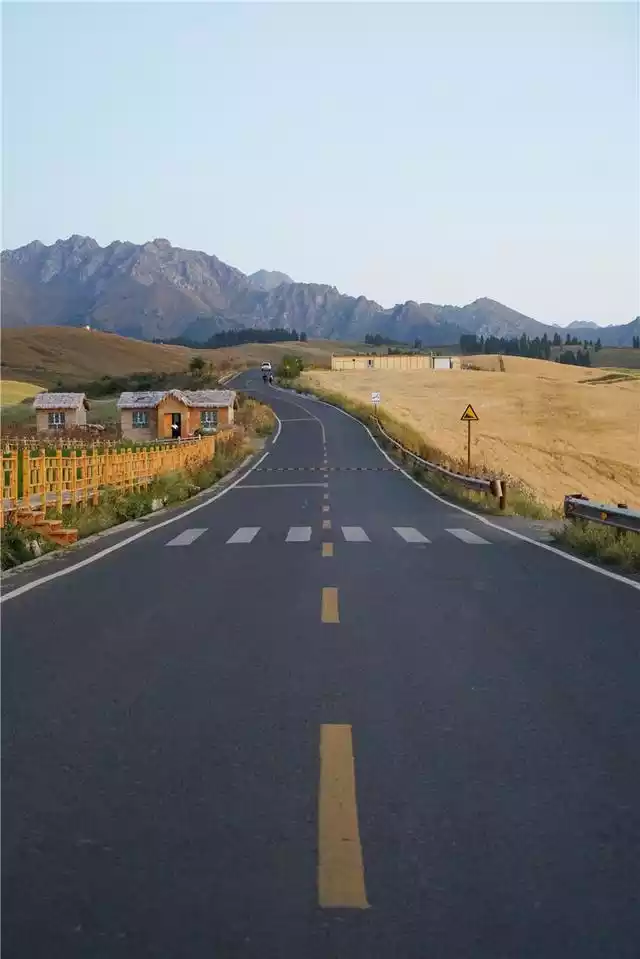
Jiangbulake is Kazakh, meaning "source of holy water". Many people may not have heard of this name. In fact, Jiangbulake can be said to be another pure land on earth after Yili. Locals say that "the grasslands of Xinjiang are not limited to Yili."
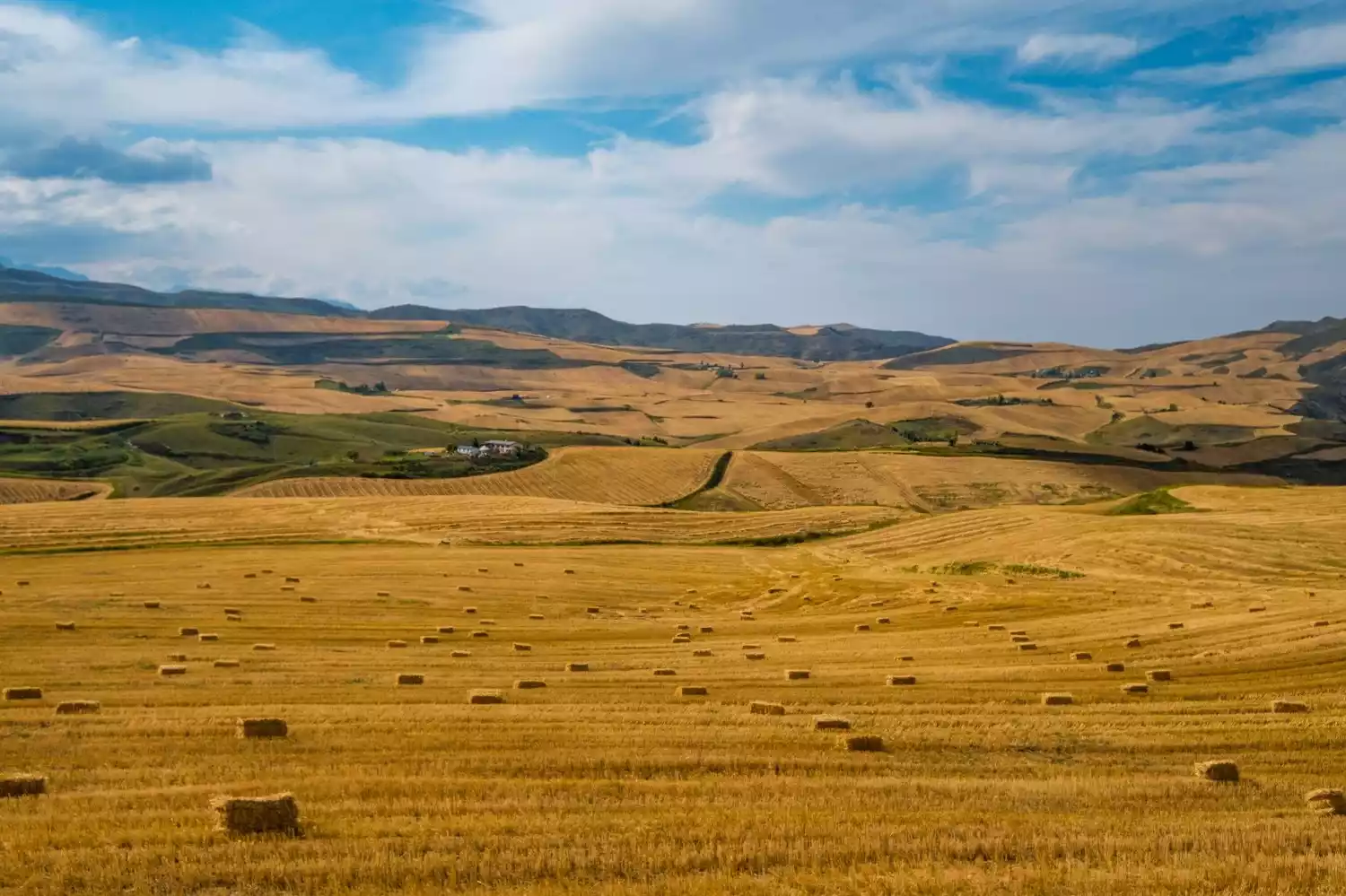
Jiangbulake's average summer temperature is only 25°C, and the idyllic Jiangnan scenery is definitely here. In summer, there are not only thousands of acres of rapeseed flowers, but also miles of wheat fields, and the snow-capped mountains in the distance, forming a poetic pastoral scene.
But if you ask me when Jiangbulake is at its most beautiful, I'd say it's definitely late August or early September. The endless hills are covered with rolling golden wheat fields. A gentle breeze blows, and the wheat waves roll in, layer upon layer, promising a good harvest.


Jiangbulake also has a mysterious place called "Tianshan Strange Slope", which is 290 meters long. Here, water no longer flows to lower places, and it is more difficult for cars to go downhill than uphill.
In 2005, the Shanghai World Records Headquarters determined that the "Tianshan Weird Slope" was the world's longest weird slope after an investigation.
In fact, this is due to our visual error. The terrain on both sides of the slope is more steep than the slope itself. It is actually uphill, but it looks like downhill. There is also such a strange slope in Utah, USA.
Conclusion
It is not enough to visit Xinjiang only once. In addition to southern Xinjiang and northern Xinjiang, please also leave some time for eastern Xinjiang.
Xinjiang will never let you down.