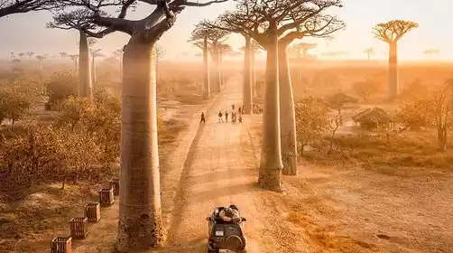
An upgraded version of Sichuan's classic Rock Route hike: A 360-degree guide to the Yading Grand Circumambulation Hike
Preface
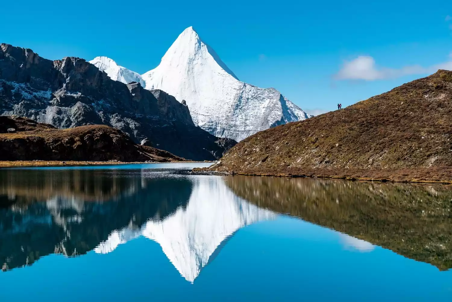
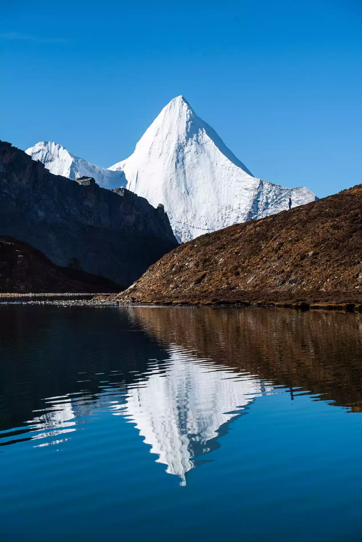
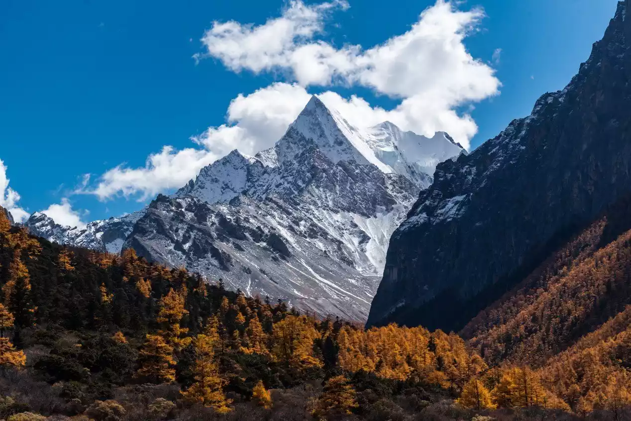
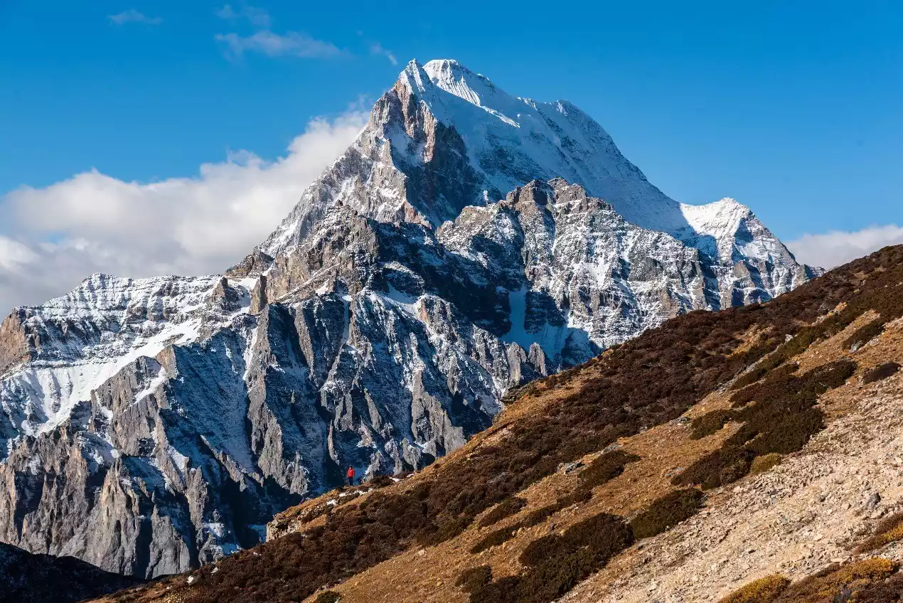
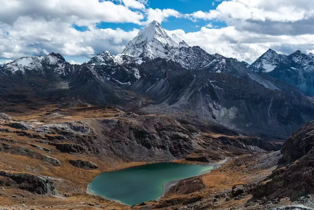
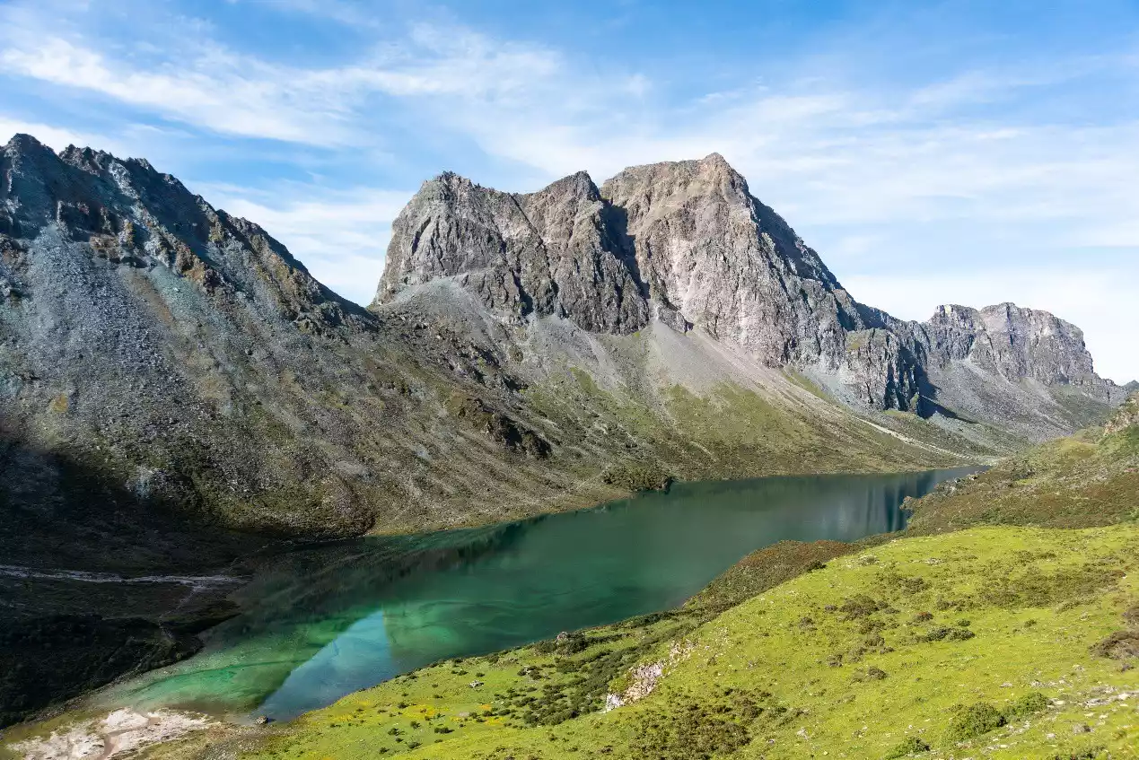
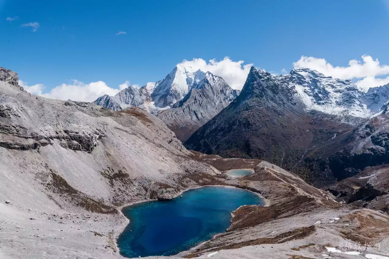
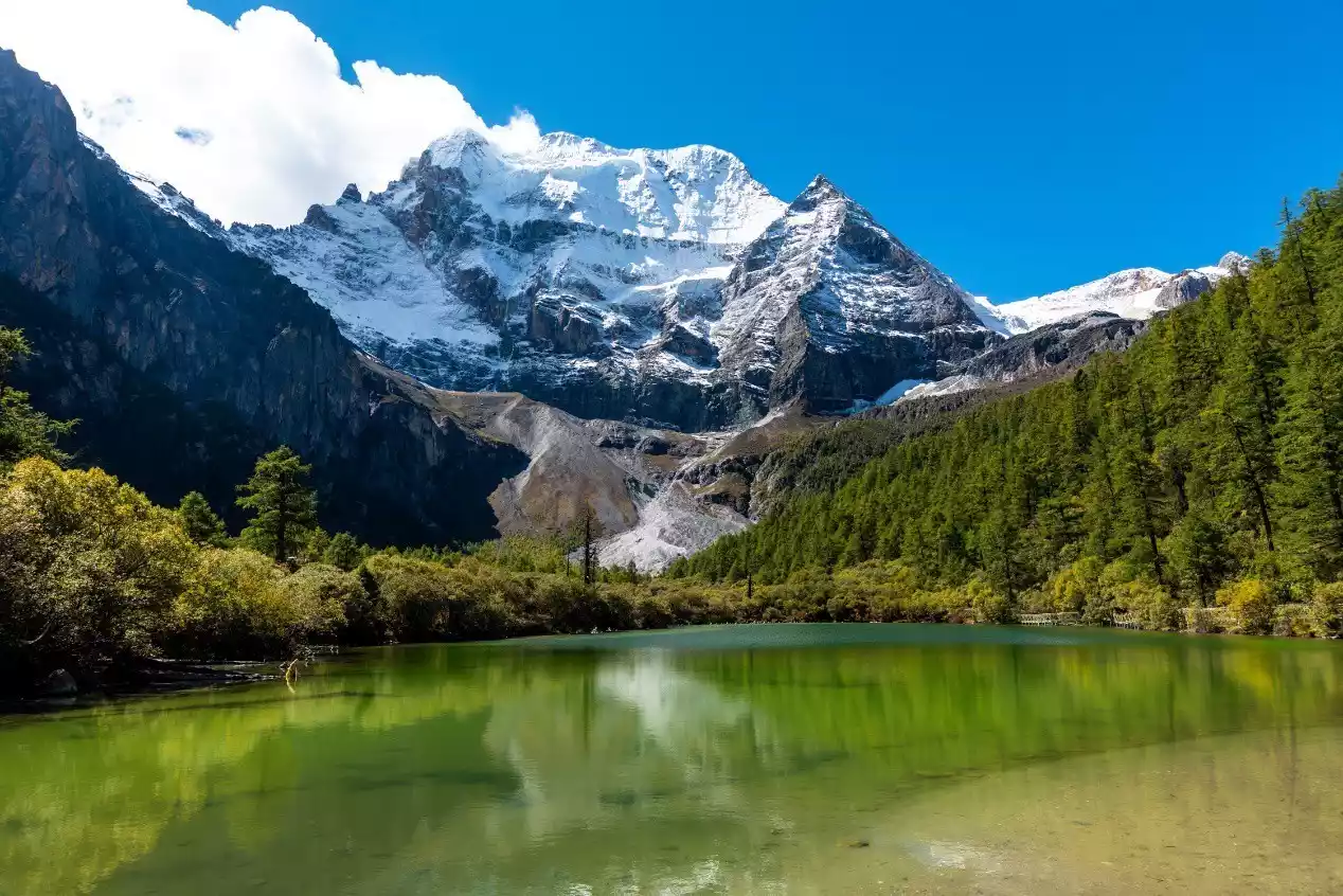
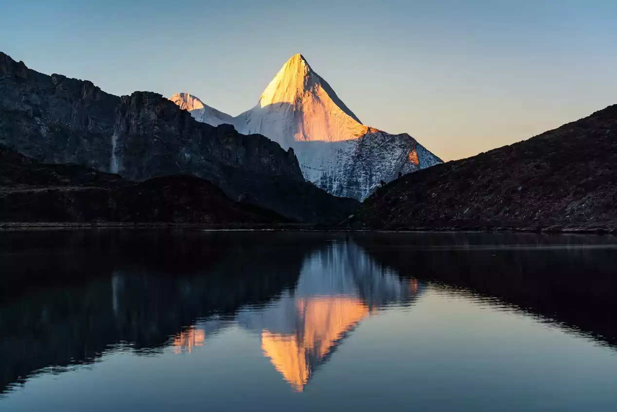
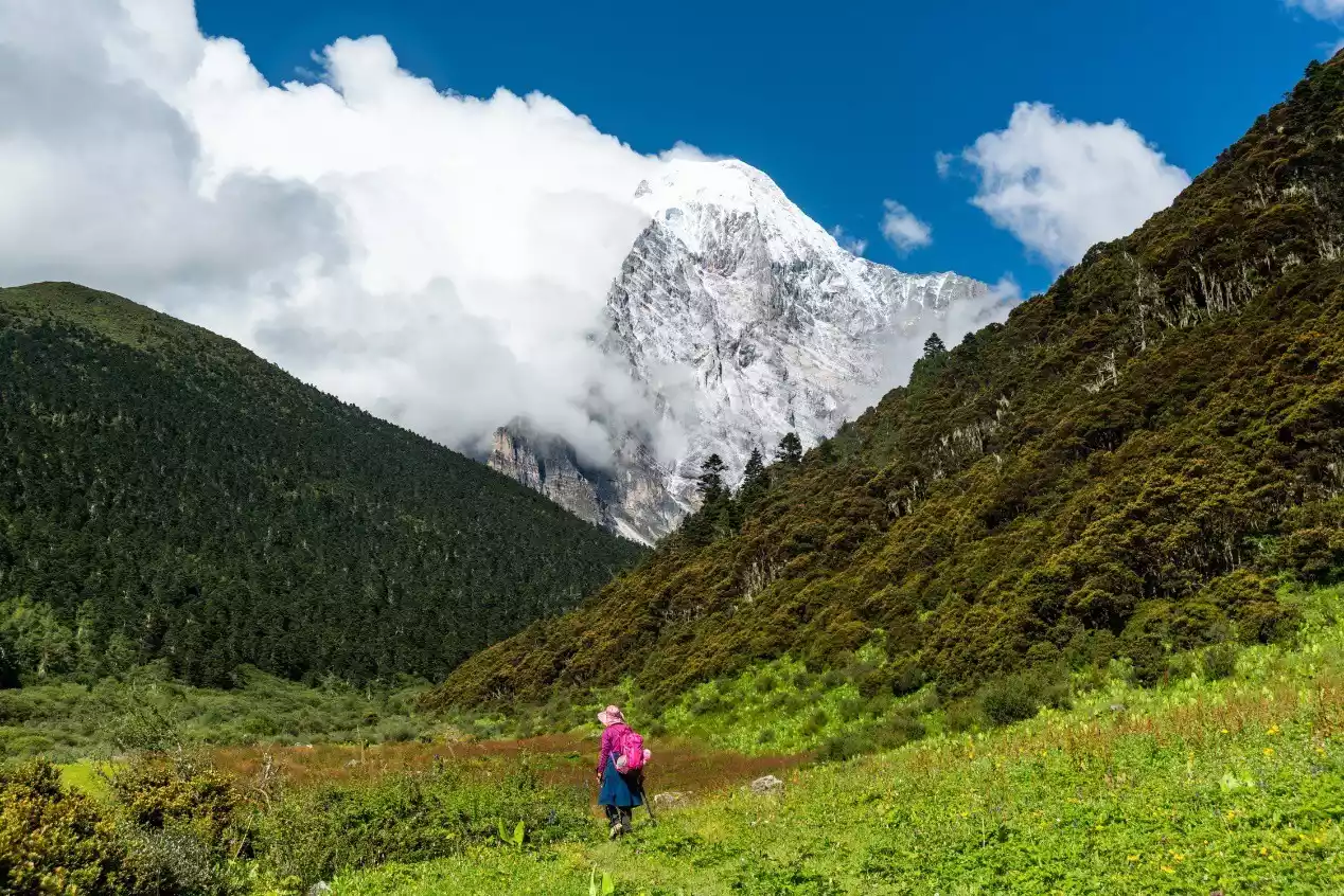
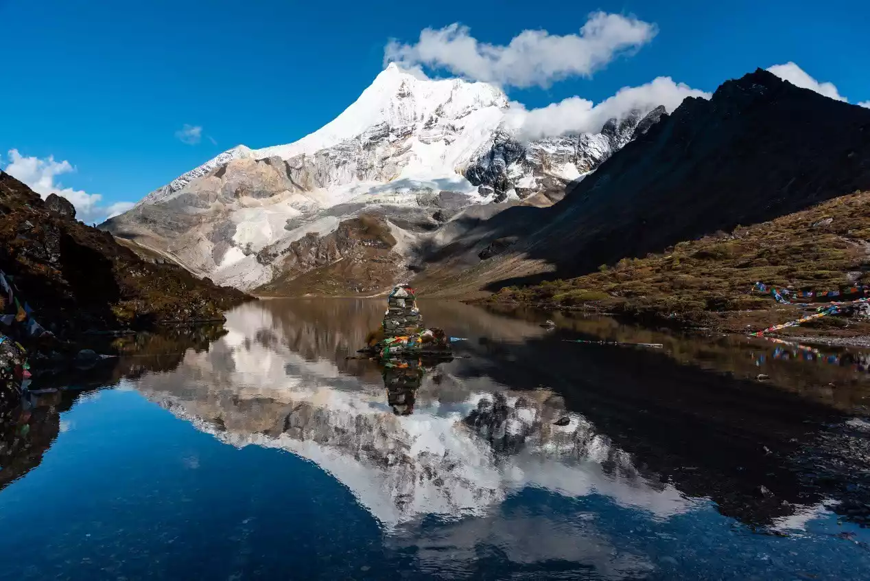
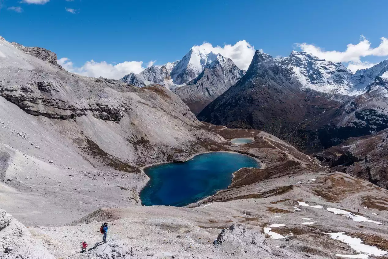
(The reflection of Yangmaiyong Peak in Boyongcuo Lake. Note the hiker on the right.)
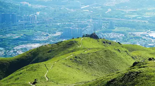
Sichuan Province's rich natural landscape, encompassing snow-capped mountains, lakes, forests, and canyons, has also created numerous classic hiking routes, beloved by both domestic and international travelers. These include the Gongga Grand Circumambulation, the Siguniang Mountain Changping Valley through the Bipeng Valley, the Genyen Circumambulation, and the Rock Line Hike. Each of these routes offers unique charm, both in terms of natural beauty and cultural heritage.
Everyone has their own answer to the question of which is the most beautiful hiking route in Sichuan. However, as a professional outdoor leader and photographer who has hiked numerous high-altitude routes, I have another favorite: the Yading Grand Circumambulation Trail, which overlaps with the Rock Trail for a short distance but offers even more stunning scenery.

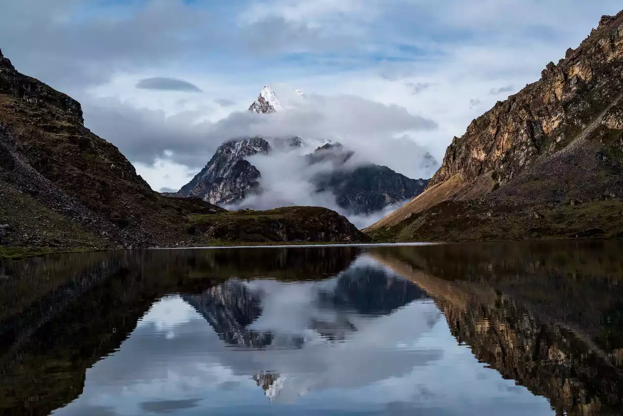
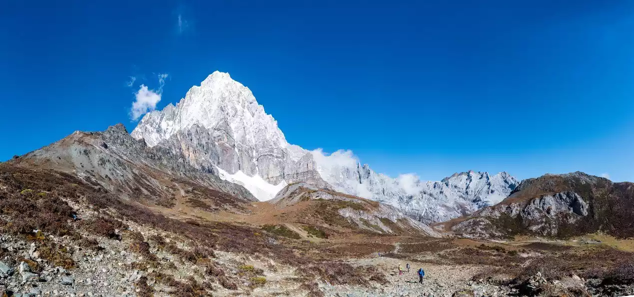
(Hikers are at the foot of the cliff on the southern slope of Yangmaiyong Mountain)
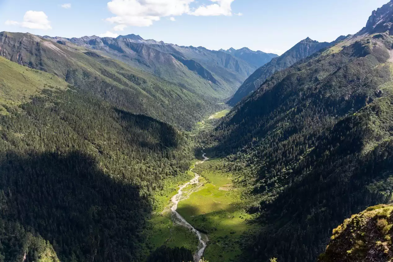
The Rock Line Hiking Route (there are several different ways to walk the Rock Line. Unless otherwise specified, this article refers specifically to the five-day hike from Muli Dulu Village to Yading Scenic Area) is named after the footsteps of the famous explorer Dr. Joseph Rock a hundred years ago. Starting from the Tibetan villages in Muli County, it passes through pristine jungles, alpine pastures, deep gorges and green valleys, snow-capped peaks and blue lakes. It is a 60-kilometer hike over five days. The highlight of the scenery is around the Three Sacred Mountains in the second half of the route. The first two days of hiking on the Rock Line mainly involve jungles and pastures, and the Three Sacred Mountains cannot be seen, so the natural scenery is relatively inferior.
The Yading Grand Pilgrimage is planned based on the traditional pilgrimage of local Tibetans. Starting from Chonggu Temple in the Daocheng Yading Scenic Area, it is a 7-day 80-kilometer hike around the outside of the Three Sacred Mountains. The sacred mountains can be seen every day, and the natural scenery every day is no less than that of the second half of the Rock Line.
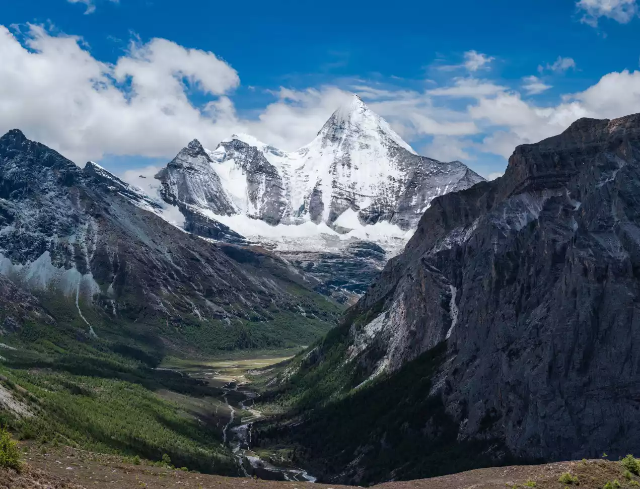
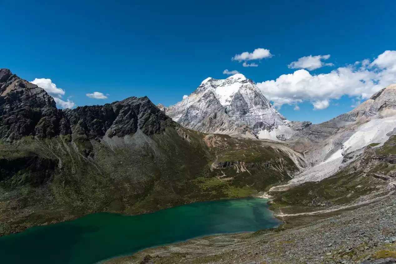
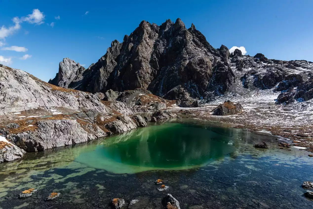
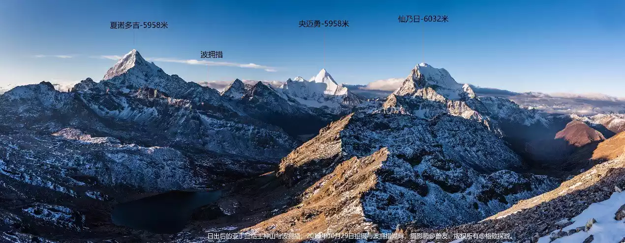
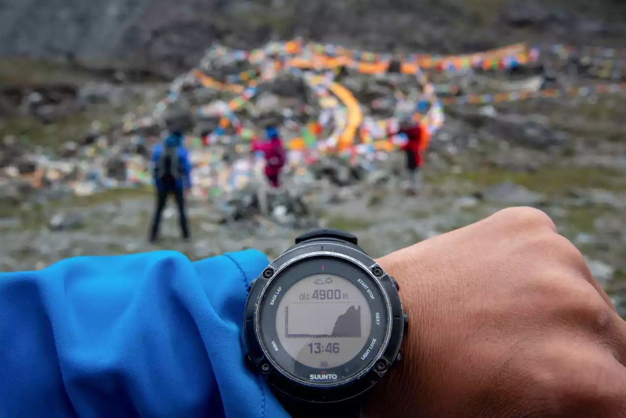
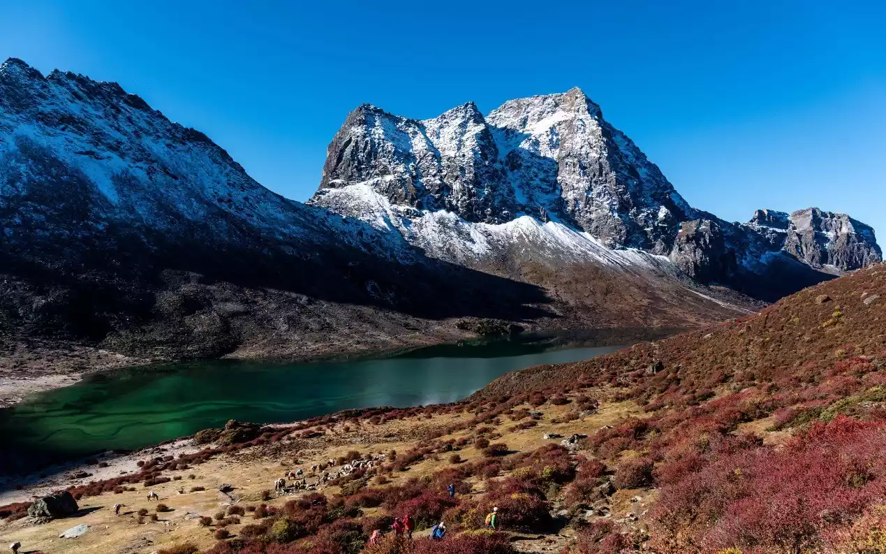
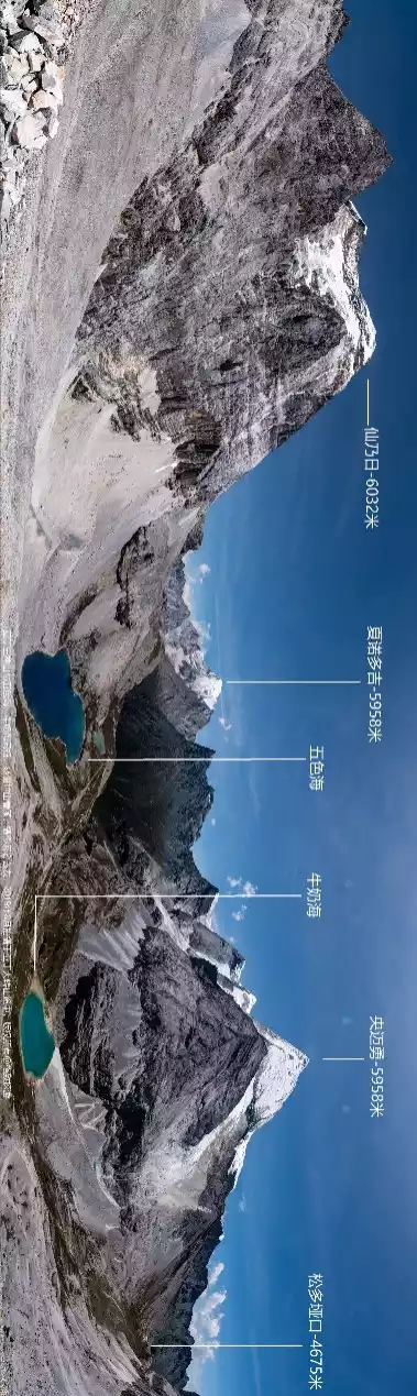
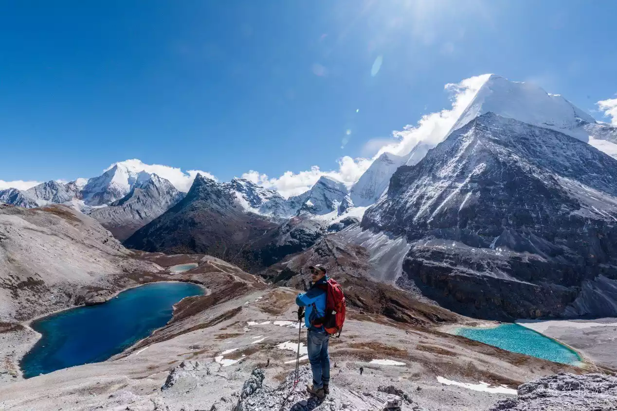
(At the Shuangshen Lake check-in point, you can see the Five-Colored Sea (left), the Milk Sea, as well as Xianuoduoji (left) and Yangmaiyong)
Please follow my words and pictures below to explore the scenery along this strong contender for the most beautiful route in Sichuan, and appreciate the ever-changing views of the Three Protectors Mountain from all angles, as well as the beauty of the surrounding jungles, pastures, peaks, valleys, lakes and rivers.
Overview of the Yading Grand Circumambulation Hiking Route
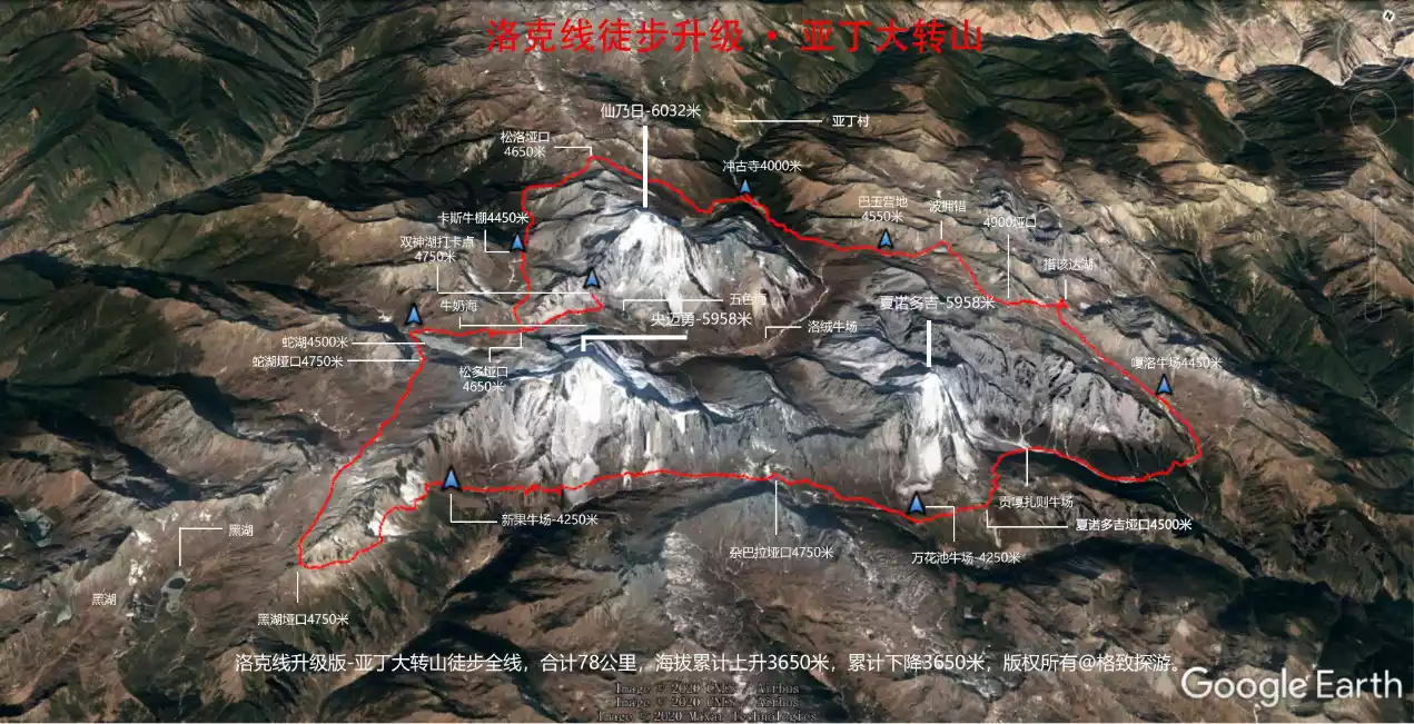
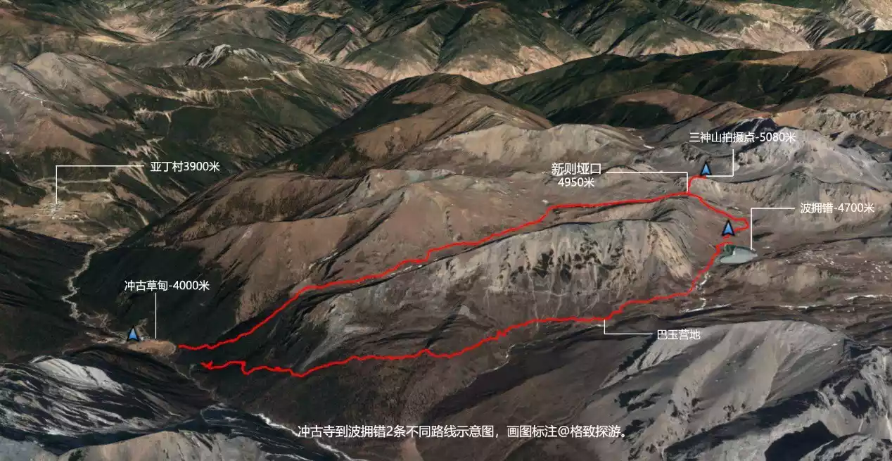
As shown on the map, the starting and ending points of the Yading Grand Pilgrimage are both Chonggu Temple in the Daocheng Yading Scenic Area. The total hiking distance is 78 kilometers, and the altitude throughout the entire journey is between 4,000 and 5,000 meters. The cumulative climbing and descending are both about 3,650 meters. A total of 8 passes above 4,500 meters are crossed, including 2 times of crossing the Songduo Pass. There is also a small pass of 4,400 meters that is not marked on the map.
From the above simple data, it can be seen that the Aden Circumambulation is higher than the classic Rock Line hiking route in terms of difficulty and intensity. Among the high-altitude hiking routes in China, it belongs to the upper level of the pyramid and requires sufficient physical fitness and experience to respond flexibly.
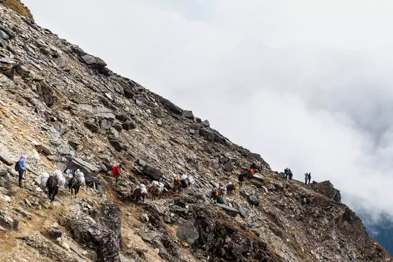
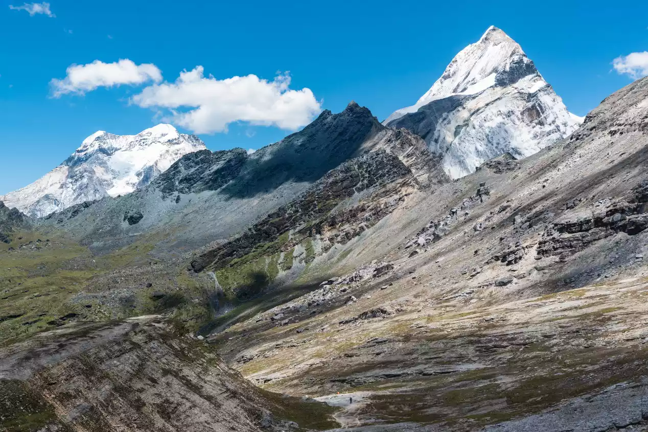
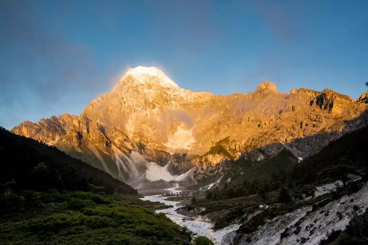
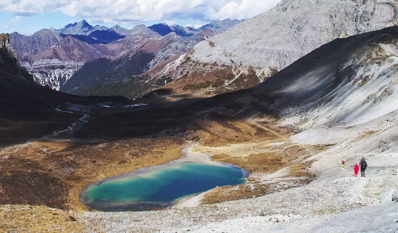
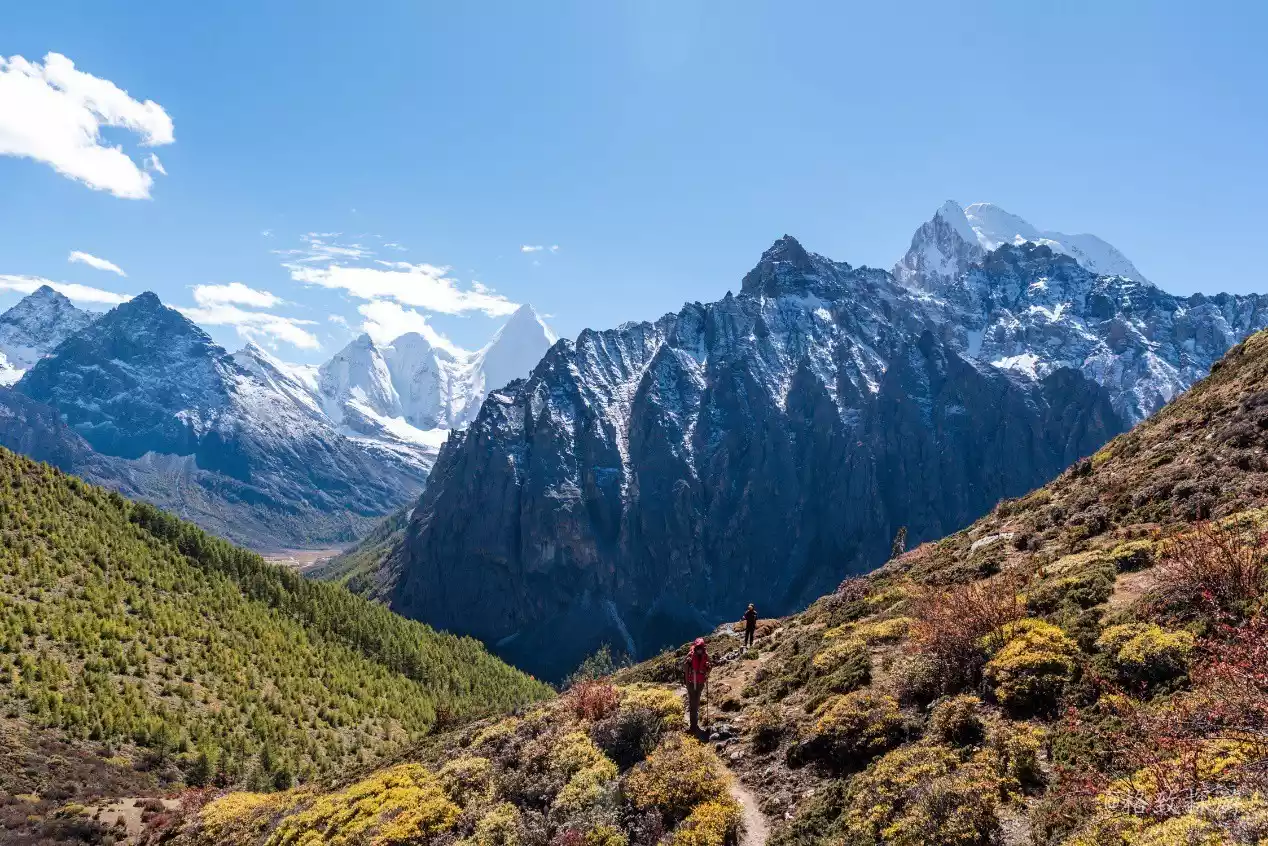
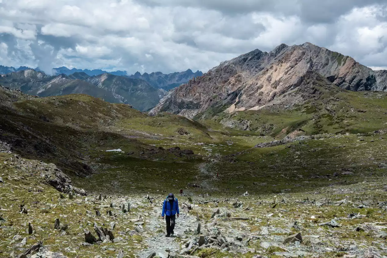
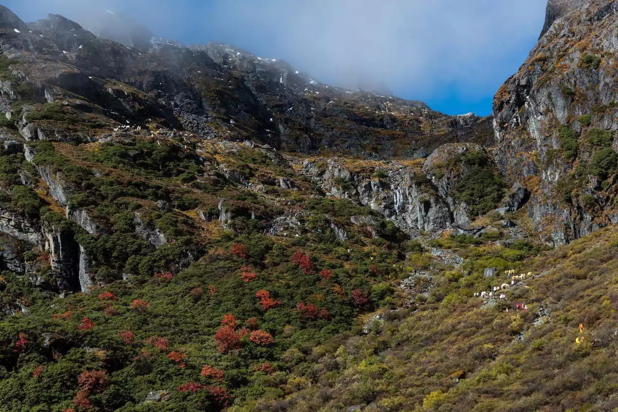
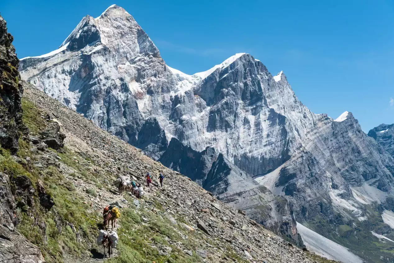
(The section between Xinguo Niuchang and Heihu Pass is the most dangerous section of the entire journey)
If it weren't just the sheer difficulty and intensity of the hike itself, the Yading Grand Pilgrimage wouldn't be enough to captivate me. The natural scenery and cultural charm that complement it are what truly make it such a delight. Regarding the natural scenery, this article will share photos I took during my eight hikes up the Yading Grand Pilgrimage. Regarding the cultural aspects of the Yading Grand Pilgrimage, I'd like to share two key aspects.
First, in both Tibetan primitive religion and Tibetan Buddhism, there's a tradition of circumambulating mountains to express reverence and worship for mountains that represent deities and Buddhas. The Three Sacred Mountains of Yading represent the incarnations of three bodhisattvas in Buddhism: Xiannairi represents Avalokitesvara, the benevolent Bodhisattva; Yangmaiyong represents Manjushri, the wisdom-loving Bodhisattva; and Xiannuoduoji represents Vajrapani, the courage and strength-loving Bodhisattva. As such, the Three Sacred Mountains hold a high religious status in Tibet and are worshipped by many Tibetans. Every year during the Year of the Rooster (the Tibetan zodiac follows the same twelve animals as the Han Chinese) on the Tibetan calendar, it's the zodiac year for the Three Sacred Mountains of Yading. Large numbers of Tibetans come to circumambulate the surrounding mountains. The specific route differs slightly from the one described in this article, as the modified version incorporates the natural scenery surrounding the standard circumambulation route.
Secondly, while the traditional Locke Route is named after Dr. Locke, who set foot in the uninhabited area around Yading a century ago, Dr. Locke's actual route is closer to the Yading Grand Pilgrimage. According to Dr. Locke's travelogue, he first traveled from Muli Temple to Garuo Village, hiring local Tibetans as escorts. He then passed through Garuo Ranch, Gongga Zhaze Ranch, the pagoda south of Yangmaiyong, the Black Lake Pass, Snake Lake, and Kasi Hell Valley to Chonggu Temple. After resting for two days at Chonggu Temple, he returned to Garuo Ranch via Bayu Camp and then to Garuo Village. Therefore, the Yading Grand Pilgrimage described in this article is the authentic Locke Route that more closely follows Dr. Joseph Locke's footsteps.
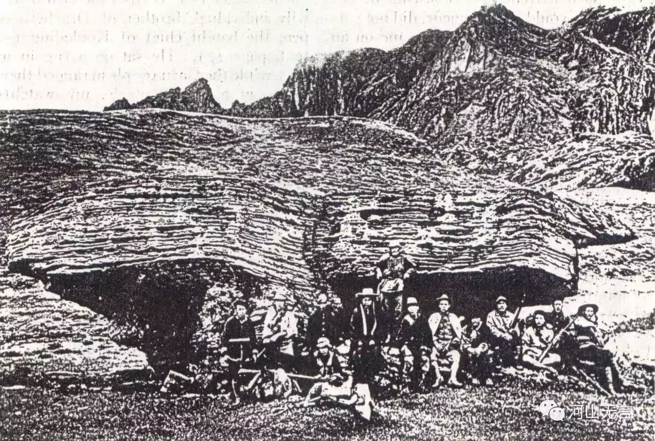
(Dr. Locke and his team took a photo at Butterfly Rock in Jiadu Niuchang)
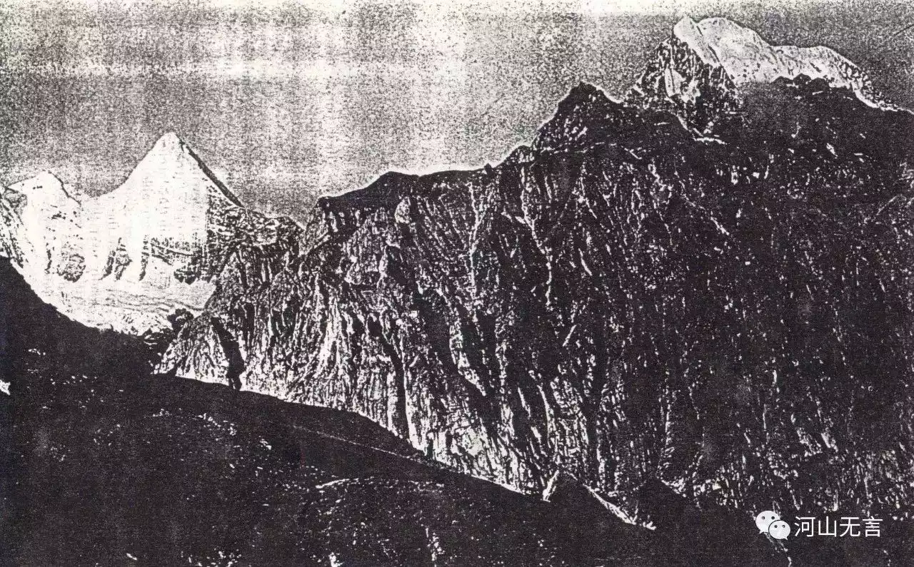
(Dr. Locke photographed Yangmaiyong (left) and Xiannairi at Bayu Camp.)
(Reference: Fan Xiao: How did Locke travel to Shangri-La? https://mp.weixin.qq.com/s/SvTlMrLuhSSLNOn6kwcWBA)
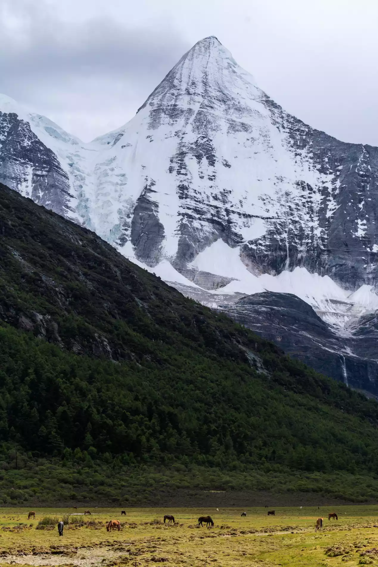
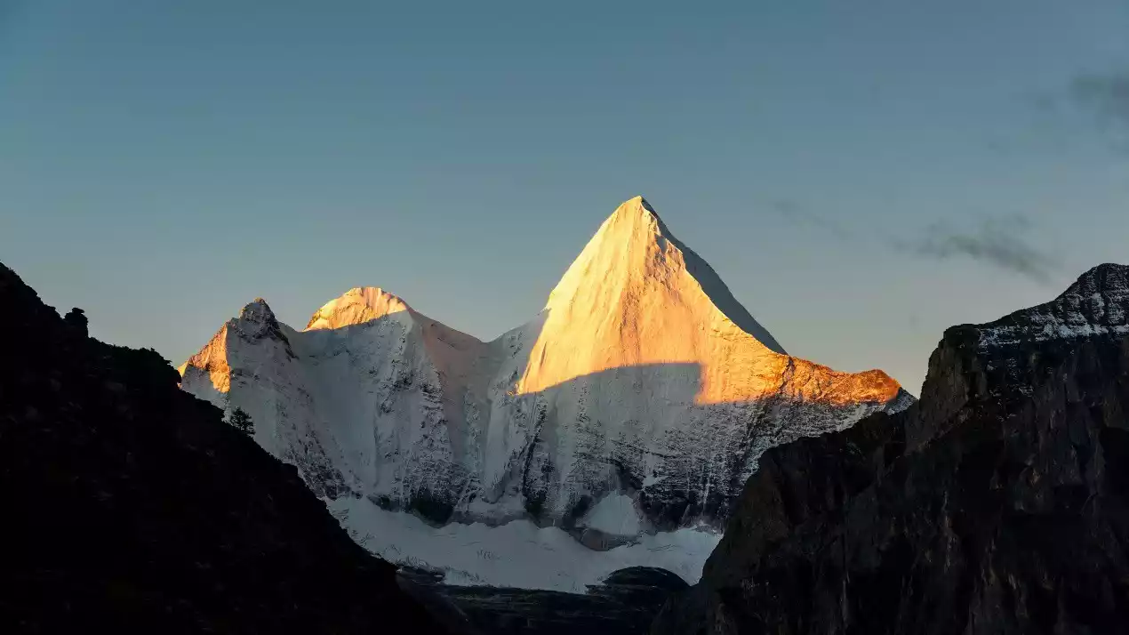
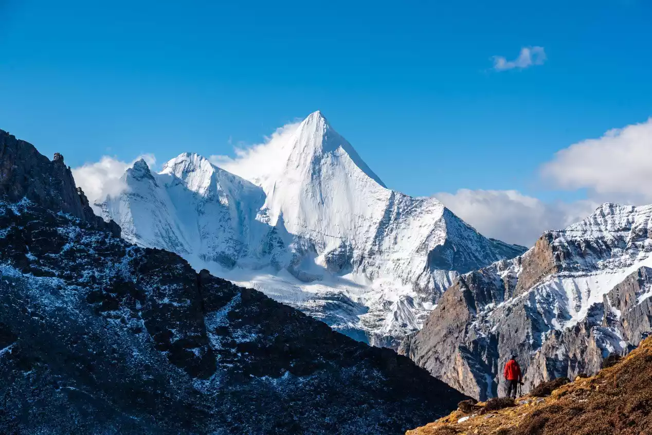
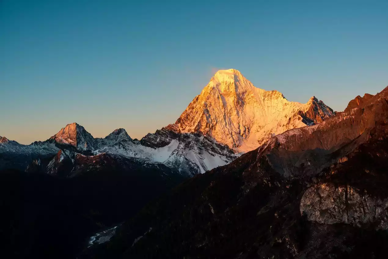
During the hike to the Three Sacred Mountains of Aden, the most exciting thing is the three majestic snow-capped mountains. During the 360-degree circumambulation of the mountains, we can appreciate them from different angles. They look like ridges from the front and peaks from the side, and they look different from different distances and heights.
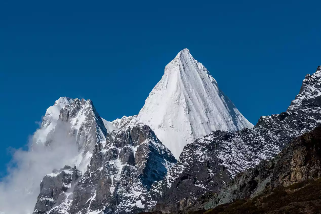
Yangmaiyong from different perspectives
(Photo taken by Yang Maiyong at Luorong Cattle Farm in Yading Scenic Area)
(Photo taken near Bayu Camp, Yangmaiyong)
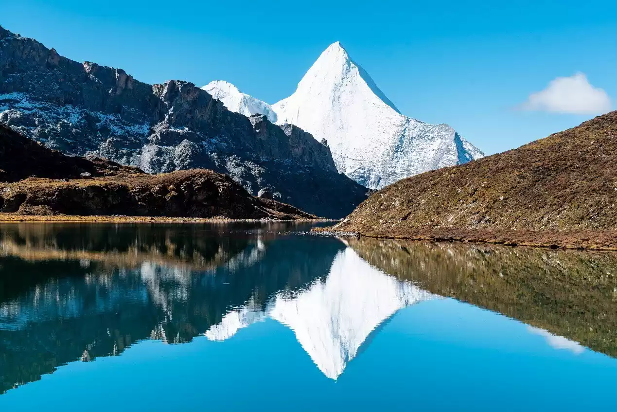
(Bo Yongcuo photographed the reflection of Yangmaiyong)
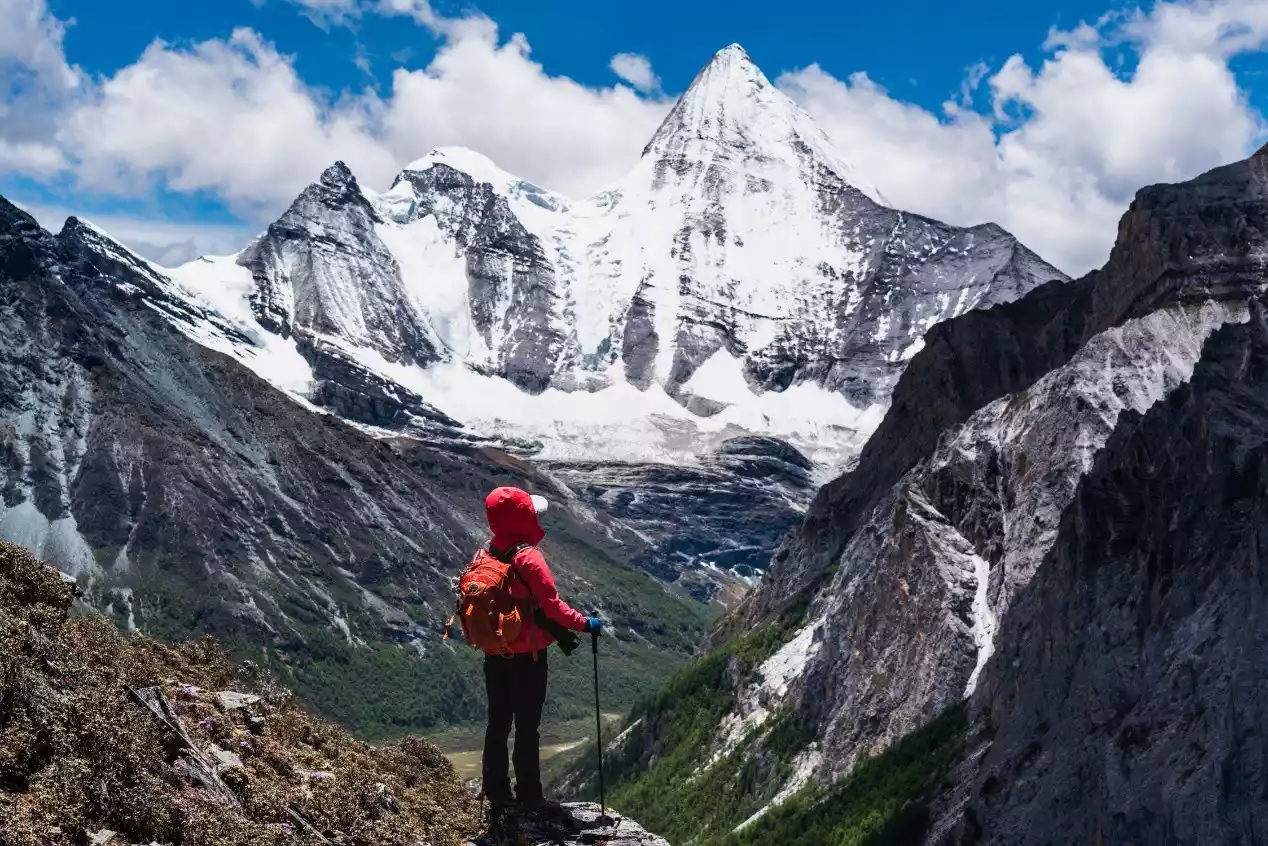
(Photographing Yangmaiyong Peak near the Xianuoduoji Pass)

(Looking up at Yangmaiyong from the southeast cliff of Yangmaiyong)
(Photographing Yangmaiyong in the valley on the south slope of Yangmaiyong)
(Yangmaiyong (right) and Xiannairi were photographed in the valley west of Yangmaiyong)
(Photo taken at Shehu Pass, Yangmaiyong)
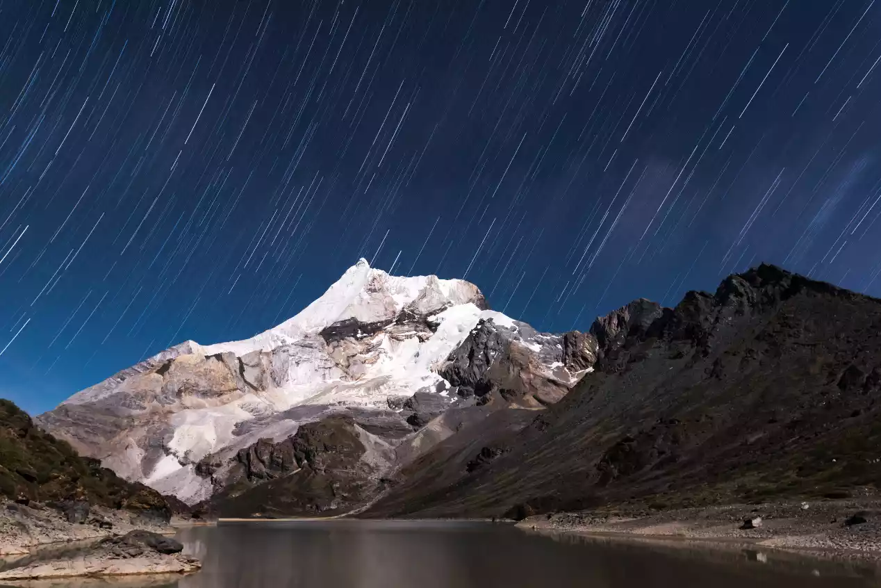
(The star trails of Yangmaiyong were photographed from the tail of Snake Lake)
(Photo taken near Kasi Cowshed, Yangmaiyong)
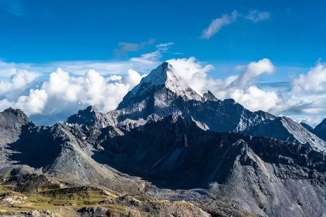
[Xianuoduoji] from different perspectives
(Xianuoduoji photographed in Chonggao Meadow)
(Photo taken on the hillside near Boyong Co)
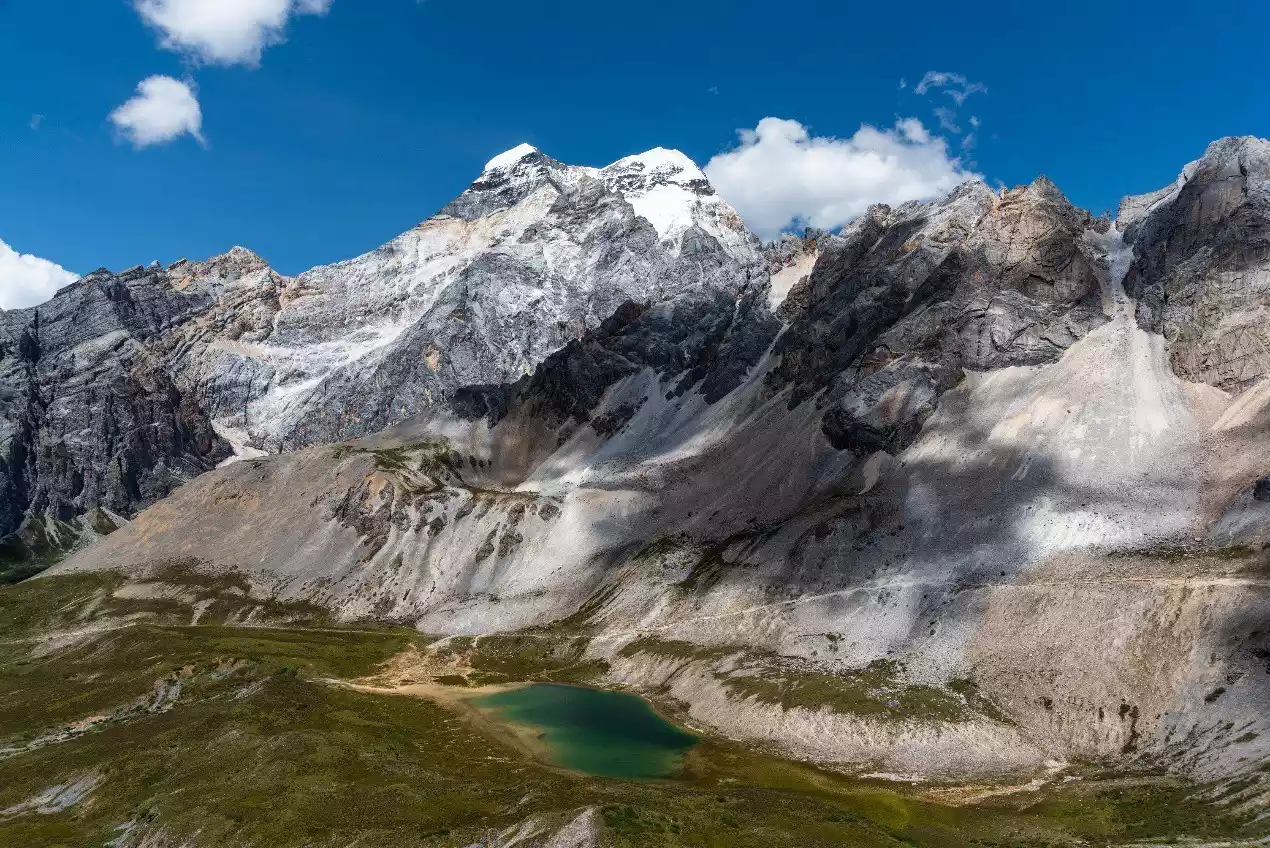
(Photo taken by Xianuo Duoji at Cuogaida Lake)
(Photo taken from Chagong Cow Farm on the east face of Xianuoduoji)
(Photo taken from Gongga Zhaze Cow Farm on the east face of Xianuoduoji)

(Photo taken at the Xianuoduoji Pass)

(Photo taken from Wanhuachi Niuchang on the south face of Xianuoduoji)
(Photographing the west face of Xianuoduoji from the valley on the south slope of Yangmaiyong)
(Photo taken from Luolong Niuchang on the west wall of Xianuoduoji)
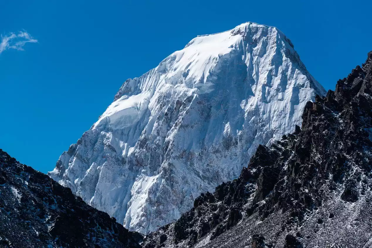
【Xian Nai Ri】from different perspectives
(Photo taken from the observation deck near Yading Village)

(Photo taken at the Pearl Sea on Xiannairi)
(Photo taken on the hillside near Boyong Co)
(Bo Yongcuo photographed the reflection of Xiannairi)
(Photographing Xiannairi and Snake Lake at Snake Lake Pass)
(Photographing Xiannairi and Resongcuo near Songduo Pass 15)
The Yading Grand Pilgrimage passes through 10 high mountain lakes along the way
【Bo Yongcuo】
(Poyongcuo and Xianuoduoji)
(Reflections of Boyongcuo and Yangmaiyong)
【Mother's Mistake】
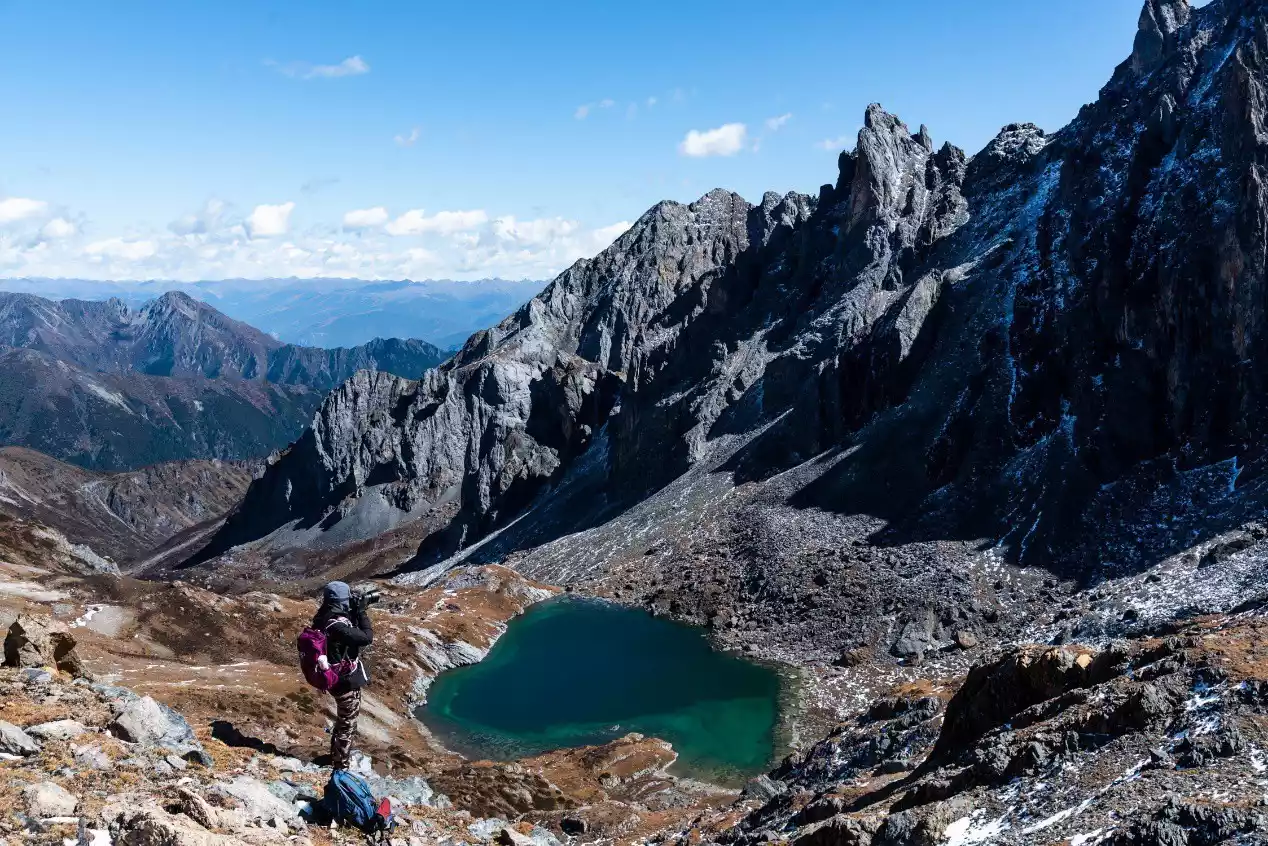
【Dacogada Lake】
【Xiaocuogaida Lake】
Black Lake
Snake Lake
【Milk Sea】
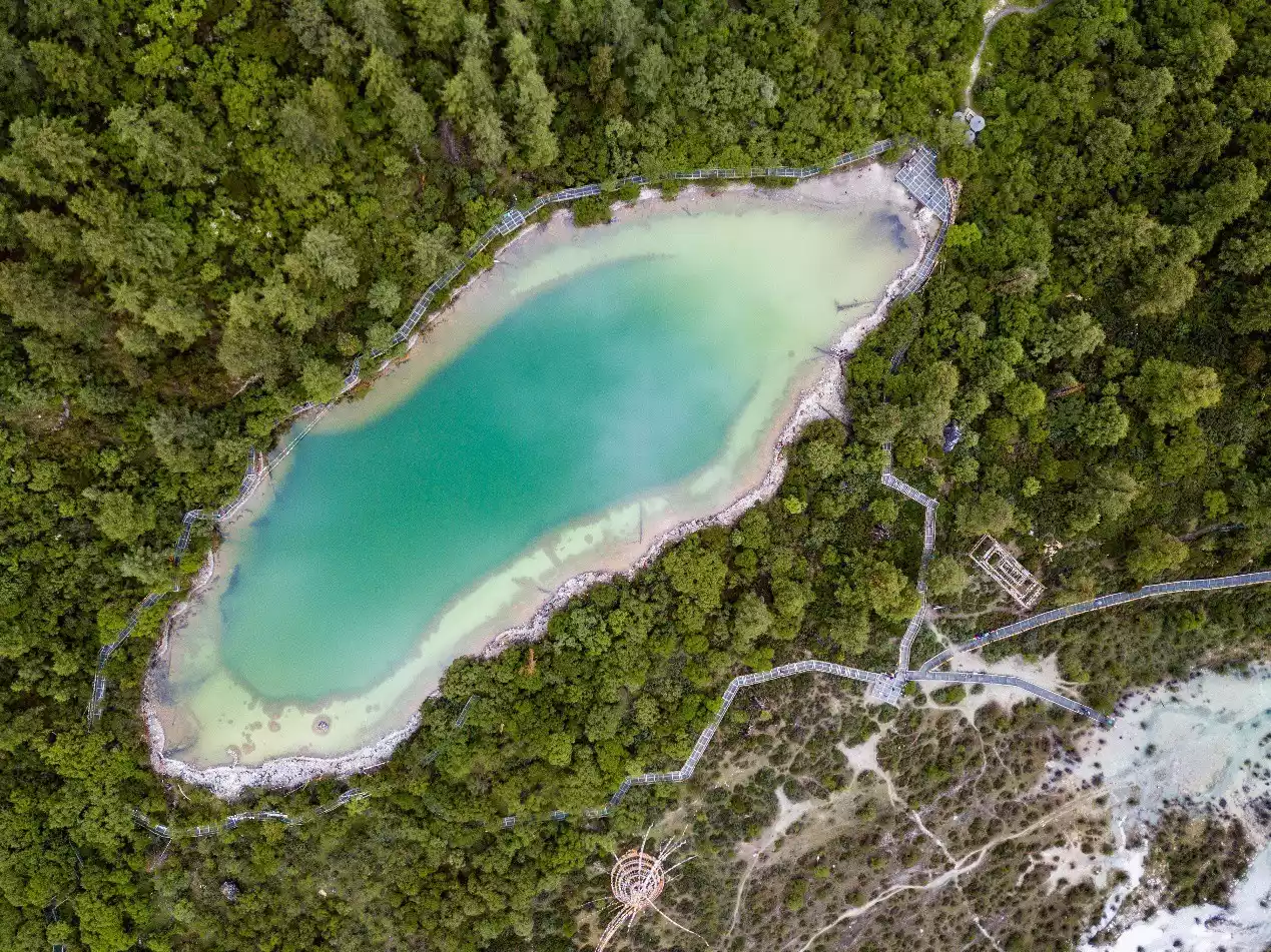
【Five-Colored Sea】

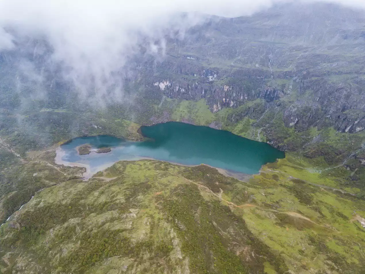
(Five-Colored Sea (below) and Milk Sea from an aerial perspective)
【Resongcuo】
【Pearl Sea】
Best time to travel
The extremely high altitude of the Yading Grand Pier means that this is a route that is not suitable for the snowy season. From November of each year to May of the following year, the risk and difficulty of this route are greatly increased due to the deep snow at the pass and the severe cold in the camp.
The best times to hike are during the azalea bloom season in late May and early June, when you can admire numerous seas of azalea along the way. Mid-to-late October is also the best time to see the vibrant forests blanketing the mountains. Rain and snow are also less likely during these two periods, so the chances of seeing snow-capped mountains are higher.
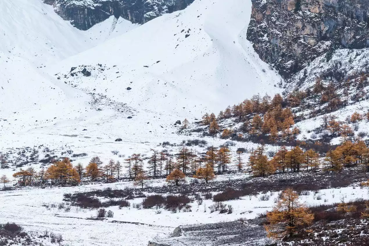
(Gongga Zhaze Cattle Farm after a snowfall in late October)
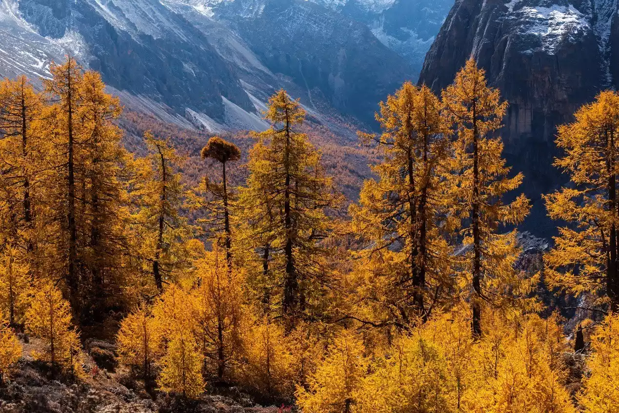
(At the end of October, the colorful forests covering the mountains are mainly composed of larch)
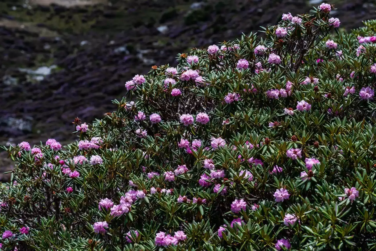
(Azalea sea in May and June)
Specific itinerary
Now, follow my pictures and text and take a cloud trip along the route of the Yading circumambulation.
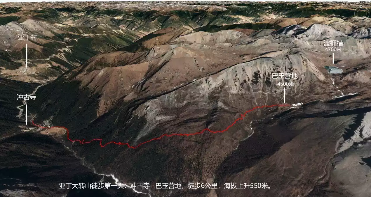
Day 1 Chonggu Temple-Bayu Camp
Hike: 6 km, 550 m elevation gain.
Campsite: Bayu Campsite, 4550 meters above sea level.
Alternative campsite: Lake Poyongcuo (4,700 meters above sea level).
Our hiking journey starts from the Daocheng Yading Scenic Area. Since the altitude of the Daocheng Yading Scenic Area is generally above 4,000 meters, the altitude of Yading Village is also 3,900 meters, and the altitude of Shangri-La Town where the entrance to the scenic area is located is only 2,900 meters, it is recommended to arrange accommodation in the town the day before, which is more conducive to adapting to the altitude and preventing altitude sickness.
I recommend setting up camp at Bayu Camp on the first day. Although the scenery of Poyong Co is more beautiful and the distance from Chonggu Temple to Poyong Co is not very long, the altitude of Poyong Co is 4,700 meters, which is relatively dangerous as a camping spot on the first day. It is very easy to cause varying degrees of altitude sickness.
Generally, the hike from Chonggu Temple to Bayu Camp takes about 3-5 hours. For the first day's acclimatization hike, lower intensity and physical exertion are more conducive to adapting to the high altitude and reducing the impact of altitude sickness on the hiker's body.
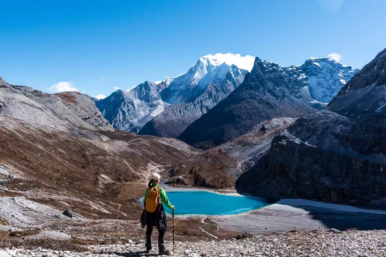
If you feel that you are in good physical condition and have adapted well to the altitude, you can go to Pearl Lake first to enjoy the beautiful scenery of lakes and mountains. The round trip hike from Chonggu Temple to Pearl Lake is about 2.5 kilometers and usually takes about 2 hours.
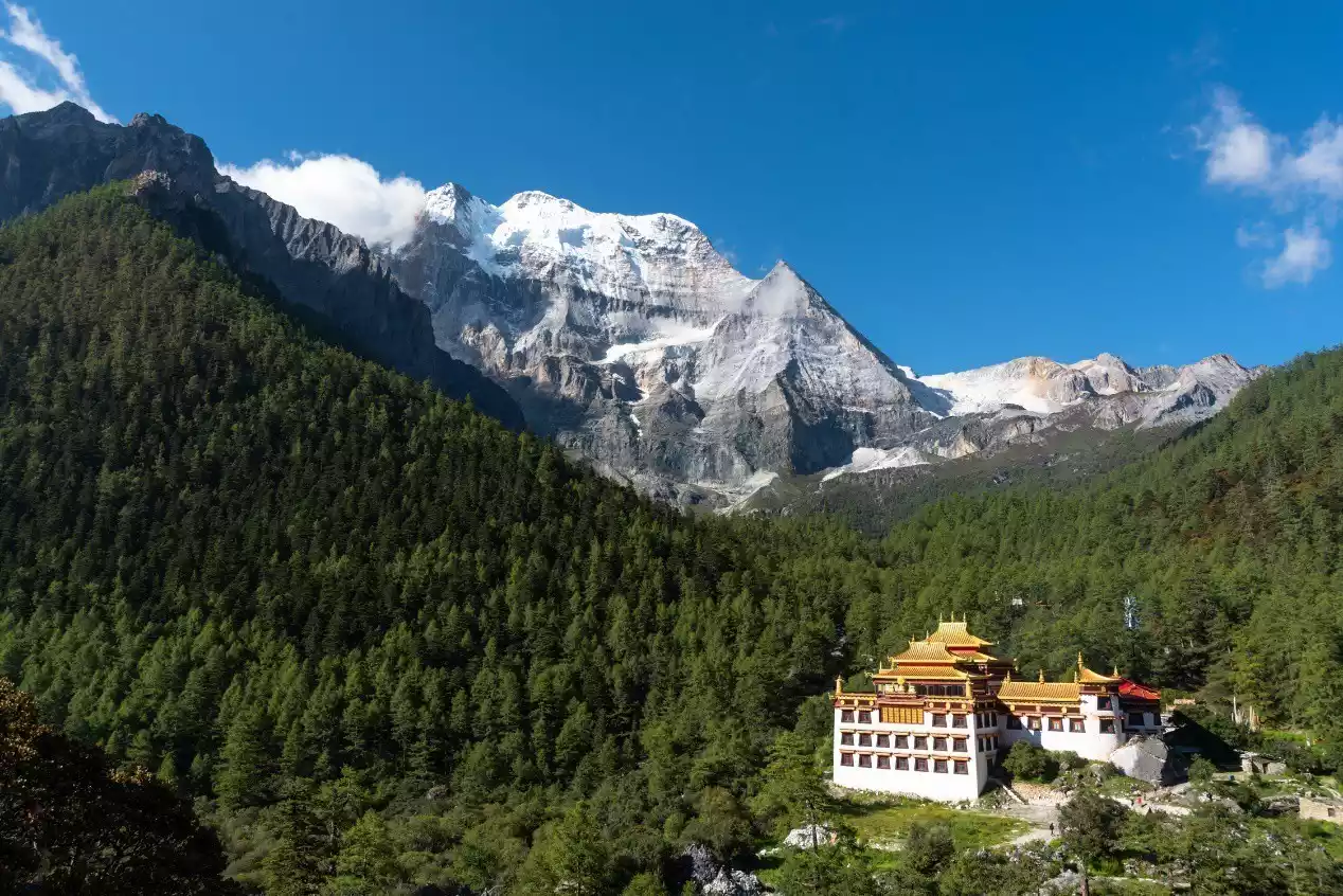
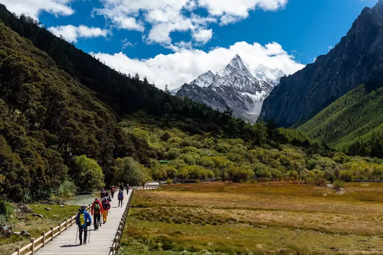
After getting off the scenic area sightseeing bus, you need to walk to Chonggu Temple first, then walk a few hundred meters along the wooden plank road, and then turn left into the woods next to the road where the electric car is running. This is the real starting point of our hiking trip.
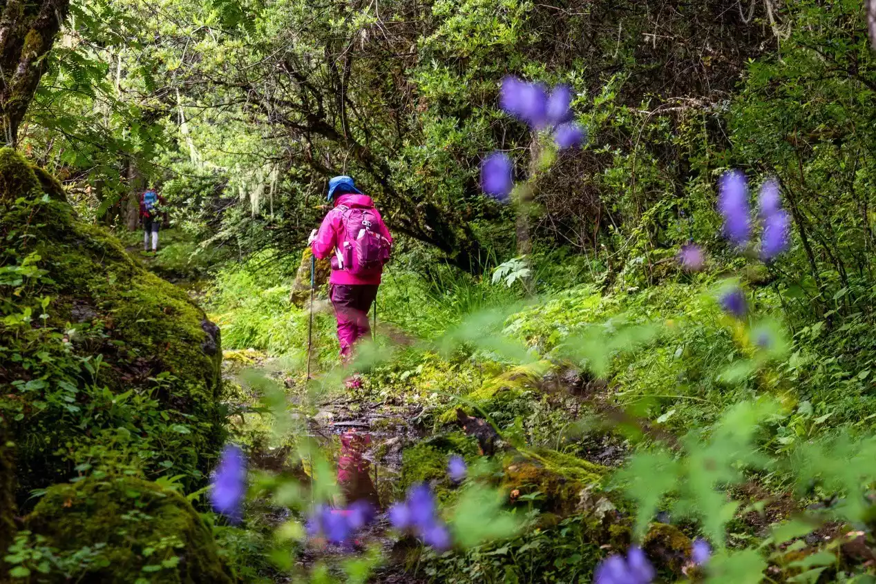
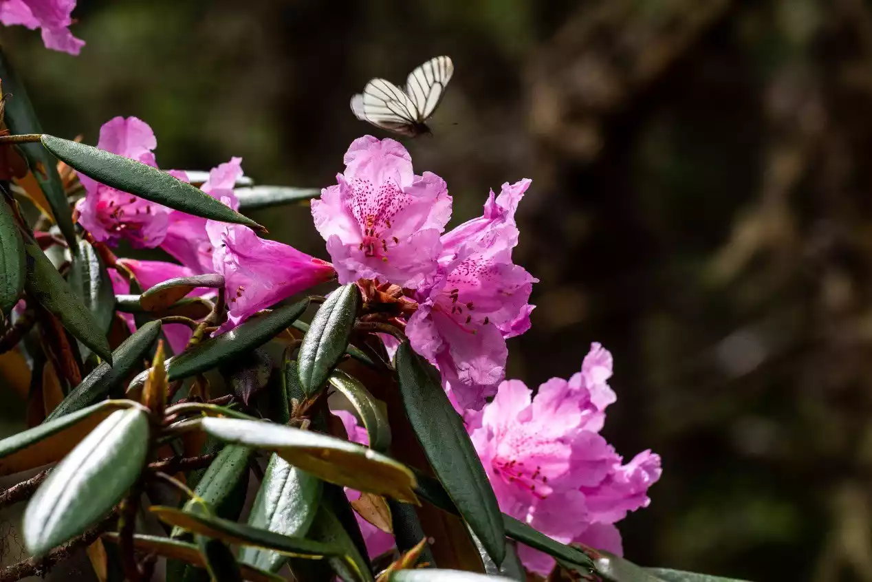
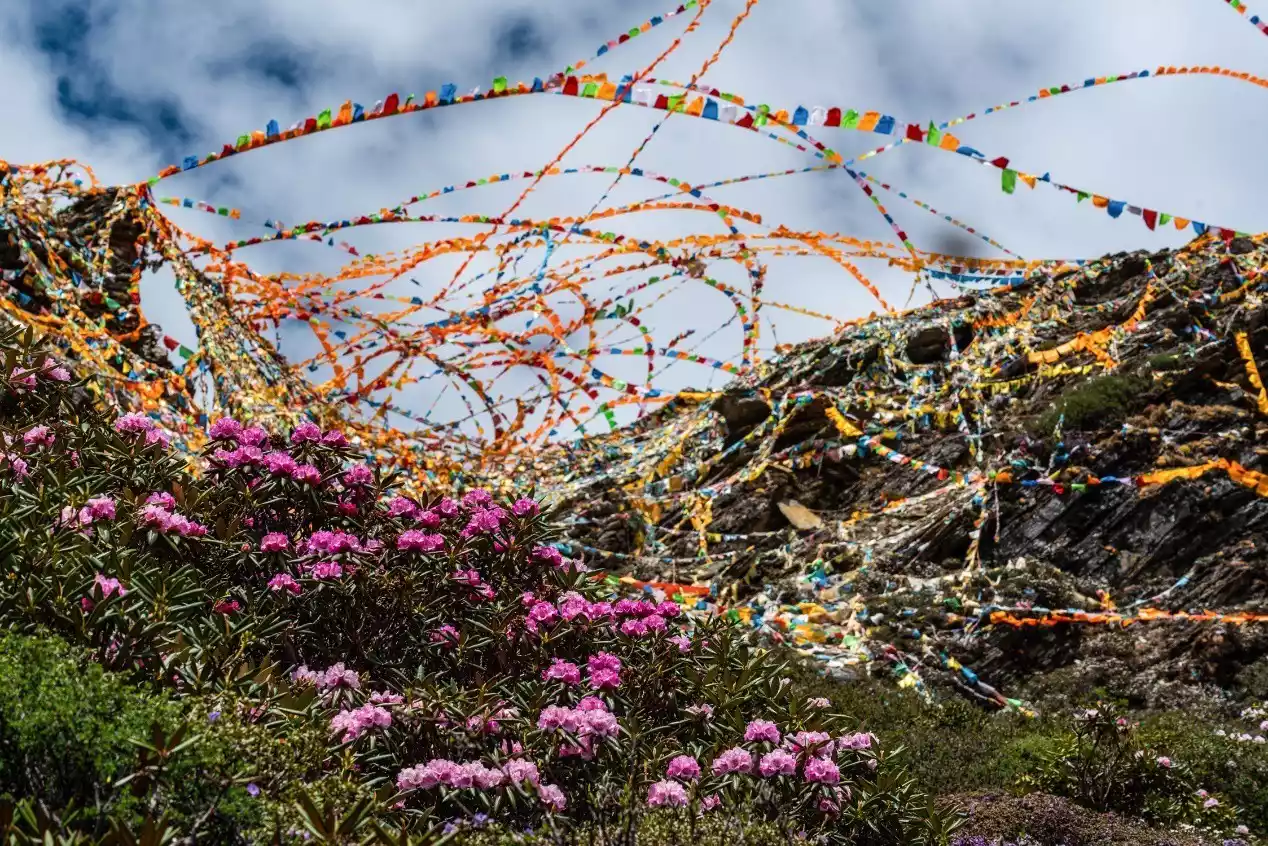
The first half of the day's hike is through pristine jungle, dominated by tall cycads and coniferous trees, including numerous alpine rhododendrons reaching three or four meters tall. This section is in full bloom from late May to early June, and by late October, the forests are a brilliant golden hue.
Coming out of the jungle, you will see low shrubs and alpine meadows with a wide view. You can see the rocky peaks of Xiannuoduoji and Xiannairi. When you are near the Bayu camp, you can also appreciate the beautiful peak shape of Yangmaiyong.
Bayu Camp is located on a high mountain pasture beside a stream. Flowers bloom in the summer. If your physical fitness allows, you can go to the south side to admire the canyon where Luolong Ranch is located and the Yangmaiyong statue sitting at the end of the canyon like a god.
(Xiannairi and Chonggu Temple)
(Pearl Sea and Xiannai Ri)
(Wooden plank road and Xianuoduoji at the starting point of the hike)
(Through the primitive jungle)
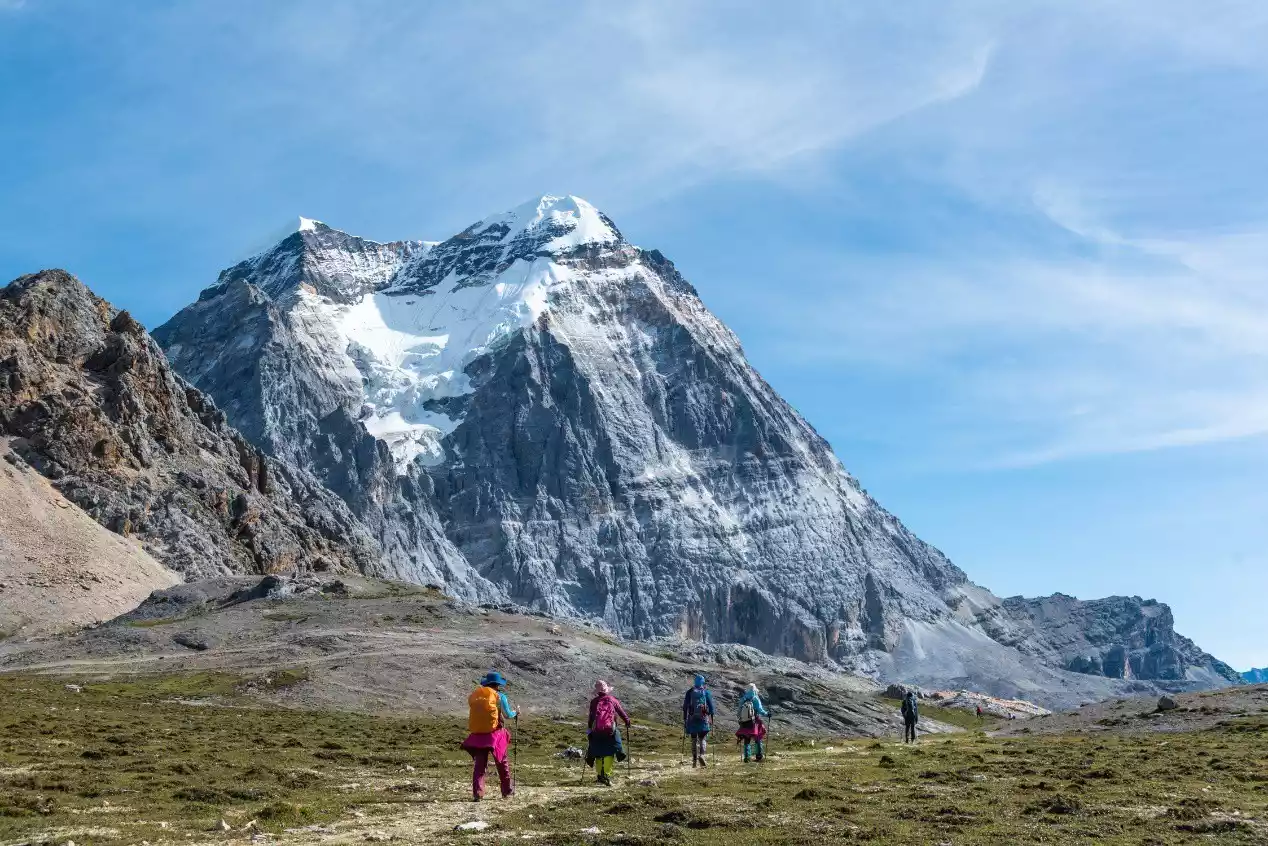
(Hikers and Shanuo Dorje)
Hikers in the bush, with Yangmaiyong (left) and Xiannairi in the background.
(Hikers and Yangmaiyong)
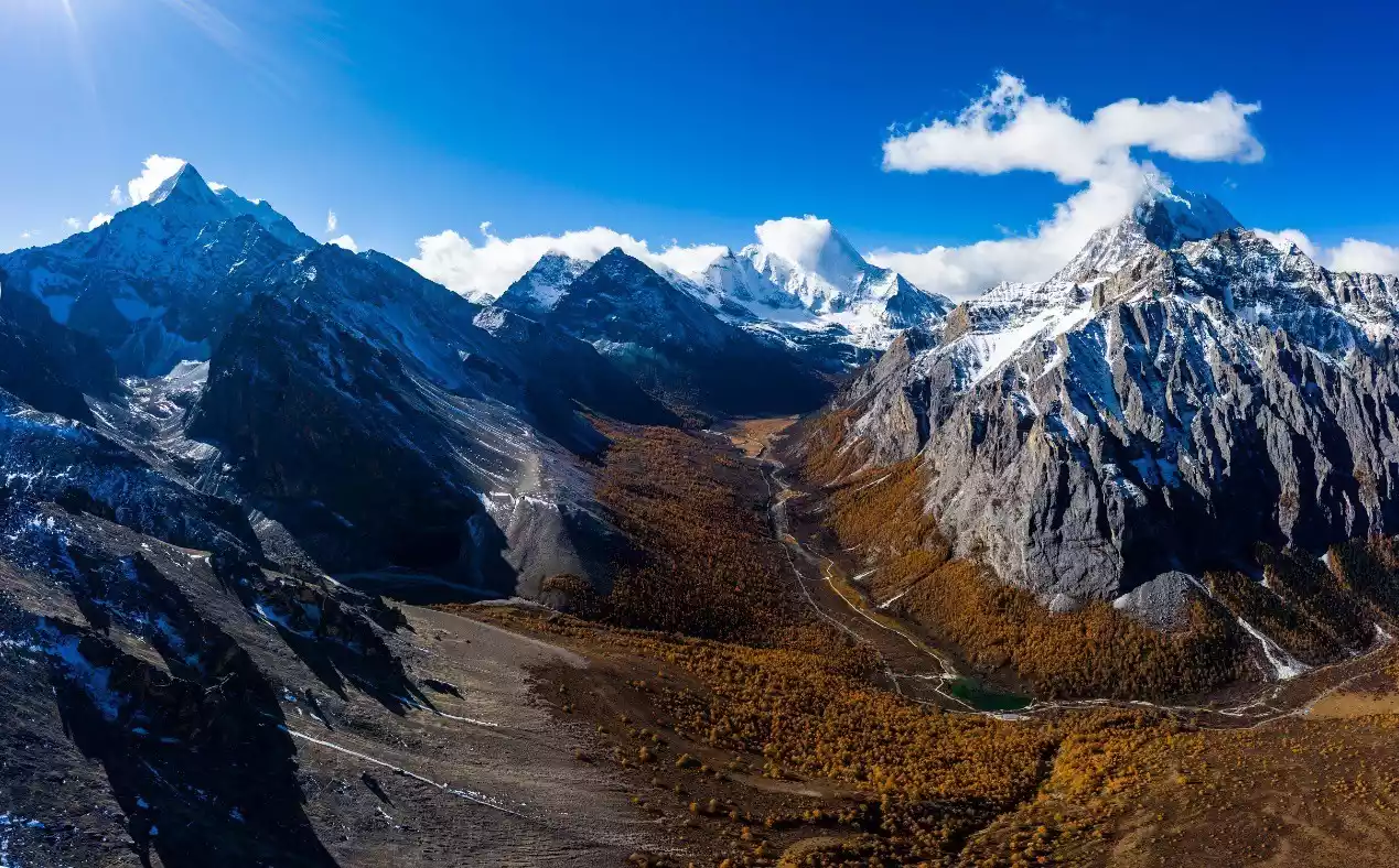
(The colorful forest and the Three Sacred Mountains at the end of October, from left to right: Xianuoduoji, Yangmaiyong, and Xiannairi)
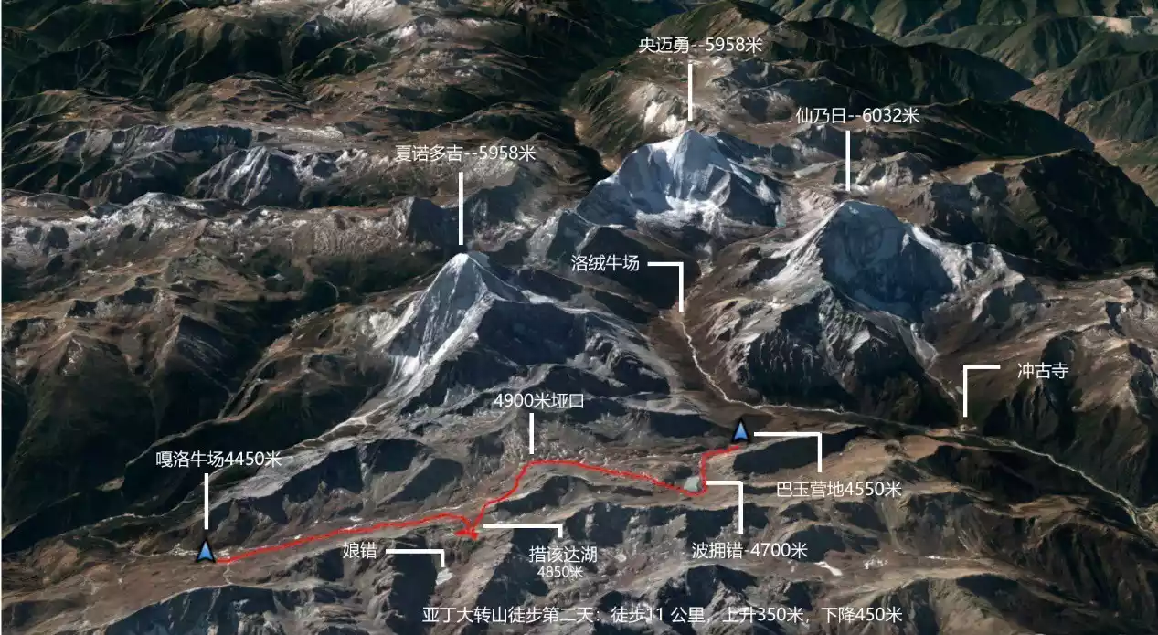
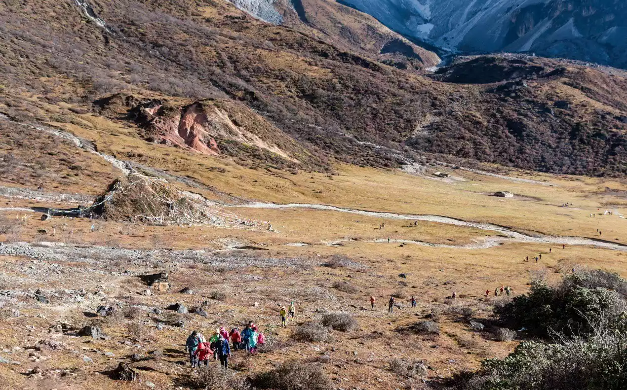
Day 2 Bayu Camp - Poyong Co - 4900 Pass - Cogaida Lake - Garuo Cattle Farm
Hiking: 11 km, 350 m ascent, 450 m descent
Campsite: Galuo Ranch, 4450 meters above sea level
Alternative campsites: Chagong Cattle Farm (4450 meters above sea level), Gongga Zhaze Cattle Farm (4100 meters above sea level)
The distance from Bayu Camp to Boyong Co is approximately 1.5 kilometers, with a 250-meter elevation gain. The high altitude makes the hike quite demanding, which was one of the reasons we decided to camp at Bayu Camp on our first night. Of course, there are trade-offs. Camping at Boyong Co allows for sunrise shots of the golden mountains of Xiannairi and Yangmaiyong. Mornings are also generally windless, and the water is calm, offering more opportunities for capturing reflections. Of course, all this assumes you don't suffer from altitude sickness; otherwise, you'll not only be unable to capture any photos, but also face the pain and risks that come with it.
Photography enthusiasts might consider spending a day at Boyong Co, as the hillside near Boyong Co offers the best vantage points for photographing the Three Sacred Mountains of Aden. However, climbing from the lakeside to the nearby hillside is necessary, and the rocks near Boyong Co are very steep and dangerous. Part of the route is steep and broken gravel slopes, with a high risk of rockfall and slips. This requires a certain level of physical fitness and skill.
On the second day of the hike, the effects of high altitude on hikers will generally be alleviated to varying degrees. Since the intensity of today is not high, you can reserve one to two hours to play and take photos by the Boyongcuo Lake. This is also one of the most beautiful places in the Yading Grand Pilgrimage.
Another route from Chonggu Temple to Boyongcuo involves crossing the 4,950-meter Xinze Pass. This is more demanding and challenging than the route through Bayu Camp. The ridgeline near the pass offers a perfect vantage point for framing the three sacred mountains of Yading. However, the climb from the pass to the ridgeline is a steep, gravelly slope with an inclination of over 60 degrees, making it both risky and challenging. If you have more time, we recommend camping at Boyongcuo from Bayu Camp for one night and then hiking to the site the next day for photography.
From the east side of Boyong Co, we climbed to a high mountain pasture and then crossed the 4900 Pass. Although the climb from Boyong Co to the high mountain pasture is less than 500 meters, it is quite steep and it would be a bit strenuous for those with poor physical fitness.
Although the 4900-kilometer pass is the highest on the entire route, it's not difficult to reach due to its gentle slope. The pass is easy to spot, featuring Tibetan-made Mani piles. After crossing the pass, it's a 5-kilometer descent to reach the Garuo Ranch.
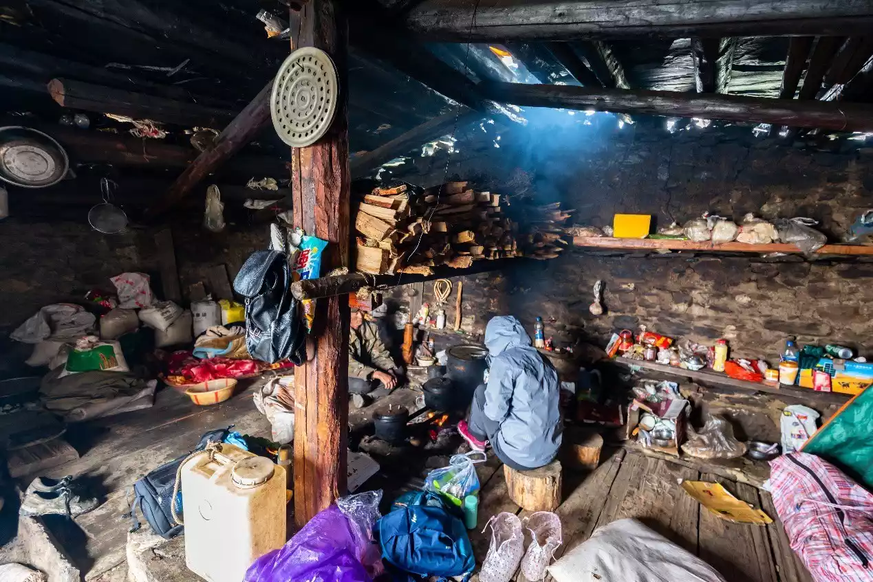
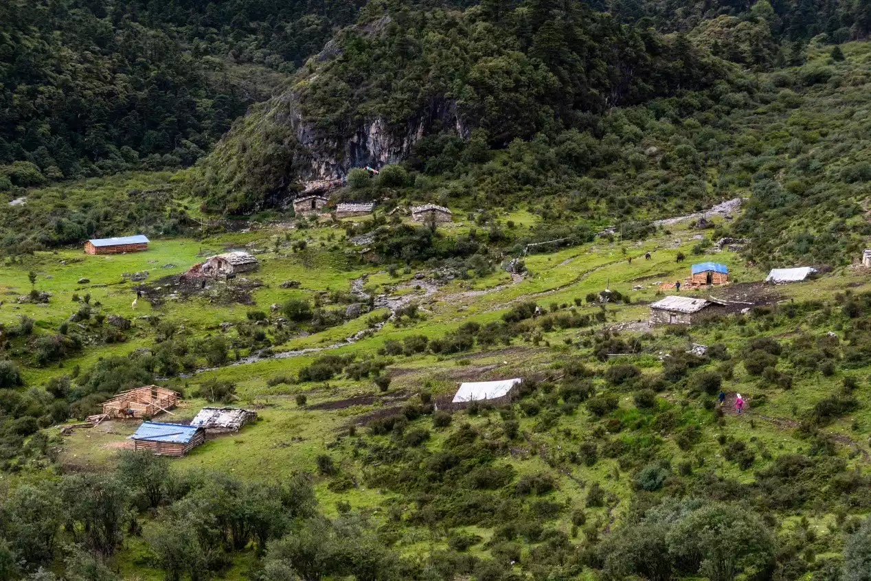
Garo Cattle Farm is a gathering place for cattle sheds built by Garo villagers with stones. There are twenty or thirty stone houses. During the Cordyceps season from April to June every year, the cattle farm becomes a temporary shelter for dozens of Tibetans. Only a few herdsmen live here at other times. During the ice and snow season from the end of October to March, no one lives here.
About 2 kilometers northeast of the 4900 Pass, there are three small lakes worth a detour. They are named Cuogada Lake (referring to the two smaller lakes) and Niang Co. Cuogada consists of two small lakes, one large and one small, and is closer. Niang Co is farther away and requires descending dozens of meters in altitude, so it is not recommended to go down to Niang Co. Instead, you can enjoy a good view from the hilltop near Cuogada.
The Garuo Ranch has ample water and offers accommodation in stone houses (for a fee). These houses also offer a fire, making them a great option if you encounter rain or snow during your hike. However, the Garuo Ranch itself doesn't offer a view of Mount Kailash, so the scenery is average.
There is a Chagong cattle farm about 1.5 kilometers away from the Garo cattle farm, where you can see the east wall of Xianuoduoji. However, since the water source is a stream more than 100 meters away and the water volume of the stream is small, it is only suitable for small teams with good physical fitness to stay there.
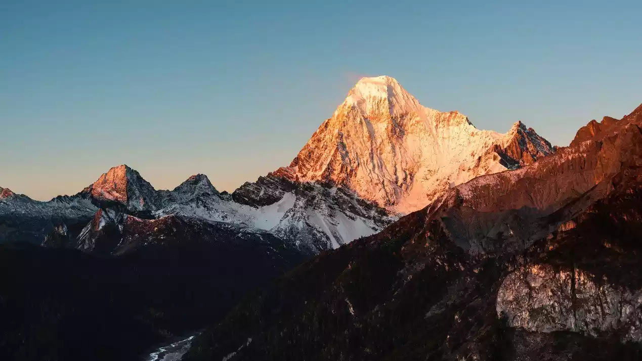
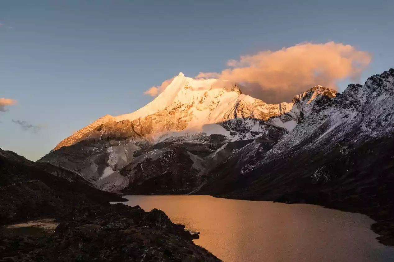
(Photo taken from Bayu Camp at Yangmaiyong Golden Mountain at sunrise)
(Photo taken on the hillside near Boyong Co)
(Hikers departing from Bayu Camp, with Xiannairi in the background)
(Yangmaiyong Mountain is reflected in Boyongcuo Lake at sunrise.)
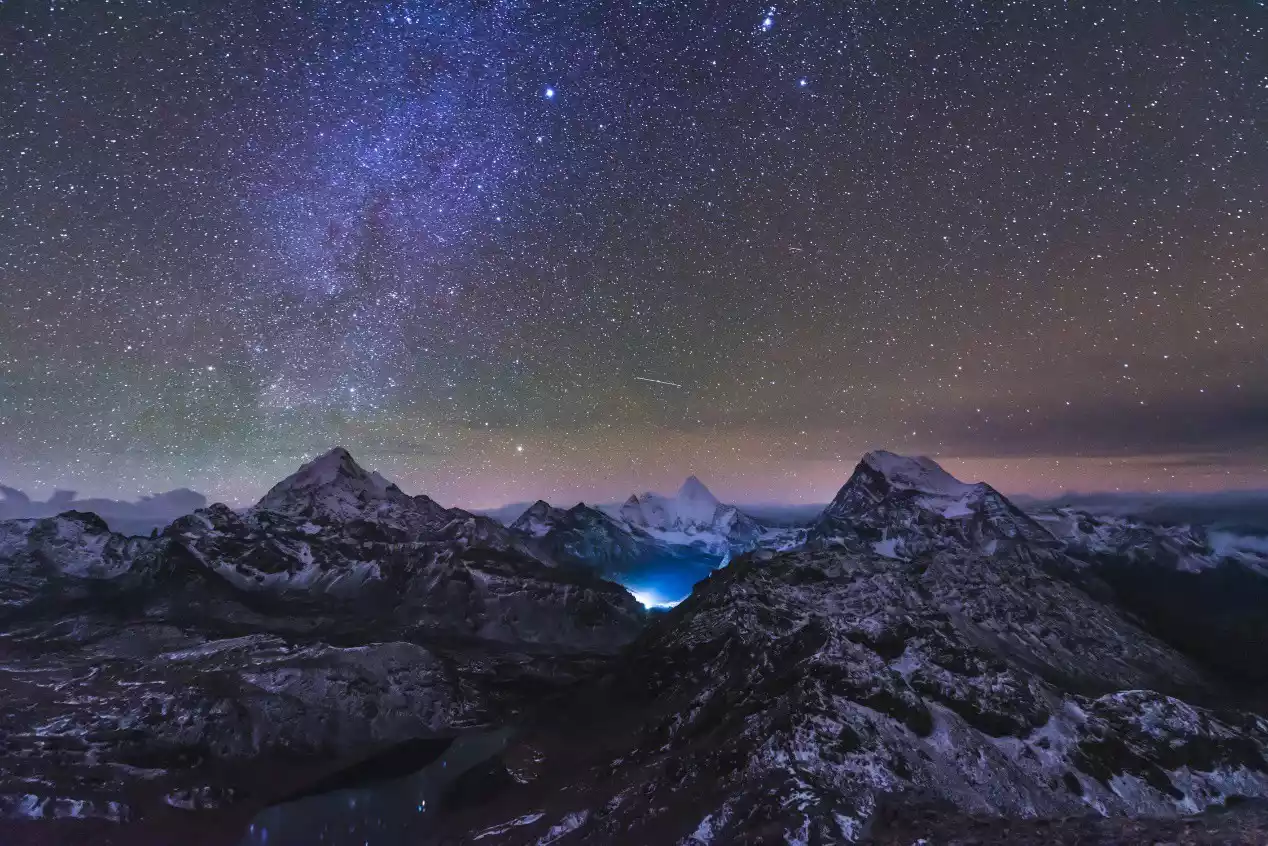
(The Three Sacred Mountains of Aden and Boyong Co under the night sky)
(The Three Sacred Mountains of Aden after sunrise, taken from the ridge near Xinze Pass)
Hikers on the shores of Boyongcuo Lake and the reflection of the Sun.
(Gentle uphill slope before the 4900 Pass)
(Hikers reach the 4900 pass)
(Hikers at Nyaung Tso Viewpoint)
(Azaleas in full bloom and columnar rock peaks near Garuo Cattle Farm)
(Galuo Cattle Farm)
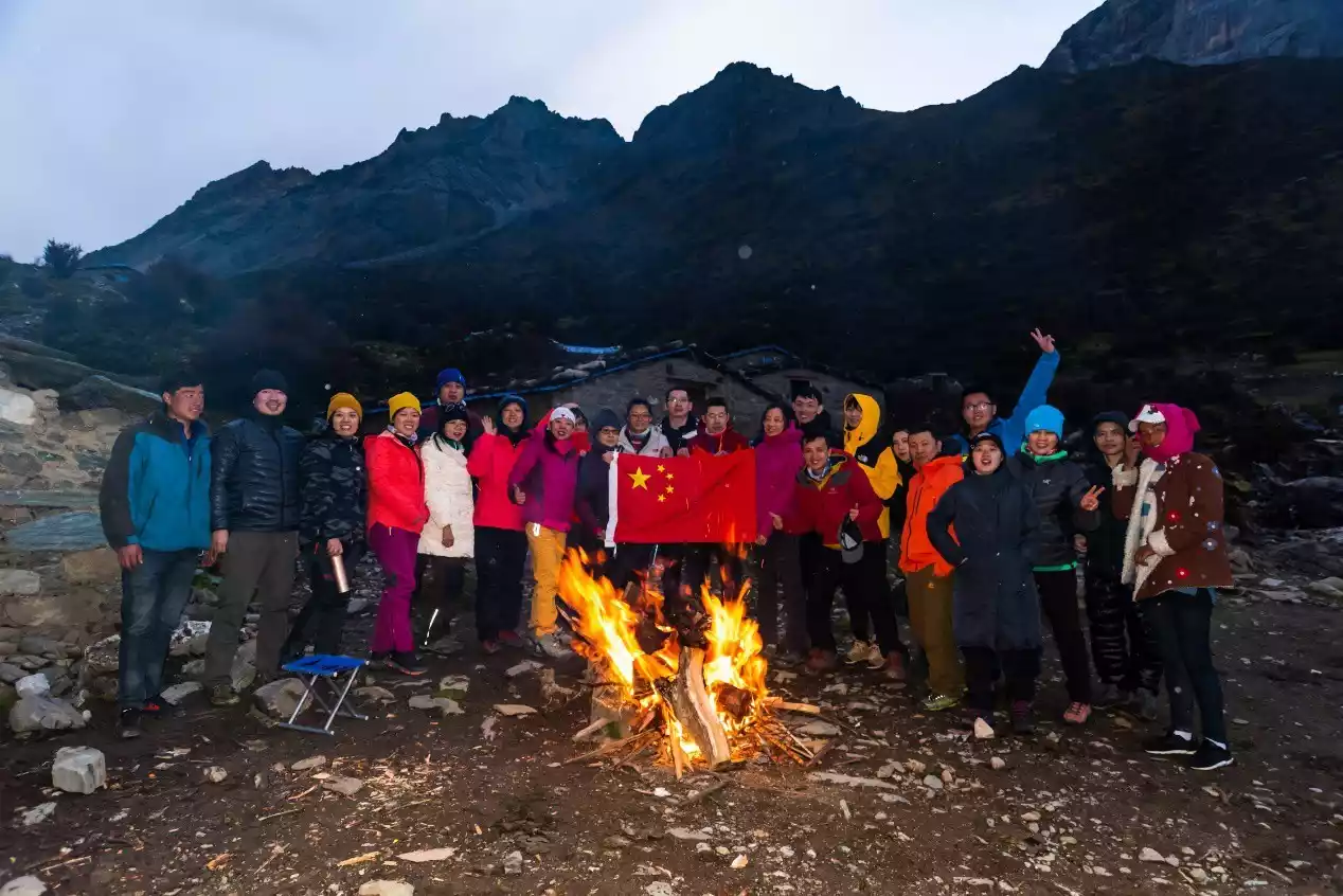
Hikers at the Galuo Cattle Farm during National Day 2019
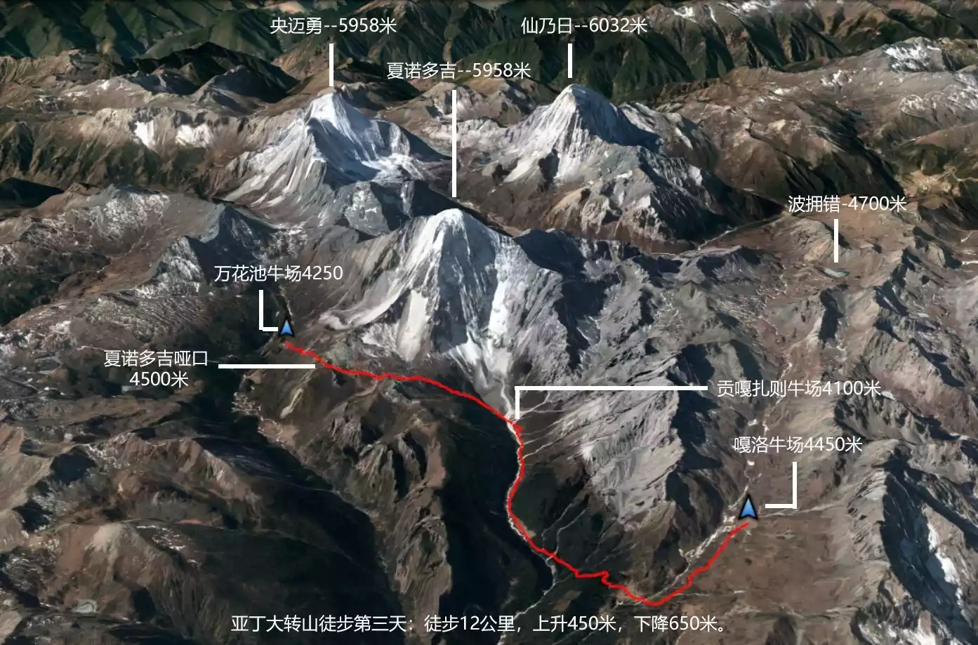
Day 3: Garuo Cattle Farm - Gongga Zhaze Cattle Farm - Xianuoduoji Yakou - Wanhuachi Cattle Farm
Hiking: 12 km, 450 m ascent, 650 m descent
Campsite: Wanhuachi Cattle Farm, 4250 meters above sea level
Alternative campsites:
The cattle shed below the Xianuoduoji Pass (4,400 meters above sea level) and the camp below the Zabala Pass (4,380 meters above sea level).
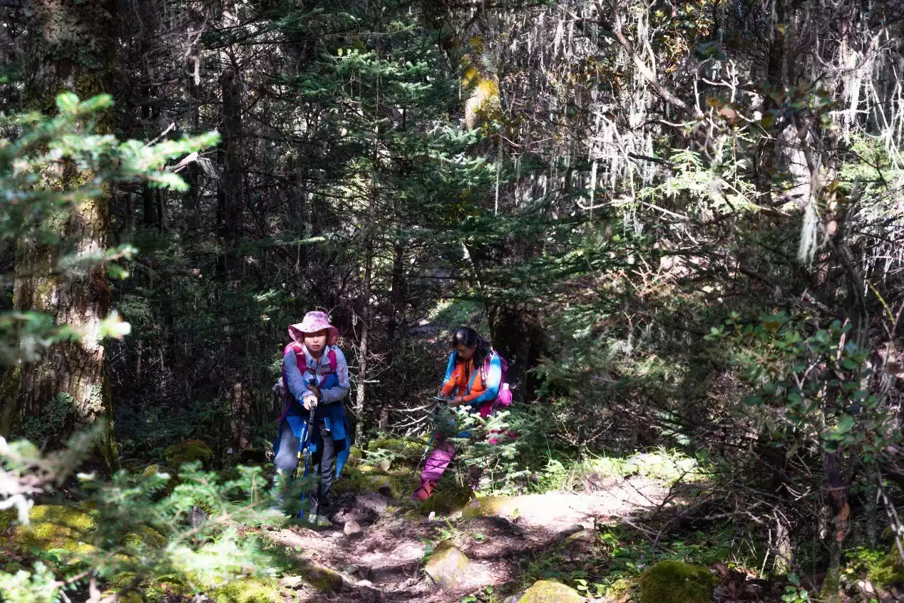
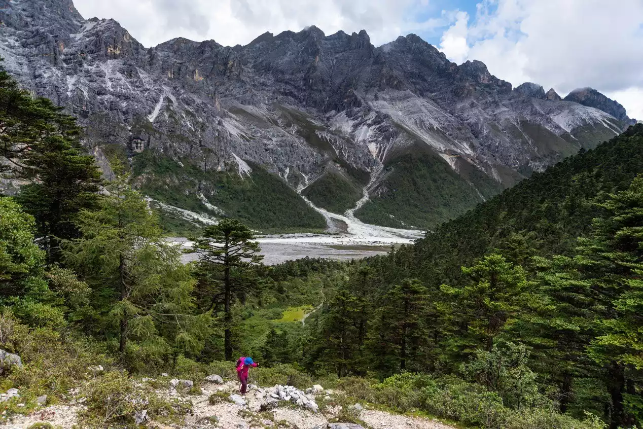
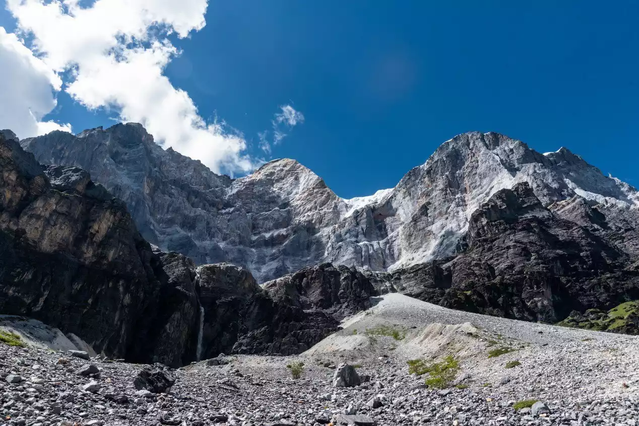
The entire trek from Garuo Ranch to Gongga Zhaze Ranch is downhill. The first two kilometers are a narrow mountain trail through alpine scrub, with numerous forks and easy mistakes. Furthermore, some sections of the trail are flooded by streams year-round, and during the rainy season, the currents are strong, adding to the difficulty and risk. After crossing a small bridge, we enter the primeval forest. The path generally descends through the forest, but there are brief climbs, requiring four water crossings. Around noon, we reach Gongga Zhaze Ranch at the foot of Xianuoduoji Mountain. This is also the source of the Baishui River, located at an altitude of approximately 4,100 meters.
If you camp at Boyongcuo on the first day, you can choose Gongga Zhaze Ranch as your second campsite. The scenery is five-star, especially at sunrise. The distance from Galuo Ranch to Gongga Zhaze Ranch is about 6.5 kilometers.
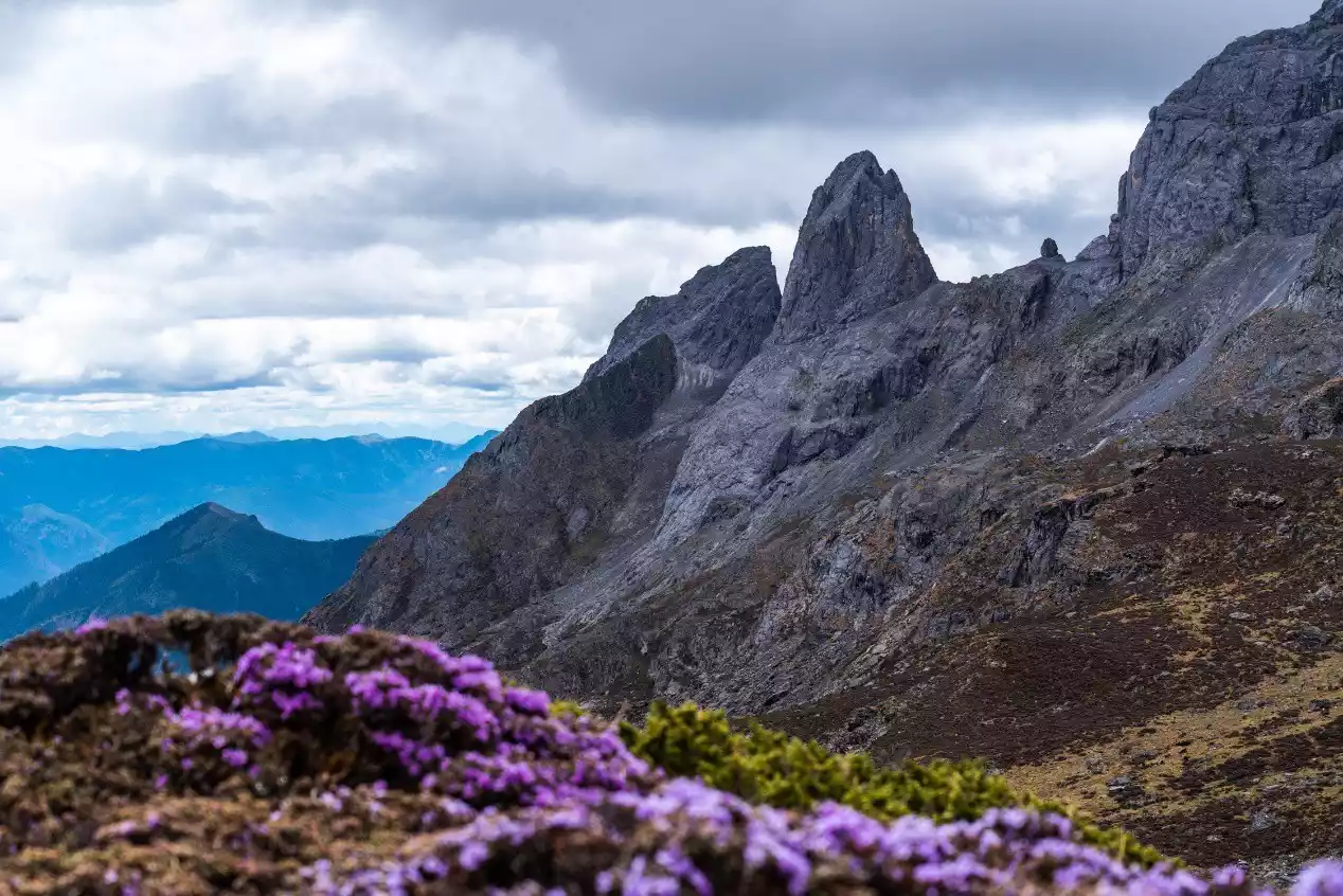
Gongga Zhaze Ranch is a comfortable spot for both camping and lunch. This is also the day's lowest point. From here, we continue our climb all the way to the 4,500-meter Xianuoduoji Pass (there are two false passes before the pass). This section of the hike is approximately 4 kilometers, with the first half steeply climbing through the jungle, but the path remains clear. This section of the trail is lined with alpine rhododendrons, which are a delight to behold during their blooming season in late May and early June.
Also, be aware of the fork in the road before the pass. There's a cattle shed to the left of the second false pass, where Tibetans sometimes stay. Be careful not to go downhill from the shed; the real pass is to the right of the false pass. You can still reach the Wanhuachi Cattle Farm by going downhill from the shed, but it's a longer journey and twice as physically demanding, so it's not worth it.
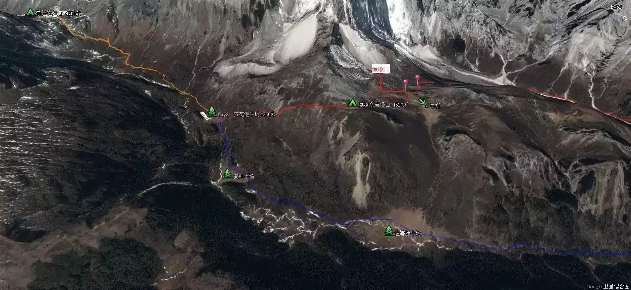
After crossing the Xianuoduoji Pass, you'll see the cattle ranch in the valley. Note the fork in the road. The path down takes you to the Wanhuachi Cattle Ranch, our campsite. The parallel path leads directly to the base of the Zabala Pass. If you choose the second route, you can also camp in the alpine meadows below the pass. However, compared to the convenient cattle sheds and warm campfires at the Wanhuachi Cattle Ranch, I think most people will choose it as their campsite.
Wanhuachi Cattle Farm is a shared campsite for the Yading Grand Pilgrimage and the traditional Rock Route. Due to the large number of groups hiking the Rock Route this year, especially in October, the campsite can accommodate hundreds of people.
The Wanhuachi Cowshed is located below the southern slope of Xianuoduoji, and you can enjoy the golden mountain at sunrise.
(Hikers resting at the Garuo Cattle Farm)
(Photo taken at the Chagong Cattle Farm, showing the sunrise at Xianuoduoji Mountain)
(Traveling through the lush primeval jungle)
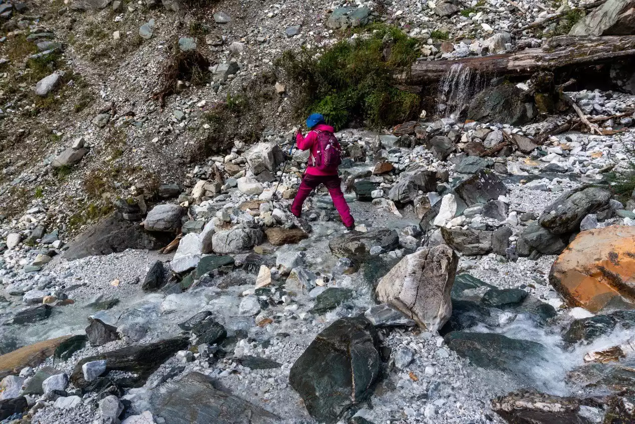
(Some sections of the road require caution during the rainy season)
(Hikers and Shanuo Dorje in the valley)
(Gongga Zhaze Cattle Farm at sunrise)
(In early June, azaleas bloomed on both sides of the mountain road)
(Hikers struggling to climb, with the northeast ridge of Shanuoduoji behind them)
(Hikers and the long northeast ridge of Shanuoduoji)
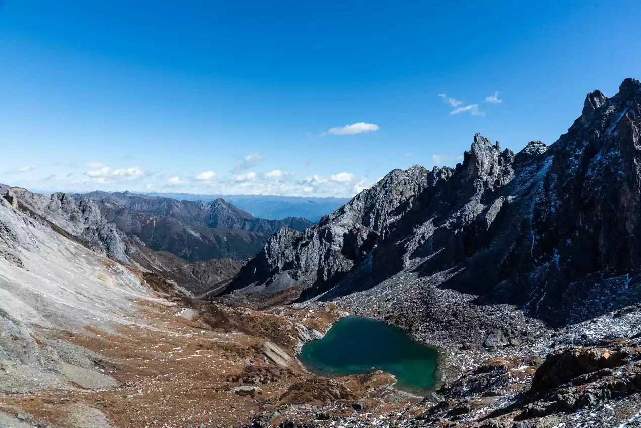
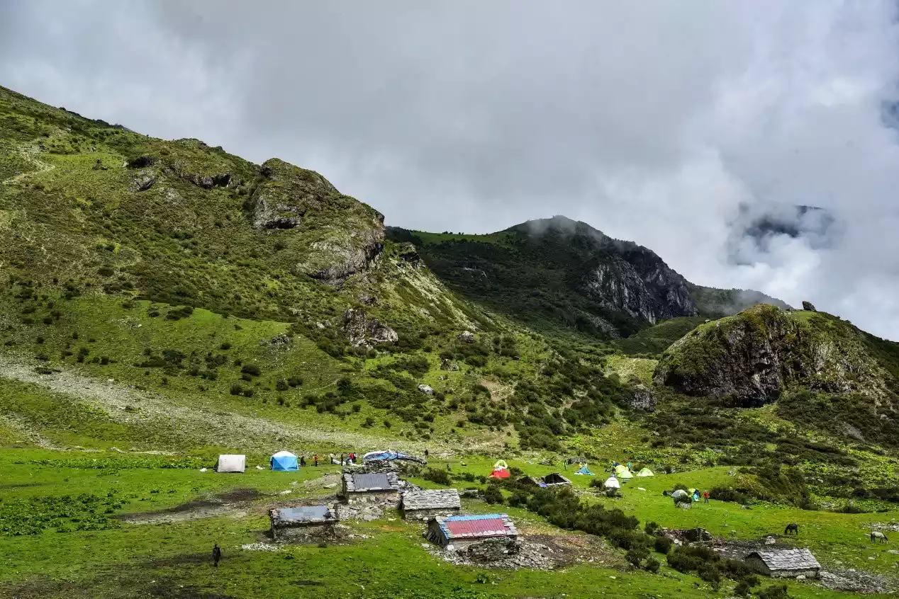
(Wanhuachi Cattle Farm)
Day 4: Wanhuachi Cattle Farm – Zabala Pass – Pagoda – 4400 Small Pass – Xinguo Cattle Farm
Hiking: 13 km, 750 m elevation gain and 750 m descent
Campsite: Xinguo Cattle Farm, 4250 meters above sea level
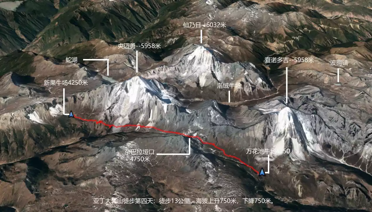
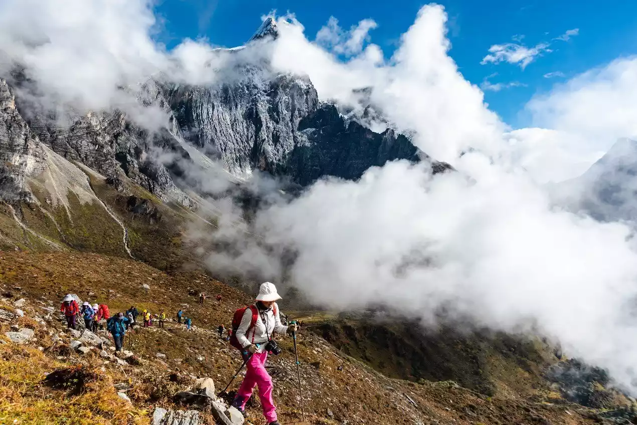
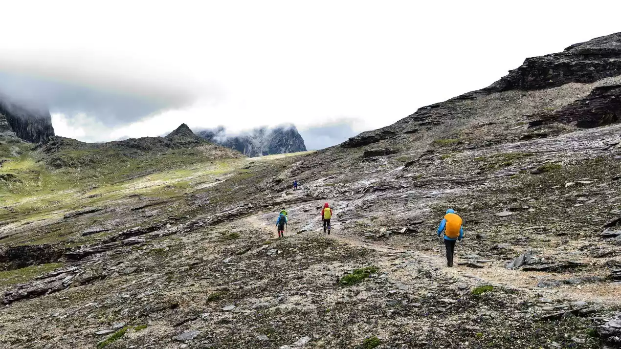
The section from Wanhuachi Ranch to Xinguo Ranch overlaps with the traditional Rock Trail. The most challenging part of the day lies at Zabala Pass, at an altitude of 4,750 meters. The route from Wanhuachi Ranch to Zabala Pass is approximately 5 kilometers. The first half is a shrubby mountain path, with streams and small pools during the rainy season, making it difficult for hikers. The second half offers a steep climb. The pass is also subject to frequent strong winds and low temperatures, along with unpredictable weather, which can easily lead to temporary hypothermia and exhaustion. Be sure to take protective clothing.
Zabala Pass is also an extension of the connection between the ridges of Xianuoduoji and Yangmaiyong. After crossing the pass, you will reach the south slope of Yangmaiyong.
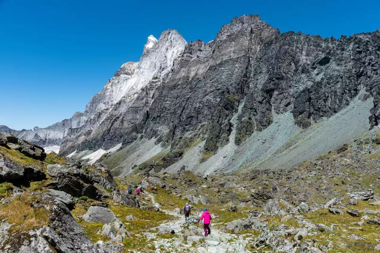
After crossing the pass, there's a relatively steep 1.5-kilometer descent, making it easy to stumble in rainy or snowy weather. Following this, there's a 1-kilometer stretch of alpine meadows, which is quite easy to walk and perfect for rest and recovery. Afterward, there are two sections of scree crossings. These sections represent the terminal moraine of the hanging glacier on the south side of Yangmaiyong Peak. The glacier has now melted and is no longer visible, leaving only a cascading waterfall and a several-meter-high terminal moraine. Due to the large number of hikers, the scree has become a well-defined path, making it relatively easy to navigate.
Between two sections of gravel, at the foot of the Yangmaiyong cliffs, lies a cave, a rest stop on the circumambulation route. Here, a beautifully decorated pagoda stands, beneath which Tibetans leave behind ornaments and clothing as a token of their reverence. Dr. Locke once met the leader of the bandit gang that governed the Aden region. With his permission, Dr. Locke was able to make two trips to Aden. (A third planned trip to Aden was prevented by the leader's interference.)
After passing the second gravel section, we began to climb over a small pass at 4,400 meters. Although this small pass is not long, it is very steep and is the last test of the day.
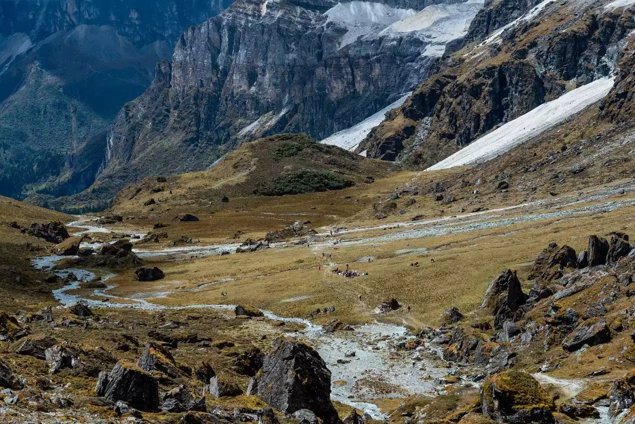
When you reach the pass, you can overlook the lush canyon (the canyon below is called Laowaxionggou) and then go downhill all the way to Xinguo Cattle Farm to set up camp.
Xinguo Ranch, located on the southern slope of Yangmaiyong, is a vast, flat alpine pasture divided into two sections, with a stream running through them. Rhododendrons bloom in May and June, and wildflowers abound in July and August. The steep southern slopes of Yangmaiyong stretch out with a long, sheer cliff face like a massive wall. However, the peak we saw at Xinguo Ranch was not the main peak of Yangmaiyong, but rather a ridge extending from it. The true summit of the main peak will be revealed during the following day's hike.
Warm reminder: Tibetans at Xinguo Cattle Farm collect camping fees all year round, ranging from 30 to 80 yuan.
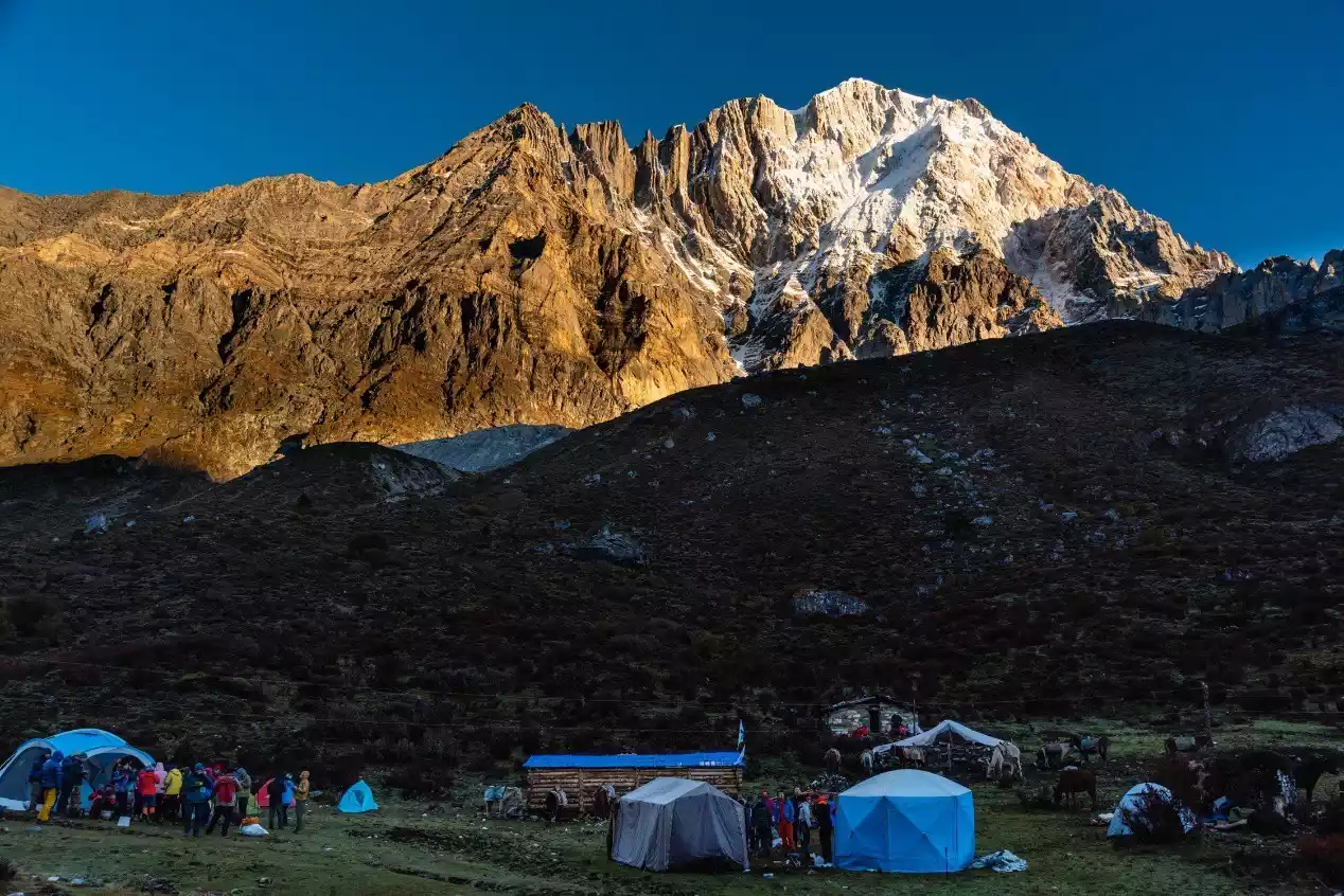
(Wanhuachi Niuchang and the south face of Xianuoduoji at sunrise)
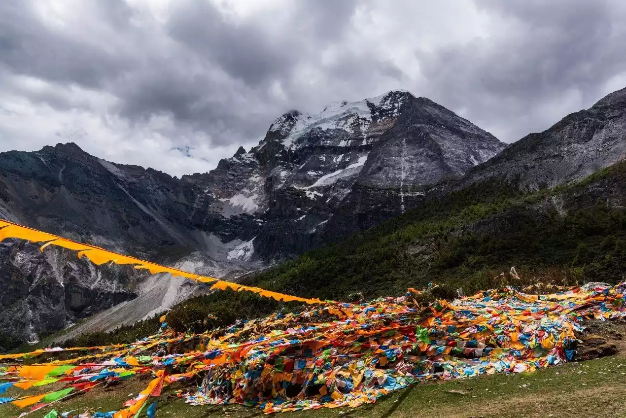
(On National Day in 2019, hundreds of hikers and horse transport teams gathered at Zabala Pass)
(Hikers are about to reach Zabala Pass)
(Hikers take a photo at Zabala Pass, with Xianuoduoji in the background)
(After crossing the Zabala Pass, you will arrive at the southeast slope of Yangmaiyong Mountain. The top of the mountain in front is Yangmaiyong Weifeng.)
(Yangmaiyong southeast slope valley, pay attention to the hikers resting in the valley)
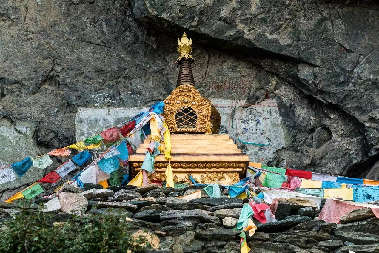
(The pagoda on the southeast slope of Yangmaiyong)
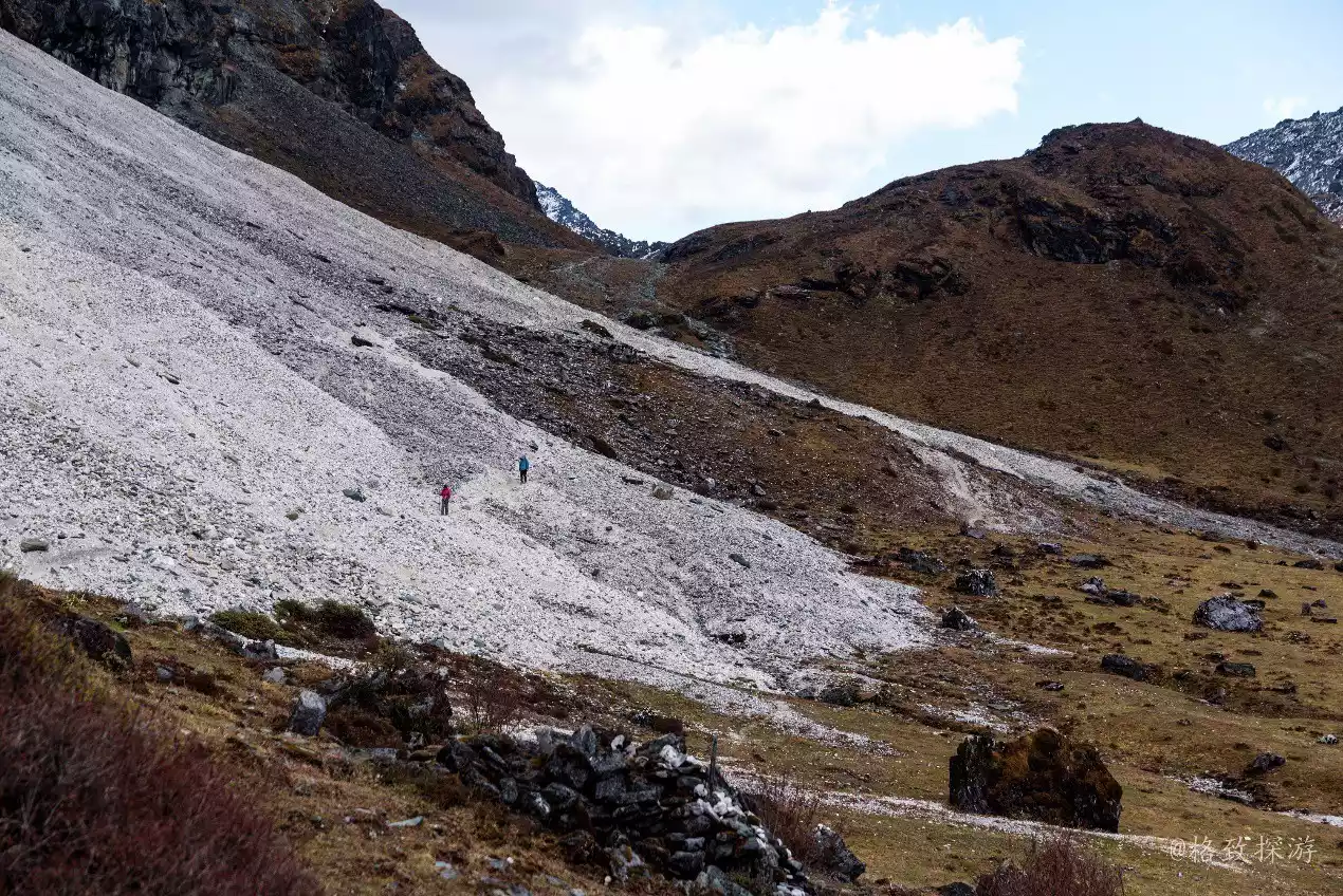
(Gravel slope formed by the terminal moraine of the glacier)
(Southeast of Yangmaiyong)
(Laowaxiong Valley on the southern slope of Yangmaiyong)
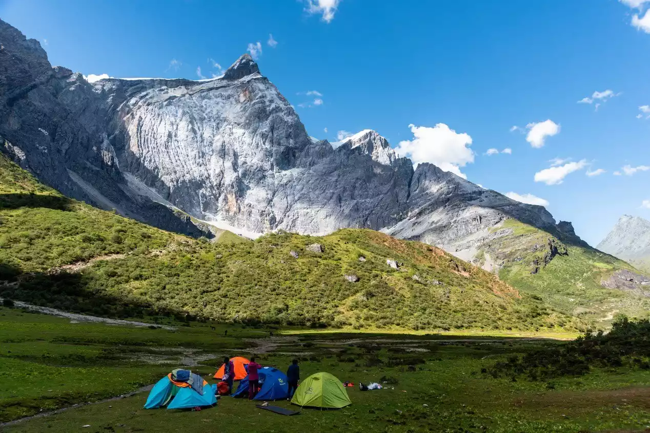
(Hikers camped at Xinguo Cow Farm, with Yangmai Yongwei Peak in the background)
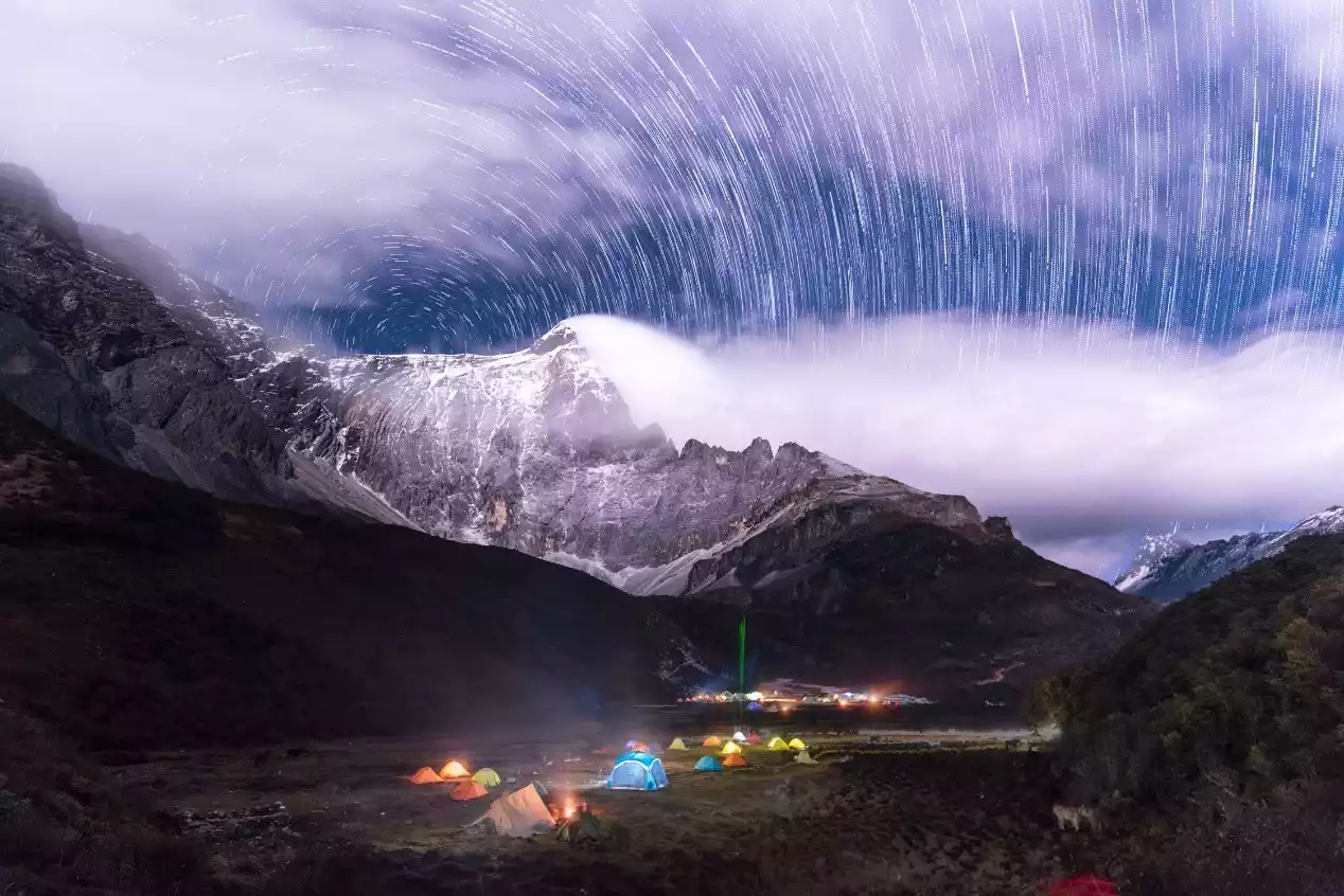
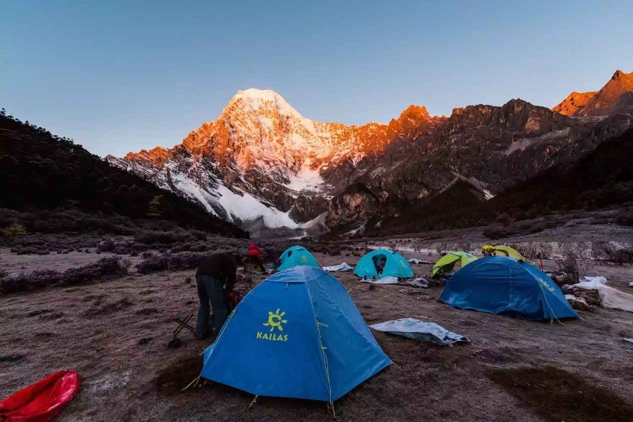
(Xinguo Cow Farm where many hikers camped and star trails)
Day 5: Xinguo Cattle Farm – Heihu Pass – Jiadu Cattle Farm – Shehu Pass – Shehu Camp
Hiking: 12 km, cumulative altitude increase of 750 meters, cumulative altitude decrease of 500 meters
Campsite: Snake Lake Camp, 4,500 meters above sea level
Alternative campsite: Jiaduniuchang (4550 meters above sea level)
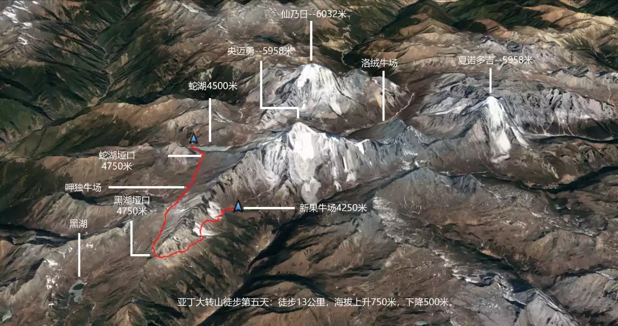
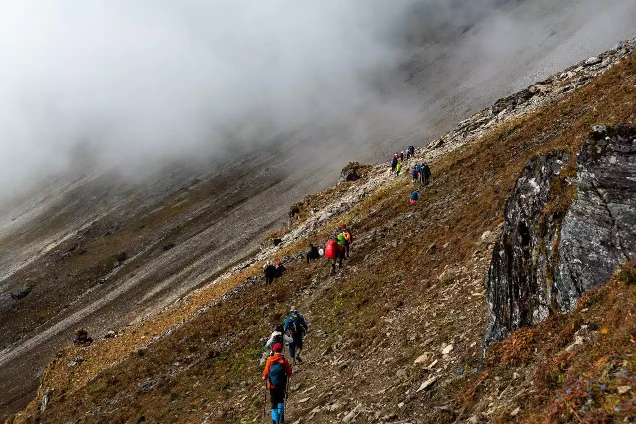
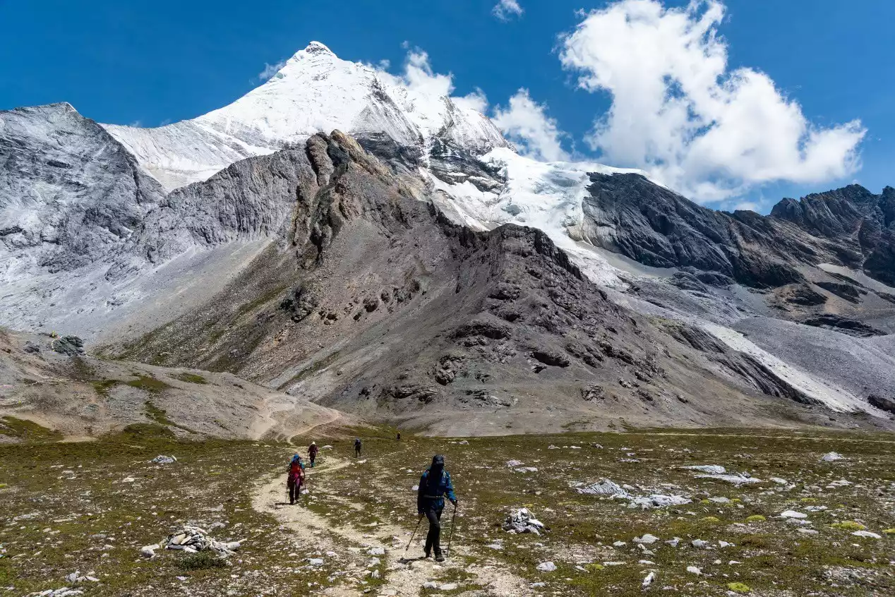
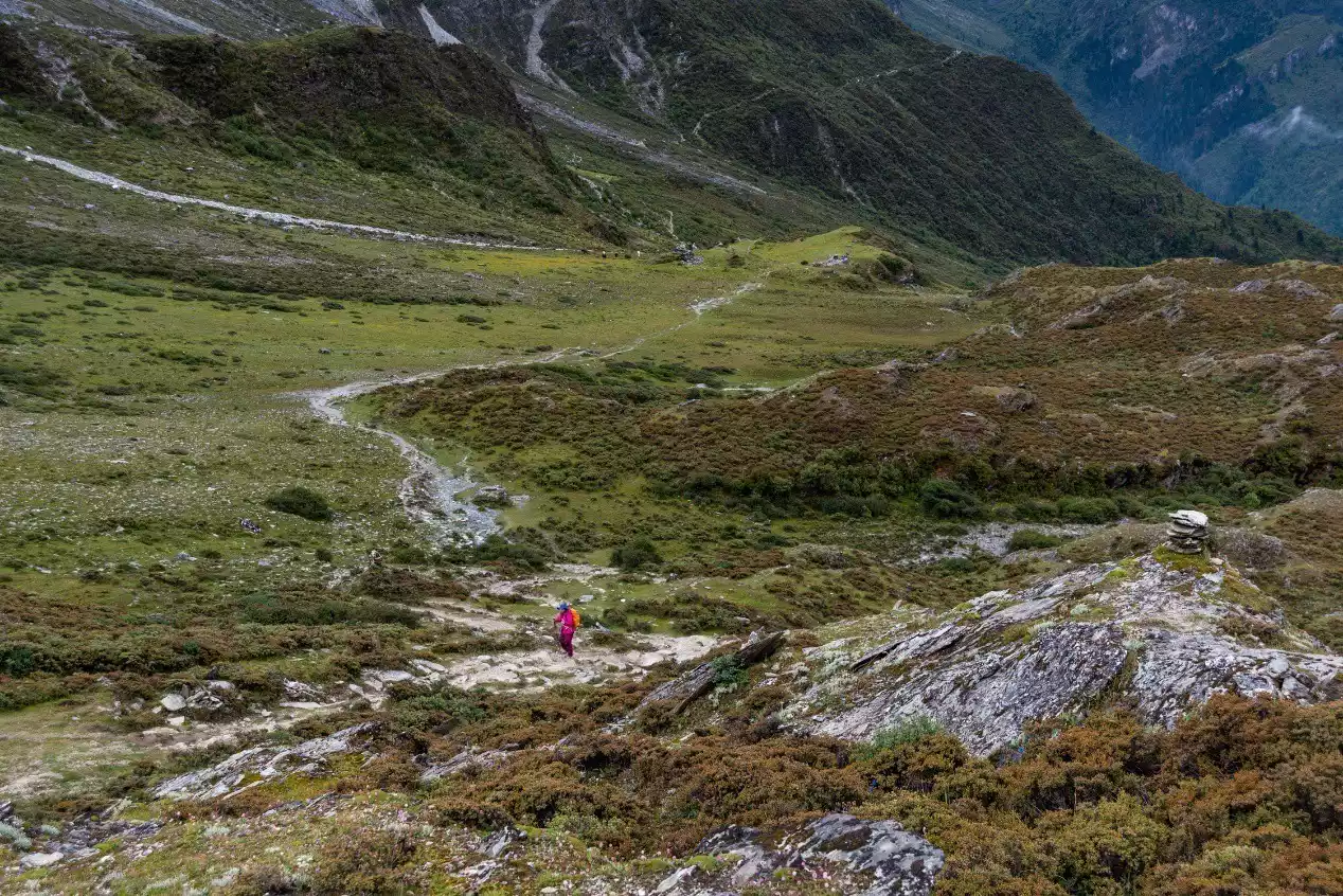
The sunrise at Xinguo Ranch is beautiful. After crossing the entire Xinguo Ranch, we will begin a long uphill climb. Today we will cross the most dangerous landslide area, so hikers with less physical fitness or experience are best accompanied by a guide.
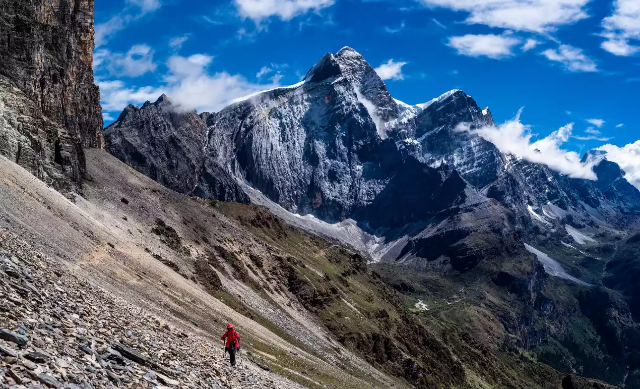
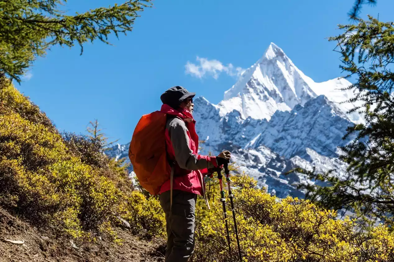
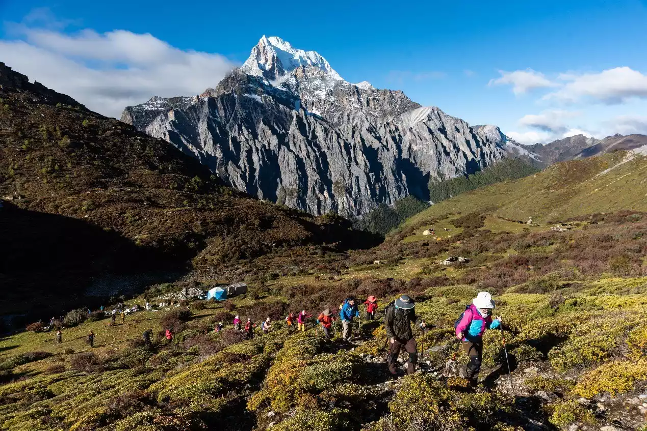
The 4.3-kilometer climb from Xinguo Niuchang to Heihu Pass is the most challenging part of the hike. However, by the fifth day, most hikers have acclimatized to the altitude and are recovering to varying degrees. This section is also perfect for taking scenic photos, with the majestic and handsome Yangmaiyong standing behind the hikers, like a divine warrior sent from heaven.
At the Black Lake Pass at 4,750 meters, the caravans and hikers will temporarily part ways. The pass the hikers are crossing is difficult for horses to pass, so they will need to take a longer detour to a more accessible pass. Black Lake Pass is named after the alpine lake 1.8 kilometers away. Due to its distance, few people venture to explore the lake.
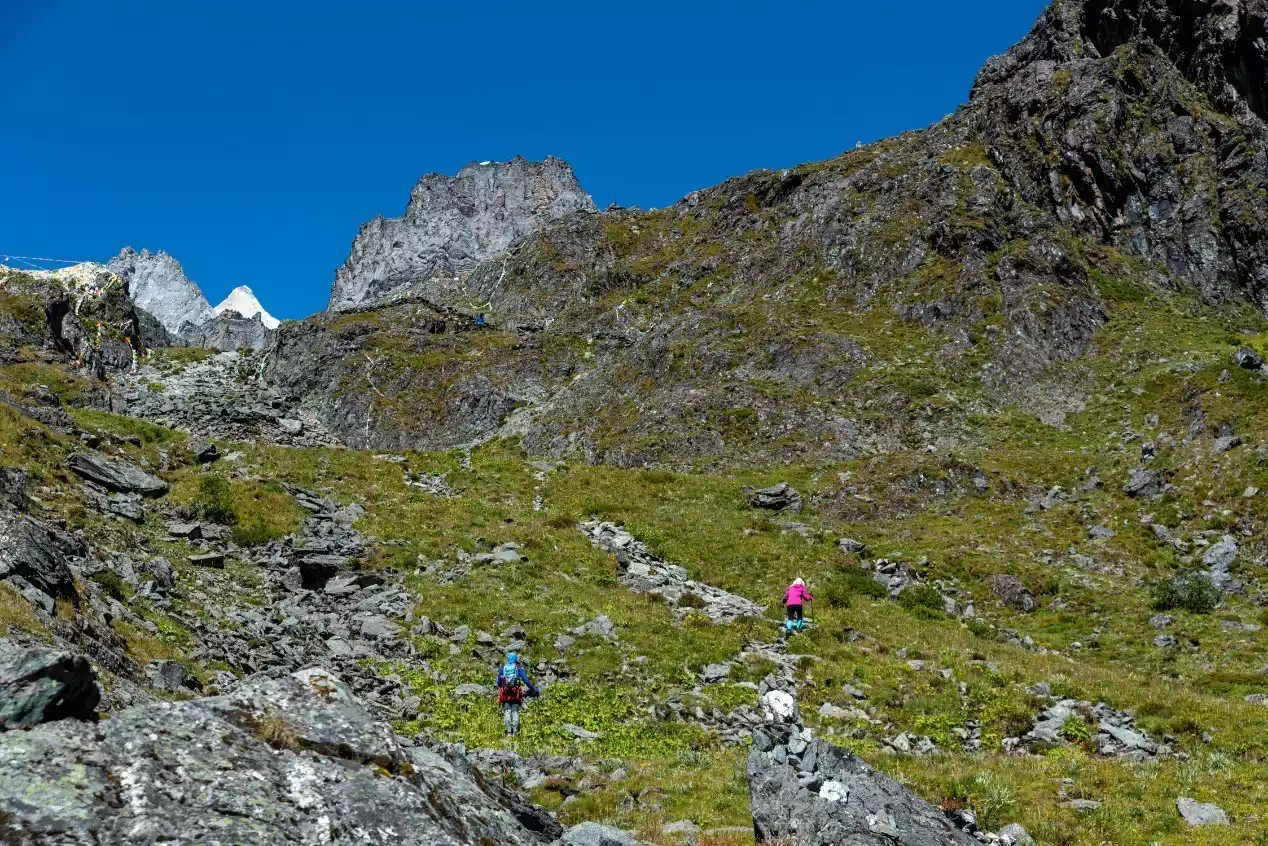
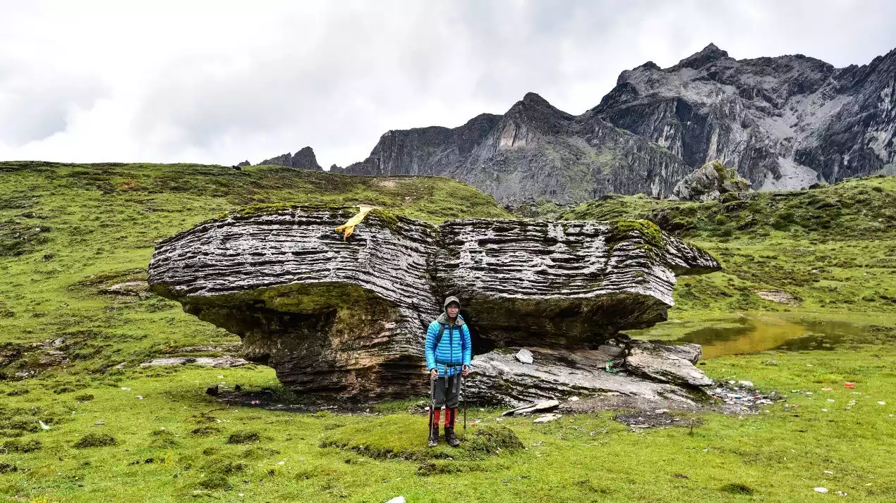
The path between Heihu Pass and Shehu Pass is relatively flat and easy to walk, with low risks. The Jiaduniu Farm in front of Shehu Pass is well-known for a uniquely shaped stone because Dr. Locke once took a photo in front of this stone.
Jiadu Ranch boasts lush grass and beautiful scenery, and a small lake nearby, making it a good backup campsite. Nearby are the stone houses of local herders, and before you, you can see the snow-capped peaks of Yangmaiyong and Xiannairi rising from behind the ridgeline.
The distance from Jiaduniuchang to Shehu Pass is not long and the slope is not steep. There are several Mani piles more than one meter high in front of the pass, which are very eye-catching.
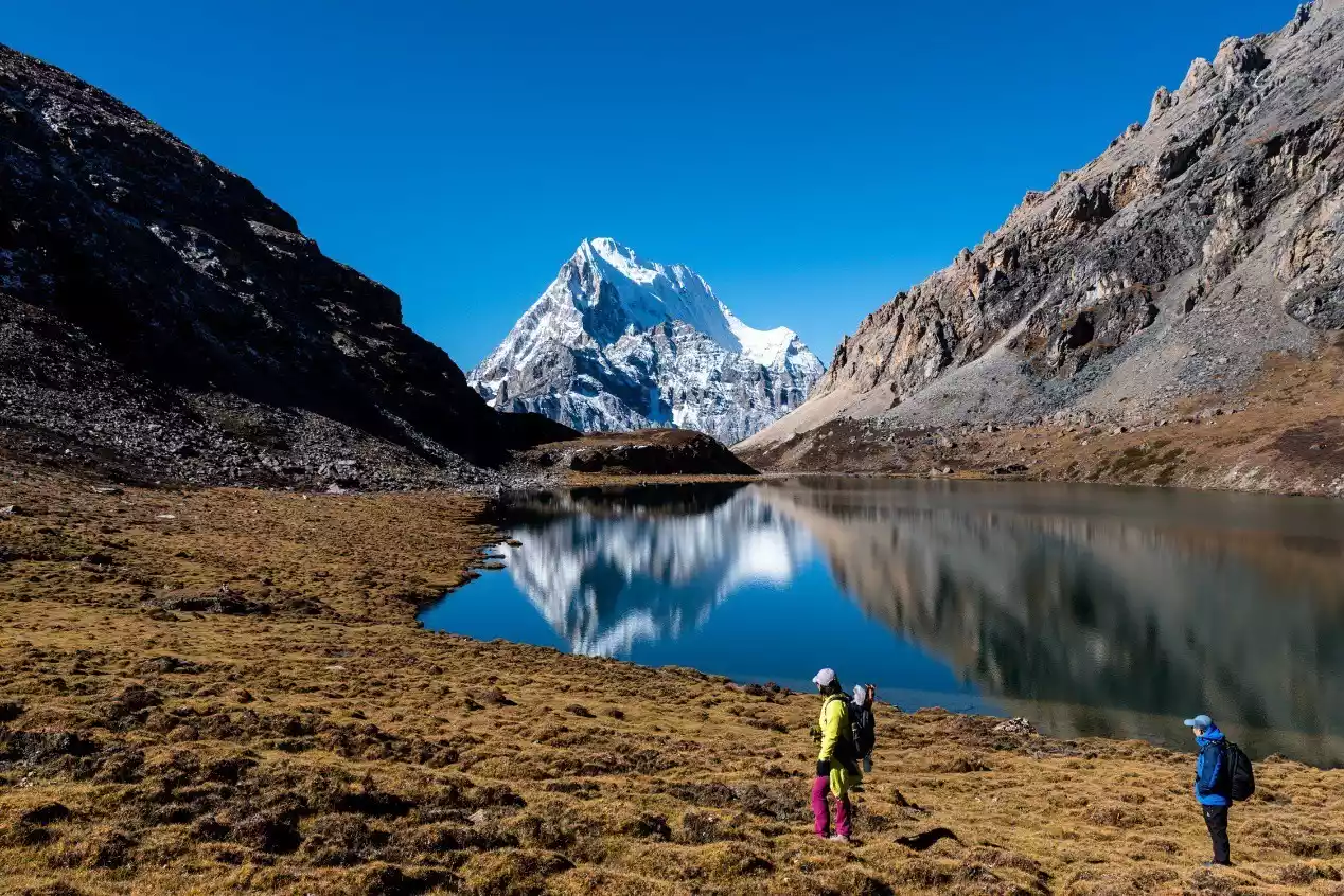
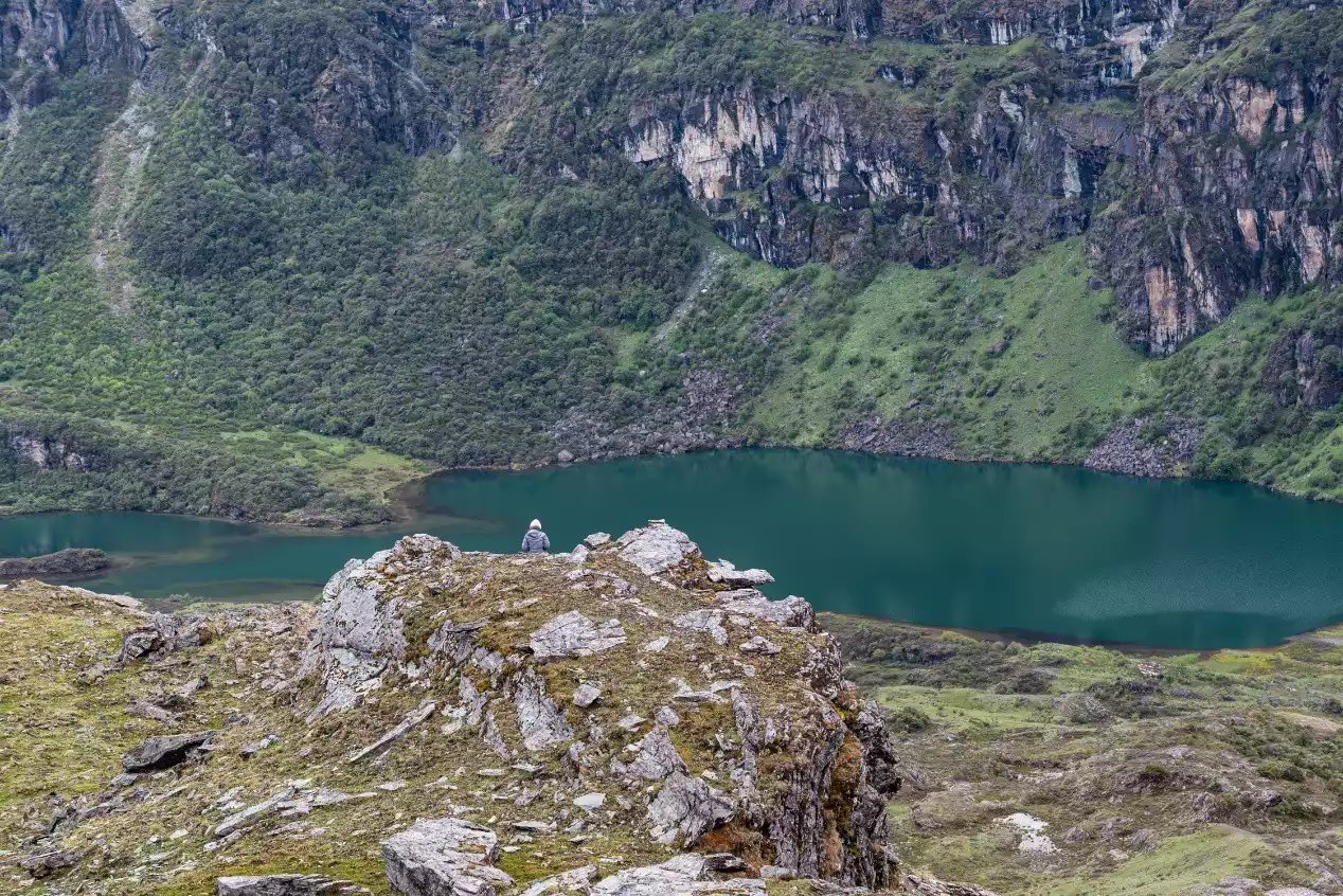
From the Shehu Pass at an altitude of 4,750 meters, walk a little over a hundred meters to overlook the emerald green Shehu Lake, with Xiannairi to the right and Yangmaiyong to the right. Shehu Lake is arguably the largest lake in the Yading area, a narrow, conical lake approximately 1.4 kilometers long from east to west. It is primarily fed by glacial meltwater from Yangmaiyong and rainfall.
Both ends of Snake Lake can be used as campsites. Since the east side is the water inlet and the west side is the outlet, the eastern end of Snake Lake is known as the Snake's Head and the western end as the Snake's Tail. Considering that the Yading Scenic Area is northeast of Snake Lake and the traditional Rock Trail generally exits the mountain from the scenic area, Rock Trail hikers tend to camp at the Snake's Head. There are several dilapidated stone houses here that can serve as shelter for caravans.
Personally, I prefer to camp at Shewei because it provides a better angle to appreciate Yangmaiyong and gives me a better chance to see the reflection of the snow-capped mountains.
Although the hiking route from Snake Lake Pass to the edge of Snake Lake is relatively obvious, it is very steep and difficult to walk. Hikers need to know in advance whether their team will camp at the head or tail of the snake lake, because the paths are different, so as to avoid taking the wrong path and wasting energy.
Tips: Whether you are the head or tail of a snake, local Tibetans will collect camp fees, ranging from 50 to 80 yuan.
(Hikers depart from Xinguo Cattle Farm)
(Hikers and Yangmaiyong)
(Hikers walking on a gravel slope with greater risks)
(Hikers and Yangmaiyong)
(Transportation caravan and Yangmaiyong)
(Hikers looking towards Black Lake)

(Photographing Xiannairi and Yangmaiyong (right) in the valley west of Yangmaiyong)
(The valley road on the west side of Yangmaiyong is flat and easy to travel)
(Hikers take photos at the Xiadu Niu Ranch, where Dr. Locke took photos a century ago)

(Photographing Xiannairi and Snake Lake at Snake Lake Pass)
(Photo taken at Shewei Camp, showing the reflection of Yangmaiyong in Snake Lake)
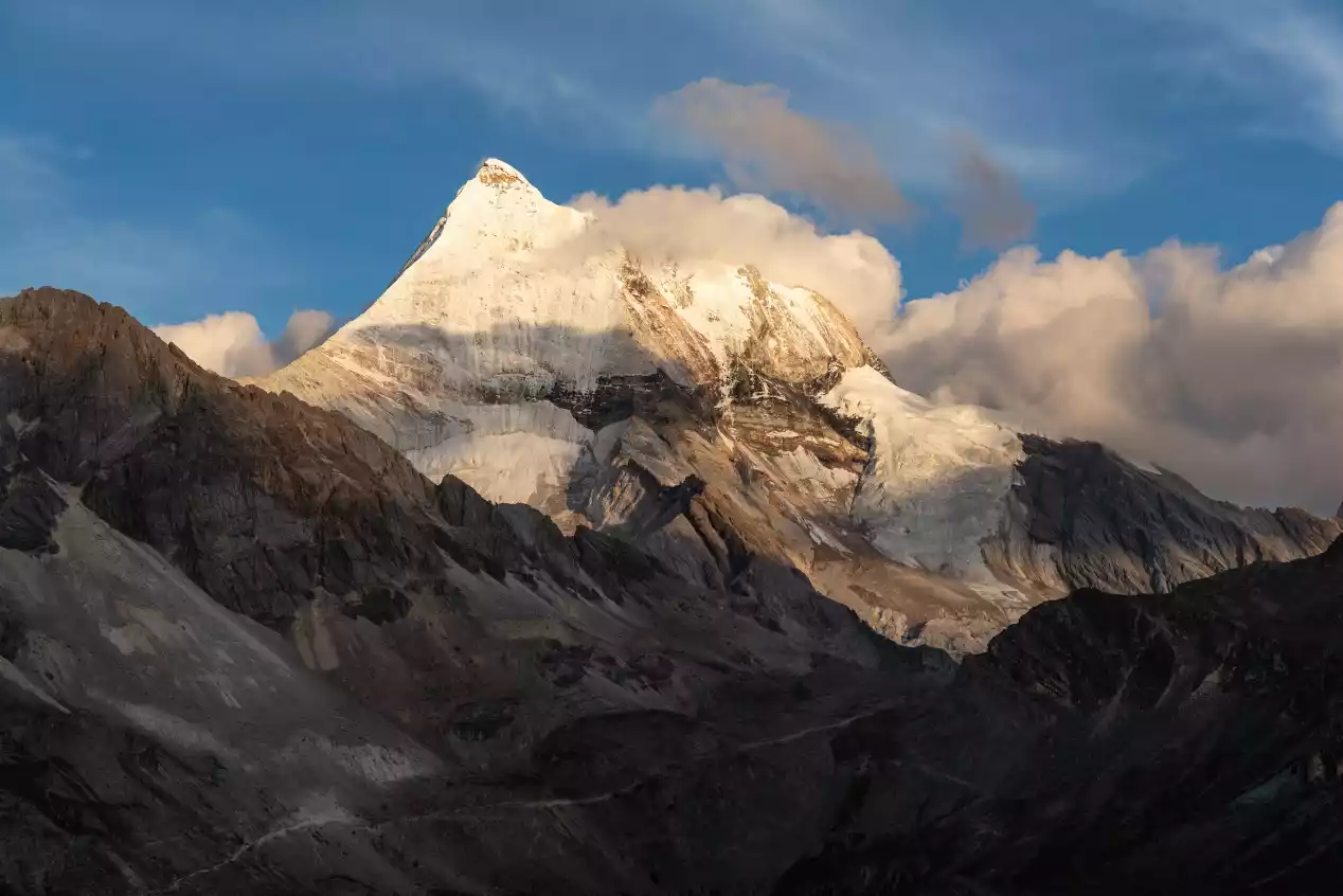
(Sunset Golden Mountain at Yangmaiyong)
Day 6: Snake Lake Campsite - Songduo Pass - Five-Colored Lake - Shuangshen Lake Check-in Point - Songduo Pass - Kasi Cowshed
Hiking: 12 km, 500 m ascent, 550 m descent.
Campsite: Kas Cowshed, 4450 meters above sea level.
Alternative plan: Go directly out of the scenic area and stay in Daocheng County.
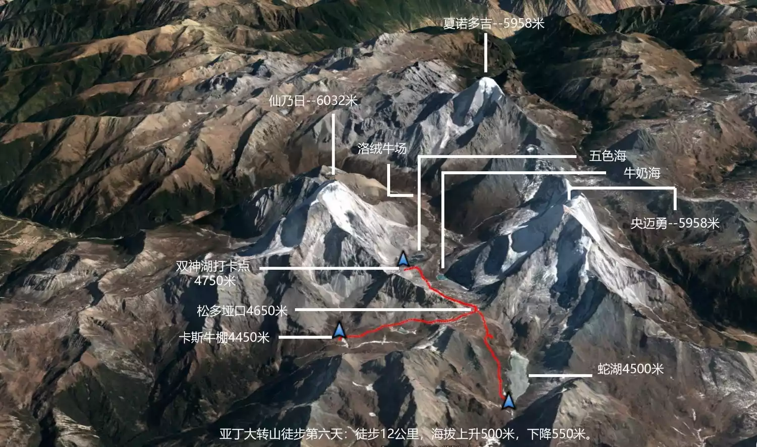
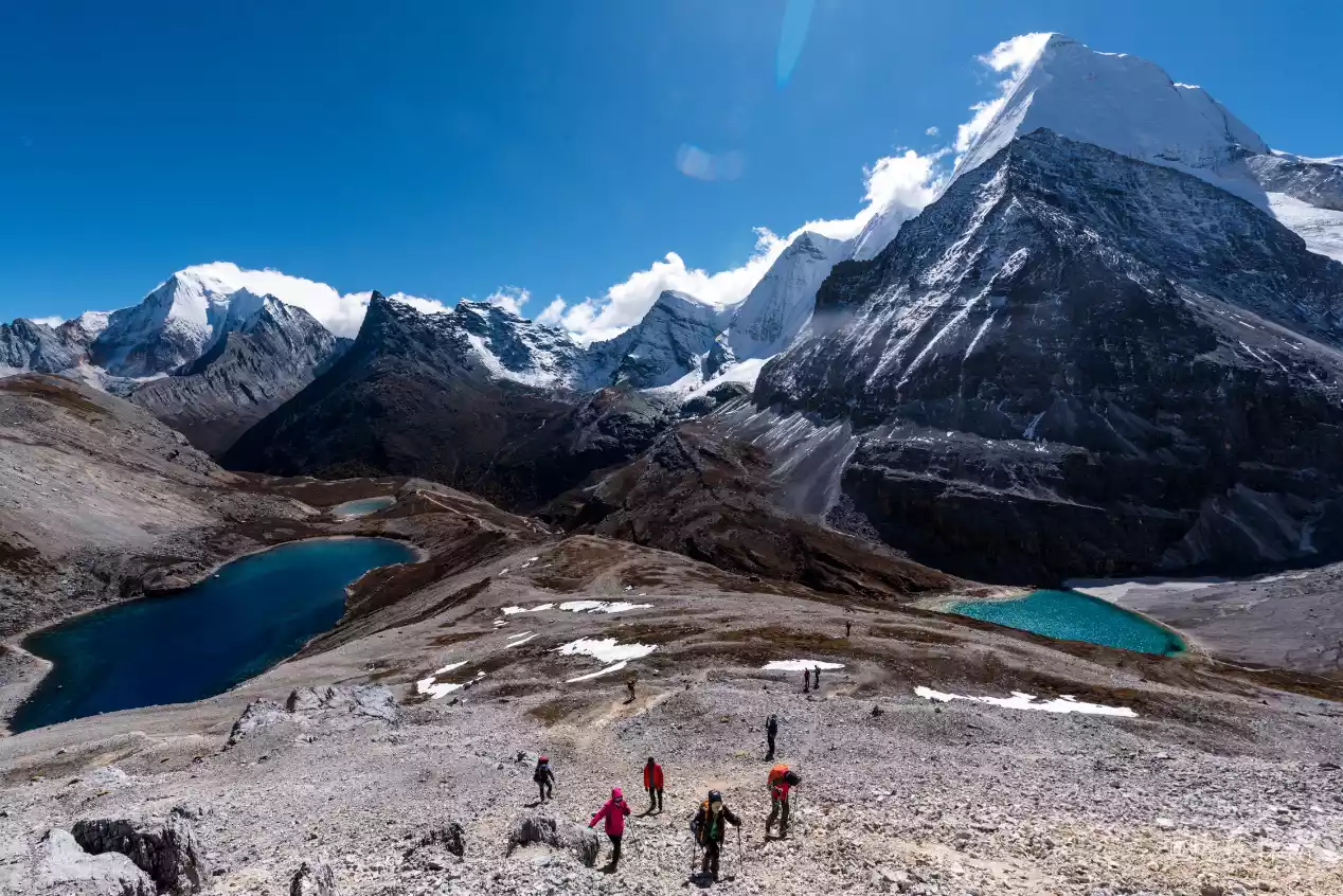
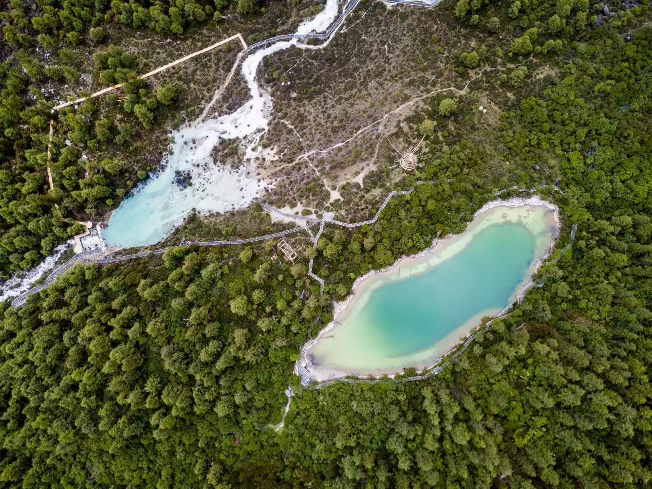
Today's main focus is to appreciate the Five-Colored Sea and Milk Sea in the Aden Scenic Area. Here we recommend an excellent spot, located on the hillside west of the Five-Colored Sea, where you can enjoy the Five-Colored Sea, Milk Sea, and three sacred mountains at the same time.
Starting from Shewei Camp, it's about 3 kilometers to Songduo Pass, at an altitude of 4,650 meters. First, follow the mountain path along the lake to the vicinity of Snake Head. A word of caution: there's a fork in the road before Snake Head that takes you directly below the pass, eliminating the need to descend to the cattle shed at Snake Head. However, the fork in the road isn't obvious, so be careful to identify it or follow the trail.
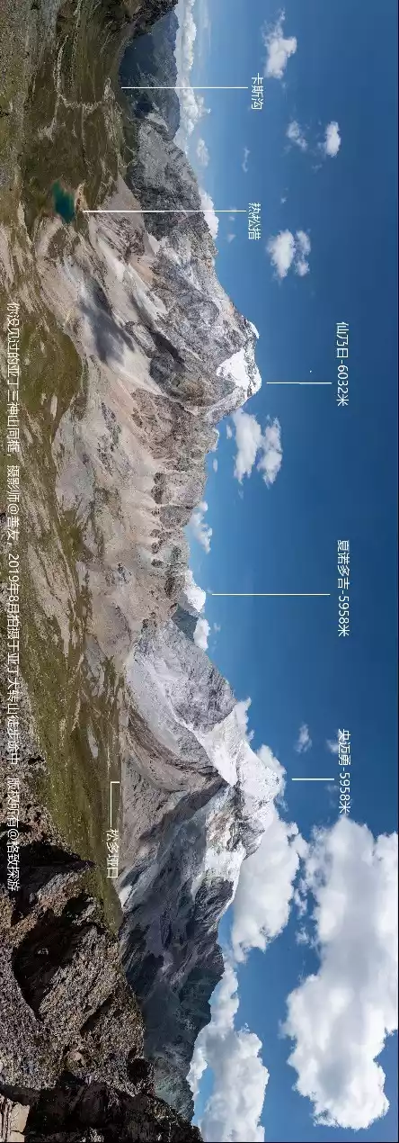
Songduo Pass is a three-way pass, leading to the Yading Scenic Area, Snake Lake, and the Kasi Hell Valley, where the Kasi Cowshed is located. We first climbed from the pass to the valley where the scenic area is located, enjoying the scenery, and then returned to the pass to camp at the Kasi Cowshed.
For alpine lakes, viewing them from a high vantage point offers even more stunning views than being right at the lakeside. Therefore, I personally believe it's unnecessary to hike to the Milk Lake or the Five-Colored Lake; simply reaching the right vantage point will provide the best viewing experience. Of course, those with better physical fitness can hike to the Milk Lake, but the altitude difference between Milk Lake and the pass is significant, so the climb back to the pass on the afternoon return trip will require more energy and time.
The first half of the trail from the pass to the Shuangshen Lake checkpoint has a clear path and is easy to follow. However, the second half is quite treacherous due to the steep gravel slope, especially the final climb, where even finding a suitable foothold is difficult. Hikers in poor condition are advised to avoid this section.
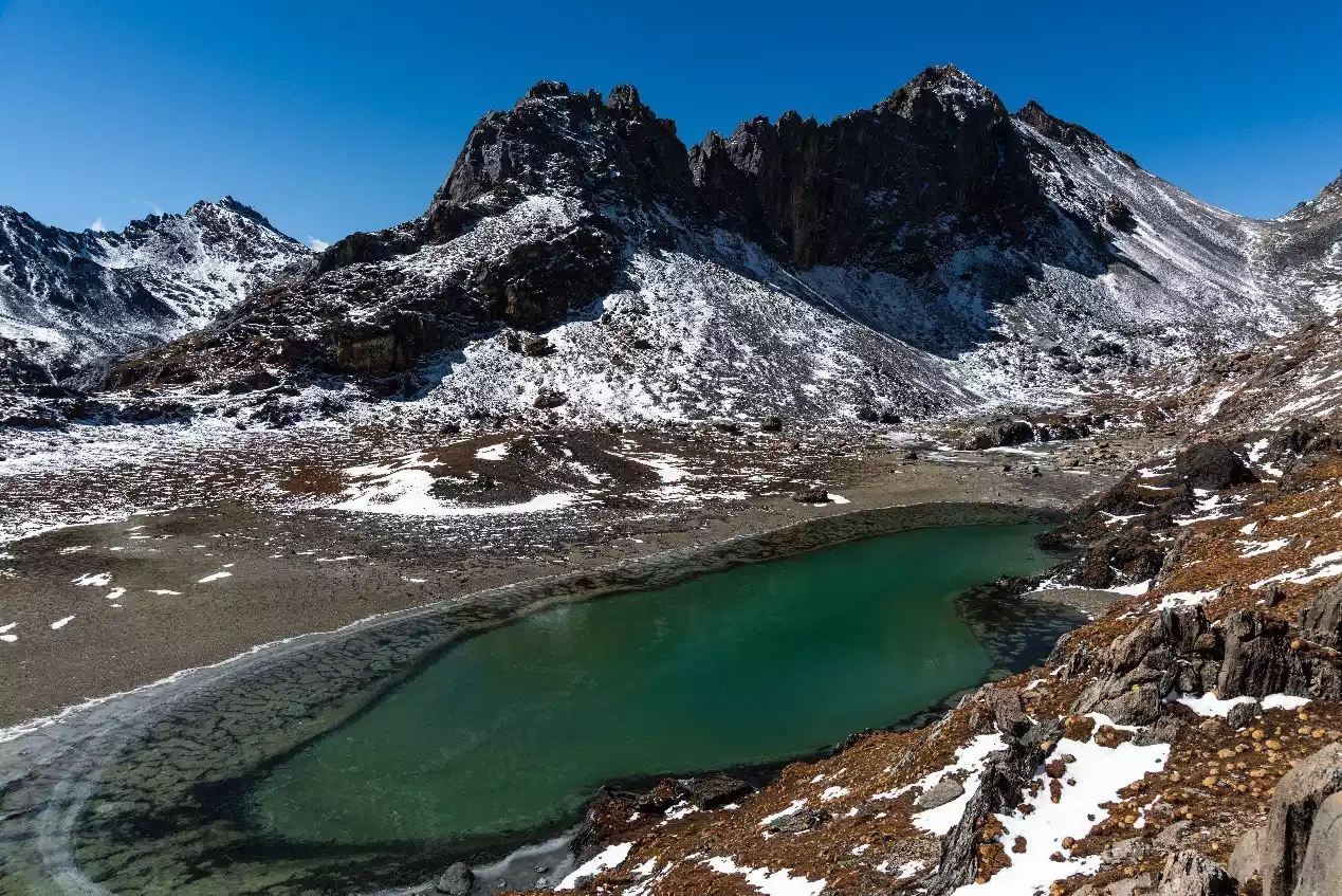
Return to Songduo Pass and continue downhill for about 2.5 kilometers to Kasi Cowshed, where there is a low stone house and two prayer flag arrays. On the way, you will pass a green lake called Resong Co.
The view of Yangmaiyong will be blocked from the location of Kasi Cowshed, but the hillside opposite the stream on the south side can capture a relatively complete view of the western slope of Yangmaiyong. The golden mountain under the sun at sunset is worth looking forward to.
Alternatively, you can visit Shuangshen Lake and then follow the scenic path out of the mountains. After hiking to Luorong Cow Farm, take an electric car to Chonggu Temple, then transfer to a scenic shuttle bus to Shangri-La Town. Accommodation is available in Shangri-La Town or Daocheng. The scenic area will require hikers to purchase a new sightseeing bus fare, but if you already have the ticket you purchased on the first day, you are exempt from the new purchase. The one-way electric car fare is 50 yuan per person, and the scenic shuttle bus fare is 120 yuan per person.
Warm reminder: Local Tibetans sometimes charge camping fees ranging from 30 to 80 yuan at Kasi Cowshed.
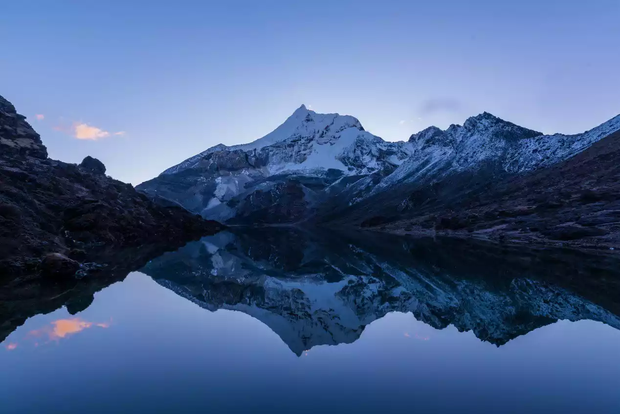
(The surface of Snake Lake is calm in the early morning, reflecting the Yangmaiyong Peak)
(Hikers travel from Snake Lake to Songduo Pass)
(Hikers are at Songduo Pass, with Xiannairi in front)
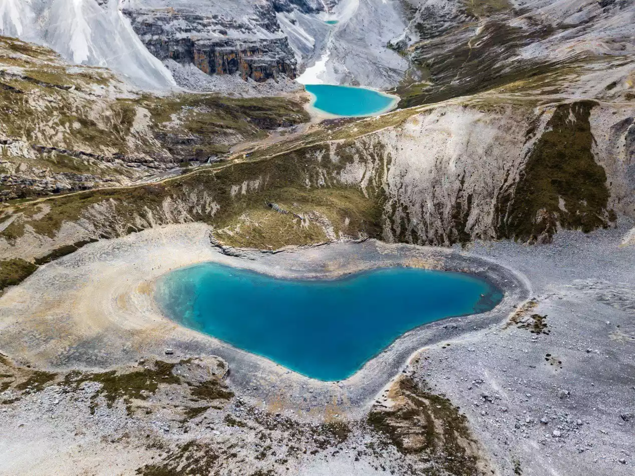
(Aerial photography of the Five-Colored Sea (below) and the Milk Sea)
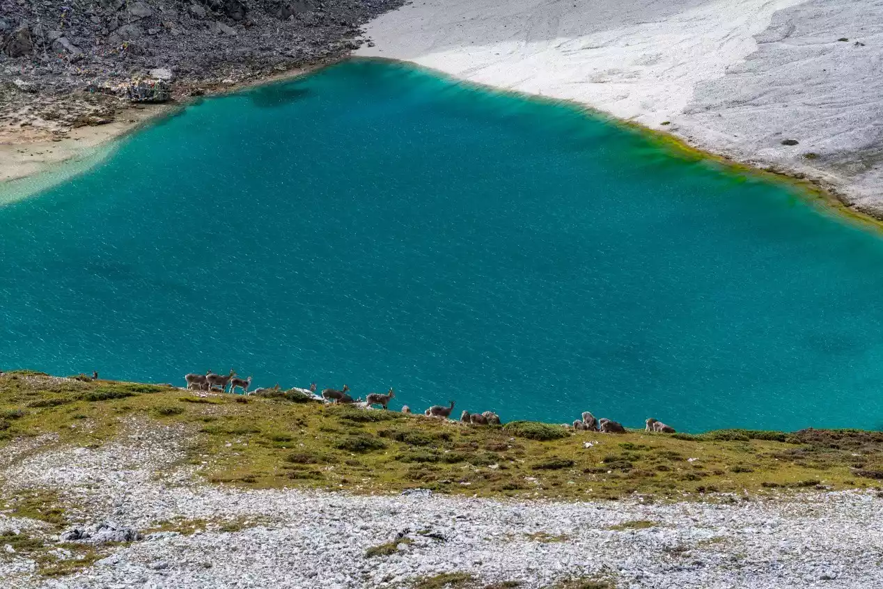
(A group of wild blue sheep roam freely near the Milk Lake)
(Hikers and the Five-Colored Sea, Xianuoduoji)
(Three Sacred Mountains, Five-Colored Sea, and Milk Sea photographed at the Shuangshen Lake check-in point)
(Hikers take pictures at the Shuangshen Lake check-in point)
(Hikers are walking at Songduo Pass, with Yangmaiyong Mountain behind them)
(The Three Sacred Mountains of Yading and Resong Co, taken from a hilltop near Songduo Pass)

(The sunset at Yangmaiyong Golden Mountain, taken by Kas Niubeng)
Day 7 Kasi Cowshed - Songluo Pass - Pearl Lake - Chonggu Temple
Hiking: 12 km, with a cumulative altitude increase of 300 meters and a descent of 750 meters.
Accommodation: Shangri-La Town, Daocheng County, or Litang County
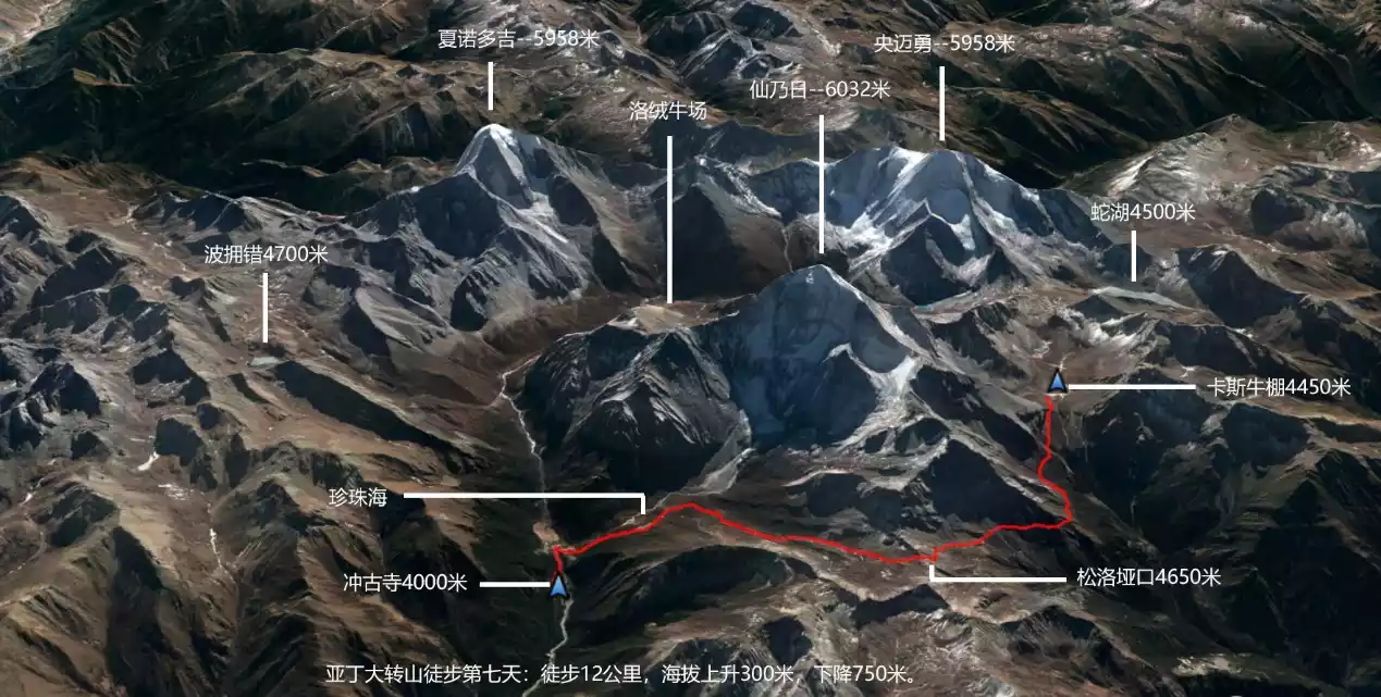
Today marks the final day of the Yading Grand Circumambulation trek, which takes us from Kasi Cowshed to Songluo Pass and then to Chonggu Temple. This is also the route for the Yading Small Circumambulation. The so-called Small Circumambulation of Yading refers to a circumambulation around the sacred mountain of Xiannairi, a common practice for local Tibetans. After all, the Grand Circumambulation of Yading covers nearly 80 kilometers and is both time-consuming and strenuous. Most Tibetans only undertake the Grand Circumambulation once every 12 years, during the Year of the Rooster (the zodiac year of the three sacred mountains of Yading). The Small Circumambulation, on the other hand, is only about 30 kilometers long and can generally be completed in just over ten hours, without requiring an overnight stay. While leading the trek, I also encountered Tibetans circumambulating the mountain.
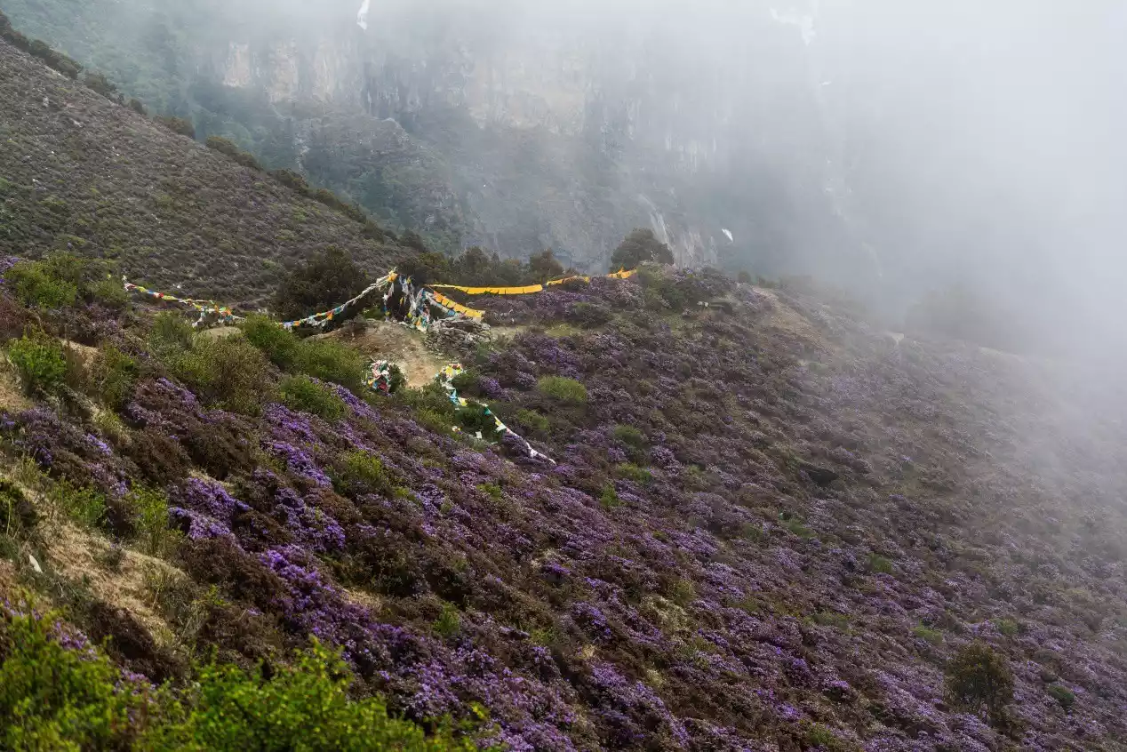
The distance from Kas Cowshed to Songluo Pass is about 5 kilometers. Except for the 1 kilometer before the pass, the slope of other sections is not very steep. The vegetation along the way is mainly alpine shrubs. There are hundreds of meters of mountain roads on both sides covered with alpine rhododendrons, and the flowering period in May and June is particularly dazzling.
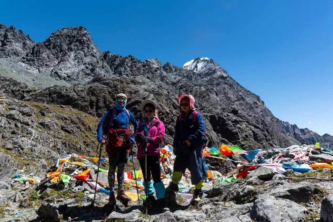
The final uphill section before Songluo Pass is a bit steep, but not very difficult. The pass is about 4,650 meters above sea level and is covered with colorful prayer flags by Tibetans circumambulating the mountain.
The road continues downhill after the pass until we reach the scenic area's scenic plank road. Following this path, we reach Pearl Lake, one of the iconic landmarks of the Yading Scenic Area. Another 1.5 kilometers of hiking brings us to the starting point, Chonggu Temple. This concludes our 7-day Yading Grand Circumambulation hiking trip.
Take the scenic shuttle bus from Chonggu Temple to the exit of the scenic area, and then you can arrange accommodation in Shangri-La Town or Daocheng County. If you have arranged a vehicle in advance, you can also consider going directly to Litang for accommodation, and you can return to Chengdu from Litang in one day.
(Azalea sea in the valley west of Xiannairi)
(Alpine pasture below Songluo Pass)
(Prayer flags and blooming azaleas at Songluo Pass)
(109 Shannairi pasture on the north side of the prayer flag array and Shannairi)
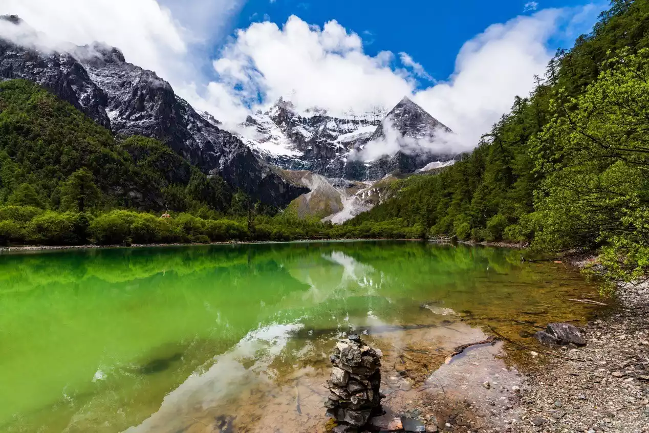
(Pearl Sea and Xiannai Ri)
(Xiannairi from an aerial perspective)
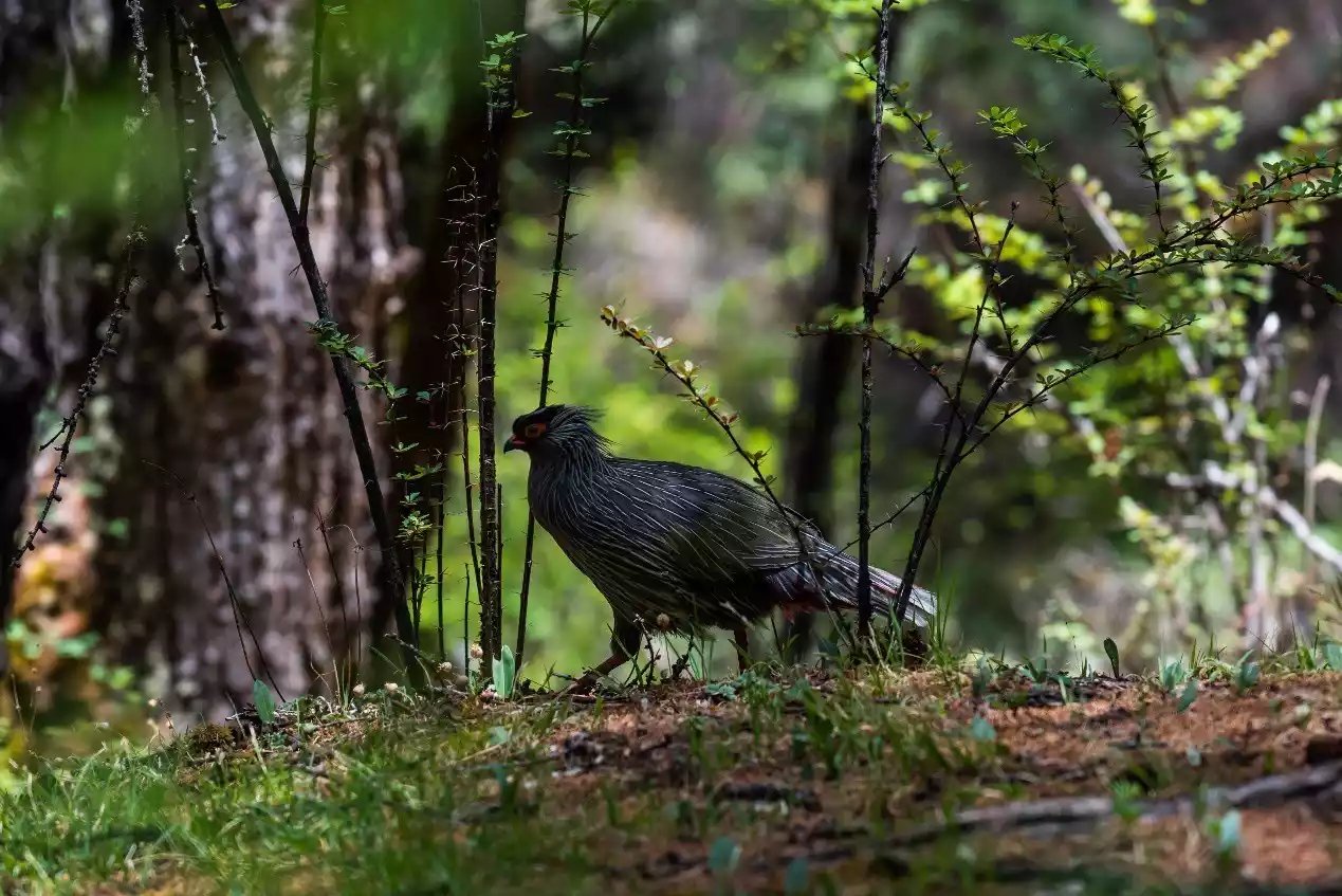
(I encountered a beautiful blood pheasant in the jungle near the Pearl Sea)
Other itinerary references
If you have high-altitude hiking experience and good physical fitness, you can also consider completing the Yading Grand Circumambulation in six days. This arrangement requires a higher level of acclimatization and will require more energy in the first two days. It is more suitable for experienced hikers who are more prepared to handle acute altitude sickness and other unexpected situations.
The reference itinerary is as follows:
Day 1, Chonggu Temple – Bayu Camp – Poyong Co;
Day 2, Poyong Co - 4900 Pass - Garuo Cattle Farm - Gongga Zhaze Cattle Farm;
Day 3: Gongga Zhaze Cattle Farm – Xianuoduoji Pass – Zabala Pass – Xinguo Cattle Farm;
Day 4, Xinguo Cattle Farm - Black Lake Pass - Snake Lake;
Day 5, Snake Lake - Songduo Pass - Shuangshen Lake check-in point - Kasi Cowshed;
Day 6, Kas Cowshed – Songluo Pass – Pearl Sea.
Conclusion
This concludes my sharing of the entire route for the Yading Circumambulation. For more information on the Yading Circumambulation, please read my previous guide:
(Yading Grand Circumambulation Guide: Hike 80 kilometers around the Yading Three Sacred Mountains Plateau)