Inner Mongolia is more than just grasslands. Along the spine of China's map, it reveals its unknown beauty!
Preface
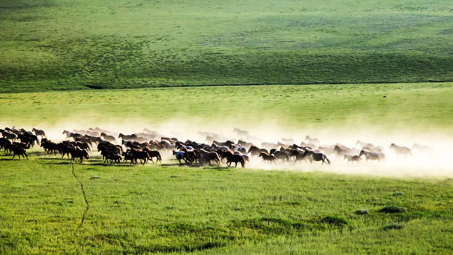
Is there only grassland? Many people come to Inner Mongolia for the grasslands, ride horses, stay in yurts, return ecstatically, and never return. They say all grasslands are the same, nothing more than endless green fields, no different here from there.
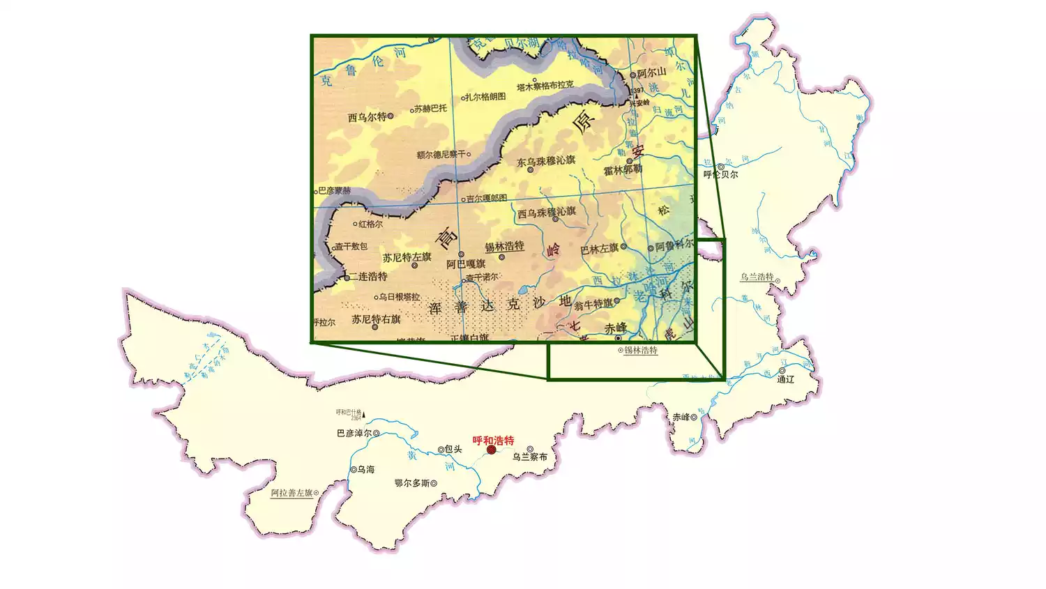
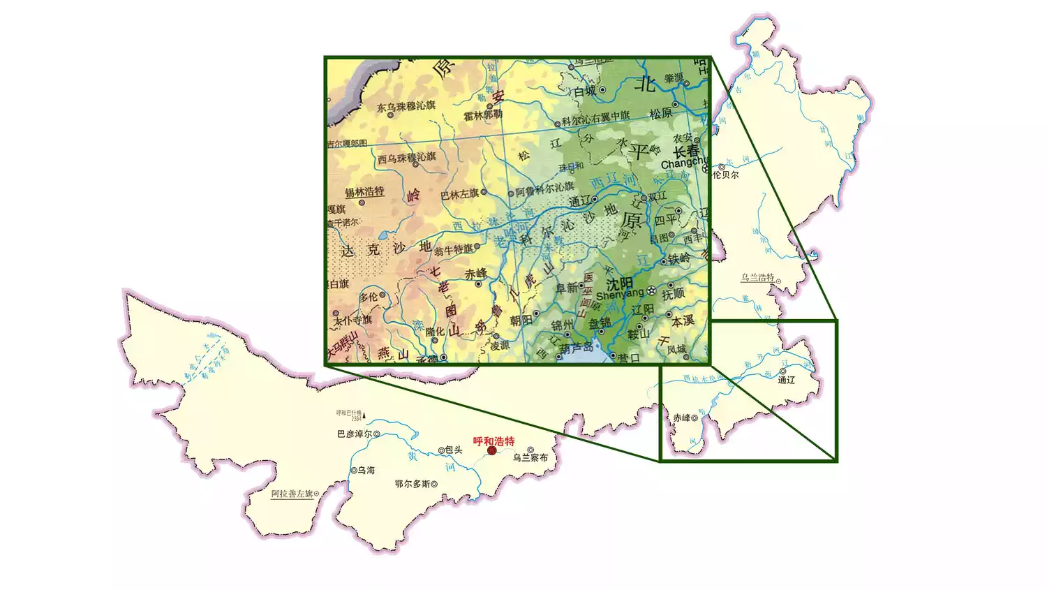
Inner Mongolia has a large area. The area of the Ergun region alone is similar to the combined area of Zhejiang and Jiangsu provinces. There are so many secrets in the grasslands. The regional differences and the distinct geological landscapes seem to be obscured by the prejudice of "endless".
This guide will introduce the Inner Mongolia grasslands in detail and help you understand its diverse nature.
(Image source: Internet)
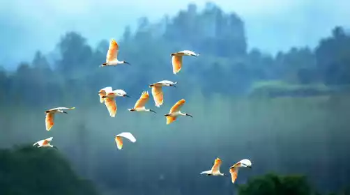
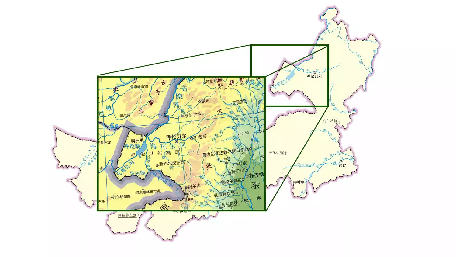
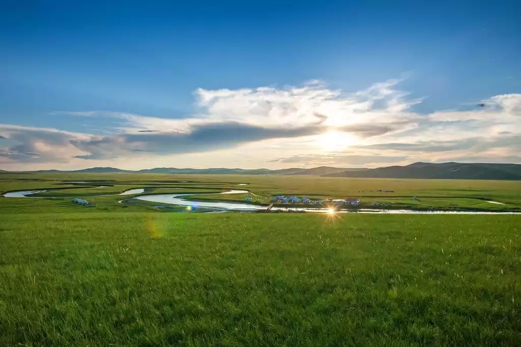
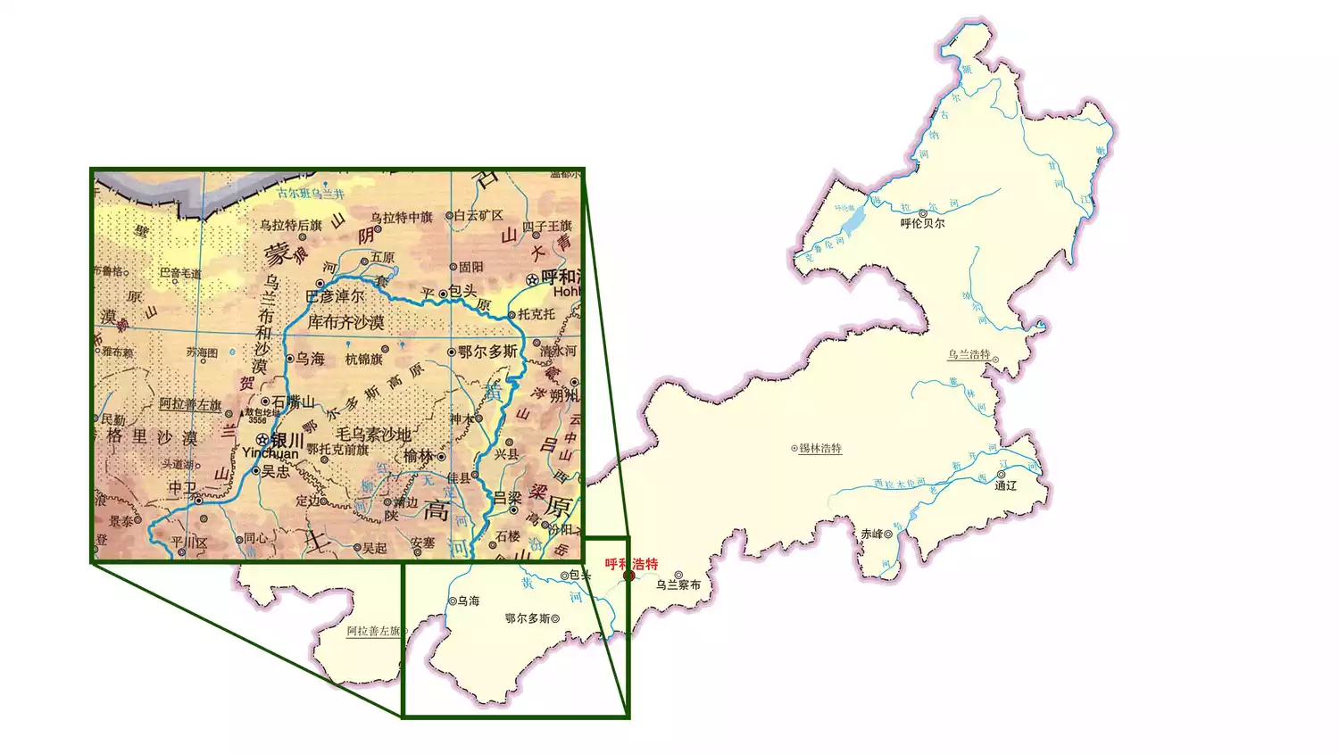
Where are the grasslands in Inner Mongolia?
(Image source: Internet)
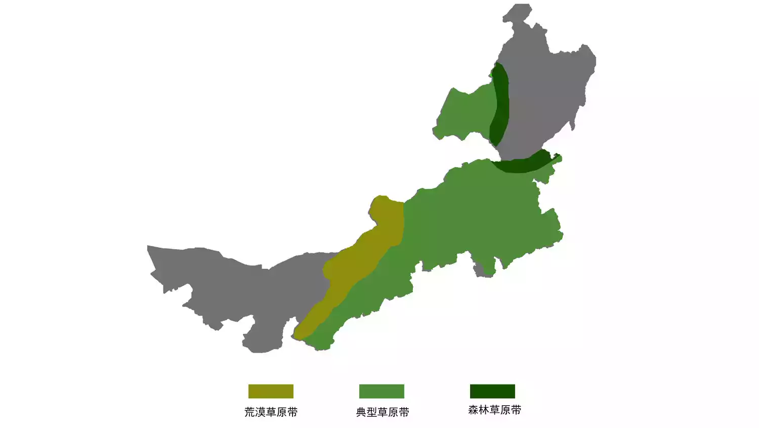
From the Erjina in the west to the Ewenki in the east, and from 97° east longitude to 126° east longitude, the Inner Mongolia Plateau forms a significant uplift in the eastern extension of the continent and penetrates deep into the core of the continent.
The dry climate shapes the overall characteristics of the grassland. The average annual precipitation in the grassland area ranges from 150mm to 450mm, but different geographical conditions such as latitude bring about internal differences.
(Image by @阿北)
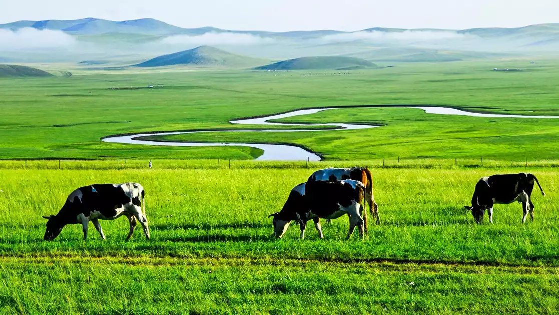
Forest steppes have formed on the edge of the Greater Khingan Range, with deciduous forests and meadow steppes mosaicked together. In Hulunbuir near Arshan, we often see cattle chewing grass on the rolling hills. There is a sense of patchwork in the landscape, reminiscent of European pastures.
As we reached Xilin Gol, Horqin, and even parts of Central Mongolia, we entered a typical grassland region, where gently rolling terrain unfolded. Within each region, there were still significant variations. The southern extension of this region experienced the baptism of agricultural civilization, and the conversion of cultivated land to grasslands dramatically altered the grasslands.
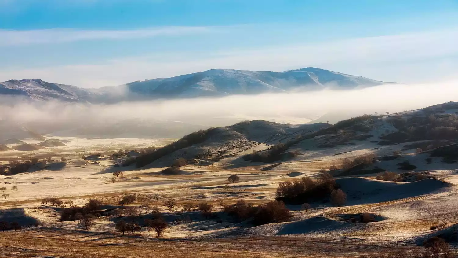
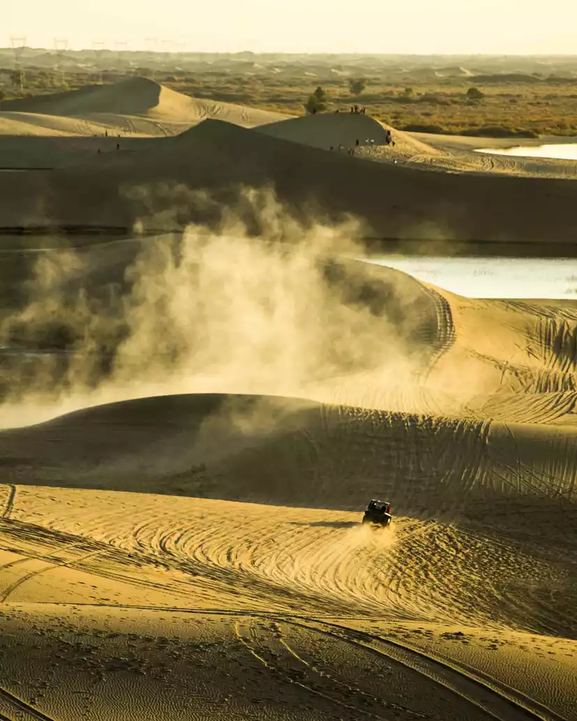
The grassland's momentum is drawing to a close in the Bayannur region, where sand and grassland are locked in a tug-of-war. The vibrant green of the Alxa Gobi Desert is no longer visible; it has become the territory of the Tengger and Ulan Buh Deserts. Traveling here feels like stepping outside the traditional understanding of Inner Mongolia.
The famous grasslands in Inner Mongolia include Hulunbuir, Xilingol, Horqin, Ulanqab, and Ordos. In order to prevent you from treating the Inner Mongolia grasslands as a "solid block", Abei will give an overview based on the most prominent features of these grasslands.
River's territory ⭐ Hulunbuir grassland
(Image by @阿北)
Named after its two lakes, Hulun Lake and Beier Lake, Hulunbuir, "China's largest grassland" enjoys a close symbiotic relationship with the rivers that wind through it. These rivers often emerge from the high forests of the Greater Khingan Range or are tributaries of the mother river, the Ergun River.
(Image source: Internet)
Outside the border, the grassland continues to unfold, and Hulunbuir is just a corner of the larger grassland, which is special because it borders the Greater Khingan Range.
The legends of the Mongols, Ewenkis and Russians are intertwined on this grassland, and the mysteries of shamanism and natural gods still surge in the long wind.
(Image source: Internet)
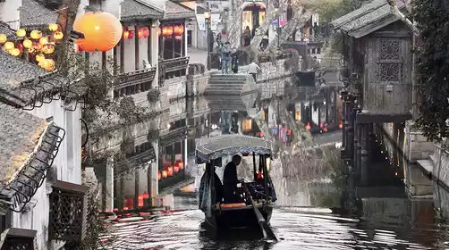
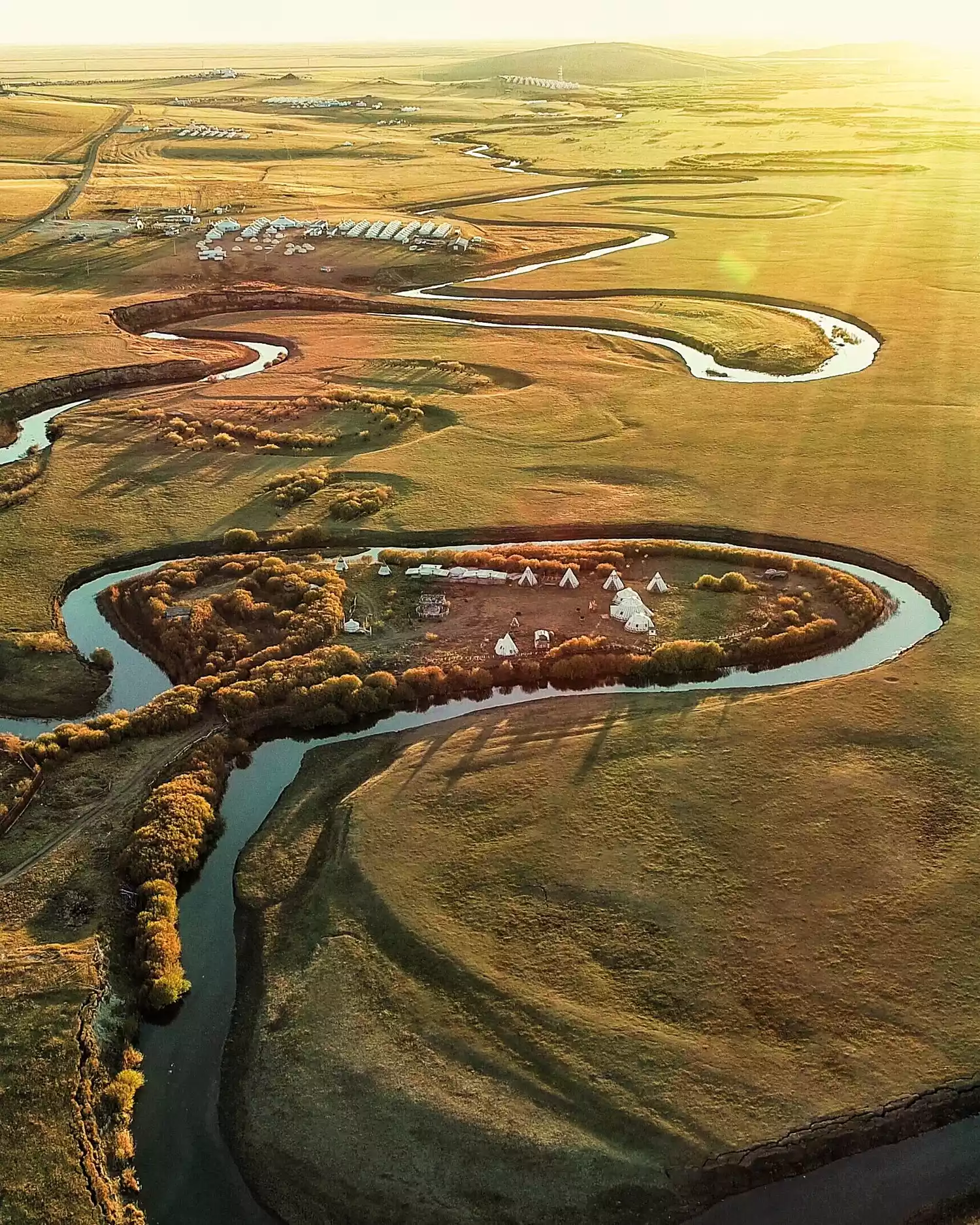
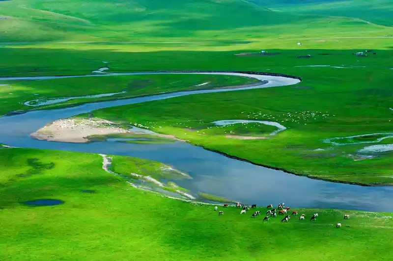
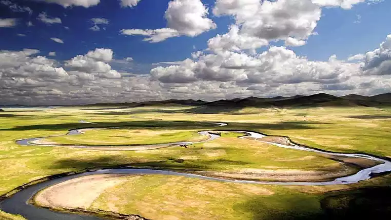
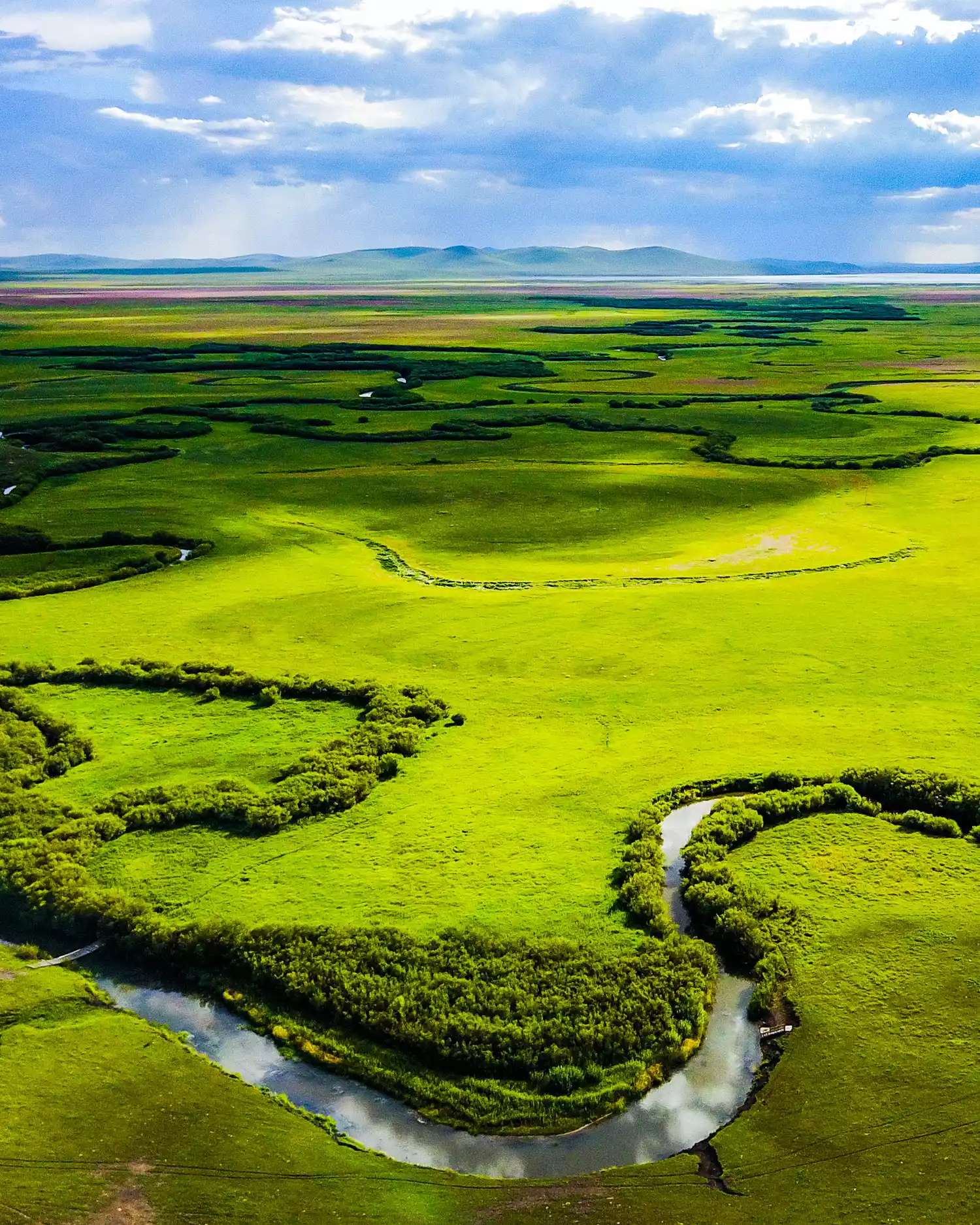
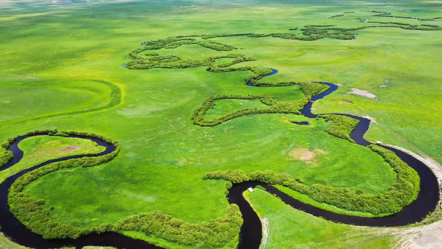
The Ergun River leaves a flowing trace across the grasslands, sprouting lush wetlands and scrub wherever it passes. The Ewenki people also call Hulunbuir "this side of the river." As you gaze down at the vast, dancing lines of the Nine Bends River, entwined in the embrace of the grasslands, you might be immersed in a personal history that slowly flows through time.
The largest grassland
(Image source: Internet)
(Image source: Internet)
Hulunbuir has a total area of 262,000 square kilometers and is located in Hulunbuir League, Inner Mongolia Autonomous Region, at the junction of China, Russia and Mongolia. It borders Heilongjiang Province to the east and Mongolia and Russia to the northwest.
(Image source: Internet)
Here you can find the Greater Khingan Range forest, lush grasslands, the winding Morgele River, and blue skies and white clouds, so pure that they seem fake that it is known as the "Jade of the North".
On the map, Hulunbuir is the part marked in blue in the picture below, located at the position of the chicken's head and comb.
(Image source: Internet)
(Image source: Internet)
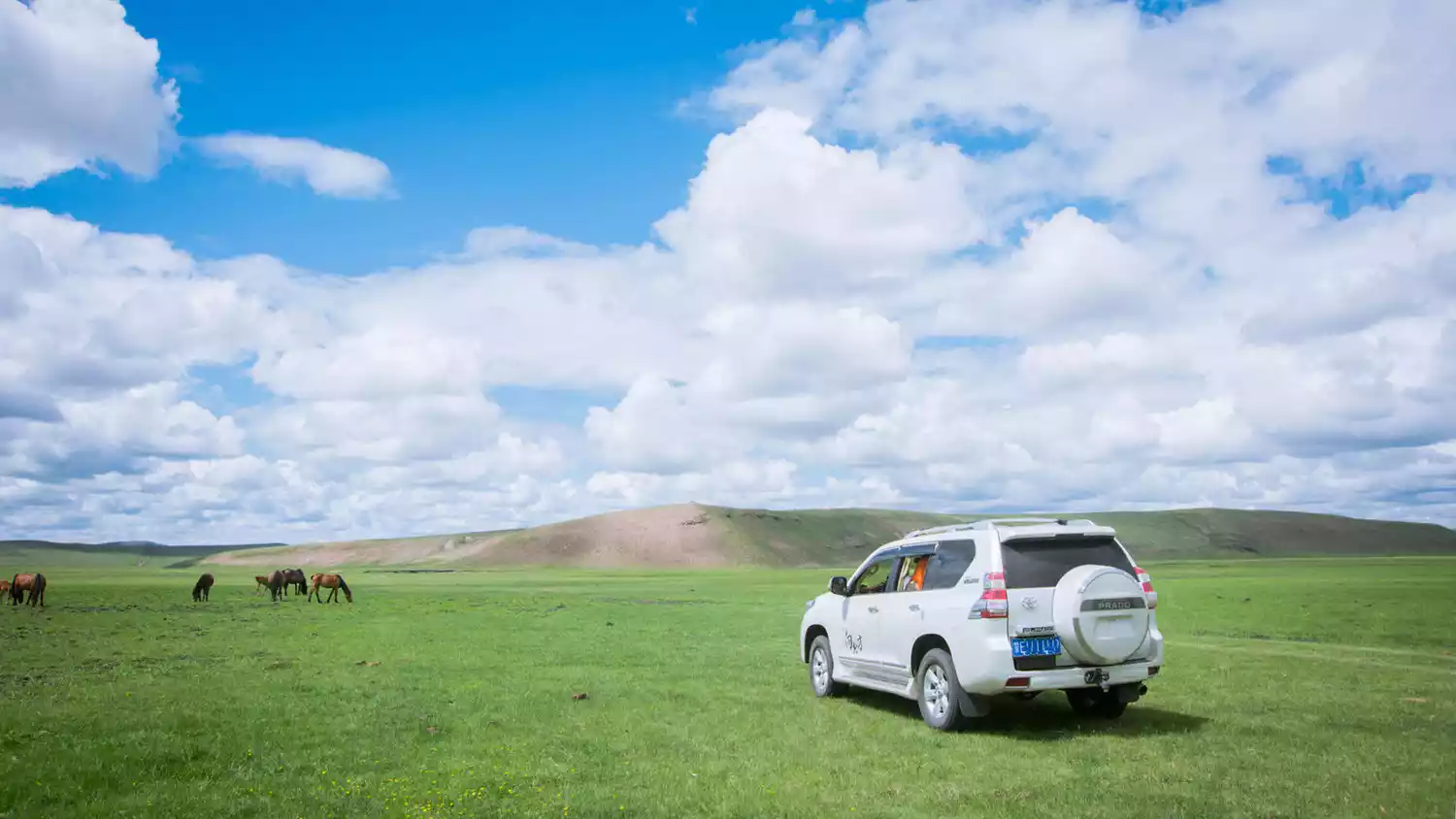
Hulunbuir is so big that you need to drive across it to fully experience it.
In addition to border roads, you can also get a sense of independence away from the world by leaving national and provincial roads and taking the slightly bumpy county roads and crossing the uninhabited grasslands.
Tips:
<Best time to travel>
June to September is the best tourist season for Hulunbuir Prairie, especially during July and August when the prairie grass is lush.
The highest temperature in Hulunbuir in the summer is around 35 degrees Celsius, but it only lasts about a week, so you don't have to worry about the high temperatures here. Even during the hottest periods, as long as you take precautions against the sun, the temperature feels quite comfortable, especially when the wind blows on the grassland, which can bring a cool breeze.
The most comfortable time of the day is evening. After the sun sets, the breeze blows on your face, and the pure air can blow away the fatigue of the day. In the summer, you don’t need to turn on the air conditioner or fan to sleep on the grassland at night, the temperature is very suitable.
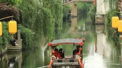
Mozhgrad River
(Image source: Internet)
The Morigele River flows through the heart of the Hulunbuir grassland. Compared with the Ergun Wetland and the Genhe Wetland further north, the river here is more "refreshing" and has the pure feeling of the grassland itself.
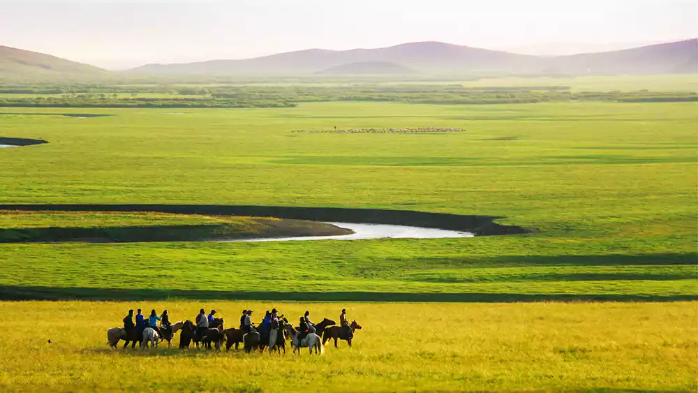
Riding an off-road vehicle, driving along the river, layers of clouds nestle in the distant mountains, dotted herds of cattle sip on the river bank, and time slows down in the pleasant wind.
(Image source: Internet)
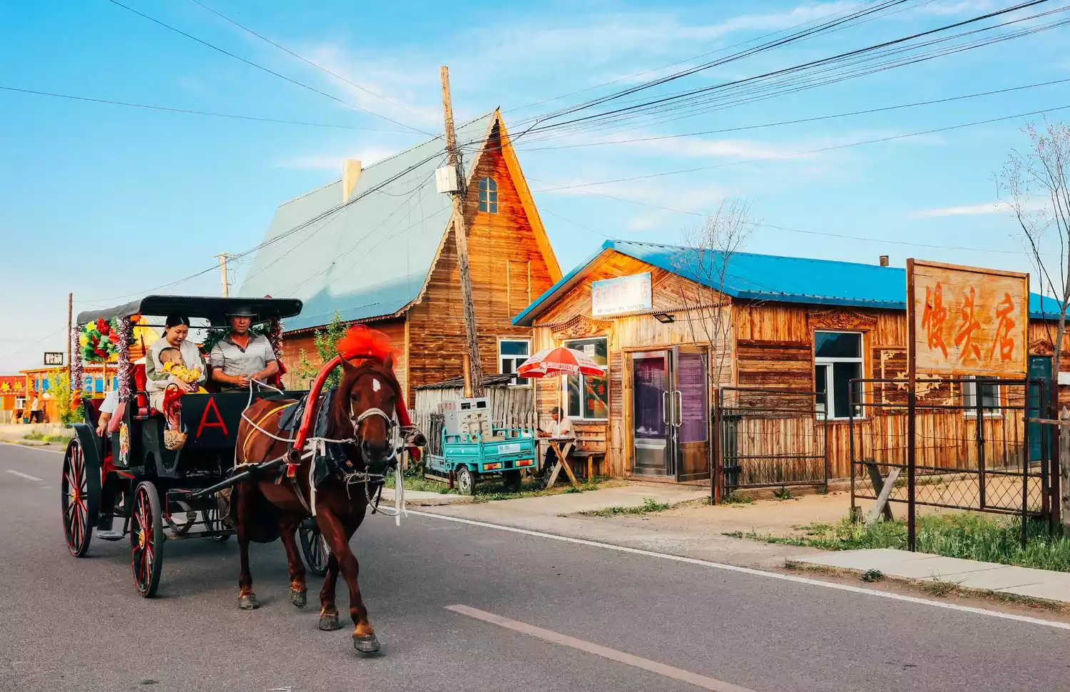
Mongolian tribes dot the banks of the Morigele River. It's not far from Hailar District, and the drive takes no more than an hour, but you can experience the purest Mongolian customs.
(Image source: Internet)
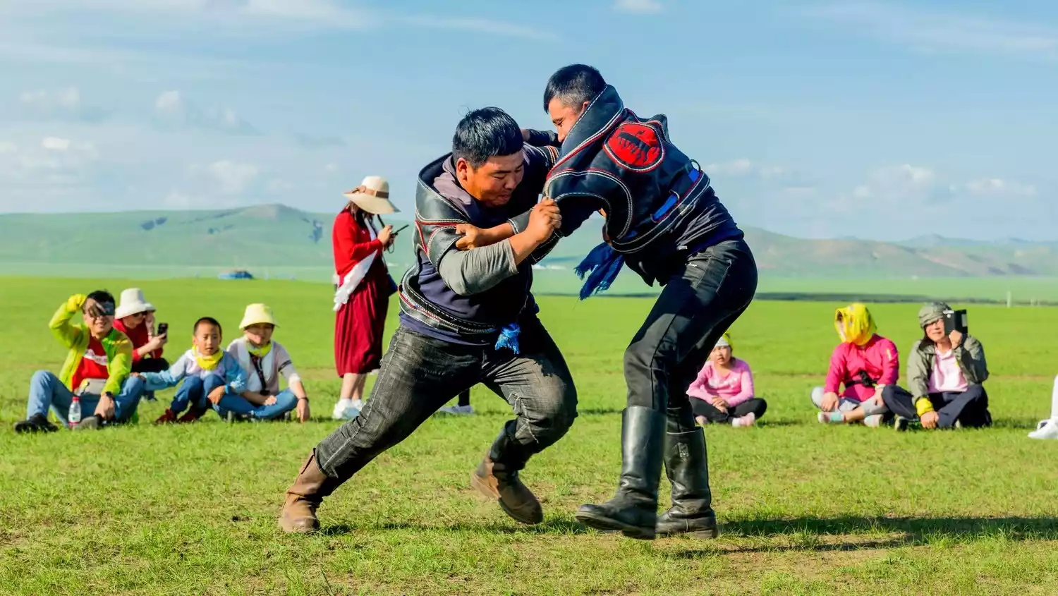
Not to mention Mongolian traditions such as drinking wine after dismounting and offering Hada, the small Nadam and Aobao sacrifices are truly exciting.
Enhe Russian Town
(Image source: Internet)
(Image source: Internet)
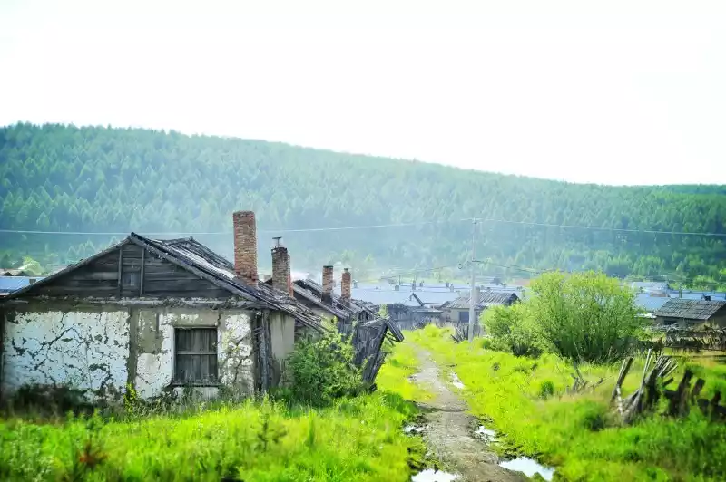
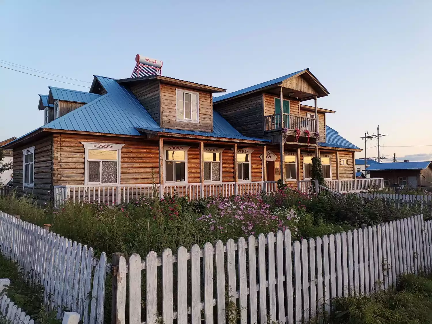
Enhe is the only Russian ethnic township in China. It is located in the buffer zone between the grassland and the Greater Khingan Range. Going north along the Ka Line Highway, you will arrive at this quiet town nestled in the mountains and beside the water.
(Image source: Internet)
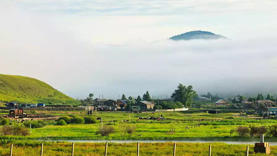
In fact, in addition to Enhe, other well-known places in this area include Shiwei and Linjiang. Enhe is smaller and less commercial, so you can see more stable and traditional life.
(Photo credit: Photography by Song Xinzi)
(Image source: Internet)
The Ewenki people use the Ergun River as their boundary and define the forests east of the Yangtze River as their homeland. From Enhe, you can visit the Ewenki reindeer park.
The border highway is also very stunning. When you approach the checkpoint, you will see a border life that is completely different from that in the mainland. The distant mountains and river views here are also very attractive.
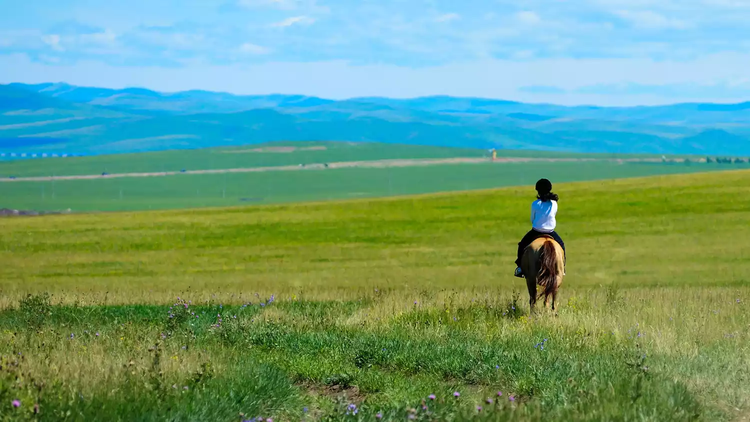
Golden Pasture ⭐ Xilin Gol
(Image by @阿北)
If I were to recommend only one grassland among many, Xilin Gol would definitely be the best choice. The southern extension of the Xing'an Mountains is low, and compared to Hulunbuir, Xilin Gol has more convenient transportation.
(Image source: Internet)
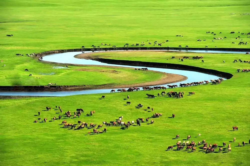
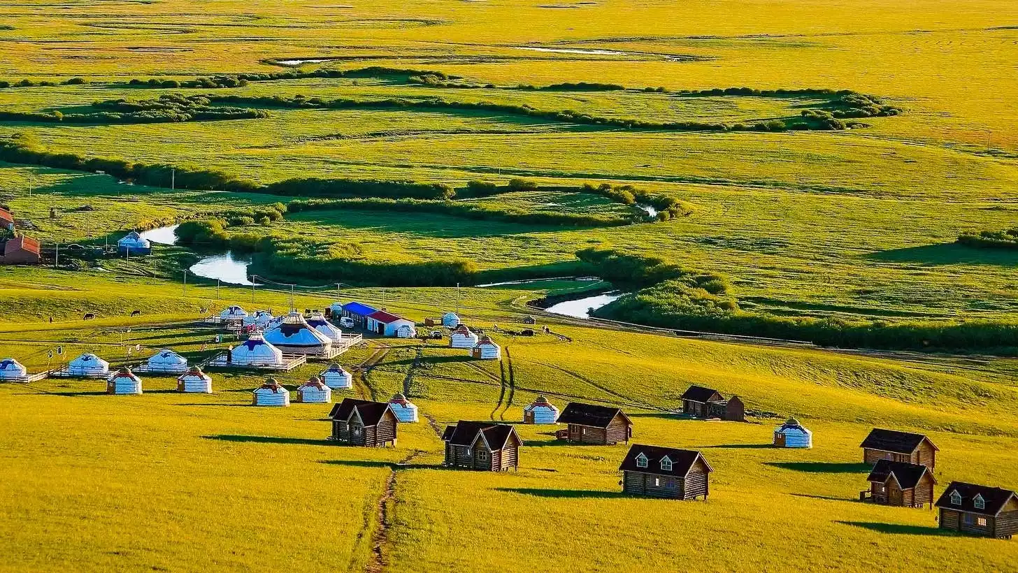
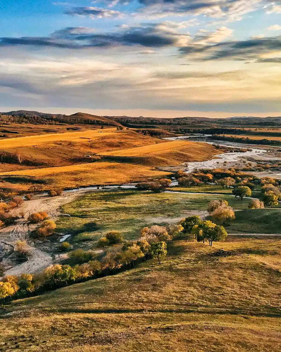
"Xilin" means mountain in Mongolian, while "Gol" means water. Xilin Gol's altitude gradually decreases from northeast to southwest. On the map, you can see dense rivers flowing westward from the eastern mountains, creating beautiful river scenery comparable to Hulunbuir.
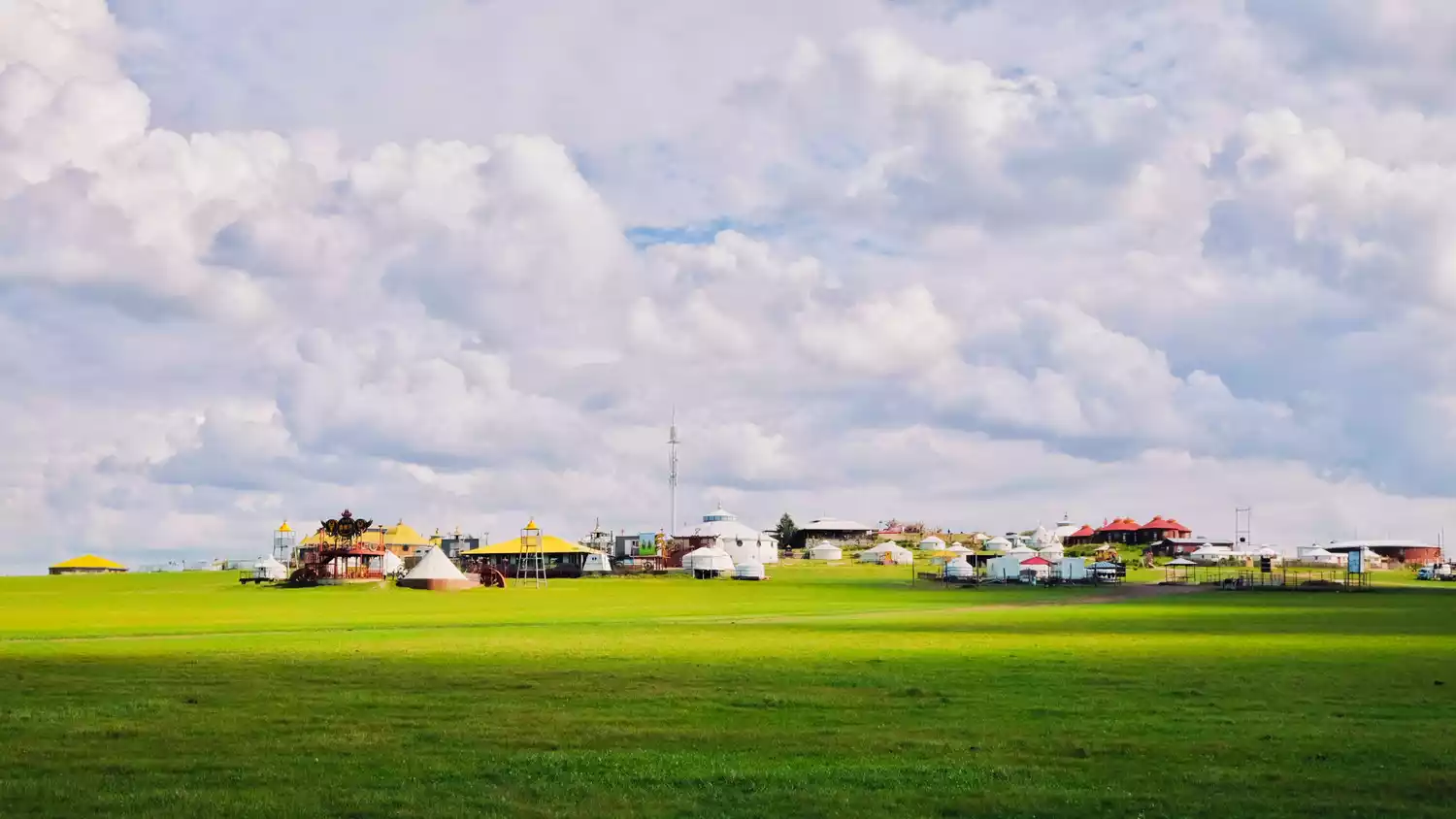
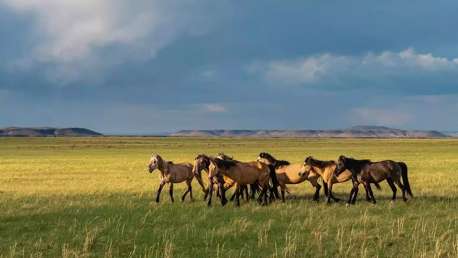
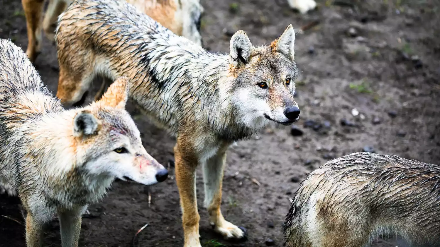
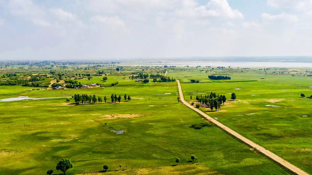
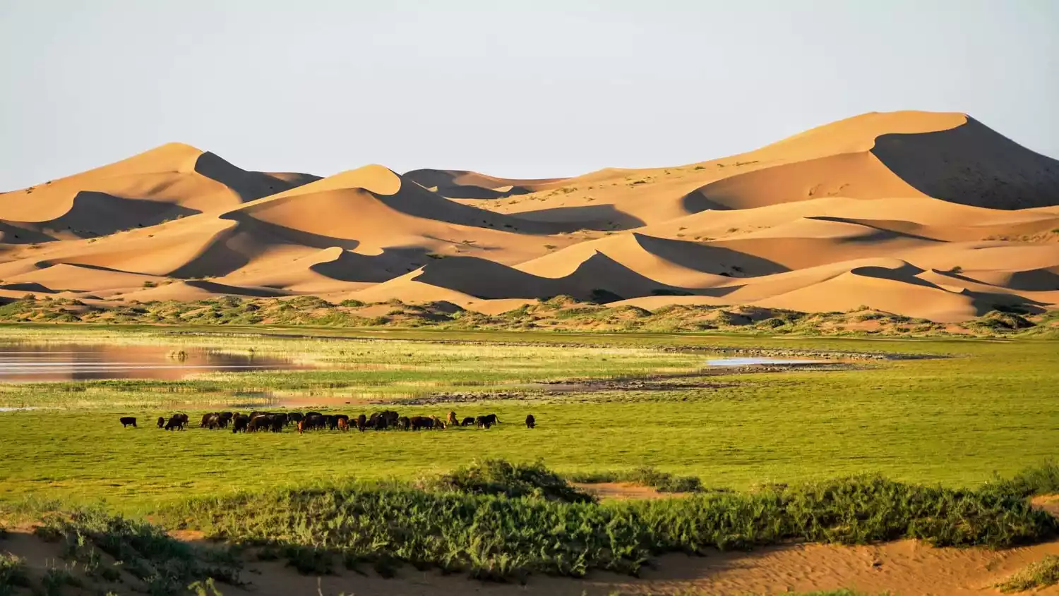
The Ulagai River is the largest inland river in Inner Mongolia, and its nourishment has transformed the Ulagai Grassland into the renowned "Paradise Grassland." The Mongolian Ujumchin tribe thrived on this vast plain, and the 51st Corps was once stationed here. Relics of educated youth can still be found on the pasture, allowing you to connect with the story of Wolf Totem.
About Watch, about the legend of wolves
(Image source: Internet)
Xilingol is the gathering place of the Ujumchin tribe of Mongolia. In the hearts of traditional herdsmen, wolves have a unique and even lofty status.
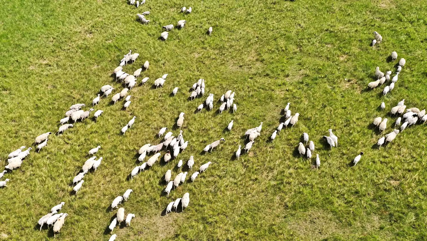
Wolves carry away sick sheep, maintaining the number of sheep on the pasture and safeguarding the balance of the grassland. Therefore, wolves are not enemies of herders, but their friends and protectors of the grassland.
(Image source: Internet)
The theme of life in Xilin Gol, or indeed almost all life on the grasslands, is balance: balance between tribes, balance between humans and nature, and balance between nature and nature itself.
Grasslands rarely leave profound traces of geological changes like other areas. The changes in grasslands leave no trace. The vast grasslands you see are the result of interaction and balance.
(Image source: Internet)
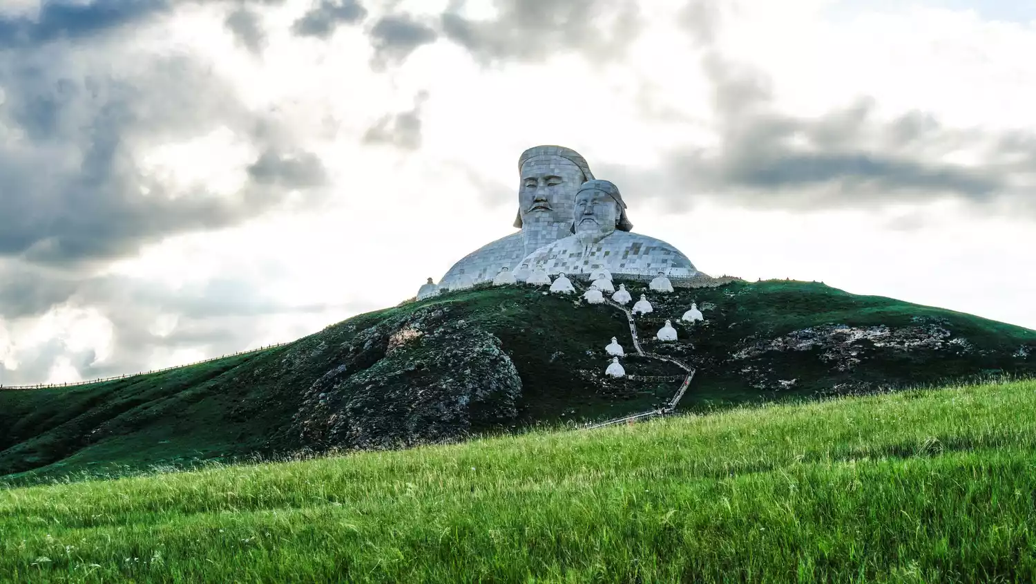
There are also long-standing Mongolian tribal legends here, and modern people have made these stories concrete. You can go to Khan Mountain to learn about the legends of Genghis Khan and his descendants.
Jiuqu Bay
(Photo source: Photography @Qingfengwenshan)
Paradise Grassland gets its name from the Ulagai River, which, due to its gentle terrain, forms a stunning nine-bend bend. Wherever the river flows, low shrubs grow, creating a lush and pleasant scene.
(Photo source: Photography @Qingfengwenshan)
In the past, due to the construction of the Ulagai Reservoir, the Ulagai River was once on the verge of drying up, but now spring has returned to the grassland.
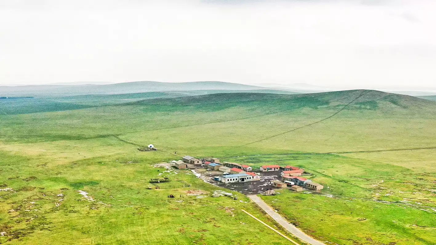
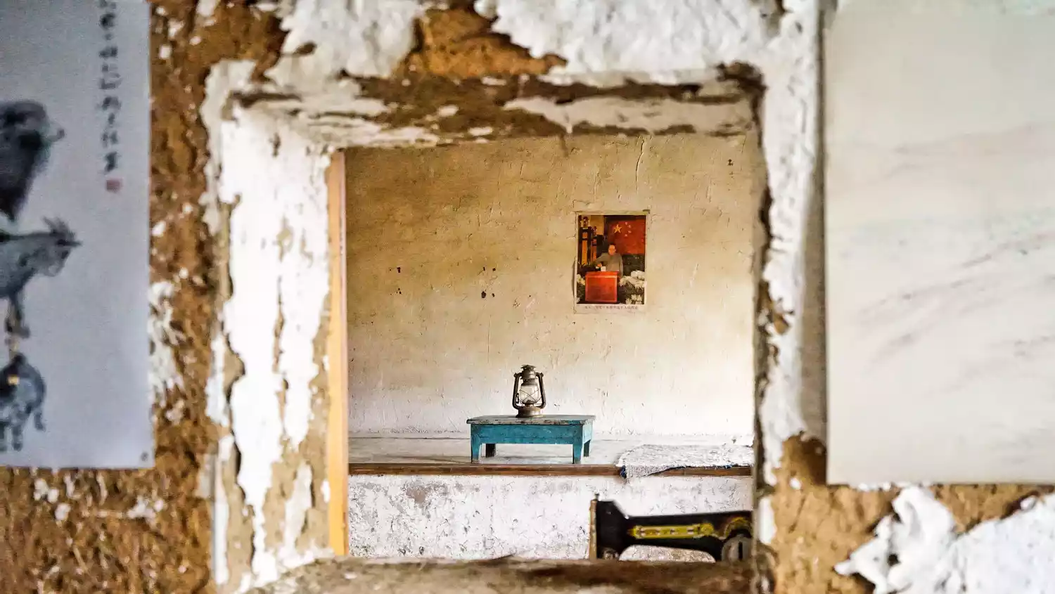
Corps Town
(Photo credit: Photography @stdolly)
The 51st Corps was once stationed in Ulagai, and the educated youth stayed in the unfamiliar grassland. The grassland wind more or less took away the traces of their past, but you can still see some low, dilapidated earthen houses on the roadside, which is where they once lived.
(Photo credit: Photography @stdolly)
The Bingtuan Town is a replica of the original architecture, but it's not a crude replica. The movie Wolf Totem was filmed here. The Zhiqing Town, further away, is a genuine relic, and the Zhiqing canteen there still has a unique atmosphere of everyday life.

(Photo credit: Photography @stdolly)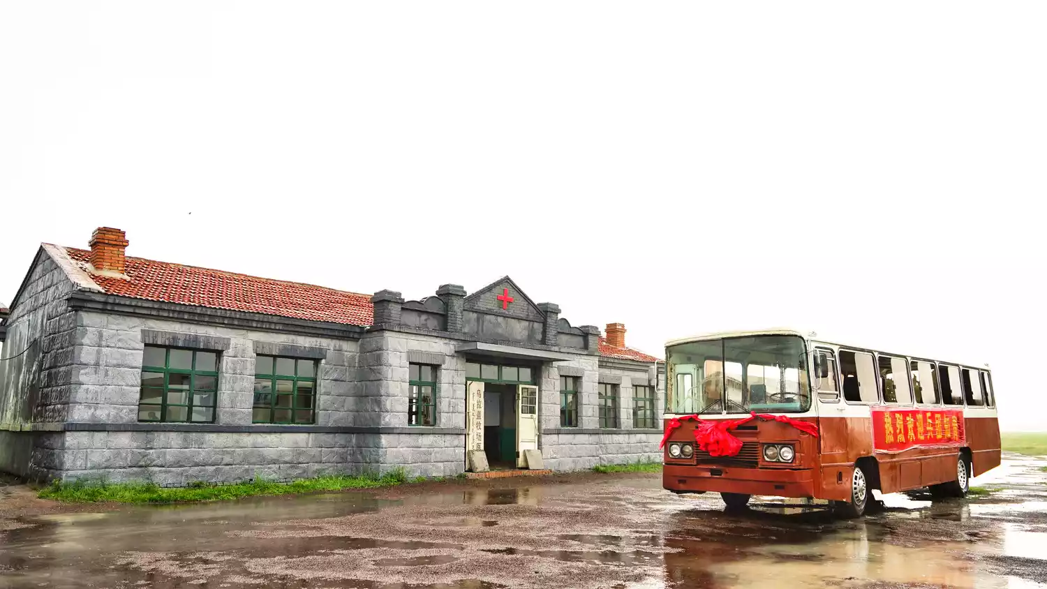
(Photo credit: Photography @stdolly)
(Image source: Internet)
Wolves are the guardians of the grasslands, so consider them as your theme for your grassland itinerary. Near Bingtuan Town lies a wolf park, where the wolf actors from the production of "Wolf Totem" are said to still live and breed there, along with their descendants.
Symbiotic mudflats ⭐ Horqin
(Image by @阿北)
Korqin itself is like a modern history of the grasslands: the cries of nomads fade into the horizon with the galloping hooves of horses, while the songs of the countryside take root at the edge of the grasslands. Here, the nomadic and agricultural economies clash most fiercely.
(Image source: Internet)
Horqin now looks more like a part of the Sanjiang Plain than a part of the grassland, but the forces of grassland, cultivated land and sand are still entangled here, symbolizing wildness, domestication and barbarism.
Uliger is a Mongolian storytelling art originating from Khorchin. It is the result of the collision between Mongolian traditional culture and Han culture in the Central Plains. The interest of grassland heroic epic is combined with the theme of the rise and fall of dynasties in the Central Plains, symbolizing the inherent symbiosis of the two civilizations.
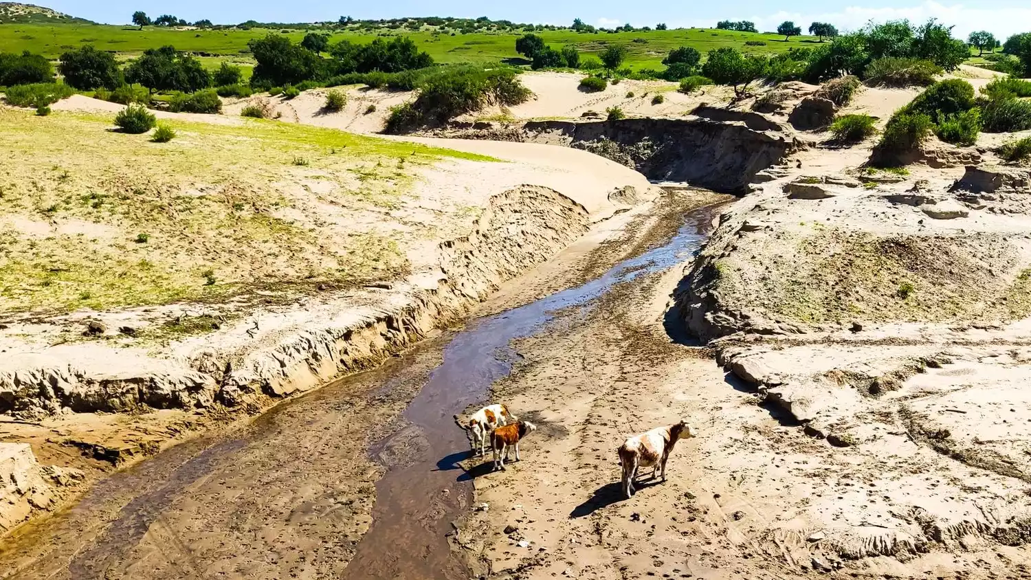
The same is true in Horqin today. If you go to the banks of the Xilamulun River, the mother river of Horqin, you can see tall trees growing tenaciously on the light yellow sand. There is grass only when there is water, and there is life only when there is a river. The history of the northern ethnic groups has been intertwined and interpreted in this river basin. Compared with struggle, the more enduring theme of Horqin is symbiosis.
Balance and symbiosis, eternal themes
(Image source: Internet)
People living in northern cities often resist the desert, as sandstorms often lead them to think of it as the culprit. Upon arriving, they'd say, "So, the bad weather comes from here." However, this is a common misconception: sand has existed since ancient times. The key isn't to reduce its abundance, but to balance it with the surrounding environment.
While Horqin isn't the largest or the most fertile grassland, it's still richly endowed. While there aren't vast distant mountains or surging rivers, you can still see tenacious trees and living creatures striving for survival. The experience here is a unique kind of "ordinariness," where grassland and sand lie on a fine line, and everyone lives under these similar symbols.
Tips:
Uliger Art of the Horqin Grassland
According to legend, each dynasty, from the Xia, Shang, and Zhou dynasties to the Qing dynasty, had its own Uliger. Uliger essentially used the dynasty to identify a specific work. "Investiture of the Gods" is a Uliger version of the Shang and Zhou dynasties, while "Romance of the Three Kingdoms" is a version of the Three Kingdoms. Uliger is the result of the collision of nomadic and agricultural civilizations in the Zhuosuotu, Zhaowuda, and Zhelimu Leagues.
In 1996, the Ministry of Culture named Horqin Right Banner as the "Hometown of Chinese Folk Art"; in 2007, the Autonomous Region Federation of Literary and Art Circles and the Folk Artists Association named Horqin Right Middle Banner as the "Hometown of Uliger", and Uliger became the core competitiveness of the regional culture.
You can try the Hutong Uliger in Hexige, which is played by the horse-head fiddle.
Xilamulun River
(Image source: Internet)
The Xilamulun River is not a well-known river, quietly flowing through the Horqin River and into the Sanjiang Plain. However, its diverse ecology, a combination of grasslands, trees, and sand, has shaped its diverse landscape.

(Image source: Internet)
Although the water level in the lower reaches of Xilamulun gradually decreases, the water flow in the valley is still turbulent, which is very suitable for rafting.
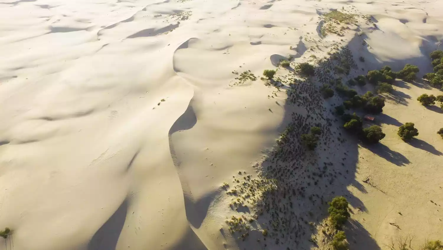
Horqin Sandy Land
(Image source: Internet)
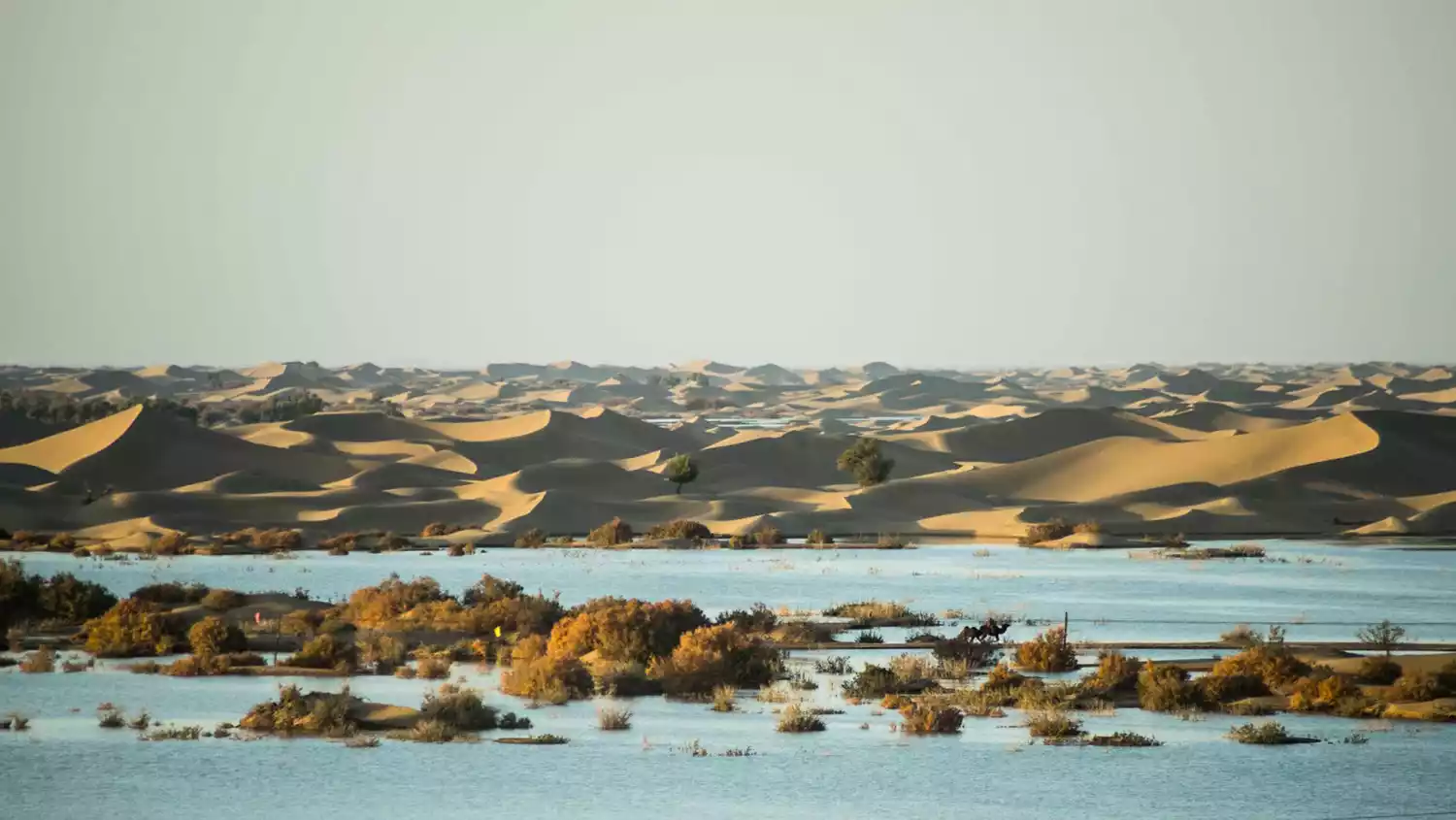
The Horqin Desert is more famous than the Horqin Grassland. Nearby, there's also the Hunshandake Desert in Xilin Gol. Desert doesn't necessarily mean desolation; in nomadic life, it serves as a welcome complement to grassland.
The grasslands will experience snowfall in winter, and the sheep will easily get sick if they eat grass in the snow. However, snow is not easy to accumulate in sandy areas, so the vegetation in the sand is an extremely important food supplement for the herd.
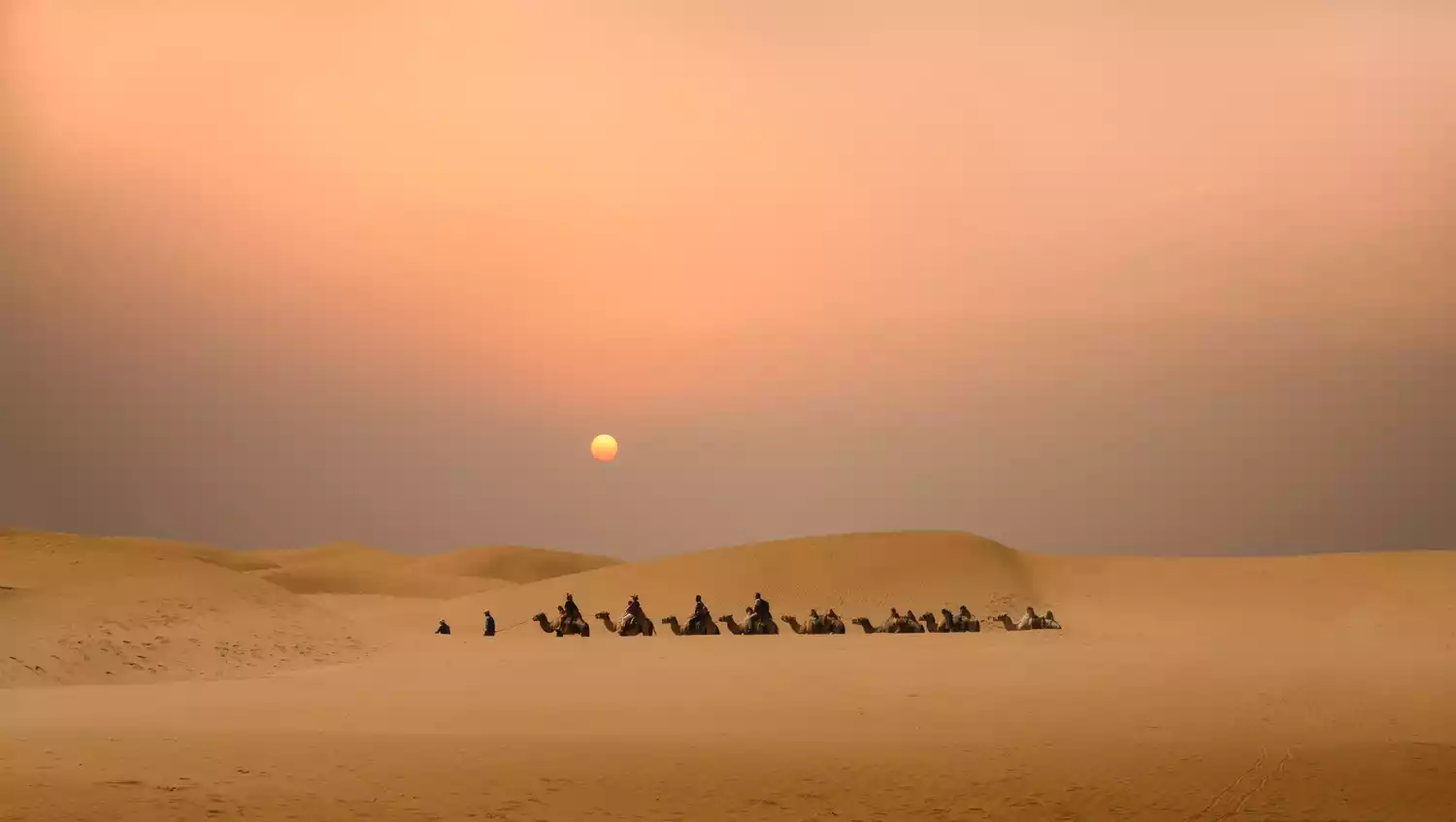
Camping and off-road activities in Horqin Desert are very attractive.
Geological wonders ⭐ Ulanqab
(Image by @阿北)
This year is 2020. Have you seen the only Lunar New Year movie "Lost in Russia"? If you have, you must have heard of the two names "Ulanqab" and "Jining".
Jining, a district under the jurisdiction of Ulanqab, is a town that does not resemble Inner Mongolia. It sounds like a local dialect similar to that of northern Shanxi. The town is accessible by railway, making Jining more like a city in Shanxi.
(Image source: Internet)
Heading north from Jining, you'll find grasslands that look nothing like the Inner Mongolian grasslands. You might pass the Daqing Mountains, where the strange rocks of Huanghuagou stand silently amidst the vibrant landscape; then you'll reach Ulan Buh, where the intact volcanic cone suddenly appears; and then, through vast expanses of grassy plains resembling burnt grass, you'll reach the volcanic wonder of Dahong Mountain.
Arriving in Jining, you've reached the heart of the Inner Mongolian grasslands, where the typical grasslands gradually transition to desert steppes. Jining is also an excellent hub for travelers, with flights already operating and high-speed rail services in the pipeline.
Windmill fields, and many unexpected things
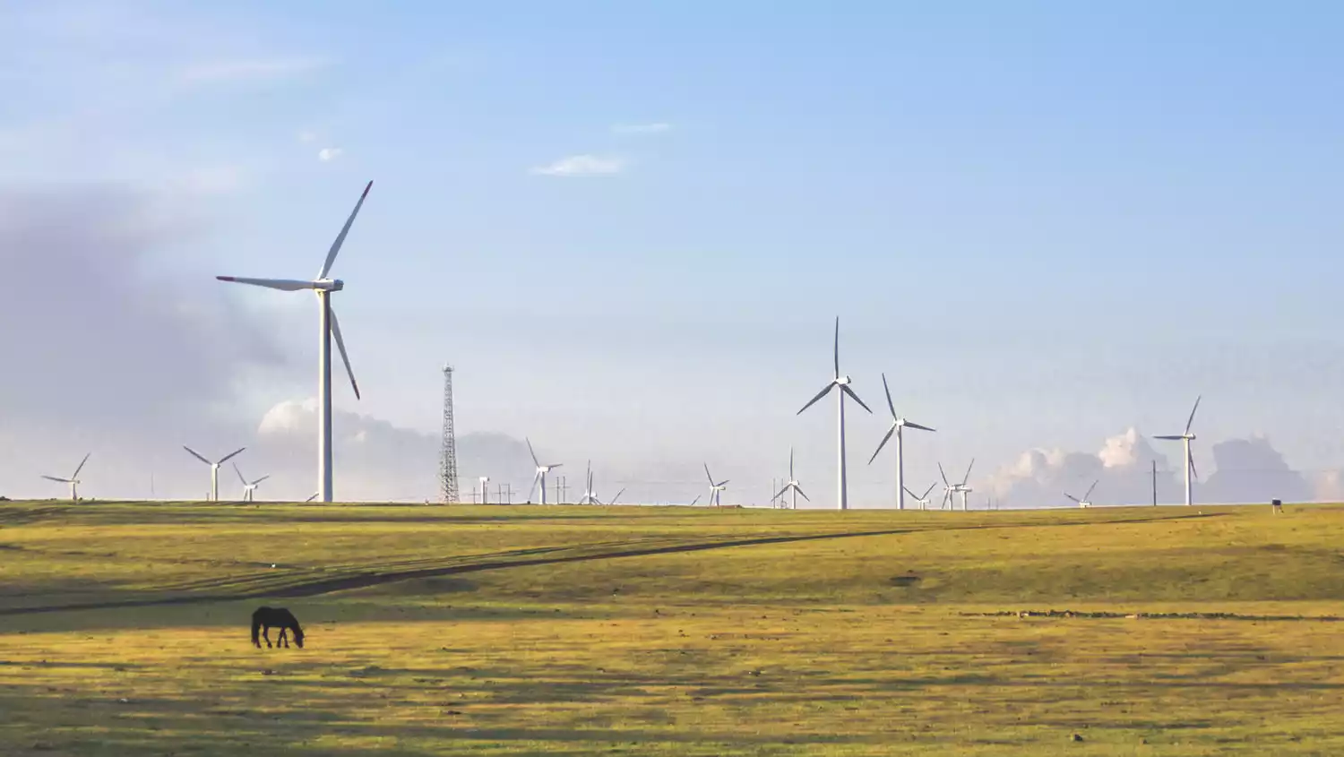
(Image source: Internet)
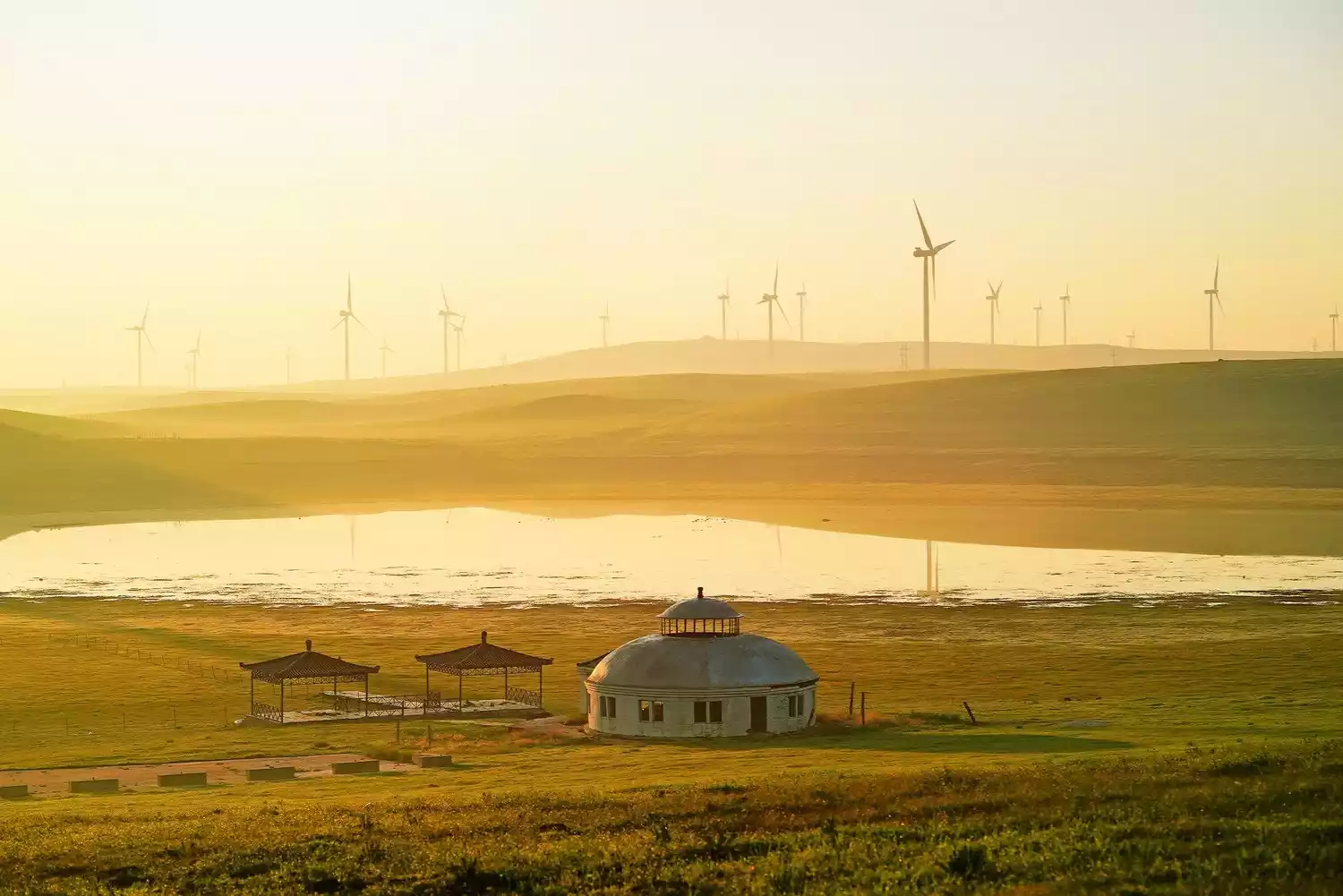
(Image source: Internet)
(Image source: Internet)
Windmills and grasslands? This fusion of modern industry and traditional animal husbandry is a beautiful sight to behold in Holingol! Inner Mongolia boasts abundant wind resources, and the Ulanqab region is particularly blessed by the wind god. Standing before these silent, slowly turning giants, one feels even more insignificant.
Ulanqab is perhaps the most subtle blend of inland life and grasslands. If you're looking for a relaxing grassland adventure, I highly recommend visiting Ulanqab. The cuisine in Ulanqab is more like that of Shanxi Province, where you can enjoy delicious oat noodles and authentic hand-pulled pork.
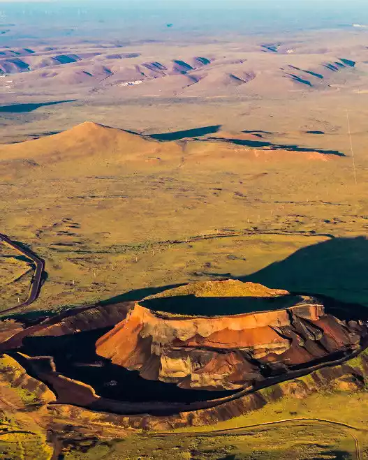
Ulan Hada Volcano
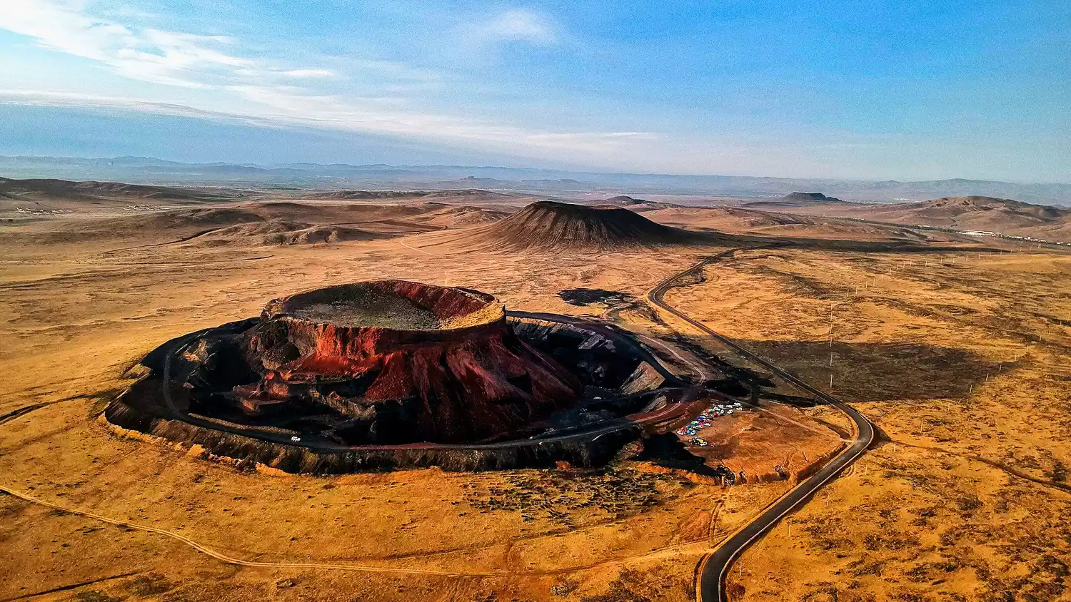
(Image source: Internet)
Driving along the G55 Erguang Expressway, you'll be struck by the sudden appearance of a cluster of more than ten volcanoes. The two most prominent, Volcanoes 5 and 6, are known locally as "Alchemy Furnaces."
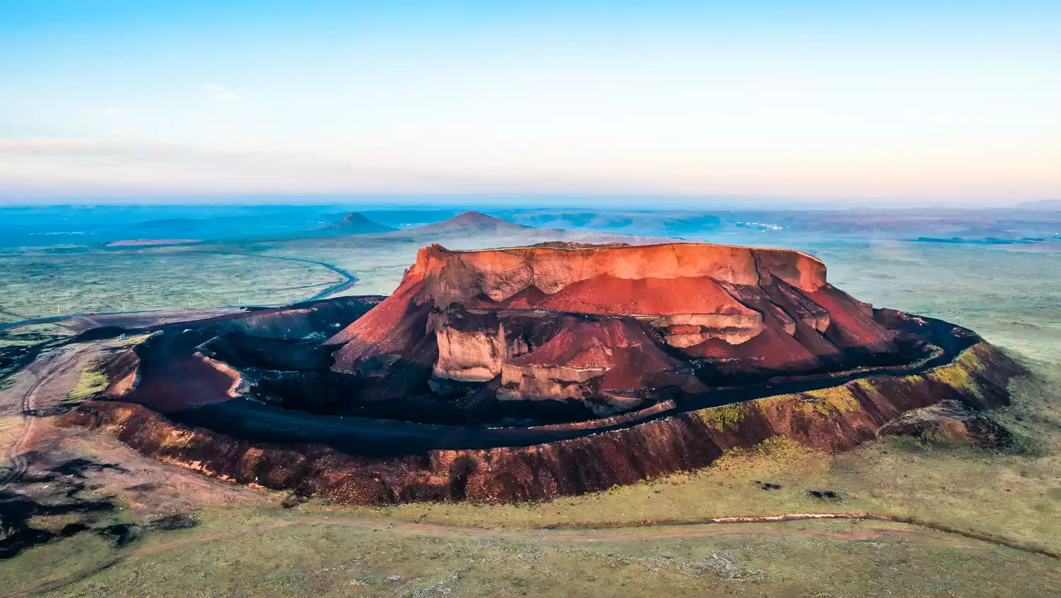
(Image source: Internet)
The No. 5 volcano is intact, and climbing up along the plank road reveals that the mountain pass is covered with vegetation. The No. 6 volcano has exposed its fiery red rock layers due to mining, which is particularly spectacular under the sunset.
Dahongshan
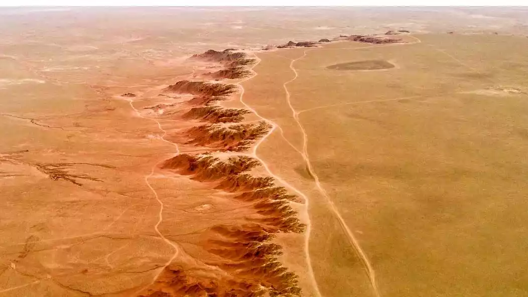
(Image source: Internet)
Dahong, also known as Naomugeg Mountain, is located in the northwest of Siziwang Banner. Although it is a waterless grassland, the grass is lush in the rainy season and wild animals often appear here. You can see gazelles, foxes or wild camels.
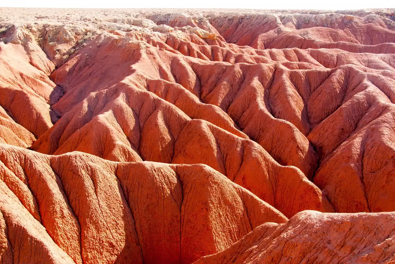
(Image source: Internet)
The complex texture of the Red Mountain is very similar to Australia's famous Ayers Rock. You can stop at Uhante Yinboer and Tuaobao, the highest point of the Red Mountain, and overlook its unique shape; or walk in the rugged valley, where you can occasionally see animal skeletons.
A difficult achievement ⭐ Ordos
(Image by @阿北)
Some say Ordos isn't worth visiting. Its reputation as a "ghost town" has endured for years, gradually becoming a haunting specter. Amidst the utilitarian urban atmosphere, the grasslands have naturally been encroached upon by commercialism, creating the very thing that travelers to Inner Mongolia least want to encounter.
(Image source: Internet)
But Ordos doesn't care about these misunderstandings. Despite the howling deserts and barren wastelands to the north and south of the grasslands, it persists in its unwavering faith in progress. You can see this tenacity in the Kubuqi Desert, where you can see the tenacious growth of shelterbelts along the edge of the strip of desert. You can also feel this resilience on the west bank of Laoniuwan and at the Wanjiazhai Reservoir.
Surrounded on three sides by the Yellow River, Ordos seems trapped outside a "J" shape, cut off from the very roots of the grasslands. Yet, Ordos has inherited the Yellow River's spirit, carving deep into the dusty loess plateau until it has forged a resolute stance, a shape capable of nurturing hope.
Symphony of poverty and abundance
(Image source: Internet)
The Ordos Grassland may not be as famous as the other grasslands mentioned above, but you can still get a good grassland experience here. Importantly, the convenient transportation can take you to Kubuqi or other places in Shanxi.
Kubuqi Desert
(Image source: Internet)
(Image source: Internet)
The strip-shaped Kubuqi National Forest Park is located on the south bank of the Yellow River, facing the fertile Hetao Plain across the river. Its first impression is often barren and desolate, but only when you go deep into Kubuqi National Forest Park can you see its vastness and tranquility.
(Image source: Internet)
Kubuqi already has a mature desert hiking route. Compared with the complete and mature desert fun in Xiangsha Bay, crossing Kubuqi has a more wild feeling and can really go deep into the desert and experience the desert day and night.
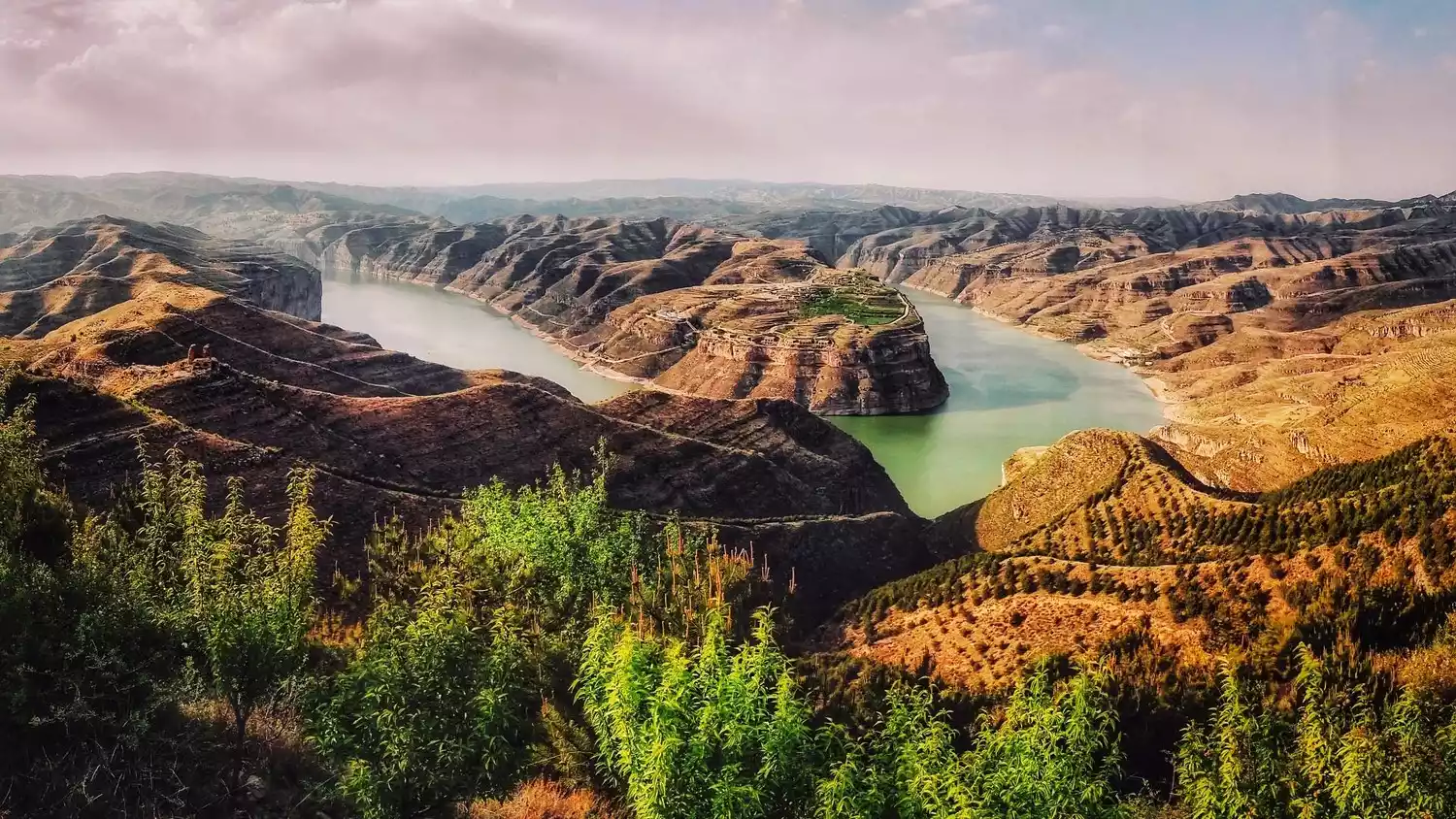
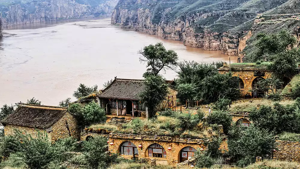
Laoniuwan
(Image source: Internet)
Laoniuwan is located at the junction of Inner Mongolia and Shanxi. The Yellow River flows through here, makes a 180-degree turn, and creates a stunning river bend landscape.
(Image source: Internet)
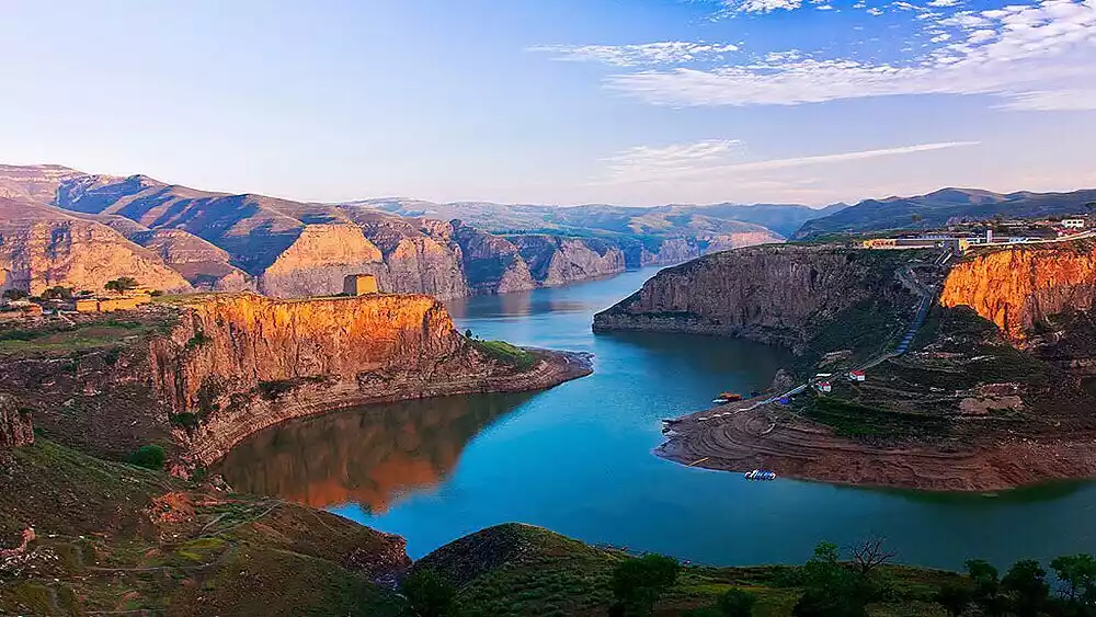
(Image source: Internet)
Take a ferry to Laoniu Bay, where the downcut rock face unfolds before your eyes, and a beacon tower stands alone on the barren hilltops of the Loess Plateau. Staying in a traditional earthen kiln in a village on either side of the strait and enjoying a meal of freshly cooked mutton is truly delightful.
Conclusion
(Image source: Internet)
You've undoubtedly read this poem: "The sky is vast, the wilderness is boundless; the wind blows the grass low, revealing cattle and sheep." Abei has seen many people use this last line to recreate their own vision of the grassland.
But do you know that the landscape described in this poem is not grassland, but the alpine meadow on the southern foot of Yinshan Mountain, and the cattle and sheep are lurking not on pasture grass, but on another common plant - coniferous tree.
We mistakenly believe that the grassland only has endless grasslands, white yurts, and leisurely sheep, but deep in the grassland there are often beautiful views that we have never thought of and are difficult to predict.
[Statement] We are committed to protecting the content of every original creator, but because some pictures and texts come from various channels such as the Internet, we cannot trace the author. If there is any infringement, please contact us to delete it.