Come visit Xinjiang this summer and discover these five stunning Tianshan hiking routes—you won’t regret it if you don’t try them!
Preface
Mountain ranges are formed when mountains extend into veins. Mountain ranges form the backbone of China's geography, topography, and topography, often marking the boundaries between different topographical regions. The direction in which a mountain range extends is called its strike.
The tall mountains on Earth are all fold mountains, which are formed by the compression of the continental margins or the collision of continental plates, and have obvious folds.
Mountain ranges can be divided into two types: monolithic and scattered.
The former are located on a monolithic plateau, such as the Tianshan Mountains, while the latter have some integrity but are not located on a monolithic plateau, such as the Wugong Mountains in the middle of the Luoxiao Mountains, which is a long low-lying warm zone.
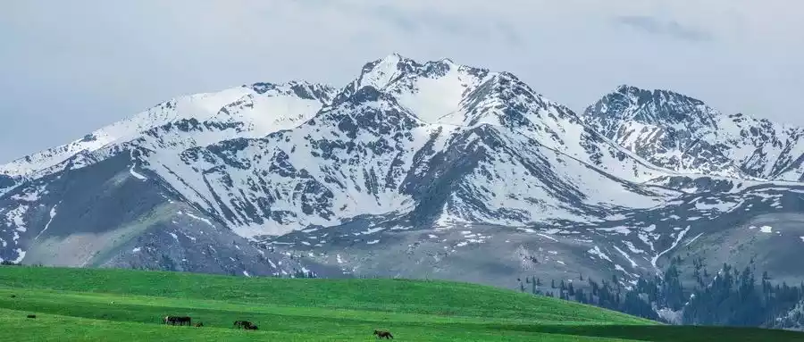
The Tianshan Mountains, as part of a larger mountain range, are considered the axis of the Western Regions. The mountain range to which the Tianshan Mountains belong is the world's largest independent latitudinal mountain range, the farthest from the ocean, and the largest mountain range in the world's arid regions.
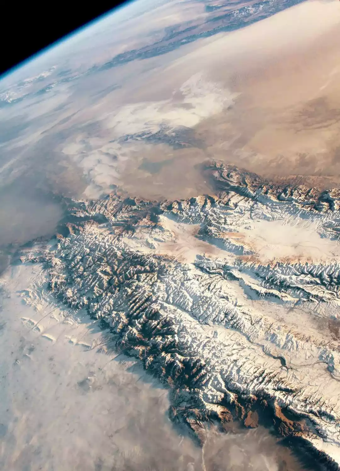
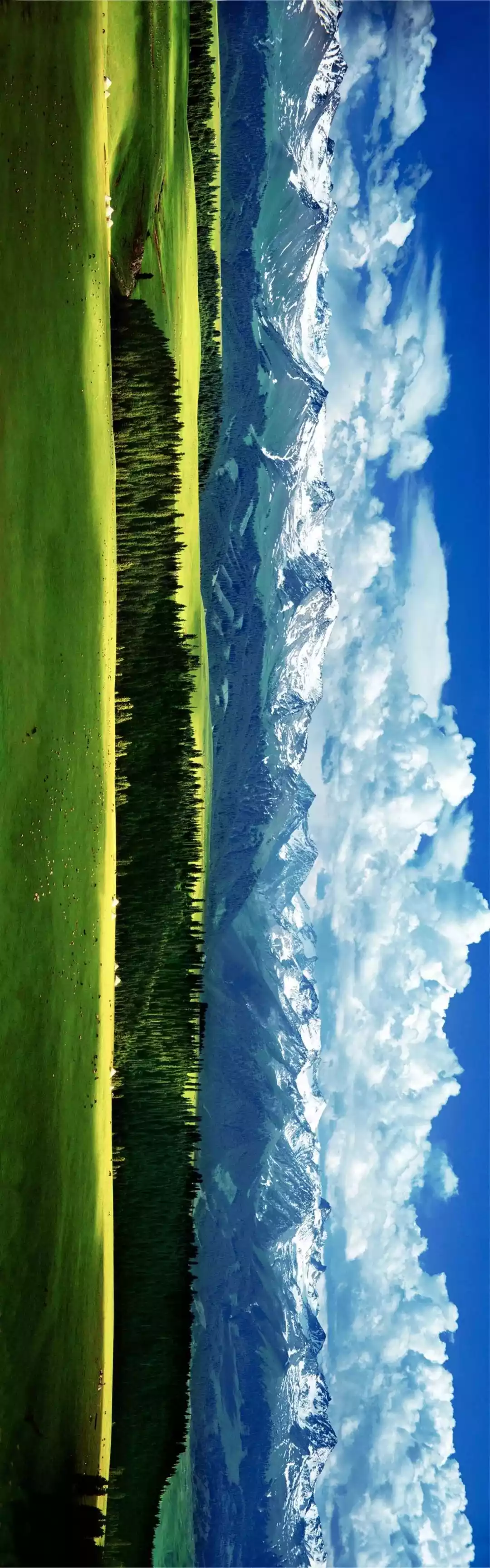
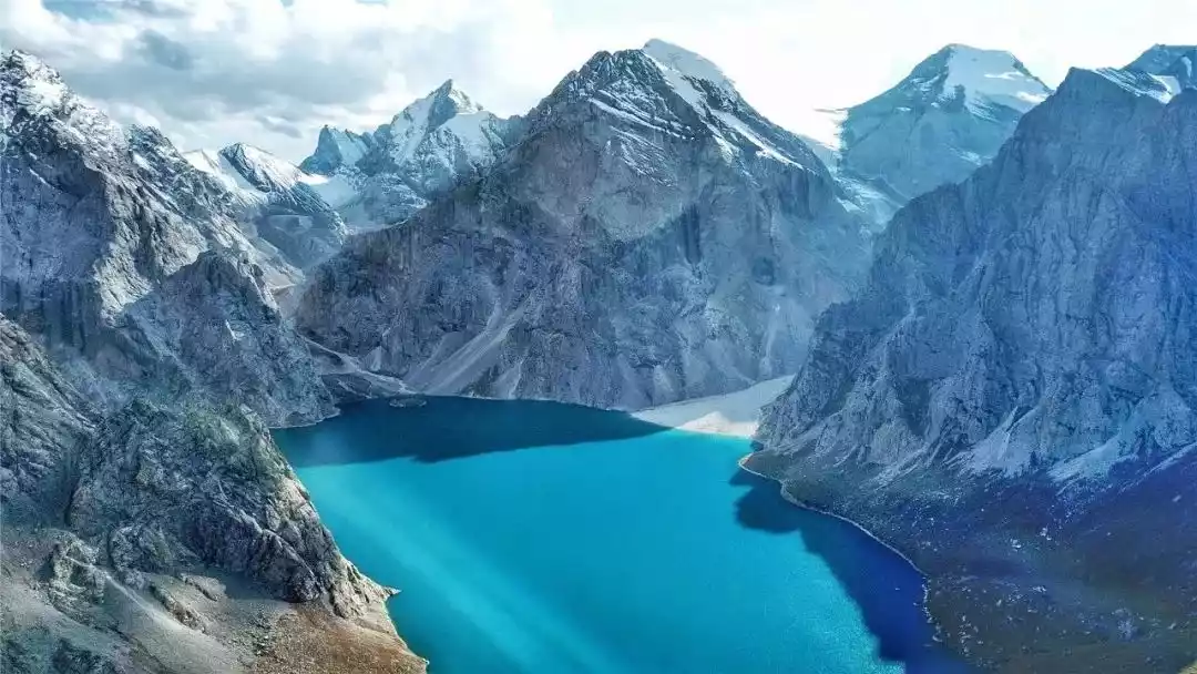
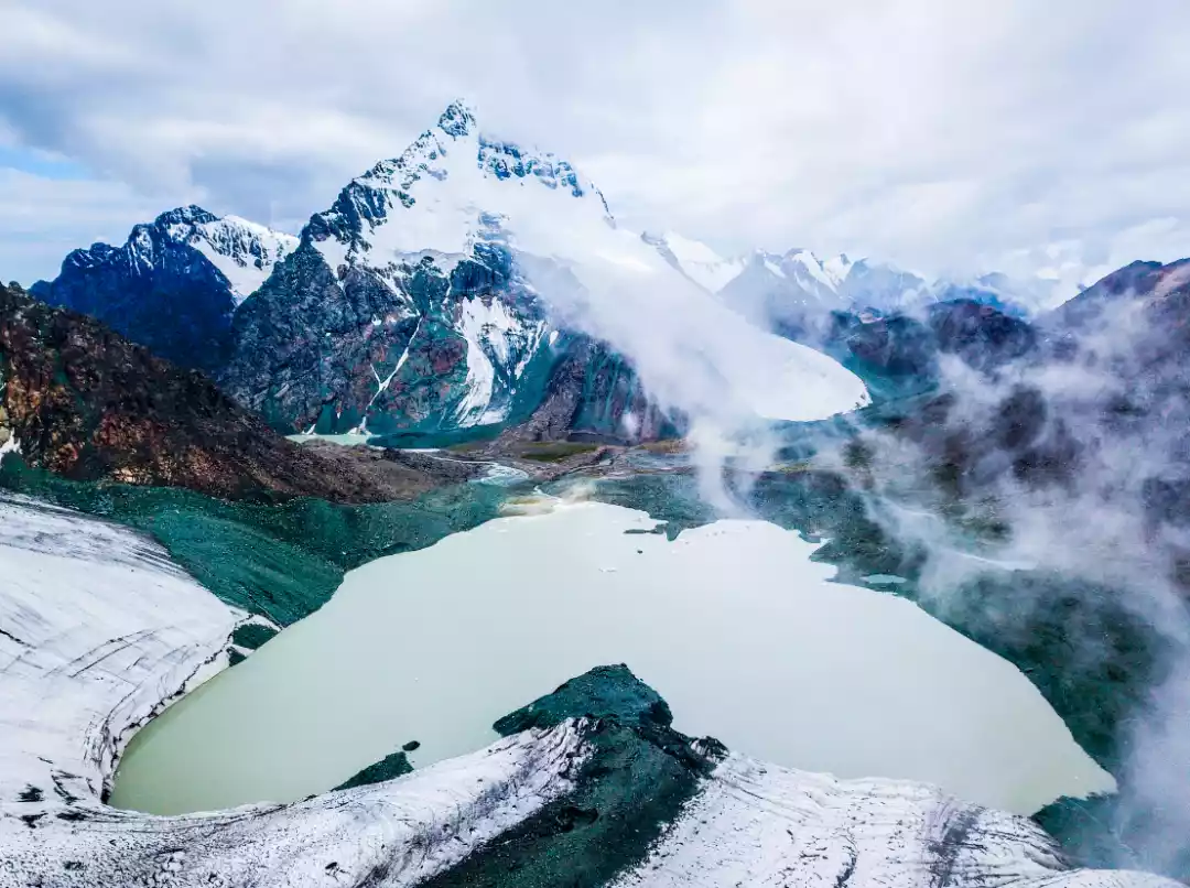
Tianshan Mountains from space
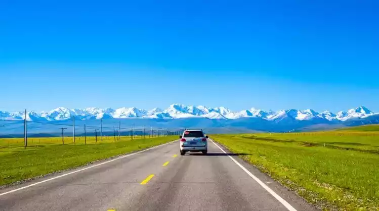
The Tianshan Mountains lie in the heart of the Eurasian continent, stretching east-west across China, Kazakhstan, Kyrgyzstan, and Uzbekistan. They are approximately 2,500 kilometers long, with an average width of 250-350 kilometers from north to south, reaching over 800 kilometers at their widest point.
The Xinjiang Tianshan Mountains refer to the portion of the Tianshan Mountain Range located within China, also known as the Chinese Tianshan Mountains or the Eastern Tianshan Mountains. Stretching for 1,700 kilometers within China, they cover an area of over 570,000 square kilometers, accounting for approximately one-third of Xinjiang's total area.
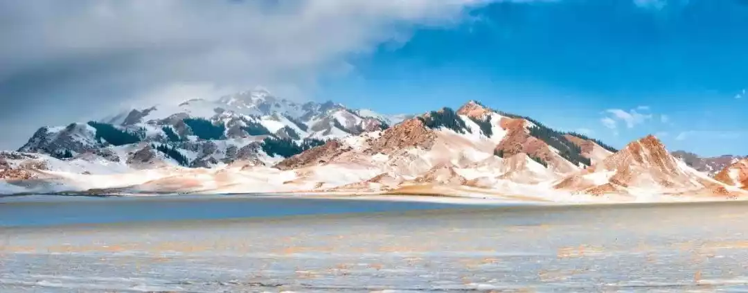
The Tianshan Mountains roughly divide Xinjiang into two parts: the Tarim Basin in the south and the Junggar Basin in the north. Mount Tomur is the highest peak in the Tianshan Mountains, at 7,443.8 meters above sea level. The Syr Darya, Chu River, and Ili River all originate in the Tianshan Mountains.
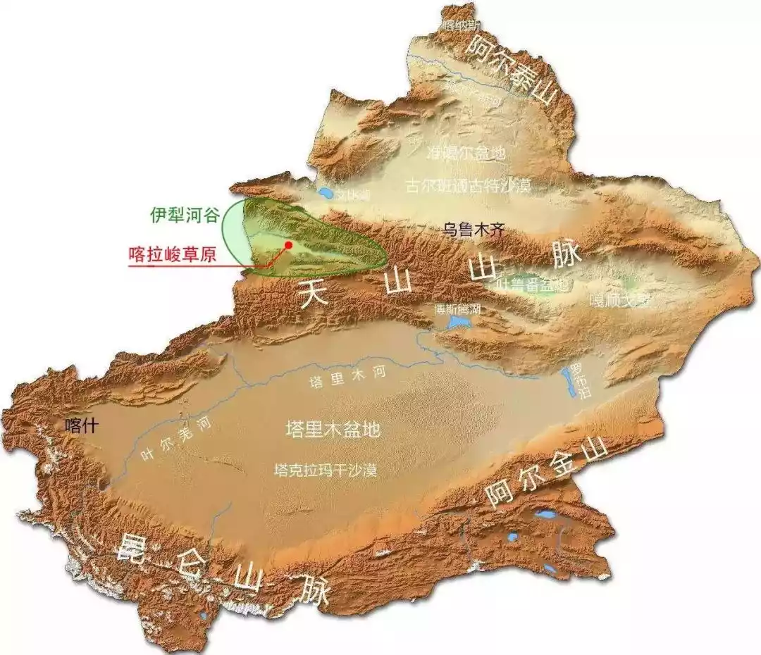
On June 21, 2013, the four areas of Tomur Peak, Karajun-Kuldenin, Bayinbuluke and Bogda in the Tianshan Mountains in China were successfully applied to become a World Natural Heritage under the name of "Xinjiang Tianshan", becoming China's 44th World Heritage Site.
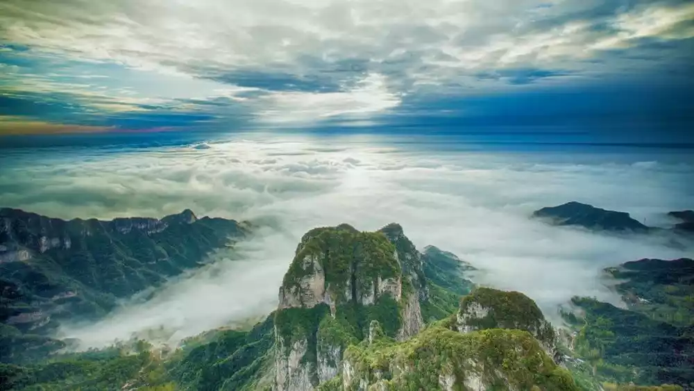
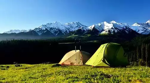
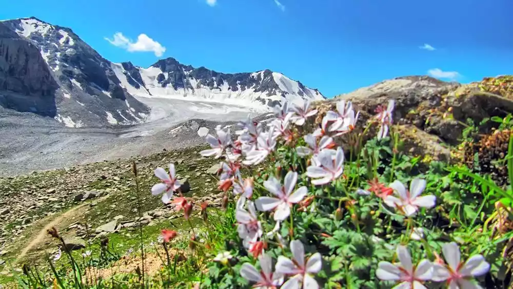
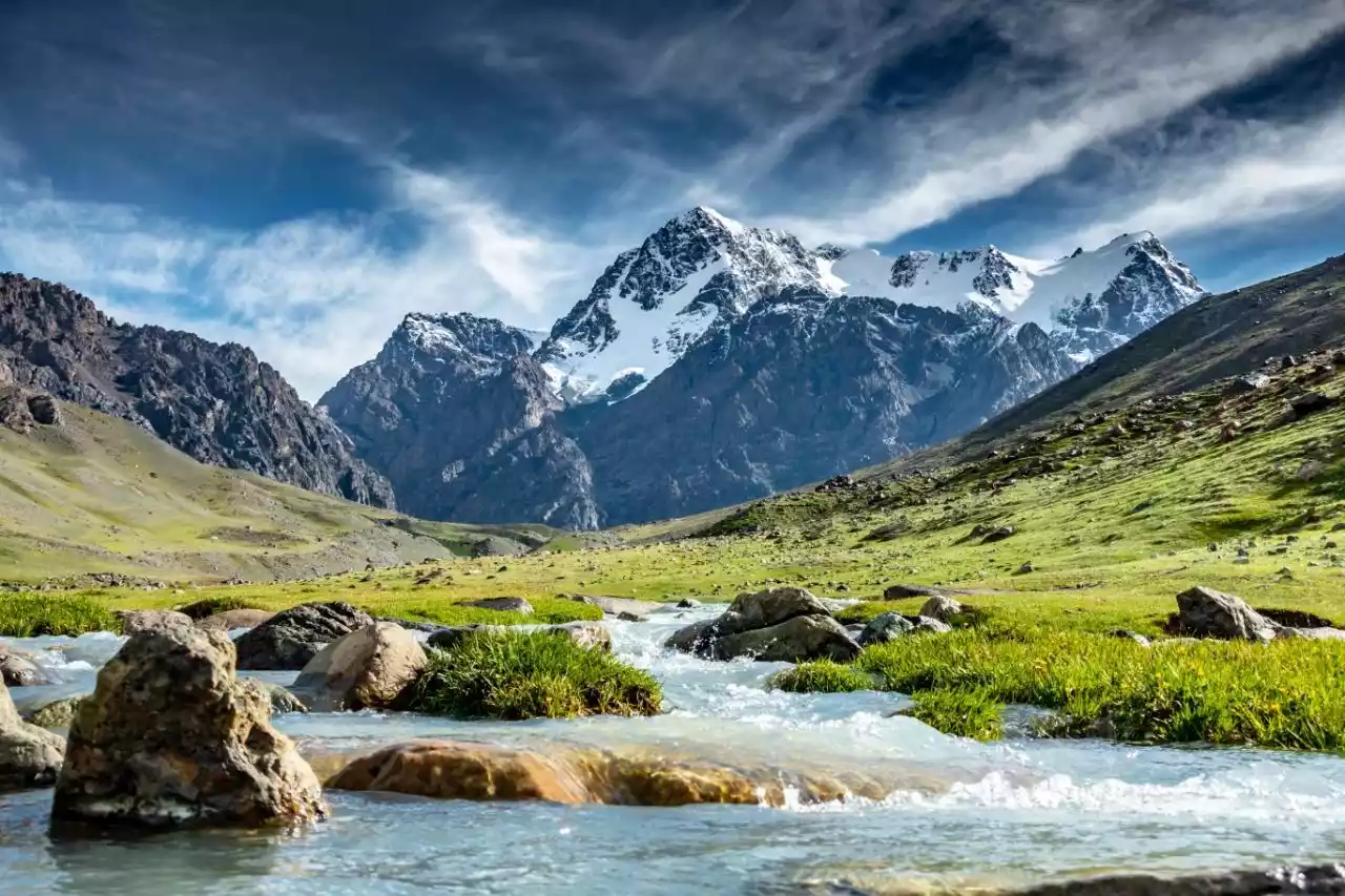
The Tianshan Mountains are a very wonderful place. It has both glaciers that never melt and glacier belts that melt in the summer. It is covered with dense grasslands, rich vegetation, and a rich river network, but also has very dry areas, forming the magnificent Tianshan Grand Canyon.
There are many poems and verses in ancient times that describe or quote Tianshan Mountain. The Tang Dynasty poet Li Bai once praised Tianchi Lake like this: "The bright moon rises from Tianshan Mountain, among the vast sea of clouds." There is also the "Tianshan Snow Lotus" that often appears in martial arts novels and is portrayed as a miraculous medicine that can bring the dead back to life.
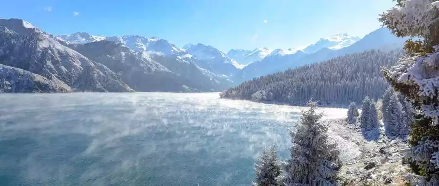
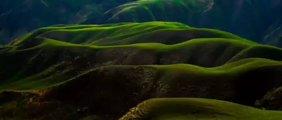
In Tianshan Mountains, you can see the following scenery: winding snow-capped mountains, crisscrossing glaciers, meandering rivers, scattered lakes, green grasslands, lush meadows, forests like belts, vast deserts... There is not only harmony and perfection here, but also contradictions and conflicts.
The Tianshan Mountains juxtapose opposites such as cold and heat, drought and humidity, flatness and steepness, height and depth, ice and snow and green, richness and monotony in the same time and space.
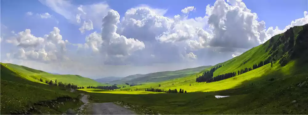
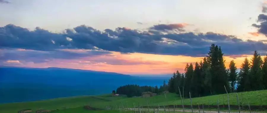
Every May, Xinjiang transforms into a sea of green. Fields of flowers, spruce trees, and flowing water, illuminated by the setting sun, create a vibrantly colored painting: "The sky is emerald green, the ground is emerald green, and even the gentle breeze is filled with green."
Recommended hiking routes in Xinjiang
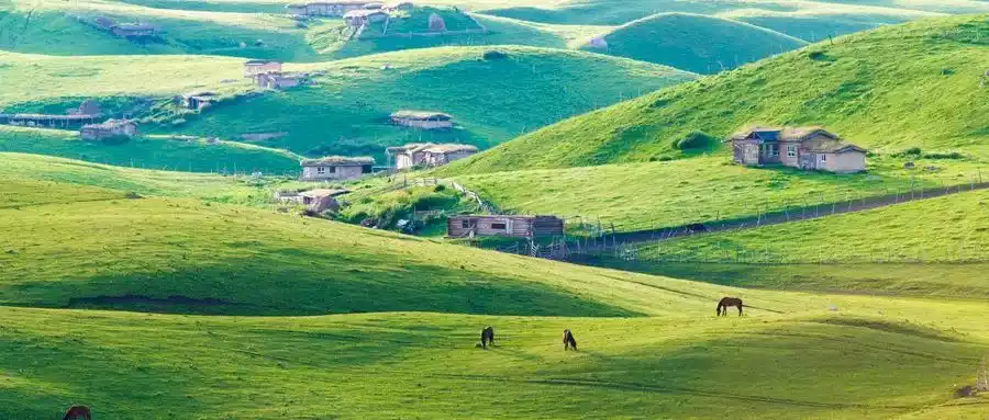
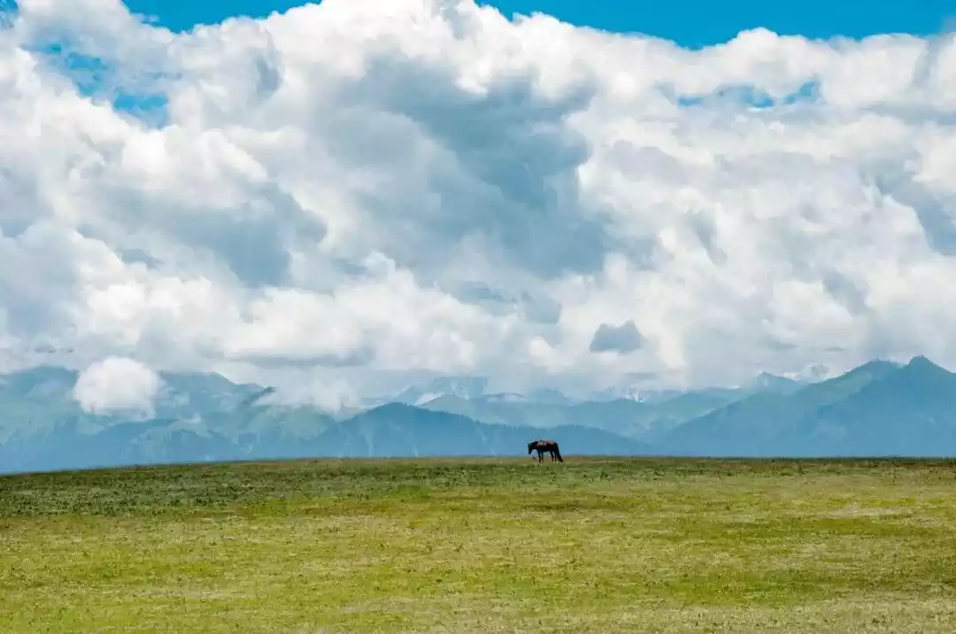
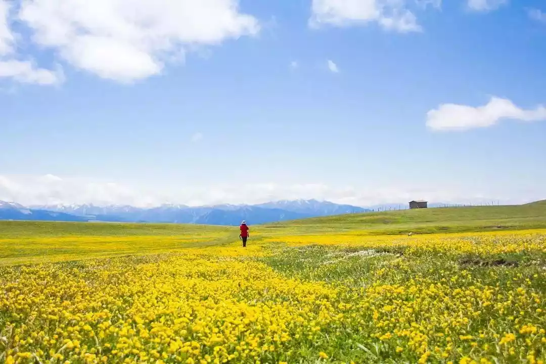
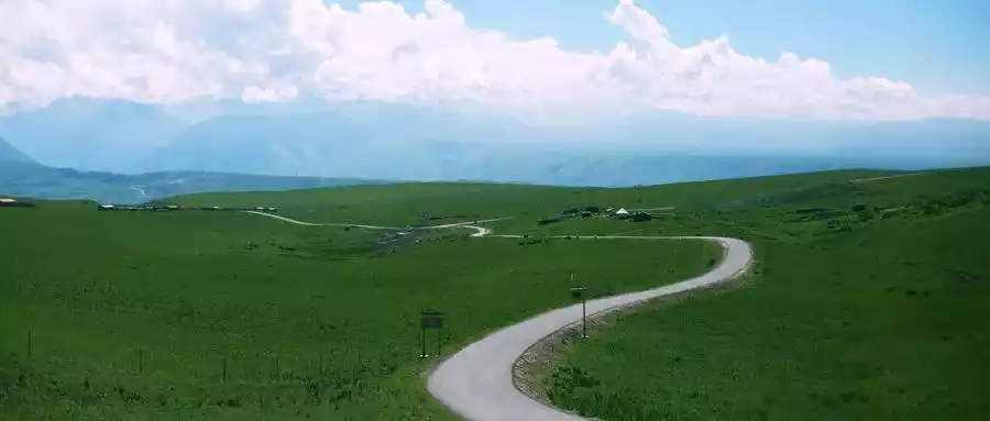
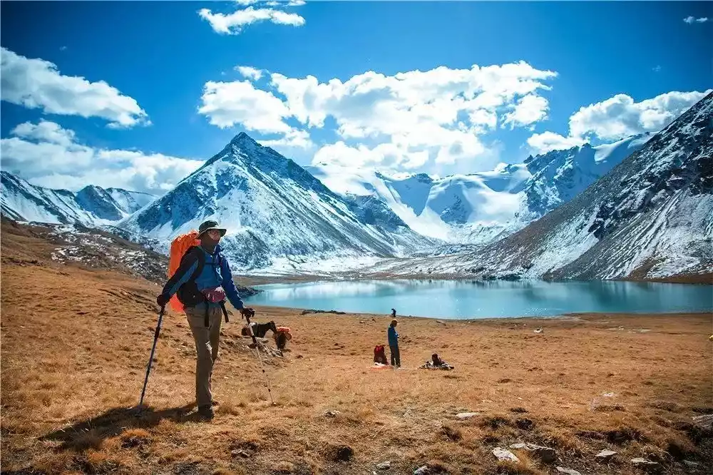
01 / Kalajun
"Karajun," meaning "wild plains on the mountain ridge" in Kazakh, is the core area of the Tianshan World Heritage Site.
Represented by the Tianshan coniferous forests and mountain meadows, it boasts a unique and intact ecosystem and is the most biodiverse region in Xinjiang.
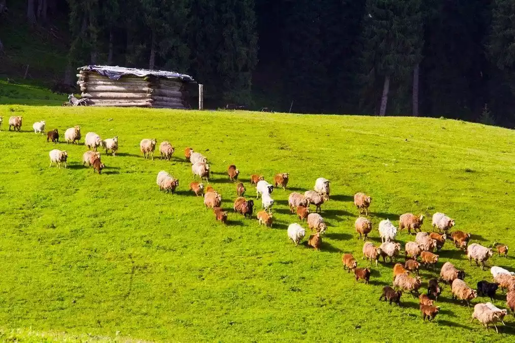
Karajun, also known as the northern route of the ancient Silk Road, was home to the Wusun Kingdom, the largest nomadic nation in the Western Regions. Nestled against the majestic Tianshan Mountains, it's home to scattered cattle and sheep and the authentic lifestyle of Kazakh nomads.
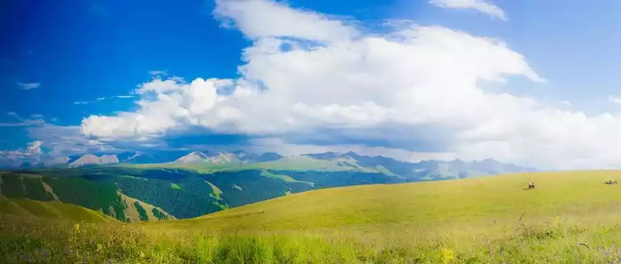
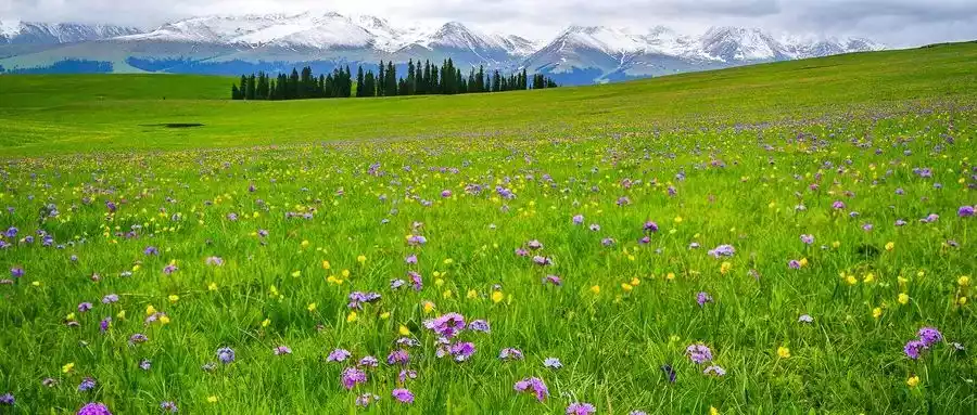
The Kalajun Mountains stretch east-west, flanked by ravines and undulating plains dotted with lush, primeval spruce forests. The summit of Kalajun, however, forms a seamless, south-sloping plateau, covered in lush grass and vibrant flowers, like an unfurling green carpet that stretches all the way to the foot of the snow-capped mountains.
As the spokesperson for "China's Peak Natural Beauty", Kalajun sweeps away the fatigue brought by the traditional grasslands, monotonous colors and single landscapes, and displays the beauty of colors from another time and space.

It boasts some of the world's rare high-quality alpine grasslands, with undulating, three-dimensional prairie patterns like waves and uneven heights. It is known as "China's most beautiful three-dimensional grassland landscape belt."
In November 2016, Kalajun Scenic Area was rated as a 5A tourist attraction by the National Tourism Administration, and is truly the "King of Ili Grassland".
In the summer, the Kalajun grassland is full of blooming flowers, green grass, herds of cattle and sheep, and dotted with yurts. The earth is covered with a green velvet carpet, the grassland is a sea of flowers, and in the distance are the magnificent snow-capped Tianshan Mountains.
Run freely in the blooming five-color meadow, hike to the edge of the grassland canyon, overlook the aerial grassland and the third-level planation surface, as well as the vivid Crocodile Bay and the popular "Human Grassland"!
Only when you come to Kalajun will you realize that the peak natural beauty is not so out of reach.
Only when you really stand in the sea of flowers in Kalajun, you will find that the yellow is so bright.
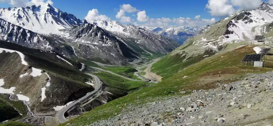
02 / Mengkede Ancient Trail
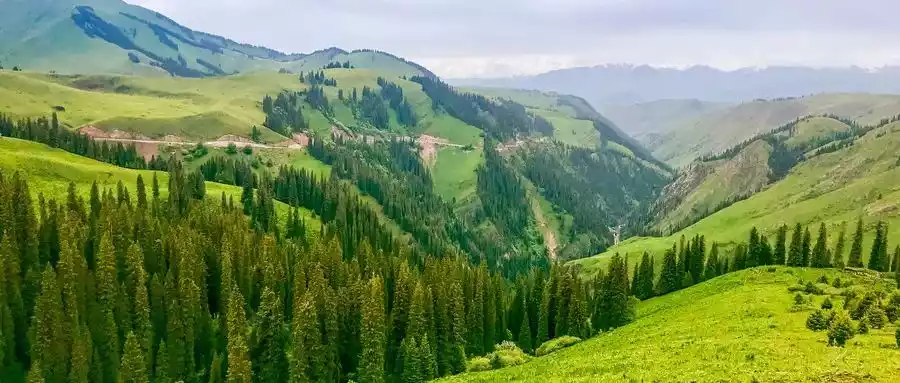
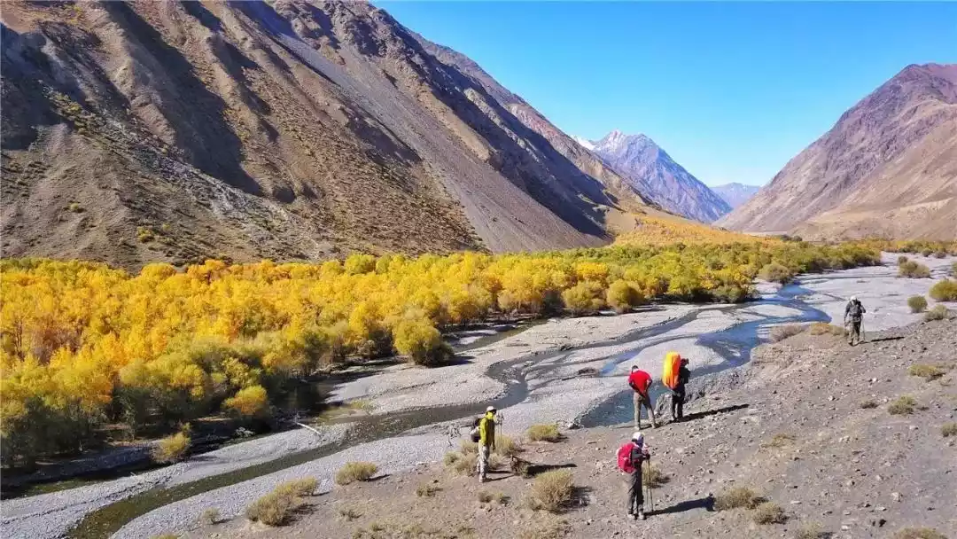
The Mengkede Ancient Road is located in the easternmost section of the Borokonu Mountains in the central Tianshan Mountains. Starting from Dushanzi on the Duku Highway, it passes through swaying poplars, a variety of dead trees, the Tianhu Lake that rivals Jiuzhaigou, and the Tangbula Grassland, a 100-mile gallery.
The Mengkede Trail offers breathtaking scenery, yet it doesn't require the same "hellish" hikes as the Wolf Tower and Shate Trails.
Its length and intensity are both moderate, making it a perfect start for first-time hikers in Xinjiang and a great place to unwind after visiting these infernal areas.
The Duku Highway is the starting point of the ancient road, like a giant dragon lying on the Tianshan Mountains. Although it is only separated by a mountain, this road is an experience of ice and fire "from fire to sea water"!
Photo/China-TravelNote Cavalry
From the barren red earth and rocky mountains to the lush green grass, from the fragrant wildflowers to the freezing white snow, you can experience the magic of "different weather every ten miles, four seasons in one day" and the thrill of "Snow in July in Tianshan Mountains".

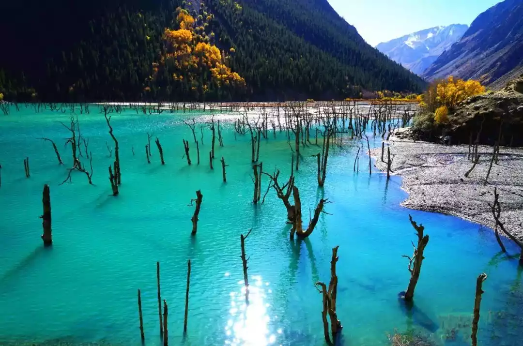
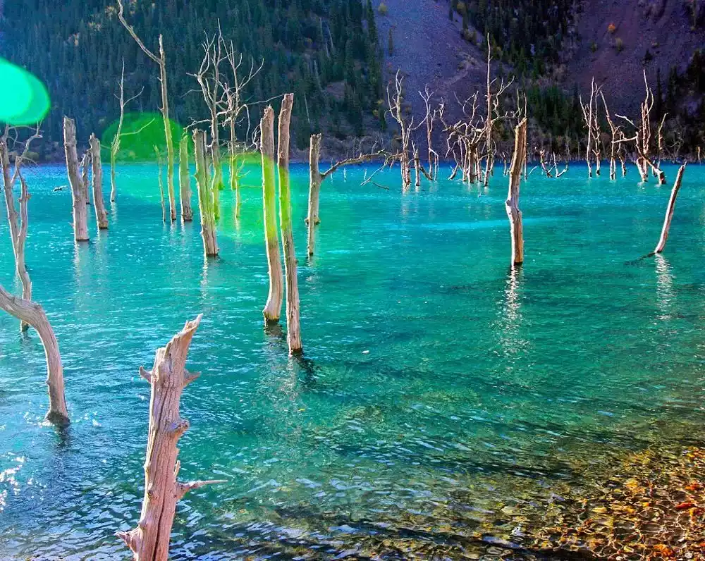
Then we came to Ulan Sadek Lake, with a clear blue sky and turquoise water, with dead poplar trees standing in the water.
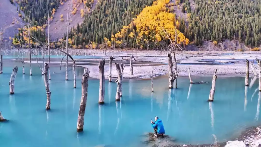
The mountains in the distance are dark blue, while the mountains nearby are colorful. People affectionately call this lake, which is like a paradise on earth, "Heavenly Lake".
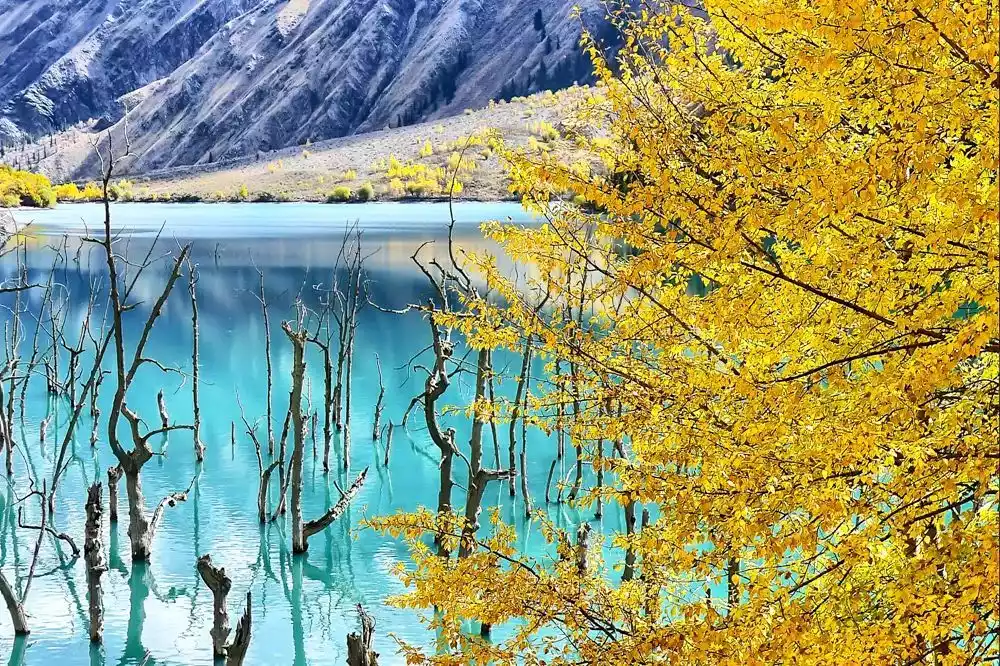
Amidst the vast ancient road, the beautiful Tianhu Lake is crystal clear and vibrantly colored, like a spirit that has fallen into the mortal realm, hidden in its innermost chambers. Ulan Sadek Lake, shaped like a round mirror, was later split in two by a landslide, forming its current bow shape.
Picture/Huhu6
The lake, bathed in sunlight, shimmers in a dazzling array of colors, its shimmering ripples irresistibly captivating.
The stumps of poplar trees, some alive but not dead, some dead but not falling, embellish this otherwise unearthly place with a poignant beauty.
Walking along the quiet horse trail on the mountainside by the lake, I suddenly had an illusion of time and space dislocation. If I hadn't seen it with my own eyes, it would be hard to believe that such beautiful scenery could be hidden in the desolate ancient road.
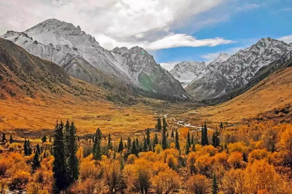
Menketing Pass, also known as Menketing Pass in Mongolian, is 3,495 meters above sea level. It is one of the highest passes in the Yilianhabierga Mountains. Covered with snow year-round, the route is steep and treacherous, and rare wild animals such as snow leopards occasionally appear nearby.
Mengked Lake is also extremely beautiful against the backdrop of the sunset. The mountains on both sides in the distance are still steep, the slopes on both sides of the valley are still covered with green grass, and the river water has become gentle.

Tangbula Grassland is a natural pasture with abundant grass and water, herds of cattle and sheep. It is known as the Hundred Miles Gallery of Tianshan Mountains. Here is the "Little Huashan" with its majestic and towering cliffs, which is also one of the famous attractions in Tangbula.
Here you can empty yourself, throw yourself into the embrace of nature, and experience the artistic conception of "the sky is vast, the wilderness is boundless, the wind blows low and cattle and sheep are seen" with the feelings of a poet.
Meet the snow-capped mountains, the Ulan Sadek River Valley accompanied by the river, the strange and mysterious poplar forests, and the Kuitun River formed by the meltwater from the Tianshan Mountains.
Experience the changing seasons along the way, from spring to summer to autumn to winter, and appreciate the unique natural scenery of Tianshan Mountains.
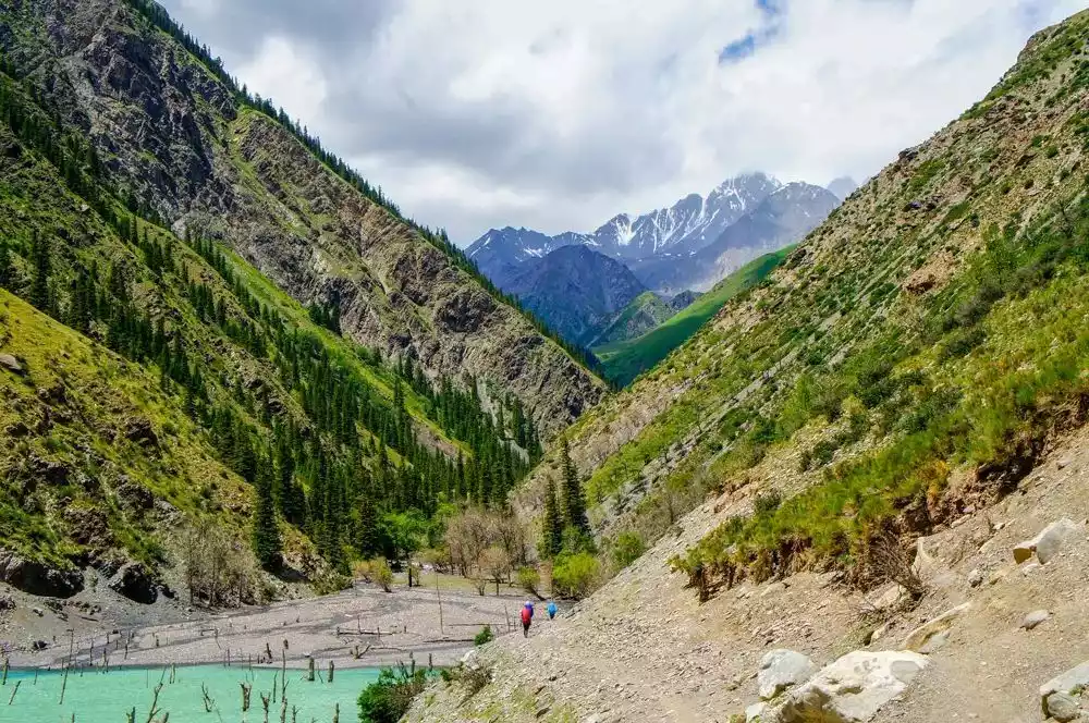
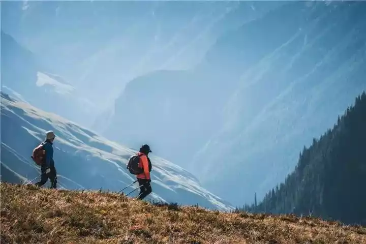
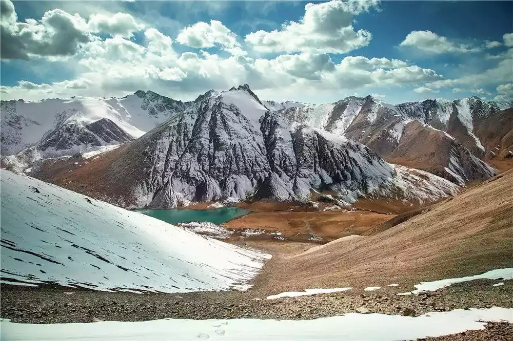
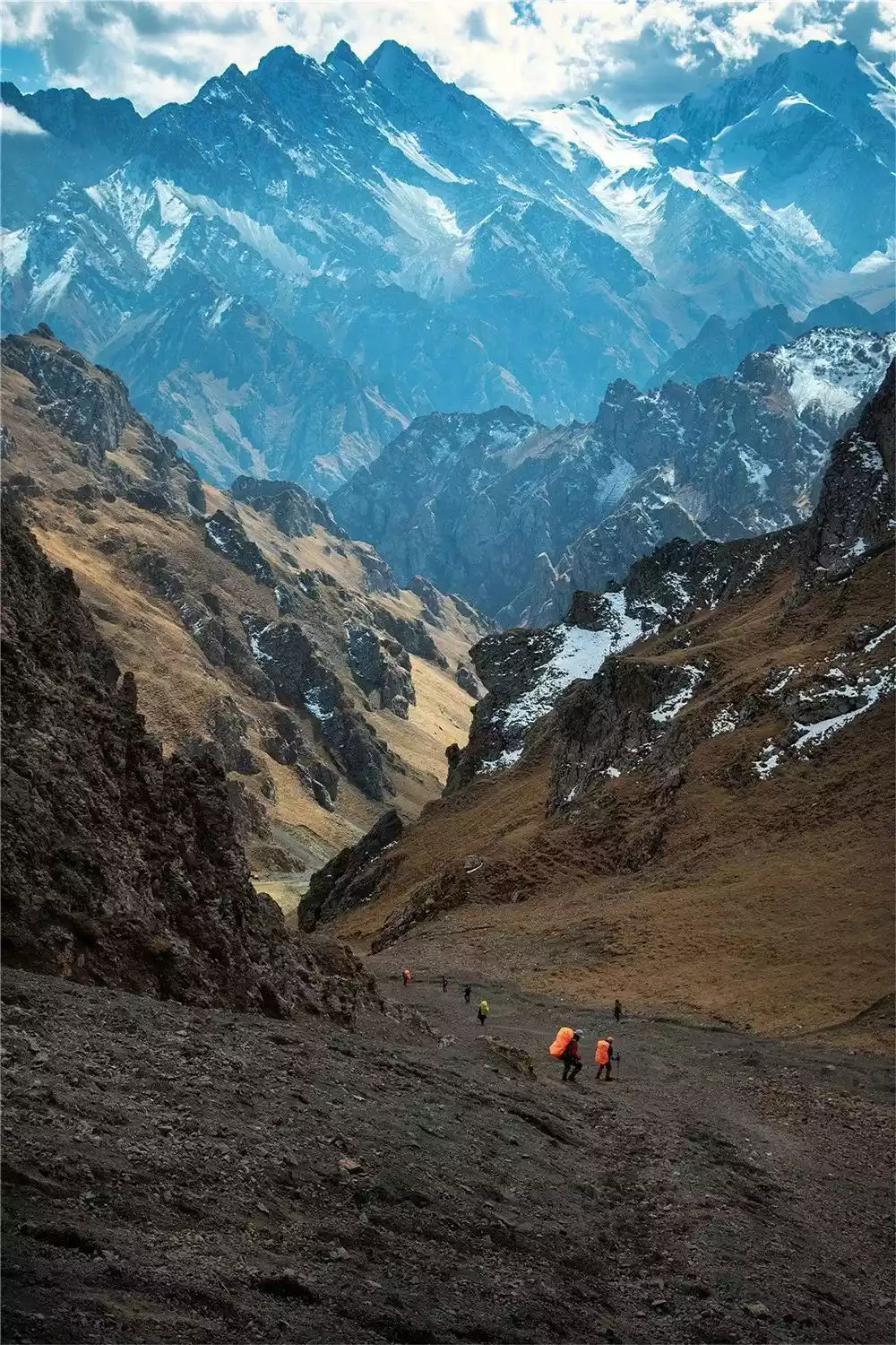
03 / Wusun Ancient Road
"Legend has it that in the past, carriages and horses traveled very slowly. The King of Kucha fell in love with Princess Lieyou's daughter, Dishi. They had to cross the Tianshan Mountains and walk along the ravines and bumps of the Tianshan Mountains. Relying on horses and human legs, they walked this ancient road, traversing thousands of mountains and rivers, and passing a lake high in the mountains - Tiantang Lake. They paved the way for the famous Love Road - the Wusun Ancient Road!"
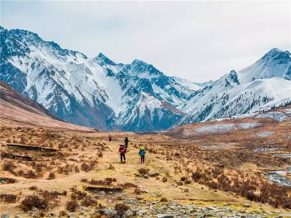
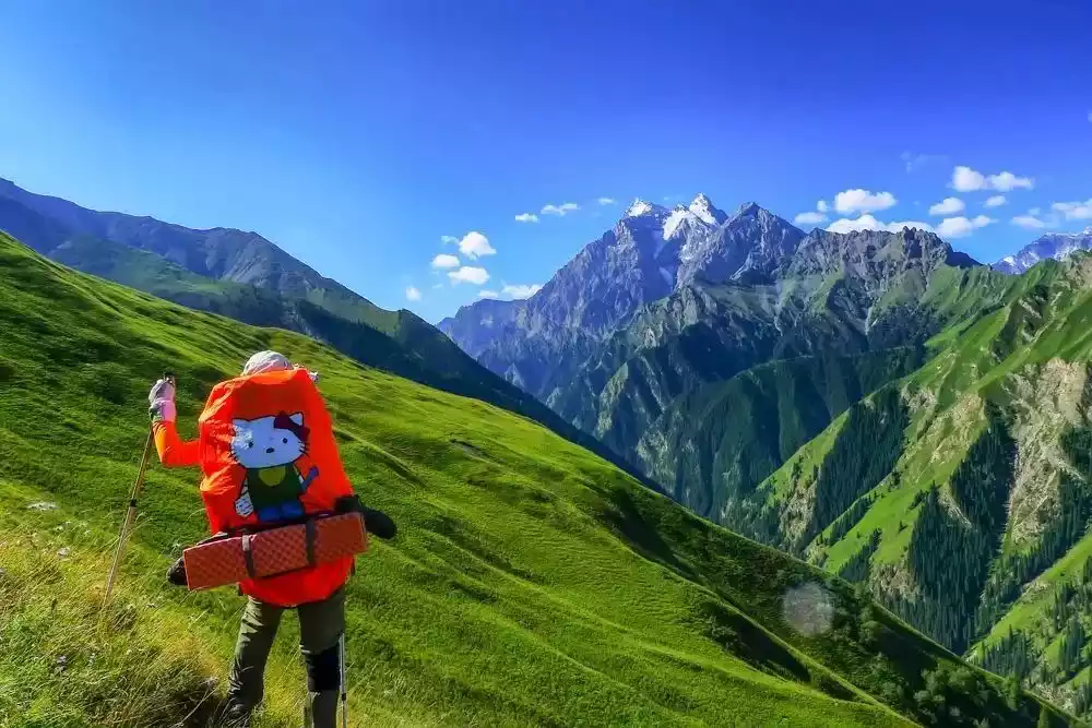
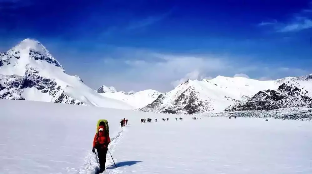
The Wusun Ancient Trail, one of Xinjiang's three most renowned hiking routes, boasts centuries of rich history.
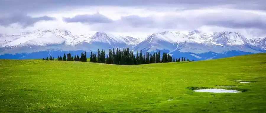
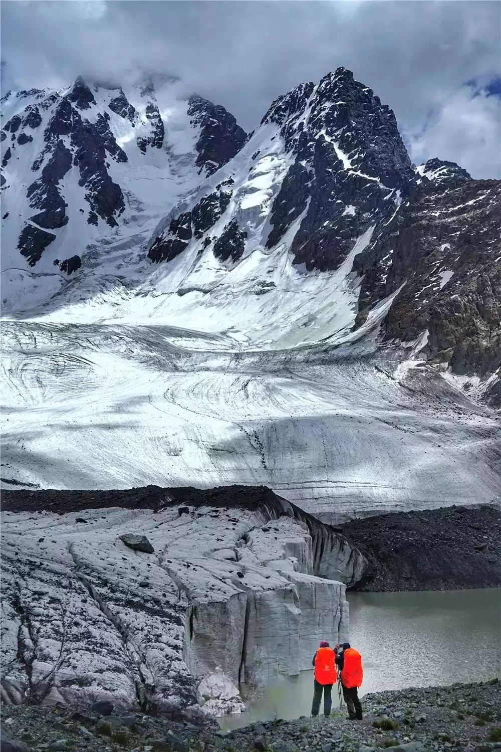
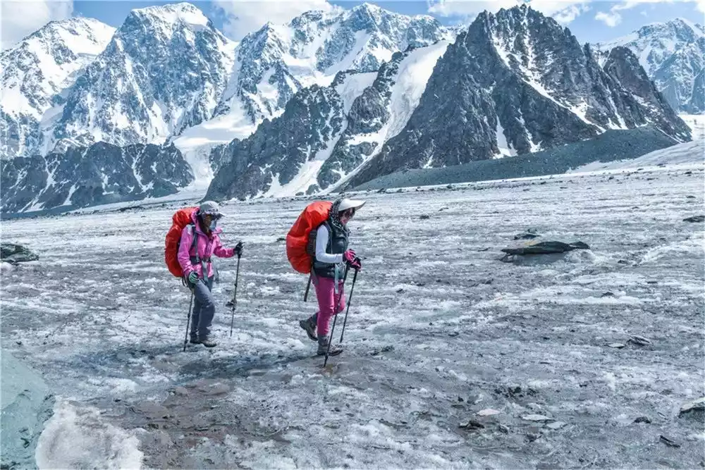
Spanning 130 kilometers from north to south across the Tianshan Mountains, it offers breathtaking scenery, including grasslands, dense forests, snow-capped mountains, glaciers, and lakes.
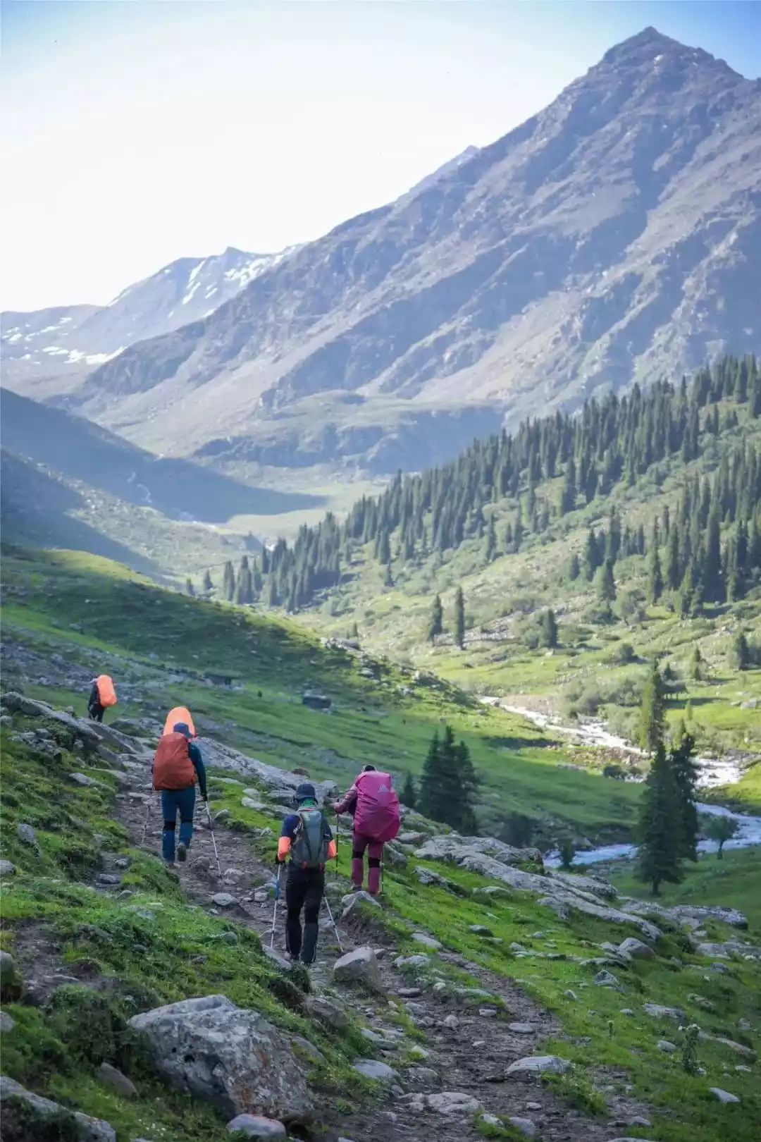
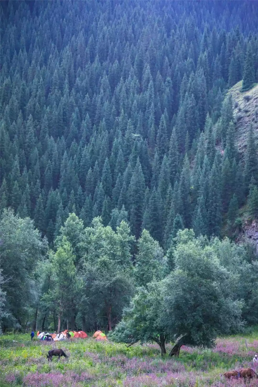
High mountain grasslands, vast expanses of fir and spruce trees in the Ili River Valley, low-lying creeping pines, the perpetual glaciers of the two Daban passes, the pristine habitats of animals, and the rich diversity of natural layers...
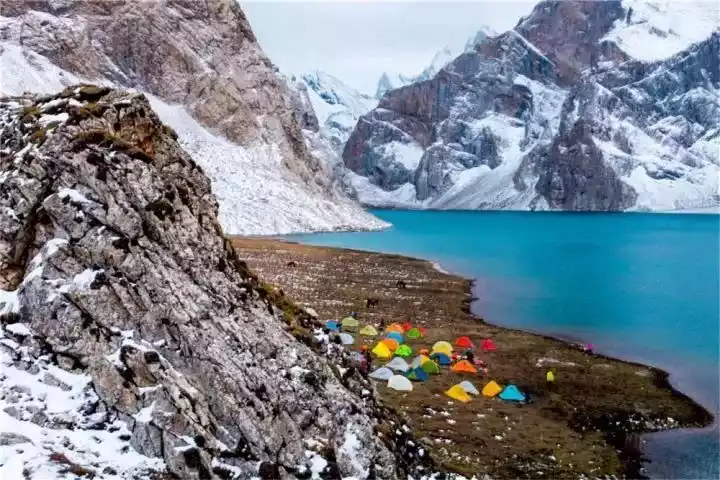
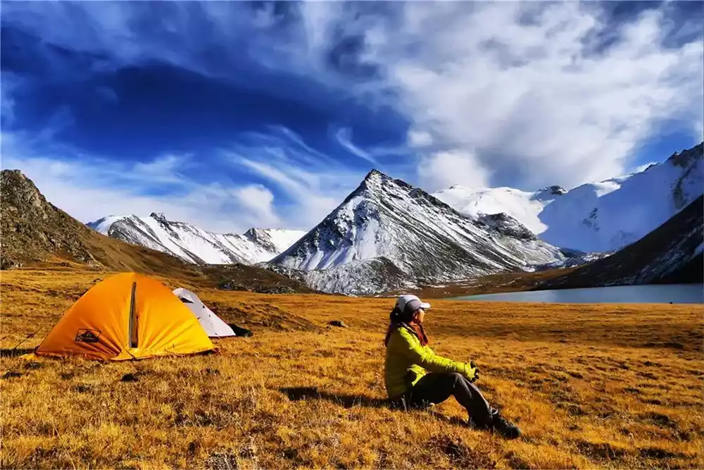
You might eat at a place like this
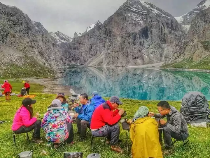
I'll camp in places like this too.

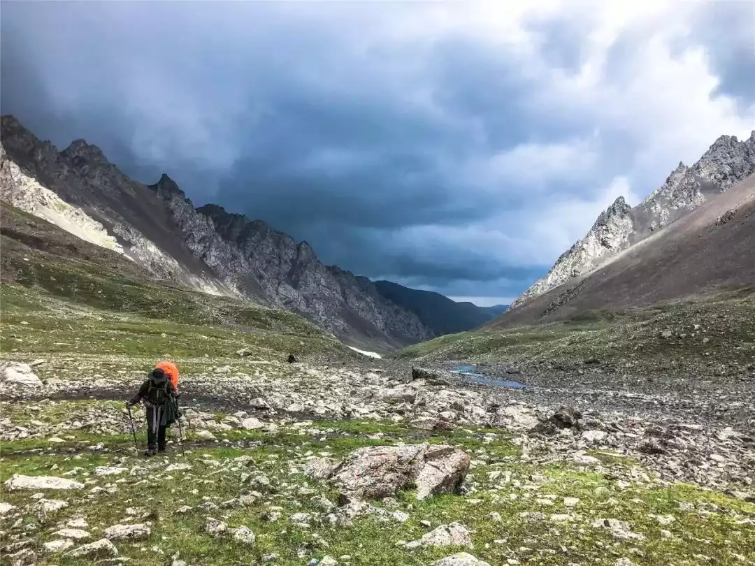
You might start out in the golden autumn, but 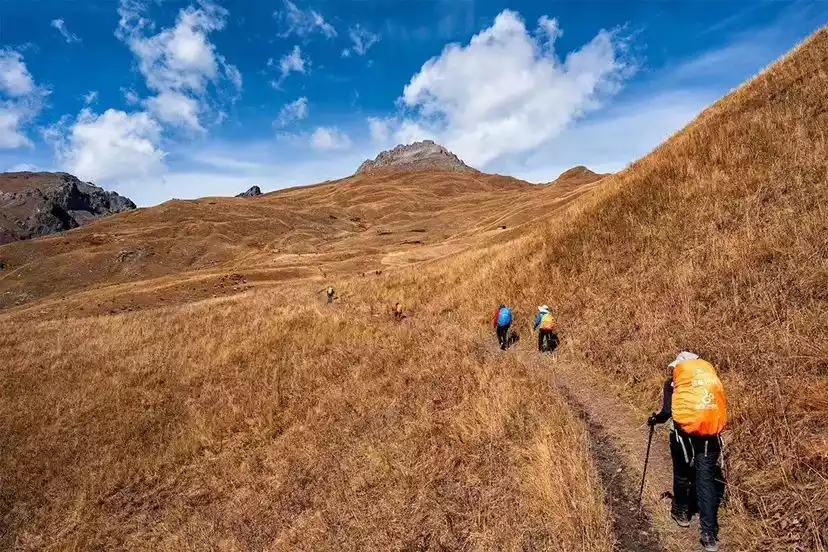
as you walk, you'll find yourself covered in snow. 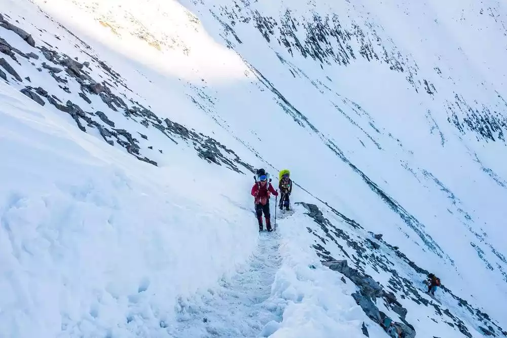
The highest point, Akebulak Pass, is 3,900 meters above sea level, and some sections of the trail slope over 60 degrees. Don't look back as you ascend, or your legs will give out.
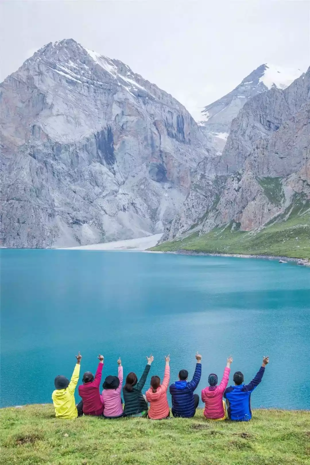
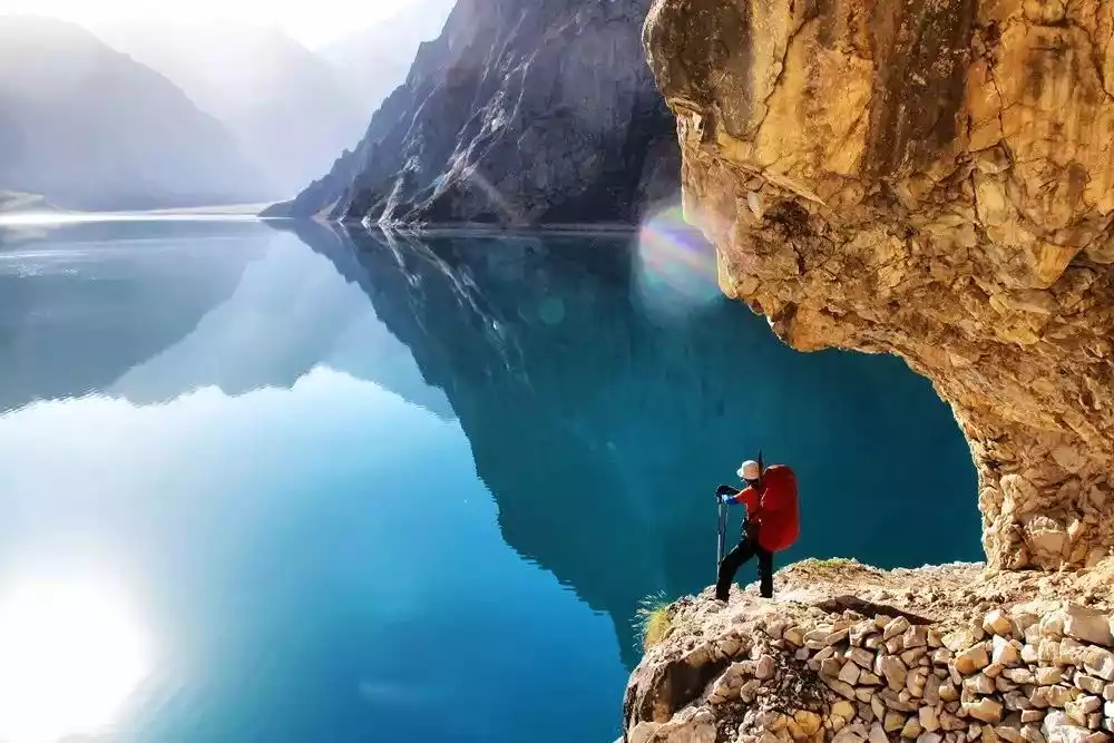
But after crossing the hopeless Daban Pass, you can see the holy land that all outdoor enthusiasts dream of - the alpine lake "Paradise Lake".
The lake is deep and clear, shaped like a crescent moon. Surrounded by white snow-capped mountains and against the azure sky, it creates an infinitely charming scene.
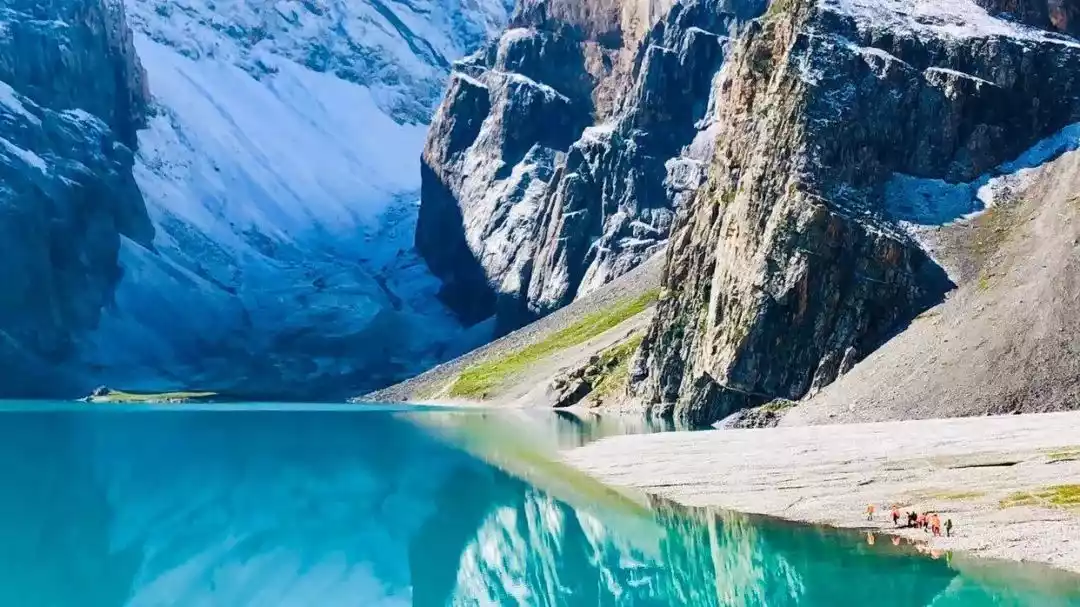
When the weather is fine, the color of the lake water is as warm and blue as jade. When the sky is covered with dark clouds, it is as dark blue as the deep sea, reflecting the mountains and green spaces beside the lake.
Look down at her aloofness from the top of Akbulak Pass, watch her tranquility from the high ground by the lake, and walk around the lake, where her various charms are displayed with every step.
In Xinjiang's forests, dense clusters of Picea schrenkiana trees cling together, often covering entire hillsides entirely.
Looking at them, I can't help but recall this line from a poem: "The tree stretches its branches, the wind shakes its leaves, and we stand here, saying nothing, yet it is so beautiful."
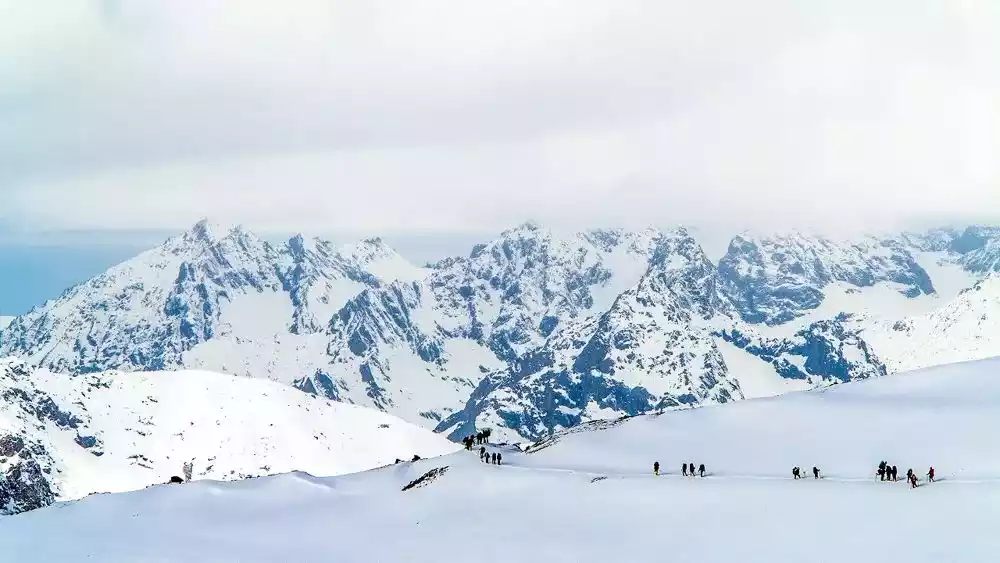
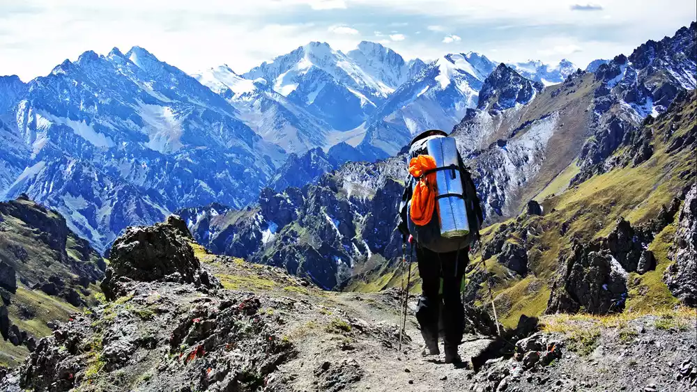
04 / Bogda Grand Loop
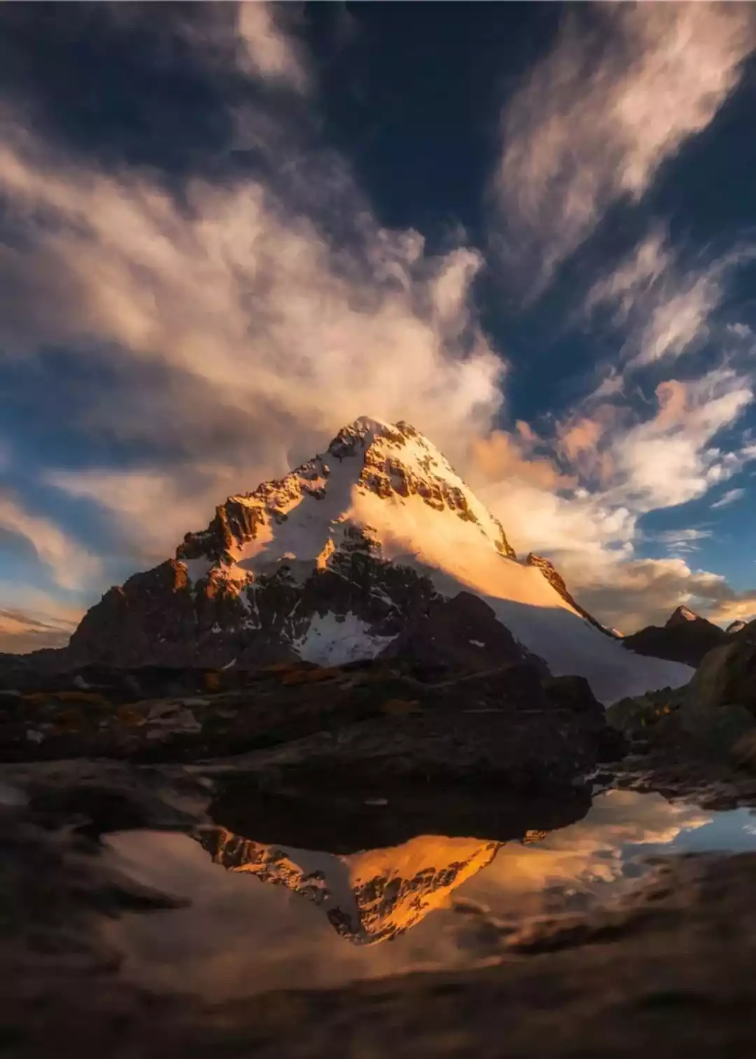
Bogda means "sacred mountain", "holy mountain" and "spiritual mountain" in Mongolian. It is 5,445 meters above sea level. In a sense, Tianshan represents Xinjiang, and Bogda represents Tianshan.
Among the many main peaks of Tianshan Mountain, Bogda is not the highest, and its altitude ranks only third, but its fame far exceeds that of other peaks.

For a long time, in the minds of various ethnic groups in the west, Bogda has been the most divine mountain. It has always been regarded as the home of gods and the source of purple air and worshiped by people.

Bogda Peak stands as a landmark in the Western Regions. Diverse ethnic groups have flocked to it, and diverse civilizations have converged here.
People consider it a sacred mountain. Beginning with King Mu of Zhou's visit to Tianshan to offer sacrifices to heaven, worship of Bogda Peak has continued for thousands of years. It is not merely a peak in the geographical sense, but also a spiritual peak...
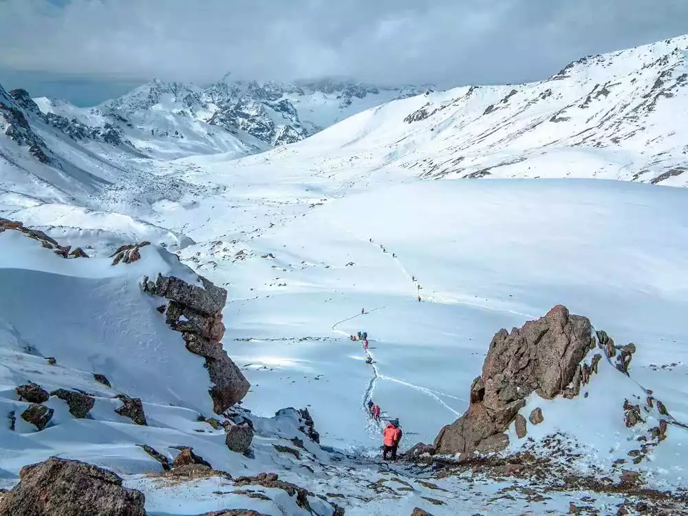
The Bogda Loop, Xinjiang's most demanding hiking route, is a visual feast set against the backdrop of snow-capped mountains. Gravelly glaciers crisscross the landscape, while clouds and life surge from the earth. It feels like a cold, ethereal paradise, the end of the world.
The total length is about 90 kilometers, and it requires crossing five passes over 3,000 meters, the highest of which is a simple pass at 4,125 meters.
Eight days allows you to experience the beauty of four seasons in just a few days. Experience the stark contrast between the desolate southern slopes of the Tianshan Mountains and the lush greenery of the northern slopes. The vast contrast in natural scenery and the majestic snow-capped mountains are breathtaking.
Qiu Chuji was invited by Genghis Khan to pass through this place and left a poem which reads "Three peaks rise up and pierce the cold clouds, four walls stretch out and wind around the stream."
There is also the life-saving medicine in martial arts novels - Tianshan Snow Lotus. They survive tenaciously near the snow line of Bogda Peak all year round. Every summer, they bloom together with Bogda Peak to welcome the arrival of pilgrims.
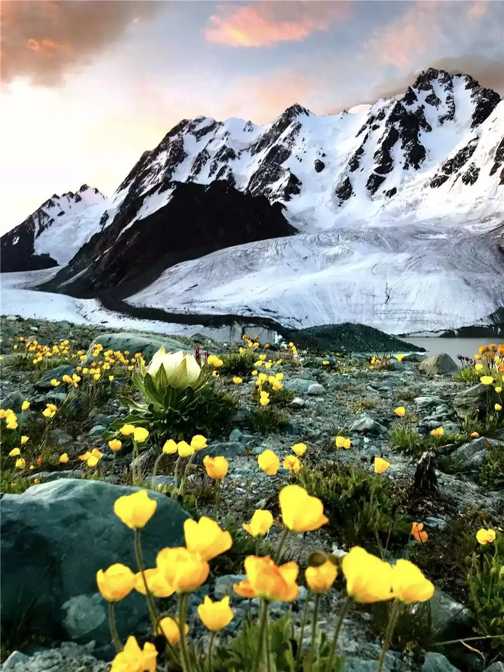
▲Tianshan Snow Lotus and Bogda Peak. The flowers with white petals and green leaves are Tianshan Snow Lotus. Local regulations in Xinjiang prohibit picking snow lotus.
The greater the challenge, the greater the reward. The scenery at different locations on Bogda Peak is unique. Different perspectives offer unexpected surprises, all within the Bogda Grand Loop.
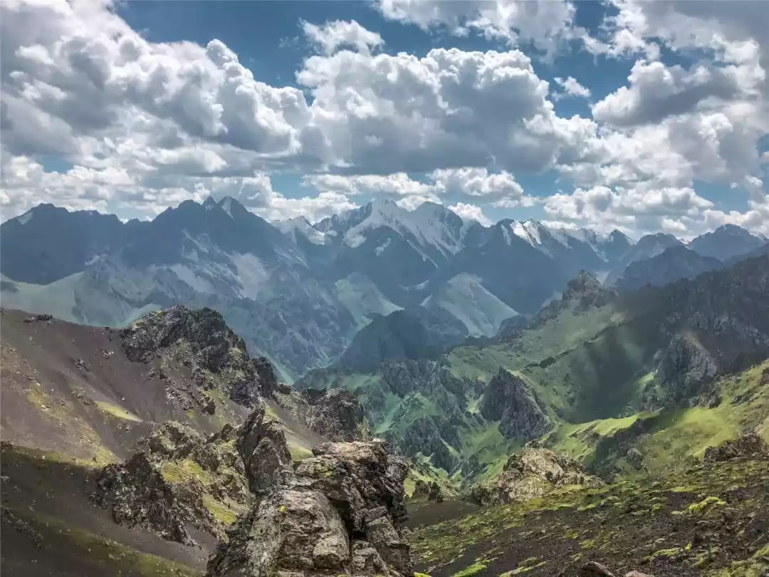
05 / Wolf Tower C+V Line
"Wolf Tower" in Kazakh means a mountain guarded by a pack of wolves. It is the name given by Kazakh herdsmen to Heyuan Peak, the highest peak in the region.
Regarding the Wolf Tower Line, there are six routes crossing it: A, B, C, D, V and C+V.
"I like difficult and self-torturing hiking adventure routes, which one is good?" - "Wolf Tower C Route"
"I like hiking and exploring routes that are rarely traveled. Any recommendations?" - "Wolf Tower V Route"
"Where can I find a challenging and adventurous route that has both cultural significance and beautiful scenery, and is rarely traveled?" - "It must be the Wolf Tower C+V route."
The entire journey is 200 kilometers, crossing 9 passes of nearly 4,000 meters, with a total elevation gain of nearly 10,000 meters, and wading through countless glaciers.
Wolf C tortures the body, Wolf V tortures the heart, Wolf Tower C+V returns, any mountain is just a slope in front of you~
Wolf Tower C+V is the spiritual totem and ultimate dream of every hiker. It is brutally intense and dangerous, but the scenery is superb and all indicators are at the highest level.
There is a saying that has been circulating in the outdoor circle: If you walk through it, you will either become a hardcore athlete or a hardcore player.
At Wolf Tower, all your expectations about the outdoors can be met at once, including glaciers and snow-capped mountains, rapids and plank trails, snow-capped spruce trees, gullies and canyons, alpine pastures, rivers and lakes, cliffs, and tigers and wild beasts.
The Wolf Tower Road, with its rich cultural connotations, stunning natural landscapes, and sparsely populated wilderness, is full of challenges, yet it also sharpens our minds and increases our outdoor experience.
During the 11-day hike, you'll experience alpine pastures, virgin forests at the bottom of the valley, exotic flowers and plants, a breathtaking green lake, and the famous Tianger Peak. Almost every hiking enthusiast considers the Wolf Tower C+V a dream of theirs!
Conclusion
Tianshan Mountain and Xinjiang complement each other. If you go to Xinjiang one day, no matter how beautiful other places are, they will just be so-so! Here, there is a thrill that goes straight to the soul, and the scenery before your eyes is like a dream.
More outdoor exciting content recommendations
Please pay attention to the tourists' official account