Recommended snow-capped mountains in Tibet for beginners, and tips and equipment for beginners hiking outdoors
Preface
With an average altitude of over 4,000 meters, Tibet, known as the "Roof of the World" and the "Third Pole" after the North and South Poles, is a destination that captivates countless people. The mystique of its snow-capped mountains has always captivated countless outdoor enthusiasts. Countless wonders of snow-capped mountains, such as the Himalayas, Mount Kailash, and Mount Namjagbarwa, await your advent. Tibetans believe that every snow-capped mountain is the abode of deities. Today, we'll take a look at Tibet's most worthwhile snow-capped mountains, ranked in no particular order.
Several peaks worth visiting in Tibet
/Mount Everest/
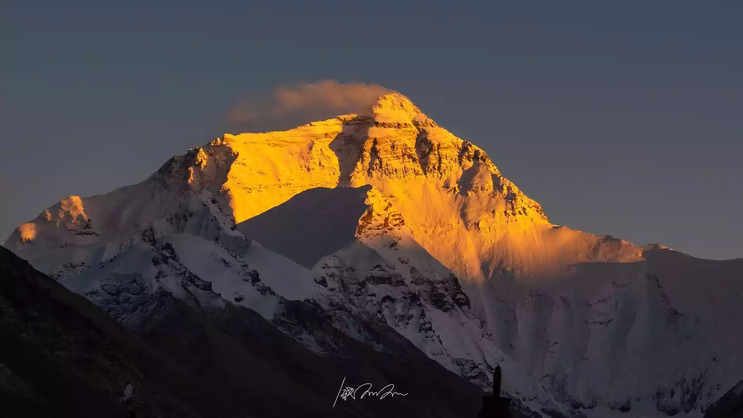
Everyone is familiar with Mount Everest, the world's highest peak, standing at 8,848.86 meters above sea level. It's the main peak of the Himalayas. In Tibetan mythology, Mount Everest is considered the third of five goddesses, the most majestic of all mountains and the summit of the Earth, often called the "Third Pole."
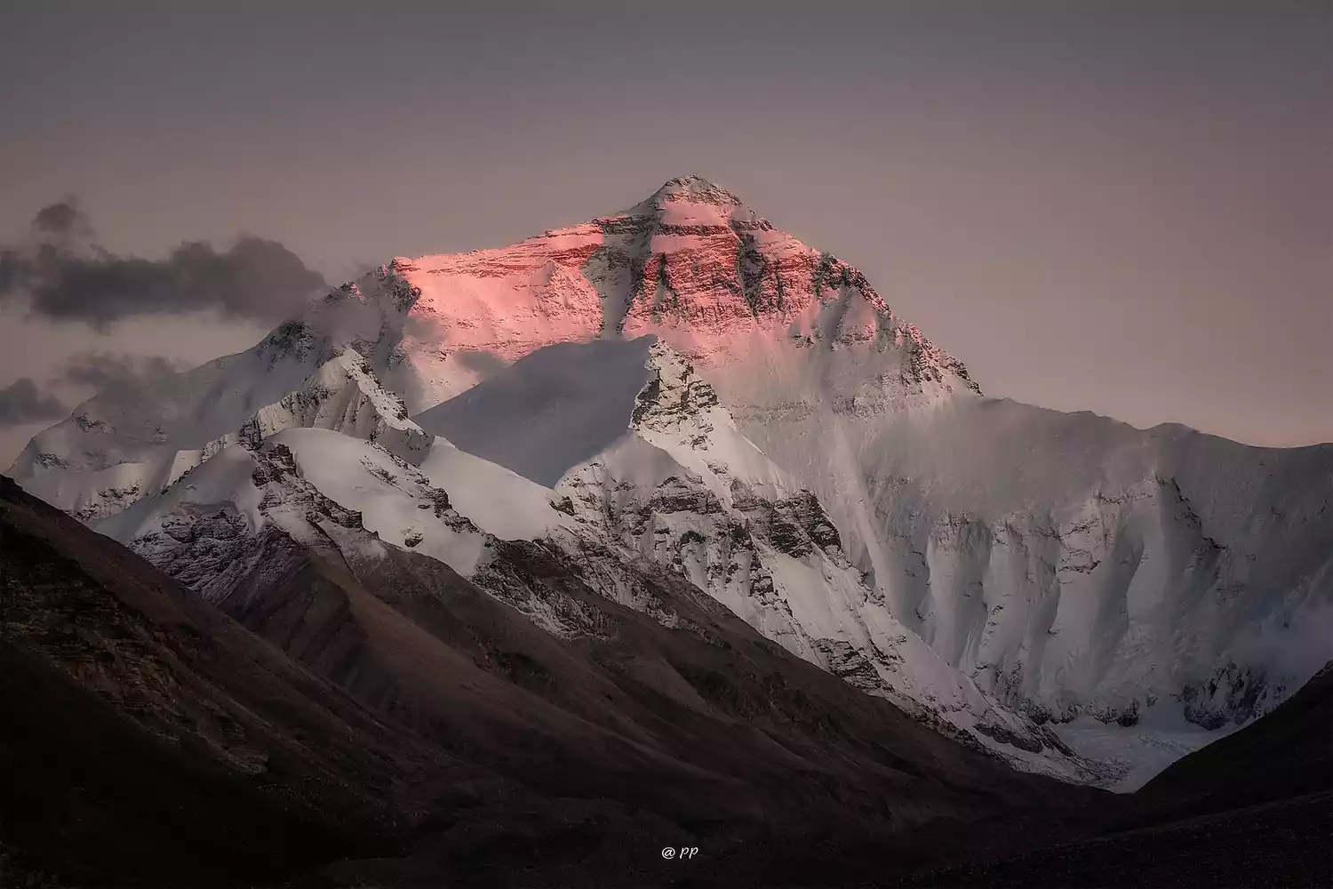
Mount Everest is located on the border between China and Nepal. Its northern part is located in Tingri County, Shigatse City, Tibet Autonomous Region, China (the western slope is in Zhaxi Zong Township, Tingri County, and the eastern slope is in Qudang Township, Tingri County, where the Mount Everest Base Camp is located), and its southern part is located in northern Nepal. It is the highest peak in China and the world, and is also the center of China's Mount Everest Nature Reserve spanning four counties and Nepal National Park. It is 120 kilometers west of Mount Shishapangma.
Tips:
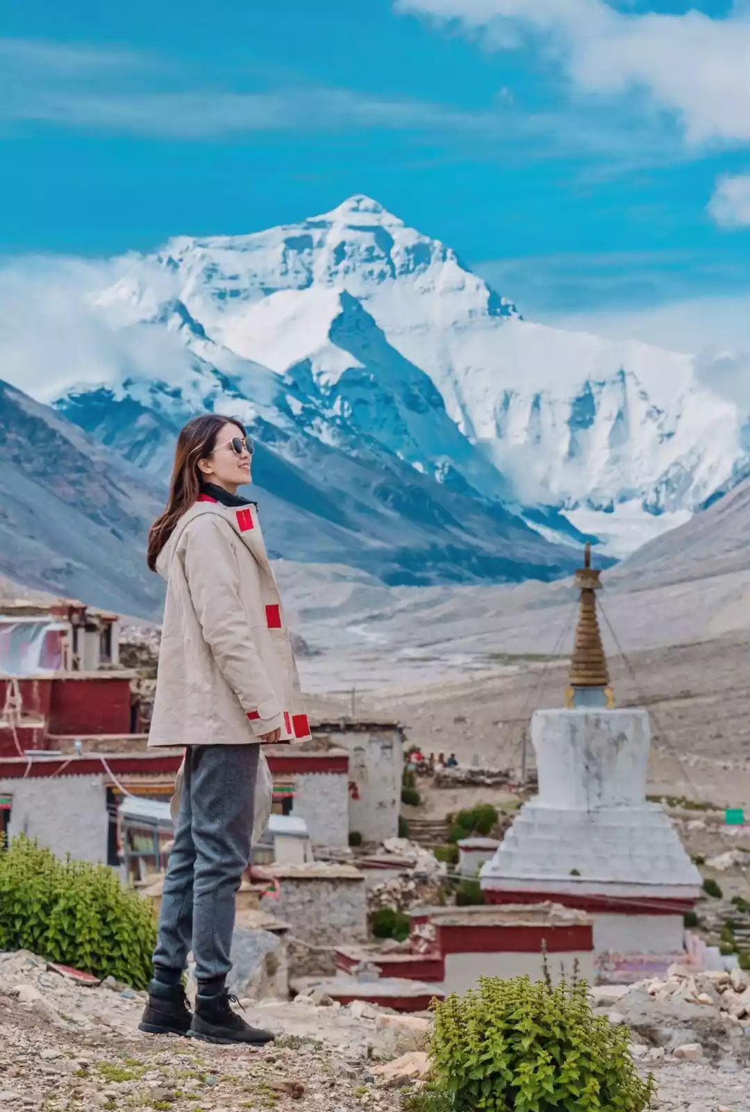
Best time to travel: September to January
Best viewing locations: Shigatse, Mount Everest Base Camp, Rongbuk Monastery, and Gawu La Pass
Recommendation: It is best to visit Mount Everest in winter, when there is less rain and fog, the air is dry, and there is a high probability of seeing the golden mountain in the sun.
Note: You need a border pass to go to Mount Everest, which needs to be processed in advance.
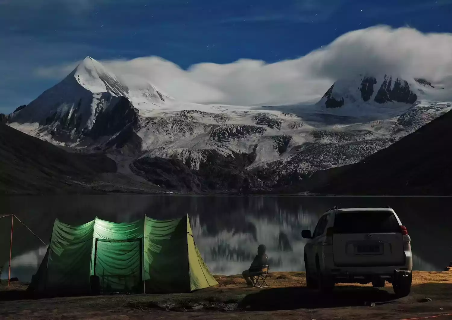
Depart from Lhasa | 6 days and 5 nights
6-Day Kulagangri Circumambulation | 30km Light Hiking to the Holy Mountains and Lakes
¥3780 from 829 people have registered Register now/Mount Kailash/
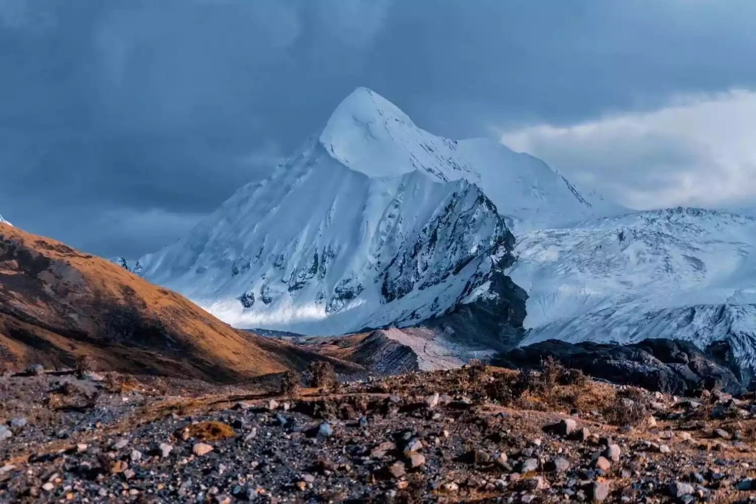
Mount Kailash is located in Baga Township, Purang County, Ali Prefecture, Tibet. It is 6,638 meters above sea level and is the second highest peak in the Gangdise Mountains.
Among the highest mountains known for their sheer height and sheer power, Mount Kailash stands out. Even in winter, when snow blankets its sprawling peaks, it remains remarkably recognizable. Its unique shape, like a gently curving pyramid, towers above the plateau, exuding a tranquil, regal presence.
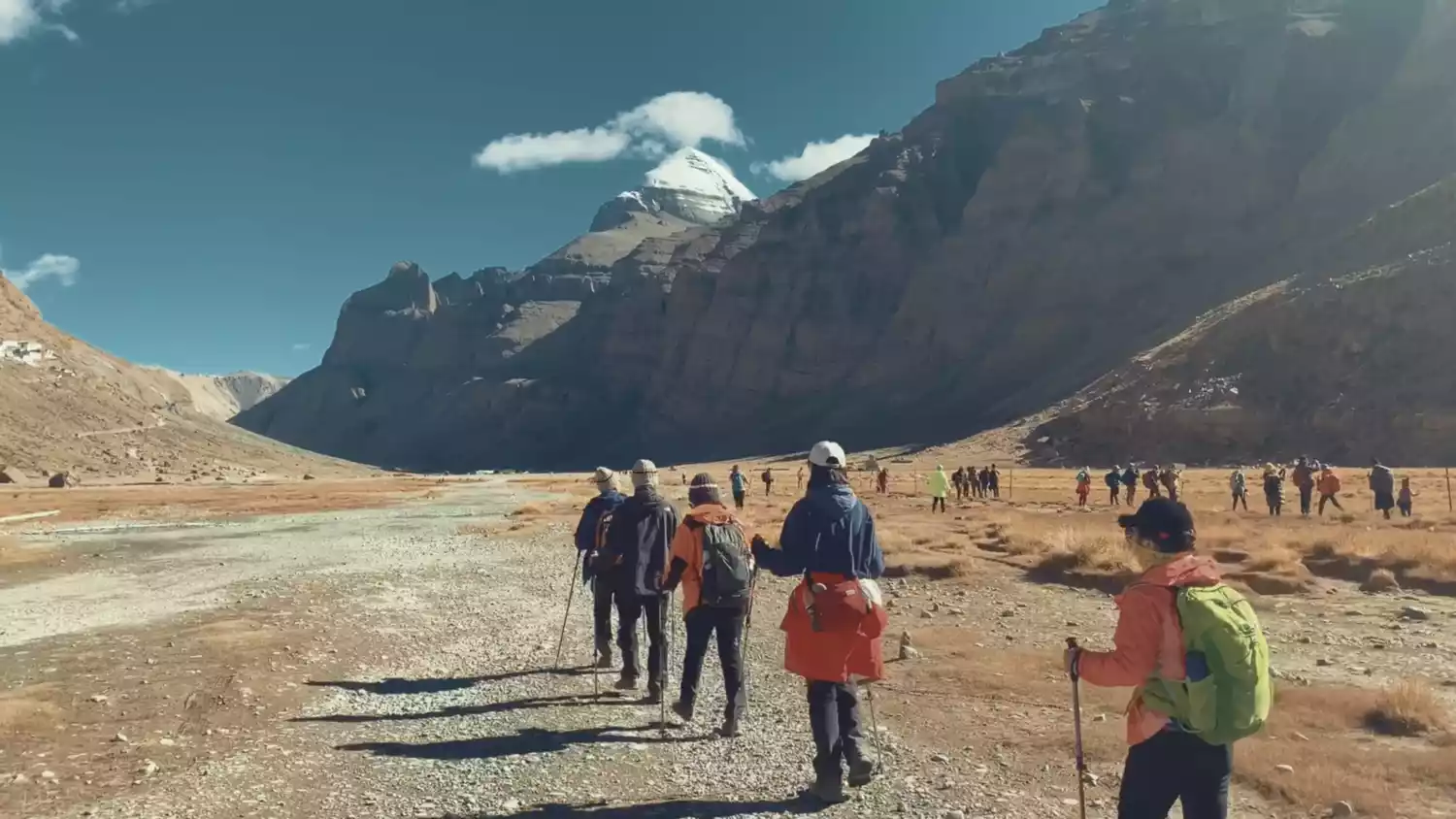
The sunny side of Mount Kailash is covered in snow year-round, while the shady side, shielded from sunlight, rarely sees any snow. This miraculous phenomenon, contrary to the laws of nature, is a sacred sight found only in the sacred land of Tibet.
Tips:
Nearby attractions: Lake Manasarovar, Lake Laangcuo, Mount Namuani, and Hot Explosion Hot Springs
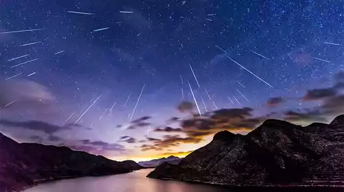
Recommended Tour: Start by navigating to the Hot Explosion Hot Springs, part of the loop around Lake Manasarovar. The route is crowded with pilgrims, and the hot springs are about 30 kilometers away, where you can boil eggs and soak in the water. Finally, head towards Purang to reach the shores of Lake Manasarovar and Laangcuo, where you can get a close-up view of Mount Namnawi. Stay overnight in Tarchin to view the starry sky above Mount Kailash.
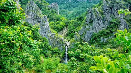
/Sapu Sacred Mountain/
Located in Puzonggou, Yangxiu Township, Buxi County, Sapu Sacred Mountain has stood for thousands of years, surrounded by mountains. Its main peak is revered as the "King of Sacred Mountains" in the area. Its highest peak, also known as Sapu Gunla Gabu, stands at 6,956 meters and is considered one of the sacred mountains of the Bon religion in Tibetan Buddhism.
In midsummer, the summit of Sap Mountain is capped with snow and shrouded in mist, while at its base, flowers bloom, grass grows green, and the water and grasses flourish. Due to the deep valleys and inaccessible access, this breathtaking glacier has remained hidden and little-known, a virgin tourist destination yet to be developed.
Tips:
Transportation recommendation: You can only drive yourself, and off-road vehicles are best. There is currently no public transportation to Sap.
Tickets: Starting from May 2021, 100 yuan/person
Accommodation recommendations: There are several accommodations near the lake, but they are limited and offer beds in shared rooms. Camping is not permitted, and bears are known to roam nearby.
/Namunani Peak/
Namuani Peak, at 7,694 meters, is known to Tibetans as the "Mountain of the Holy Mother" or "Goddess Peak," a rare aspect of the mountain. The western ridge fanns from north to south, while the sole eastern ridge has been eroded into a sharp, sheer ridge, creating a cliff face with a height difference of nearly 2,000 meters. In contrast, the western slope is more gradual, with five massive glaciers cascading through the canyons, their surface dotted with crevasses and cliffs.
The best time to climb Mount Namunani is from May to late June, when good weather is common and can last for 6-8 days. The rainy season begins in early July, with the heaviest rainfall in July and August.
Tips:
Best time to travel: July to September. Be careful of altitude sickness.
Recommended self-driving routes:
1. From Urumqi, the capital of Xinjiang Uygur Autonomous Region, travel south along the Xinjiang-Tibet Highway, through Yecheng Shiquanhe to Purang, a total distance of 3,044 kilometers.
2. Travel west from Lhasa, the capital of Tibet, through Shigatse and Saga to Purang, a total distance of 1,433 kilometers.
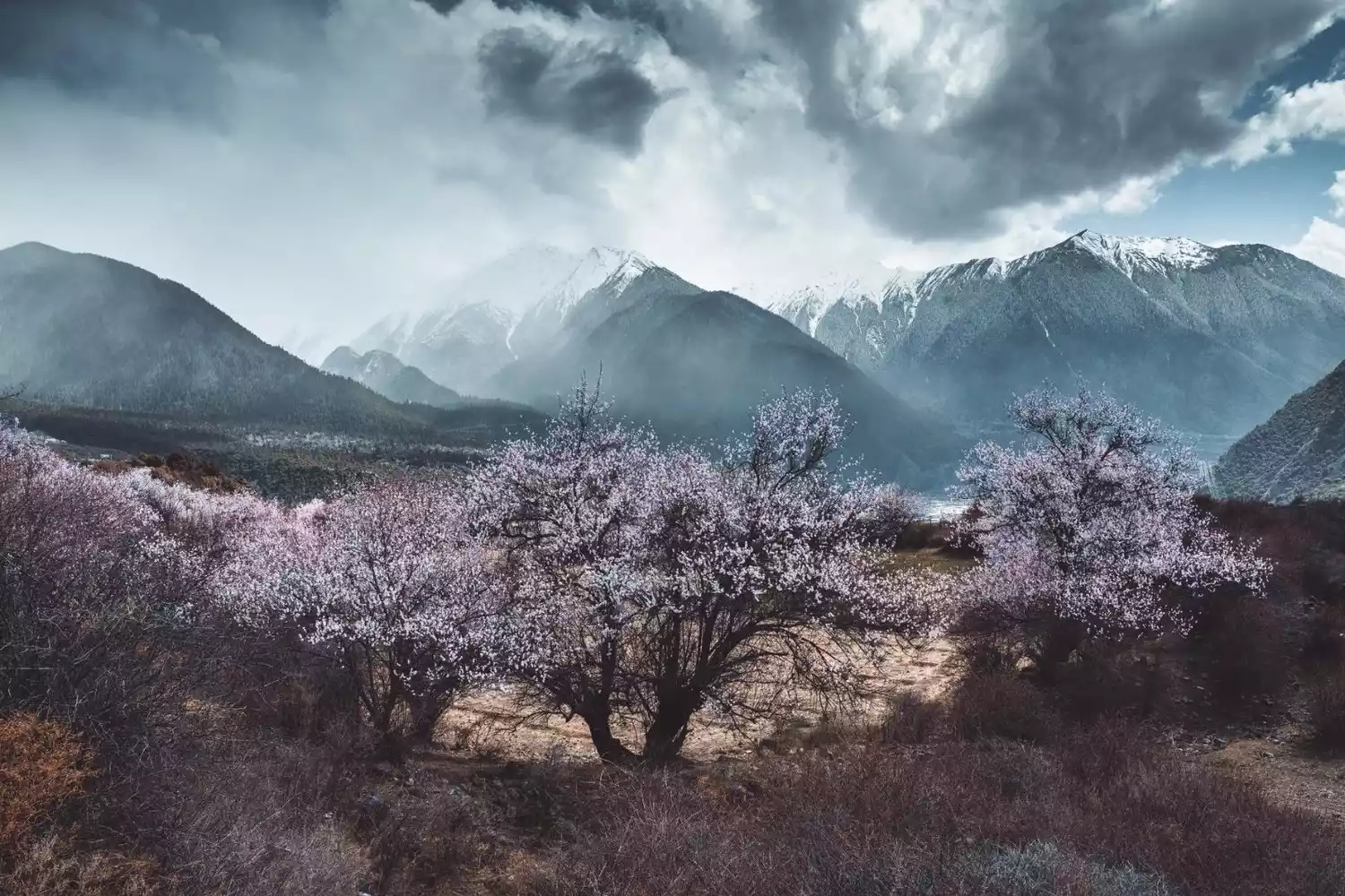
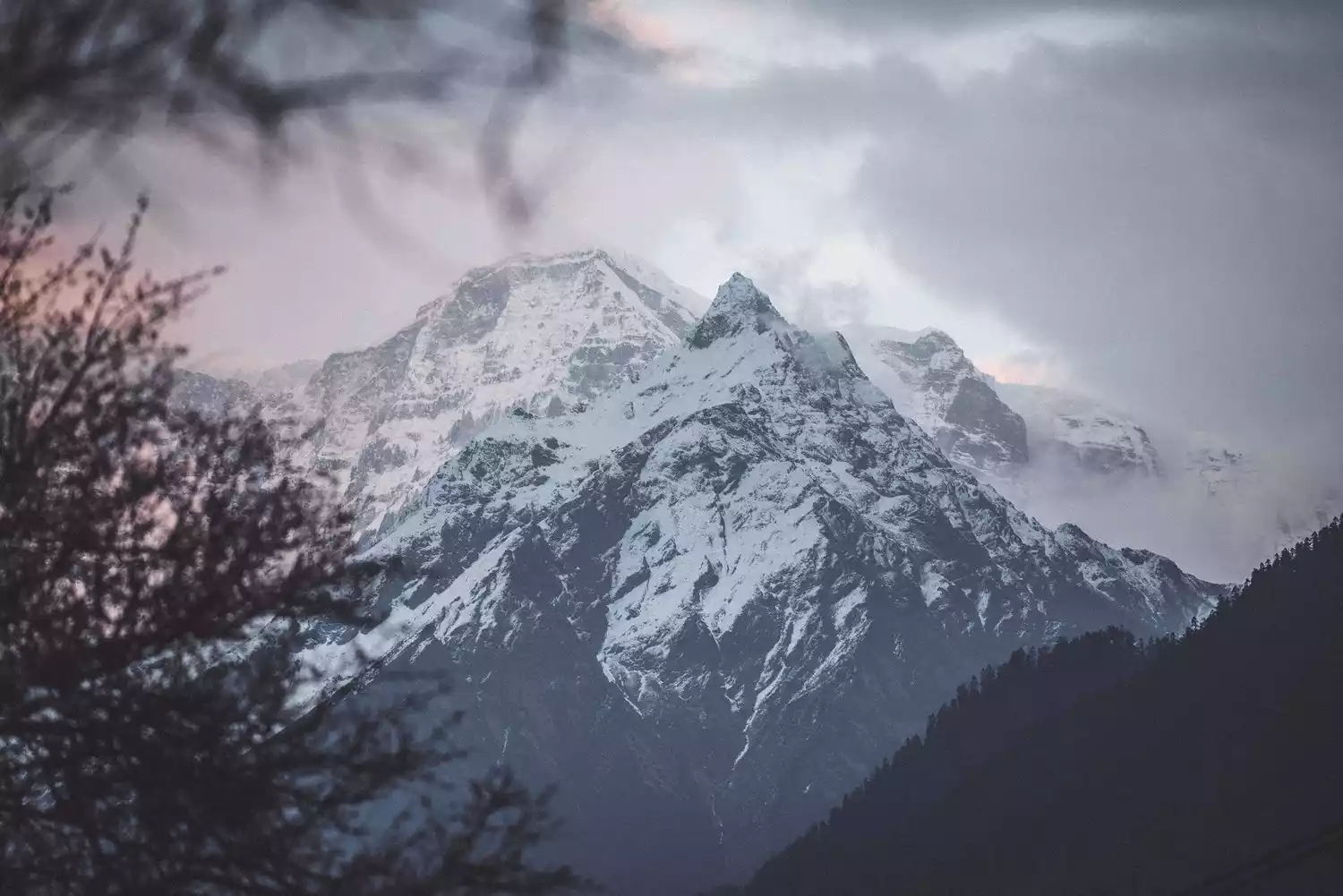
/Namjagbarwa Peak/
Mount Namjagbarwa, the highest mountain in Nyingchi City, Tibet Autonomous Region, China, stands at 7,782 meters above sea level. It belongs to the Himalayas and is known as the "Father of Tibetan Mountains." Due to its perpetual snow-covered peak and the abundant moisture from the Yarlung Zangbo River, it remains shrouded in mist year-round, never revealing its true face. Legend has it that nine out of ten people have never seen it, hence its nickname, "Shy Girl Peak."
Mount Nanga Bawa, which was also named "China's Most Beautiful Mountain" by China National Geography magazine, has only been successfully climbed once in history, and that was in 1992. It is well worth seeing its true appearance.
Tips:
Best viewing spots: Suosong Village, Sejila Mountain Pass, Dadu Pass
Note: The chances of seeing the full view are relatively higher in winter, but it all depends on luck. If you can also see the golden mountain in the sun, you will be even luckier.
Recommended travel time: Winter (off-season December-January), peach blossom season (peak season March-April)
Outdoor hiking equipment recommendations
/Backpack/
For short trips, we recommend an ultralight, waterproof backpack that's thin, lightweight, and spacious, and can be folded up when not in use. For 2-3 day hikes, we recommend a large-capacity backpack between 40L and 50L, preferably with a waist buckle to reduce back weight.
/Wear/
① Quick-drying clothing: It is recommended to wear quick-drying clothing next to the skin even in autumn and winter. It is best not to wear thermal underwear. Sweating is inevitable during hiking, so quick drying is very important.
② Jacket: Three-in-one jacket is very practical, with waterproof outer layer and warm inner layer.
③Warm clothing: For hiking in snowy mountains, it is recommended to add a thin down liner inside the jacket, which is easy to put on and take off.
④Hiking shoes: Hiking shoes are very important, especially when hiking in the wild, it is particularly important to choose a pair of good non-slip shoes.
/Outdoor Equipment/
① Trekking poles + gloves: Outdoor beginners often overlook the importance of trekking poles, which can actually reduce leg strain by approximately 30%. Pairing them with half-finger gloves provides sun protection and prevents friction between your hands and the poles.
② Knee pads and elbow pads: Knee pads are generally enough for hiking. There are two types of knee pads. One is a full-coverage one that is more suitable for wild climbing and collision prevention, and the other is a regular knee pad to protect the knees.
/Sunscreen Products/
①Sunscreen and sunscreen spray: UV protection in autumn and winter should not be ignored, especially in plateau areas.
②Sun protection clothing and ice silk sleeves: not necessary in autumn and winter, recommended in spring and summer.
③Sun hat, magic headscarf, sunglasses: just choose what you like.
/Emergency Equipment/
① Rain gear: Outdoors people don't usually bring rain gear, so a waterproof jacket will suffice. If you really need to be prepared, a poncho or umbrella is also fine.
②First aid kit: includes emergency medicines such as alcohol cotton, Band-Aids, and anti-friction foot patches to treat minor abrasions.
③Headlamp: It is generally not needed for short distances, but it is a must if you need to stay overnight. It is very practical for dealing with darkness!
Tips:
Finally, remember to bring plenty of water and food to replenish your energy when doing outdoor sports!
What preparations do you need to get started hiking?
In addition to preparing the outdoor equipment recommended above, we also need to have a certain plan and understanding of ourselves and the route before we officially hike, so that we can better carry out outdoor sports.
/Myself/
① Do what you can and choose an outdoor hiking activity that suits you based on your physical condition.
② Whether you have strong physical fitness, are aware of your body coordination and flexibility, cold and heat tolerance, and outdoor ability.
③Master outdoor knowledge, survival knowledge, self-rescue and first aid, and skills in asking for help.
④Have team awareness and team spirit, and obey the management of the outdoor team leader.
⑤ The individual has strong psychological quality, clear mind and can deal with things calmly.
⑥ Be proficient in reading tracks, reading maps, and analyzing terrain and site conditions.
⑦ When outdoors, you can clearly know your direction and location, and communicate with your family about your current status.
/Line Aspects/
① Choose the route based on your personal ability, from easy to difficult, in a gradual cycle. Do not follow blindly, safety first.
② Make an estimate of the risks that may arise along the route, and make a detailed assessment of the route's strength and difficulty, the terrain conditions, the terrain orientation (mountain entrance, exit, descent point, etc.), and the status of the supply points. You should have your own considerations for the route.
③ Make alternative route plans and emergency plans.
④ Check the weather conditions of various locations along the way in advance, including temperature, wind speed, altitude and other values.
⑤ Make advance plans on how to deal with accidents and download trajectory maps and topographic maps in advance.
Conclusion
Outdoor hiking is a great sport, and gradually more and more people are joining the ranks of outdoor sports, but we must also pay attention to making adequate preparations to be prepared for any eventuality.