Bijia Feihu Line | Overlooking the Emerald Lake and checking in at the top of Bijia Mountain

Day 1 Shanghai → Bijiashan → Shanghai

All day

Meet at the designated location of China-TravelNote at 6:45 and depart on time at 7:00 to Bijia Mountain.

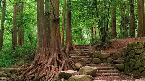
We got off the highway at 10:30 and headed to the starting point of the hike. After warming up, we started hiking up the mountain. This route required us to cross eight large slopes.

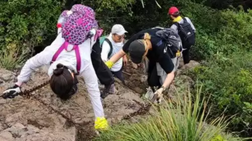
We will arrive at Hutou Mountain around 11:30. You will need to climb over a large rock by rope. Please pass through in an orderly manner under the arrangement of the team leader.

There is a large reservoir next to it, with rippling blue water and beautiful scenery. You can have lunch in between hikes.

Please note: The road after passing Hutou Mountain is densely vegetated and you may be hit in the face by bamboo leaves. It is recommended to wear an outdoor sun hat or cover your face with a headscarf.

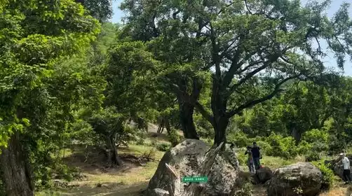
After crossing Yushi Mountain, Wanghai Mountain, and Jiufeng Mountain, when approaching Bijia Mountain, you will follow the ridge line, holding the iron chain rope and crossing the mountains, so please pay attention to safety.

We arrived at the end of the hike around 18:00. After a brief rest, we boarded the bus back to Shanghai.

At 21:30 we returned to the departure point in Shanghai. We were reluctant to leave and kissed goodbye with tears in our eyes. We agreed to meet again next time!!!

There will be slight adjustments to the closing points in autumn and winter, and the specific details will be announced by the tour leader on the day!

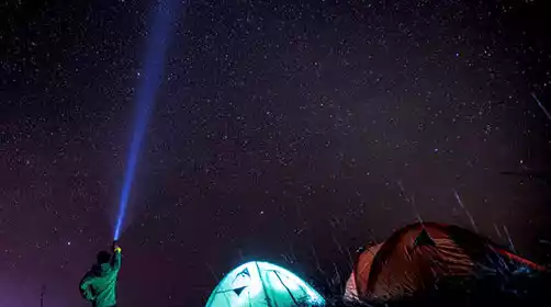
It gets dark earlier in autumn and winter, so it's recommended to bring a headlamp! Also, bring a set of clean clothes to change into after your hike to avoid getting cold in wet clothes!

Those who are afraid of heights should be careful!

Driving time: about 3.5 hours

Hiking: The hike is 19 km long, with an elevation gain of approximately 1,200 m. (This data was measured using the Erbulu app installed on a mobile phone; results obtained using other software and hardware may vary.) There are descent points at 7.5 km and 12.5 km. There are no restrooms or resupply points along the way.

Remark:

1.Why didn’t I receive a text message notification after registering?

2. What if it rains during the event?

2-3 days before the event, we will decide whether the event will proceed as scheduled based on the weather forecast and route conditions. Please pay attention to our notifications. Most activities can proceed as usual even if there is light rain. There is still fun to be had on rainy days. If heavy rain is forecast, the event will be cancelled and a full refund will be given to everyone.

3. Is this route crowded?

Most of our routes are natural and niche, with relatively small traffic. Of course, it also depends on the registration situation for each period. Generally, ordinary models are 37-seat buses, and a few large models are 53-seat. Each car has a certain proportion of tour leaders to ensure the quality of the event.

1. There is a mountain in the east of Fenghua city, which is shaped like a pen holder and was called Wenbi Mountain in ancient times. Later, a folk myth circulated that Wenquxing had passed by this place, so the locals called it Bijia Mountain. Bijia Mountain is 414 meters above sea level and is the third highest peak in Xiwu Street. Where there are mountains, there is water. The many streams of Bijia Mountain converge into Fengxi. The water of Fengxi flows from the mountain into the village at the foot of the mountain. Miaohouzhou Village is located at the northern foot of Bijia Mountain, with Jingou Mountain on the left, Dongjiang River on the right, and Yongxin River on its back. The water of Fengxi meanders from the east side of the village to the north and flows into Yongxin River. Miaohouzhou is an ancient village with a history of more than a thousand years.