Huai Yang Waterfall, Prachuap Khiri Khan
Prachuap Khiri Khan
by Kenny Anne Journey
Jul 20, 2021
by Kenny Anne Journey
Jul 20, 2021
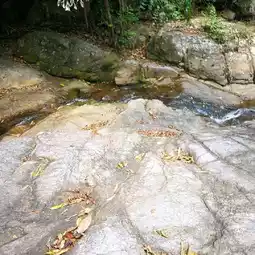

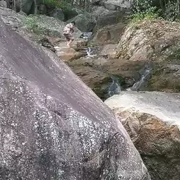
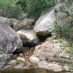

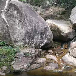
Huai Yang Waterfall National Park covers an area of approximately 100,625 rai or 161 square kilometers, covering the Tap Sakae forest in Tambon Huai Yang, Tambon Khao Lan, Tambon Saeng Arun, Tambon Na Hu Kwang, Tambon Ang Thong, Amphoe Tap Sakae, Tambon Chaikasem, Amphoe Bang Saphan, and Amphoe Mueang, Prachuap Khiri Khan Province. It was declared a national park on December 8, 1991, making it the 70th national park in Thailand.
Huai Yang Waterfall National Park is located in the Tenasserim mountain range. Most of the mountain ranges are approximately 100-1,200 meters above sea level, with Khao Luang as the highest peak. It is the source of water from the mountain ridge that separates Thailand and Burma, including Khlong Ang Thong, Khlong Kaeng, Khlong Tap Sakae, Khlong Chakra, Khlong Khai Nao, Khlong Ta Klet, Khlong Huai Yang, Khlong Huai Ma, and Khlong Hin Chuang. The eastern side is adjacent to the plains and the coast of the Gulf of Thailand.
#FatAnnChecksIn #PrachuapKhiriKhan
#kennyannejourney 💚☺️❤️📸
#flowerspotsinthailand#waitingforthedaytotravel#missnature#centralregionteam#southernregionteam
Post by Kenny Anne Journey | Jul 20, 2021