August in Maling River: Ultimate Guide to Thousand-Waterfall Rafting × Canyon Wonders × Miao Sour Soup
Maling River Canyon
by AWwwwwME
Jul 23, 2025
by AWwwwwME
Jul 23, 2025

Dian-Qian Road Trip (30) "A Beautiful Scar on the Earth" - Maling River Canyon
March 29 (Tuesday) Anshun - Southwest Guizhou
Weather: cloudy turning to partly cloudy, 13-22°C; today's highest elevation 1711 meters.
Traveling all the way through Guizhou, there are many tunnels, long tunnels, and viaducts, not only numerous but also of high quality. In the past, Guizhou was known for its "roads without three feet of flatness," but now "natural barriers have become thoroughfares," with flat plains everywhere. Not only do all counties have expressways, but major scenic spots are also connected by expressways or high-grade roads, providing convenience for self-driving tours. This is a testament to the country's world-class road and bridge construction capabilities, living up to the title of "infrastructure mania."
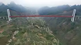
We specifically took 15 kilometers on National Highway 320, passing a scenic spot: Baling River Bridge.
Baling River Bridge, located in Guanling County, Anshun City, is a super-large highway bridge on the G60 Hukun Expressway. Construction began in April 2005, and it opened to traffic in December 2009. The main bridge is 1088 meters long, with a height of nearly 370 meters from the bridge deck to the valley water surface. After completion, international parachuting and bungee jumping competitions have been held here. This bridge is currently the highest commercial bungee jumping facility in the world (Photos 1, 2).
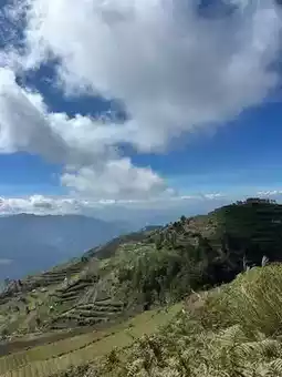
At 10:30 a.m., we entered Qinglong County in Southwest Guizhou.
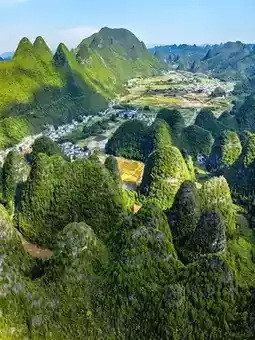
Southwest Guizhou Bouyei and Miao Autonomous Prefecture, with its capital in Xingyi City, is home to 35 ethnic groups. The area features beautiful mountains and rivers, a pleasant climate, rich cultural heritage, and outstanding people.
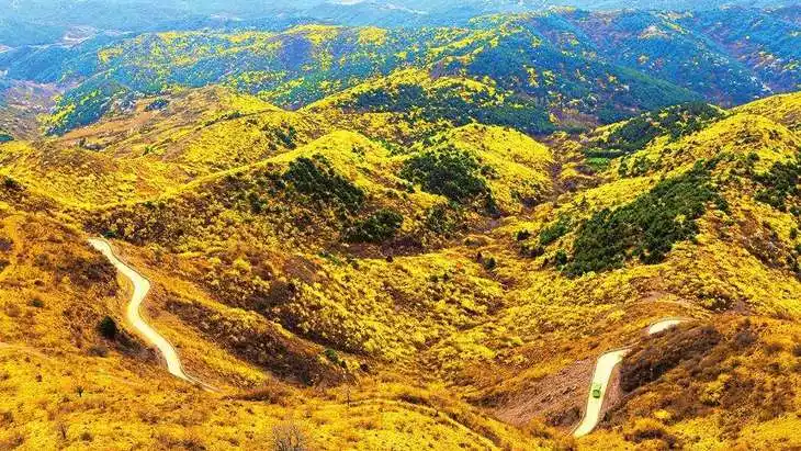
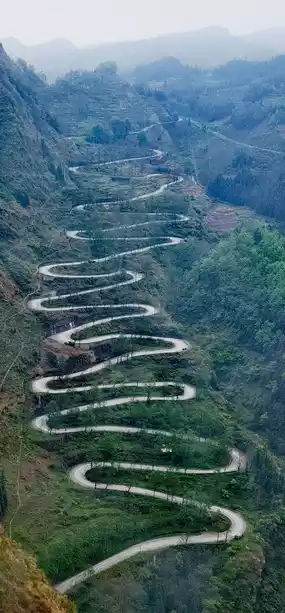
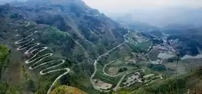
In Qinglong County, we stopped by the "Twenty-Four Bends" scenic area.
The "Twenty-Four Bends," also known as the Stilwell Road, was first built in 1935 during the Republic of China era and completed the following year. During World War II, this road was the only route from Dian-Qian to Chongqing, becoming a vital artery in the China-Burma-India theater, responsible for transporting international aid to China.
The "Twenty-Four Bends" winds through the steep and majestic Qinglong Mountains and Mopanshan between a concave steep slope, with an elevation difference of 200 meters and a length of about 4 kilometers, forming an impregnable defensive position.
We took the sightseeing shuttle bus, traveling up and down the "Twenty-Four Bends" route, and from the viewing platform, we gazed at this lifeline that records the difficult history of the war of resistance (Photos 3, 4).
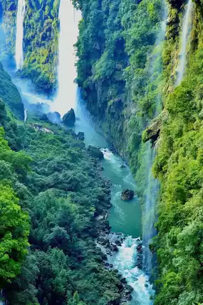
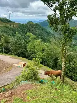
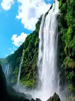
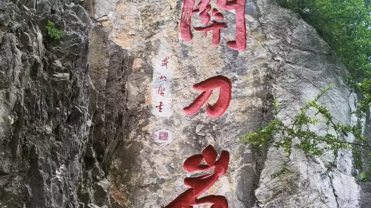
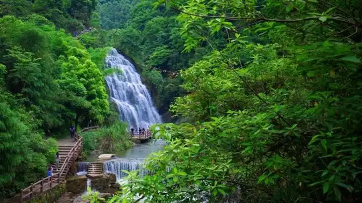
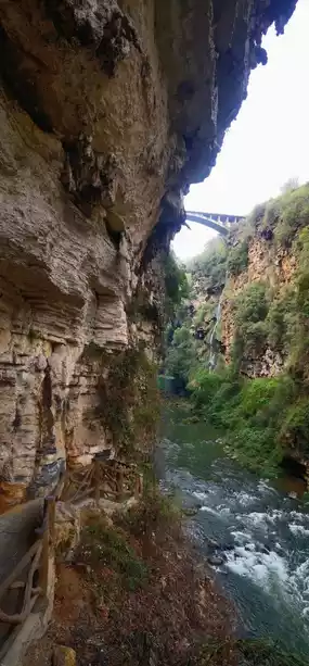
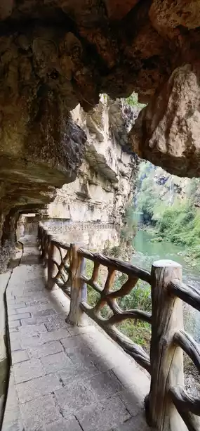
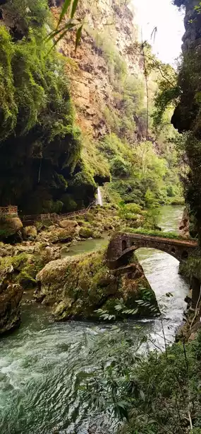
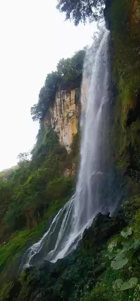
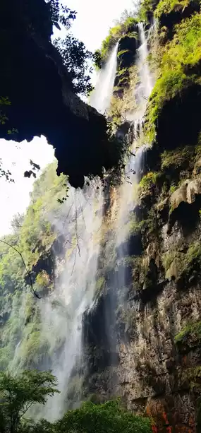
In the afternoon, we visited Maling River Canyon.
Maling River Canyon Scenic Area (4A), located within Xingyi City, is 74.8 kilometers long, 50-100 meters wide, and 120-280 meters deep, with the valley floor more than 200 meters below the surface. It is a large rift valley formed during orogeny, combining grandeur, uniqueness, danger, and beauty.
The canyon is deep and secluded, with plank roads climbing the cliffs, winding and fascinating. Traveling along the path feels like entering a painting, with a new scene at every step, ever-changing views, and countless forms. It is praised as "a beautiful scar on the Earth" (Photos 5-9).
Tomorrow we will continue touring Southwest Guizhou.
Post by WINTER TERRY | Oct 17, 2025