Live Your Best Lives
Tibet, because of its mystery, many people describe it as difficult and dangerous to enter Tibet, and how unattainable it is. I think: going to Tibet is just an ordinary trip, a long trip.
Tibet – it is a place that many people are fascinated by, and if you don't go to Tibet in your life, your life will become imperfect. As for how I get to a post-50s generation, join a group, self-help or self-driving. Returning from Dunhuang by bicycle, there is a thought that has been lingering in my mind, that is, driving to Tibet. After struggling for a while, I finally chose to drive, this is my sixth long-distance self-driving, and it is a more challenging self-driving, Sichuan and Tibet in, Qinghai and Tibet out. Before that, I drove 8,200 kilometers by bicycle in Inner Mongolia, and this time I took on a longer distance of more than 10,000 kilometers.
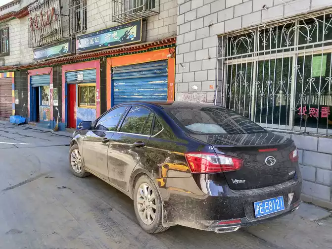
My companion is a brother who can't drive, and I drive a Southeast V5 sedan with a displacement of 1.5L and a chassis of 14CM. For such a small displacement, low-chassis car to take the Sichuan-Tibet line is a test, come on!
Then I started to be busy making strategies, way out books, setting travel dates, preparing materials, etc. Considering that autumn is the most beautiful season in Tibet, we chose to depart from Shanghai on August 30, take China's landscape avenue G318 into Tibet to Lhasa, and return to Shanghai from Tibet from Tianlu G109.
G318 has always been considered the most beautiful self-driving landscape avenue in China, especially the 2,140-kilometer Sichuan-Tibet line from Chengdu to Lhasa, it is a pity not to drive in person. The meaning of travel is to see some unseen scenery, whether natural or humanistic, and to meet some people and things that you have never met.
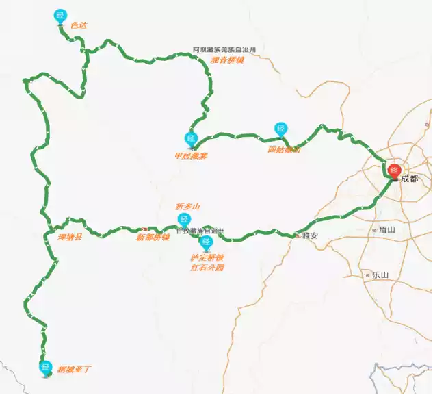
Design itinerary: Shanghai - Wuhan - Guang'an - Langzhong - Anren - Ya'an - Luding - Dadu River Canyon - Xinduqiao - Tagong Grassland - Litang - Daocheng - Aden - Batang - Mangkang - Basu - Ranwu Lake - Bomi - Lulang - Bayi - Lhasa - Yangzhuo Yongcuo - Karola Glacier - Gyantse - Namco - Naqu - Golmud - Xining - Xi'an - Shanghai
D1 Shanghai-850km - Wuhan Suhanting Wuhan East Lake Store Standard room 228 yuan Wuhan altitude 100 meters above sea level
Departed at 5:00 in the morning, after eleven hours of travel, arrived in Wuhan at 16:00, the whole journey was high-speed.
only drank the water of the Yangtze River, and ate Wuchang fish, and watched the turtles and snakes on the Yellow Crane Tower, which was better than walking ...... idle courtyard
D2 Wuhan-870km-Guang'an 7-day Guang'an Passenger Transport Center store standard room 177 yuan Guang'an is 366 meters above sea level
on the road at 7:00 in the morning, and arrives in Guang'an at 18:30 in the evening, Deng Xiaoping's hometown.
D3 Guang'an-190km-Langzhong Holiday Inn Standard room 158 yuan Langzhong altitude 464 meters
Sichuan is named after the four major rivers of the Yangtze River, Minjiang River, Tuojiang River and Fujiang River.
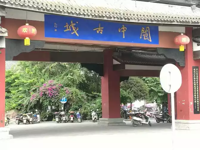
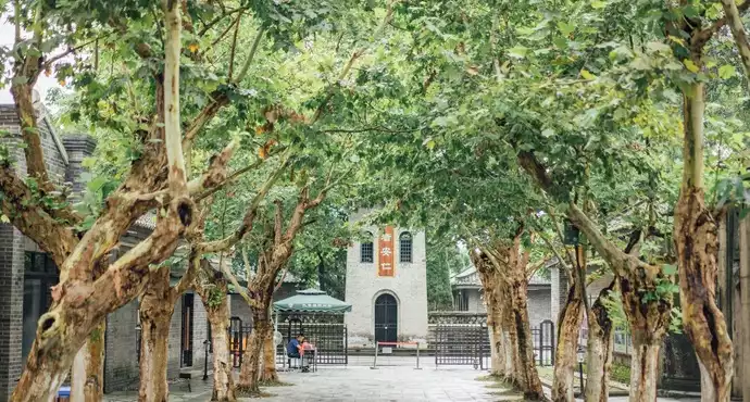
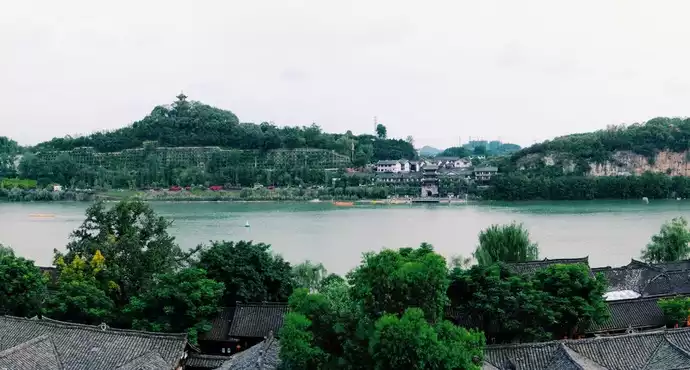
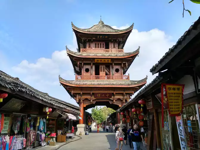
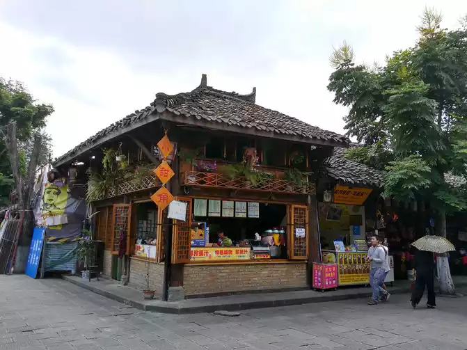
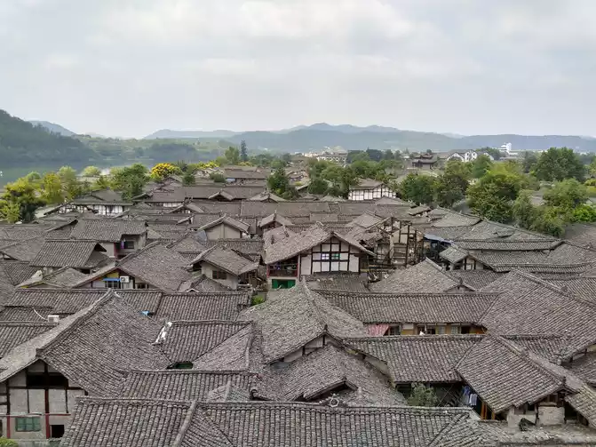
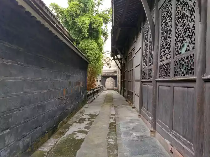
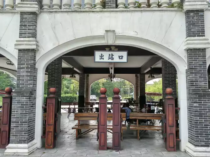
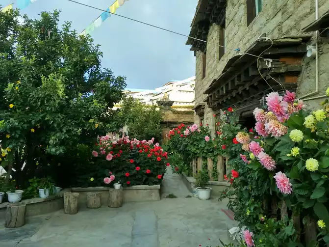
Langzhong Ancient City is located on the banks of the Jialing River in Nanchong, Sichuan, and is now one of the four ancient cities in China, with a history of more than 2,300 years. The four ancient cities in China are Lijiang in Yunnan, Pingyao in Shanxi, Langzhong in Sichuan, and Shexian in Anhui. Since ancient times, Langzhong has been a military town of Bayu and Shu, with a unique style of residential buildings in the ancient city, a checkerboard-like pattern, and a combination of north and south architectural styles, which is a model of the "unity of heaven and man" in the ancient city of China.
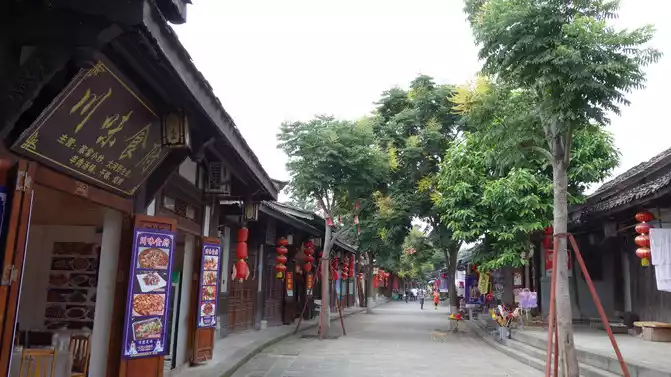
Zhongtian Tower
thatched cottage villa
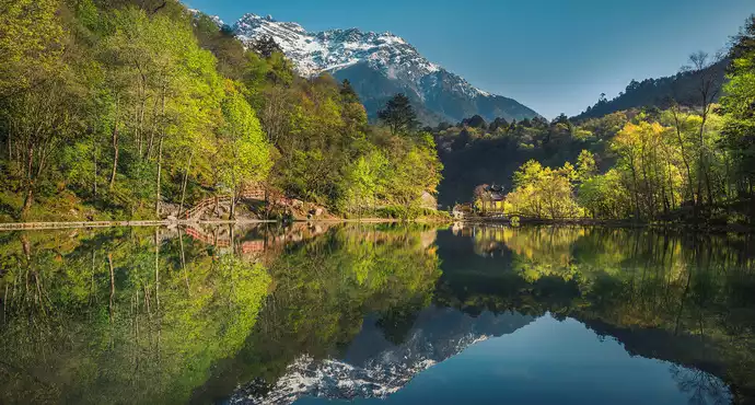
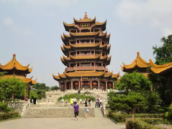
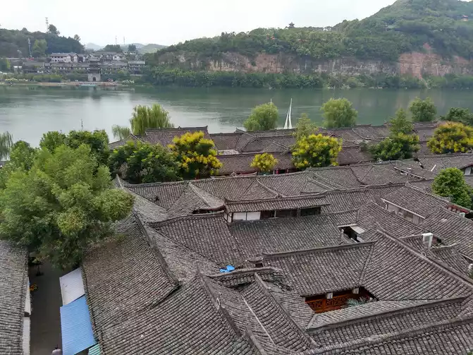
The tallest building in the ancient city, Huaguang Building, also known as the South Building and Zhenjiang Building, was built in the Tang Dynasty, and the existing Huaguang Building was rebuilt in the sixth year of Tongzhi in the Qing Dynasty (1867 AD) and is a landmark building in Langzhong. Climb the tower to see the whole picture of the ancient city, the Danqing city outline, and the Jialing landscape. The river light embraces the city on three sides, and the surrounding mountains are shrouded in mist......
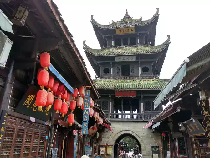
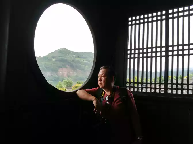
Brother Ren is in a corner of the Huaguang Building
D4 Langzhong-340km-Anren Ancient Town-100km-Ya'an Accommodation Ya'an Shangji Anya Hotel Standard room 189 yuan Ya'an altitude 641 meters
departed at 8:00 a.m. to Anren Ancient Town, and was stuck in traffic for nearly 2 hours on the Chengdu Ring Expressway. Arrive at the ancient town at 13:00 in the afternoon, play for about 2 hours, and arrive at Ya'an Hotel at 17:30.
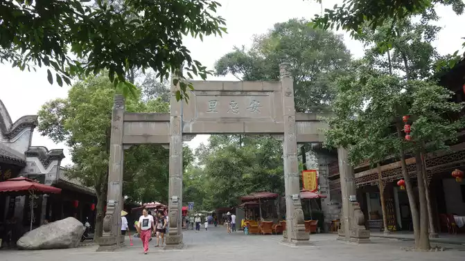
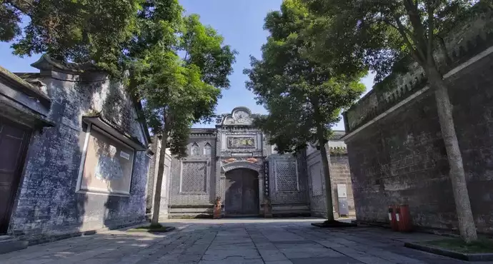
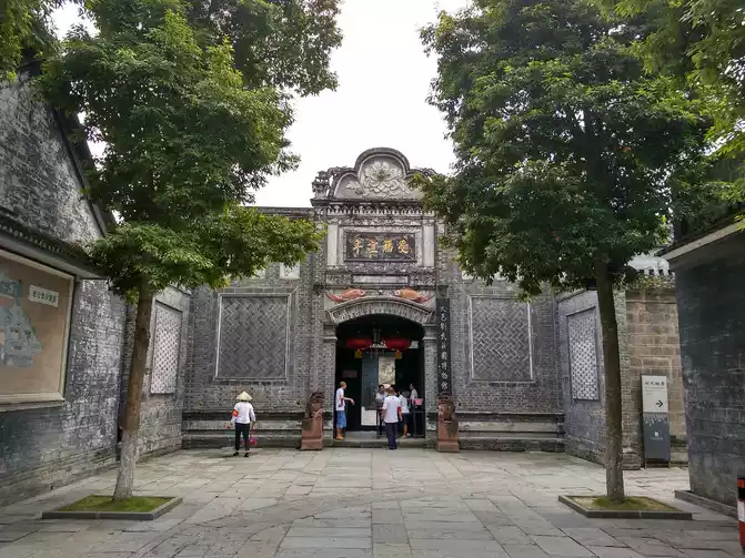
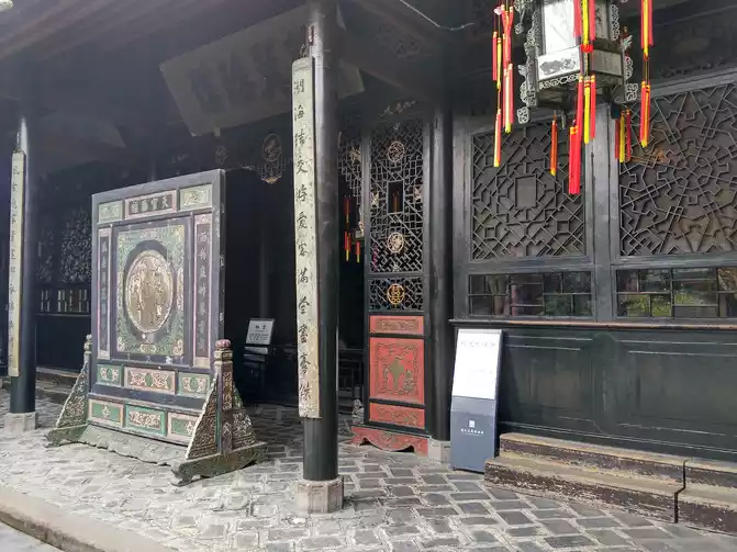
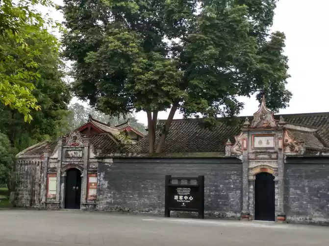
Anren "takes the meaning of benevolent Anren", the ancient town was founded in the Tang Dynasty, and the existing old-style neighborhoods were built in the late Qing Dynasty and the beginning of the Republic of China. There are 27 ancient mansions such as Liu's Manor and Liu Xiang Mansion, and three ancient streets such as Hongxing Street, Shuren Street, and Yumin Street; Small western-style buildings, Anren Middle School, bell tower and other ancient buildings.
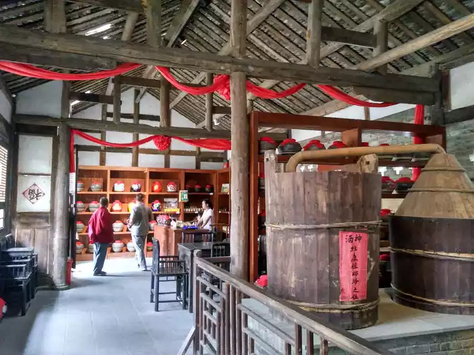
winery
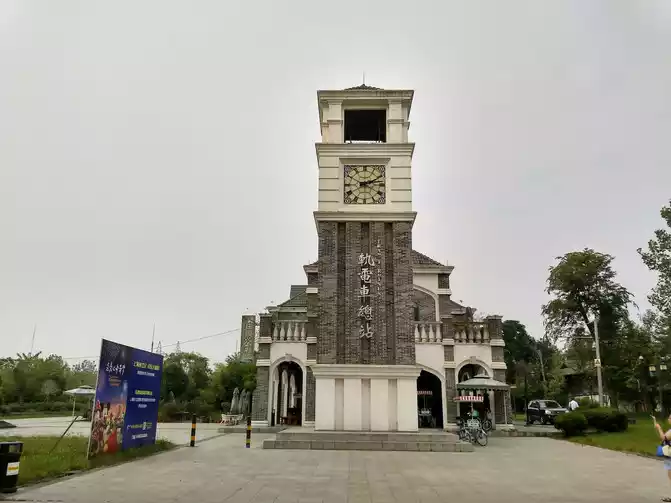
tram station
buildings of the Liu family in the heyday of the Republic of China were mostly a combination of Chinese and Western, solemn and elegant, creating a special architectural style of Anren. It has created the cultural essence ...... of western Sichuan architecture
Ya'an has three uniques: Yayu, Yanu and Yayu. Yayu refers to the continuous drizzle in Ya'an, which is the rainiest area in Sichuan. Yayu is a unique fish in the Tsing Yi River, with a green and slender body and tender meat and delicious taste. Legend has it that when Nuwa was mending the sky, she fell the sword into the river and turned into a fish, so there was a bone spur resembling a sword in the fish's head. As for the elegant girl......
Ya'an Covered Bridge

Rainbow Bridge
Hotel is located on the Tsing Yi River, and you can come to the river within 100 meters. The sky in Ya'an in the evening was very gloomy, so we still went to the river and looked at the covered bridge and rainbow bridge on the Tsing Yi River from a distance.
To Ya'an, it is a must to taste the Yayu soup pot, the fish is 145 yuan per catty, and the two of us asked for a smaller one, 260 yuan.
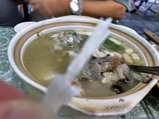
Ya'an Ya Fish and Saber Fish Bone
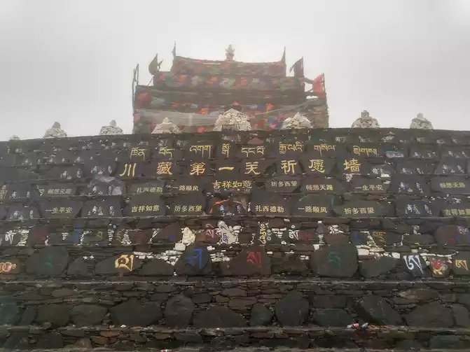
D5 Ya'an-140km-Luding-130km-Xinduqiao Suxinduqiao Suobo Zangjiazhuang Standard room 120 yuan Xindu Bridge is 3,450 meters above sea level
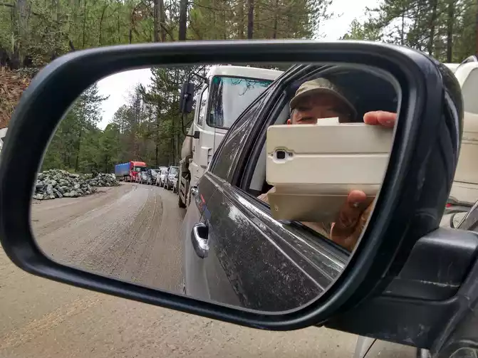
,Ya'an is really a veritable rain city, it started to rain last night, and it has not stopped. Today we have embarked on the Sichuan-Tibet Line, the true Chinese landscape avenue G318. It was raining all the way out of Ya'an City, and the two-way National Highway 318 was very slippery, but there were not many cars. Soon in Tianquan County, the expected bad road finally appeared, due to poor foundation conditions, many heavy trucks, and the climate was more extreme, road construction became a job that only started and did not end, and car accidents and traffic jams were also common.

bumper car!
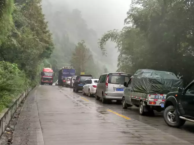
traffic jam......
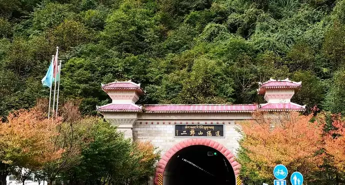
weather in the plateau area is changeable, and after crossing the Erlangshan Tunnel, the sky is clear, and it feels a bit like a Tibetan area, the altitude rises sharply, and the sealed food bags begin to swell. After Erlang Mountain, you can overlook the Dadu River, and Tibetan costumes are gradually increasing. On the way to Luding, you can drive along the Dadu River Canyon, where you can enjoy the scenery of the cliffs of the Dadu River Canyon and the geological book.
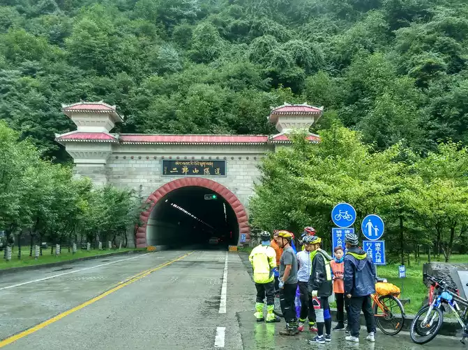
Erlangshan Tunnel and cyclists
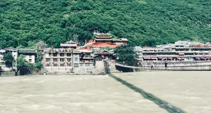
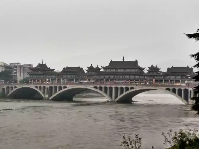
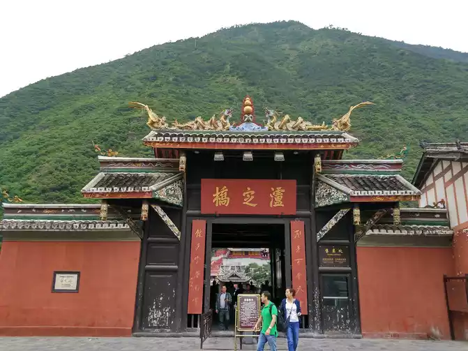
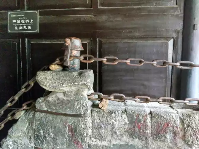
Luding Bridge was built in the forty-fourth year of the Kangxi Dynasty of the Qing Dynasty (1705 AD). This is a ferrata suspension bridge, consisting of a stone east-west abutment and 13 horizontal iron cables, 13 iron cables connected by 12,164 iron buckles, weighing about 21 tons. The Luding Bridge is 101.67 meters long and 3 meters wide, and there is a Luding Bridge stele made by the Kangxi Emperor of the Qing Dynasty on the east side of the bridge, which records the beginning and end of the bridge.
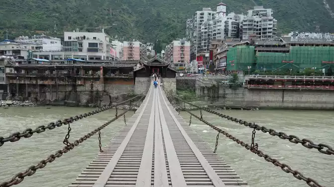
Dadu Bridge crossing iron cable cold
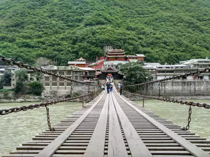
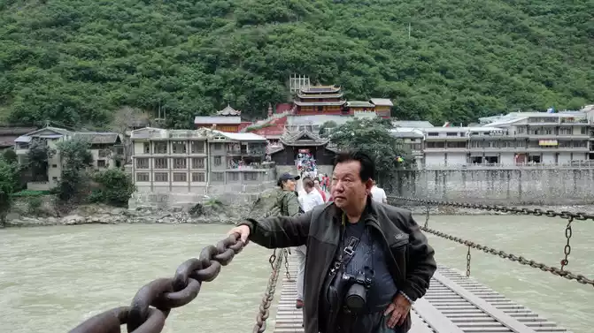
Luding Bridge is full of emotion
Although the Ya'an to Xindu Bridge is an asphalt road, the road surface is uneven and difficult to walk. Passing by Kangding, the hometown of love songs, all the way at an altitude of more than 3,000 meters, I don't feel any loss of car power, and I can easily get it done by climbing a third gear.
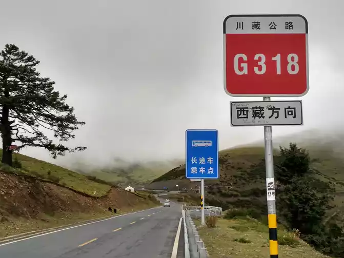
driving on National Highway 318 for a few days, but whenever I see the words "Tibet direction" on the roadside sign, I still can't hold back the excitement in my heart, we are going to Tibet! That mysterious feeling always touches my heart.
After passing Kangding City, you have to cross the Zheduo Mountain Pass (4,292 meters above sea level), the highest peak of Zheduo Mountain is 4,900 meters above sea level, and there is a high mountain pass known as the "First Pass of Kangba" on the Sichuan-Tibet Line. Zheduo Mountain is the dividing line of Sino-Tibetan culture, and after crossing Zheduo Mountain, you will enter the Kangba Tibetan area. "Zheduo" means curved in Tibetan, and the winding mountain road of Zheduo Mountain winds back and forth like a "many" word, one bend after another, so there is an old folk saying: "Erlang Mountain that scares people to death, Zheduo Mountain that scares people to death". When arriving at the pass, the wind and rain were combined, the visibility was very poor, and the people left after a few clicks, and after 41 kilometers downhill across the pass, they arrived at the Xindu Bridge.
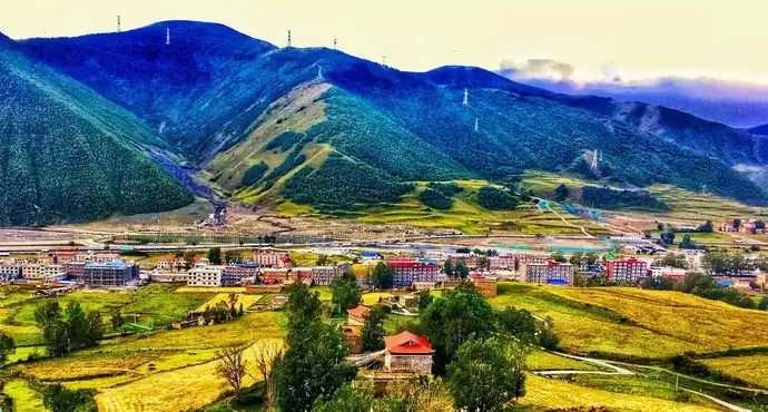
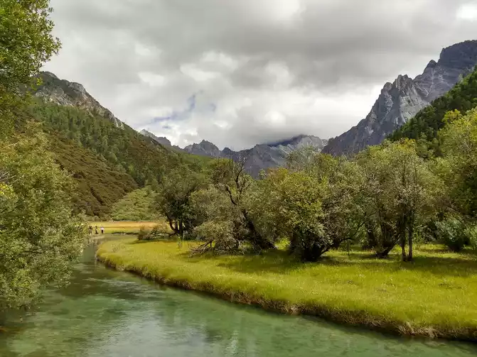
Today's destination is Xindu Bridge, which has the reputation of "photographer's paradise", and the scenery on the road gradually takes on the characteristics of Tibetan areas, as well as residential buildings.
It's a picturesque paradise, and the best time to take photos is in the evening and early morning. Magical light, endless grasslands, winding streams, golden cypress poplars, rolling mountains, Tibetan villages scattered among them, cattle and sheep grazing peacefully ......
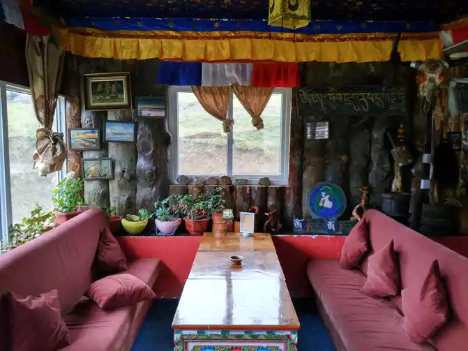
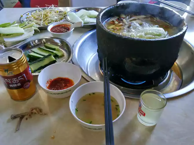
We stayed at Sobo Zangjiazhuang, and the owner was a Tibetan girl named Ram. The Tibetan meal for dinner is called "beef cover", drinking butter tea, and tasting a little highland barley wine, living a real Tibetan life. After a short break of tea and food, I took a bath, and the bed was covered with an electric blanket, and it felt very good to go to bed. Video chatting, a glass of milk before going to bed, leisurely, a good dream.
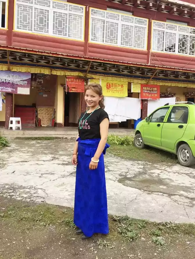
Miss
Ram
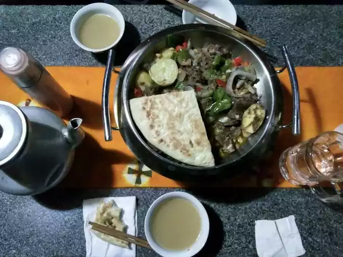
dinner
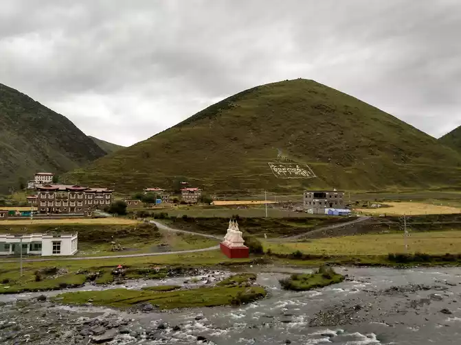
D6 Xinduqiao-360km-Daocheng Sudaocheng Adinana Youth Hostel Standard room 130 yuan Daocheng is 3750 meters
above sea level
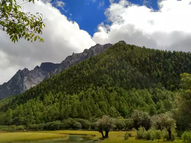
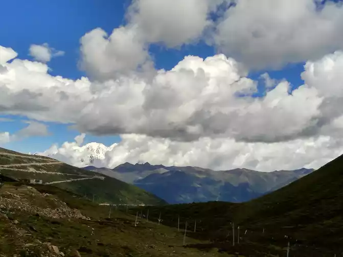
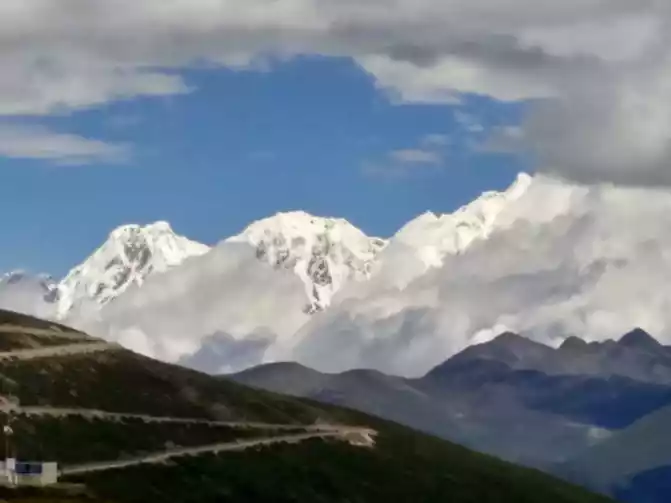
Today, we have to climb over 5 mountains of more than 4,000 meters, and Gao'er Temple Mountain now does not need to cross the pass, but can walk from the Gaoer Temple Tunnel. After crossing the Yalong River Canyon on the Yajiang River, cross the "Eighteen Bends of the Heavenly Road", climb through the scissors-like scissor bend mountain, and finally reach the Scissor Bend Pass (4,659 meters above sea level), which is a new high. The higher the altitude, the more foggy the mountain is, and the car walks in the clouds. In order to prevent landslides, some places will be equipped with barrier nets, but it will not be long before the barrier nets will be smashed by sliding stones, so these places should be stopped less. Despite the twists and turns, this section of the road is very good and climbs all the way to Mount Kazila (4,718 meters above sea level). The road down the mountain pass is incredible, the only thing you need to do is to control the speed, you must slide down in gear, excessive braking will bring danger.
to the last pure land of the blue planet......
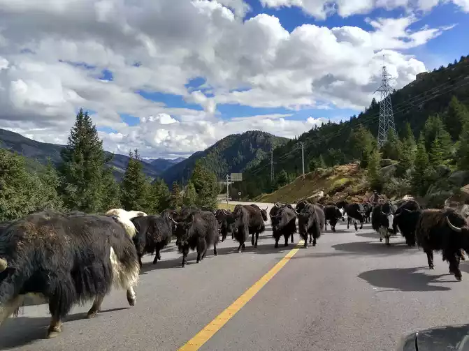
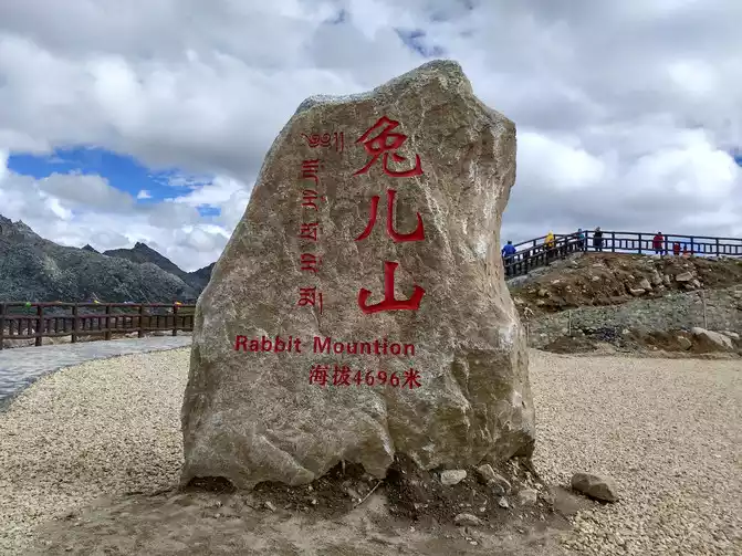
Crossing Rabbit Mountain (4,696 meters above sea level) and Haizi Mountain (4,602 meters above sea level), the scenery from Litang to Daocheng is pleasant, and the white clouds in the sky are much larger than marshmallows. The vegetation along the way is not dense, you can see some shallows, the mountain road is winding no matter how fast it is, and the road construction is still dusty in some places. When driving and encountering Tibetans driving the yaks, you must slow down and drive slowly, otherwise you will get into trouble.
one day, several mountain passes were crossed, all at an altitude of more than 4,500 meters. The snowy mountains are close at hand, the snow is at your feet, the blue sky is transparent, the white clouds are like fluff, the sun is shining, the hail is sudden, the climate change is diverse, and the scenery is diverse. Excited countless times, moved countless times, G318 is really a beautiful landscape avenue.
The red grassland
passed about seventeen kilometers past the town of Sangdui, and saw the red grassland of Sangdui, with a row of poplar forests behind it. It is said that only in autumn for more than ten days, there will be red aquatic plants, yellow poplars, blue skies and white clouds, forming a colorful landscape painting. I don't know if it's the wrong time or the climate, but we only saw a small handful of red grass.
Daocheng White Tower Forest
In the evening, go to the riverside township to see the green poplar forest, and you can go to the salad at a distance to enjoy the famous riverside sunset in Daocheng. The scenery along the way is quite beautiful.
poplar forest
Talking about butter tea in Tibetan areas, Tibetans told me that authentic butter tea is only available at high altitudes. Butter tea: For example, it is called ghee mixed with brewed tea, which is slightly salty and not bad, and is very useful for preventing high and reverse. Ghee is a product of yak milk, and the remaining milk residue is called milk cake by Tibetans, that is, cheese, slightly sour, and unaccustomed to eating.
D7 Daocheng-120km-Aden-120km-Daocheng Stay in Daocheng Yadinana Youth Hostel Standard room 130 yuan Daocheng altitude 3750 meters above sea level
Originally planned to stay overnight in Aden Village, but later changed to a one-day trip to Aden and returned to Daocheng on the same day. We didn't go to the Milk Sea and the Five-Colored Sea to play, and we had plenty of time, mainly because we could only go to Riwa Township (i.e. Shangri-La Town) by car, and we had to take a scenic car for 40 kilometers into Aden Village, which would be inconvenient, and the living conditions in Aden Village were also poor.
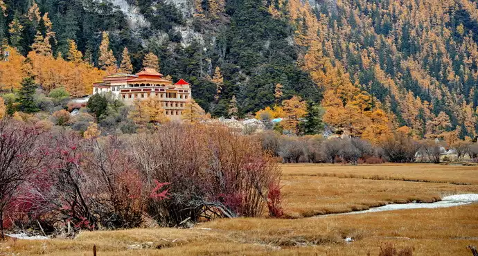
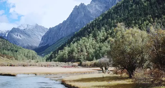
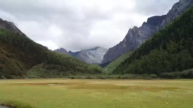
Aden is located in Ganzi County, Sichuan, adjacent to Tibet and Yunnan, with an average altitude of more than 3,000 meters. The beautiful snow-capped mountains, meadows, lakes, pastures, and pastoral fields are fascinating, and it is the last pure land on the blue planet.
In Aden in autumn, the earth is painted with heavy colors, and you can not only enjoy the snow-capped mountains covered by clouds and mist, but also have a panoramic view of the autumn colors under the blue sky. The weather in Aden is changeable, which may be due to the high altitude, and the snow-capped mountains in Luorong Cattle Farm (4,150 meters above sea level) are always hidden in clouds and mist, accompanied by bursts of drizzle from time to time, and the Maiyangyong Snow Mountain has not shown its dignity.
Chonggu Temple is a must-pass place to see the three sacred mountains, the sunset scenery is very charming, and there is a small grassland in front of the temple, that is, Chonggu Meadow.
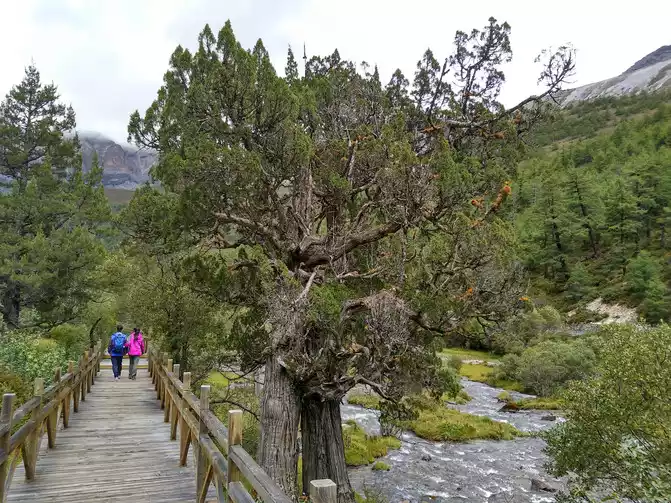
wooden boardwalk
Chonggu Temple, located at the foot of Xiannai Ri Snow Peak, is a scenery not to be missed, if you stay for a while, the sound of chanting will bring mystery to the silent Chonggu Temple......
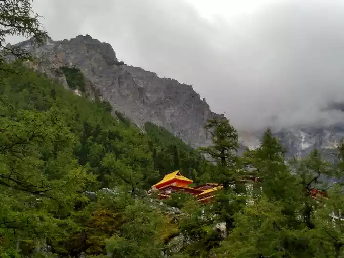
Chonggu Temple
Aden ticket is 150 yuan, 60 years old and above 80 yuan, scenic car round-trip 120 yuan. Chonggu Temple takes a battery car to Luorong Cattle Farm for 80 yuan round trip, Luorong Cattle Farm rides a horse to the Milk Sea for 300 yuan, and the five-color sea needs to be walked up.
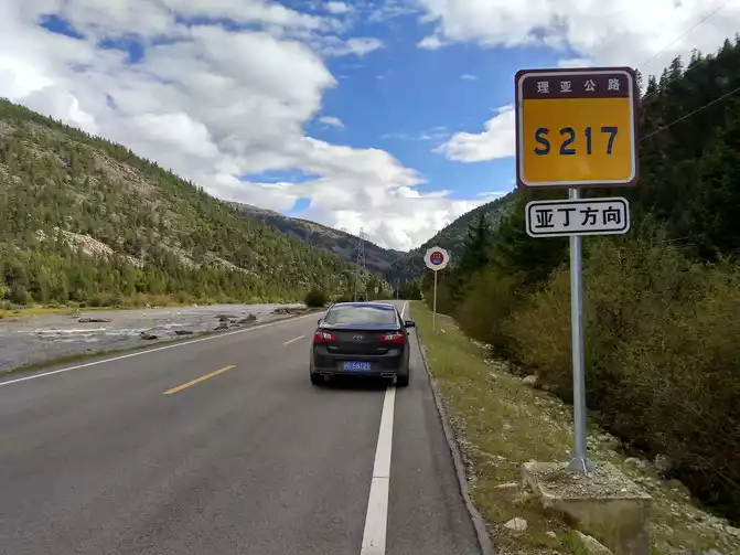
D8 Daocheng-420km-Mangkang Stay at Mangkang Huatai Business Hotel Standard room 200 yuan Mangkang altitude 3875 meters
We set off at 7:00 in the morning, S217 Liya Provincial Highway from Daocheng to Litang. Along the way, I saw all kinds of cars, as long as you drive slowly and boldly enough, and you need some skills, there is no 318 that can't go. I saw QQ and MINI entering Tibet, so it really doesn't matter what car you drive into Tibet.
I admire the cyclists very much, seeing them riding on the winding national highways, sometimes solo travelers. When we see cyclists lying on the ground resting due to fatigue, we always feel that there is a spirit supporting them, and what they need to overcome is not something we can understand.
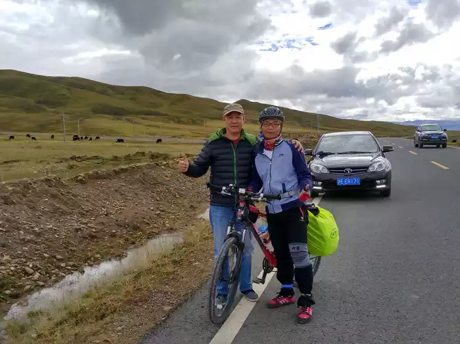
Near Litang, the world's high city, I met a rider in Pingliang, Gansu Province, and took a group photo with him. He set off from Chengdu and is expected to arrive in Lhasa in 23 days, riding the 2,140 kilometers of the Sichuan-Tibet Line, which is his sixth day of travel. Cheers to him and all the cyclists! Like!
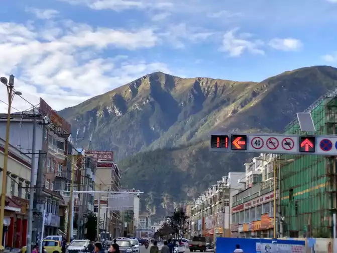
The world's highest city, Litang (4,014 meters above sea level), is the highest county in the world, with an oxygen content of only 48% in the plains.
Litang West Gate (under maintenance).
The Tibetan word for Litang means a grass dam as flat as a bronze mirror, and the Maoya grassland along the way is more than 4,000 meters above sea level, but it is not felt that on the plateau, the endless meadows stretch along the road. Presumably, when the spring flowers bloom, the greenery on both sides will make people's hearts beat and happy.
Here I want to talk about altitude sickness: at an altitude of about 4,000 meters, most people will feel short of breath and always feel that the oxygen they inhale is not enough, so they gasp for breath. Personal experience is that everything has to be slow motion on the plateau, and the need to keep warm and drink some hot glucose water are effective methods. As for taking drugs such as rhodiola rosea and plateau an, it may have a certain effect and provide psychological comfort. The most direct way to alleviate high reactions is to take oxygen, which has an immediate effect, but it will be dependent and not advocated. Thankfully, at an altitude of nearly 5,000 meters, I didn't have any signs of anti-reaction, and I took a bath every day, and everything was similar to that on the plain.
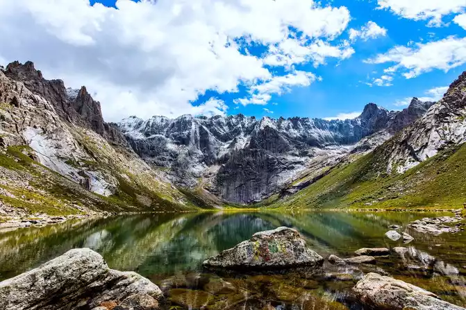
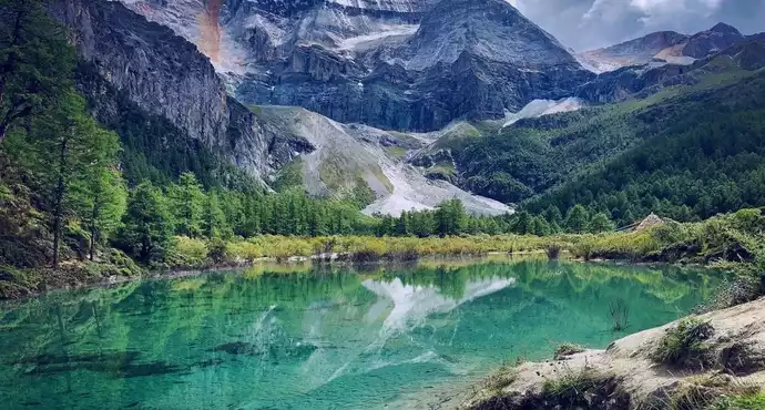
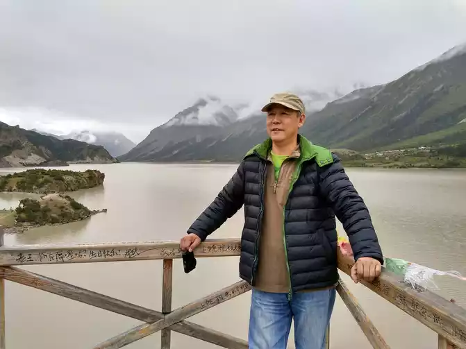
pearl on the Sichuan-Tibet Line - Sister Lake
Batang, the closest county seat to Tibet in western Sichuan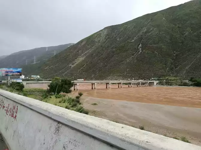
the boundary line between Sichuan and Tibet - Jinsha River Bridge
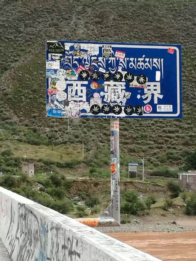
Even if we officially enter Tibet after crossing the Jinsha River, we received the speed limit bar at the checkpoint, Tibet is barren, and it is not realistic to install cameras to measure speed. It doesn't matter if you speed on the way, as long as you pass the next checkpoint on time, you can only delay and not advance, if you go ahead, you will be fined or fined. 
into Tibet's first speed limit list
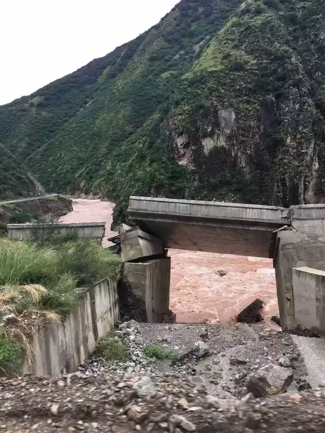
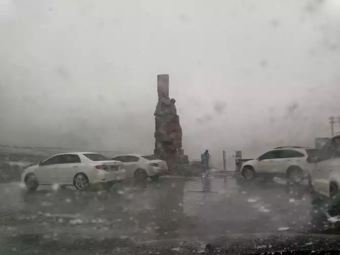
At 4 p.m., we crossed the Jinsha River Bridge and entered Zhubalong Township on the Tibetan border, 71 kilometers away from Mangkang County, with a time limit of 2 hours. At this point, the bad road began, and it was also the beginning of the nightmare, because the traffic police said when the collar was tied: It is good to be able to get to Mangkang at ten o'clock in the evening, and I thought it was impossible after hearing it. The first 30 kilometers of road were rotten, but smooth, and at 17:40 they were blocked in an unknown canyon due to the landslide, that is, there was no WeChat signal or mobile phone signal. The drivers spontaneously worked together to clear the blockage, which lasted for more than 2 hours, and it was getting dark and it was raining again.
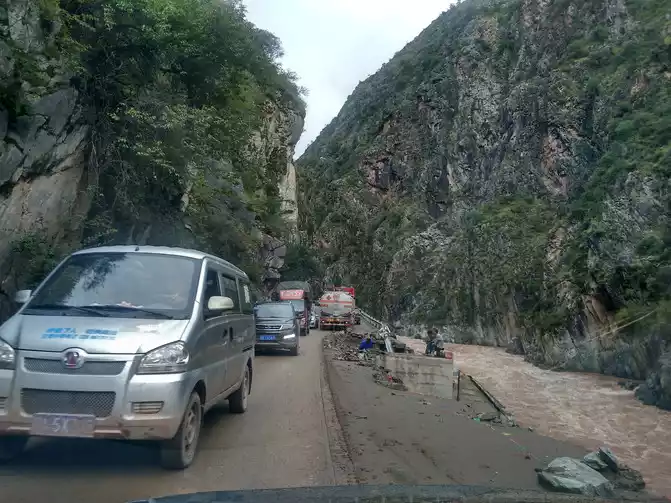
Collapses, road subsidence, broken bridges, rockfalls, darkness, strong winds, heavy rain, mountains on one side and cliffs on the other, and cars and give way. A car-wide dangerous road and deep ruts, my car can only ride on the protruding part to rush the slope, stop the fire many times, and rub the bottom many times. Dangerous roads and dangerous situations were eliminated again and again, and it was not until 23:00 in the evening that I arrived in Mangkang County, and after this thrilling 6 and a half hours, I had a deep understanding.
To be honest, if it was in many sections during the day, I would definitely not dare to pass it, and I just broke in under the black light and the truth was unknown. I am sincerely grateful to my car for carrying last night's experience and carrying me out of a desperate situation, thank you from the bottom of my heart!
D9 Mangkang-360km-Basu Basu Nujiang Yun Hotel Standard room 300 yuan, Basu is 3280 meters
above sea level
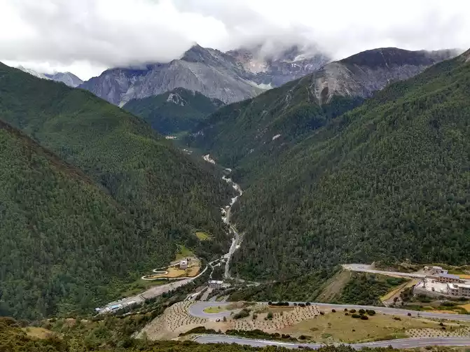
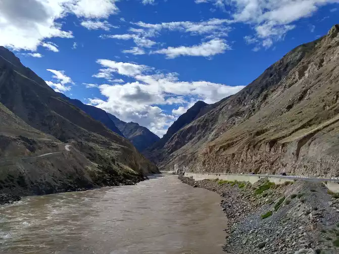
After driving on a bad road, the mentality is adjusted very well. The roads in Mangkang County are not good, and it is a bad road out of the city, but it is very different from the road conditions yesterday evening.Cross Mount Rawu (4,376 meters above sea level), drive through the Lancang River Gorge, and cross the Lancang River Bridge.
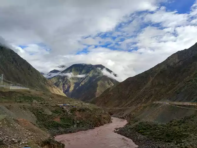
Lancang River Gorge
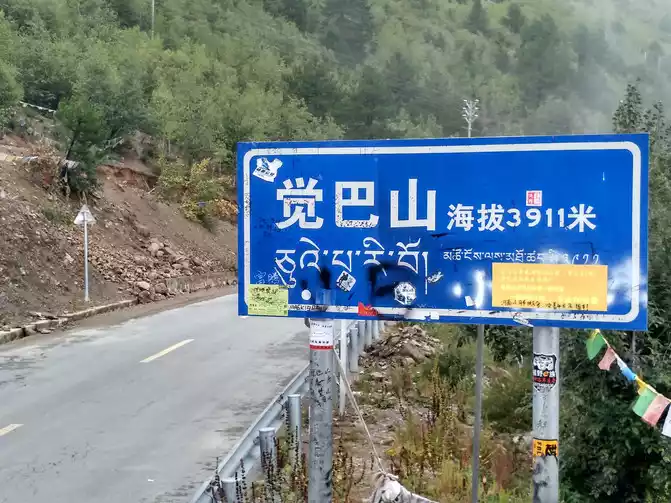
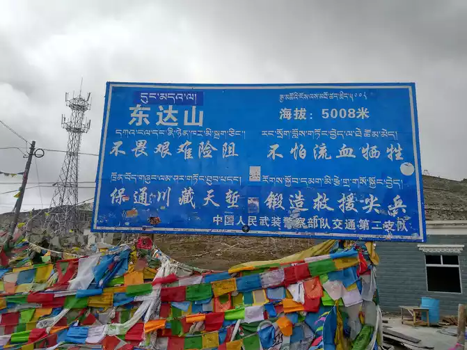
Crossing Jueba Mountain (3,911 meters above sea level) and Dongda Mountain (5,008 meters above sea level) are the highlights of this road, one dangerous and the other high. Jueba Mountain is one of the famous dangerous roads in Hengduan Mountain, with a 30-kilometer winding mountain road and a drop of nearly 2,000 meters, making Jueba Mountain the most difficult mountain to climb on the Sichuan-Tibet line.
After crossing Jueba Mountain, the mountain began to flatten, the road was no longer winding, and the sides became open. Soon we came to the second highest mountain of G318, Dongda Mountain, which is the most lingering mountain on the Sichuan-Tibet line, and it takes about two or three hours to walk. Dongda Mountain Pass is the first pass on the G318 at an altitude of more than 5,000 meters, the pass is very windy, the temperature is close to zero, and you will not be able to stand it after walking outside the car for a while.
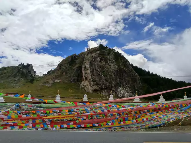
Yela Mountain Pass (4658 meters above sea level), there is an observation deck to see the Nu River 72 turns, also known as the Yela Mountain 99 turns, is the most spectacular devil's road in China, the winding zigzag winding mountain road runs through the natural moat between the Lancang River and the Nu River, these turns are steep and steep, are U-shaped bends.
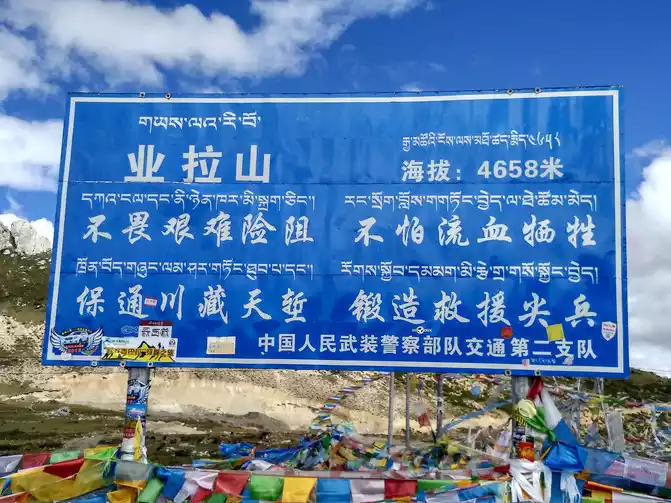
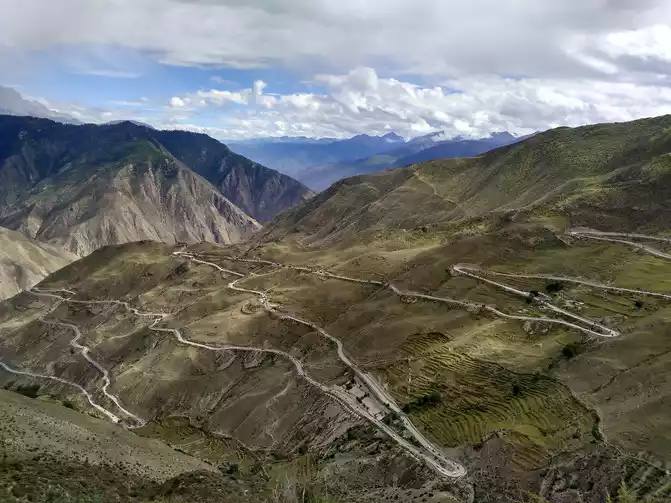
seventy-two turns of the Nu River
The sky of the plateau is extremely transparent, and the purity and inexplicability make people feel infinitely sacred. The sun shines on the white clouds, and the halo sets a gorgeous gold rim for the white clouds, is this the legendary auspicious cloud? 
The car is driving between the mountains, the newly built asphalt road has not yet faded, the blue sky and white clouds intersect and shine, you can bathe in this scene, all the glitz has receded, I only wish to become one with this divine nature. 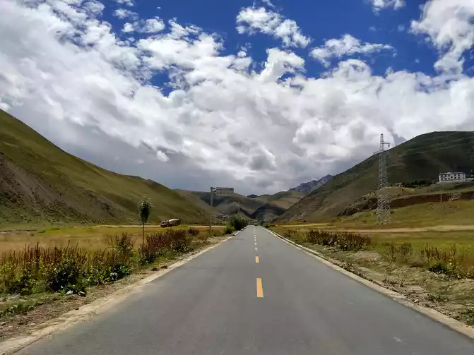
Nujiang Canyon
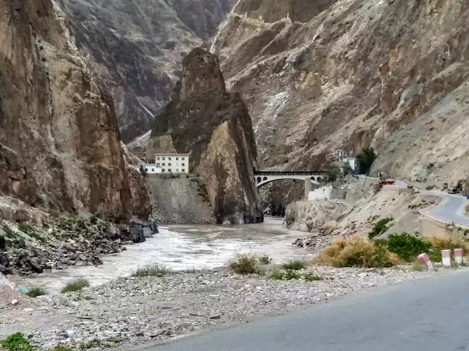
Military Station and Nujiang Bridge
arrived at Basu in the evening and stayed at Basu Nujiang Cloud Hotel. I highly recommend this newly built hotel, which is probably the most upscale in Hachijuku at present, clean and tidy, and can be eaten in the hotel's Chinese restaurant and hot pot restaurant.
D10 Basu-90km-Ranwu Lake-130km-Bomi Su Bomi Hengtai Hotel Standard room 150 yuan Bomi altitude 2725 meters It
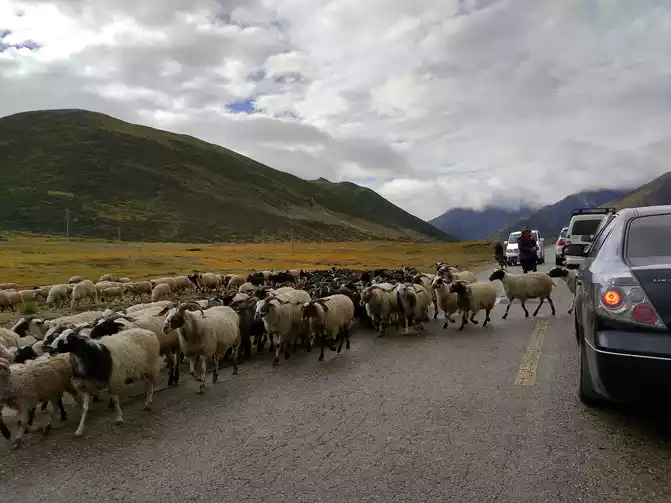
is common to see yaks or sheep wandering on the road, you have to stop to give way, don't rush, the consequences will be very serious.
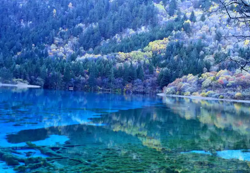
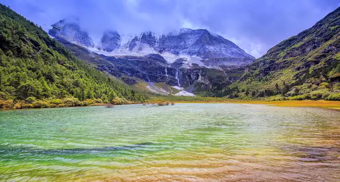
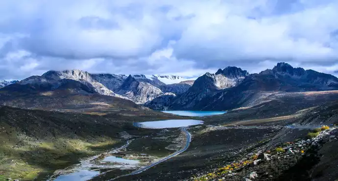
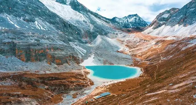
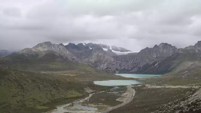
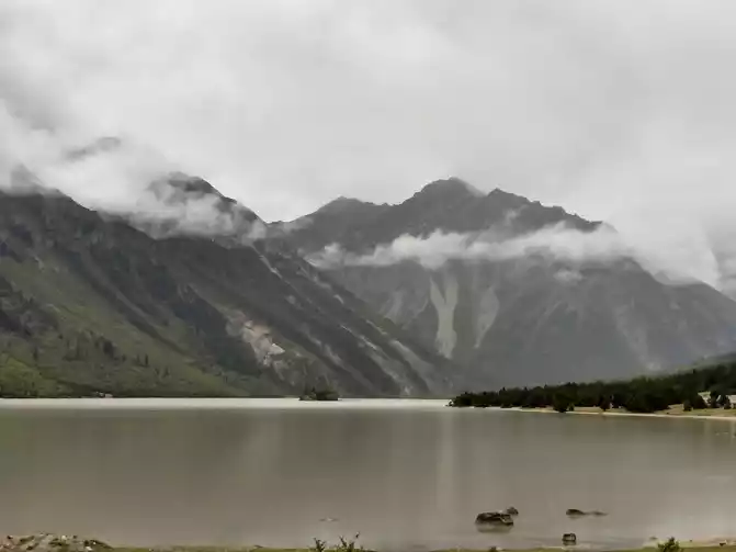
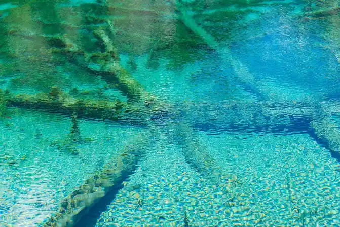
Ranwu Lake is a glacial dammed lake formed 200 years ago, covering an area of 22 square kilometers, about 26 kilometers long, 1-5 kilometers wide, and 3,850 meters above sea level. It is the source of the Palong Zangbo River. Ranwu Lake is famous for its blue and quiet, and the water changes with the seasons. However, Wuhu Lake is divided into three lakes: the upper lake is the most beautiful, the middle lake is the second, and the lower lake is the second.
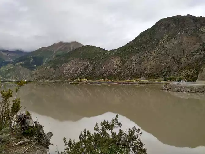
The ideal plateau lake is like a sapphire embedded in the plateau. Seeing Ranwu Lake, the result was very different, maybe the time was wrong, the blue of Ranwu Lake was gone, and Jing was still there.
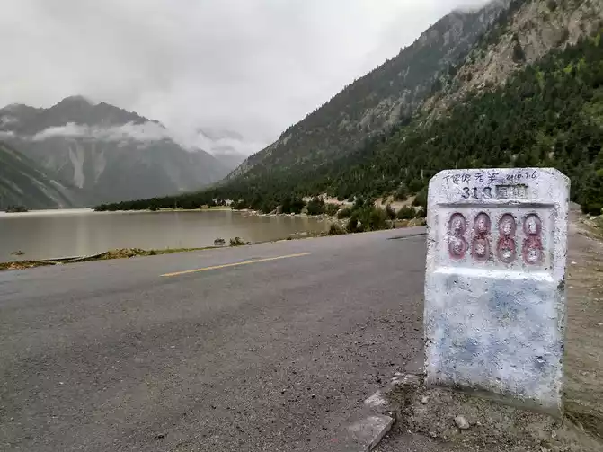
3888 milestone
on the Sichuan-Tibet Line
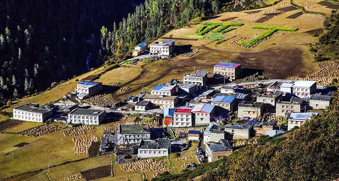
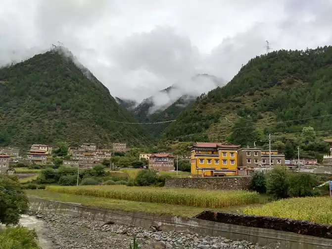
The planned trip to Laigu Glacier or Midui Glacier was canceled due to rain and rotten roads. Ranwu to Bomi is the most beautiful section of the Sichuan-Tibet Highway, with lush forests and gurgling water along the way. The autumn boulevards make it hard to believe that there is such a scenery in the plateau area, all the way into the beautiful town of Zhamu (2,725 meters above sea level), a beautiful town surrounded by snow-capped mountains and forests, where the fresh air is called "Tibet's Little Switzerland".
Fortunately, we didn't go to the glacier, otherwise we would have to fight against the bad road in the dark night. After crossing the rice pile and entering the Bomi boundary, the nightmare of the bad road repeated, and the nearly sixty or seventy kilometers of washboard and rotten road walked for nearly four hours, and from time to time it entered the traffic jam ......
D11 Bomi-240km-Bayi Town Suhanting Nyingchi Bus Station Store Standard room 219 yuan Bayi Town is 2930 meters above sea level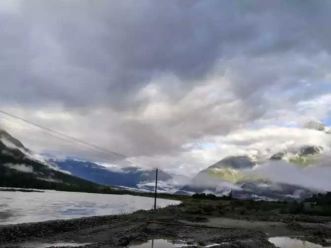
encountered a bad road when I left Bomi County, and it took more than three hours to drive to Tongmai Town after about 40 kilometers of bad roads in Guxiang.
intimidating natural danger of Tongmai Pailong is gone, and the natural moat has become a smooth road, and the car quickly passes through the Tongmai and Pailong sections.
The scenery of Lulang can be described by the word "beautiful", the surrounding grassland, forest sea, snow-capped mountains as one of the unique beauty, the majestic and magnificent Tibetan area can not be seen at all, with a beautiful scenery of the Jiangnan mountains, or a bit like the scenery of Switzerland, the Alps snow-capped mountains are set in the background.
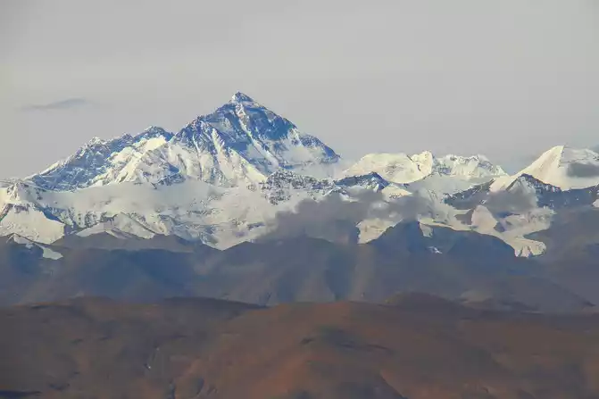
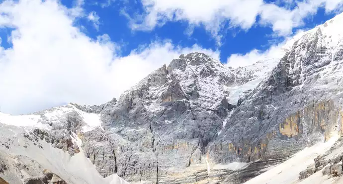
Climbing all the way out of Lulang and over Mount Sejila (4768 meters above sea level), we were lucky enough to see the dignity of Nanga Bawa Peak and look at Nanga Bawa Peak (7782 meters above sea level) - the Chinese Alps. 
Nanga Bawa Peak
gravel washboard road of more than 60 kilometers from Lulang to Bayi Town is a headache.
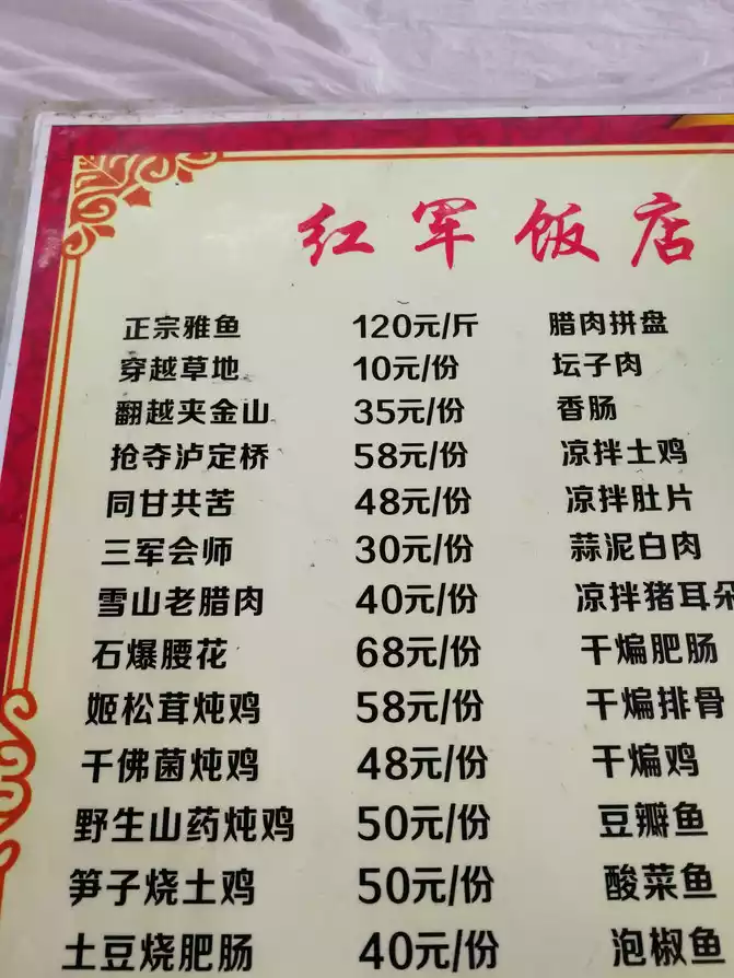
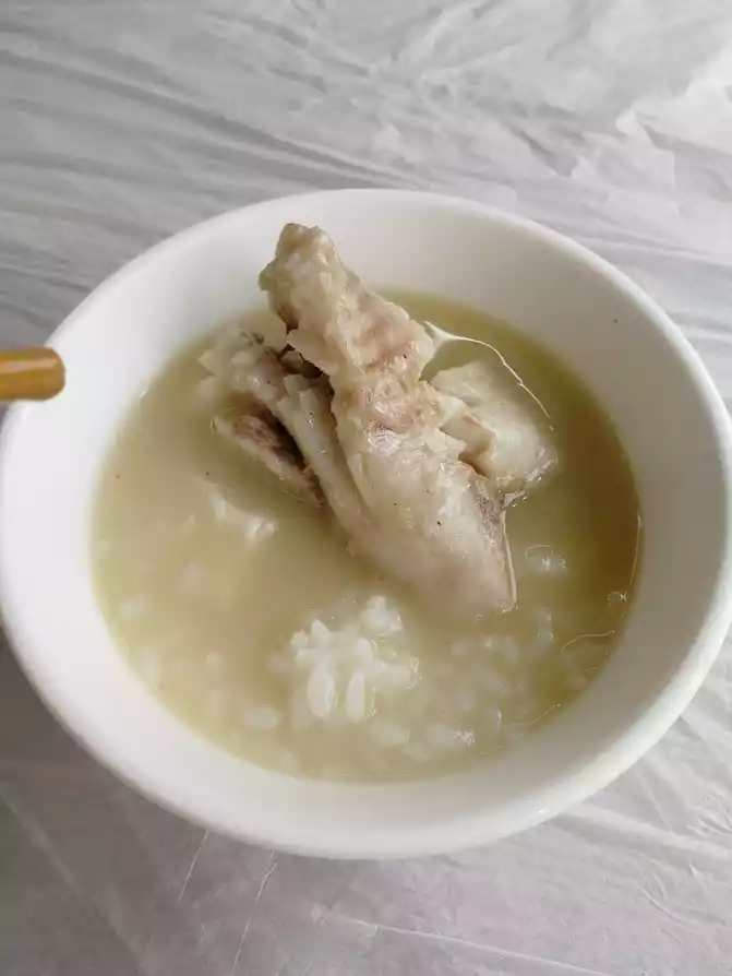
Arrive in Bayi Town in the evening, and it is a must to eat stone pot chicken. Authentic stone pot chicken, the pot is handmade from Motuo mica stone, the chicken is a free-range native chicken on the Tibetan plateau, the water is natural stream water flowing down the snow-capped mountains, and then add codonopsis, palm ginseng and matsutake mushrooms, and simmer for several hours to get a pot.
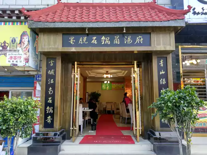
Every restaurant in the town has stone pot chicken, the hotel owner recommends this one, when I entered the store, the stone pot chicken was stewing on the fire, beautiful.
The two of us asked for a small pot for 298 yuan, which was actually half a chicken, including all side dishes, seasonings and staple foods.
Highland barley rice wine is very delicious, that is, the soup made with wine.
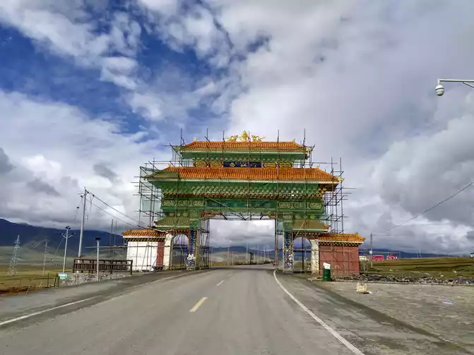
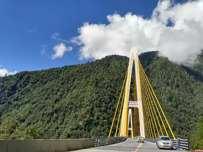
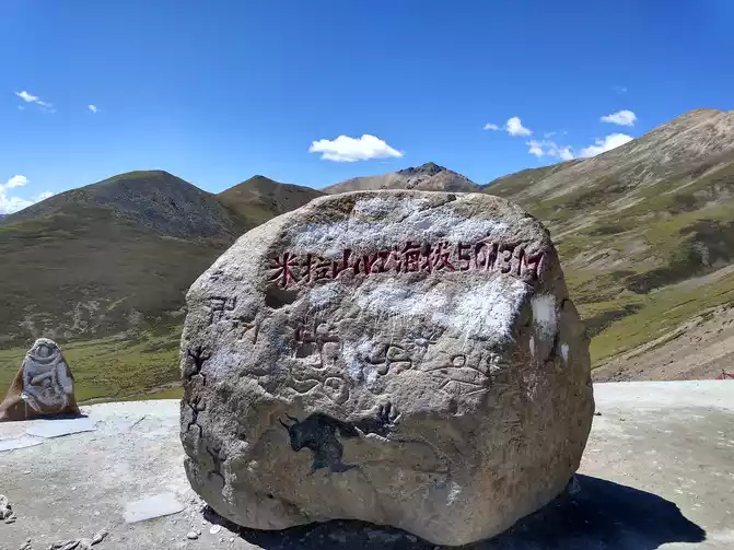
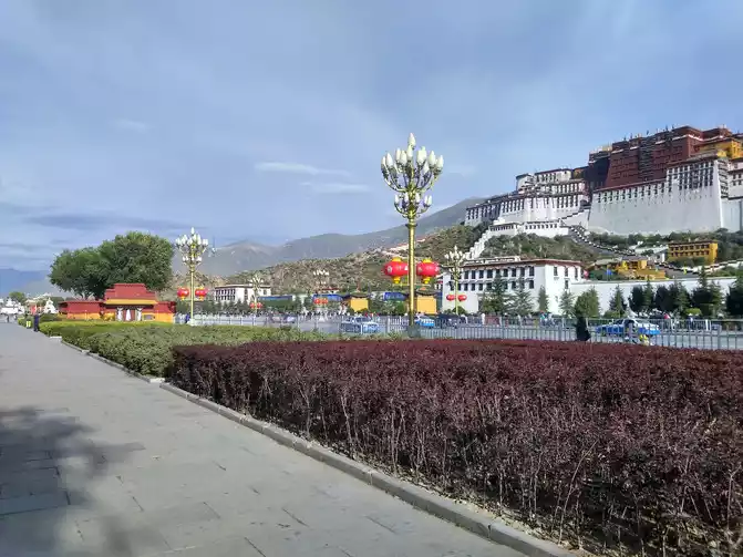
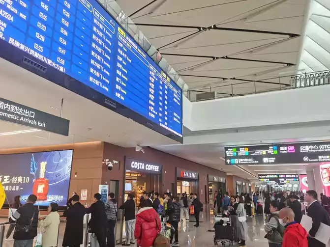
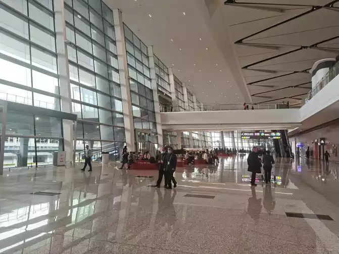
D12 Bayi Town-410km-Lhasa Stay at Lhasa Haihui Hotel Standard room 380 yuan Lhasa altitude 3650 meters above sea level
< img src="https://dimg04.c-ctrip.com/images/100n0900000042r8l6E74_W_671_0_Q90.jpg?proc=autoorient" />
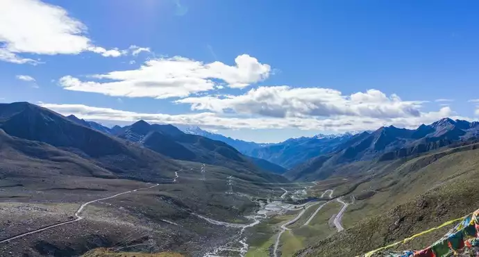
On the way, we crossed the Mira Mountain Pass (5,013 meters above sea level), which is the highest mountain on National Highway 318.
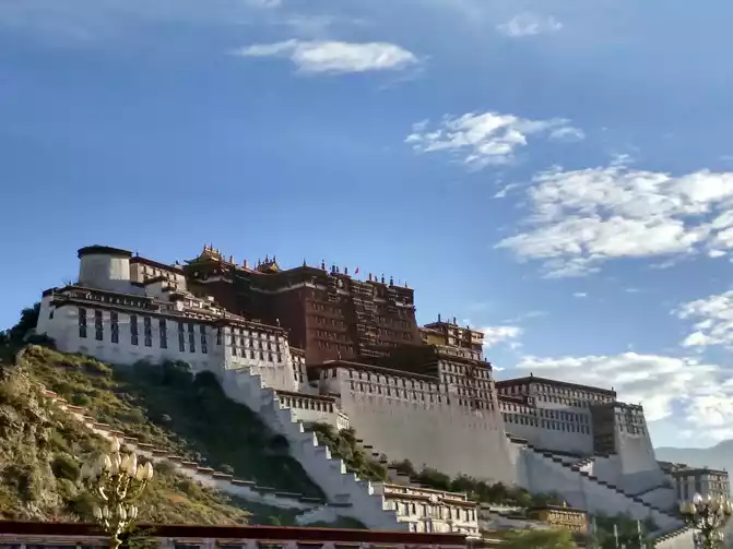
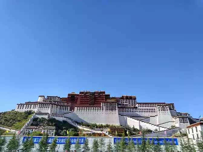
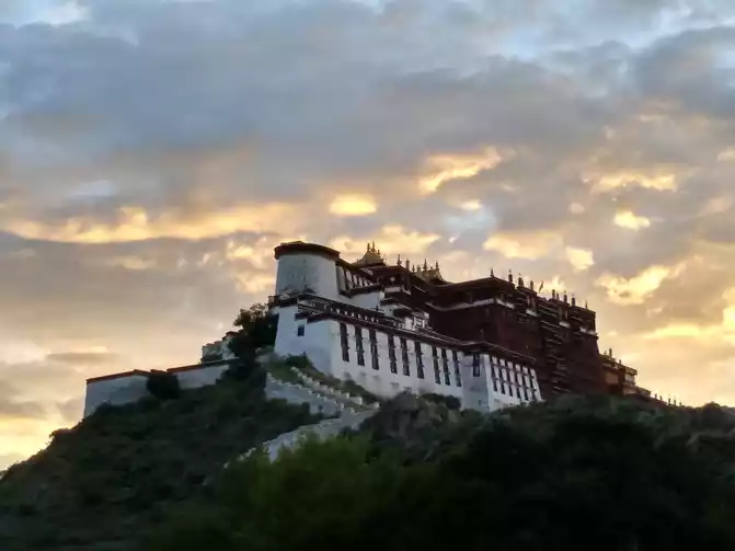
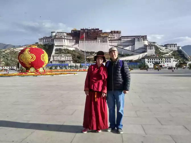
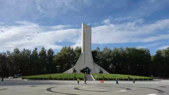
Then went west along the Lhasa River Valley and arrived in Lhasa at 16:00 on September 10, which lasted 12 days, drove 4,835 kilometers, all the way to the danger and beauty, and finally arrived at the pilgrimage site. The Potala Palace against the blue sky and white clouds is majestic, when the red and white Potala Palace stands in front of my eyes, the dream has come true, and the mood at this moment is indescribable, I can't help but burst into tears......
Self-driving Sichuan-Tibet line, especially driving a car with small displacement and low chassis, is an experience and test of people's will, physique, perseverance, courage, driving skills and vehicle conditions. Thank you again for my car, it is inseparable from me, I want to shout for it!
 ......
waiting for the car wash
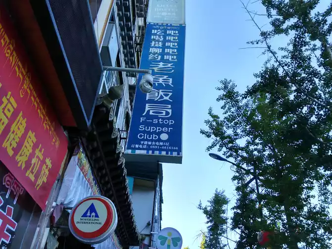
Old Fish Dinner is a restaurant with a view of the Potala Palace, where we had dinner and were lucky enough to take pictures of the sunset of the Potala Palace.
D13 Lhasa tour accommodation at Lhasa Haihui Hotel standard room 380 yuan Lhasa altitude 3650 meters
above sea level
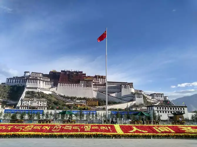
Yaowang Mountain is on the right side of the Potala Palace, at an altitude of 3,725 meters, and is close to the Potala Palace. The observation deck halfway up the mountain is the best place to take pictures of the Potala Palace, and if you wait until sunset, you can enjoy the night view of the Potala Palace.
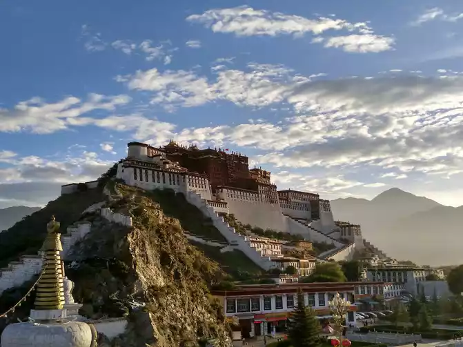
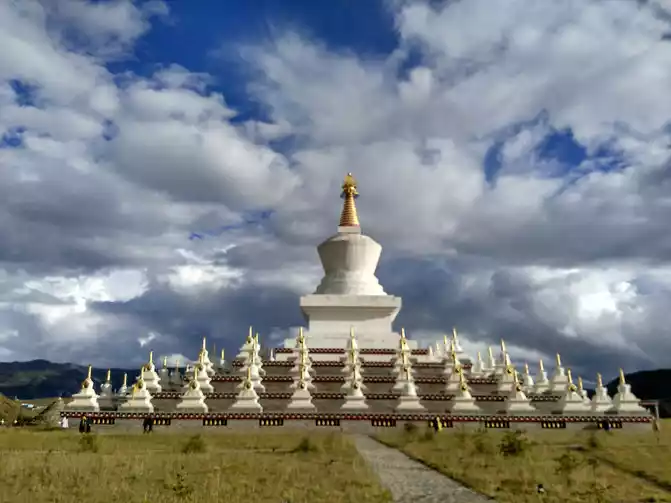
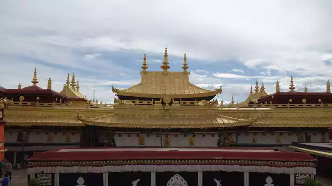
Potala Palace (ticket 200 yuan), this 1,300-year-old palace-style complex with a typical Tibetan architectural art style and grand scale is the highest and most majestic palace in the world. The Potala Palace extends the splendor of Tibetan culture, collects extremely rich cultural relics and handicrafts, and is a truly worldly heritage.
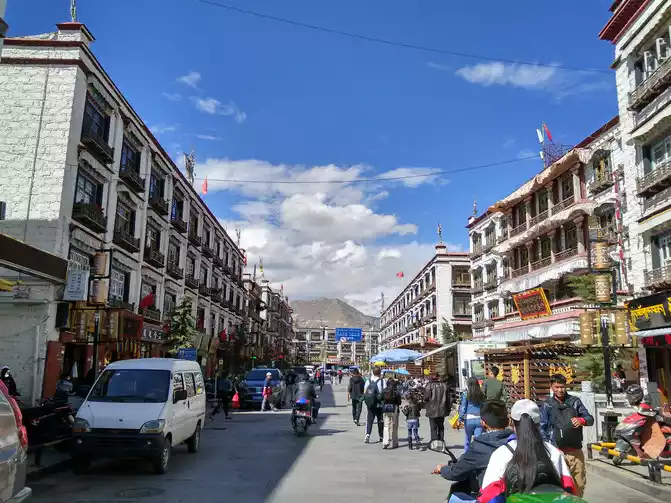
The days in Lhasa are really long! The sun was already shining brightly at 8 o'clock in the morning, and the sky was still not dark at 9 o'clock in the evening. It only takes more than ten minutes to walk from the hotel we are staying in to Bugong Square.
believer
who kowtowed
After visiting the Potala Palace, he knew: gold is not valuable, but gems are priceless!
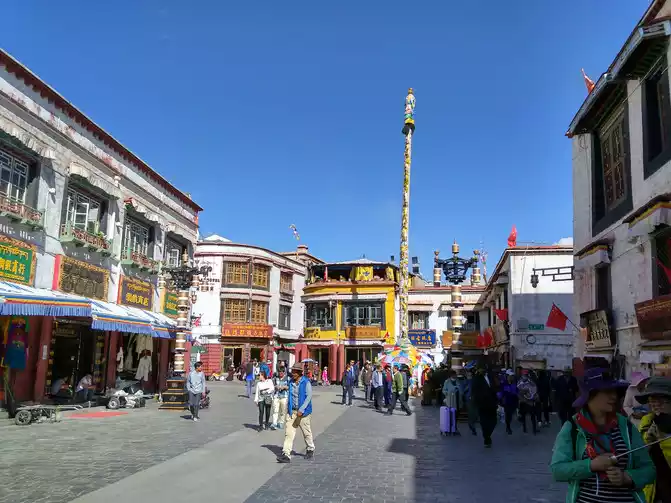
Jokhang Temple (ticket 85 yuan) was built in the 21st year of Tang Zhenguan, built by the Tibetan king Songtsen Gampo to commemorate the entry of Princess Chizun into Tibet, and is the most brilliant Tibetan period building in Tibet and the earliest civil structure building in Tibet. There are nearly a kilometer-long Tibetan mural of Princess Wencheng entering Tibet and the construction of Jokhang Temple, as well as two Ming Dynasty embroidered thangkas.
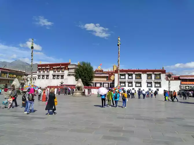
Jokhang Temple Square
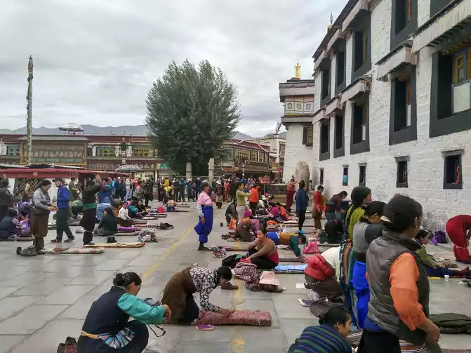
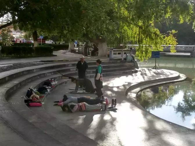
Every morning, before dawn, a large number of Tibetan believers kowtow their heads, and they have to kowtow 110,000 times in this one temple, which is a challenge for anyone.
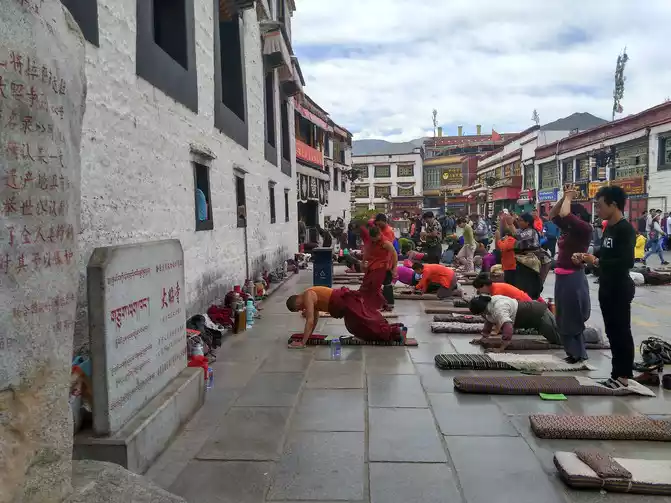
are eight wooden pillars outside the Shakyamuni Hall in the temple, which must be knocked with your own hands, and they will make a sound like iron.
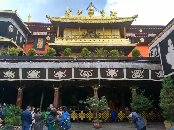
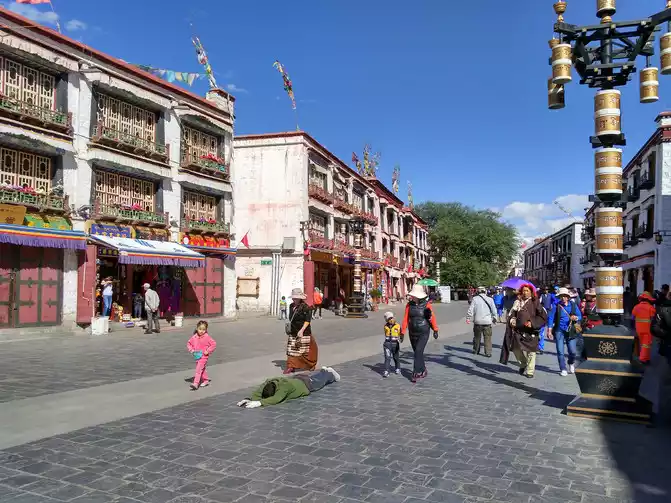
Bakhor Street is a turning point around Jokhang Temple, which Tibetans call the "holy road". Every day, many Tibetans turn around the temple clockwise along Bakhor Street.
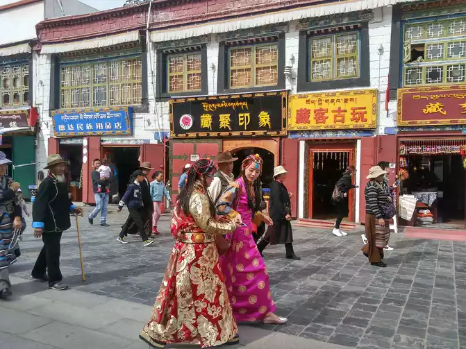
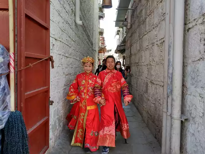
The newcomer is coming!
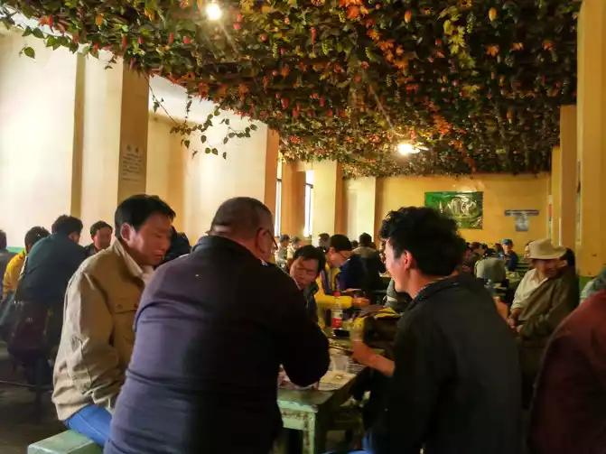
The Guangminggang Qiongtian Teahouse next to Jokhang Temple Square is a very famous teahouse, which is full of locals and foreign tourists every day. The sweet tea you drink is actually milk tea, and it is still interesting to go to a sweet teahouse to experience the process of drinking tea. The shop hall is full of long tables and benches, so they all sit together. First of all, find an empty seat and sit down, then go and get a clean cup and put it on the table, put change. As long as the cup is empty, there will be a waiter to pour tea, 8 cents a cup, if you don't want to drink it, put the money away.
Guangminggang Qiong Tian Tea House
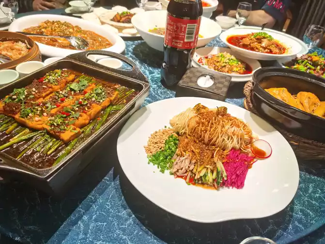
In Lhasa, there are many Tibetan restaurants and Sichuan restaurants, as well as some Northeast restaurants, and Texan chain fast food is everywhere. And the food in Lhasa tastes generally good, and you will definitely not be hungry because you are not used to eating Tibetan food.
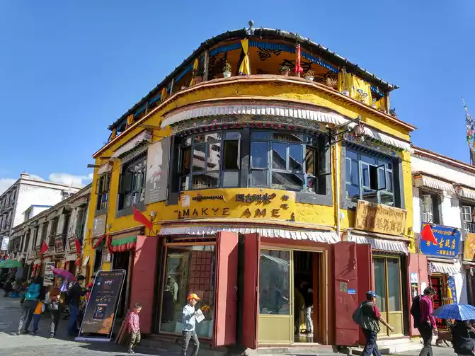
Maggie Ami is a Western food bar, with a petty bourgeois atmosphere, often visited by foreigners, and is a good place for literary and artistic young people and foreigners to spend time.
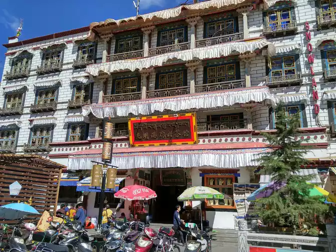
Lhasa is a clean small city, there are no high-rise buildings, and the choice of hotel accommodation is relatively large, and it is also very clean.
The plan did not change quickly, and the companions who traveled with him were unwell and feared carelessness, so they decided to cancel all subsequent trips and return directly to Shanghai. The trip is only halfway through, and before I can feel the sophistication of Lhasa, I am going back. It's really a pity, and I can only make up for my regrets as a reason to come to Tibet in the future. Goodbye, Lhasa!
D14 Lhasa-360km-Naqu Accommodation at Scala Hotel Naqu Standard room 260 yuan Naqu altitude 4500 meters
< img src="https://dimg04.c-ctrip.com/images/100t090000003t6bh3FAB_W_671_0_Q90.jpg?proc=autoorient" />
Many things in life take time to precipitate, too early to see through, too late to get used to it. On the way back, they met worshippers from Qinghai Yushu, who planned to go to Lhasa for 8 months by kowtowing their heads. Thank you for meeting them at the time of the encounter, let us witness and deeply feel this faith, faith and persistence!
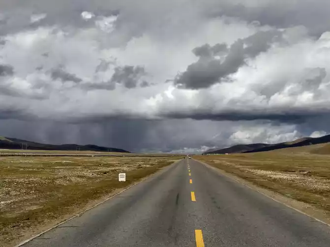
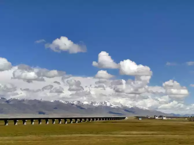
The Qinghai-Tibet Line is a highway on a plateau platform, the mountains are gentler, there are no alpine canyons and cliffs like the Sichuan-Tibet Line, but the average altitude is above 4,000 meters. So this road is called the road to heaven.
The Qinghai-Tibet Line has a straight asphalt road that looks quite beautiful. But the actual situation is that many sections of the road look flat from a distance, and when you get to the front, you will find that there are many ups and downs, there are many pits, and the speed is not a little faster. Therefore, you should be optimistic about the car in front, keep the distance between the cars, and control the speed without trying to be fast.
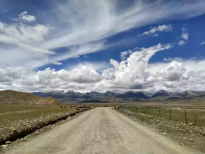
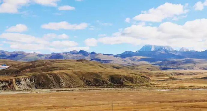
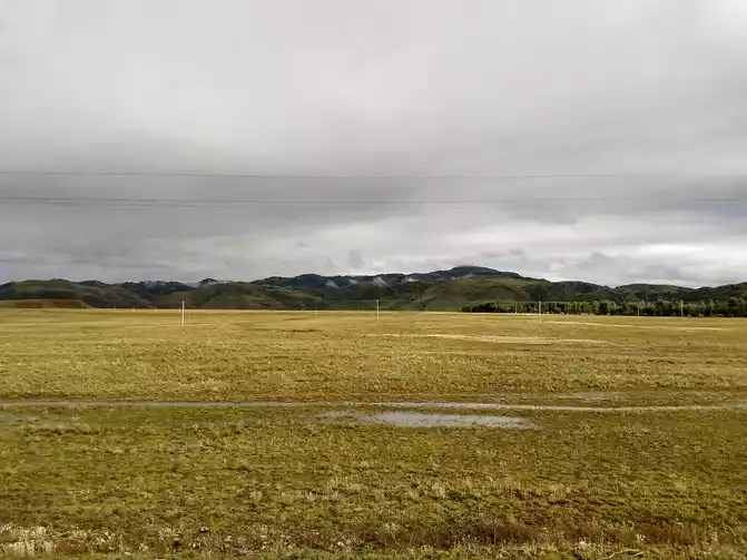
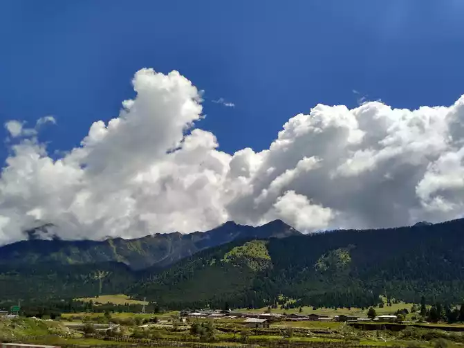
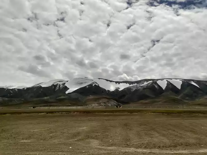
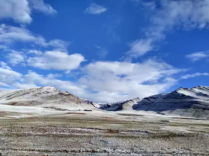
After Dangxiong, he came to the endless and undulating Qiangtang grassland. Qiangtang Grassland is located between the Tanggula Mountains and the Nianqing Tanggula Mountains, at an altitude of more than 4,500 meters, and is an alpine grassland, one of the five major pastures in China.
D15 Naqu - 420km - Tuotuo River - 420km - Golmud - 810km - Xining - 880km - Xi'an - 850km - Lu'an - 570km - Shanghai
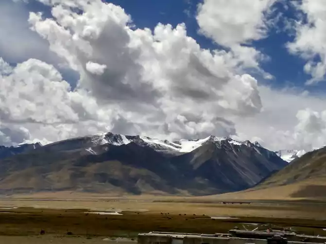
Tanggula Mountain is the boundary mountain between Tibet and Qinghai, and when we climb up the pass of Tanggula Mountain (5231 meters above sea level), it is time to say goodbye to Tibet. The yearning and worry about the unknown secret land before departure has now become an experience and memory of life. Tibet's blue sky, white clouds, snow-capped mountains, high lakes, and grasslands are all taken into photos and imprinted in ...... mind
rain and snow at the pass of Tanggula Mountain
Kunlun Mountain
are many wild animals along the Qinghai-Tibet Line in Hoh Xili, including Tibetan antelopes, Tibetan yaks, Tibetan wild donkeys and other ......
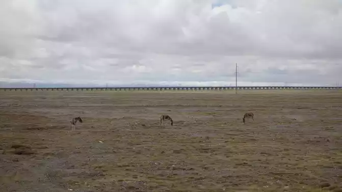
Not sure what animal? It should be a Tibetan antelope!
Hoh Xili
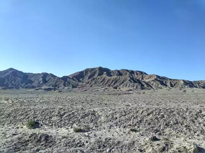
Qaidam Basin
During this trip to Tibet, we crossed more than ten mountains above 4,000 meters above sea level, crossed nearly ten rivers, and passed through China's highest highway and the most beautiful landscape avenue! The scenery along the way is gorgeous and unique, with snow-capped mountains, glaciers, canyons, lakes, rivers, forests, meadows ......
During the journey, we were baptized by the scorching sun, heavy rain, strong winds, heavy snow and hail, and experienced the four seasons of spring, summer, autumn and winter in one day, the road was arduous and dangerous, lasting 21 days and covering 9,166 kilometers.
A trip to Tibet is a travel experience for me, a slightly more difficult travel experience. This travelogue can leave you with the best memories, and it is also a little reference for friends who are about to leave.


Number of days: 6 days, Average cost: 1200 yuan, Updated: 2022.02.13


Number of days: 5 days, , Updated: 2021.11.15
Number of days: 13 days, , Updated: 2024.11.28
Number of days: 4 days, Average cost: 5000 yuan, Updated: 2020-09-20 10:16
Number of days: 8 days, Average cost: 8000 yuan, Updated: 2021.08.18
Number of days:5 days, Average cost: 930 yuan, Updated: 2024.07.04