Live Your Best Lives
7. The first experience
of Daocheng County
Daocheng County is located on the southwestern edge of Sichuan Province, China, in the south of Ganzi Prefecture. It is located in the southeast of the Qinghai-Tibet Plateau and on the east side of the Hengduan Mountains. Ganzi Tibetan Autonomous Prefecture belonging to the Kangba Tibetan Region.
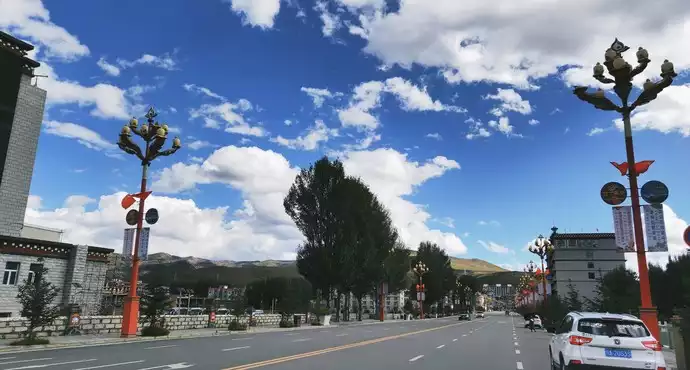
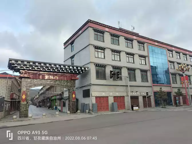
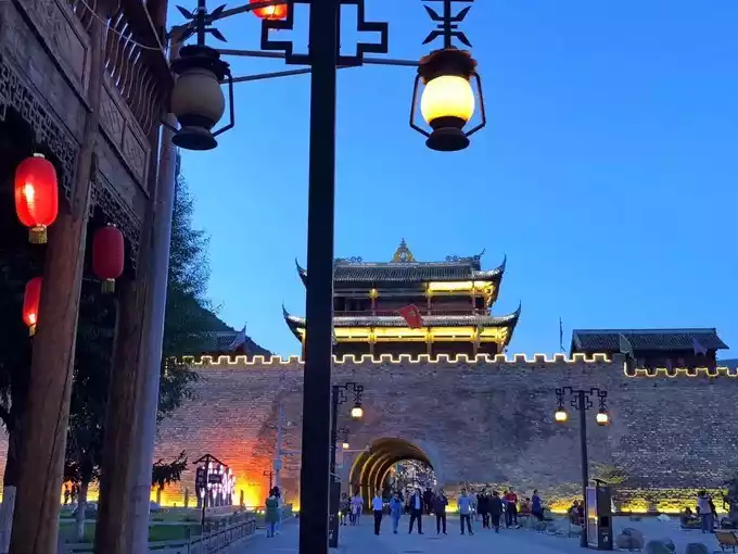
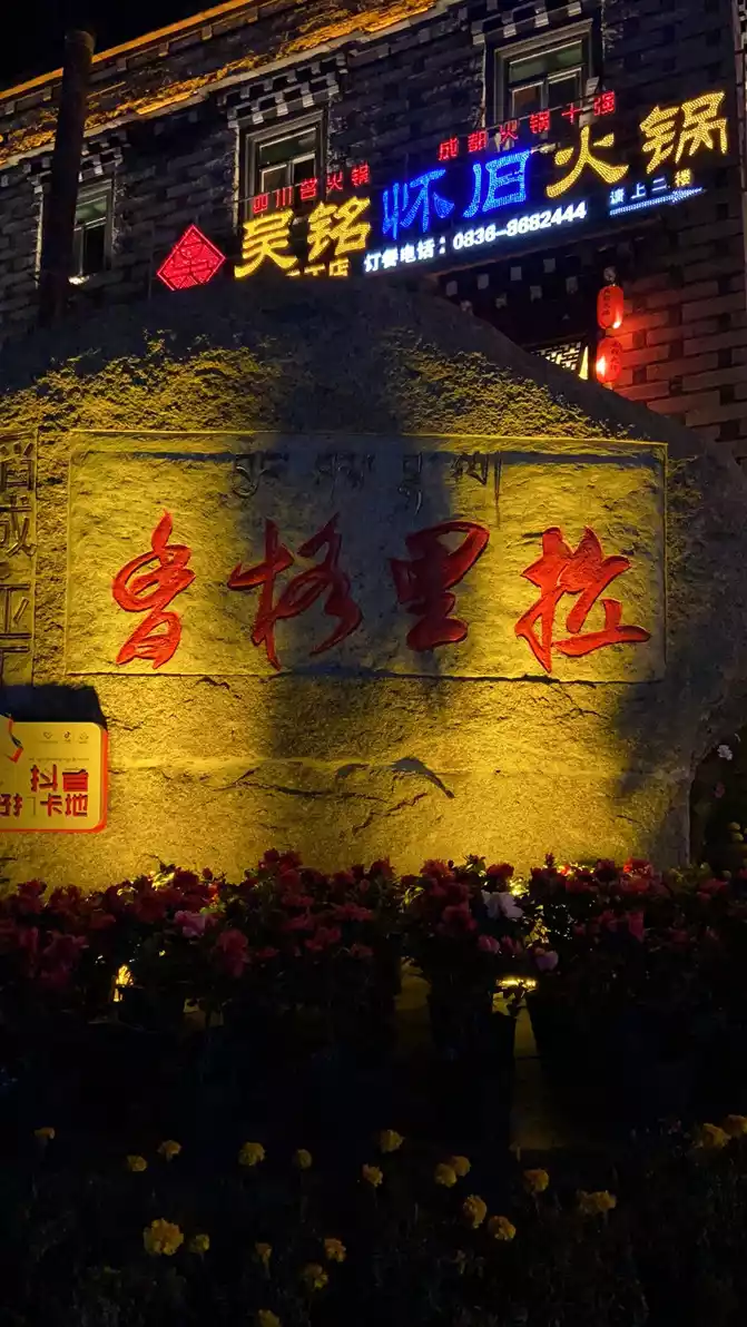
(August) 6 a.m. at 7 a.m. to get up and pack up the luggage, take the camera out to sweep the streets and have breakfast, the streets of Daocheng County are spacious, tidy and decorated uniformly, because it is still early, there are not many pedestrians on the streets, we live near the Snow Mountain Square in the city center. While walking, I walked into a neat-looking breakfast shop and ate a bowl of beef noodles, a large bowl of 15 yuan, and the price was relatively moderate. There is a nucleic acid testing point in the Snow Mountain Square, I went to consult the epidemic prevention policy of Sichuan Province, and learned that some scenic spots (including Aden) only recognize the 48-hour nucleic acid result, for the sake of insurance, I immediately made one, and suggested that the whole group also do it once (nucleic acid testing in Sichuan Province, except for entering Sichuan Province to get off the highway in Enyang, other places are 3.5 yuan per person per time).


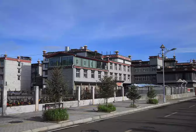
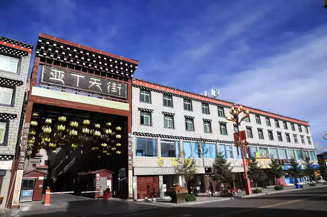
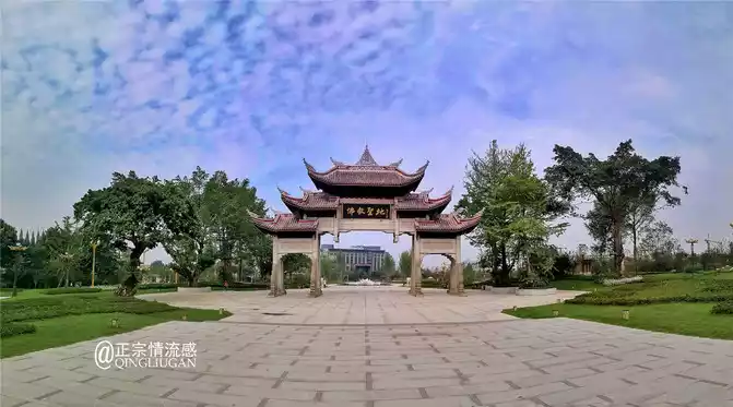
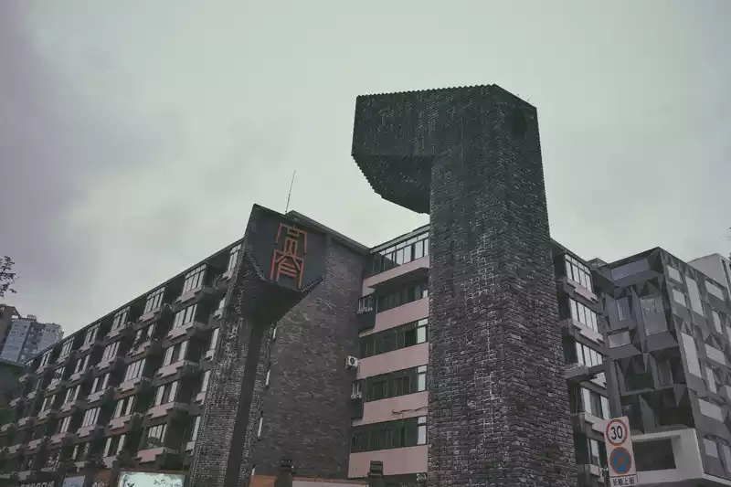
Daocheng County street scene, Aden Tianjie is a commercial center
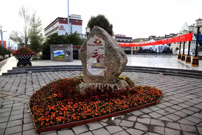
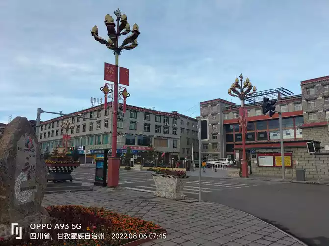
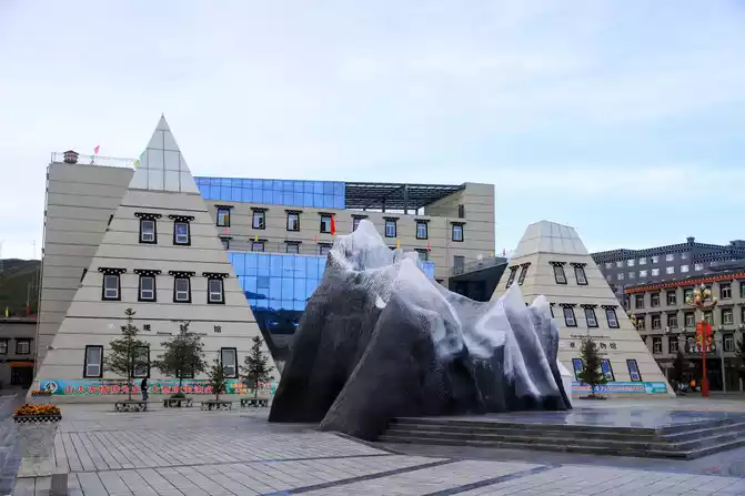
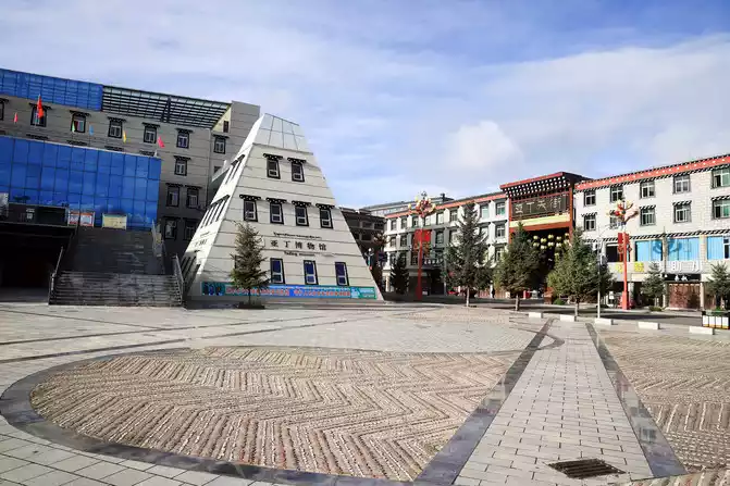
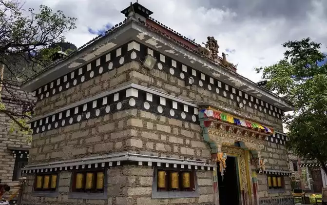
Located in the Snow Mountain Square in the center of the county, this is the central area of Daocheng County, surrounded by buildings such as the Aden Museum, the Daocheng Planning Museum and the Visitor Center
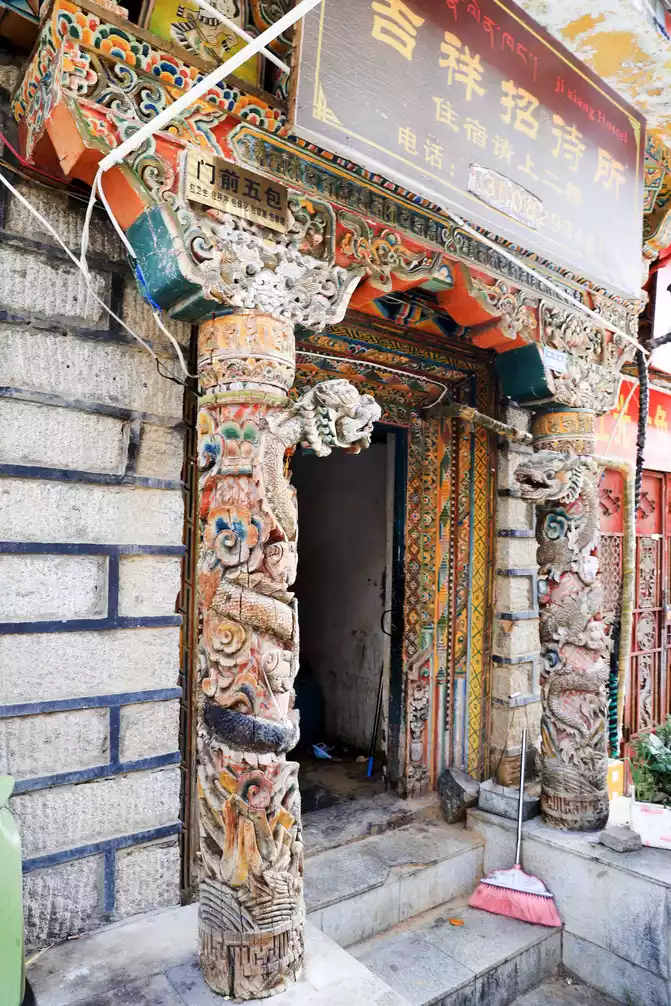
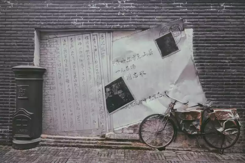
The façade of a guest house located in the county pedestrian street
< img src="https://dimg04.c-ctrip.com/images/0100w120009x0kk5uA632_W_671_0_Q90.jpg?proc=autoorient" />
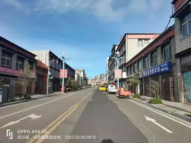
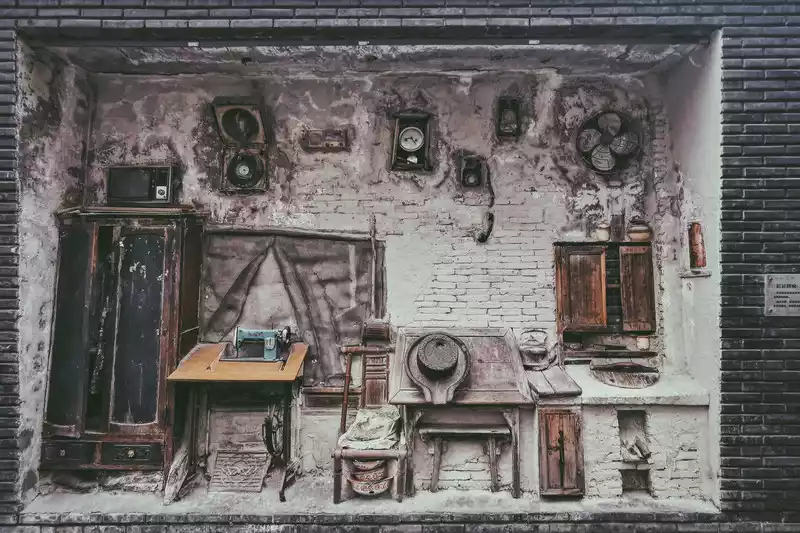
Daocheng County Street View
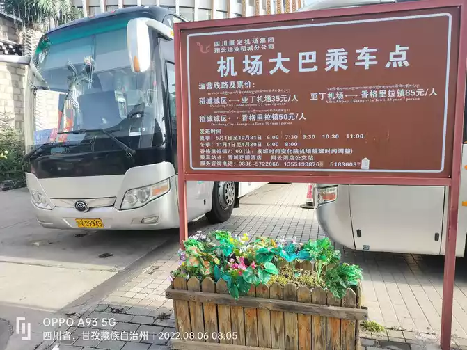
At about 9:30 a.m., take a bus to Aden Scenic Area, a distance of 116 kilometers, about two hours to arrive. Spend two days in Aden, which is a major scenic spot, and the plan is to leave Aden on the evening of the 7th.
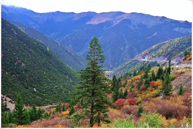
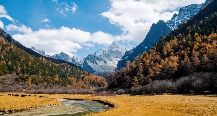
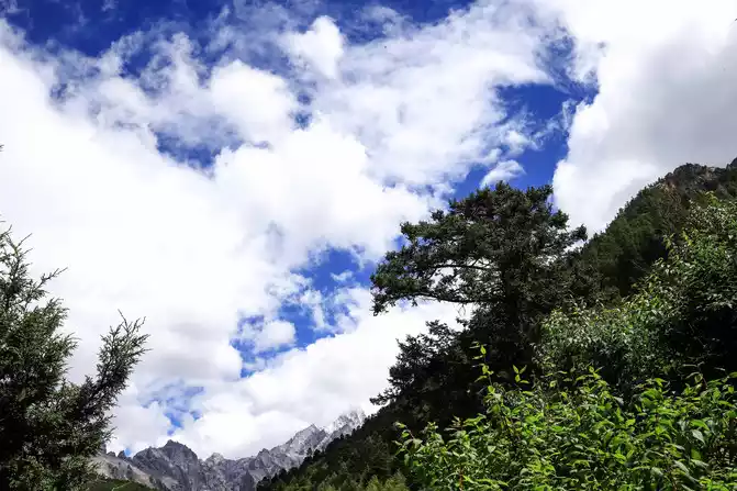
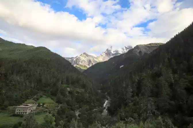
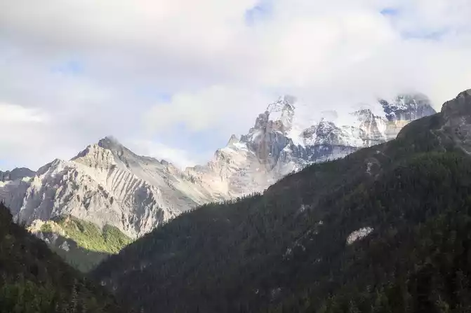
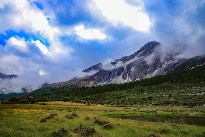
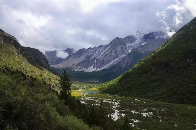
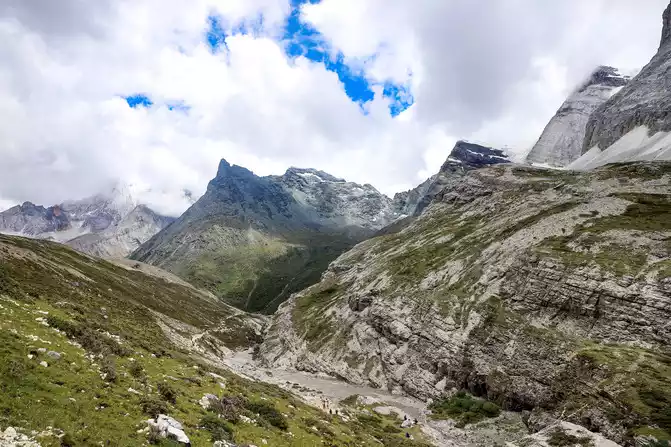
On the way to Aden, the road conditions are good, the vision is wide, the blue sky and white clouds, the green mountains and green waters, the plateau pastures, and the air is fresh.
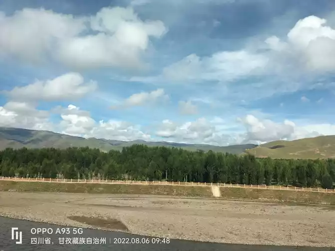
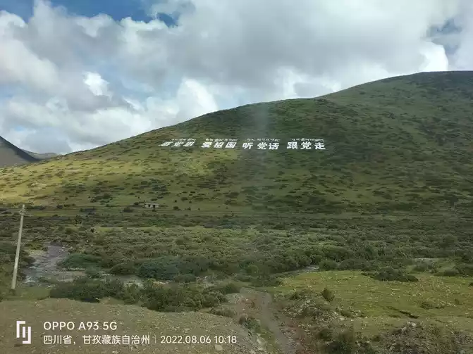
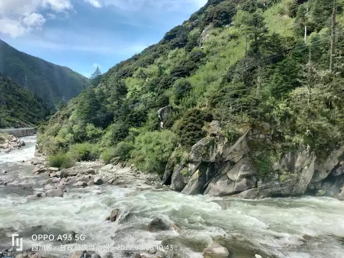
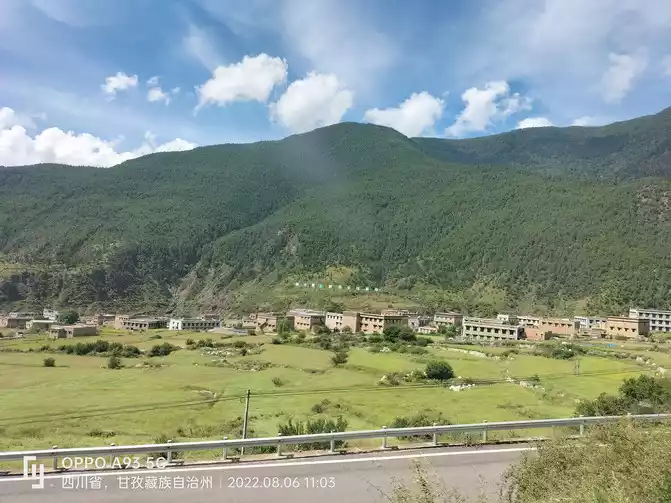
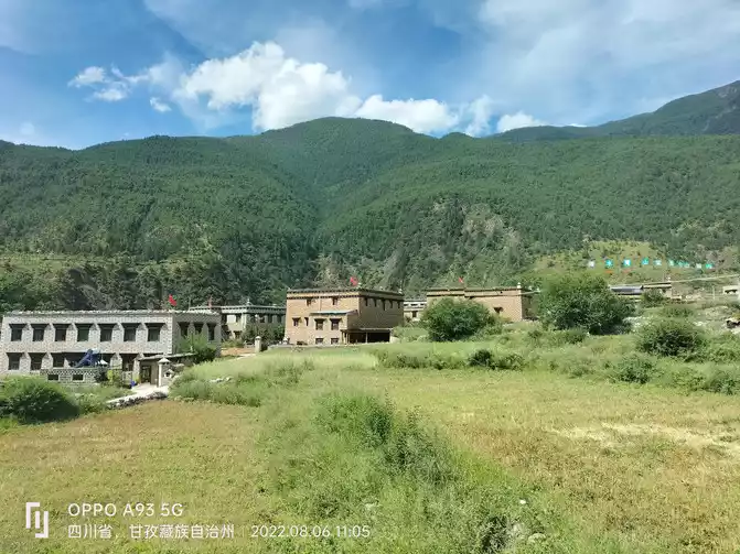
Scenery along the way to Aden
8. "The Last Pure Land on the Blue Planet" - Daocheng Aden Scenic Area Short Line: Zha Guan Collapse - "Chonggu Temple" Zhuoma Latso (Pearl Sea) - "Zhaguan Collapse
Sichuan Daocheng Aden Scenic Area is the most complete natural ecosystem in our country, known as "the last pure land on the water blue planet", the three sacred mountains in the scenic area are one of the top ten famous mountains in China, is a famous Buddhist cultural holy place, the tourism resources in the area set nature, scenery and geological relics as one, is a tourist attraction integrating alpine ecological tourism and religious cultural tourism.
Aden Scenic Area is located in Riwa Township, Daocheng County, Ganzi Tibetan Autonomous Prefecture, Sichuan Province, covering an area of more than 800 square kilometers, with three sacred mountains (Xiannairi, Yangmaiyong, Xiana Dorji) as the core area, and 10 peaks above 5,000 meters, 32 peaks above 4,500 meters, as well as 62 large and small alpine lakes and many glaciers, grasslands, forests and other natural landscapes, the main attractions are: Shalang Dorji, Xiannai Ri Peak, Vajra Xuanmu (Yang Maiyong), Chonggu Temple, Aden Nature Reserve, Mengzi Grand Canyon, Ochu Mountain, Axi Alpine Park, Pearl Sea, Luorong Cattle Farm, Aden Village, etc.
We arrived at the Daocheng Aden Scenic Area at 11:30 a.m. on the 6th, and because we had to stay here for two days, we stayed in Aden Village in the scenic spot that night. In order not to delay time, we handed over our luggage to the hotel owner and sent it to the hotel, and we went directly to the scenic spot to play.
The scenic area is divided into two routes: long and short, and our plan for the day is to take the short line first: Zhaguanbeng→ Chonggu Temple→ Zhuomalatso (Pearl Sea), → Xiannairi Observation Deck→ and circle around.
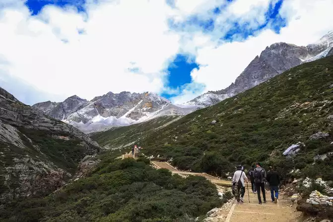
We entered the scenic spot by bus at about 1 p.m., about 40 kilometers from the visitor center to Zha Guanbeng, 50 minutes by car, and after getting off the car at Zha Guanbeng, we followed the direction of the sign to visit the short line. The scenery along the way is beautiful, all the way, all the way, the speed of travel is slow, and in the meantime. After lunch (the dry food I brought) and rested for a while, there was basically no discomfort such as high reaction.
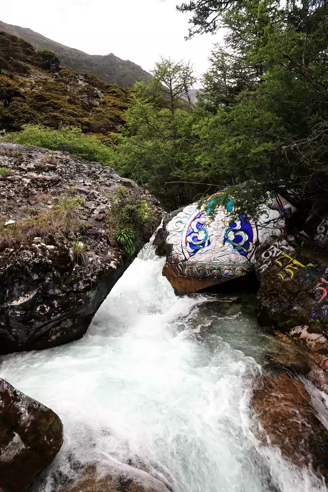
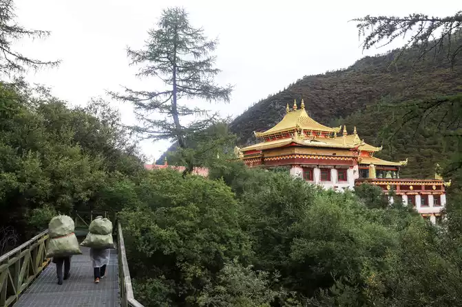
First, pass by Chongkoji Temple, which is located at the foot of Mount Sennohi at an altitude of 3,880 meters and is one of the must-visit attractions for many tourists. Chonggu Temple belongs to Gonggalangjiling Temple, and the original temple is seriously damaged, and the age of the temple can no longer be verified. Now there is a two-story house next to the old temple, the first floor is the guest room and lama's room, and the second floor is the scripture hall, where Zhaba chants scriptures and chants Buddha, and the Buddha Shakyamuni Buddha statue is enshrined in the scripture hall.
With the extension of the plank road, we slowly go up, the plank road in the scenic spot is mainly steel plank road, supplemented by wooden plank road, more humane, increased the protection of tourists, worthy of praise. We first arrived at Chonggu Temple, stayed for a while, and then continued upward, which is 4,000 meters above sea level.If you are supported by trekking poles when going uphill, you can reduce physical exertion and rest properly (I bought a trekking pole this time, I feel good, of course, it also affects the operation of shooting, but this is another problem. )
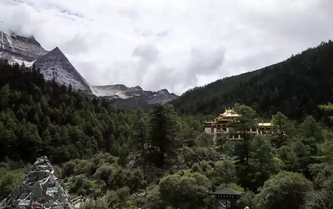
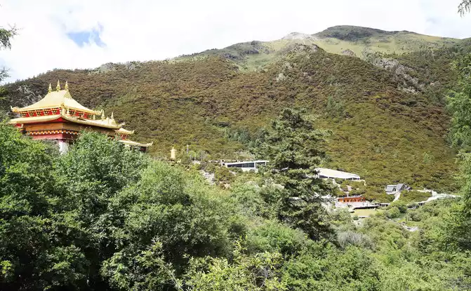
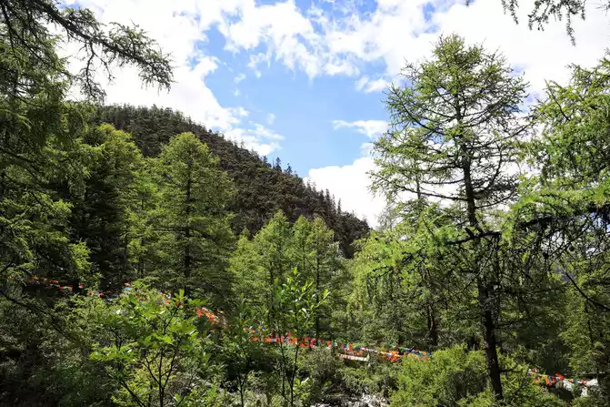
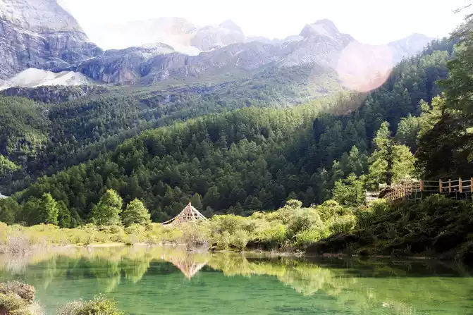
The glorious roof in the picture is Chonggu Temple, hidden in the dense green trees, which looks very quiet and very suitable for practicing and chanting
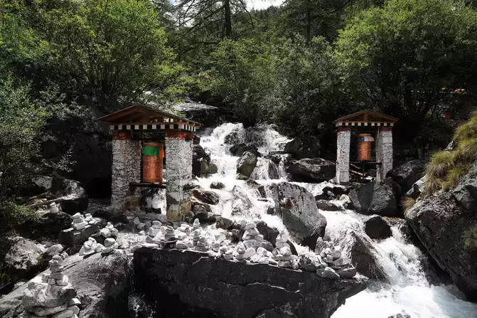
ubiquitous prayer wheel
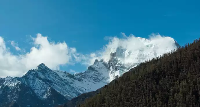
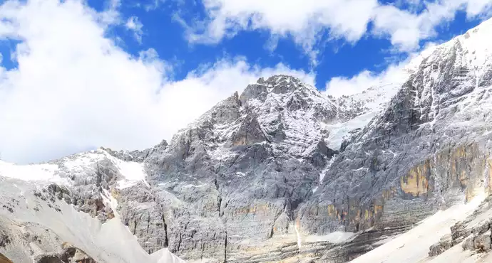
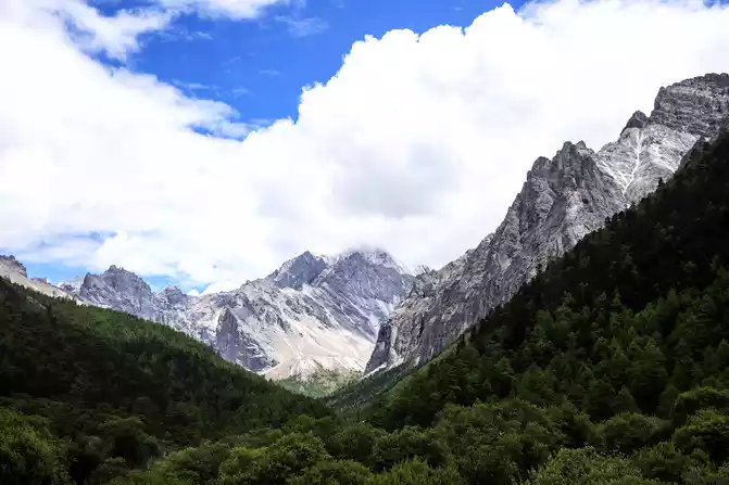
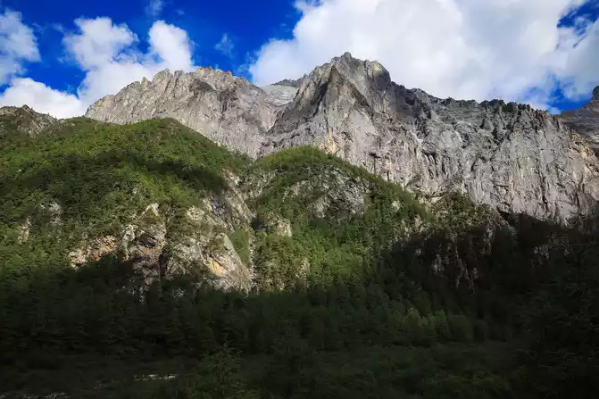
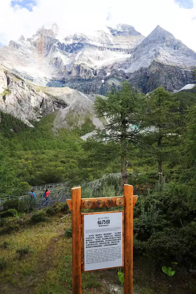
Xiannairi is located in the Aden Nature Reserve in Daocheng County, and is the closest sacred mountain to the entrance of the Aden Scenic Area. Xiannairi Snow Mountain is the first of the three peaks of the Aden Scenic Area, and is the "north peak of the Three Pillars Snow Mountain, with an altitude of 6,032 meters." Around Xiannai Ri is the ice erosion peak forest landform, mountains, lakes, glaciers and woods, forming a beautiful landscape, this is a paradise for photography lovers.
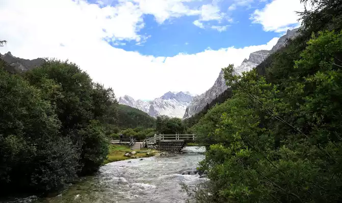
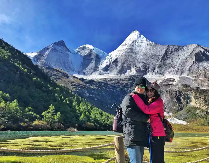
looking at the Xiannai Ri Sacred Mountain in the distance
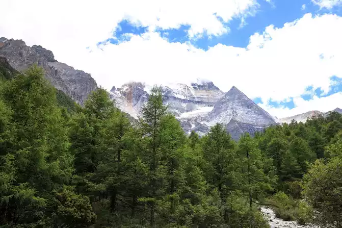
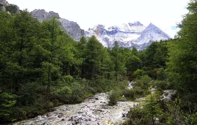
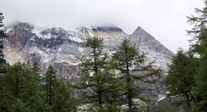
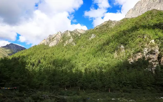
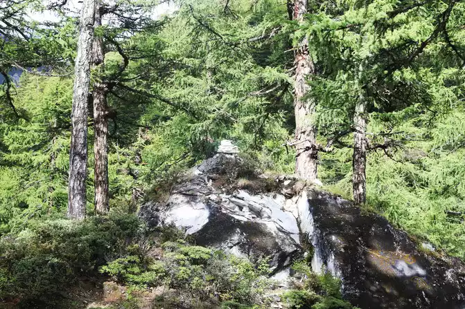
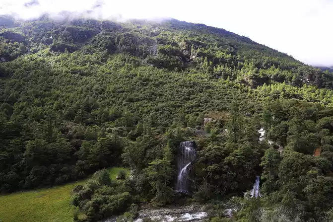
lush forest, gurgling water, snow-capped mountains
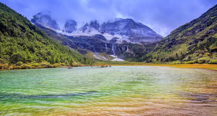
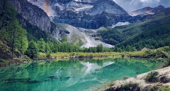
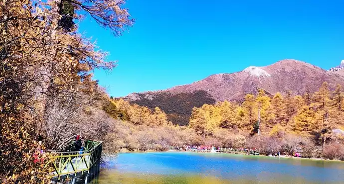
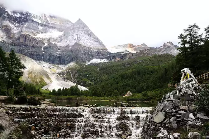
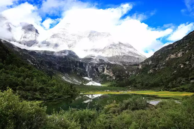
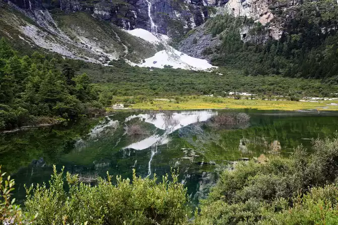
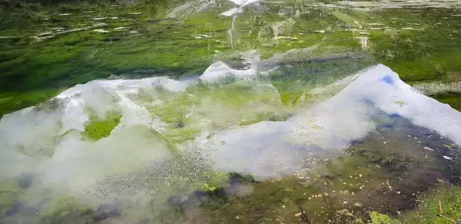
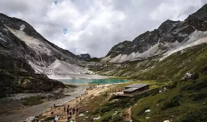
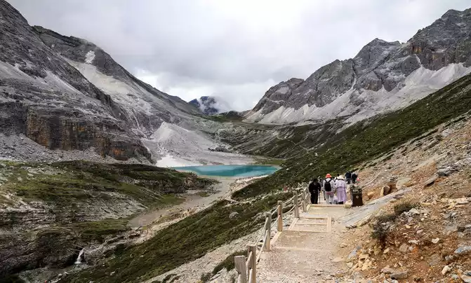
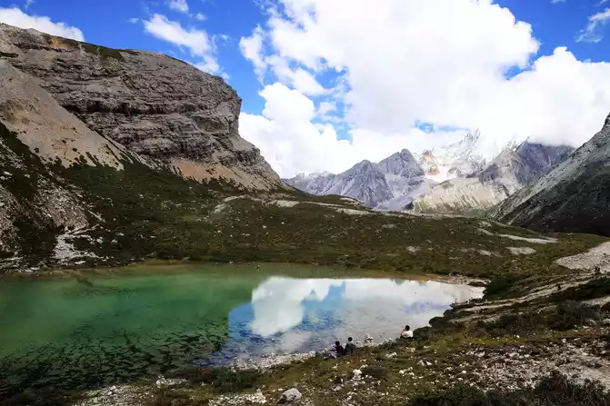
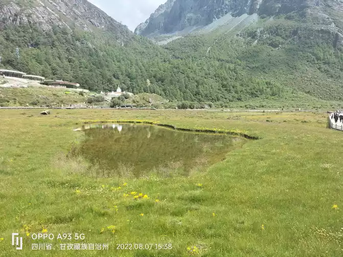
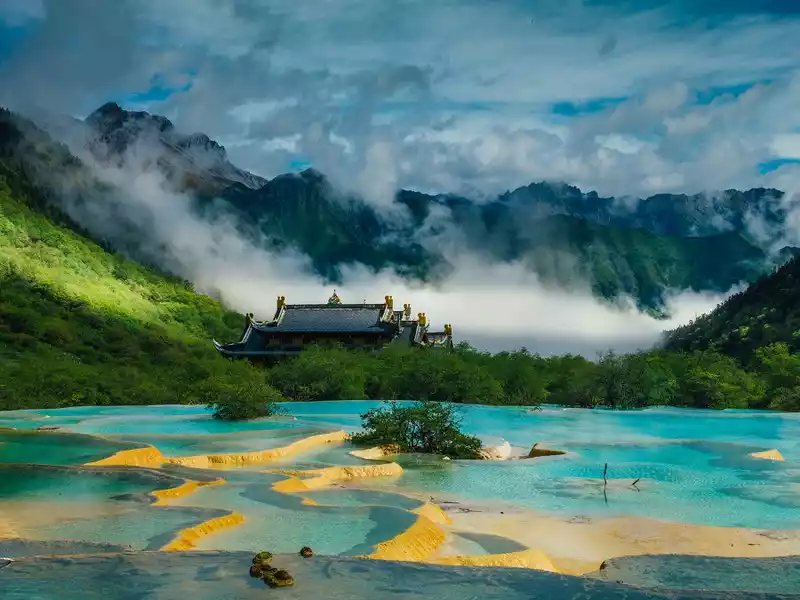
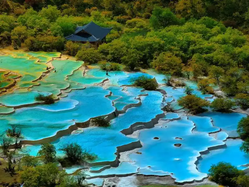
The Pearl Sea, known as "Dolma Latso" in Tibetan, is a sea formed by the melting snow of Xiannai Day. The area is about 0.1 square kilometers. The sea of pearls in the dense forest is like an emerald inlaid on the lotus throne, rippling blue waves, shimmering waves reveal infinite beauty, and the lakeside is surrounded by ginseng like a screen. In spring, the rhododendrons by the lake bloom brilliantly, and in autumn, the forests are dyed, reflecting the colorful world, which is dazzling.
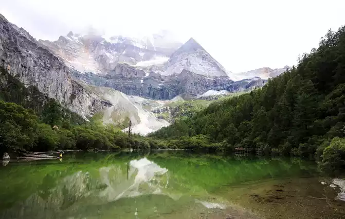
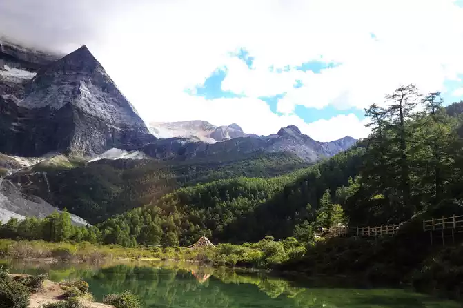
The Sea of Pearls reflects the Xiannai Ri Sacred Mountain, which is beautiful, making people fascinated and happy
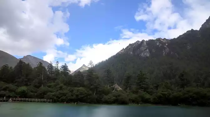
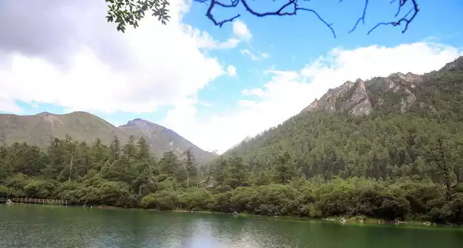
Peaks and primeval forests around the Pearl Sea
When we set off from Zha Guanbeng in the afternoon, the weather was not very good, and raindrops fell on us from time to time. I took the camera out of my photography bag twice
and put it in my bag twice. Fortunately, the rain didn't really fall, and the third time I took out the camera basically didn't affect the shooting. When I walked to the Pearl Sea, the weather was gloomy and severe, and suddenly it started to rain heavily, so I immediately ran to the rest pavilion to take shelter from the rain. The weather on the plateau is changeable, and the rain stops after about 10 minutes. So I continued to move forward, after the baptism of heavy rain, the air after the rain was particularly fresh, and the blue sky and white clouds in the sky after the rain were even more gorgeous.
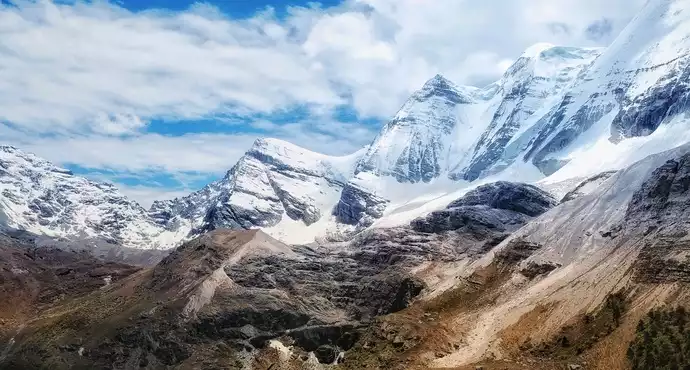
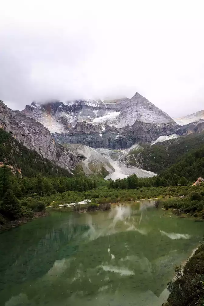
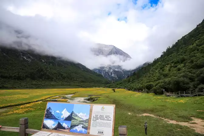
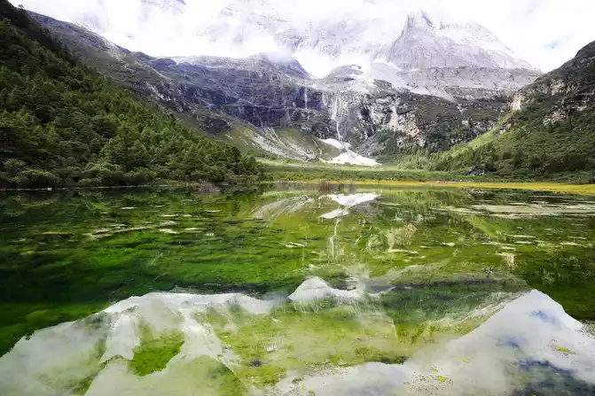
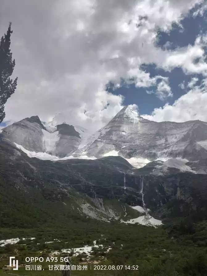
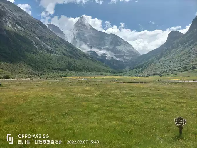
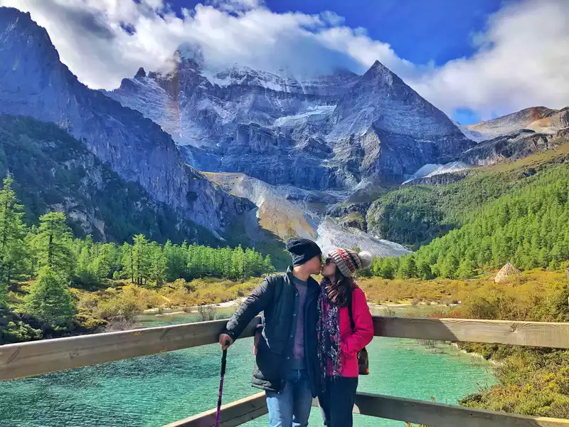
After the heavy rain, go around Dolmaratso to the Xiannai Observatory, which is one of the three sacred mountains in Daocheng Aden (the snow-capped mountain on the left side of the triangular peak on the right in the picture is the Xiannai Ri Sacred Mountain). )
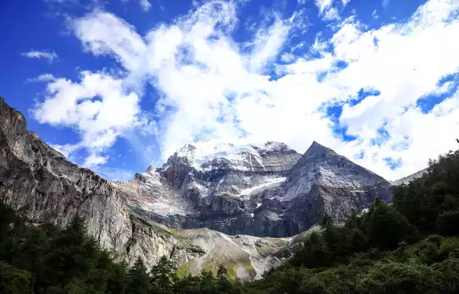
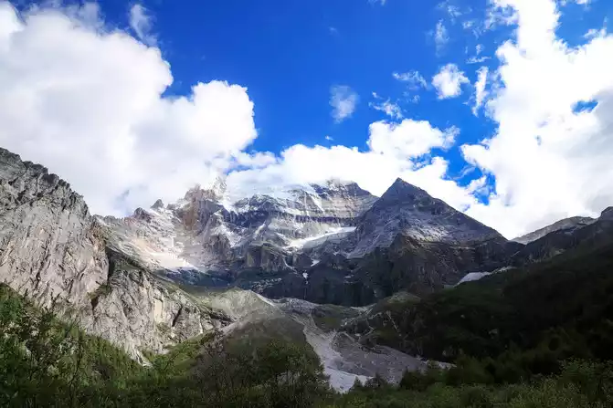
On the other side of the Pearl Sea, there is an observation deck of Sennohi Sacred Mountain, from which you can get a close view of Sennohi Sacred Mountain. In fact, you can see the fairy day all the way from Chonggu Temple, but due to different distances and different directions, the specific shape you see is different.
Aftera lap along the Pearl Sea, the return journey began, and the scenery along the way was still dizzying.
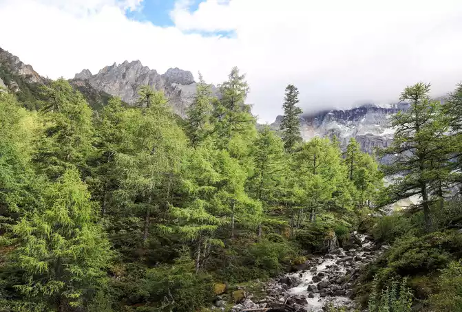
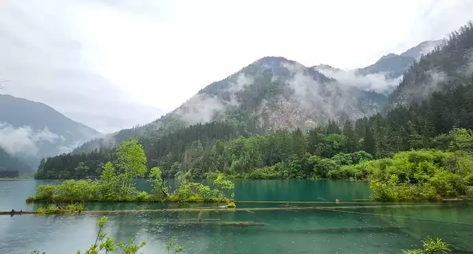
Daocheng Aden Scenic Area is an area where a variety of environments coexist, with snow-capped mountains, lakes, rivers, primeval forests, and shrubs, where biodiversity is fully reflected
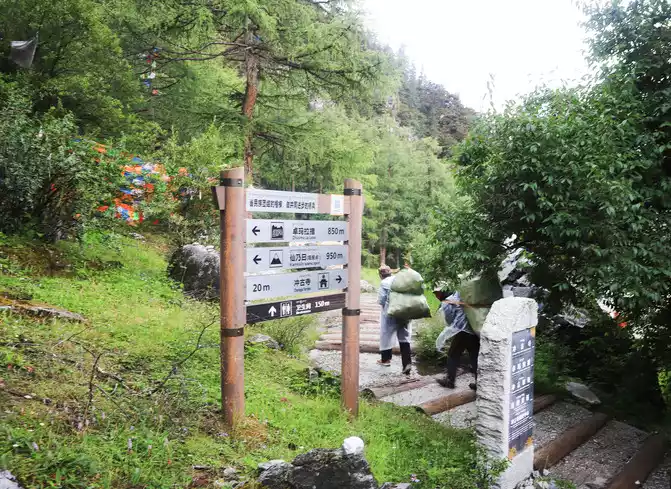
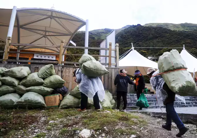
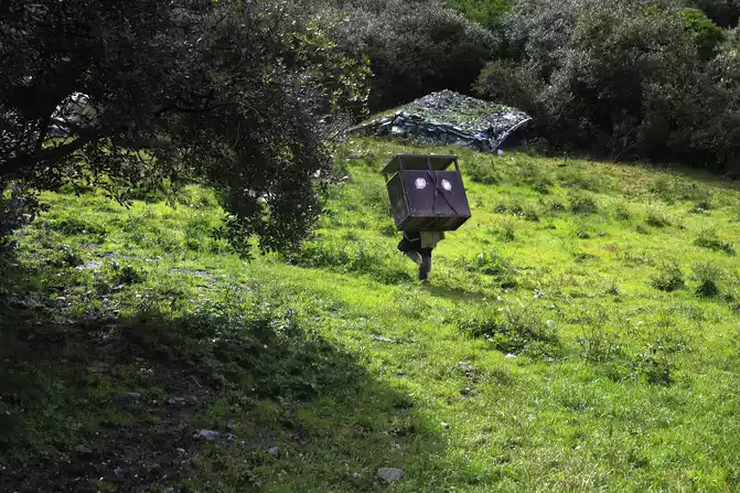
On the way down the mountain, I met two sanitation workers, and after talking, I learned that their task was to pack the garbage in the garbage cans along the way in woven bags and carry them to the garbage concentration point where the garbage collapsed, and then transfer them to the garbage station by car. It is 4 round trips a day, 1.5 km one way. On the way to carry it, it is very hard to check the scattered garbage left by tourists on the wooden plank road and under the wooden plank road, put it into woven bags, and the work is very hard! It is the hard work of sanitation workers that ensures the cleanliness and tidiness of the scenic spot, provides tourists with a good visiting environment, and pays tribute to sanitation workers!
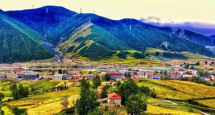
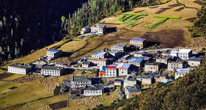
Aden Village means "land of the sun" in Tibetan, located in the Aden Scenic Area of Daocheng, and is known as the "last Shangri-La" because of its long sunshine. The village is hidden between the sky and the grassland, as if it does not exist, looming, as if it only appears when the eyes are shifted. Many tourists who visit the scenic spots of Aden will choose to stay here. It is also a popular place for photography enthusiasts to take a lot of good photos.
: After returning from Xiannai Ri on the 6th, we stayed at the nature camp at the No. 4 bus point in Aden Village in the scenic area, which is an open area outside the gate of this camp, with leisure tables, chairs, benches and pergolas, overlooking the Xiannai Ri Sacred Mountain.
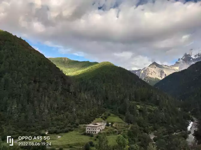
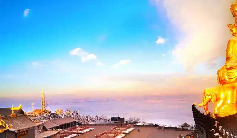
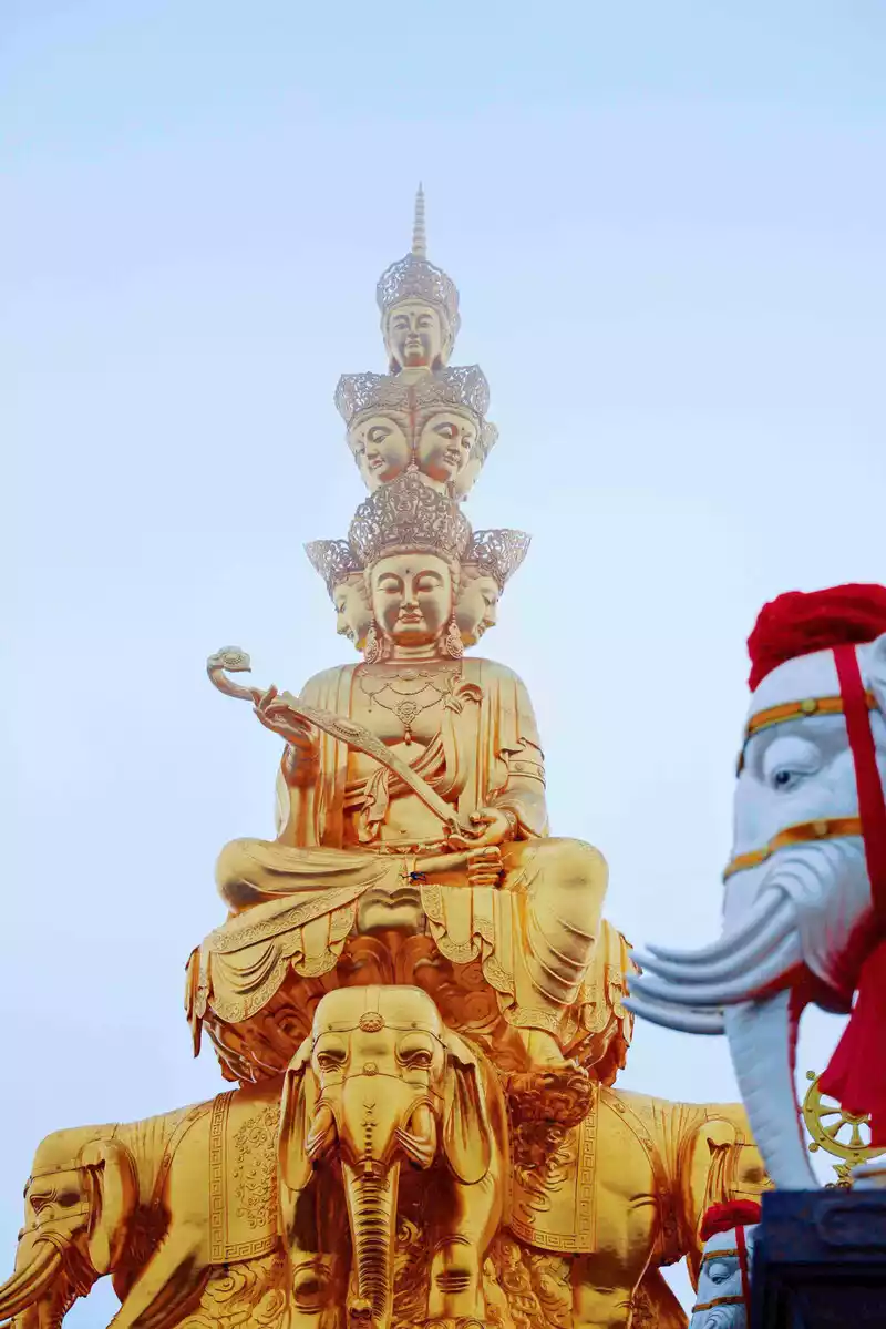
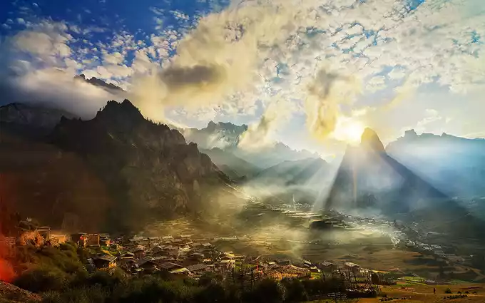
At around 7 o'clock in the evening, when the sun was about to set, it felt a bit like the sun was shining on the Golden Mountain
< img src="https://dimg04.c-ctrip.com/images/0106n120009x76k67DBB6_W_671_0_Q90.jpg?proc=autoorient" />
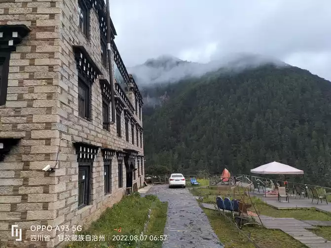
Camp 4 in Aden Village is a good place to overlook the Xiannai Ri Sacred Mountain, and we stayed here that night
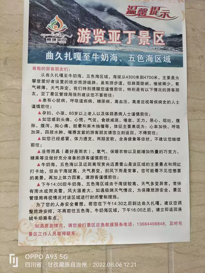
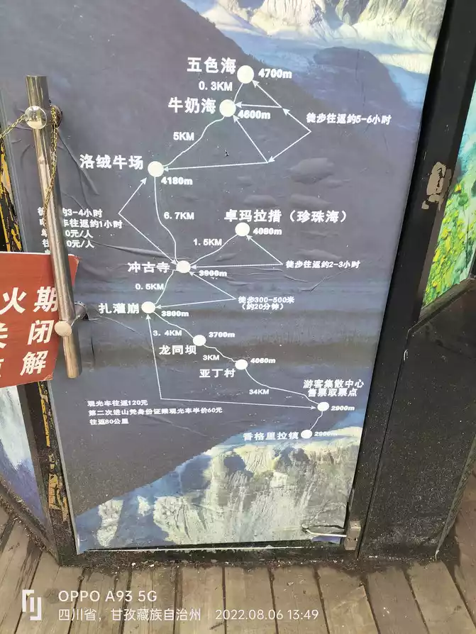
9. "The Last Pure Land on the Blue Planet"- The long line of Daocheng Yading Scenic Area: Zha Guan Beng - "Luorong Cattle Farm" - "Milk Sea" - "Five Color Sea - " Zha Guan Beng
No. 7 At 8 o'clock in the morning, after breakfast, take the scenic delivery bus to Zhaguan Beng at the No. 4 camp in Aden Village, and then take the battery car (fare 80 yuan) to Luorong Cattle Farm (3.4 kilometers away), and then the most arduous journey of this trip, gradually going up 5 kilometers on the 4,100-meter plateau to the milk sea and the five-color sea at an altitude of 4,700 meters.
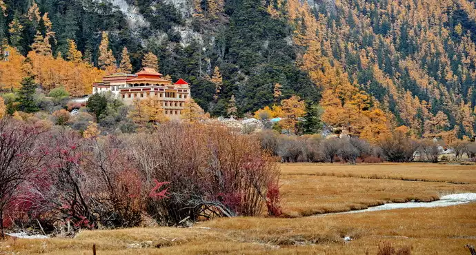
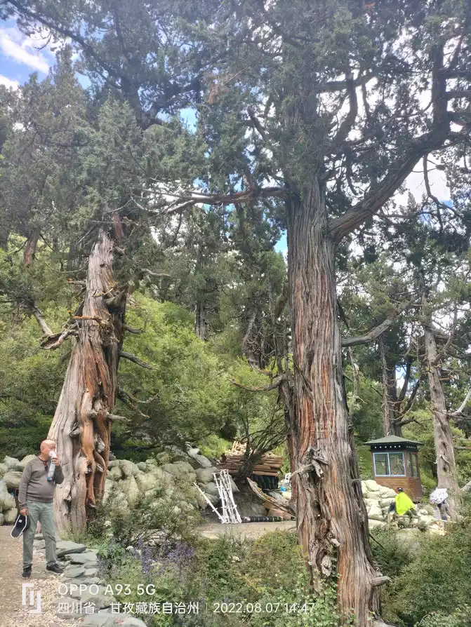
Luorong Cattle Farm is one of the most famous accommodation places in Aden Scenic Area, and it is also the starting point for walking to the Milk Sea and the Five Colors Sea (about 3.5 hours on a one-sided walk). Surrounded by the three sacred mountains of "Risong Kampot", the Gongga River shuttles from the pasture, the forest stream gurgles, and the pasture wooden houses complement each other, forming a primitive and charming scenery, allowing people to enter the realm of returning to simplicity. It is also backed by the three sacred mountains of Xiannairi, Yangmaiyong, and Xiano Dorji, which is a good place to watch the three snow-capped mountains. Visitors can choose to camp here or set up their own tents. Snowy peaks, forests, meadows, streams, lakes, waterfalls and ranch cabins complement each other. In addition, Xiaozhuan Shenshan Xiannai Ri also passes through here (starting from Chonggu Temple, going around Xiannai Ri via Luorong Cattle Farm, the whole journey is 20 kilometers).
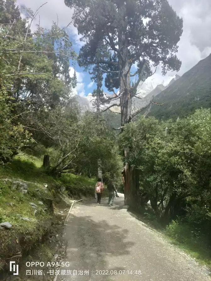
We set off from Luorong Cattle Farm at about 9 a.m. to the Milk Sea and the Five Colors Sea, and the first half of the journey was basically at the foot of the mountain at an altitude of about 4,100 meters along the trail, without a big slope, and it was relatively easy to walk.
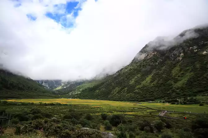
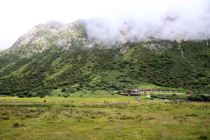
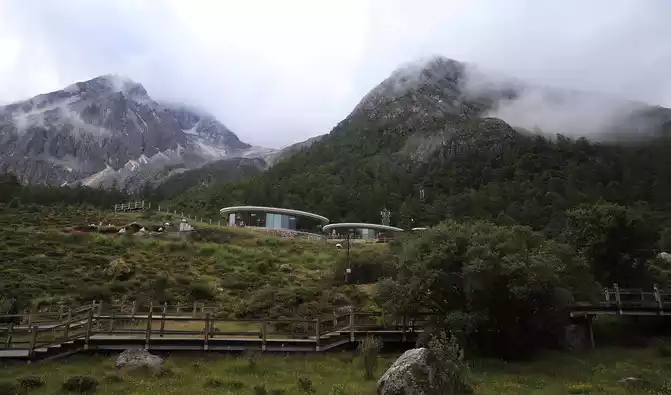
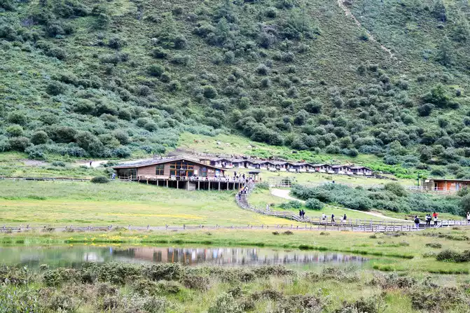
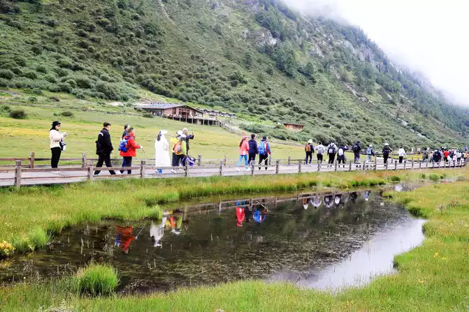
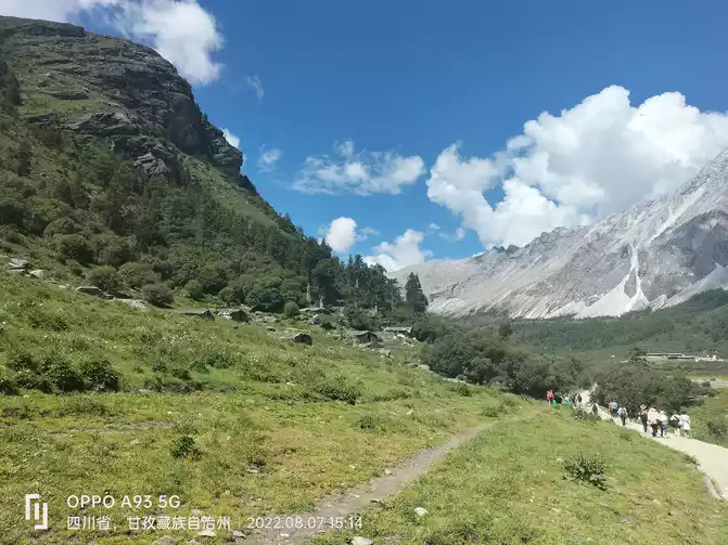
The pictures above are the tourist facilities and campsites around Luorong Cattle Farm, and an endless stream of tourists have begun their mountaineering trips.Due to the early weather, the cattle and sheep grazing have not yet been seen
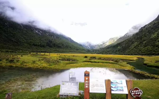
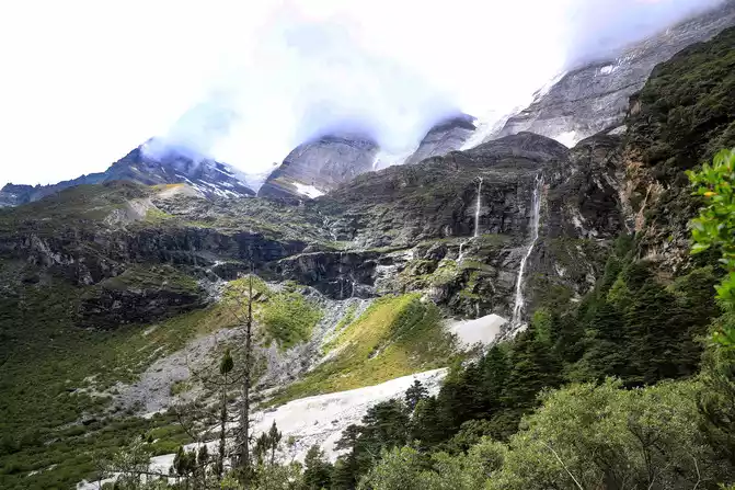
This is a viewpoint to see the Yangmai Yong Sacred Mountain, but due to the thick fog and clouds, the peak cannot be seen
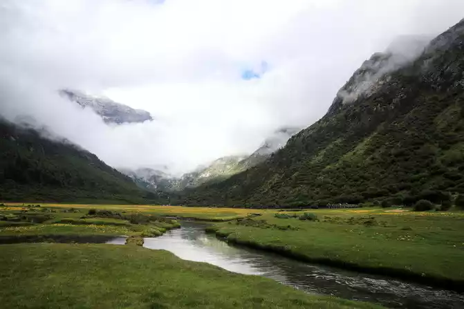
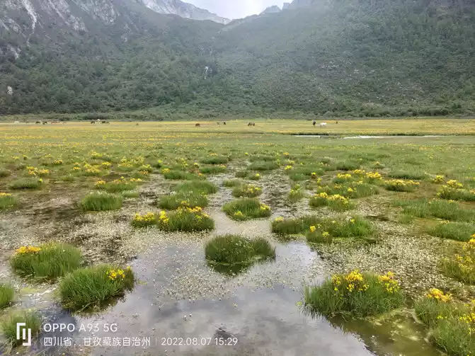
The Gongga River flows slowly in the middle of the meadow
peaks on both sides of the green grass are also surrounded by white clouds, and a beautiful picture is presented in front of people
This is another viewpoint
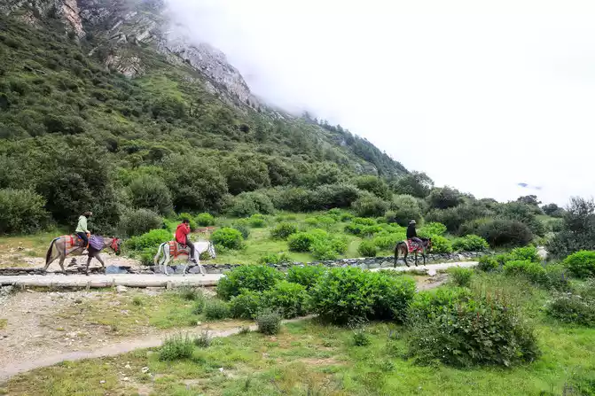
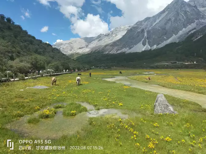
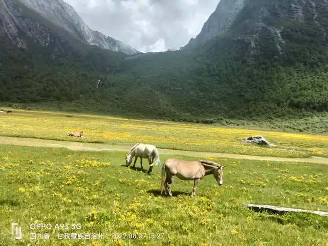
owner of the Horse Gang rode his horse to greet the tourists who were preparing to ride up the mountain
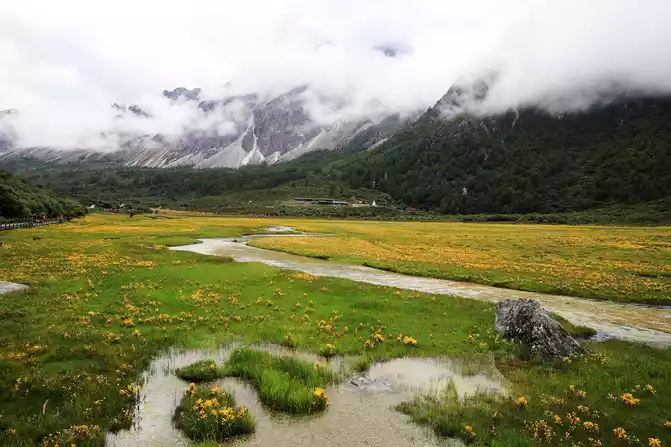
white clouds linger, green grass, small flowers, and gurgling water
A 73-year-old father and wife traveled to Daocheng Aden for more than a month, driving all the way, taking selfies all the way, I asked them how long they would play home, they said, there is no specific time, when do you want to play and go back again. What a chic old father and wife! Hehe! Or our fellow townsman from Jingmen, Hubei Province! Admire them!
scenic spot staff who repair trash cans
From Luorong Cattle Farm to Milk Sea and Five-Color Sea, the schematic map of the scenic route is marked as 5 kilometers, but this 5 kilometers is a 5-kilometer gradual ascent from an altitude of 4,100 meters to 4,700 meters, and I also carry a backpack containing two cameras and some spare parts, food and water weighing more than ten pounds, and I also have to capture the beautiful scenery for filming, and the difficulty of its march can be imagined!
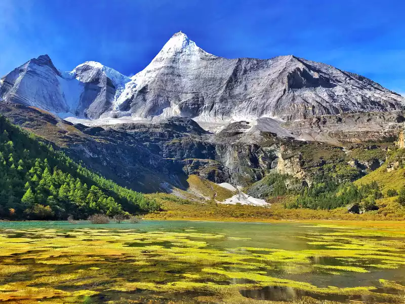
Yangmai Yong Sacred Mountain is the southern peak of the "Three Lords" Snow Mountain, with an altitude of 5,958 meters, ranking first among the "Three Lords" snow mountains in Buddhism. Yang Maiyong's Tibetan meaning is "Manjushri Bodhisattva", and in Buddhism it is the embodiment of wisdom, Xuefeng is like Manjushri using the wisdom in his hand to point straight to the sky, and the ice crystal jade Yang Maiyong proudly stands between heaven and earth.
reflection of Yangmai Yong Shenshan in the lake taken at Gongga Lake is like God overturning the color palette?
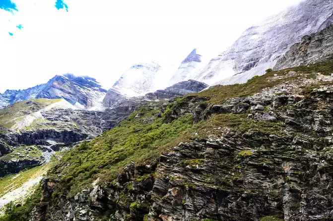
Thedistance of about 3 kilometers behind is basically ascending step by step, and it will make people shudder when you see the steel plank road that towers into the blue sky hundreds of steps hovering above your head! But people need to have a little spirit! Now that you have set a goal, you must do your best to achieve it! At this point, there is only to move forward! There is no way out! Step by step, persevere! In fact, as long as you master the skills, have a strong physique and a strong will, you can persevere until victory!
The real test of people starts from this sign, which is relatively close to Yangmaiyong Sacred Mountain, and you can take pictures of Yangmaiyong's majestic posture without any obstruction. But it is also from here that it is gradually going up, and the tour is slowly rising.
This is the Holy Water Gate under the Yangmai Yongshen Mountain, which is a natural bonsai, named after the shape of the gate naturally formed on the opposite cliff, and is a glacier relic created by ice
erosion
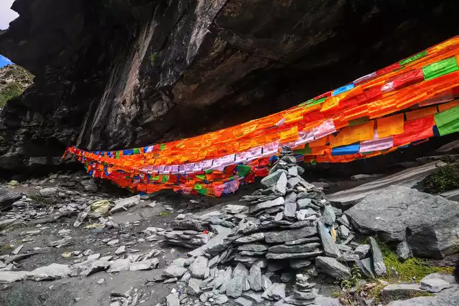
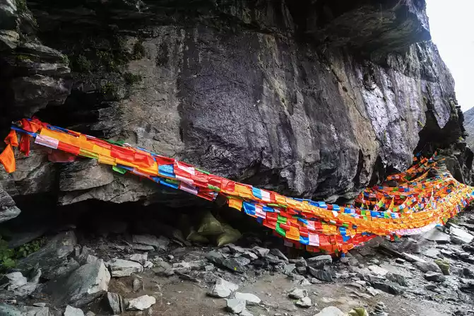
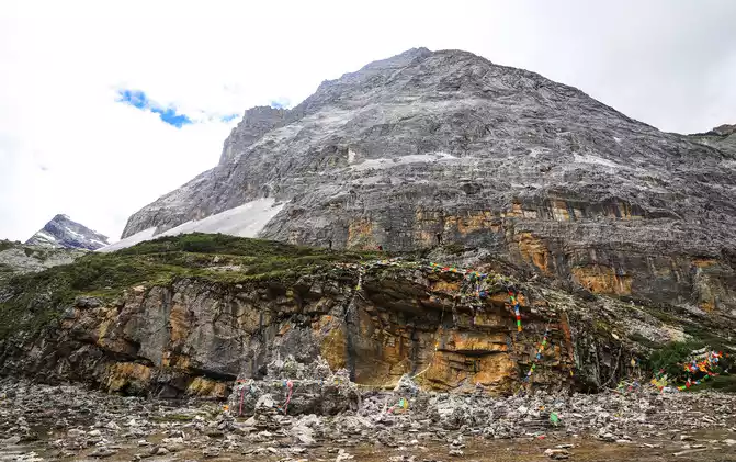
These pictures are 1.5 kilometers away from the Milk Sea and the surrounding cliffs, the Sacrifice Cliff is about 100 feet high, grand and spectacular, tourists and people who turn the mountain go to the hillside opposite the Sa Shen Cliff, when resting, take a look at the cliff topography of the Sake Cliff, or burn incense to worship the gods. Standing on the cliff of the cliff, it is like a knife cut, which is very dangerous.
According to legend, hunters rushed around Dorjee to hunt deer on the Sacrifice Cliff, and then ascended to heaven, while a high monk thought that he had been meditating and enlightening for many years, jumped off the cliff, and fell to pieces.
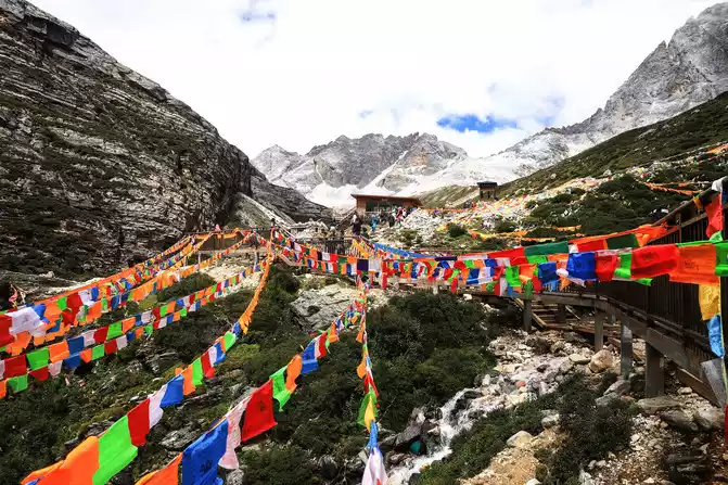
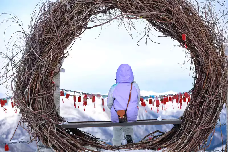
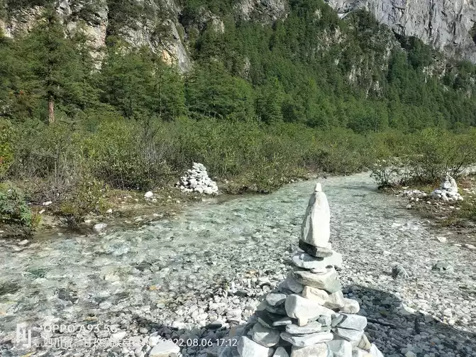
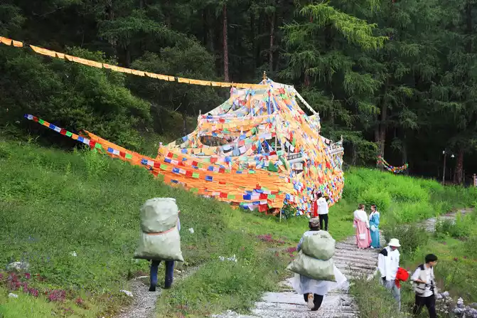
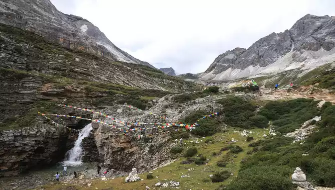
Countless prayer flags dress the mountains into a colorful world, symbolizing purity and auspiciousness
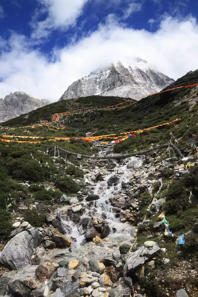
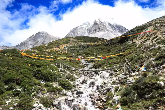
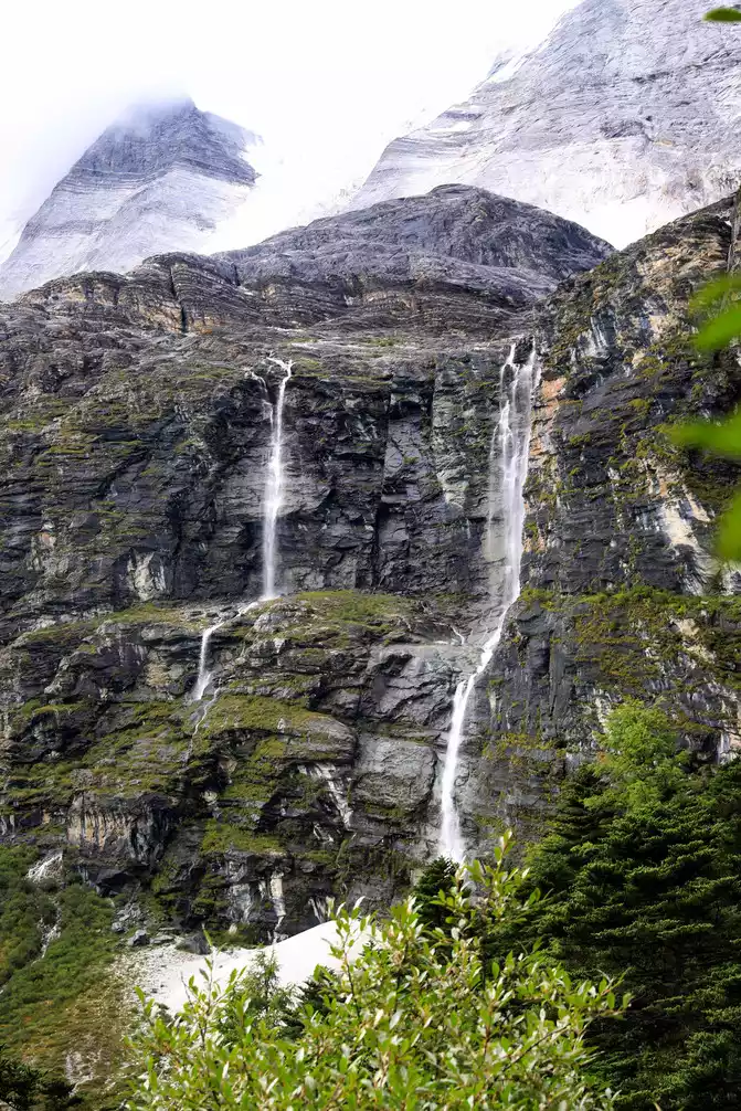
The snow-capped mountains melt and flow down, the snow water forms a trickle
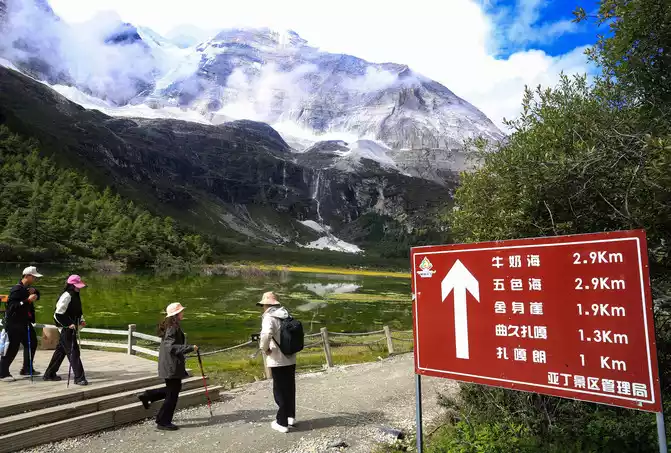
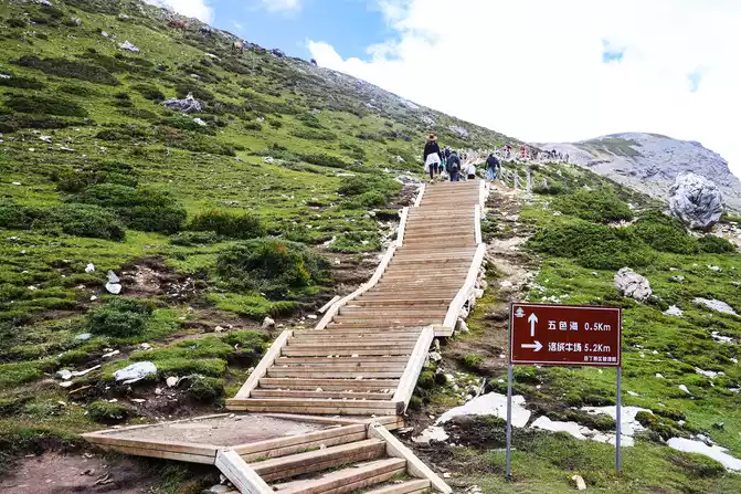
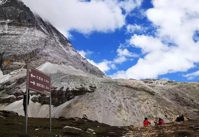
,and the signs at this intersection indicate the direction to the Milk Sea and the Five-Color Sea, going straight to the Milk Sea, going up to the Five-Colored Sea, I chose to go straight, first to the Milk Sea, this choice is correct, after all, it is easier to go straight back and down than up and down.
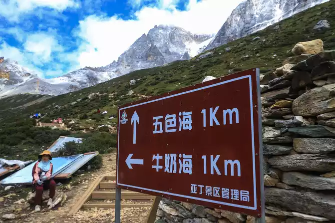
The sign below indicates the direction of going down the mountain to Luorong Cattle Farm and going up to the Five Colors Sea when returning from the Milk Sea, of course I chose to go up to the Five Colors Sea, Then descend from the other end of the five-colored sea.

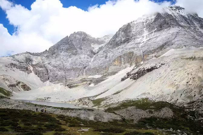
Around 12 o'clock, we arrived at the Milk Sea, which is said to be white around the lake, so it is called the Milk Sea. The Milk Sea, also known as Orongcuo, is an ancient glacial lake that resembles a drop of water and covers an area of 0.5 hectares. Although the milk sea is surrounded by snow-capped mountains, when viewed up close, I feel that there is nothing very amazing, just an ordinary plateau sea. Considering the time constraints, I did not circle around the sea of milk.
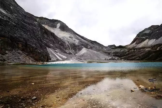
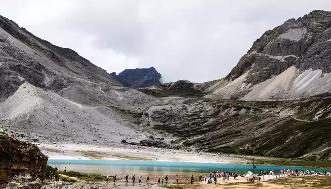
the lake surface of the Milk Sea
the peaks around the Milk Sea
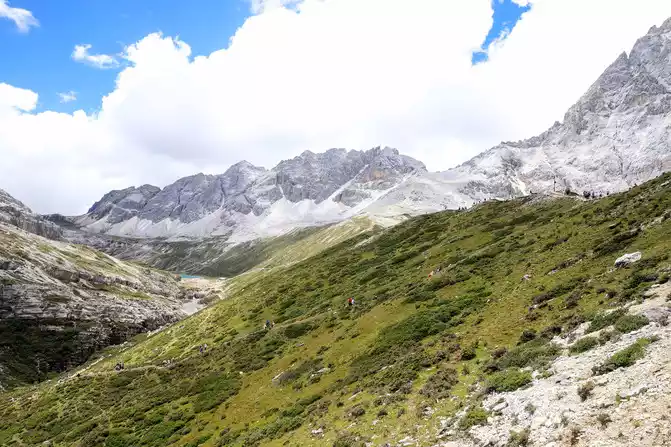
Leaving the Milk Sea, continue the climb to the Five Colors Sea, the highest and final attraction of the trip. Although it is only a short 0.5 kilometers, it is appropriate to go up another 100 meters on the plateau at an altitude of 4,600 meters! Although there is no feeling of "body in hell", it is also a slow step by step with the help of trekking poles, and it also stops from time to time, looks around, and takes pictures of the beautiful scenery of "eyes in heaven" with a camera.
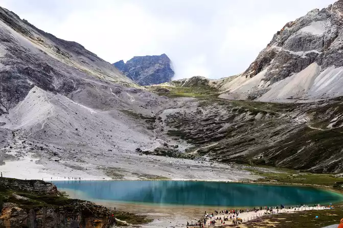
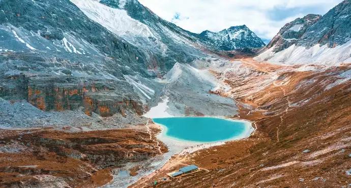
Looking at the milk sea from a high place, the scenery is much better than up close, and the turquoise lake reflects the snow-capped mountains, and the scenery is still very beautiful.
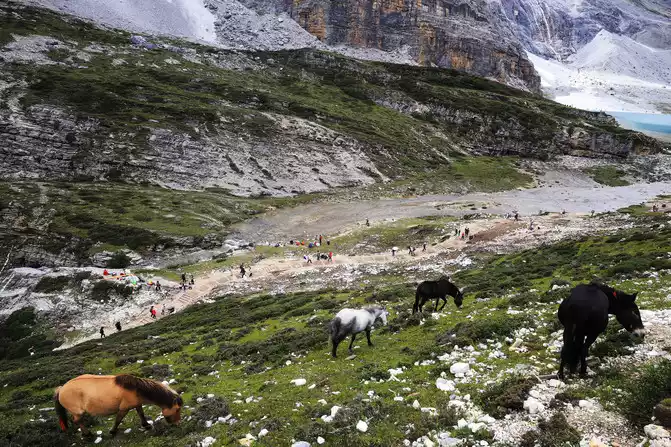
On the way up, look around, the mountains are majestic, the grass is green, the horses are leisurely, the lake is green, the pedestrians are beautiful, and a peaceful atmosphere envelops this plateau holy place.
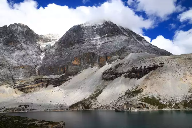
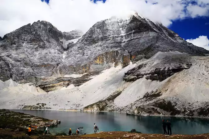
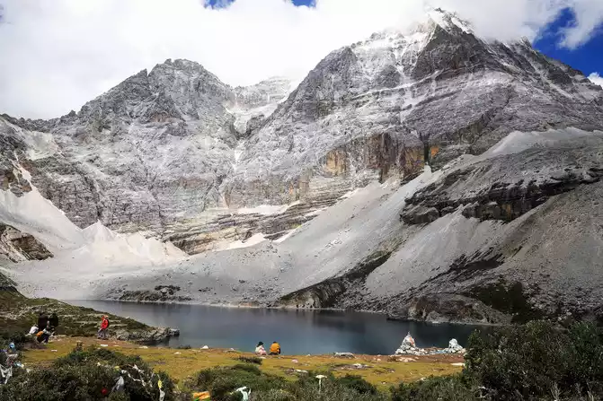
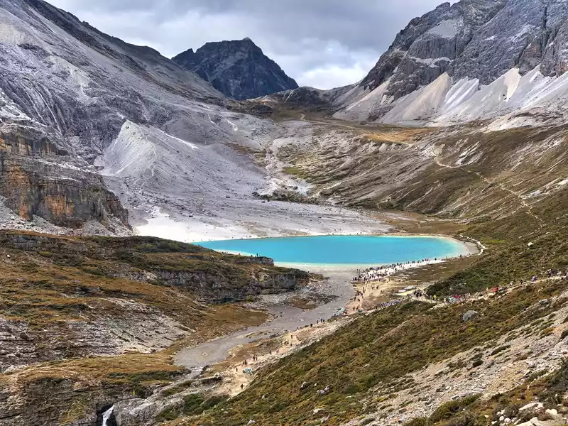
Then continue to ascend and after almost 4 and a half hours of trekking, you will reach the last attraction at 1:20 pm - the five-colored sea at an altitude of 4700 meters. The five-colored sea is named because it produces five different colors under the refraction of light. Its real name is "single increase measure". It is located between Xiannai Ri and Yangmaiyong, at an altitude of 4,700 meters (high on the lake surface), the lake surface is circular, with an area of 0.7 hectares, and the modern ice valley extends down to the lakeside, with snow-capped mountains reflecting the lake, which is a famous sacred lake in Tibet.
 This
This
is a sign when going up to the Five Colored Sea, indicating that you will go down from the Five Colored Sea to the Milk Sea, and then go down the mountain to the Luorong Cattle Farm
These pictures are taken from different directions and
angles< img src="https://dimg04.c-ctrip.com/images/0104b120009yf4eeuE83C_W_671_0_Q90.jpg?proc=autoorient" />
successfully completed the trip to climb the Daocheng Aden Scenic Area. Although it was a little tiring, I felt good about myself.
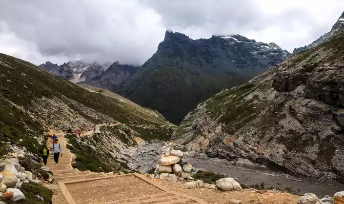
(7th) At about 2 p.m., I began to descend the mountain slowly, in order to try a different downhill path, I chose the bridle road down the mountain (the ascent is a walking trail), the bridle road is paved with stone slabs and stones, the height is uneven, it is difficult to walk, it can be regarded as a try. Although the descent was relatively brisk, it took nearly 3 hours to arrive at the visitor center at the foot of the mountain at 5:10 p.m., and the activities of Line A ended.
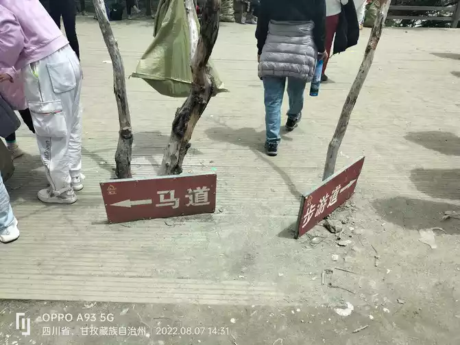
The way down the mountain, the left side is the bridle road, the right side is the trail, and the bridle road is chosen.
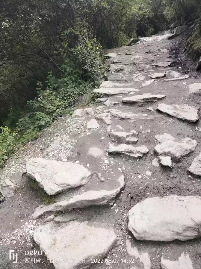
rugged, difficult horse track
Scenery along the way down the horse road
Yangmai Yongshen Mountain and Seongsumun Gate seen on the way down
Luorong cattle farm I saw on the way back, at this time the fog dissipated, the sun was shining, the flowers were blooming, and the horses were grazing leisurely on the grass. In order to go down the mountain as soon as possible, the camera was put away, and the photos were taken with a mobile phone.
At about 6 p.m., the A-line personnel took a sleeper bus from the Daocheng Aden Scenic Area Visitor Center to Xinduqiao at night in order to meet with the B-line personnel for follow-up trips.
(Note: The follow-up itinerary will be described in "Western Sichuan Travel Photography Travelogue (Part II)", so please look forward to it.) The lower part of the picture of this travelogue is marked with a mobile phone, and the camera piece is not marked. Thank you! Author
: am0722
2022.09.15.


Number of days:7 days, Average cost: 3600 yuan, Updated: 2021.06.28
Number of days: 6 days, Average cost: 3480 yuan, Updated: 2021.05.12
Number of days: 3 days, Average cost: 1500 yuan, Updated: 2021.07.21
Number of days: 4 days, Average cost: 5000 yuan, Updated: 2021.04.01


Number of days: 3 days, Average cost: 2100 yuan, Updated: 2024.07.12

Number of days: 5 days, Average cost: 2500 yuan, Updated: 2020.11.12