Karakoram Mountains
What are the most recommended things to do in Karakoram Mountains?
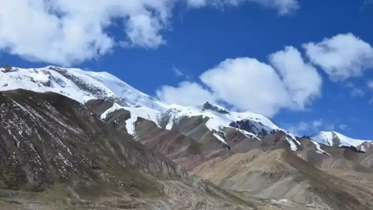
- Hike through the majestic Karakoram range and experience breathtaking views of towering peaks and glaciers.
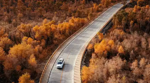
- Visit the famous Karakoram Highway, a historic road that connects Pakistan and China, passing through dramatic mountain landscapes.
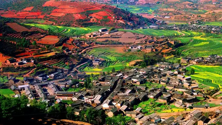
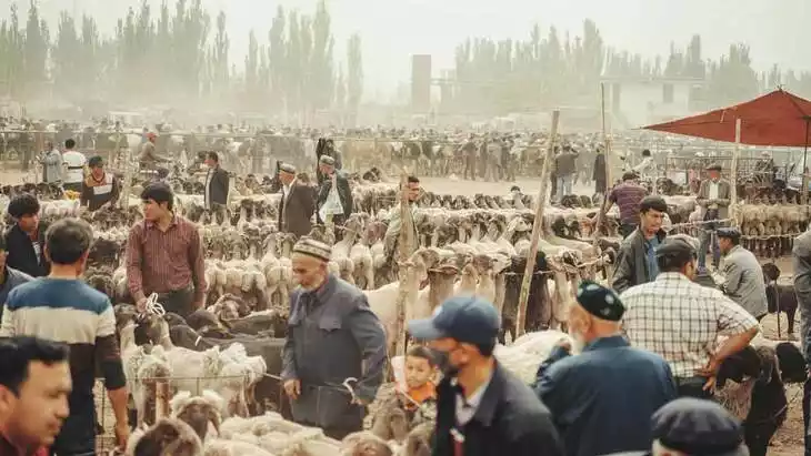
- Explore the local culture by visiting nearby villages and interacting with the indigenous people.
- Try mountaineering or trekking expeditions, as the area offers some of the world’s most challenging routes.
- Photograph the stunning landscapes, especially the snow-capped peaks and vast valleys.
Introducing Karakoram Mountains
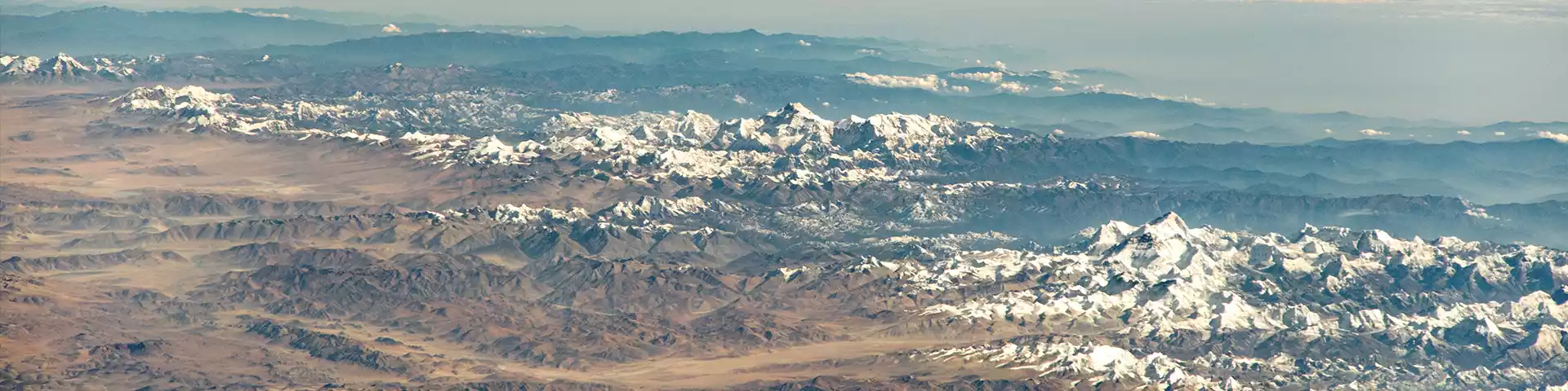
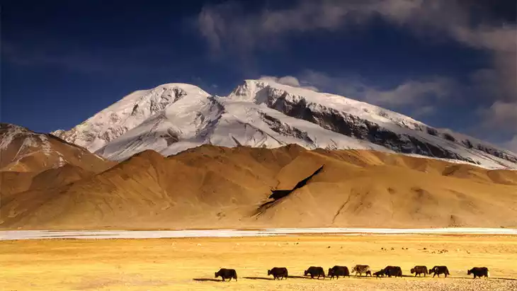
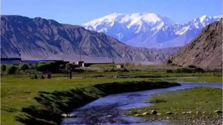
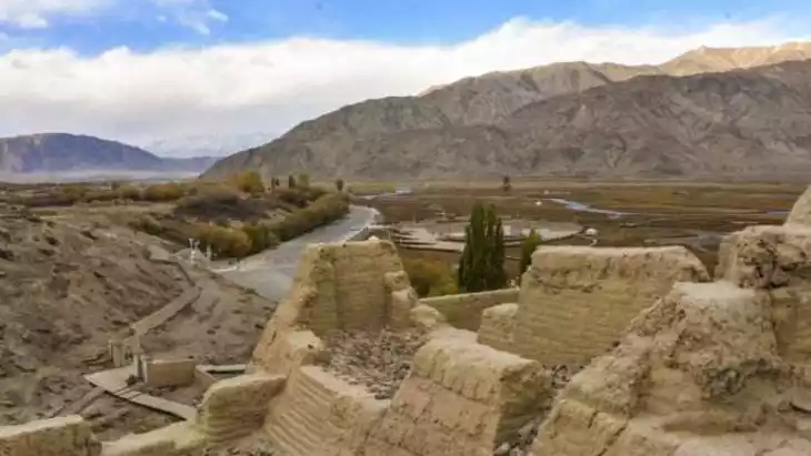
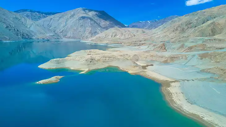
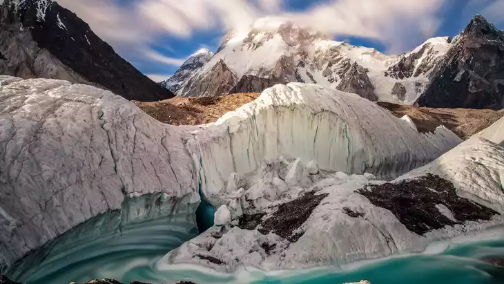
The Karakoram Mountains, located in Yecheng County, Kashgar Prefecture, Xinjiang, primarily comprise the Karakoram Mountains, which form the Pamir Plateau. This mountain range boasts the world's most extensive mountain glaciers, boasting uninterrupted expanses of snow and is a renowned mountain range in Asia. The Karakoram, meaning "black rock mountain" in Turkic, has an average elevation of over 5,500 meters, a width of approximately 240 kilometers, and a length of 800 kilometers. It boasts the world's longest and highest concentration of glaciers outside of high mountains and high latitudes, attracting numerous tourists and mountaineering enthusiasts.
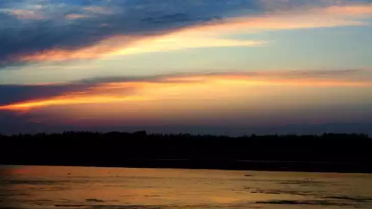
Climate and best time to travel
Temperate continental climate, summer
Recommended number of days and locations for visiting
Karakoram Highway, Hindu Kush Mountains, Pamir Plateau, 3 hours
Tickets
free
Attraction opening hours
All day
Most Popular FAQs for Karakoram Mountains
What is the history and significance of this attraction/city?
The Karakoram Mountains are one of the highest mountain ranges in the world, home to peaks such as K2. It has historical significance as a natural barrier between the regions of Central Asia and the Indian subcontinent. The area is known for its challenging treks and mountaineering history.
Where is it located and how do I get there (metro, bus, taxi, walking)?
The Karakoram Mountains are located in the western part of Xinjiang, Kashgar, China, extending into Pakistan and India. Accessing the area generally requires flying to Kashgar, followed by car or bus travel to the base of the mountain range. The area is remote, and local transportation may be limited.
What are the opening hours and best times to visit?
The area is open year-round, but the best times to visit are during the spring (April to June) and autumn (September to November) months, when the weather is mild and suitable for outdoor activities like trekking and photography.
What is the entrance fee/ticket price, and how to buy tickets (online/offline)?
There are no specific entrance fees for the Karakoram Mountains themselves. However, if you are joining guided tours or visiting specific protected areas, you may need to pay for those services or permits, which can be arranged locally in Kashgar.
Do I need to book tickets in advance, and how far in advance?
Booking in advance is recommended if you are planning to visit during peak trekking seasons. Tour guides or mountaineering permits may require bookings several weeks in advance.
How much time is needed to fully explore it?
A typical visit to the Karakoram Mountains can last anywhere from a few days to a couple of weeks, depending on your trekking itinerary. For a thorough exploration, including trekking and cultural visits, a 7-10 day trip is ideal.
What are the must-see highlights or main areas inside?
- The majestic K2, the second highest mountain in the world.
- The Karakoram Highway, offering scenic views of the mountain range.
- The Hunza Valley, a picturesque region known for its natural beauty and local culture.
- Base camps for trekking, like the Concordia Base Camp, known for spectacular views of several peaks.
Are guided tours or audio guides available (and in which languages)?
Guided tours are available, especially for trekking expeditions. English-speaking guides are available, though booking in advance is advised. Some tours also offer historical and cultural insights along the way.
What are the best viewpoints or photography spots?
- The Concordia Base Camp offers panoramic views of K2 and several other giant peaks.
- The Karakoram Highway has several viewpoints with dramatic mountain vistas, ideal for photography.
- The summit of Mount Rakaposhi provides one of the best vantage points in the region.
What is the recommended route or itinerary inside?
The recommended route often includes starting from Kashgar, driving through the Karakoram Highway to the Hunza Valley, and then proceeding to trekking spots like Concordia or the K2 Base Camp. The route can be adjusted based on personal interests and trekking difficulty.
Are night visits, light shows, or special tours available?
Night visits or light shows are not available in the mountains themselves due to the natural terrain. However, some nearby towns like Hunza offer cultural performances or nighttime gatherings that can be part of a longer trip.
Is it crowded, and when are the least crowded times/days to visit?
The Karakoram Mountains are relatively remote and generally not crowded. The least crowded times are during the off-peak seasons, particularly winter and early spring (March-April), though weather conditions can be challenging then.
What facilities are available (toilets, food, water, rest areas, shops)?
Facilities are limited in the mountain regions. While trekking, expect basic rest areas and tents at base camps. Food and water are available at nearby towns like Hunza or Kashgar, but carry your own provisions while trekking.
Is the attraction accessible for elderly, children, or disabled visitors?
The Karakoram Mountains are a challenging destination, particularly for those who are elderly or have mobility issues. Some areas may have accessible viewpoints, but trekking and mountaineering are not recommended for children or those with disabilities.
Is cash needed or are cards/mobile payments accepted?
Cash is preferred in the region. Mobile payments or credit cards are rarely accepted in remote areas, so it’s important to carry cash, especially in smaller denominations.
What restaurants or cafes are available inside or nearby?
In remote areas, food options are basic, often available as part of local guesthouses or trekking packages. In towns like Hunza, you'll find more diverse dining options, including restaurants serving local and international cuisine.
Are there vegetarian/vegan/halal food options?
Vegetarian, vegan, and halal food options are available in the larger towns like Kashgar and Hunza. On trekking routes, the food will generally be more basic and focused on local traditional meals.
What hotels or accommodations are close to the site?
Accommodations in the Karakoram Mountains are limited but available in towns like Hunza, which offers guesthouses, hotels, and eco-lodges. Some trekking camps may also provide basic lodging for trekkers.
What other attractions or landmarks are nearby and easy to combine in a day trip?
- Husseini Suspension Bridge, one of the most dangerous bridges in the world, located near the Hunza Valley.
- Altit Fort and Baltit Fort, historical landmarks offering stunning views of the valley.
- The beautiful Passu Cones, distinctive pointed peaks located near Hunza.
Are there souvenir shops and what are the typical souvenirs?
Souvenir shops are available in towns like Hunza and Kashgar, selling local handicrafts, rugs, and traditional garments. The region is known for its unique jewelry and handmade items from local artisans.
What are the best transportation options to continue the trip after visiting?
After visiting the Karakoram Mountains, the best transportation options include buses or private taxis back to Kashgar or other towns. If traveling to Pakistan, the Karakoram Highway offers a scenic route to cross the border.