Top 10 classic hiking routes in the Middle East and Africa, explore the stories behind the legendary hiking routes!
Preface
Even in the domestic hiking community, hiking routes in the Middle East and Africa are little known. Hiking routes in the Middle East and Africa are intertwined with pilgrimages, trade routes, war marches, and geographical discoveries.
We follow famous expeditions, chronicle the spread of religions, and witness the rise of hiking. Every trail, whether it's 1,000 meters or 1,000 kilometers, tells the story of this planet.

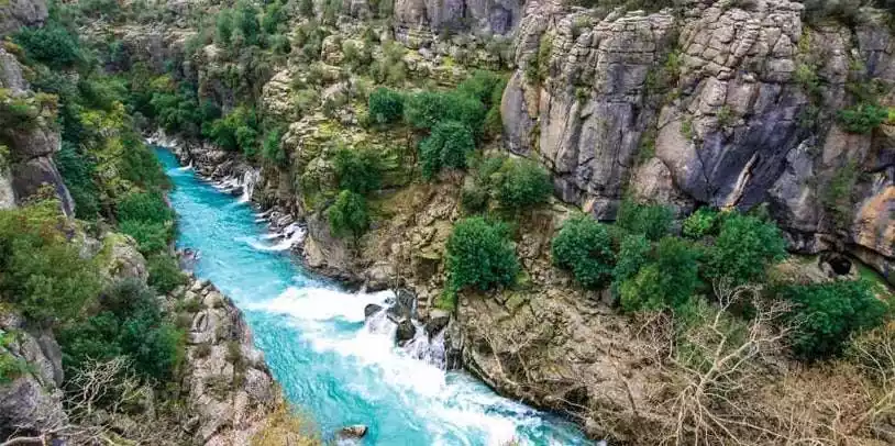
NO.1 Lycian Road, Türkiye
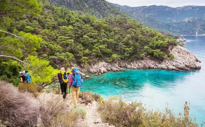
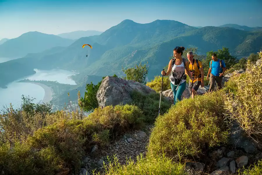
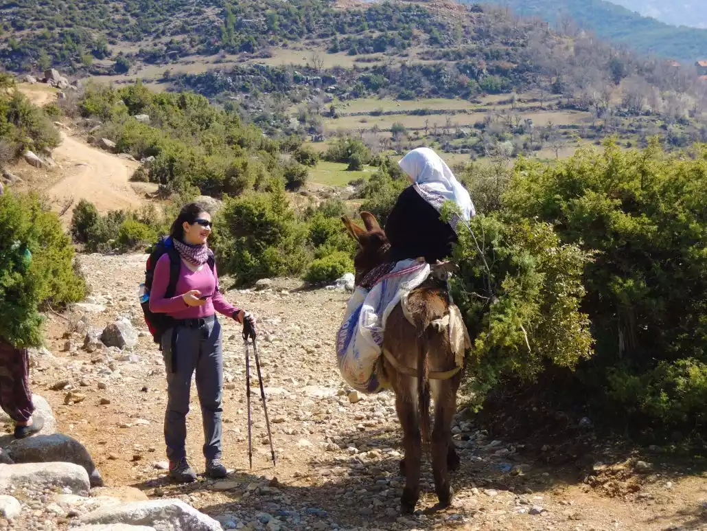
The Lycian Way is one of the world's great long-distance hikes, frequently ranked in the top ten for its unique combination of Mediterranean scenery, mountainous hinterland, Turkish culture, and ancient ruins.
It is also Türkiye's first official hiking route and was signposted in 1999.
However, its origins can be traced back much further. Around 3000 BC, the democratic but warlike Lycian people lived and traded on the Teke Peninsula.
Alexander the Great marched through the region in 334 BC, and hikers today follow the same footpaths and mule tracks he used, along with roads later paved by Roman rulers.
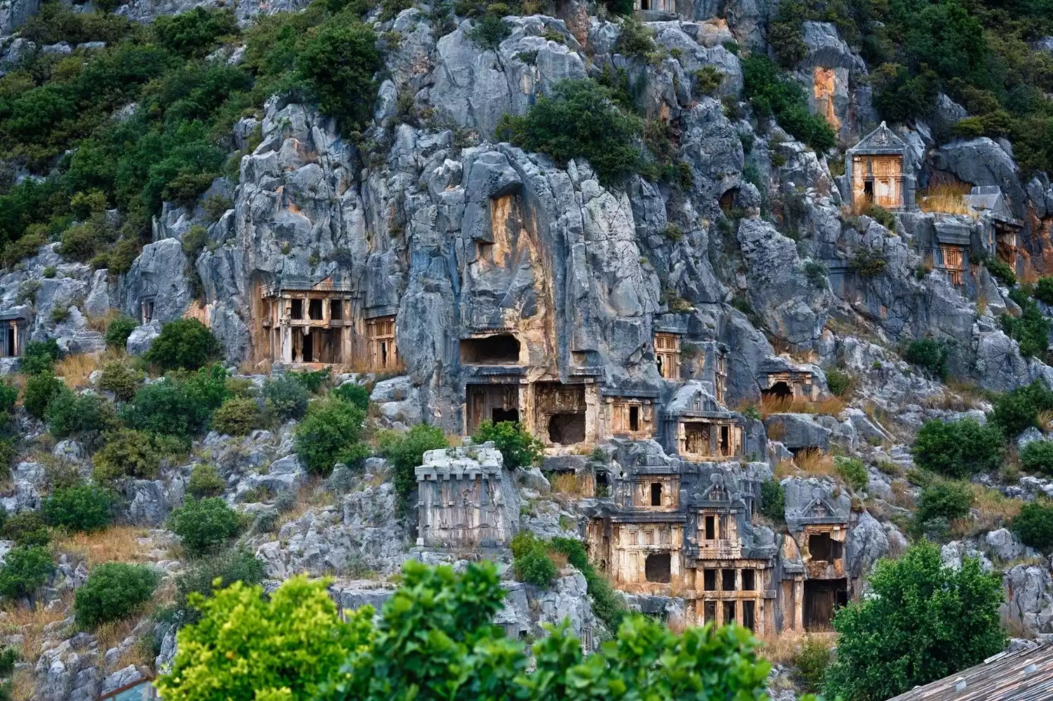
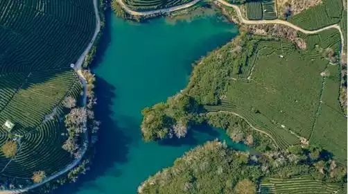
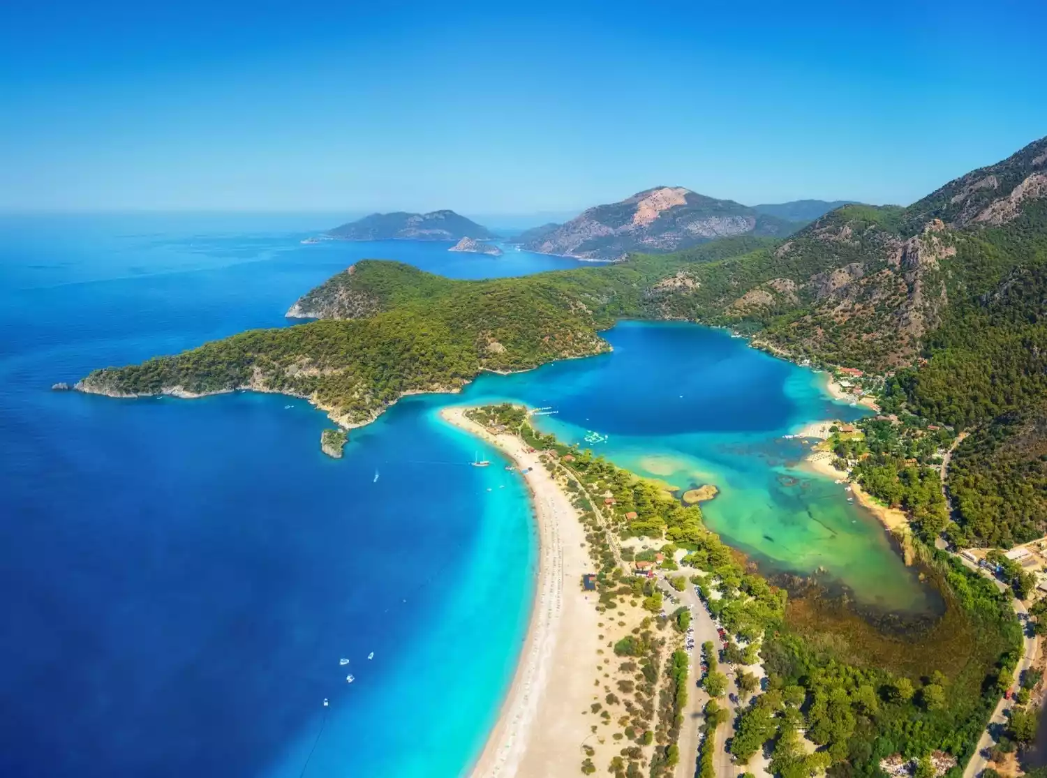
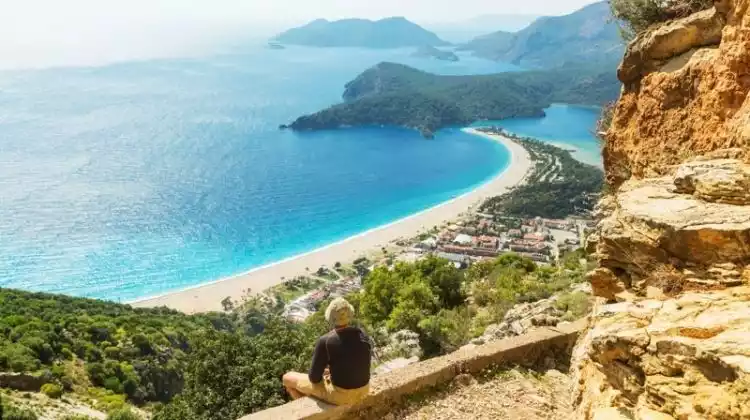
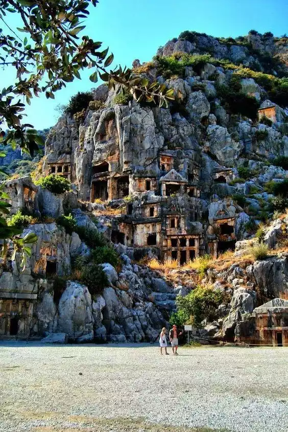
The Lycian Way stretches from Oludeniz to Antalya, often following the rugged azure coastline amidst carob, strawberry, and juniper trees. It also passes hidden historical sites, from Roman ruins to crumbling Byzantine monasteries, submerged cities, and Lycian tombs.
Tips:
English name: LYCIAN WAY
Location: Southern Türkiye
Length: 540 km
Duration: 29 days
NO.2 Crossing the Danakil Depression in Ethiopia
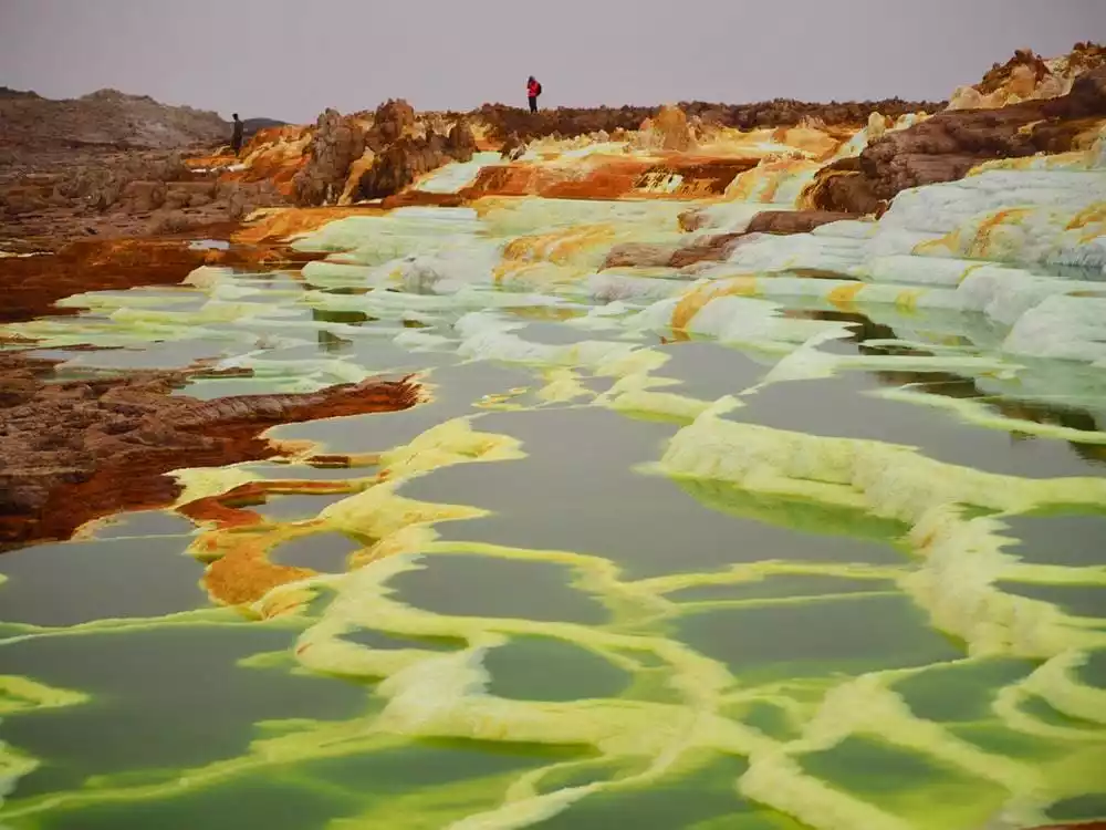
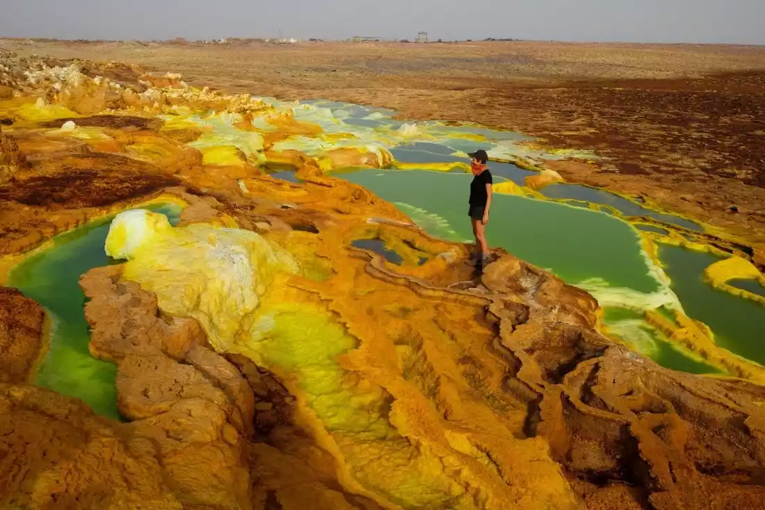
The Danakil Depression is one of the most geodynamically active regions on Earth.
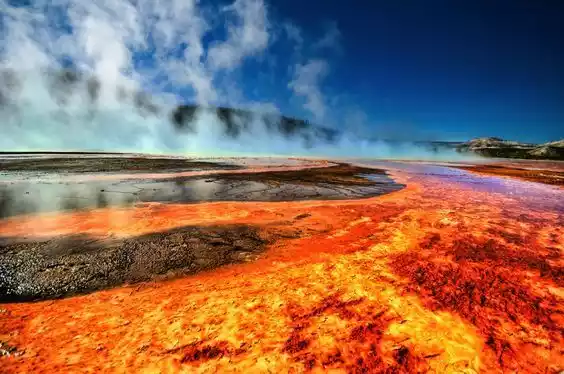
The mounds of yellow sulfur make this place look like an alien planet, and the rolling and surging magma lights up the dark night.
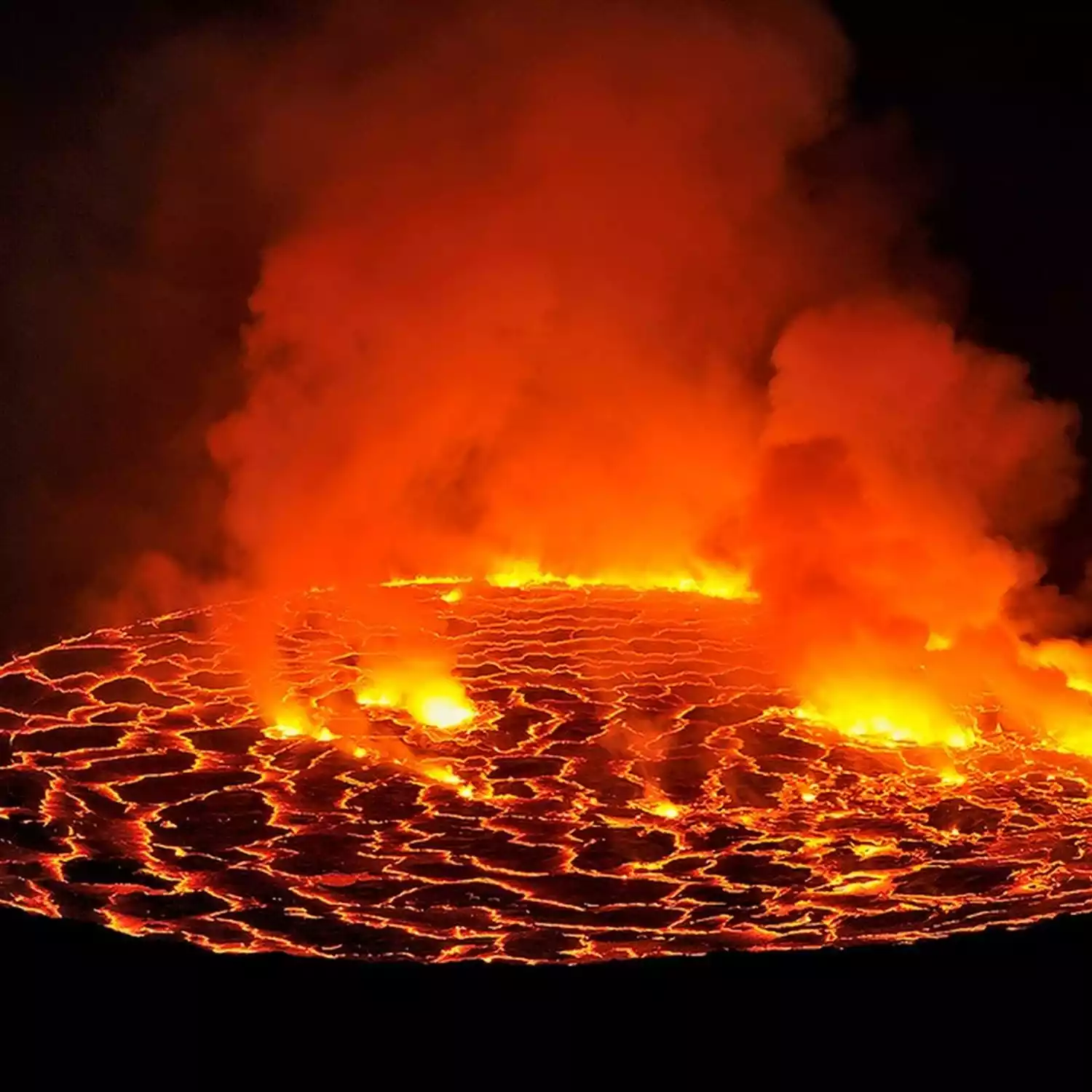
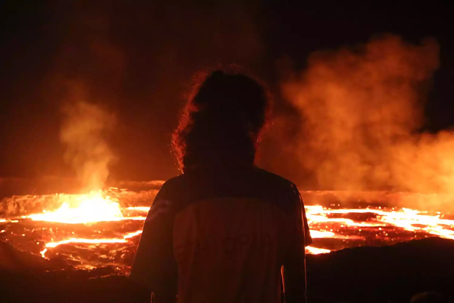
This hike leads you to the Erta Ale volcano and Dagur, the lowest point in the Danakil Depression.
Erta Ale volcano is located 50 meters below sea level. The oval lava lake is the oldest of the six lava lakes in the world. After hiking to the top of the mountain, you can try to walk around the crater accompanied by splashing lava.
Tips:
English name: DANAKIL DEPRESSION THRU-HIKE
Location: Afar region, Ethiopia
Length: 15 km
Best time to hike: November to February
Important tip: When you reach the crater, it is best to wear a gas mask because the sulfur gas emitted by the magma is somewhat toxic.
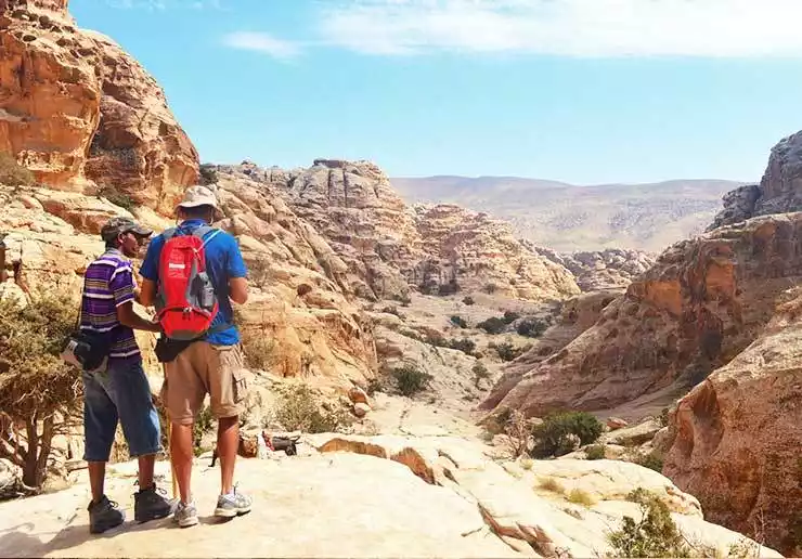
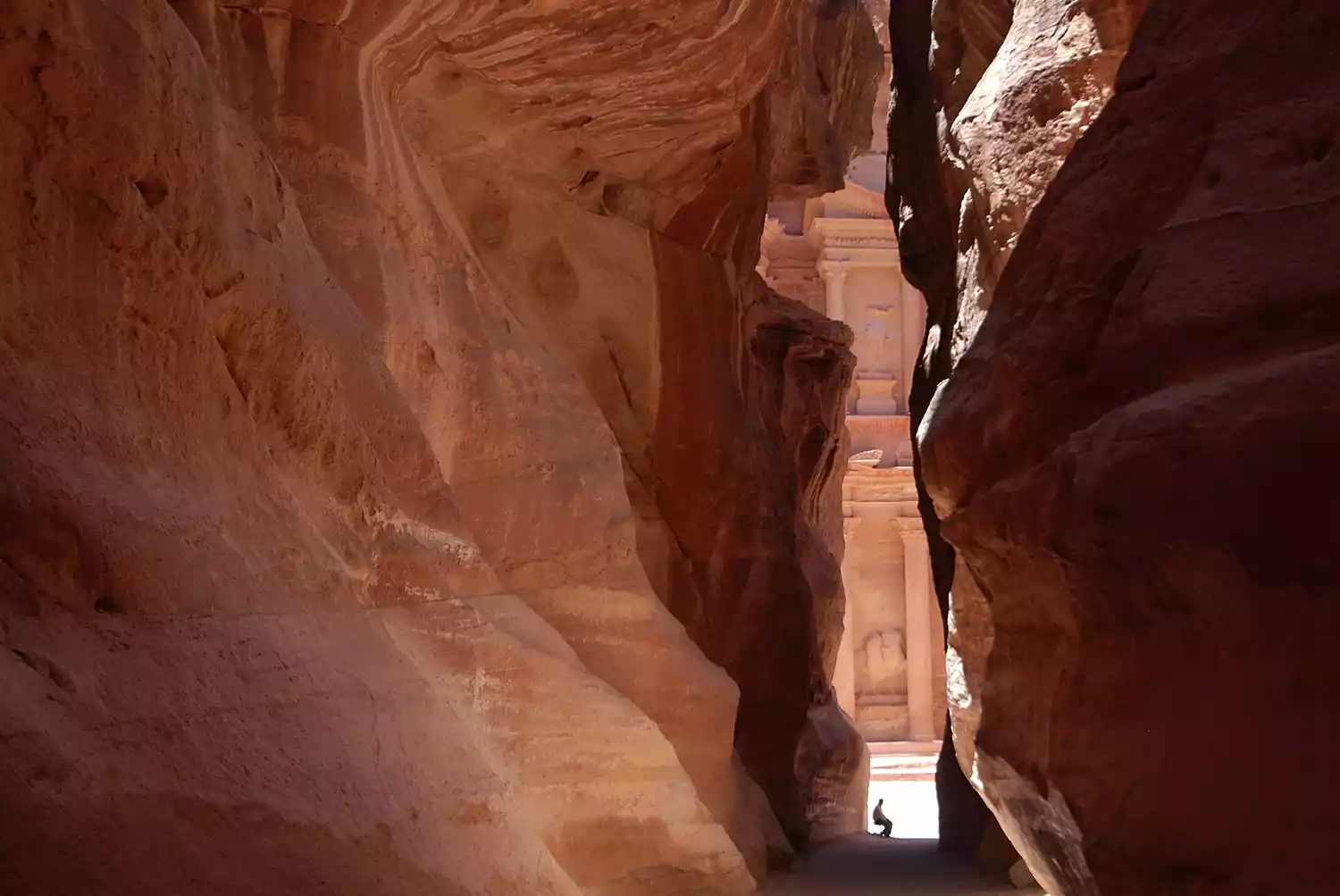
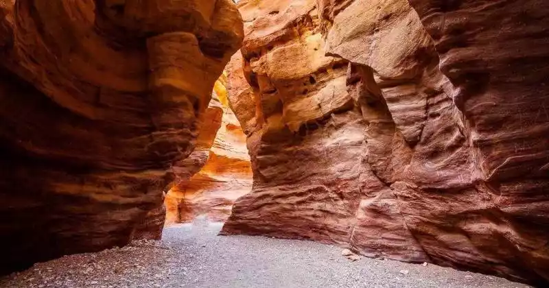
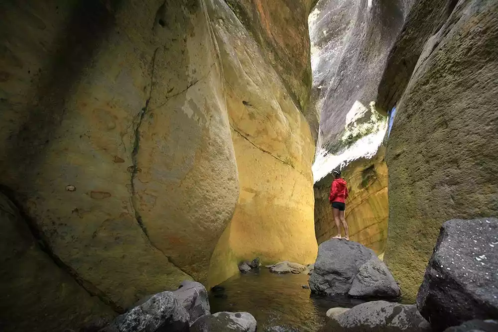
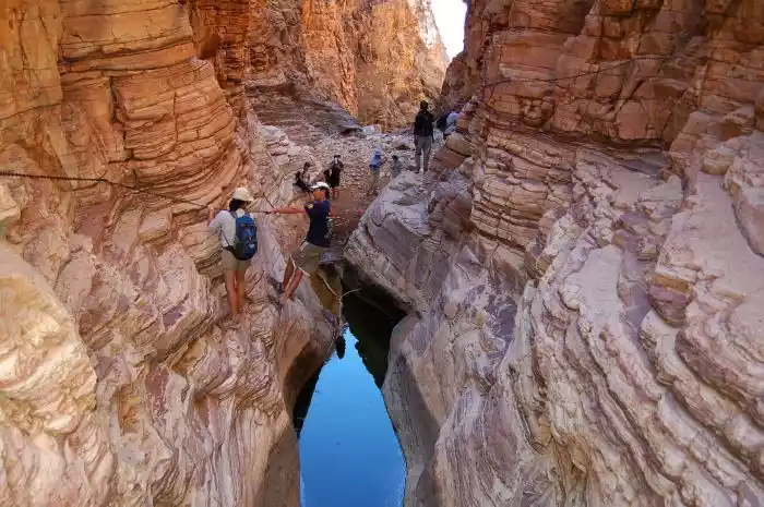
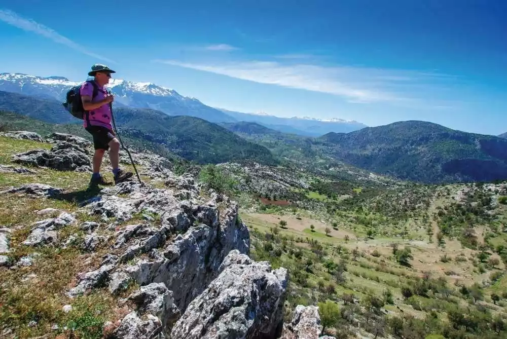
NO.3 Jordan Dana-Petra Hike
People call this hike the "Inca Trail of the Middle East." Although the terrain is very different from the Peruvian Andes, this desert hike is indeed a wild and untamed route, with a similar iconic landmark at the end.
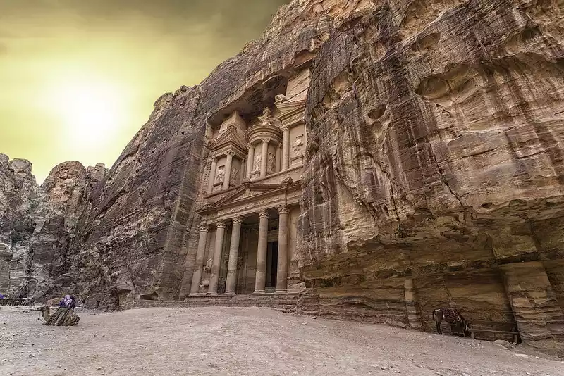
The city of Petra was carved out of rock in western Jordan about 2,000 years ago.
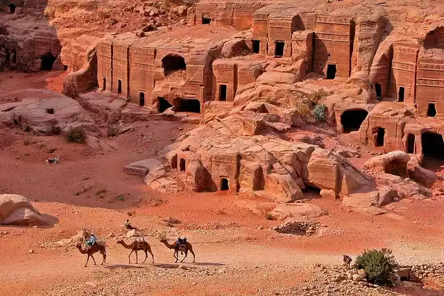
At Petra, people built large tombs, colonnaded streets, altars, temples, and tall facades amidst the rose-red valley.
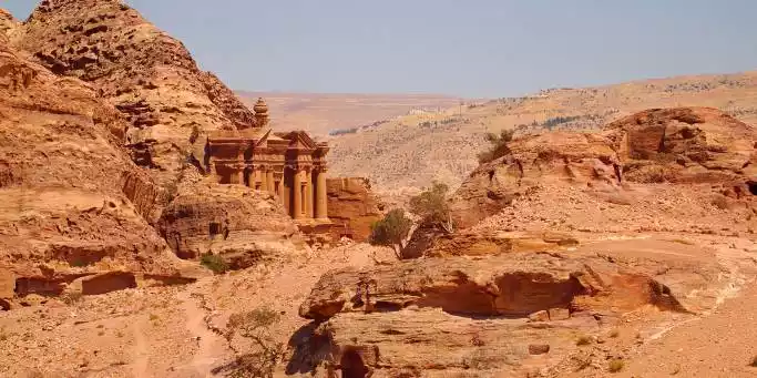
This trek, using ancient hunter and mule trails, takes you from the Dana National Park to the UNESCO World Heritage-listed city of Petra in 4-6 days. Along the way, you can camp in Bedouin-style tents or sleep under the stars.
Tips:
English name: DANA-PETRA TREK
Specific location: Jordan
Length: 45 km
Best time for hiking: February to April, October to December
Important: Sturdy shoes are essential for walking through the rocky desert
Israel National Trail
The Israel National Trail is a hiking route known as the "Epic Trail." Opened in 1996, it is 1,000 kilometers long and consists of 45 sections.
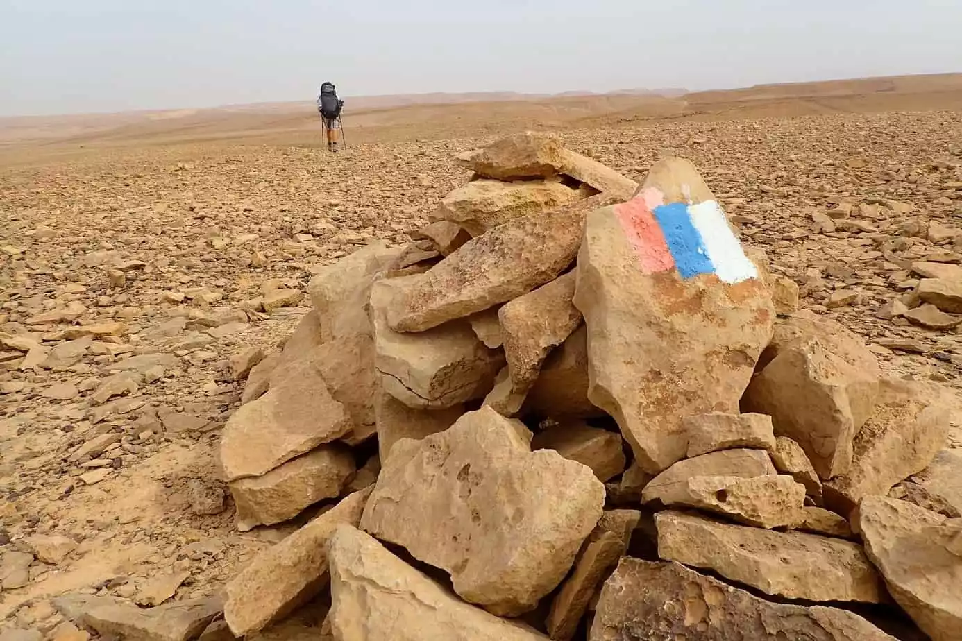
The landscapes along the way are biblical and beautiful in equal measure, ranging from the shimmering Sea of Galilee to the timeless desolation of the Negev Desert Trail across Israel.
Starting in the village of Dan, near the border with Lebanon, the trail heads south to Eilat on the Red Sea, passing the baptismal Jordan River and the awe-inspiring remnants of Mount Tavor – where General Barak and 10,000 Israelites defeated the Canaanites. The trail follows the Mediterranean Sea near Tel Aviv and climbs Mount Carmel. Other visual delights along the way include wildflower meadows, Nubian sheep, and semi-nomadic Bedouin migrating across the plains.
Tips:
English name: Isral national trail
Location: Northern Israel (near the Lebanese border) to southern Eilat
Best time for hiking: April-May
Mileage: 1,100 kilometers

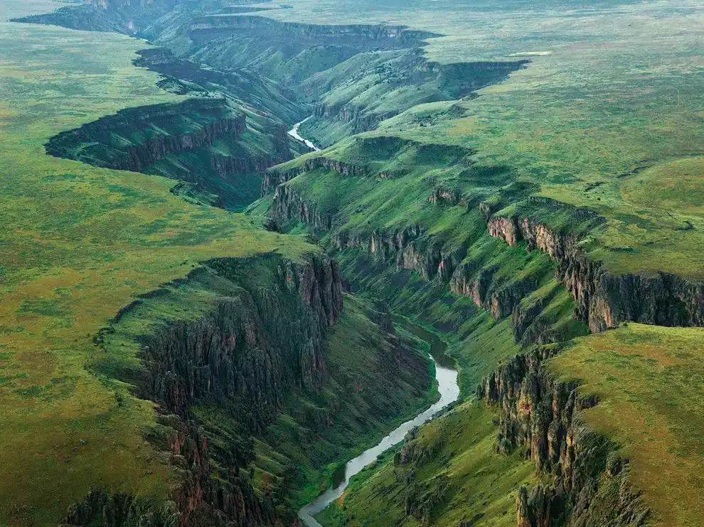
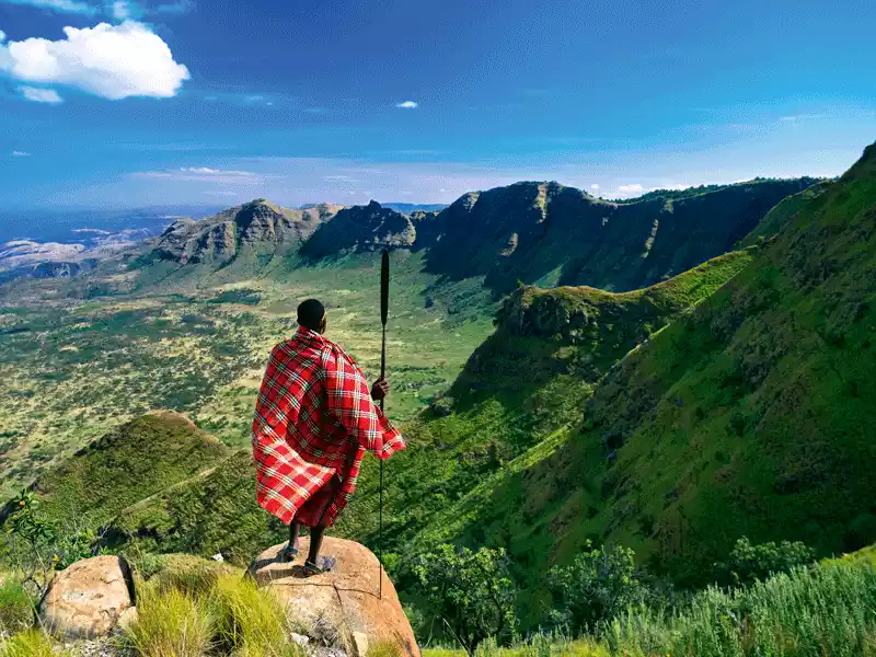
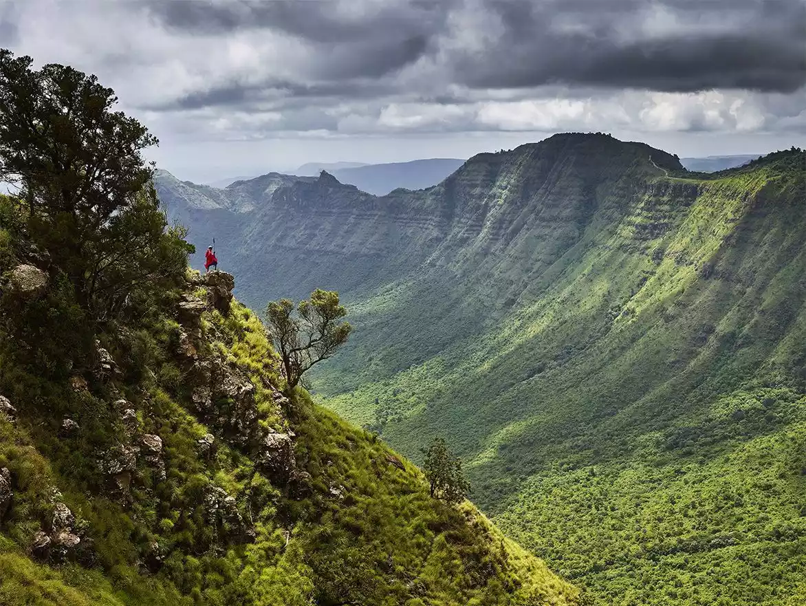
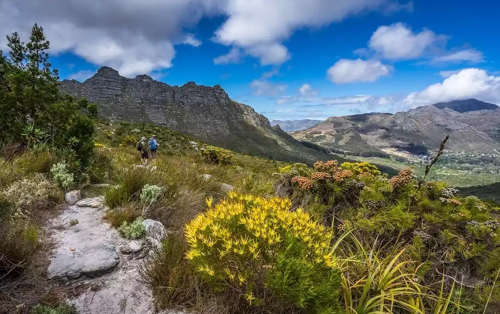
NO.5 North Drakensberg Crossing, South Africa
The Zulus describe the North Drakensberg Mountains as a "hairy barrier." These peaks, seemingly carved by knives and covered with lush vegetation, are the "unforgettable beauty" of eastern South Africa.
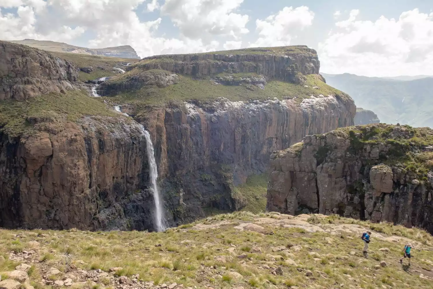
The Drakensberg Mountains are arguably the best place for hiking in Africa, with few roads in the parks.
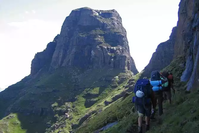
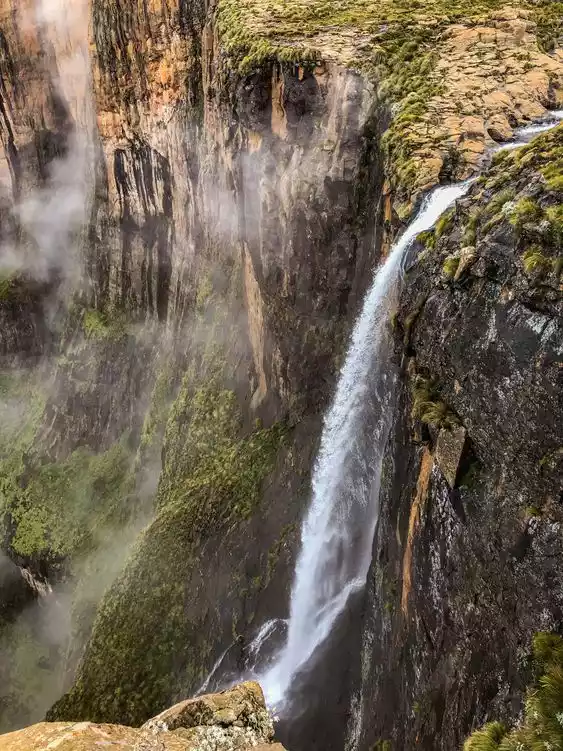
The North Drakensberg Alpine Crossing is one of the world's top ten hiking routes. It has an epic and beautiful trail - crossing mountains, cliffs, passing through many rivers and waterfalls, and finally arriving at Cathedral Peak Hotel in Giant's Castle Game Reserve.
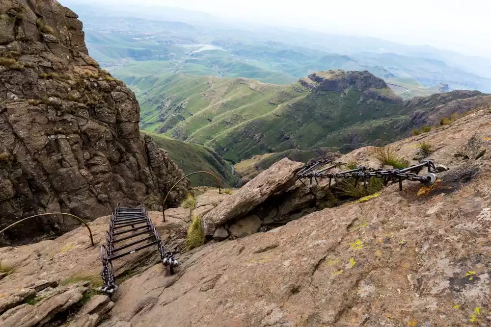

Climb up the chain ladder to the top of the plateau, where the world's second largest waterfall, Tugela Falls, flows down from high to low in five streams.
Tips:
English name: DEAKENSBERG CHAIN LADDER HIKE
Location: North of the Drakensberg Mountains, on the border between KwaZulu-Natal Province, South Africa, and Lesotho.
Mileage: 64 kilometers
Best time to hike: mid-April to early June (autumn in the Southern Hemisphere)
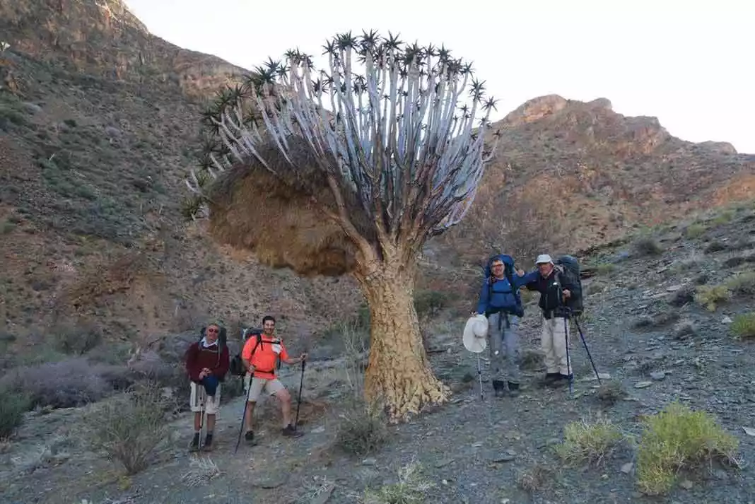
NO.6 Namibia Naukluft Trail
The strenuous 120km Nokloof Loop Trail is a prime hike through unspoiled nature, trekking along the edge of the world's oldest desert and through winding valleys.

Isolated mountains rise suddenly from the flat plains, dotted with cartoon-like quiver trees, squeaking rock hyraxes and black hawks that prey on them.
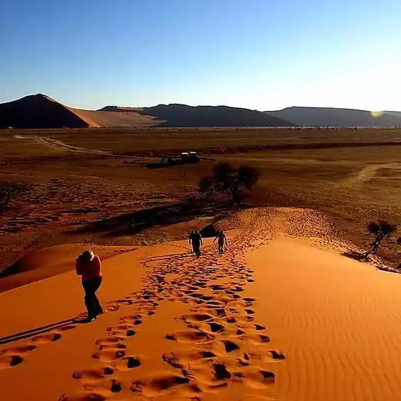
The landscape changes with the time of day: a reddish pink and purple at sunrise, a fiery yellow at noon, a gentle crimson at sunset, and at night, far from any light pollution, the most stunning starry sky twinkles here.

This route is limited in number and very popular, so booking accommodation is essential. Accommodation ranges from simple huts to stone shelters, with few amenities other than water and toilets.
In addition, this route only allows people to hike from March to October because the temperature in the southern hemisphere summer exceeds 38 degrees Celsius.
Tips:
English name: NAUKLUFT TRAIL
Location: Namib-Naukluft National Park
Mileage: 120 kilometers
Best months: March to October
Important: Bookings must be made in advance and hiking groups must be 3-12 people.
NO.7 Kenya Trans-Rift Valley Trail
The Great Rift Valley of East Africa is also known as the "Cradle of Humankind" and some of the earliest hominid remains have been unearthed here.
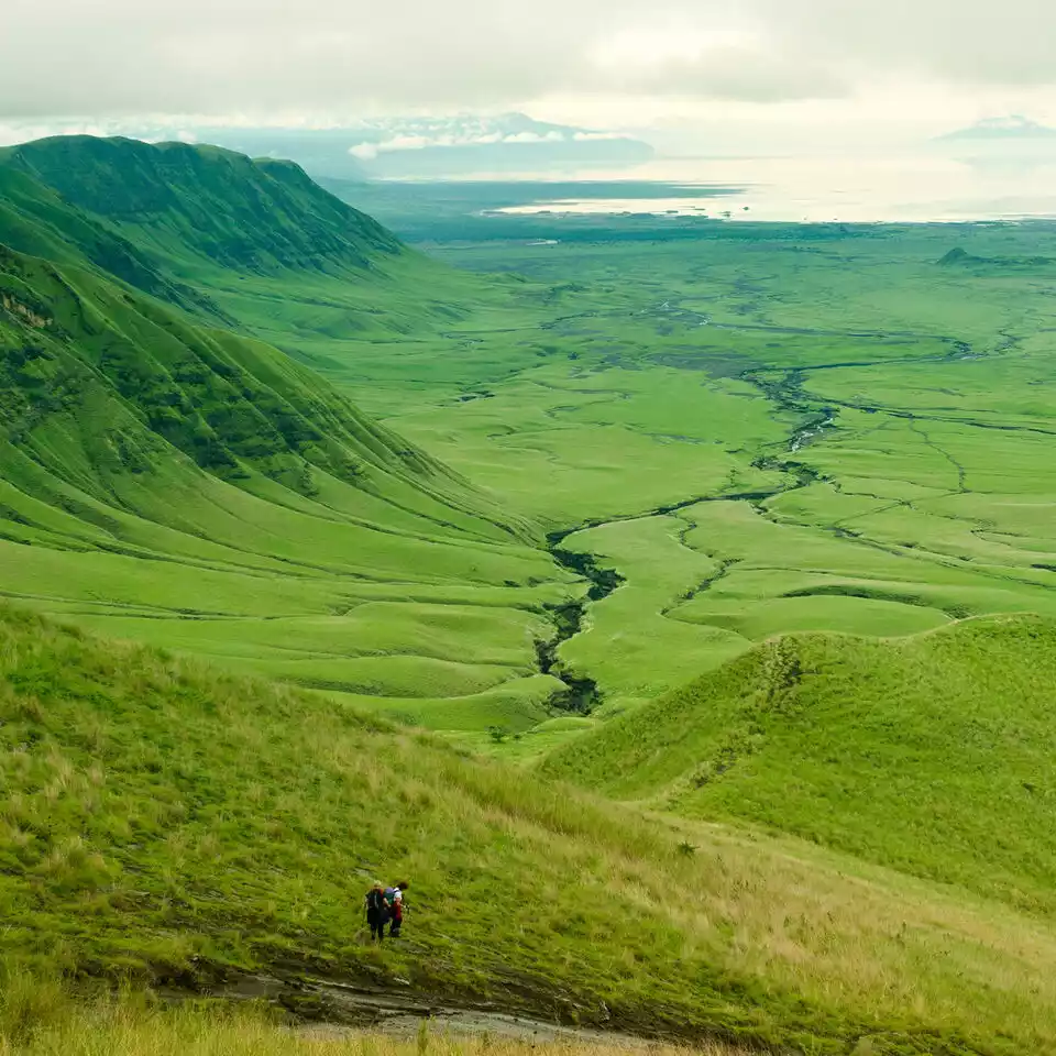
The rift valley stretches approximately 5,955 kilometers, from the Middle East to Mozambique in southern Africa, with an average width of 48-64 kilometers.
The Cross-Rift Valley Trail, officially opened in 2011, is only 145 kilometers long and winds its way from Mundrogoyi, climbing the cliffs in the east to Chorogai in the west.
The trail follows the route used by several early explorers of this land, such as Scottish geologist Joseph Thomson and Count Samuel of Hungary, who were searching for the source of the Nile.
The track incorporates ancient trading and herding routes, still used by locals today, meaning the Cross Rift Track is much more than just a wilderness hike; it also offers fascinating cultural interactions.
Tips:
English name: TRANS-RIFT TRAIL
Location: Great Rift Valley, Kenya
Mileage: 140 kilometers
Best months: July to September
NO.8 St. Paul's Trail, Türkiye
Jesus founded Christianity, but it was Saint Paul who spread it throughout the world. Saint Paul was born in Tarsus, south-central Türkiye, around 5 AD.
After receiving a vision of the resurrected Christ, he began to preach, first in Damascus, then in present-day Cyprus, Turkey, Greece, Italy, and beyond. It was St. Paul who ensured that the revelations of Jesus left the Holy Land.
The 500-kilometer St. Paul Trail runs inland from the Mediterranean Sea east of Antalya to Yalvaci northeast of Lake Erdir, extending intermittently to the route the apostle first entered Asia Minor.
The trail is a mix of Roman roads, forest paths and well-trodden paths, leading into remote villages and oak and cedar forests; past Roman aqueducts and amphitheaters, Byzantine towns, remote streets of Ottoman Turkey, and even fascinating ruins without names.
Tips:
English name: ST PAUL TRAIL
Location: Western Anatolia, Türkiye
Mileage: 500 km
Best months: May-June, August-October
Important note: You can stay in village houses and small hotels, but camping is required on some sections of the road.
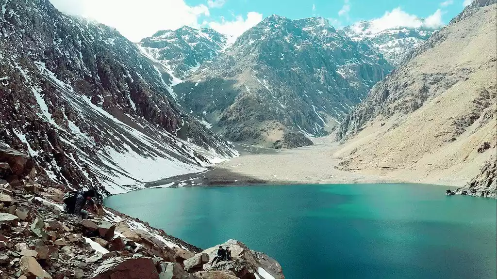
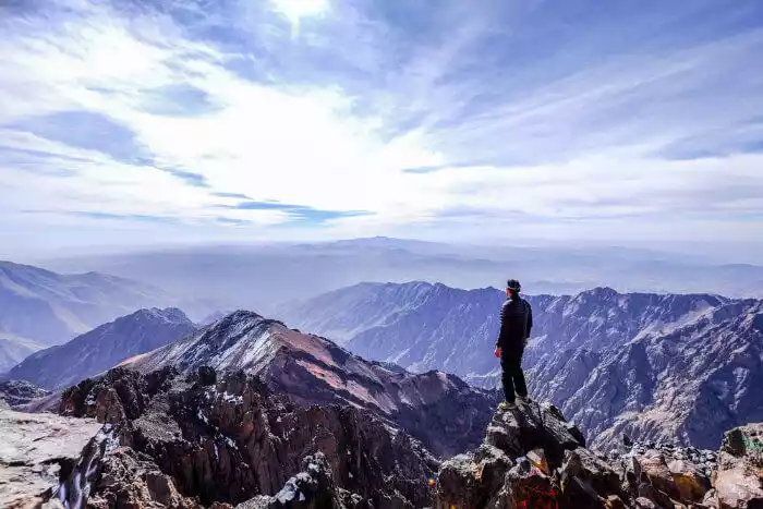
9. Toubkal Loop, Morocco
Mount Toubkal, at 4,167 meters above sea level, is the highest peak in the Atlas Mountains of Morocco and the highest peak in North Africa.
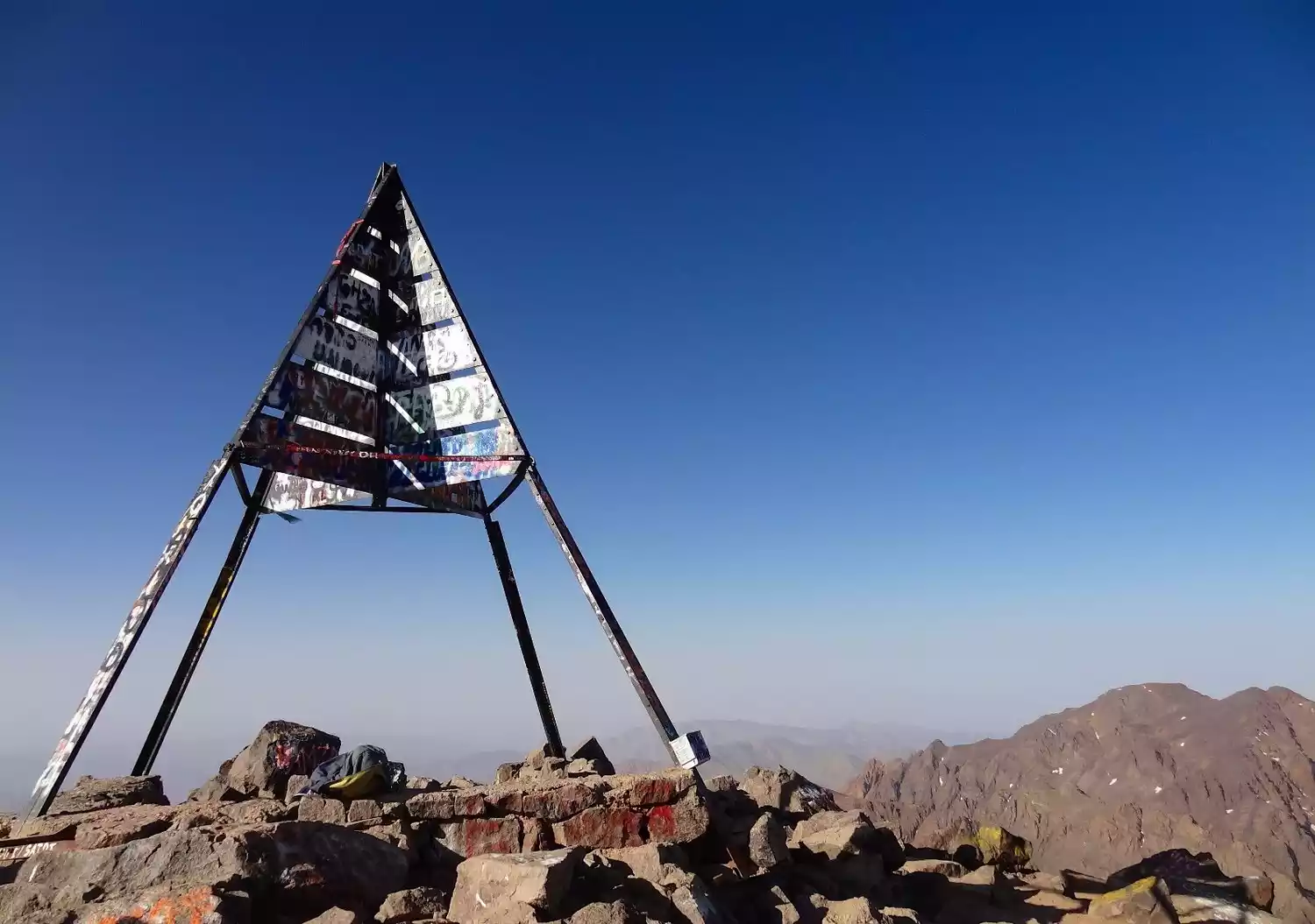
The first official ascent wasn't recorded until 1923, by the thrill-seeking Frenchman Marquis René de Sergonzac.
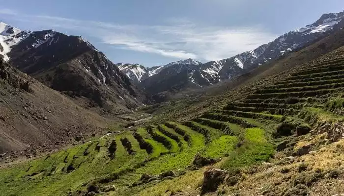
Hiking up and around the mountains is an adventure that provides both insight into Berber culture and panoramic views of the peaks.
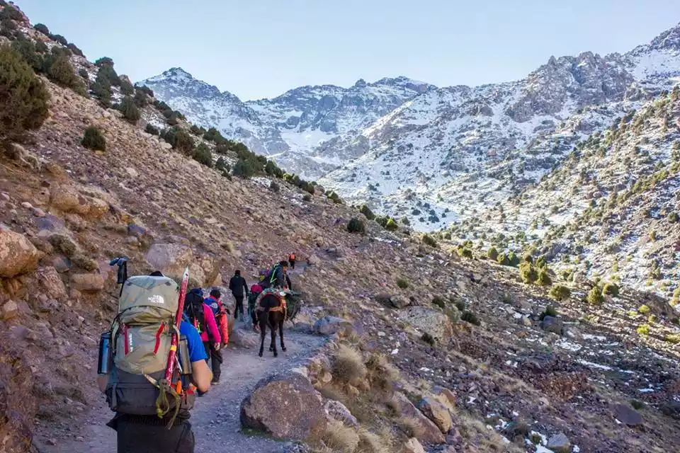
This circuit begins in the highland village of Imlil, 60km south of Marrakech, exploring Berber territory and ascending North Africa's highest peak.
Tips:
English name: TOUBKAL CIRCUIT
Location: High Atlas Mountains, Morocco
Mileage: 72 kilometers
Best months: April-May, September
Important: You can hike in winter, but you must have crampons and an ice axe.
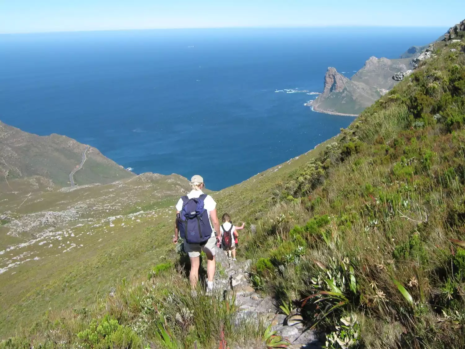
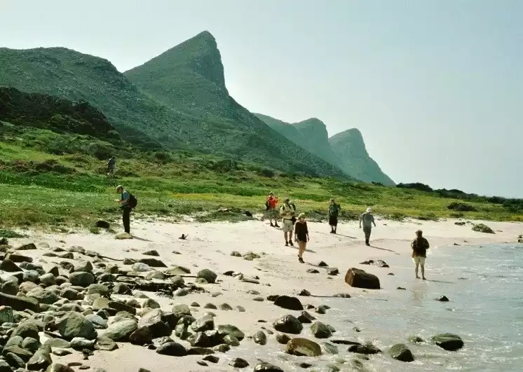
NO.10 Holiwago Trail, South Africa
The Khoi people have walked around Table Mountain for nearly 1,500 years and called it "Holiwago", which means "mountain in the sea".
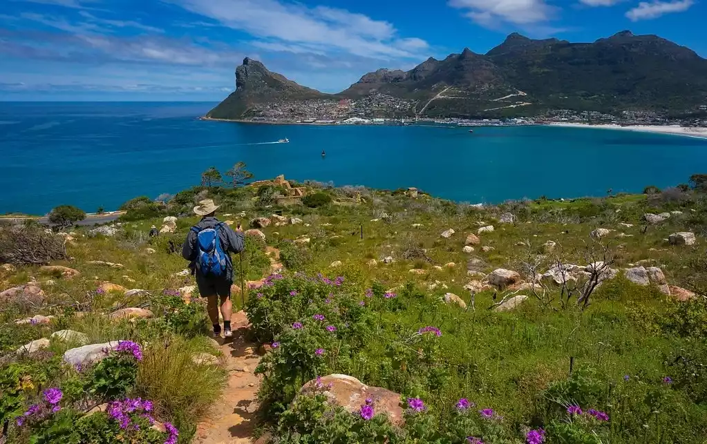
Their ancient footprints formed the basis of today's Holiwago Trail, a long walk around Table Mountain, its namesake national park, and the pristine peninsula on which it rests.
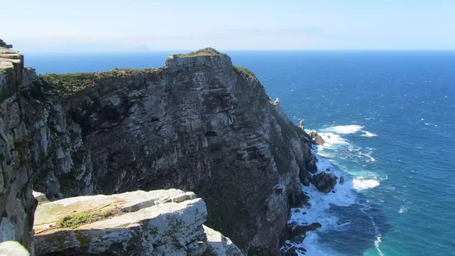
The Portuguese coined the name "Cape of Good Hope" in the late 15th century for this south-facing headland, which boasts stunning scenery, including Table Mountain, a unique flat-topped mountain rising 1,086 meters and often shrouded in mist.
The verdant slopes are home to 2,200 plant species, from fragrant marsh daisies to giant king proteas. The diverse habitats support a diverse range of animals, including rock hyrax, black eagles, and giant baboons.
The 75-kilometer Holiwago Track offers a comfortable way to explore the headlands. No need to carry a tent; there are permanent campsites along the way, offering hot water, comfortable beds, shared bathrooms, and fully equipped kitchens.
Tips:
English name: HOERIKWAGGO TRAIL
Location: Table Mountain National Park, South Africa
Mileage: 75 kilometers
Best months: November to March