Live Your Best Lives
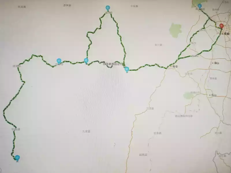
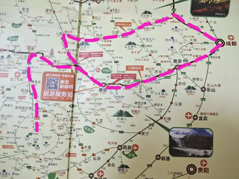
In August 2021, he and his lover drove a Mazda 6 sedan from the 318 Sichuan-Tibet South Line to Tibet and the 109 Qinghai-Tibet Line out of Tibet, passing through Ya'an, Luding, Kangding, Xinduqiao, Yajiang, Litang, Daocheng Yaden, Batang, Zuogong, Basu, Bomi, Nyingchi, Lhasa, Nagqu, Tanggula Mountain Town, and Golmud, and completed the 318 Sichuan into and out of the bicycle self-driving itinerary in and out of Qingdao in 15 days.
Due to the impact of the epidemic, there are very few self-driving cars on the 318 line, and there are very few riders, and they have not caught up with the rainy season of the 318 Sichuan-Tibet line, and there have been no landslides and mudslides. A few sections of the 318 line such as Haitonggou, Jueba Mountain, and Bomi are under construction, and the road conditions in some places are poor, making it very difficult for cars to pass and easy to hit the chassis. The 109 Qinghai-Tibet Line is above 4,000 meters above sea level, there are many large cars, passing through no man's land for a long time, the road conditions in some places are not good, it is difficult for cars to pass, my speed is basically about 4,050, if you don't pay attention to the fast speed, you will support the chassis. The 318 Sichuan-Tibet Line and the 109 Qinghai-Tibet Line are both running through the mountains and mountains, high altitude, many curves, narrow roads, many ups and downs, drive very carefully, to overcome the physical fatigue of long-distance driving and possible high reactions, be sure to slow down and drive slowly when meeting the car, and do not overtake in places with poor visibility such as curves and ramps. When traveling long distances, you must develop the habit of checking the condition of the vehicle in a timely manner, especially the condition of the tires.
Previously, we read the self-driving tour guide on the Sichuan-Tibet Line and the Qinghai-Tibet Line on the Internet, and also planned the tour route, but later due to the impact of the epidemic, the itinerary was not fully arranged according to the original plan. Basically, according to the requirements of epidemic prevention and control in various places, most areas require a 72-hour negative nucleic acid test report, and Lhasa and other regions require a 48-hour negative nucleic acid test report; Some hospitals in Tibet only provide paper test results and do not provide electronic test results. We basically arrive at the hospital before 5 p.m. the first day for nucleic acid testing, and take the paper test results the next morning, and the paper test report can accurately display the date and time of the test, which is convenient for the staff to verify whether the test report is expired when passing through the checkpoint. Nucleic acid tests were done in Daocheng County, Zuogong County, Basu County, Lhasa City, and Golmud City.
On the first day, Hanzhong City to Ya'an County, driving for 9 hours on the highway and 318 line. (Living in Ya'an County, 1500 meters above sea level)
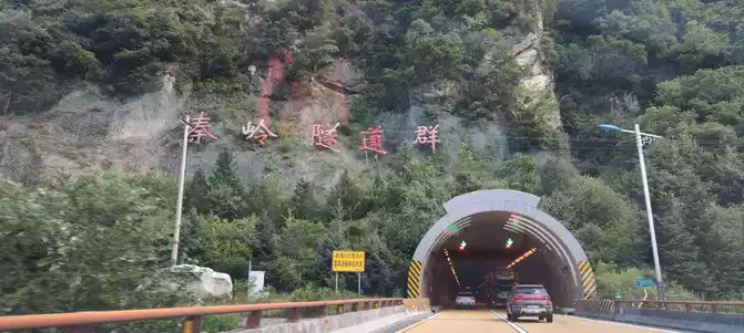
From Hanzhong to Ya'an, it is necessary to pass through the Qinling Mountains, and there are many tunnels on the highway.

Ya'an Covered Bridge, below is the Tsing Yi River.

Huo Xiang Fish Restaurant near Ya'an Covered Bridge, Huo Xiang Fish is very delicious.
The next day, Ya'an County to Yajiang County, passing through Luding, Kangding, Zheduoshan, and Xindu Bridge, drove for 10 hours on Line 318. (Living in Yajiang County, 2500 meters above sea level)

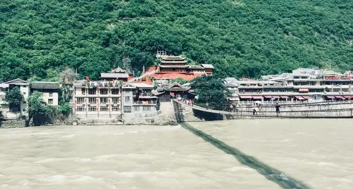
overlooking Luding Bridge

the gate of Ludingqiao Scenic Area

Ludingqiao Scenic Area

Observatory halfway up the mountain (hot water can be used and toilets can be used after charge.))

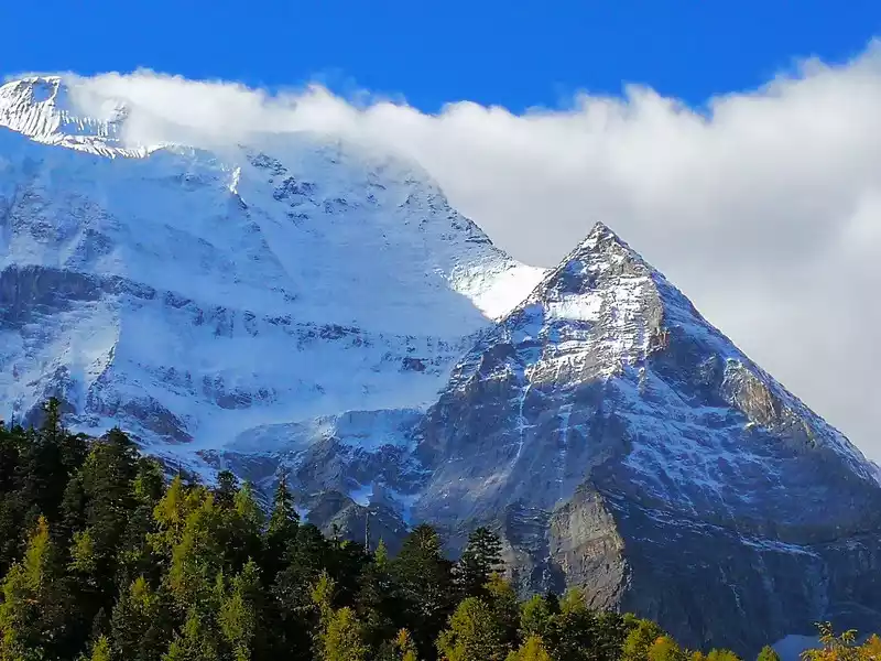
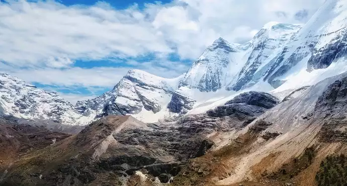
overlooking the mountains. Climb a short slope from the white pagoda on the side of the parking lot, stand on the hillside and look at the surrounding scenery is very good, this is the first high mountain above 4,000 meters above sea level on the road to Tibet, first adapt to the plateau climate.

Zheduo Mountaintop parking lot
On the third day, Yajiang County to Litang County, passing through the eighteen bends of Tianlu, Scissors Bend Mountain, and Kazila Mountain, 7 hours on Line 318. (Living in Litang County, 3,900 meters above sea level)
originally planned to stay in Batang County. Since Yajiang County did not require a nucleic acid test report, we checked online in advance that Batang County did not have a requirement for a nucleic acid test report, thinking that Yajiang County and Batang County both belong to Sichuan Province, and we were going to go to Batang County to do nucleic acid testing again. We arrived at the checkpoint in Batang County at about 3 p.m., and the staff at the checkpoint told us that we were not allowed to enter without a nucleic acid test report, so we could only return to Litang County and saw that many cars had turned around here and returned to Litang. Litang County can only do nucleic acid testing every morning and not in the afternoon, and it is too long to do nucleic acid testing in other cities. In order to continue the rest of the itinerary, you can only stay in Litang County at an altitude of 3,900 meters. At night, I had a headache, confusion, nausea, shortness of breath and other symptoms, which was very uncomfortable, but fortunately, I drank some hot water, hot porridge, took some medicine, added warm clothes, and slowly survived, and the next day I basically had no symptoms. We brought 10-liter oxygen cylinders (friends who had been to Tibet before lent us for fear of our high rebellion), and bought 4 small cans of portable oxygen.

Scissors Bend Mountain Lookout

Xiong Zongka Observation Deck

Nimagon Sacred Mountain Observation Deck

Mount Kazira Lookout

view from the Kazira Mountain Lookout

Lone Cyclist

Litang Tunnel 
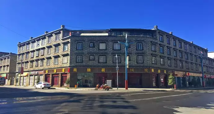
into Litang County

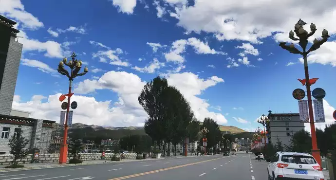
Litang County

west gate of Litang County
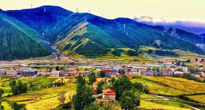
, Litang County went to Daocheng Aden Scenic Area, passing through Daocheng County, Daocheng White Pagoda, and Rabbit Mountain, and driving for 6 hours on the G227 line. (Living in Shangri-La Town, 2,900 meters above sea level)
Since I was high in Litang County at an altitude of 3,900 meters yesterday, my lover did not have a high rebellion, we decided to go to Daocheng Aden at a relatively low altitude to adapt to the plateau climate, and Daocheng Aden Scenic Area does not need a nucleic acid test report. It is already noon to arrive at Shangri-La Town, Daocheng County, from Litang County, after eating and arranging accommodation, drive directly to Daocheng Aden Scenic Area for about 20 minutes, and the scenic spot ticket is valid for 2 days. The short route we took in the afternoon visited Xiannai Ri, the Pearl Sea (Dolma Latso) and Chonggu Temple. Shangri-La Town is very lively at night, with restaurants, shopping malls, pharmacies, and hotels available for replenishment and rest.

Rabbit Mountain Lookout

looking at Rabbit Mountain in the distance

high mountains on the side of the road

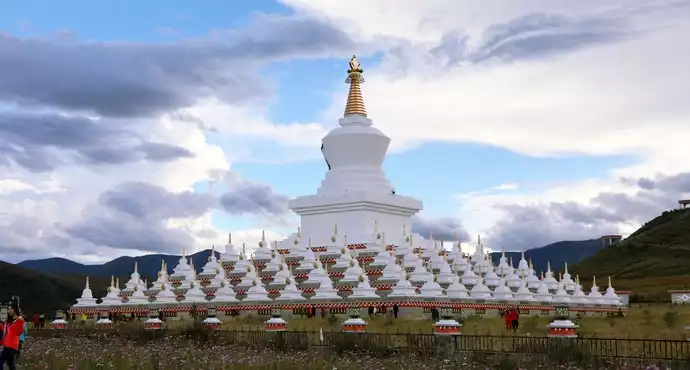
Daocheng White Pagoda

the gate of the Aden Scenic Area. It takes more than 1 hour to enter the core scenic spot by bus from here.

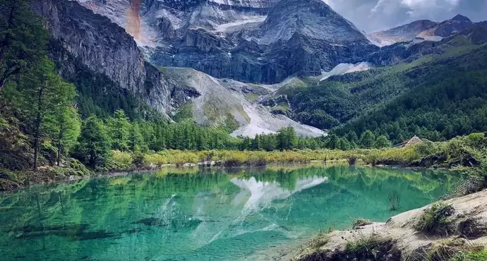
the Immortal Sun Sacred Mountain and the Pearl Sea (Dolma Ratso).

the gate of Chonggu Temple
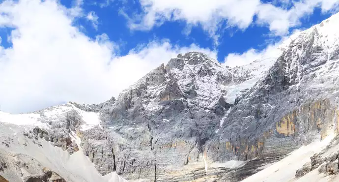
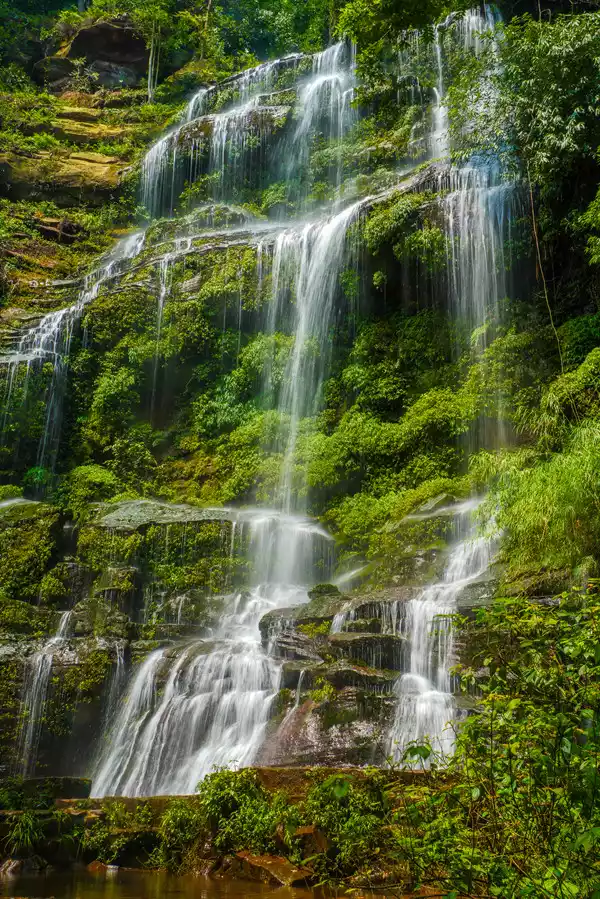
, Daocheng Aden Scenic Area. It lasted 11 hours to visit Luorong Cattle Farm, Xiannai Ri, Yang Maiyong, Xia Nuo Dorji, Five Colors Sea, and Milk Sea. (Living in Shangri-La Town, 2900 meters above sea level)
Today, we will continue to visit the long line of Daocheng Aden Scenic Area. In the morning, we took a bus from the gate of the scenic spot for more than 1 hour to reach the scenic spot, walked for a while to the Chonggu grassland under the Chonggu Temple, and took a battery car for another hour to reach the Luorong Cattle Farm. At this time, you can choose to ride a horse or walk 3 kilometers of mountaineering, horseback riding charges 500 yuan, horseback riding can only be 3 kilometers one way (no back), and then climb about 2 kilometers to reach the milk sea and five-color sea at an altitude of about 4,700 meters, the last 2 kilometers of climbing above 4,200 meters above sea level is a test of everyone's physical strength and willpower, and the return 5 kilometers also requires everyone to measure with their feet, and after walking through this 10 kilometers of distance, you can truly understand the meaning of "eyes in heaven, body in hell".

After entering from the gate of the scenic spot, the bus will stop in a parking area for a short time, and tourists can overlook the Xiannai Ri Sacred Mountain and the whole picture of Aden Village. The bus has several stops such as Aden Village to pick up tourists in the village and get on and off.

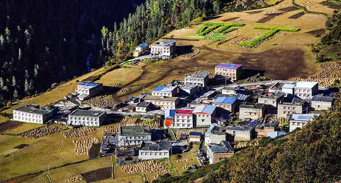
ancient grassland. In the distance is Yangmaiyong Sacred Mountain, from here it takes 1 hour by battery car to reach Luorong Cattle Farm. (You must buy a round-trip ticket for the battery car, the walk is too far.)

the ancient grassland. In the distance is the Yangmai Yong Sacred Mountain.

Los Angeles Cattle Farm.In the lower left corner is the battery car boarding point, and in the distance is the Xiannai Ri Sacred Mountain.

reminder of the scenic spot

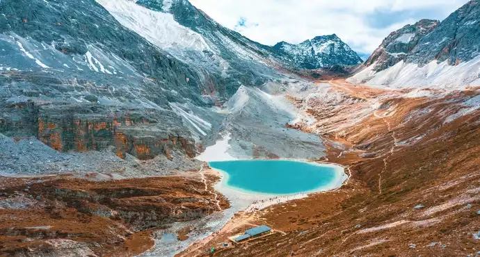
overlooking the sea of milk

far away is Yangmai Yong Shenshan

far away is Yangmai Yong Sacred Mountain

The horses rested in the afternoon

Tourists who go to the Milk Sea and the Sea of Five Colors will have to endure physical and willpower when climbing above 4,200 meters above sea level.
On the sixth day, Daocheng Yading Scenic Area went to Batang County, passed through Litang County, Haizi Mountain Observation Deck, and Sister Lake, and drove for 12 hours on Line 318. (Lives in Batang County, 2700 meters above sea level)

In the morning, I went to Daocheng County Hospital for a nucleic acid test, and the hospital said that the results would be released at 6 p.m., and the paper and electronic versions could be released. Since the results can be found online, we will continue to Batang County without waiting for the paper results. The road conditions from Litang County to Batang County are very good, and the scenery on both sides is also very beautiful, but there are many speed limit points on the side of the road, so you must pay attention to controlling the speed.

There were a lot of yaks along the way

Wulianghe Wetland

on the way to Batang.

Push cart and hiker

Haizi Mountain Observation Deck overlooking the sister lake
On the seventh day, Batang County went to Zuogong County, crossing Zongla Mountain, Lawu Mountain, Jueba Mountain, and Dongda Mountain, Drive for 9 hours on Line 318. (Living in Zuogong, 3759 meters above sea level)
This day is a day of walking through mountains and canyons, and the long journey is very hard.When I left Batang County and was about to reach the Jinsha River Bridge, there was a section of road under construction, which was very difficult to walk, and it was difficult for cars to pass. Haitong Gully is still under road construction, a long section is a gravel road, the overall road condition is very good, and there are few cars. The Jueba Mountain section is very steep, it has been driving on the high mountainside, and it is impossible to see the bottom below, there are no guardrails in many turning places, the road surface is narrow and difficult to car, the parking area is very few and simple, and some sections are under construction, which is very difficult to walk. However, seeing that tunnels are being built in many places, it should not be so dangerous to drive on this road in the future.

Batang goes to Mangkang, in front of the Jinsha River Bridge, this section of the road is not good.

crossed the Mangkang checkpoint and entered the Tibetan border

Zongla Mountain Pass

the pass of the Lau Mountain

Dongda Mountain viewing platform

Self-driving tractor Tibetan
On the eighth day, Zuogong County to Basu County, passing through Bangda Town, Yela Mountain, Nujiang 72 turns, Yela Mountain 99 turns, 7 hours on the 318 line. (Staying in eight lodges, 3260 meters above sea level)
Passing through mountains, grasslands, and rivers, the scenery is beautiful all the way. Nujiang 72 turns connect to Yelashan 99 turns, with many turns along the way, several road surfaces are seriously damaged, and cars are difficult to pass. It is very convenient to shop and eat in Basu County.

Bonda Prairie

Ye La Mountain Viewing Platform

Ye Lashan Viewing Platform

There were many yaks and sheep on the grasslands along the way.

overlooking the Nu River 72 turns.

Hospital in Basu County
On the ninth day, Basu County went to Nyingchi City, passing through Ranwu Lake, Bomi, Tongmai, Lulang, and Sejila Mountain, 12 hours on the 318 line. (Living in Nyingchi City, 2900 meters above sea level)
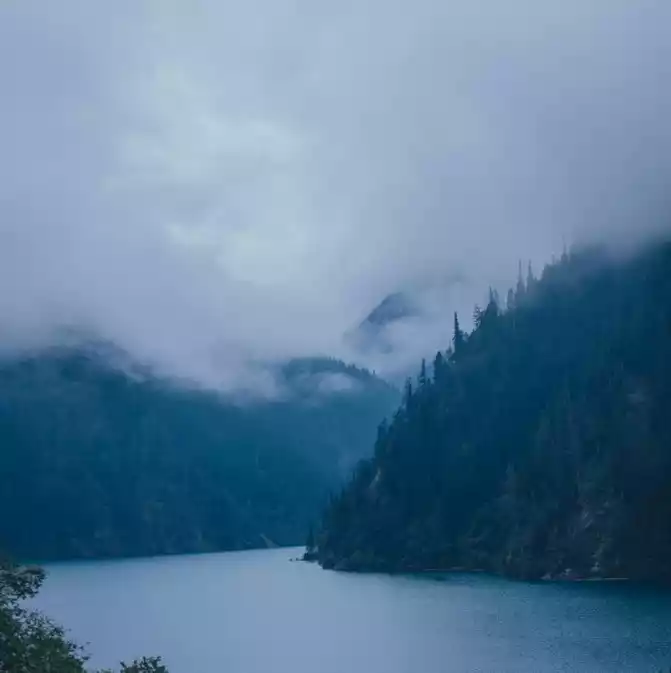
August, the water of Ranwu Lake is earthy yellow, a little turbid, not as turquoise as seen on the Internet, and it is also another beautiful scenery. Because we learned that the road from Lulang to Nyingchi would be closed for a day, in order not to delay the trip, we decided to give up the stay of Bomi and Lulang, cross the Sejila Mountains overnight, and rush to Nyingchi City at night. Maybe everyone knows the news, the road is suddenly crowded, there are a lot of vehicles, and when passing through several places where the road conditions are not good due to construction, there is a short-term congestion, which can be regarded as experiencing the traffic jam on Line 318. At this time, the passing performance of the SUV is reflected, and it is very difficult for the car to go bad. After running all the way, wearing the stars and the moon, surrounded by dangers, it is very difficult, and I am a little afraid. Tell yourself: In the future, you must follow the truth of not rushing at night when traveling long distances.

the pass of the Anjura mountains

road closure notice

of the self-driving tractor

Ranwu Lake self-driving camp

Ranwu Lake self-driving camp

Thongmait Bridge
On the tenth day, Nyingchi City to Lhasa City, passing through the Mira Hill Tunnel, driving for 7 hours on Route 318 and Linla Highway. (Living in Lhasa City, 3650 meters above sea level)
I originally wanted to enter Lhasa City through the Mira Pass at an altitude of 5013 meters on Line 318. We set off from Nyingchi City to take the Linla Highway, take the 318 National Highway to Mira Pass on the lower road in Gongbu Jiangda Town, it rained lightly when departing from Nyingchi City, the sky was sunny and rainy along the way along the 318 line, and when we were about to reach the Mira Pass, it was suddenly cloudy, and there was hail the size of rice grains, the visibility was very low, and we couldn't see 30 meters, for the sake of safety, we decided to go down the mountain and walk back slowly, along the Linla Highway, and later, we passed the Mira Mountain Tunnel on the Linla Highway, and there were some regrets that we didn't see the Mira Pass, After passing the Mira Mountain Tunnel, the weather gradually cleared up, and it was already clear to Lhasa, and the weather on the plateau was really changeable.

Gongbu Jiangda Town

Lhasa checkpoint on the Lingla Highway

through the checkpoint into Lhasa city.

Hospital in Lhasa On
the eleventh day, Lhasa City to Yangzhuo Yongcuo, driving for 8 hours round trip on the G349 line. (Living in Lhasa City, 3650 meters above sea level)
Yangzhuo Yongcuo is in Shannan City, and you need to climb over high mountains, with many curves and cars, so you should pay attention to driving safety. There is a scenic ticket office on the right side of the checkpoint in the southern part of the mountain, 60 yuan per person (this can be saved, and there is no ticket check in the observation deck in several parking areas), and you can go straight to Yangzhuo Yongcuo without entering.

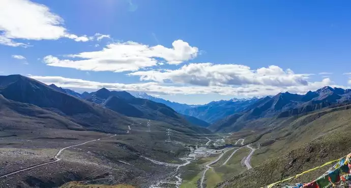
Yajiang Valley Observation Deck

This is the observation deck in the scenic area, and you need to enter with a ticket.

From the observation deck in the scenic area, you need to enter with a ticket. In front of you are Yangzhuo Yongcuo and Snow Mountain, and you can go to Langkazi County along the road.

This parking area, there is no entrance fee, you can go down to the lake to take pictures.
On the twelfth day, a day trip to Lhasa. visited the Potala Palace, Jokhang Temple, and Bakhor Street. (Lives in Lhasa, 3650 meters above sea level).

entered the first door of the Potala Palace

Book your tickets online and exchange them for paper tickets at the box office.

There are several ticket offices inside that can be exchanged for paper tickets

overlooking Lhasa

View of the Potala Palace

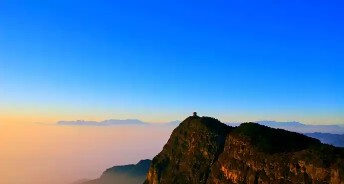
Yaowang Mountain Observation Deck

celebrates the 100th anniversary of the founding of the Communist Party of China and the 70th anniversary of the peaceful liberation of Tibet

celebrates the 100th anniversary of the founding of the Communist Party of China and the 70th anniversary of the peaceful liberation of Tibet

celebrates the 100th anniversary of the founding of the Party and the 70th anniversary of the peaceful liberation of Tibet

celebrates the 100th anniversary of the founding of the Communist Party of China and the 70th anniversary of the peaceful liberation of Tibet

View of the Potala Palace

view of Jokhang Temple from a distance

the gate of Jokhang Temple

the golden dome of Jokhang Temple

the golden dome of Jokhang Temple

Chongsai Kang overpass

Rush Seckon

Maggie Ami

visitors to Bakhor Street

Tourists on Bakhor Street
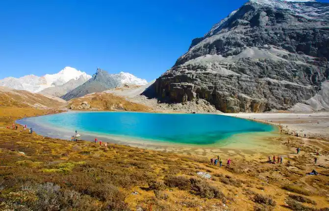
On the thirteenth day, Lhasa City to Naqu City, passing through Nagenla Pass, Namco, 11 hours on Route 318 and National Highway 109.(Lives in Naqu City, 4450 meters above sea level)

Nagenla Pass

the gate of Namtso Park, buy tickets next to it, and drive for more than 1 hour to reach the parking lot of the scenic spot.

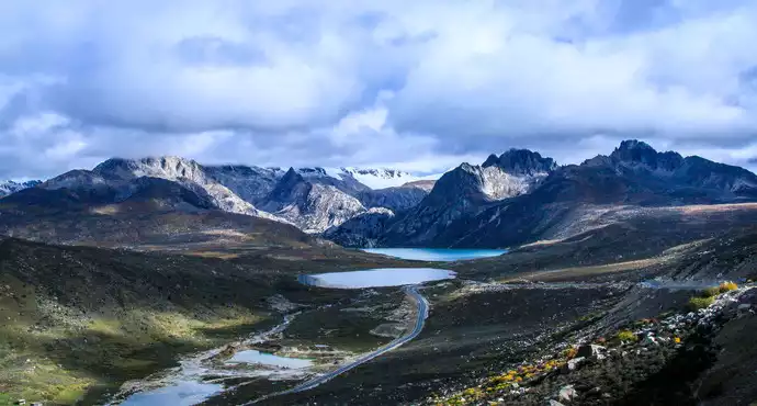
Lake Namcuo

Lake Namco

Welcome Stone (also known as Husband and Wife Stone)
On the fourteenth day, Naqu City to Tanggula Mountain Town, passing through Amdo County, Tanggula Pass, 10 hours on National Highway 109. (Living in Tanggula Mountain Town, 4543 meters above sea level)

the morning of Naqu

to Amdo County

Tanggula Pass Monument

Tanggula Pass

Tanggula Pass On
the
fifteenth day, Tanggula Mountain Town went to Golmud City, passing the Yangtze River Environmental Protection Monument and Wudaoliang Protection Station, Hoh Xili Tibetan Antelope Observation Deck, Kunlun Pass, 8 hours drive on National Highway 109.(Living in Golmud City, 2780 meters above sea level)

Tanggula Mountain Town

Tanggula Hill Town

sculpture of the source of the Yangtze River

Tibetan antelope on the side of the road from a distance

109 National Highway Service Area (the first class in the world).

No Man's Land in Hoh Xili

Sonandaje Conservation Station

Kunlun Mountain Geopark

Tibet and Qinghai Highway boundary

Kunlun Mountains

Kunlun Mountains
At the beginning of August, I started to take the 318 line from Ya'an, Sichuan Province into Tibet, and the 15-day Sichuan entry and youth trip felt a little tight, and I was on the road every day, and I had to drive for about 8 hours every day, but fortunately, the scenery was on the road, stopping to take pictures, checking in as a souvenir, and spending every day in stop-and-go, leaving a lot of good memories. Our trip in and out of Sichuan this time was still very smooth, the weather was sunny, there were few cars and few people along the way, and it was very convenient to stay, eat and shop. For us, this trip is unique and will last a lifetime. (Easy to watch on mobile phones).


Number of days: 1 day, Average cost: 500 yuan, Updated: 2021-05-01 17:47
Number of days: 3 days, Average cost: 7888 yuan, Updated: 2020.09.21

Number of days:9 days, Average cost: 5000 yuan, Updated: 2021.08.20


Number of days: 4 days, Average cost: 1800 yuan, Updated: 2020.08.21


Number of days: 16 days, Average cost: 7500 yuan, Updated: 2020.04.21
Number of days: 1 day, Average cost: 100 yuan, Updated: 2024.08.13