Nanyang Baihe
What are the most recommended things to do in Nanyang Baihe?
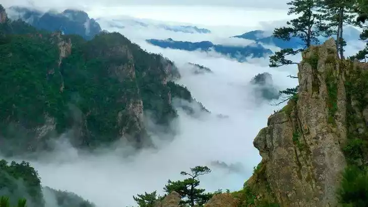
- Stroll along the scenic Baihe River to enjoy natural landscapes and tranquility.
- Explore walking trails through forests and mountains surrounding the river.
- Photography of rivers, waterfalls, and seasonal flora.
- Relax at designated picnic areas or riverbanks.
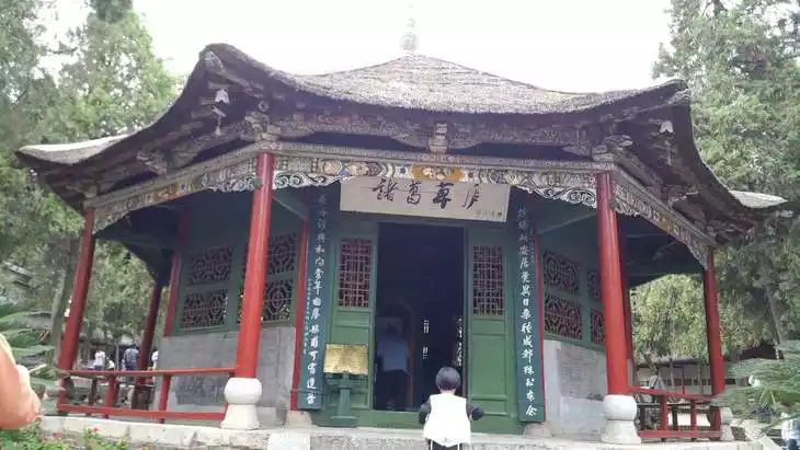
- Visit cultural or historic sites within the area, including pavilions and bridges.

Introducing Nanyang Baihe
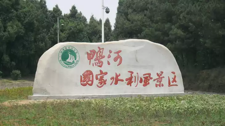
The Baihe River, formerly known as the Yushui River, originates from the Gongli Mountain in Song County, Henan Province, flowing through Song County, Nanzhao County, Fangcheng County, Nanyang County, and Xinye County before entering Xiangyang County, Hubei Province at Quwan. It becomes known as the Tangbai River after its confluence with the Tang River at Lianghekou, flowing south to Zhangjiawan and into the Han River. The Baihe River is 264 kilometers long and has a drainage area of 12,270 square kilometers. It has numerous tributaries, including the Huangya River, Liushan River, Ya River, Baitiao River, Luan River, Tuan River, and Diao River. The Song River, Lao River, Tuan River, and Diao River are the largest. With the exception of the larger Yanling River and Xizhao River, tributaries of the Tuan River, the remaining tributaries are relatively small. Floods on the Baihe River are frequent, but the construction of the Yahekou Reservoir has brought flooding under control.
The Baihe River stretches 302 kilometers within Henan Province, draining an area of 12,029 square kilometers. From its source to Qiaoduan, the Baihe River flows through deep mountainous terrain, characterized by a narrow channel and steep gradient. This leads to severe riverbed erosion, steep slopes on both sides, and good vegetation cover. From Qiaoduan to Yahekou, the river flows through shallow mountainous terrain, where the valley widens and the gradient decreases. The riverbed is covered with coarse sand and gravel, and the bank slopes are mostly oak slopes, resulting in severe soil erosion. Below Yahekou, the river flows through a ridged plain area, with a width of 1,000 to 2,000 meters, a depth of 3 to 10 meters, and a gradient of 1/1,500 to 1/3,300. The Baihe River has numerous shoals and an extremely unstable riverbed. According to records, there have been four course changes in history: the first was in the seventh year of Dading in the Yuan Dynasty (1304), when the Gangtou River in Xinye County broke through and the Lao River became the modern Baihe River; the second was in the fourth year of Longqing in the Ming Dynasty (1570), when the river moved west from Gangtou; the third and fourth were the breaches in Wadian in 1749 and 1954.
Climate and best time to travel
It has a temperate monsoon climate and the Baihe River has many tributaries. There are 29 tributaries with a basin area greater than 100 square kilometers, mainly distributed on the right bank, making it suitable for travel in all seasons.
Recommended number of days and locations for visiting
Tuanhe River, located in southwestern Henan Province, was formerly known as Tuanshui River, named for its rapid flow. Later, it was renamed Tuanhe River. It originates at the southern foot of Liqingduo River in northern Neixiang County, flows northwest to southeast, passing through Neixiang and Deng counties before emptying into the Baihe River near Tuankou in Xinye County. The river is 216 kilometers long and is ideal for walking and fishing.
It is recommended to play for about 3 hours.
Tickets
free
Attraction opening hours
Open all day
Most Popular FAQs for Nanyang Baihe
What is the history and significance of this attraction/city?
Nanyang Baihe is a scenic river area in Nanyang, Henan, known for its picturesque river, valleys, and natural beauty. It is valued for both its ecological significance and cultural heritage in the region.
Where is it located and how do I get there (metro, bus, taxi, walking)?
- Location: Nanyang, Henan Province, China.
- Taxi: Easily reachable from Nanyang city center.
- Bus: Local buses connect to the Baihe Scenic Area entrance.
- Walking: Suitable paths inside for exploration on foot.
What are the opening hours and best times to visit?
- Opening hours: Generally 8:00 AM – 5:30 PM.
- Best times: Spring and autumn for pleasant weather and optimal scenery.
What is the entrance fee/ticket price, and how to buy tickets (online/offline)?
The entrance fee is around 40–70 RMB. Tickets can be purchased at the park entrance or online through local tourism platforms.
Do I need to book tickets in advance, and how far in advance?
Booking in advance is recommended during peak tourist periods or holidays, ideally 3–7 days prior.
How much time is needed to fully explore it?
2–3 hours for a standard visit; a full day for hiking and relaxing by the river.
What are the must-see highlights or main areas inside?
- Baihe River and its scenic riverbanks.
- Mountain trails with panoramic views.
- Waterfalls and forested areas.
- Cultural sites like pavilions and historic bridges.
Are guided tours or audio guides available (and in which languages)?
Guided tours are mainly in Chinese; English guides may be arranged in advance for groups.
What are the best viewpoints or photography spots?
- Riverbanks and waterfalls.
- Scenic pavilions along the trails.
- High points along mountain paths offering panoramic views.
What is the recommended route or itinerary inside?
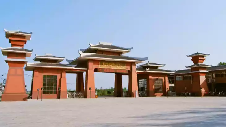
- Enter from the main entrance → walk along the Baihe River → visit waterfalls → explore mountain trails → enjoy pavilions and picnic spots → exit via the main gate.
Are night visits, light shows, or special tours available?
Night visits are generally unavailable; occasional special events may occur during holidays.
Is it crowded, and when are the least crowded times/days to visit?
- Peak holidays and weekends can be crowded.
- Weekday mornings are the quietest times for visiting.
What facilities are available (toilets, food, water, rest areas, shops)?
- Public toilets and drinking water stations.
- Picnic and rest areas along trails.
- Small food stalls near the entrance.
Is the attraction accessible for elderly, children, or disabled visitors?
Partially accessible; main paths suitable for elderly and children. Wheelchair access may be limited on rugged trails.
Is cash needed or are cards/mobile payments accepted?
Cash is accepted; mobile payments (WeChat Pay, Alipay) are widely supported.
What restaurants or cafes are available inside or nearby?
Local eateries near the park entrance; occasional snack vendors inside the park.
Are there vegetarian/vegan/halal food options?
Vegetarian options available; vegan and halal may be limited in the immediate area.
What hotels or accommodations are close to the site?
- Mid-range hotels and guesthouses in Nanyang city within short driving distance.
- Local inns near the park entrance.
What other attractions or landmarks are nearby and easy to combine in a day trip?
- Sanlihe Scenic Area.
- Local historic temples and cultural sites in Nanyang.
- Other regional natural scenic spots along rivers and valleys.
Are there souvenir shops and what are the typical souvenirs?
Souvenir shops offer local crafts, postcards, and small gifts themed on the river and natural scenery.
What are the best transportation options to continue the trip after visiting?
- Taxi or ride-hailing services to nearby attractions or Nanyang city center.
- Public buses connecting to other scenic areas in the region.