Xiaoping Trail
What are the most recommended things to do in Xiaoping Trail?
- Hike along the Xiaoping Trail while enjoying the lush natural scenery.
- Take photographs of panoramic views, streams, and rock formations along the trail.
- Birdwatching and observing local flora and fauna.
- Picnicking at designated rest areas along the trail.
- Engage in light outdoor activities such as nature sketching or meditation.
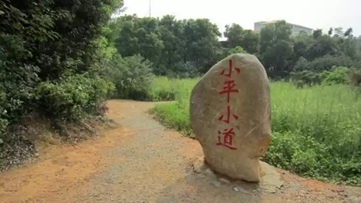
Introducing Xiaoping Trail
Located in Wangchenggang, Xinjian County, Jiangxi Province, the Xiaoping Trail is a memorial park integrating educational, commemorative, and recreational activities. Originally a 1.5-kilometer-long field path connecting the Xinjian County Tractor Parts Repair Factory and the Nanchang Infantry School, Deng Xiaoping frequently strolled along this 1.5-kilometer path during the Cultural Revolution from October 1969 to February 1973, earning it the nickname "Xiaoping Trail." Some believe the area surrounding the trail was the birthplace of Deng's key ideas for China's reform, opening up, and modernization.
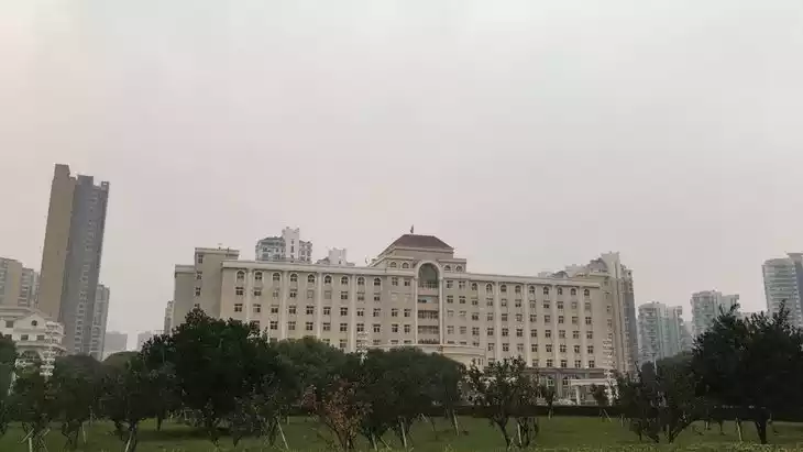
At the end of the 20th century, the local government began to carry out protective development of this trail and the area around the tractor parts repair factory. By 2008, the entire area covered a total area of 187.9 acres, and many buildings were built, including the Xiaoping Trail Memorial Hall, the Revolutionary Historical Site Browsing Area, the Xiaoping Workshop, the Xiaoping Meeting Hall, and the Leisure Square.
In 2000, it was designated as a provincial cultural relic protection unit. In March 2002, it was designated as an education base for patriotism, revolutionary tradition, reform and opening up, and Deng Xiaoping Theory. In December 2016, the Deng Xiaoping Trail Exhibition Hall was included in the "National Red Tourism Scenic Spots List."
Climate and best time to travel
With a subtropical monsoon climate, the area outside the memorial hall adheres to the principle of more greening and less construction, leaving trees and water wherever they can, making the scenic area beautiful and well-equipped with green squares, tree-lined paths, and flower-filled gardens, making it suitable for travel in all seasons.
Recommended number of days and locations for visiting
Xiaoping Building, originally a gray, two-story brick-and-wood structure, was built in the 1950s, covering 440 square meters. It was surrounded by holly trees over a meter tall and surrounded by a bamboo fence. The courtyard was home to pine, peach, laurel, gardenia, plum, camellia, and grapes. There was a small woodshed behind the building. The "Xiaoping Trail" currently covers an area of 187.9 mu (approximately 16 acres), bounded by National Highway 320 in the south, the wall of the Nanchang Army Academy in the north, the highway from Shengzhuang to Wanli in the east, and the wall of the Nanchang Army Academy in the west.
It is recommended to play for about 2 hours.
Tickets
30 yuan/person
Attraction opening hours
9:00 AM - 4:00 PM (Open year-round)
Most Popular FAQs for Xiaoping Trail
What is the history and significance of this attraction/city?
Xiaoping Trail is a scenic hiking path in Nanchang, Jiangxi, valued for its natural beauty and as a recreational spot for locals and tourists. It highlights Jiangxi’s rich landscape and outdoor culture.
Where is it located and how do I get there (metro, bus, taxi, walking)?
- Located in Nanchang, Jiangxi Province, near the suburban natural areas.
- Reachable by taxi or rideshare from central Nanchang.
- Local buses may reach nearby trailheads; short walking may be required from bus stops.
- Walking or cycling is possible if staying nearby.
What are the opening hours and best times to visit?
- Open daily, generally from early morning (around 6:00 AM) to late afternoon (around 6:00 PM).
- Spring and autumn are the best seasons for hiking due to mild weather and scenic foliage.
- Mornings are ideal for fewer crowds and cooler temperatures.
What is the entrance fee/ticket price, and how to buy tickets (online/offline)?
Entrance is usually free, though some sections may charge a small fee at ticket booths on-site; tickets are purchased offline.
Do I need to book tickets in advance, and how far in advance?
Booking is generally not required; visitors can arrive directly unless visiting during local holidays or peak weekends.
How much time is needed to fully explore it?
2–4 hours depending on hiking pace and stops for photography or rest.
What are the must-see highlights or main areas inside?
- Panoramic viewpoints overlooking the surrounding hills.
- Streams, waterfalls, and natural rock formations along the trail.
- Forested sections with diverse flora and birdlife.
Are guided tours or audio guides available (and in which languages)?
Guided tours are limited; mostly self-guided hikes. Information is available in Chinese; English resources may be sparse.
What are the best viewpoints or photography spots?
- Trail peaks or ridge points offering panoramic views of the mountains.
- Near streams, waterfalls, and natural rock formations for scenic shots.
- Forest-covered sections with filtered sunlight.
What is the recommended route or itinerary inside?
Start from the main trailhead, follow the marked path to key viewpoints, stop at rest areas, and loop back via the return path for a complete hike.
Are night visits, light shows, or special tours available?
Night visits are not recommended due to safety; no light shows or special tours are typically offered.
Is it crowded, and when are the least crowded times/days to visit?
Weekdays and early mornings are least crowded; weekends and public holidays can be busy.
What facilities are available (toilets, food, water, rest areas, shops)?
- Basic rest areas along the trail.
- Occasional public toilets near trailheads.
- Water or small snack vendors may be present at the start; limited facilities inside the trail.
Is the attraction accessible for elderly, children, or disabled visitors?
- Trail is moderately easy; suitable for children with supervision and for elderly in good health.
- Not fully accessible for wheelchairs or those with mobility impairments.
Is cash needed or are cards/mobile payments accepted?
Cash is recommended for any small on-site purchases; mobile payments may be accepted at main entry points or vendors.
What restaurants or cafes are available inside or nearby?
Local eateries and small cafes near the trailhead; mostly Chinese cuisine and snacks.
Are there vegetarian/vegan/halal food options?
Vegetarian options are usually available; vegan and halal may require prior inquiry.
What hotels or accommodations are close to the site?
Several budget and mid-range hotels in nearby Nanchang districts; some guesthouses closer to the trail for overnight stays.
What other attractions or landmarks are nearby and easy to combine in a day trip?
- Meiling Scenic Area
- Meiling Rafting
- Other hiking trails and nature spots within Nanchang outskirts
Are there souvenir shops and what are the typical souvenirs?
Few souvenir shops near the trailhead; typical items include postcards, local crafts, and small hiking-related items.
What are the best transportation options to continue the trip after visiting?
- Taxi or rideshare back to central Nanchang.
- Local buses connecting to nearby scenic spots.
- Cycling or walking to nearby trails or natural areas for extended exploration.