Hong Kong Hiking Trail: Tai Tung Shan
Sunset Peak
by Blackupmycloud
Jan 20, 2025
by Blackupmycloud
Jan 20, 2025


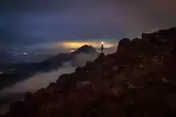
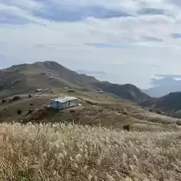
Located in Lantau, Mount Tung is 869 meters high, making it the third highest peak in Hong Kong. It is connected to Mount Er Tung and Mount Lotus.
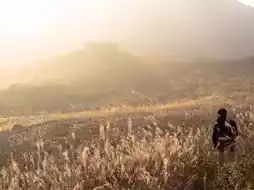
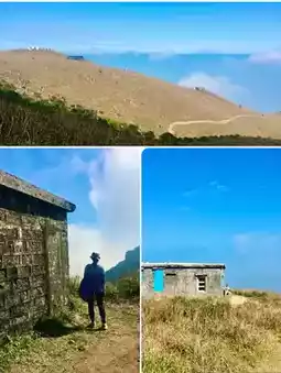
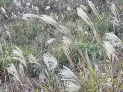
Tai Tung Shan is very famous. Every year during the mangrove season, I believe everyone's social media will be more popular than Tai Tung Shan's photos. In addition to the endless grass, there are more than a dozen small stone houses on Dadong Mountain. The scenery is very intoxicating with the afterglow of the sunset.
To reach the summit of Tai Tung, after the Phoenix Trail waypoint L014, turn into the small trail to reach the summit. The English name of Tai Tung Shan is Sunset Peak, as the name suggests. This is a good place to watch the sunset, and you can enjoy the scenery of Lantau Island and Tung Chung.
Transportation and Routes
The whole journey takes about four hours
Take bus 3M from Tung Chung and get off at Bo Kung Ho Station
After getting off, turn left onto the gazebo and enter the Phoenix Trail
Along the Phoenix Trail, the stone steps are high and sloping, which is very strenuous
Reach the L014 waymark, there is a trail on the right to climb Mount Tai Tung
After climbing Tai Tung Shan, turn back along the road and return to the Phoenix Trail
Descend along the Phoenix Trail and return to South Mountain Country Park to leave
Precautions
The steps up and down the mountain are high and sloping, very strenuous. Children and the elderly are not suitable to go.
There are many tourists during the holidays. Please be patient
There is no shade on the way up the mountain. Bring enough water and do a good sunscreen
Don't destroy the badhead camp
Avoid trampling on mangroves when taking pictures.
#weekendtravel #overseastrip #trip #couple #like #nightscape #relaxation
Post by KenFong__ | Aug 22, 2023