Cheung Yan Shan (長屻山) , Pak Kung Au (伯公坳), Ngau Tong Au (牛塘坳)and Watertop Peak (出水頂) Hike
Lantau Country Park
by wirl_robin04
Feb 3, 2023
by wirl_robin04
Feb 3, 2023


I have labelled this hike as medium difficulty, as it incorporates both easy and difficult segements.
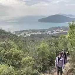
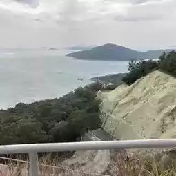
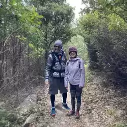
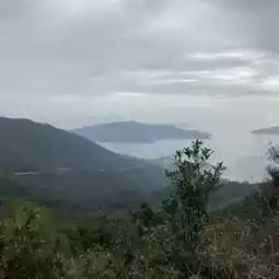
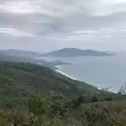
This first part of the hike is an endless ascent from Tong Fuk Village, via the Catchwater, although it has steps which are easy to climb. The ascent brings takes you up to views of South Lantau; Tong Fuk Village, Cheung Sha and even Pui O! The path will bring you to Cheung Yan Shan (443 meters elevation), Ngau Tong Au (473 meters elevation), and down to Pak Kung Au (332 meters elevation).
From here, you have a number of options.
1. Take a bus to Tung Chung/Mui Wo/Tai O/etc.
2. Walk down the Old Tung Chung Road to either San Shek Wan round-a-bout or Shek Mun Kap.
3. Walk along the trail labelled ‘Tong Fuk Catchwater’ and join back to the trail you ascended via earlier.
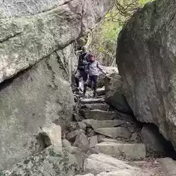
4. Take a DIFFICULT trail to 出水頂. This is for advanced hikers as the ground is very loose, very steep and there is little to stop you rolling down the hill.
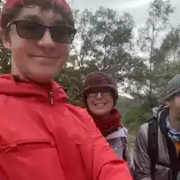
We opted for the fourth option (before we knew how dangerous it was)—it was definitely not suitable for the whole group, which consisted of two advanced hikers and one less confident hiker. However, it did offer some great views.
Please choose your route carefully. Even if you opt for an easier option, the hike from Tong Fuk Village to Pak Kung Au is a good bit of exercise, and offers some nice views!
Here are the statistics of our hike:
• Moving Time: 3 hours 5 minutes
• Average Pace: 21 minutes per kilometer
• Elapsed Time: 3 hours 55 minutes
• Elevation Gain: 792 meters
• Maximum Elevation: 476 meters
I hope you can use them to effectively plan out your hike.
Post by wirl_robin04 | Feb 3, 2023