Kulagangri Snow Mountain in Tibet | A must-see snow mountain hiking trip
Kulagangri Snow Mountain
by bumpydeeanna
Jan 3, 2025
by bumpydeeanna
Jan 3, 2025
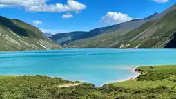
Kulagangri is located in Shannan City. It takes nearly 6 hours to drive from Lhasa Airport to the south, passing Yanghu Lake and Pumoyongcuo. Except for the last section from Se Township to Baimalincuo, which is very bad, the rest of the road is full of snow-capped mountains over 7,000 meters such as Rihe Karezhan, and many lakes such as Baimalincuo. Kulagangri includes three hiking routes, corresponding to three lakes. Each route can be traveled back and forth within one day. The starting point is the Baimalincuo parking lot in Cuoyu Village (Chuyu). You can choose a 1-3 day hiking route according to your own situation.
▪️Altitude
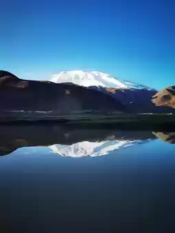
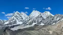
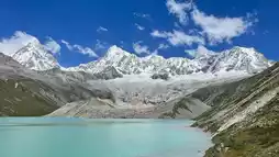
The highest peak is 7,538 meters, one of the "Four Sacred Mountains" in Tibet
The entire snow mountain consists of three peaks, standing in the middle of the Himalayas.
▪️Hiking tips:
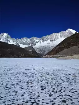
-Hiking route: Baima Jincuo Lake Circle⛰️
Cuoyu Village - Parking lot (starting point of the hike) - End of Baima Jincuo - Return to the parking lot along the original route (end of the hike)
The difficulty is not high, it can be said that it is a route that novices can take~
🧭Navigation: Baima Jincuo Family Hotel
🎫Garbage removal fee 20
🚗After the second checkpoint, the road will become a little difficult to walk on. Drive up the mountain for half an hour, park the car, and then you can start hiking!
We ate some self-heating rice before hiking to ensure we had enough energy for the hike, which took about 4 hours round trip.
▪️Photography tips:
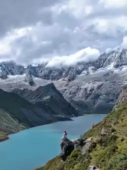
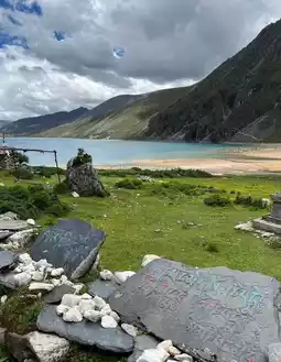
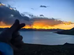
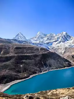
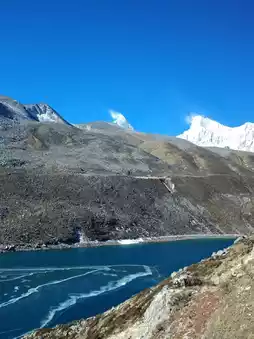
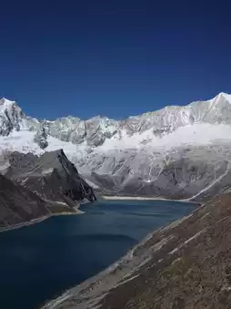
1️⃣Walk up from the parking lot, you can see the prayer flags by the Baimajincuo Lake, and you can take pictures of the Kulagangri Snow Mountain and Baimajincuo in the same frame. We also took some portraits here
2️⃣Go up the mountain on the right path and you will reach a small pavilion in about 20 minutes. The scenery here is also very good.
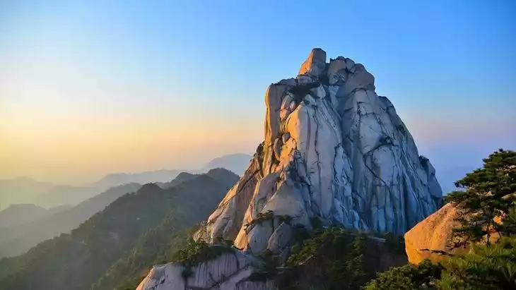
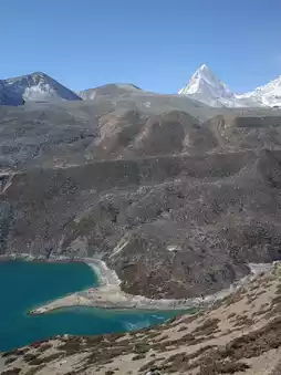
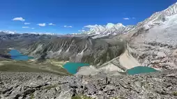
3️⃣ Continue walking along the dirt slope to the highest point. The scenery of the snow-capped mountains and lakes on the left is very beautiful. You can take pictures of the snow-capped mountains and lakes.
4️⃣There are several large rock camera positions, which can capture magnificent and majestic photos, but please pay attention to safety when going up and down the rocks.
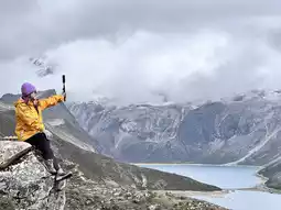
5️⃣After climbing to the highest point, climb up again. The slope is very steep and you have to climb up to the highest point! You can use a drone to take aerial photos, which is very shocking!
⚠️Note:
1️⃣Apply for a border pass
Because in Shannan area, you should apply for a border pass at your place of residence before starting your trip. In Lhasa, you need to queue up for a long time and spend unnecessary
2️⃣There is no signal when you go up from the parking lot. Make a plan in advance. Safety first
3️⃣Altitude sickness problem. Walk slowly, don't run or jump too fast, don't carry too many things to increase the burden (lose weight to move forward), we all have a bottle of water + a Snickers bar + a few candies (friends with poor physical strength can also bring two glucose sticks)
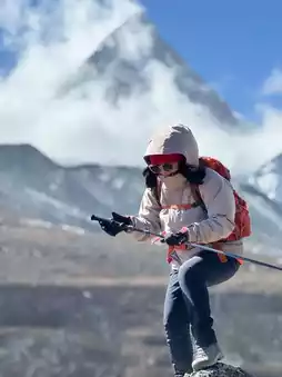
4️⃣ Outfit
The wind is very strong on the mountain, so a windproof jacket is very necessary
Hats and sunglasses are also very necessary.
Choose shoes that are light and easy to walk on and go up and down hills.
5️⃣Sunscreen
Do whatever sun protection you can! The ultraviolet rays are really strong!
Post by bumpydeeanna | Jan 3, 2025